Signs From Idaho
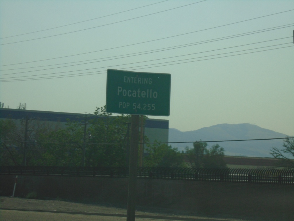
US-91 South - Pocatello
Entering Pocatello on US-91 South. Pocatello is the 6th largest city in Idaho (2020 Census) and is the county seat of Bannock County.
Taken 09-10-2022
 Pocatello
Bannock County
Idaho
United States
Pocatello
Bannock County
Idaho
United States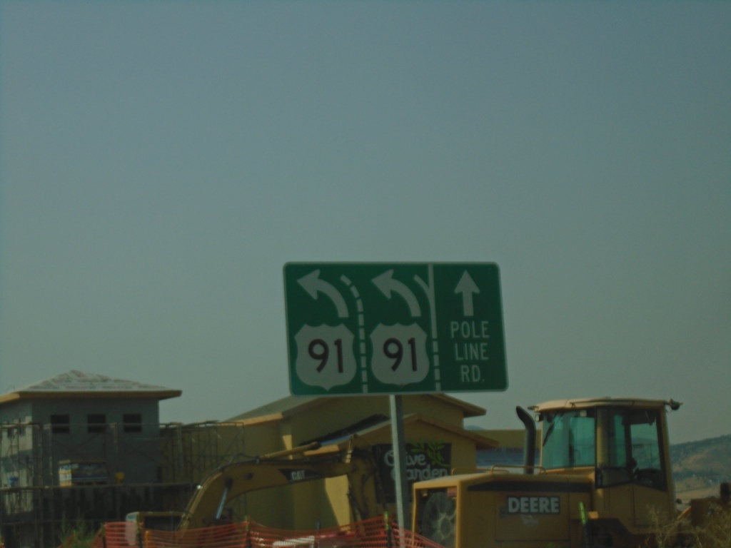
US-91 South at Pole Line Road
US-91 South at Pole Line Road. Merge left to continue south on US-91.
Taken 09-10-2022
Chubbuck
Bannock County
Idaho
United States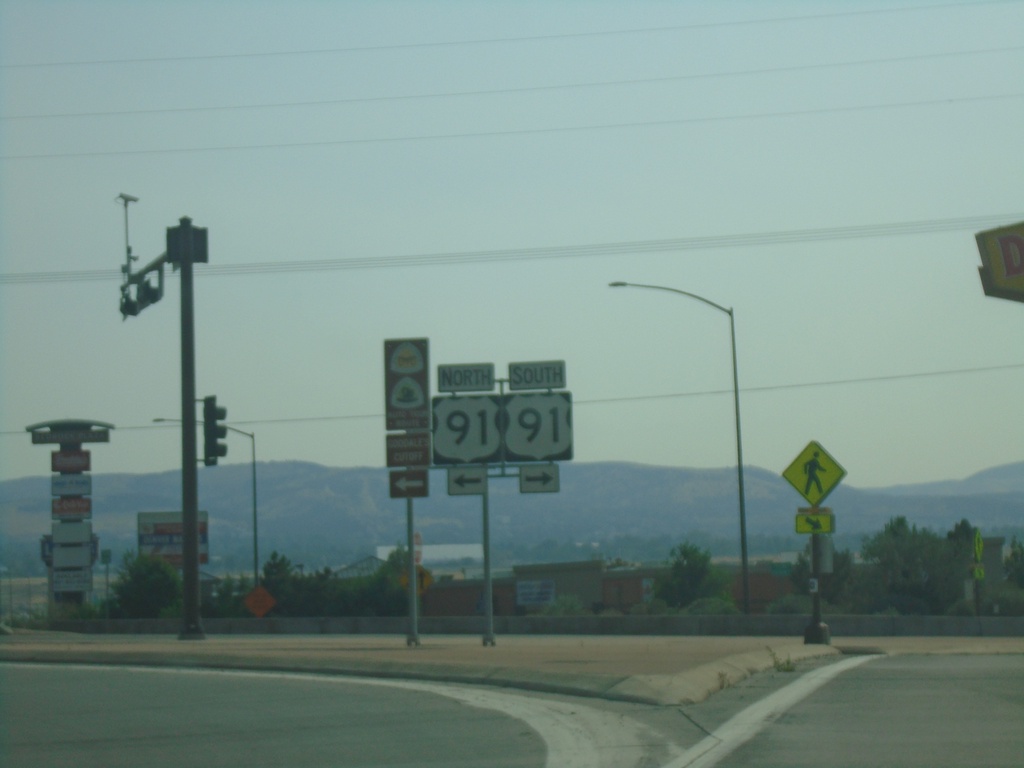
I-86 East Exit 61 Offramp at US-91
I-86 East Exit 61 offramp at US-91 in Chubbuck.
Taken 09-10-2022
 Pocatello
Bannock County
Idaho
United States
Pocatello
Bannock County
Idaho
United States
I-86 East - Exit 61 Offramp at US-91
I-86 East - Exit 61 Offramp at US-91. Use US-91 North to Chubbuck; US-91 South to Pocatello.
Taken 09-10-2022
Pocatello
Bannock County
Idaho
United States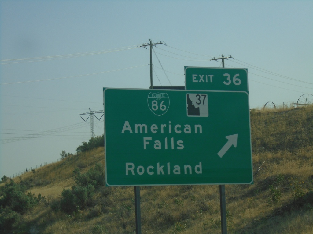
I-86 East - Exit 36
I-86 east at Exit 36 - BL-86/ID-37/American Falls/Rockland.
Taken 09-10-2022


 American Falls
Power County
Idaho
United States
American Falls
Power County
Idaho
United States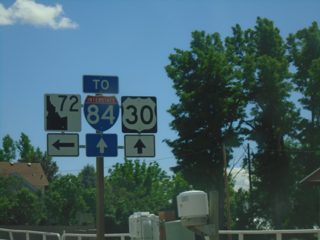
US-30 East approaching ID-72
US-30 East approaching ID-72. Turn left for ID-72; continue straight for access to I-84.
Taken 06-20-2022

 New Plymouth
Payette County
Idaho
United States
New Plymouth
Payette County
Idaho
United States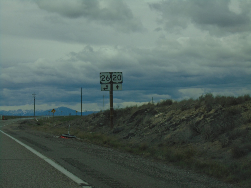
US-20 West at US-26
US-20 West at US-26 in Butte County. US-26 West joins US-20 West to Carey.
Taken 05-03-2022

 Blackfoot
Butte County
Idaho
United States
Blackfoot
Butte County
Idaho
United States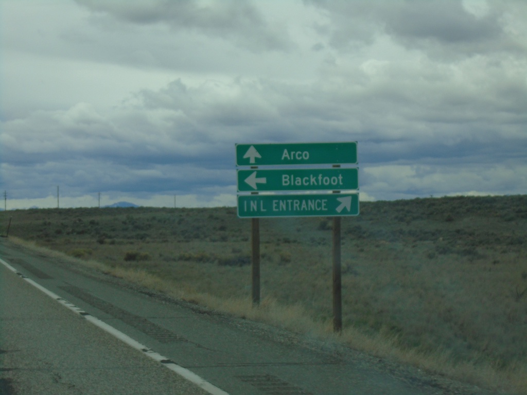
US-20 West Approaching US-26
US-20 West approaching US-26 in Butte County. Turn right for entrance to Idaho National Laboratory. Continue straight for Arco via US-20/US-26; left for US-26 East to Blackfoot.
Taken 05-03-2022
Atomic City
Bingham County
Idaho
United States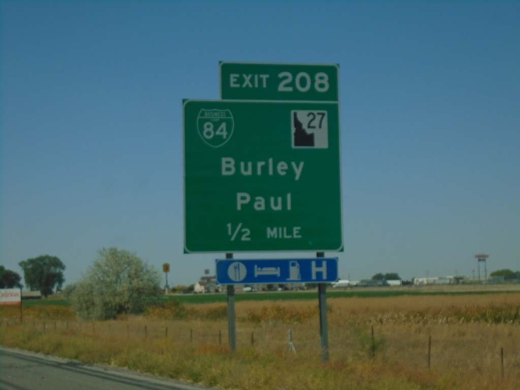
I-84 West - Exit 208
I-84 west approaching Exit 208 - BL-84/ID-27/Burley/Paul.
Taken 09-25-2021

 Heyburn
Minidoka County
Idaho
United States
Heyburn
Minidoka County
Idaho
United States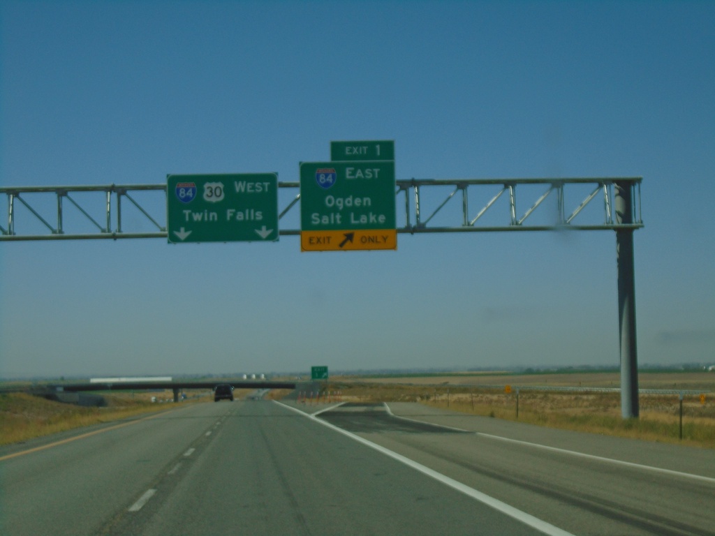
End I-86 West at I-84
End I-86 west at I-84. Merge right onto Exit 1 for I-84 East/Ogden/Salt Lake. Continue ahead for I-84/US-30 West/Twin Falls. This is the western end of I-86.
Taken 09-25-2021
Cotterel
Cassia County
Idaho
United States