Signs From Idaho
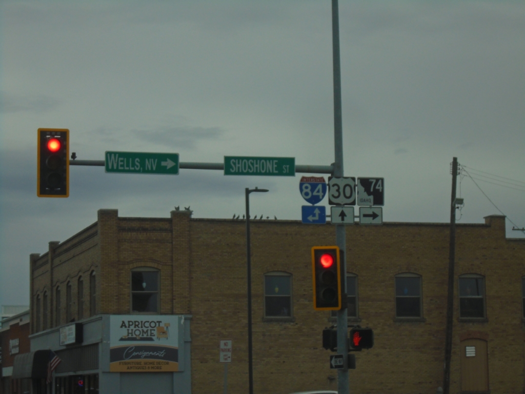
US-30 East at ID-74 - Twin Falls
US-30 East at ID-74 in Twin Falls. Turn right on Shoshone St. for ID-74 South to Wells, Nev. Continue straight on US-30 or north on Shoshone St. for I-84 access.
Taken 10-25-2025


 Twin Falls
 County
Idaho
United States
Twin Falls
Twin Falls County
Idaho
United States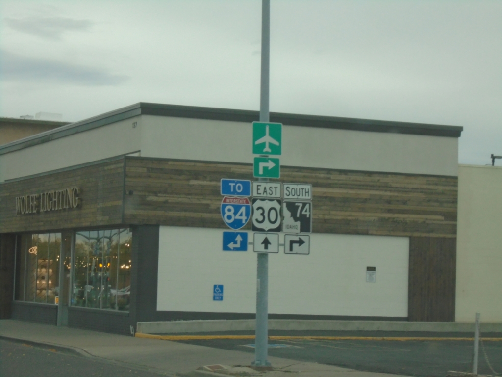
US-30 East at ID-74
US-30 East (2nd Ave West) at ID-74 South (Shoshone St.). Use Shoshone St. North or continue on US-30 east for I-84 access.
Taken 10-25-2025
Twin Falls
Twin Falls County
Idaho
United States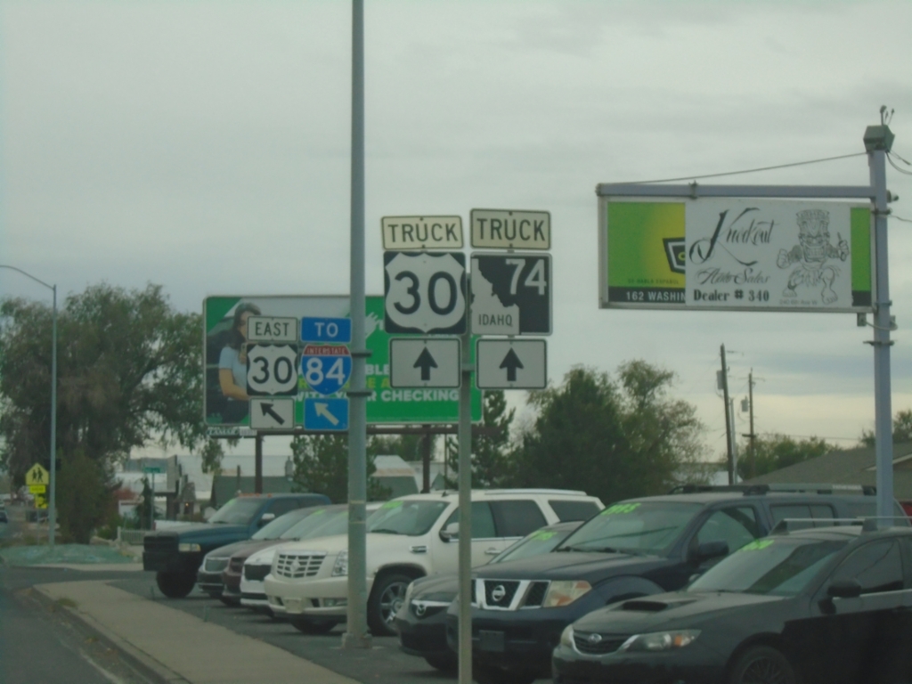
US-30 East/To I-84 - Twin Falls
Merge left on 2nd Ave West to continue on US-30/To I-84. Continue south on Washington St. for US-30 truck route and truck route to ID-74.
Taken 10-25-2025
Twin Falls
Twin Falls County
Idaho
United States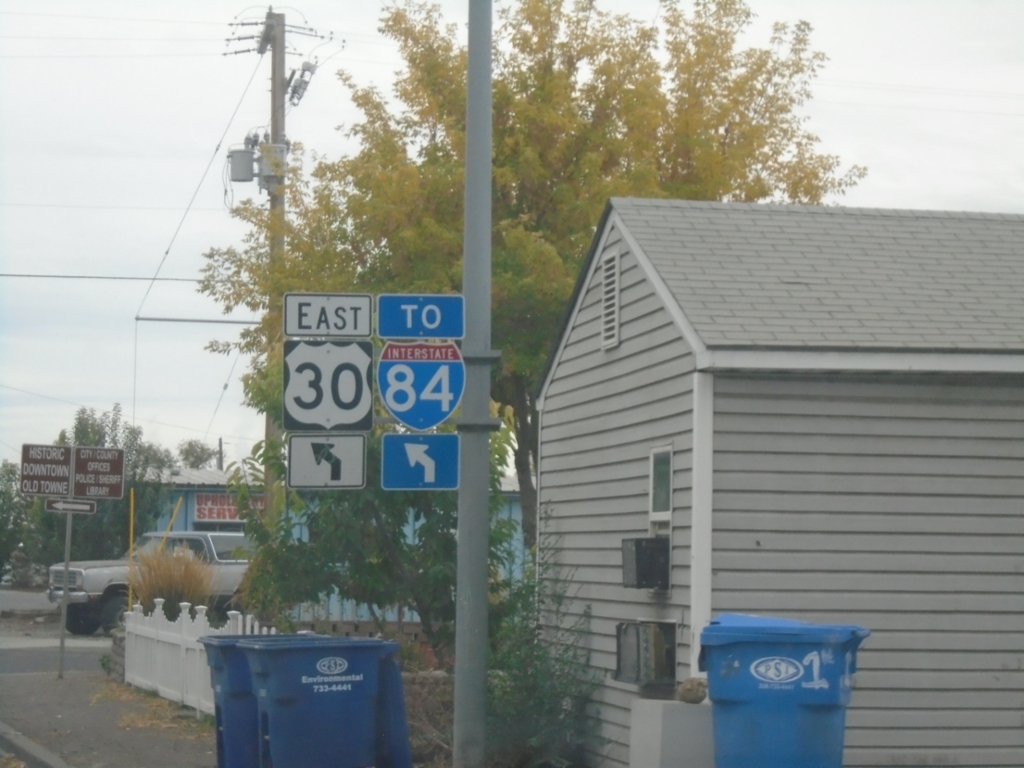
US-30 East/To I-84 - Twin Falls
US-30 East/To I-84 (Washington St. South) at 2nd Ave. W.
Taken 10-25-2025
Twin Falls
Twin Falls County
Idaho
United States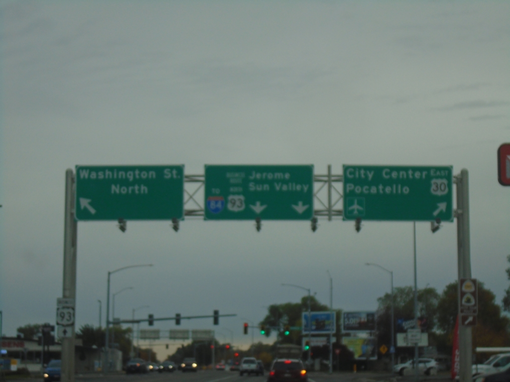
US-30 East/Bus. US-93 North Split - Twin Falls
US-30 East/Bus. US-93 North Split in Twin Falls. Turn right to continue east on US-30 to (Twin Falls) City Center and Pocatello. Continue straight for Bus. US-93/To I-84/Jerome/Sun Valley. Turn left for Washington St. North.
Taken 10-25-2025
 Twin Falls
 County
Idaho
United States
Twin Falls
Twin Falls County
Idaho
United States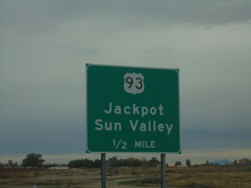
US-30 East Approaching US-93 and Bus. US-93
US-30 East Approaching US-93 South to Jackpot and Sun Valley.
Taken 10-25-2025
 Filer
Twin Falls County
Idaho
United States
Filer
Twin Falls County
Idaho
United States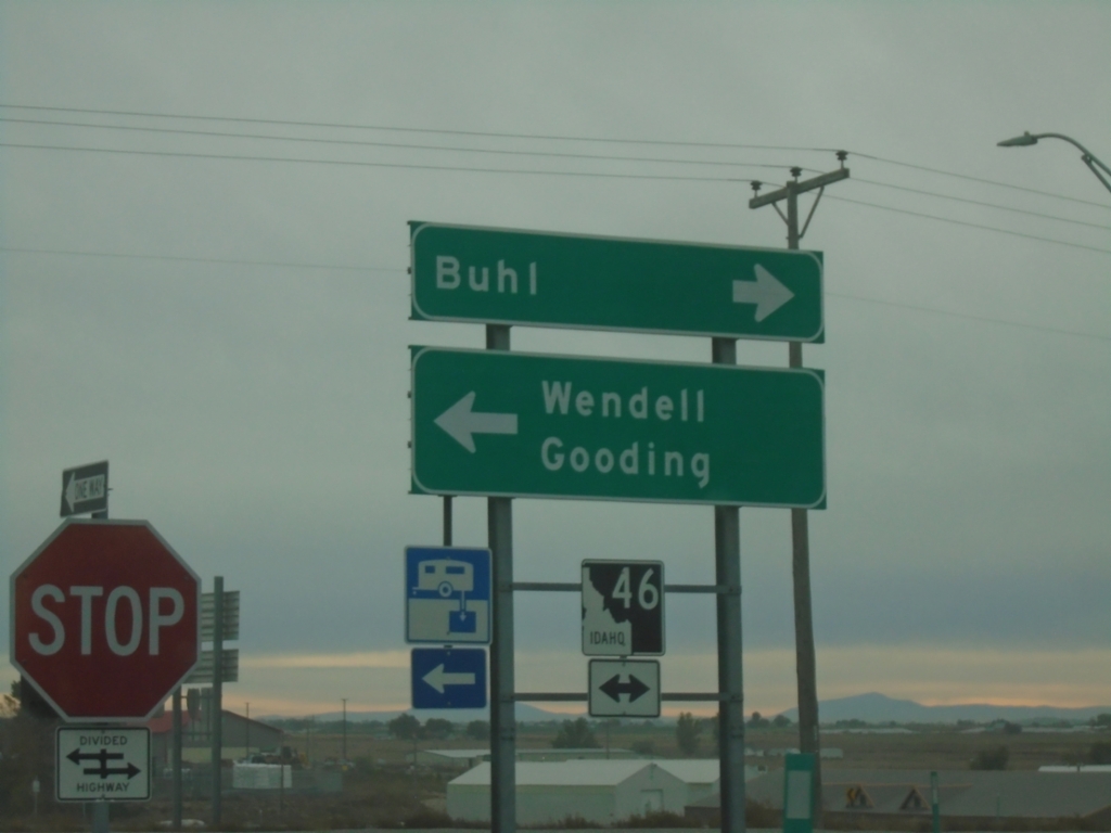
I-84 East at ID-46
I-84 East at ID-46 in Wendell. Use ID-46 north to Wendell and Gooding; ID-46 south to Buhl.
Taken 10-25-2025
 Wendell
Gooding County
Idaho
United States
Wendell
Gooding County
Idaho
United States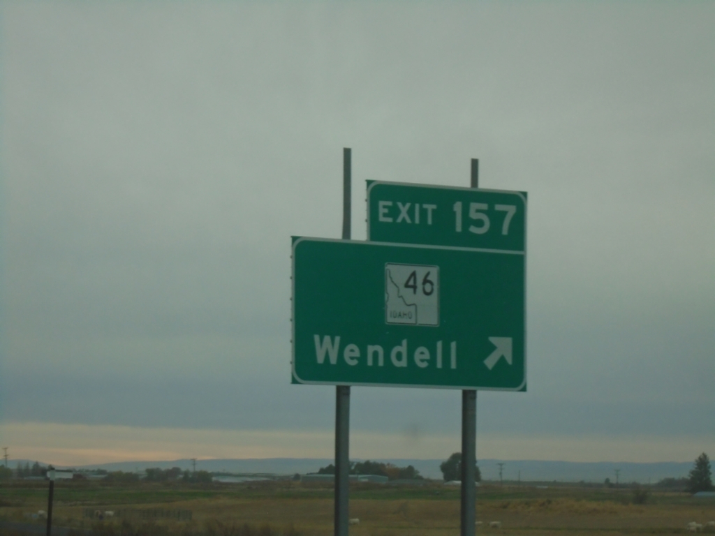
I-84 East - Exit 157
I-84 east at Exit 157 - ID-46/Wendell
Taken 10-25-2025
Wendell
Gooding County
Idaho
United States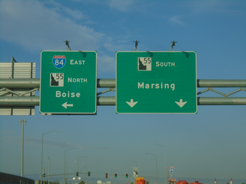
Karcher Road West Approaching I-84 East/ID-55 North
Karcher Road West approaching I-84 East/ID-55 North (Exit 33) to Boise. Continue west on ID-55 for Marsing.
Taken 07-20-2025
 Nampa
Canyon County
Idaho
United States
Nampa
Canyon County
Idaho
United States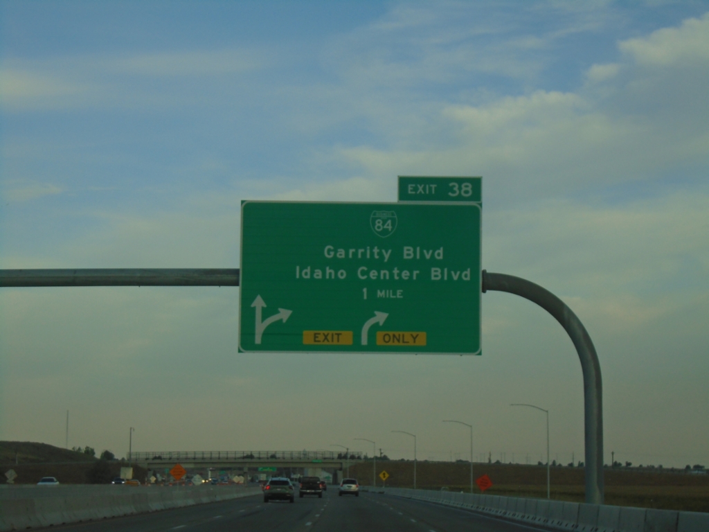
I-84 West - Exit 38
I-84/US-30 west at Exit 38 - BL-84/Garrity Blvd./Idaho Center Blvd.
Taken 07-20-2025
 Nampa
Canyon County
Idaho
United States
Nampa
Canyon County
Idaho
United States