Signs From Idaho
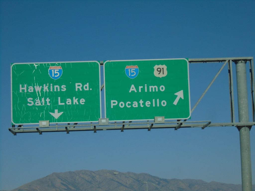
US-91 North At I-15
US-91 north approaching I-15. I-15/US-91 north to Arimo and Pocatello. Continue over overpass for I-15 South to Salt Lake (Utah) and Hawkins Road. US-91 north joins I-15 north to Pocatello.
Taken 09-25-2021

 Downey
Bannock County
Idaho
United States
Downey
Bannock County
Idaho
United States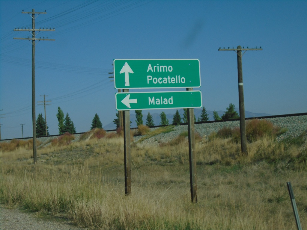
US-91 North at ID-40 West
US-91 north at ID-40 west to Malad. Continue north on US-91 for Arimo and Pocatello.
Taken 09-25-2021
 Downey
Bannock County
Idaho
United States
Downey
Bannock County
Idaho
United States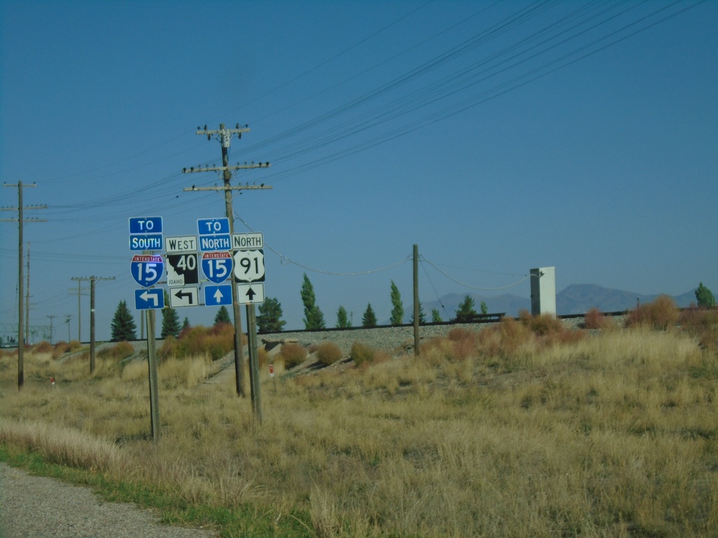
US-91 North Approaching ID-40 West
US-91 North approaching ID-40 West. Continue north on US-91 for I-15 North; use ID-40 west for I-15 south.
Taken 09-25-2021
Downey
Bannock County
Idaho
United States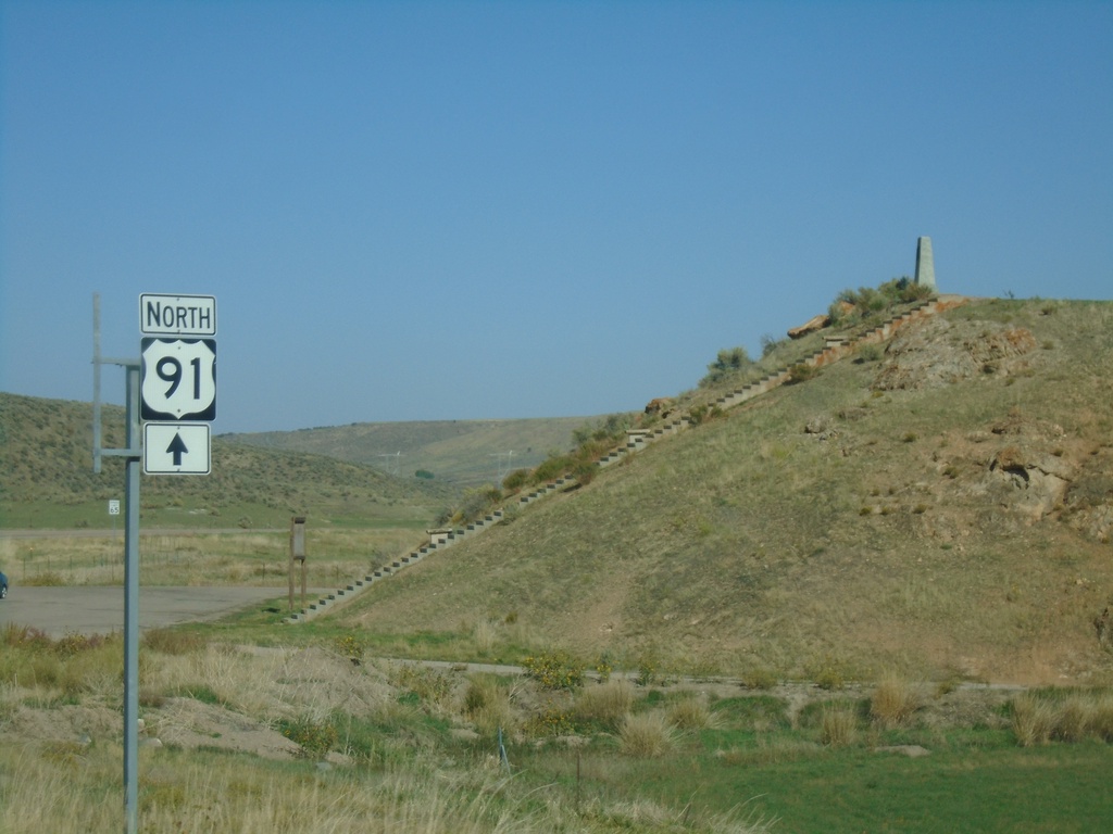
US-91 North at Oxford Highway
US-91 North at Oxford Highway in Bannock County. The intersection is located at Red Rock Pass which was the site of an ancient dam on prehistoric Lake Bonneville. The erosion of this dam created the catastrophic Bonneville Floods which affected much of the Snake River plain of Idaho.
Taken 09-25-2021
Downey
Bannock County
Idaho
United States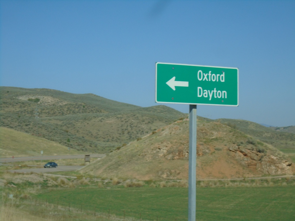
US-91 North Approaching Oxford Highway
US-91 North approaching Oxford Highway south to Oxford and Dayton.
Taken 09-25-2021
Downey
Bannock County
Idaho
United States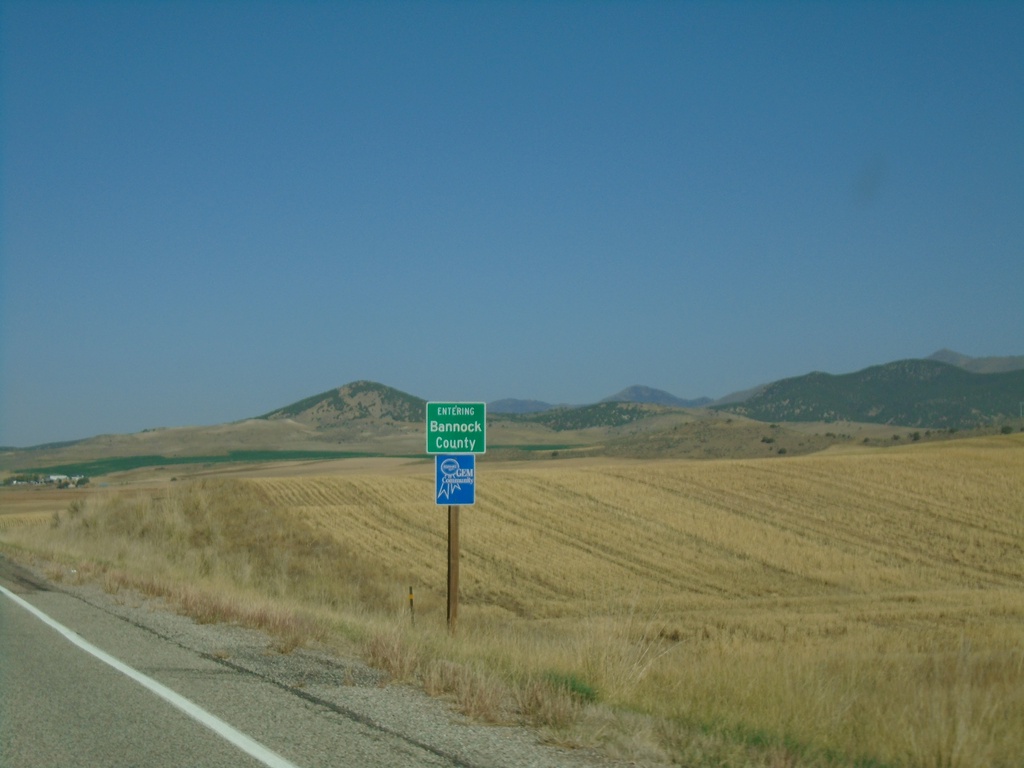
US-91 North - Bannock County
Entering Bannock County on US-91 north.
Taken 09-25-2021
Swanlake
Bannock County
Idaho
United States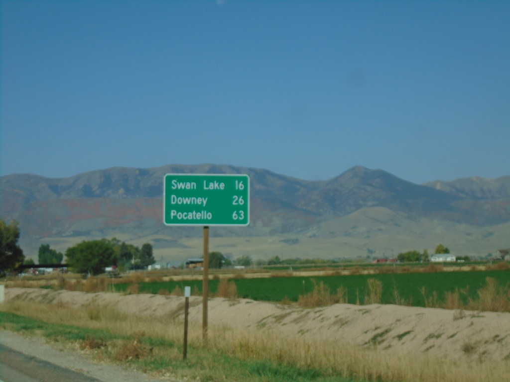
US-91 North - Distance Marker
Distance marker on US-91 north. Distance to Swan Lake, Downey, and Pocatello.
Taken 09-25-2021
Preston
Franklin County
Idaho
United States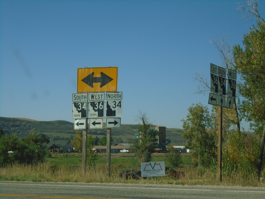
ID-36 West at ID-34 - Franklin County
ID-36 West at ID-34 in Franklin County. Turn right for ID-34 North; turn left for ID-34 South/ID-36 West. Notice the the old and new varieties of Idaho state highway markers (ID-34 North - New, ID-34 South/ID-36 West - Old).
Taken 09-25-2021

 Preston
Franklin County
Idaho
United States
Preston
Franklin County
Idaho
United States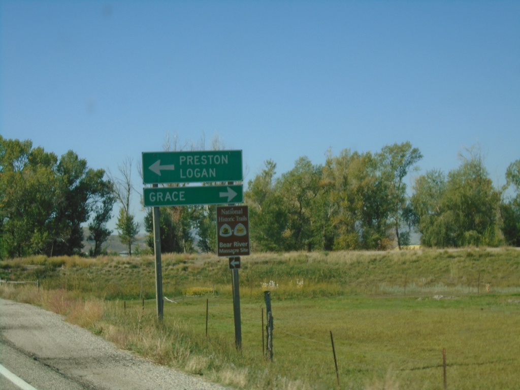
ID-36 West at ID-34 - Franklin County
ID-36 West at ID-34 in Franklin County. Use ID-34 North to Grace; ID-34 South/ID-36 West to Preston and Logan (Utah).
Taken 09-25-2021
Preston
Franklin County
Idaho
United States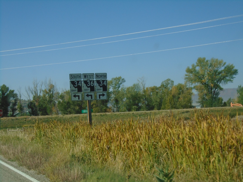
ID-36 West Approaching ID-34
ID-36 West approaching ID-34 in Franklin County. ID-36 West joins ID-34 south to Preston.
Taken 09-25-2021
Preston
Franklin County
Idaho
United States