Signs From Idaho
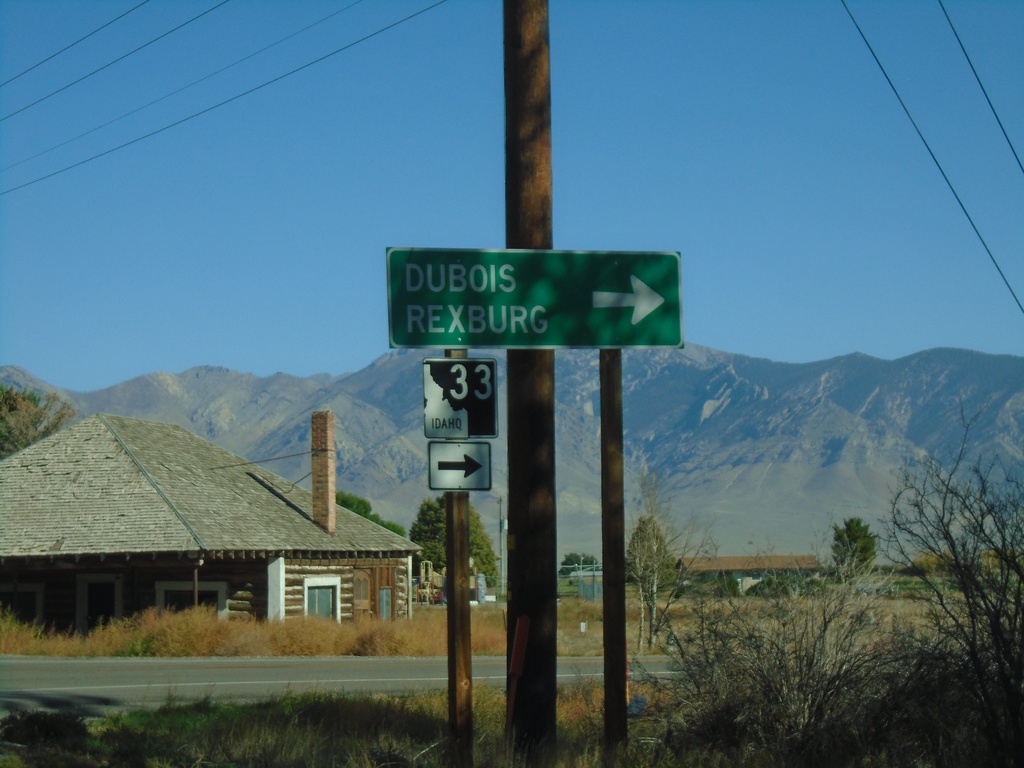
ID-33 East at Little Lost River Highway
ID-33 East at Little Lost River Highway in Howe. Turn right to continue east on ID-33 towards Dubois and Rexburg.
Taken 09-24-2021
 Howe
Butte County
Idaho
United States
Howe
Butte County
Idaho
United States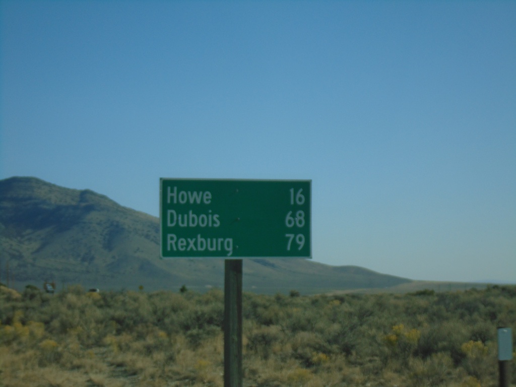
ID-33 East - Distance Marker
Distance marker on ID-33 east. Distance to Howe, Dubois (via ID-22), and Rexburg.
Taken 09-24-2021
Butte City
Butte County
Idaho
United States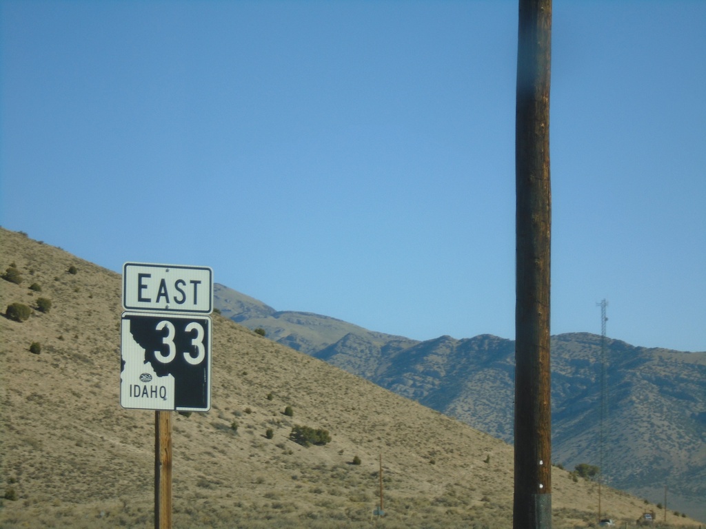
ID-33 East - Butte County
ID-33 east in Butte County. First route marker on ID-33 eastbound.
Taken 09-24-2021
Howe
Butte County
Idaho
United States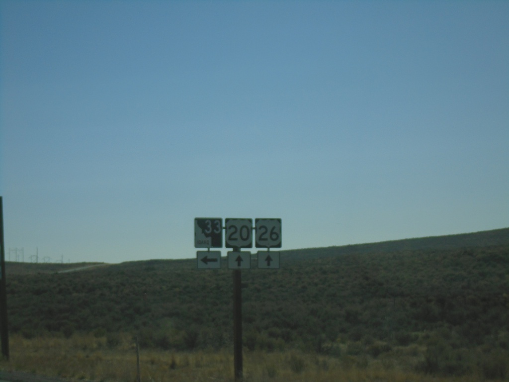
US-20/US-26 East at ID-33
US-20/US-26 East at ID-33 in Butte County.
Taken 09-24-2021

 Howe
Butte County
Idaho
United States
Howe
Butte County
Idaho
United States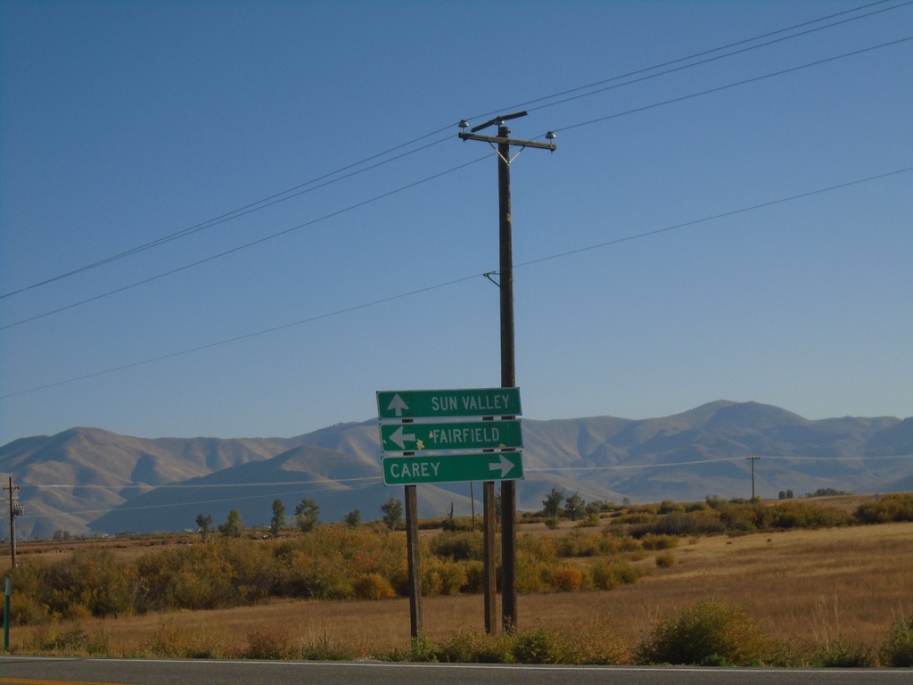
ID-75 North at US-20
ID-75 north at US-20. Use US-20 east for Carey; US-20 west for Fairfield. Continue north to Sun Valley.
Taken 09-24-2021
 Bellevue
Blaine County
Idaho
United States
Bellevue
Blaine County
Idaho
United States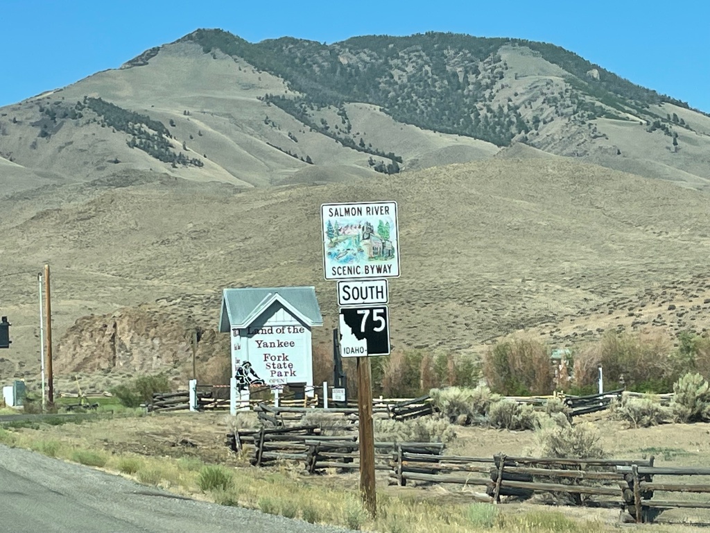
ID-75 South - Salmon River Scenic Byway
ID-75 South - Salmon River Scenic Byway in Custer County.
Taken 07-03-2021
Challis
Custer County
Idaho
United States
US-93 South at ID-75
US-93 South at ID-75 in Custer County
Taken 07-03-2021
 Challis
Custer County
Idaho
United States
Challis
Custer County
Idaho
United States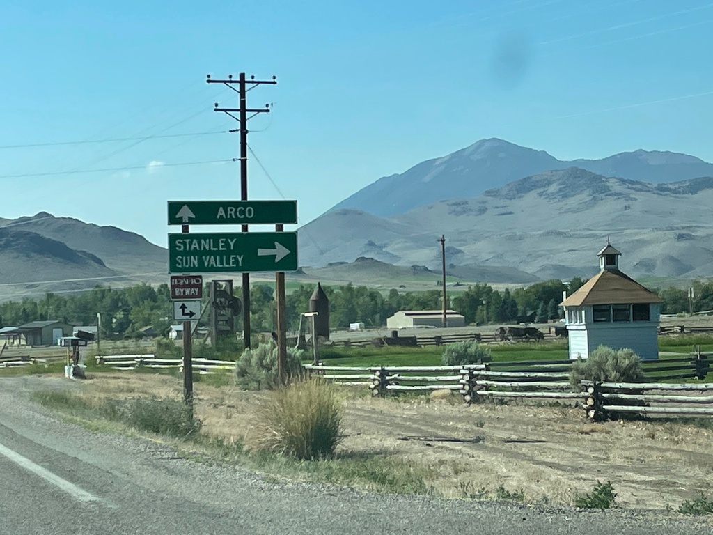
US-93 South at ID-75
US-93 South at ID-75 in Custer County. Turn right for ID-75 south to Stanley and Sun Valley. Continue south on US-93 for Arco.
Taken 07-03-2021
Challis
Custer County
Idaho
United States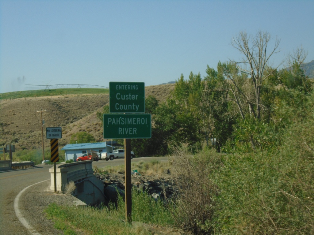
US-93 South - Custer County/Pahsimeroi River
US-93 South Entering Custer County at the Pahsimeroi River
Taken 07-03-2021
Ellis
Custer County
Idaho
United States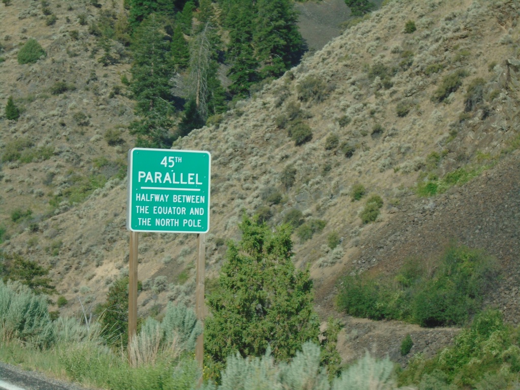
US-93 South - 45th Parallel
US-93 South - 45th Parallel - Halfway Between Equator and North Pole.
Taken 07-03-2021
Salmon
Lemhi County
Idaho
United States