Signs From Idaho
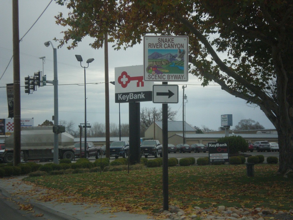
US-30 East Approaching US-95 - Snake River Canyon Scenic Byway
US-30 East approaching US-95. Turn right to continue on the Snake River Canyon Scenic Byway.
Taken 11-19-2016

 Fruitland
Payette County
Idaho
United States
Fruitland
Payette County
Idaho
United States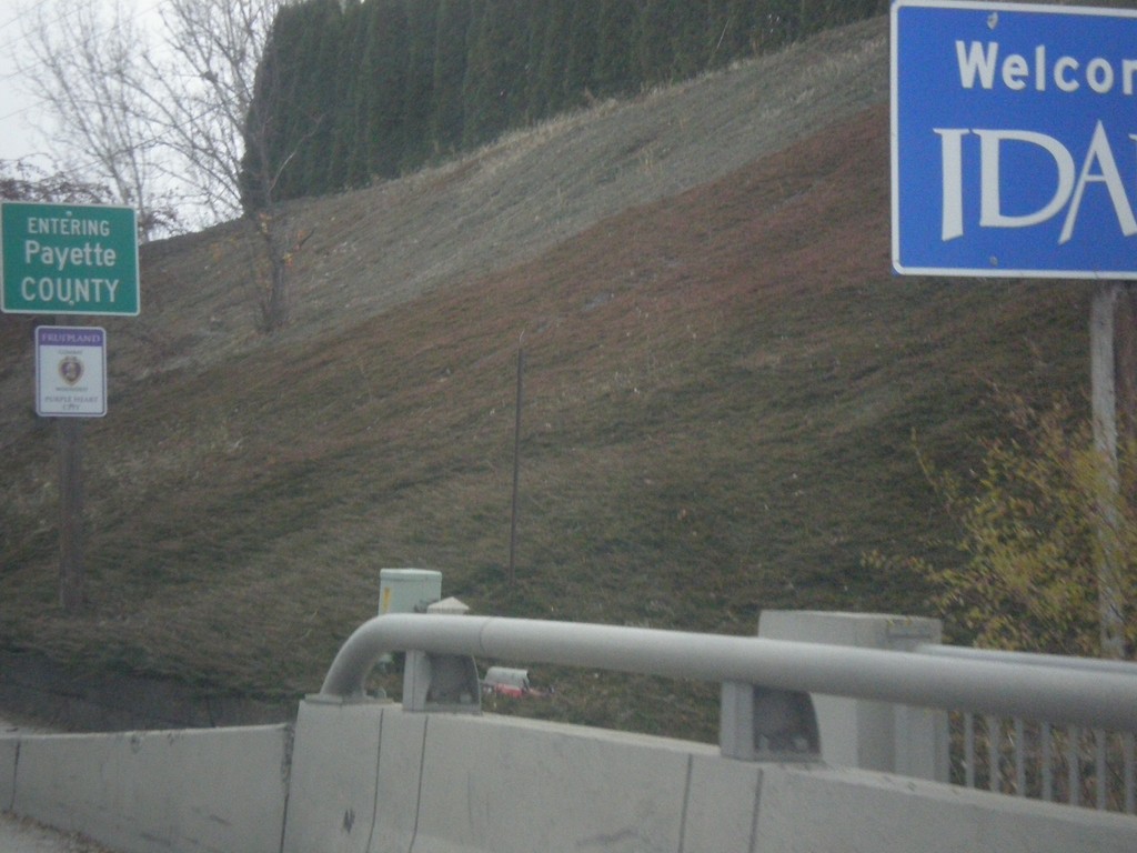
US-30 East - Entering Idaho
Welcome To Idaho on US-30 East. Entering Payette County.
Taken 11-19-2016
Fruitland
Payette County
Idaho
United States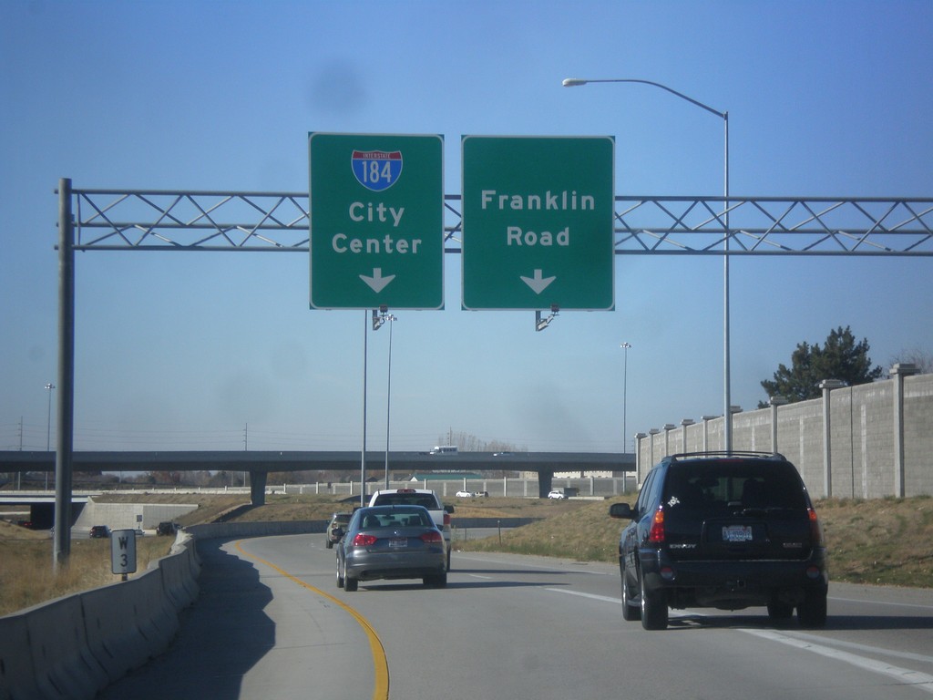
I-184 East / I-84 West Separation
I-184 East / I-84 West Separation. Use right lane for Franklin Road (Exit 1A) and left lane for I-184 East/City Center.
Taken 11-11-2016
 Boise
Ada County
Idaho
United States
Boise
Ada County
Idaho
United States
I-84 West - Nampa/Ontario
Overhead for I-84 West - Nampa/Ontario (Oregon) on I-84 just west of the I-84/I-184 junction.
Taken 11-11-2016
 Boise
Ada County
Idaho
United States
Boise
Ada County
Idaho
United States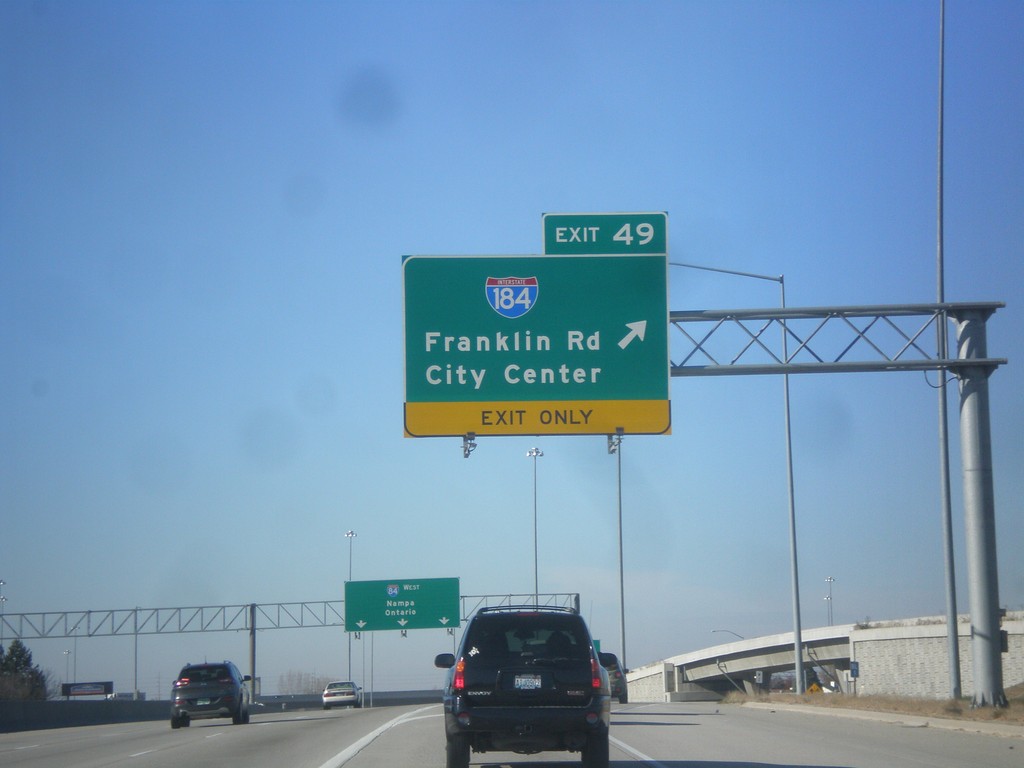
I-84 West - Exit 49
I-84 west at Exit 49 - I-184/Franklin Road/City Center.
Taken 11-11-2016
Boise
Ada County
Idaho
United States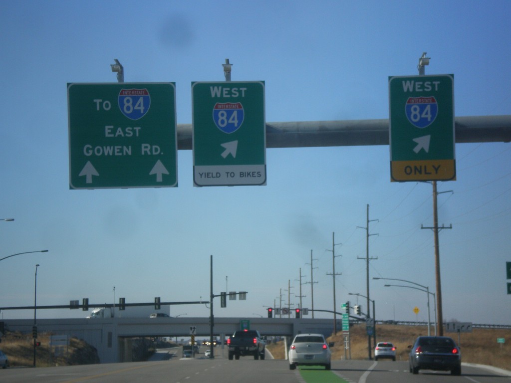
End ID-21 South at I-84 in Boise
End ID-21 South at I-84 in Boise. Use right lanes for I-84 West; left lanes for I-84 East and for Gowen Road.
Taken 11-11-2016


 Boise
Ada County
Idaho
United States
Boise
Ada County
Idaho
United States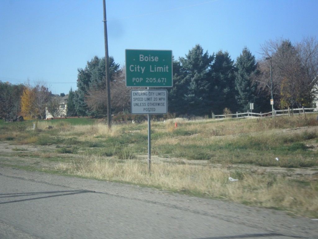
ID-21 West - Boise City Limit
Entering Boise on ID-21 west - Population 205, 671. Boise is the capital of Idaho and the largest city in Idaho.
Taken 11-11-2016
Boise
Ada County
Idaho
United States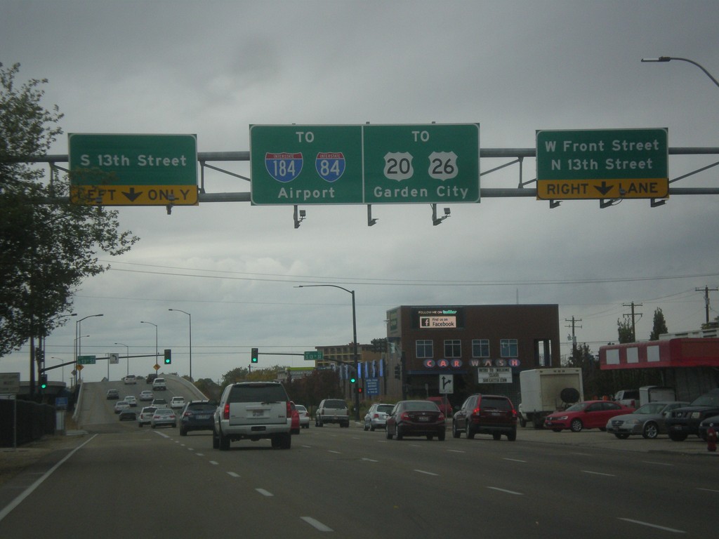
US-20/US-26 West Front St. at 13th St.
US-20/US-26 West (Front St.) at 13th St. After 13th St. US-20/US-26 becomes a freeway, locally known as The Connector. Use the connector for Garden City, I-84, and I-184.
Taken 10-15-2016
Boise
Ada County
Idaho
United States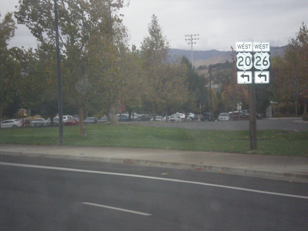
US-20/US-26 West (Broadway Ave.) at Front St.
US-20/US-26 West (Broadway Ave.) at Front St. Turn left on Front St. to continue west on US-20/US-26.
Taken 10-15-2016
Boise
Ada County
Idaho
United States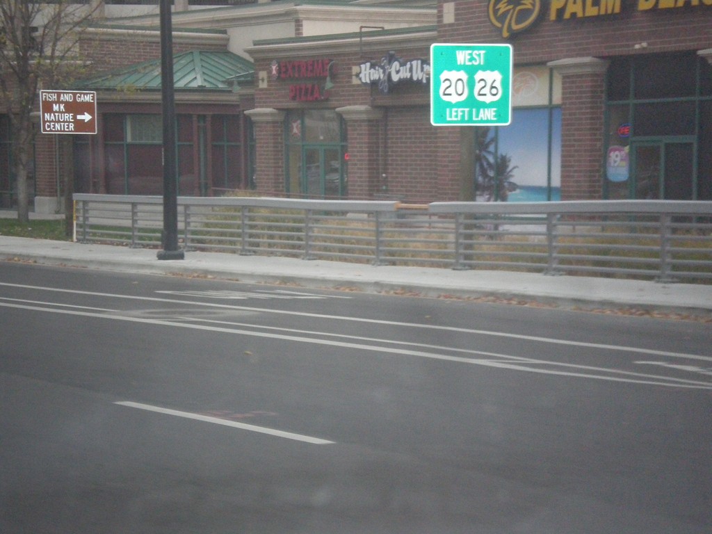
US-20/US-26 West - Broadway Ave at Front St
US-20/US-26 west (Broadway Ave.) approaching Front St. Use left lanes to continue west on US-20/US-26.
Taken 10-15-2016
Boise
Ada County
Idaho
United States