Signs From Idaho
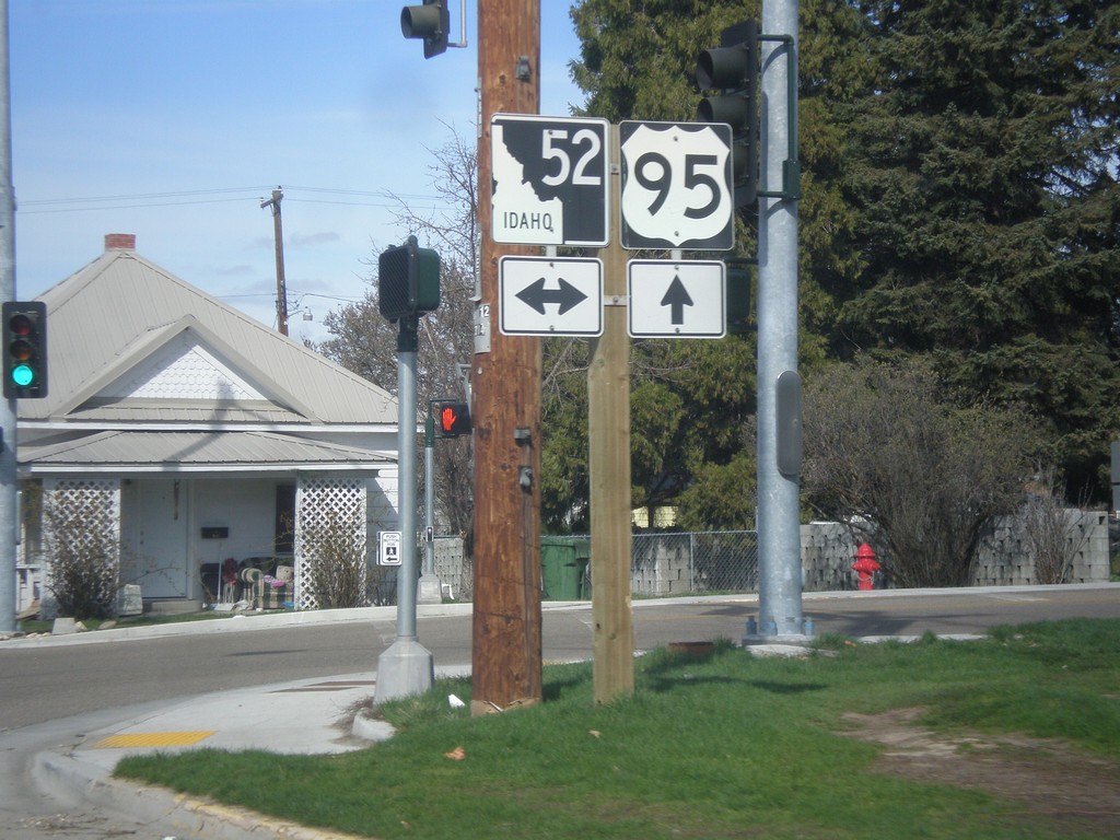
US-95 North at ID-52
US-95 North at ID-52 in Payette.
Taken 03-18-2016
 Payette
 County
Idaho
United States
Payette
Payette County
Idaho
United States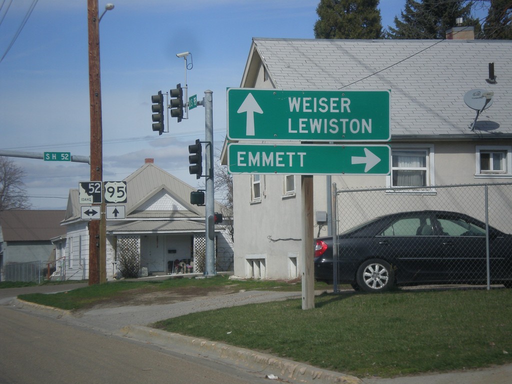
US-95 North at ID-52
US-95 north at ID-52. Use ID-52 east to Emmett. Use US-95 north to Weiser and Lewiston.
Taken 03-18-2016
 Payette
 County
Idaho
United States
Payette
Payette County
Idaho
United States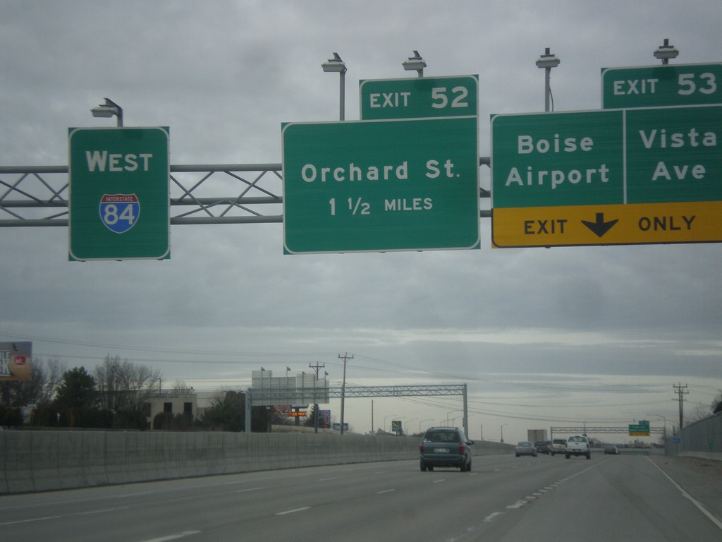
I-84 West - Exits 53 and 52
I-84 west at Exit 53 - Vista Ave./Boise Airport and approaching Exit 52 - Orchard St.
Taken 02-06-2016

 Boise
Ada County
Idaho
United States
Boise
Ada County
Idaho
United States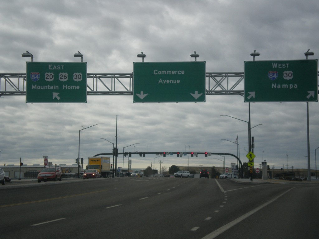
Broadway Ave. South at I-84
Broadway Ave. South (US-20/US-26 East) at I-84. Turn right for I-84/US-30 west to Nampa. Merge left for I-84 East/US-20/US-26/US-30 East to Mountain Home. Broadway Ave. turns into Commerce Ave. south of I-84. This interchange was redesigned as a SPUI in 2015.
Taken 02-06-2016

 Boise
Ada County
Idaho
United States
Boise
Ada County
Idaho
United States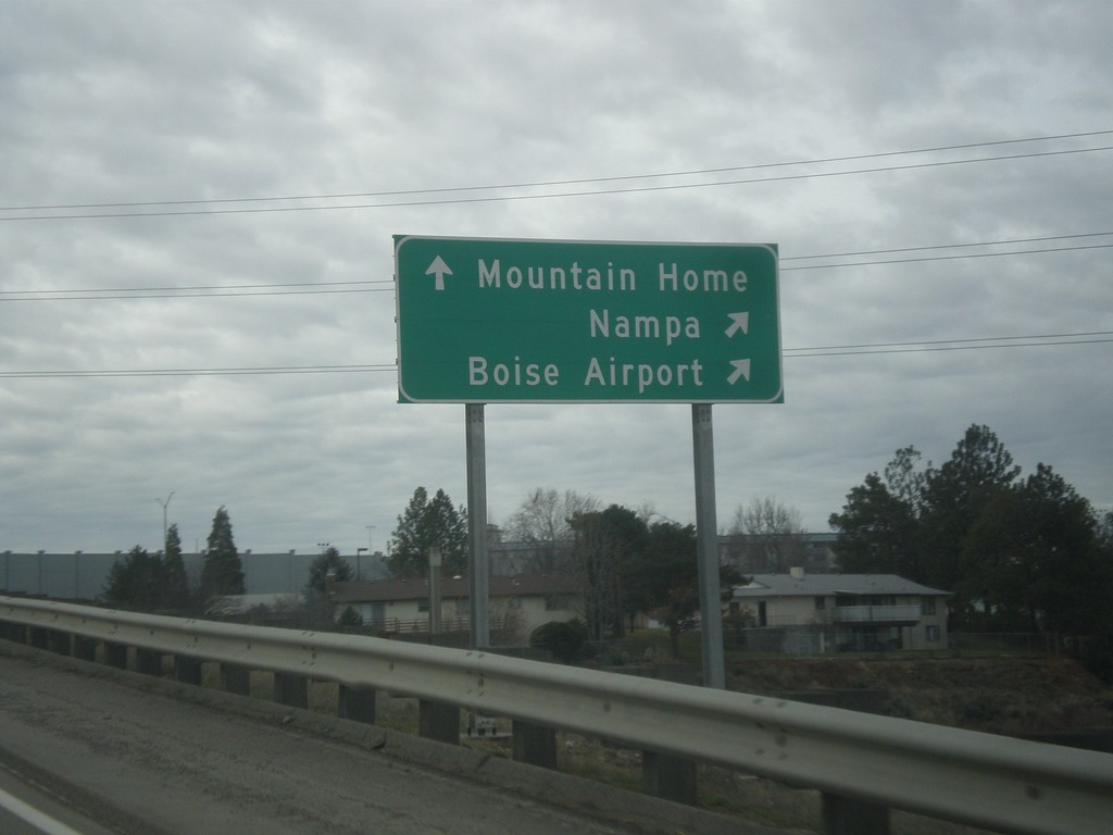
Broadway Ave. South at I-84 West Onramp
Broadway Ave. South (US-20/US-26 East) at I-84 west onramp. Turn right for I-84/US-30 west to Nampa and the Boise Airport. Continue over freeway for I-84 East/US-20/US-26/US-30 East to Mountain Home.
Taken 02-06-2016
Boise
Ada County
Idaho
United States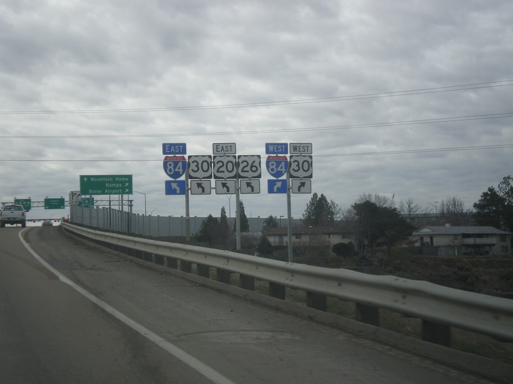
US-20/US-26 East (Broadway Ave.) at I-84/US-30 Jct.
US-20/US-26 East (Broadway Ave.) at I-84/US-30 Jct in Boise. Turn right for I-84/US-30 West; continue over freeway for I-84/US-20/US-26/US-30 East. This interchange was redesigned as a SPUI in 2015.
Taken 02-06-2016
Boise
Ada County
Idaho
United States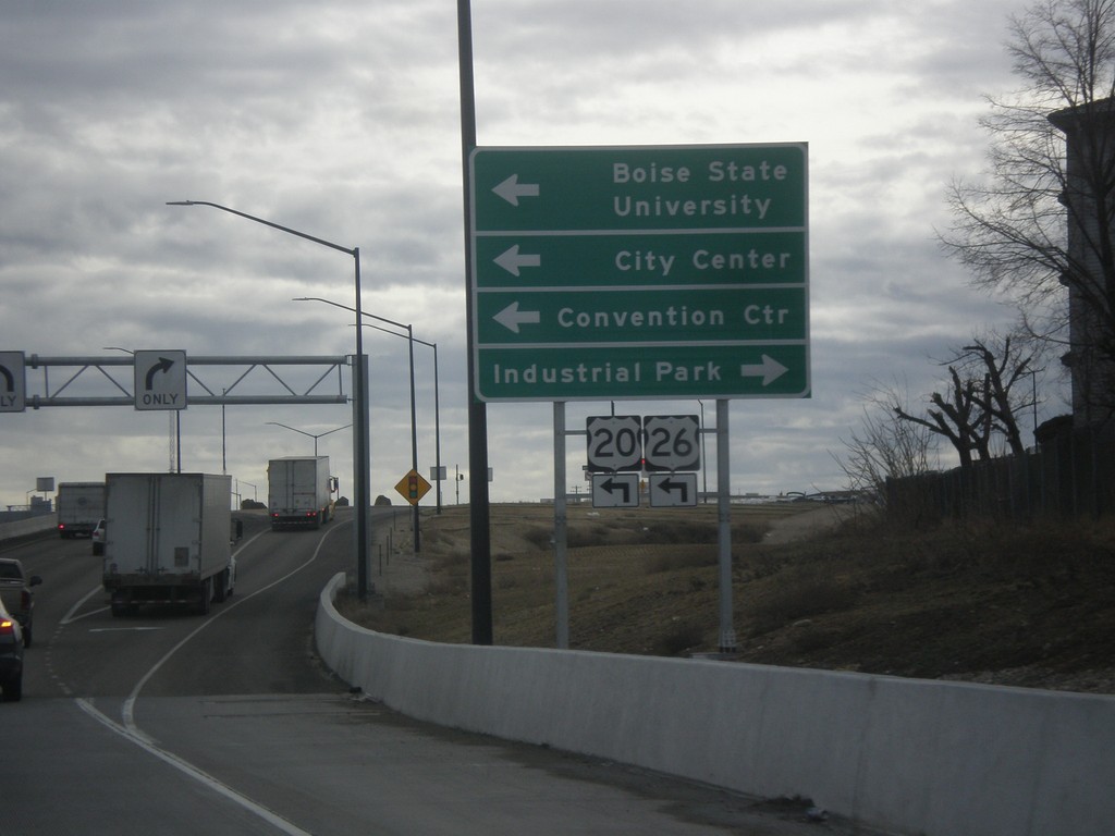
I-84 East (Exit 54) Offramp at Broadway Ave. (US-20/US-26)
I-84 East (Exit 54) Offramp at Broadway Ave. (US-20/US-26) in Boise. Turn left for US-20/US-26 West/Broadway Ave. to Boise State University, Convention Center, and City Center. Turn right for Industrial Park.
Taken 02-06-2016
Boise
Ada County
Idaho
United States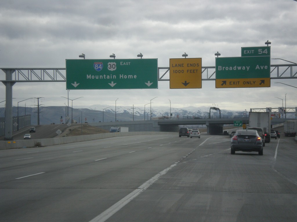
I-84 East - Exit 54
I-84 east at Exit 54 - Broadway Ave. I-84/US-30 continues east to Mountain Home. US-20 and US-26 join I-84 eastbound here.
Taken 02-06-2016
Boise
Ada County
Idaho
United States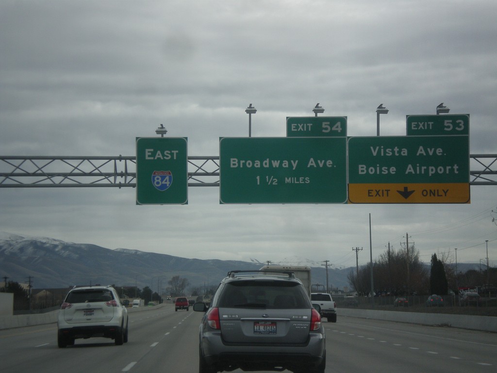
I-84 East - Exit 53 and 54
I-84 east at Exit 53 - Vista Ave./Boise Airport. Approaching Exit 54 - Broadway Ave.
Taken 02-06-2016
Boise
Ada County
Idaho
United States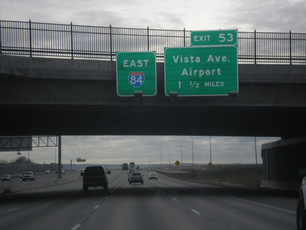
I-84 East Approaching Exit 53
I-84 east overhead, and approaching Exit 53 - Vista Ave./Airport.
Taken 02-06-2016
Boise
Ada County
Idaho
United States