Signs From Idaho
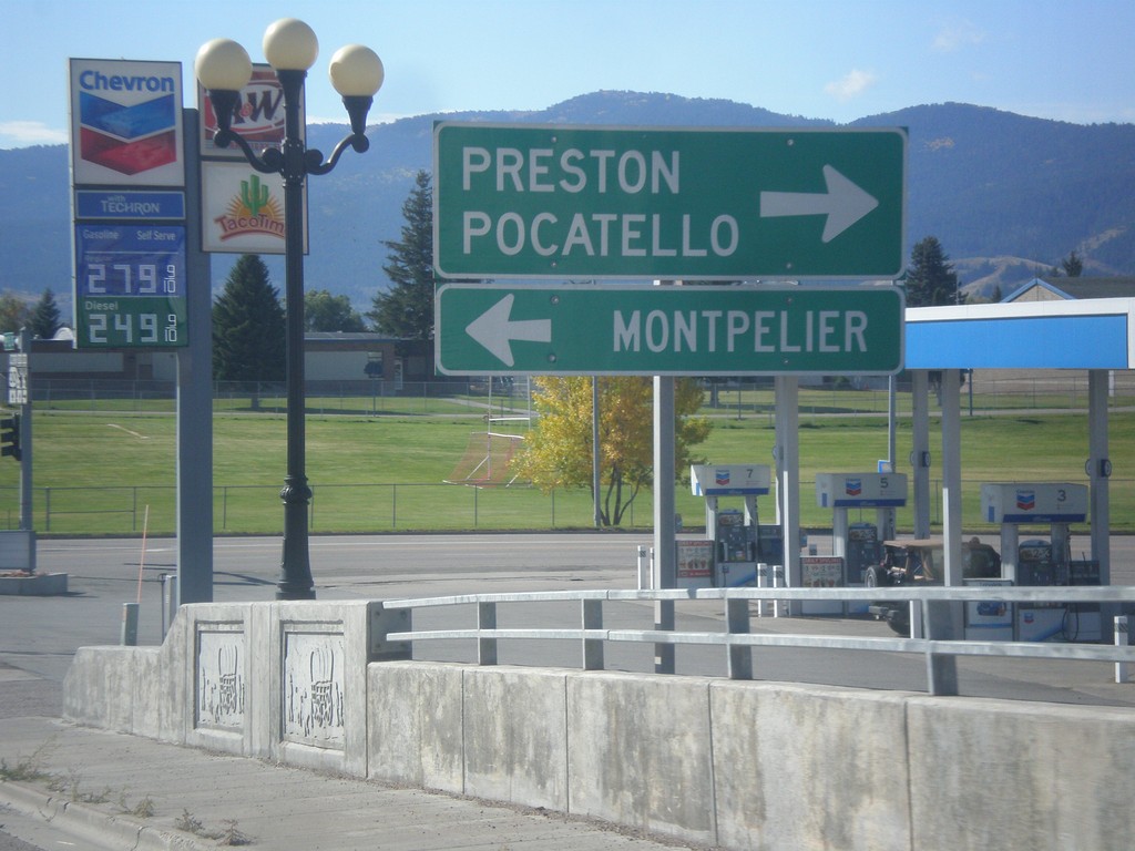
ID-34 South at US-30
ID-34 South at US-30. Turn left for US-30 west to Montpelier. Turn right for US-30 east to Pocatello and ID-34 south to Preston.
Taken 10-04-2015

 Soda Springs
Caribou County
Idaho
United States
Soda Springs
Caribou County
Idaho
United States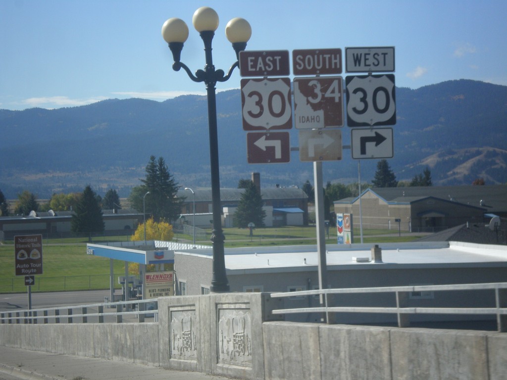
ID-34 South Approaching US-30
ID-34 South approaching US-30 in Soda Springs. ID-34 south joins US-30 east through Soda Springs.
Taken 10-04-2015
Soda Springs
Caribou County
Idaho
United States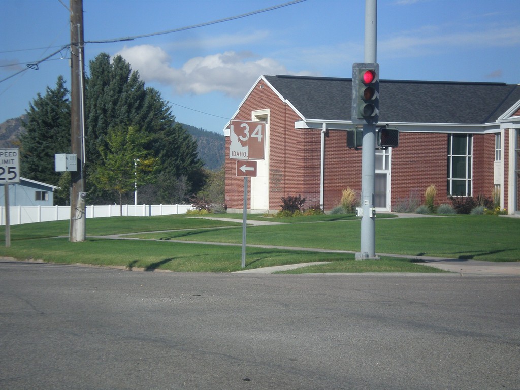
ID-34 South - Soda Springs
ID-34 south (East Hooper Ave.) at S. 3rd St. Turn left to continue south on ID-34.
Taken 10-04-2015
Soda Springs
Caribou County
Idaho
United States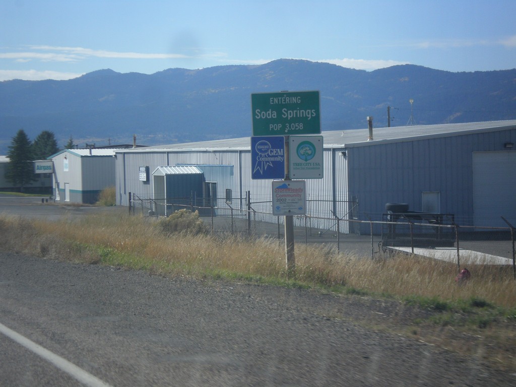
ID-34 South - Soda Springs
Entering Soda Springs on ID-34 south. Population 3058. Soda Springs is the county seat of Caribou County.
Taken 10-04-2015
Soda Springs
Caribou County
Idaho
United States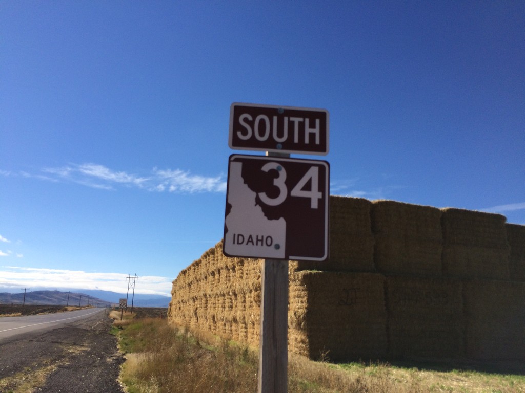
ID-34 South - Caribou County
ID-34 South in Caribou County. The shield is brown because it is part of the scenic/historic byway system, in this case the Pioneer Historic Byway.
Taken 10-04-2015
Conda
Caribou County
Idaho
United States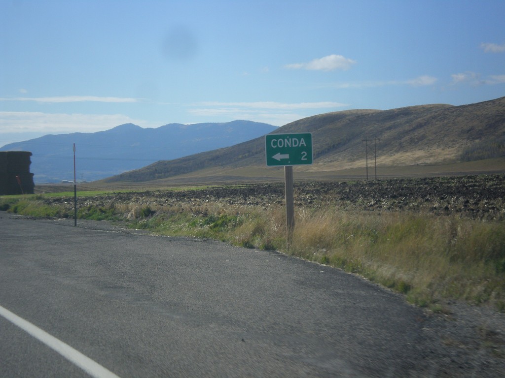
ID-34 South - Conda Jct.
ID-34 south at Conda Jct.
Taken 10-04-2015
Soda Springs
Caribou County
Idaho
United States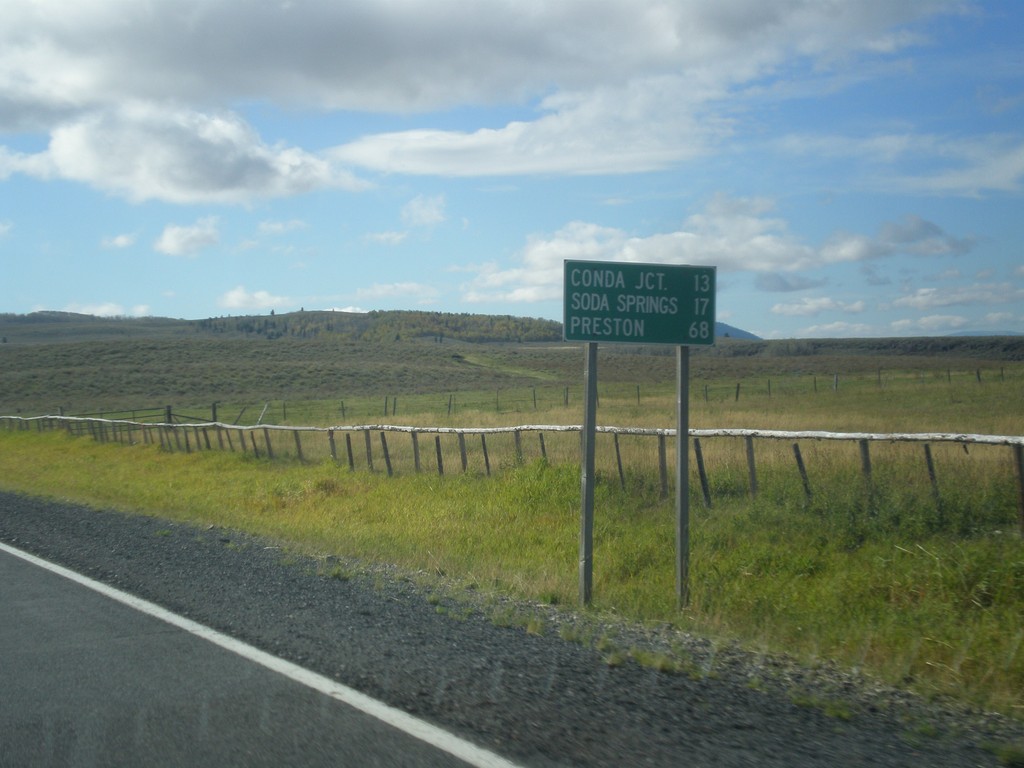
ID-34 South - Distance Marker
Distance marker on ID-34 south. Distance to Conda Jct., Soda Springs, and Preston.
Taken 10-04-2015
Soda Springs
Caribou County
Idaho
United States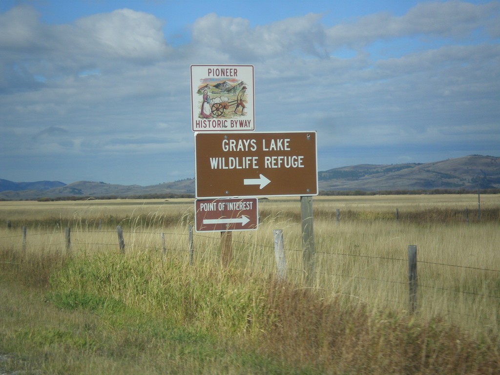
ID-34 South - Grays Lake Road Jct.
ID-34 South at Grays Lake Road Jct. Turn right for Grays Lake National Wildlife Refuge.
Taken 10-04-2015
Wayan
Caribou County
Idaho
United States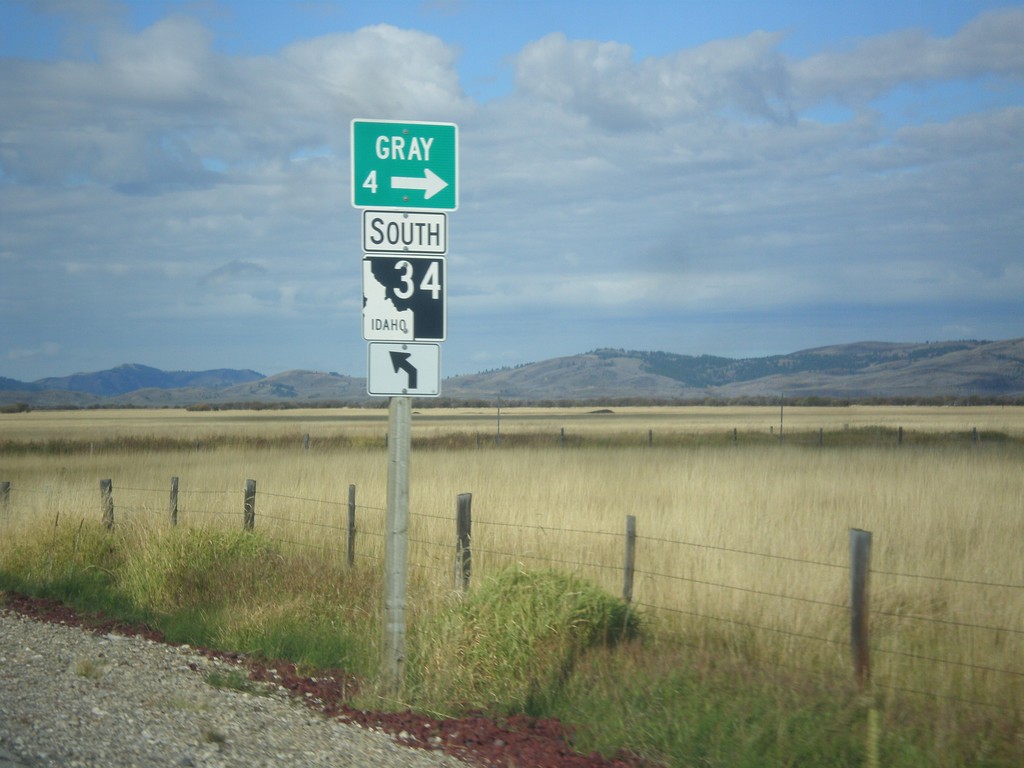
ID-34 South - Gray
ID-34 south at Grays Lake Road north to Gray.
Taken 10-04-2015
Wayan
Caribou County
Idaho
United States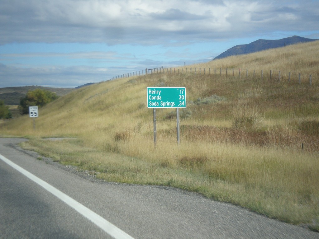
ID-34 South - Distance Marker
Distance marker on ID-34 south. Distance to Henry, Conda, and Soda Springs.
Taken 10-04-2015
Wayan
Caribou County
Idaho
United States