Signs From Idaho
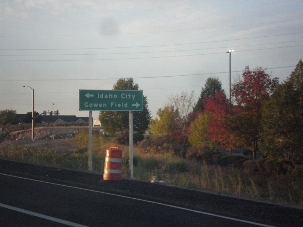
I-84 East Exit 57 Offramp at ID-21
I-84 East Exit 57 Offramp at ID-21. Turn left for ID-21 east to Idaho City; turn right for Gowen Road.
Taken 10-03-2015


 Boise
Ada County
Idaho
United States
Boise
Ada County
Idaho
United States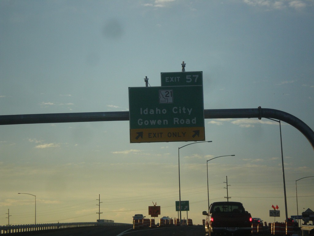
I-84 East - Exit 57
I-84 east at Exit 57 - ID-21/Idaho City/Gowen Road.
Taken 10-03-2015
Boise
Ada County
Idaho
United States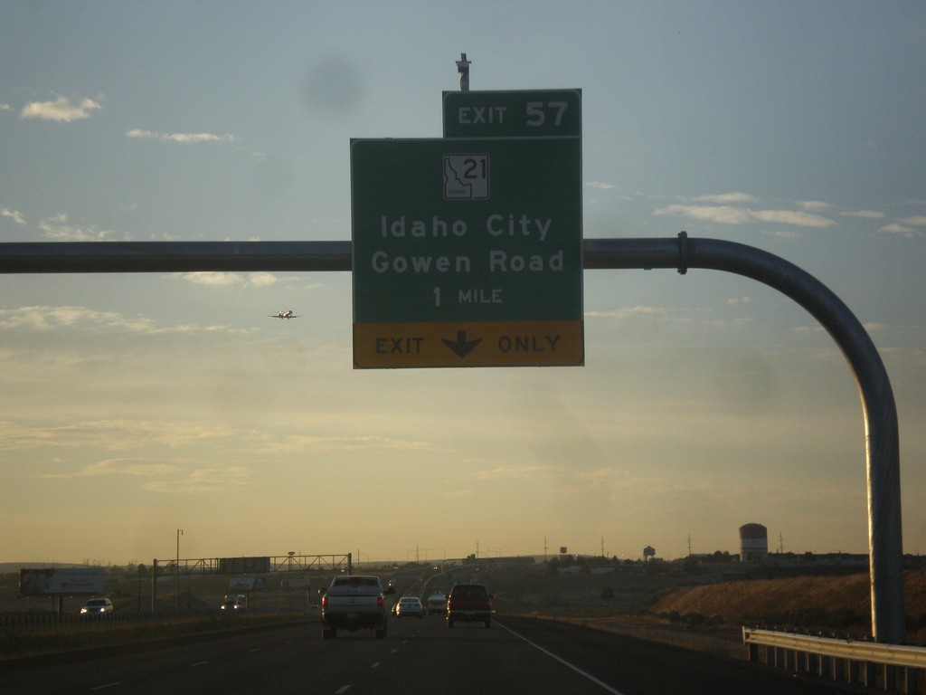
I-84 East - Exit 57
I-84 east approaching Exit 57 - ID-21/Idaho City/Gowen Road.
Taken 10-03-2015
Boise
Ada County
Idaho
United States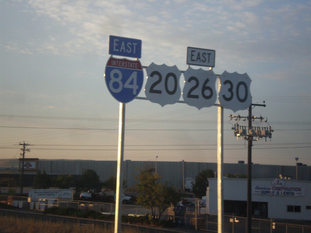
I-84/US-20/US-26/US-30 East Shields
I-84/US-20/US-26/US-30 east shields. Four highways join together between Boise and Mountain Home, which is the most overlaps of any stretch of highway in Idaho. Notice the US highway shields are missing the surrounding black box. This stretch of highway was recently widened, and it was probably incorrectly placed by a contractor.
Taken 10-03-2015
Boise
Ada County
Idaho
United States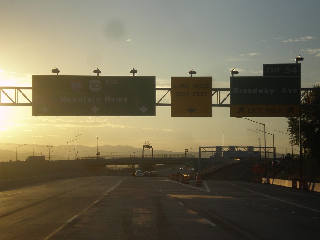
I-84 East - Exit 54
I-84 east at Exit 54 - Broadway Ave. I-84/US-30 continues east to Mountain Home. US-20 and US-26 join I-84 eastbound here.
Taken 10-03-2015
Boise
Ada County
Idaho
United States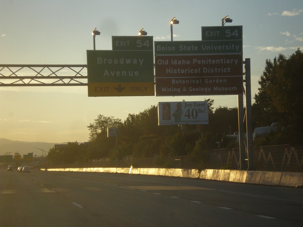
I-84 East - Exit 54
I-84 east approaching Exit 54 - Broadway Ave. Use Exit 54 for Boise State University, Old Idaho Penitentiary Historic District, Botanical Garden, and Mining and Geology Museum.
Taken 10-03-2015
Boise
Ada County
Idaho
United States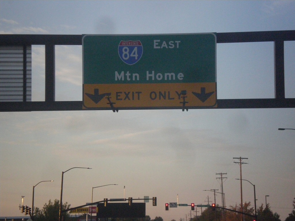
Cole Road South at I-84 East
Cole Road South at I-84 East to Mountain Home.
Taken 10-03-2015
Boise
Ada County
Idaho
United States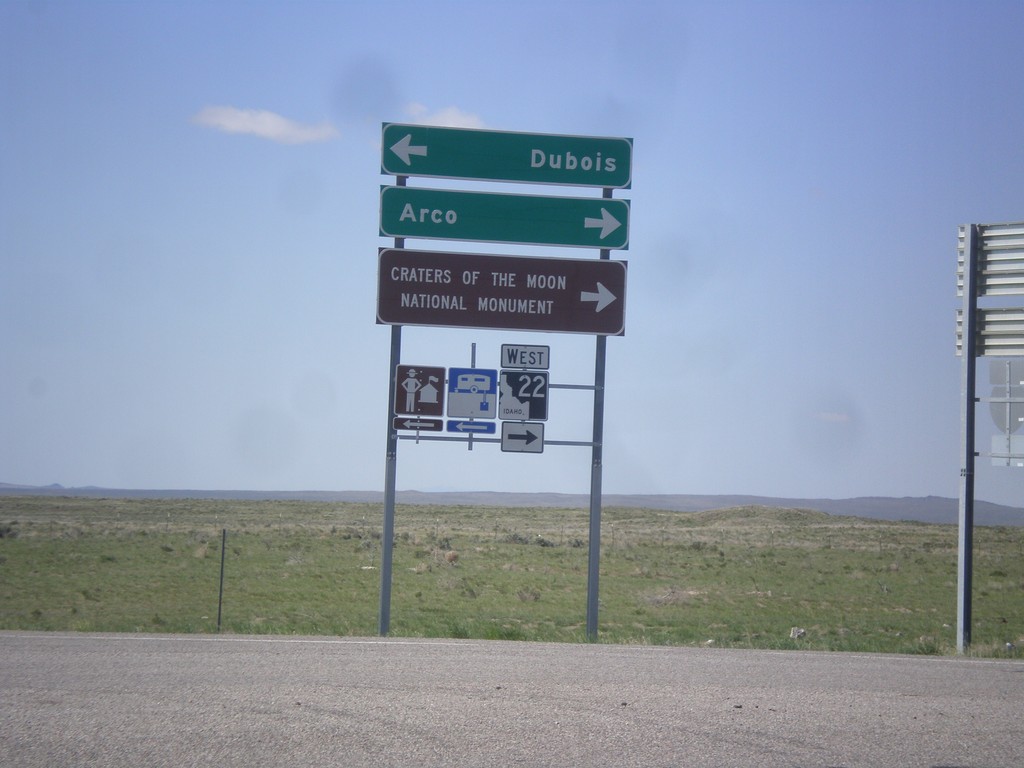
I-15 South Offramp at ID-22
I-15 south (Exit 167) offramp at ID-22. Turn right for ID-22 west to Craters of the Moon National Monument and Arco. Turn left for Dubois.
Taken 05-10-2015


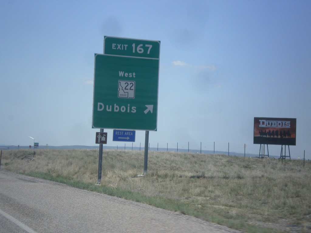
I-15 South - Exit 167
I-15 south at Exit 167 - ID-22 West/Dubois.
Taken 05-10-2015
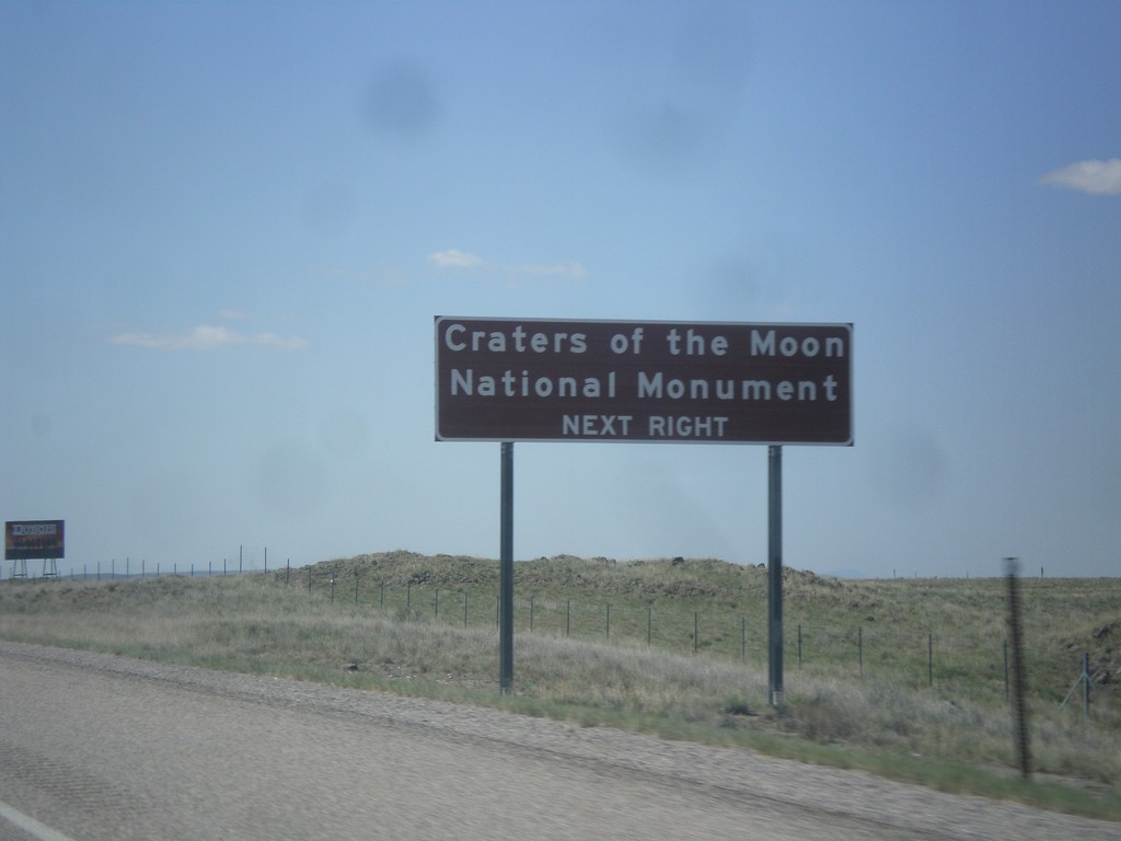
I-15 South Approaching Exit 167
I-15 south approaching Exit 167. Use Exit 167 for Craters of the Moon National Monument.
Taken 05-10-2015
Dubois
Clark County
Idaho
United States