Signs From Idaho
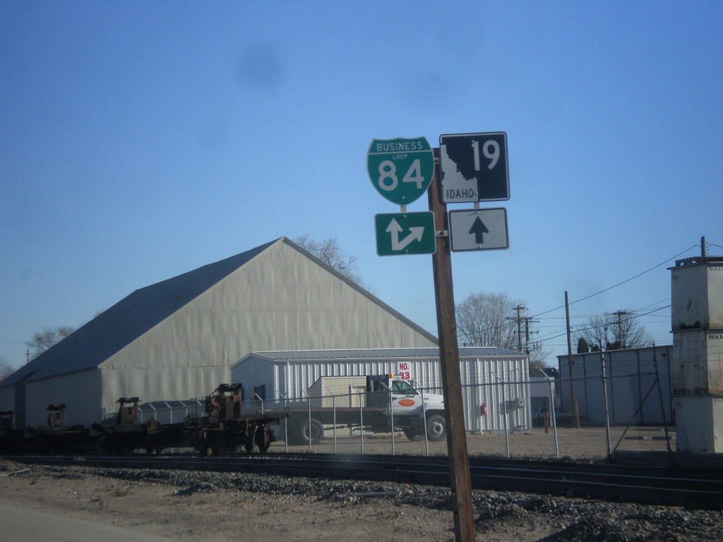
ID-19 East Approaching BL-84
ID-19 East Approaching BL-84 (Cleveland Blvd.) in Caldwell.
Taken 12-14-2014

 Caldwell
Canyon County
Idaho
United States
Caldwell
Canyon County
Idaho
United States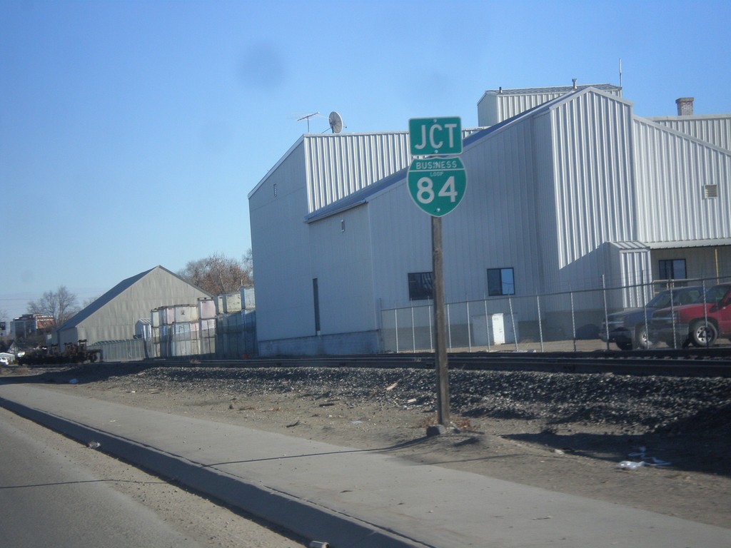
ID-19 East Approaching BL-84
ID-19 east approaching BL-84 in Caldwell.
Taken 12-14-2014
Caldwell
Canyon County
Idaho
United States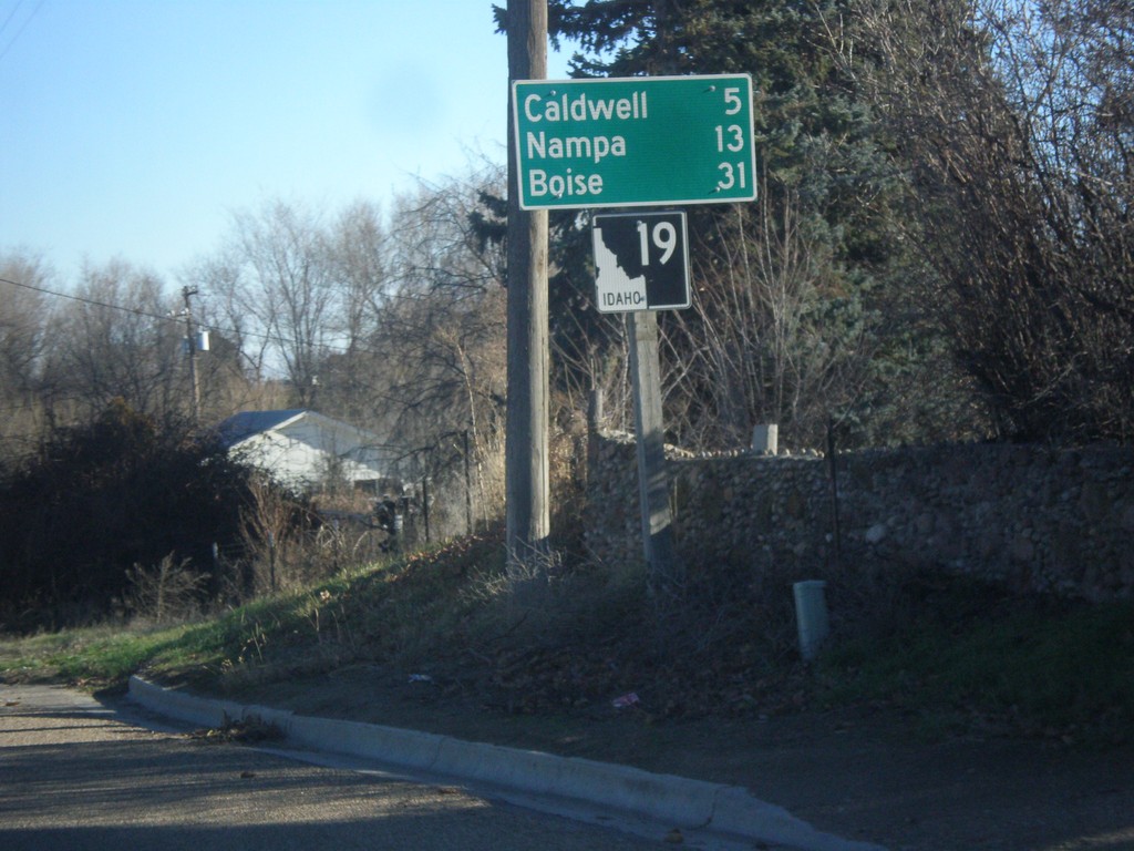
ID-19 East - Distance Marker
Distance marker on ID-19 east. Distance to Caldwell, Nampa, and Boise.
Taken 12-14-2014
Greenleaf
Canyon County
Idaho
United States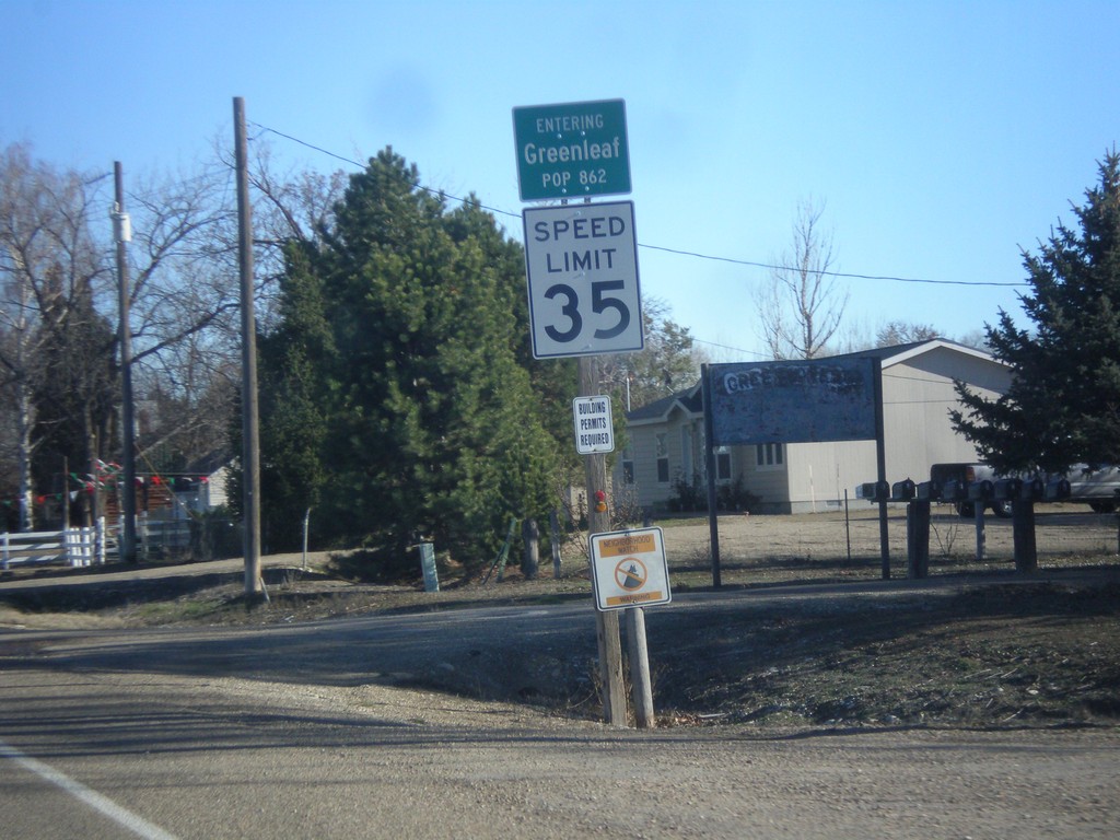
ID-19 East - Greenleaf
Entering Greenleaf, Population 862 on ID-19 east.
Taken 12-14-2014
Greenleaf
Canyon County
Idaho
United States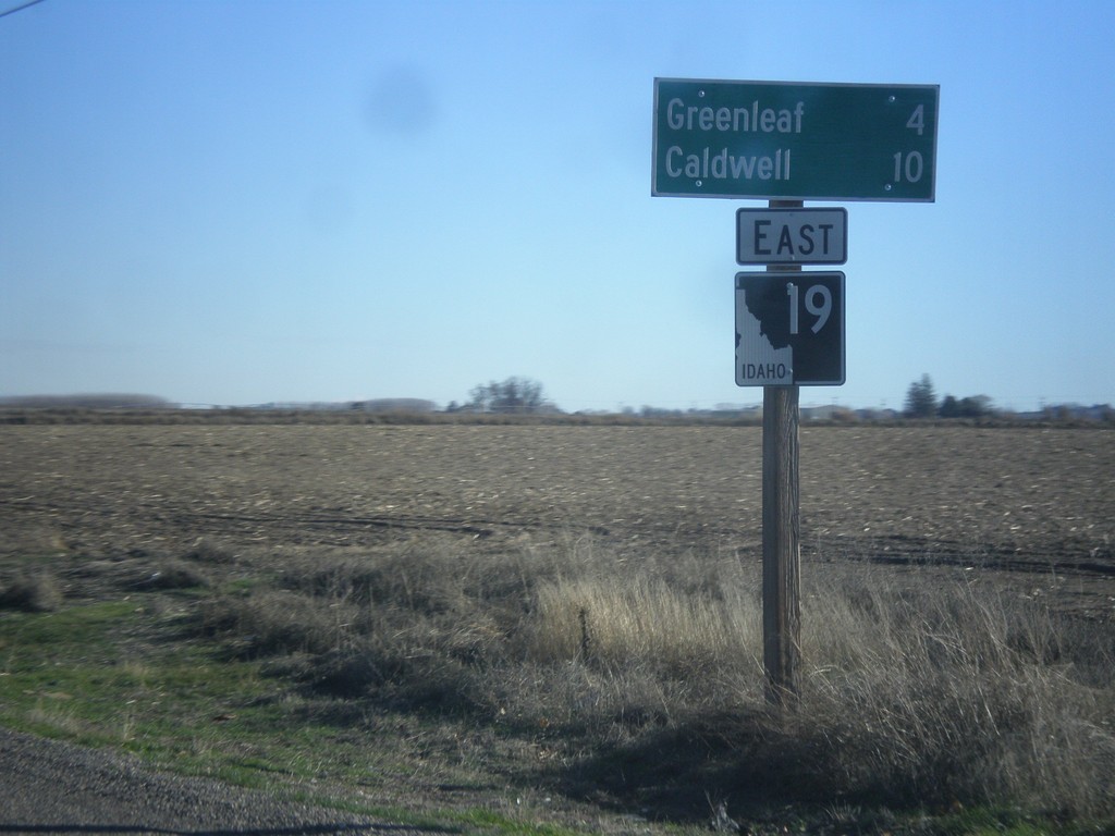
ID-19 East - Distance Marker
Distance marker on ID-19 east. Distance to Greenleaf and Caldwell.
Taken 12-14-2014
Wilder
Canyon County
Idaho
United States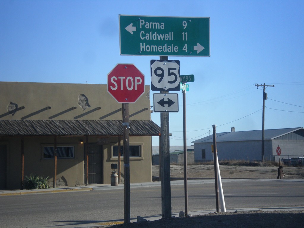
Golden Gate Ave. East at US-95
Golden Gate Ave. East at US-95 in Wilder. Turn right on US-95 south for Caldwell and Homedale. Turn left on US-95 north for Parma.
Taken 12-14-2014
 Wilder
Canyon County
Idaho
United States
Wilder
Canyon County
Idaho
United States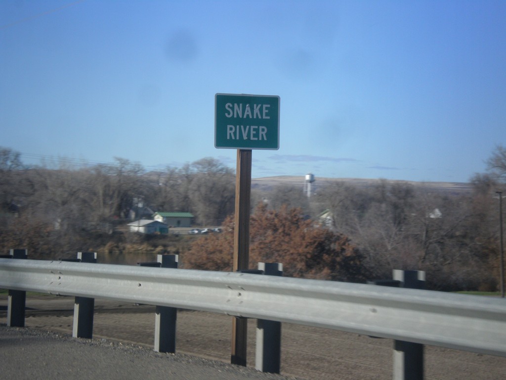
US-20/US-26 West - Snake River
US-20/US-26 West at the Snake River. The Snake River marks the boundary between Oregon and Idaho, starting just south of here.
Taken 12-14-2014

 Parma
Canyon County
Idaho
United States
Parma
Canyon County
Idaho
United States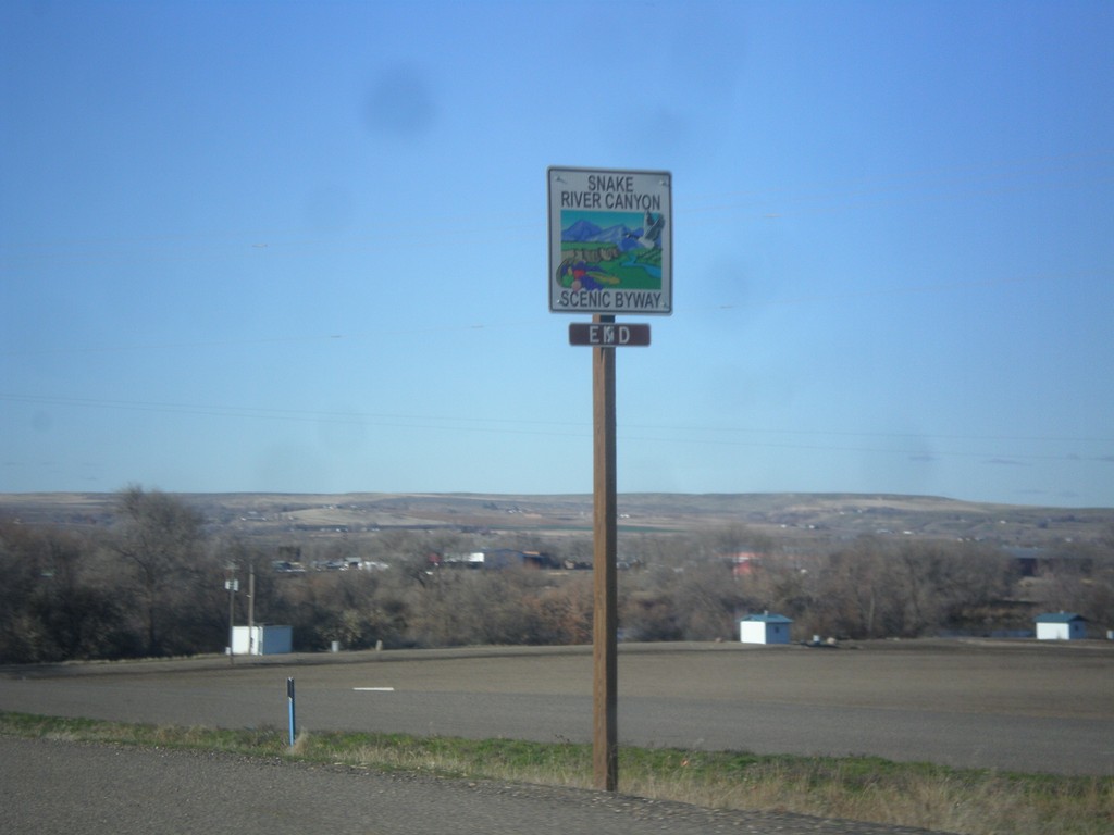
US-20/US-26 West - End Snake River Canyon Scenic Byway
End Snake River Canyon Scenic Byway on US-20/US-26 West, approaching the Oregon state line. This is the only End sign I have seen for a Scenic Byway in Idaho.
Taken 12-14-2014
Parma
Canyon County
Idaho
United States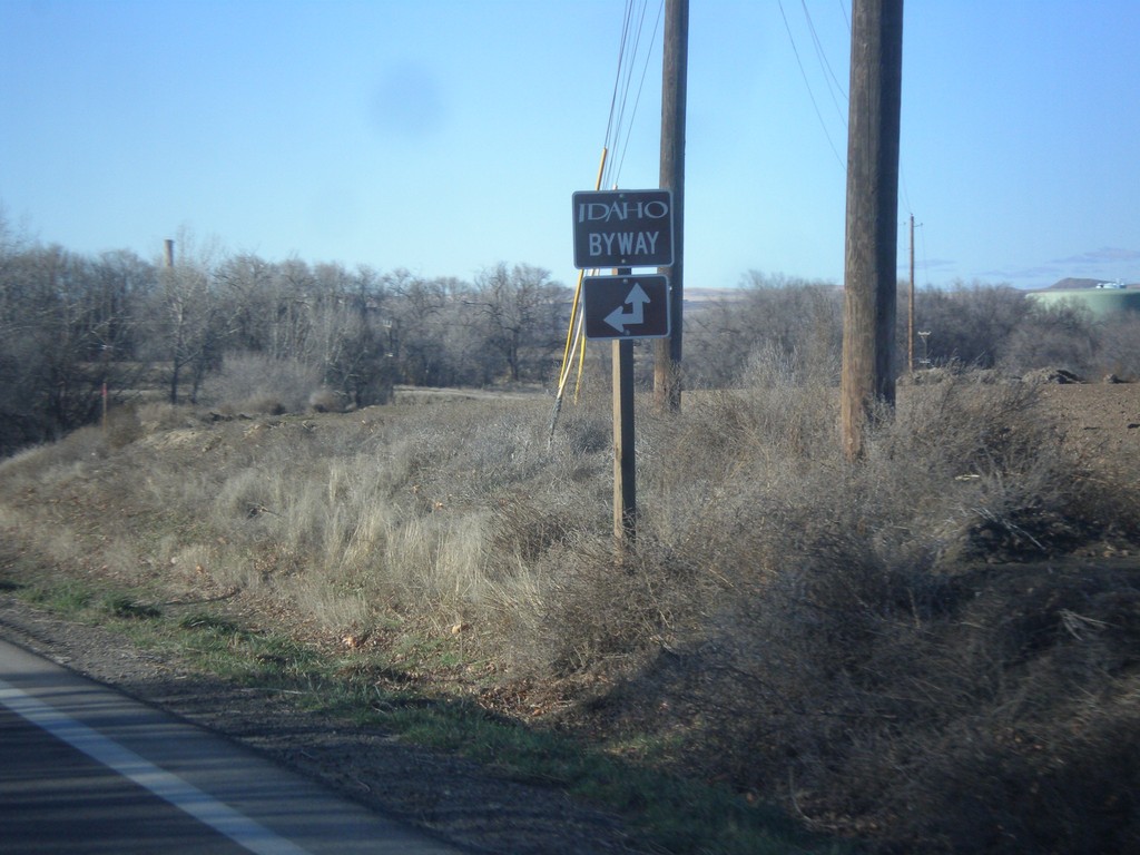
US-20/US-26 West - Apple Valley Road
US-20/US-26 west at Apple Valley Road. The Snake River Canyon Scenic Byway joins US-20/US-26 westbound here.
Taken 12-14-2014
Parma
Canyon County
Idaho
United States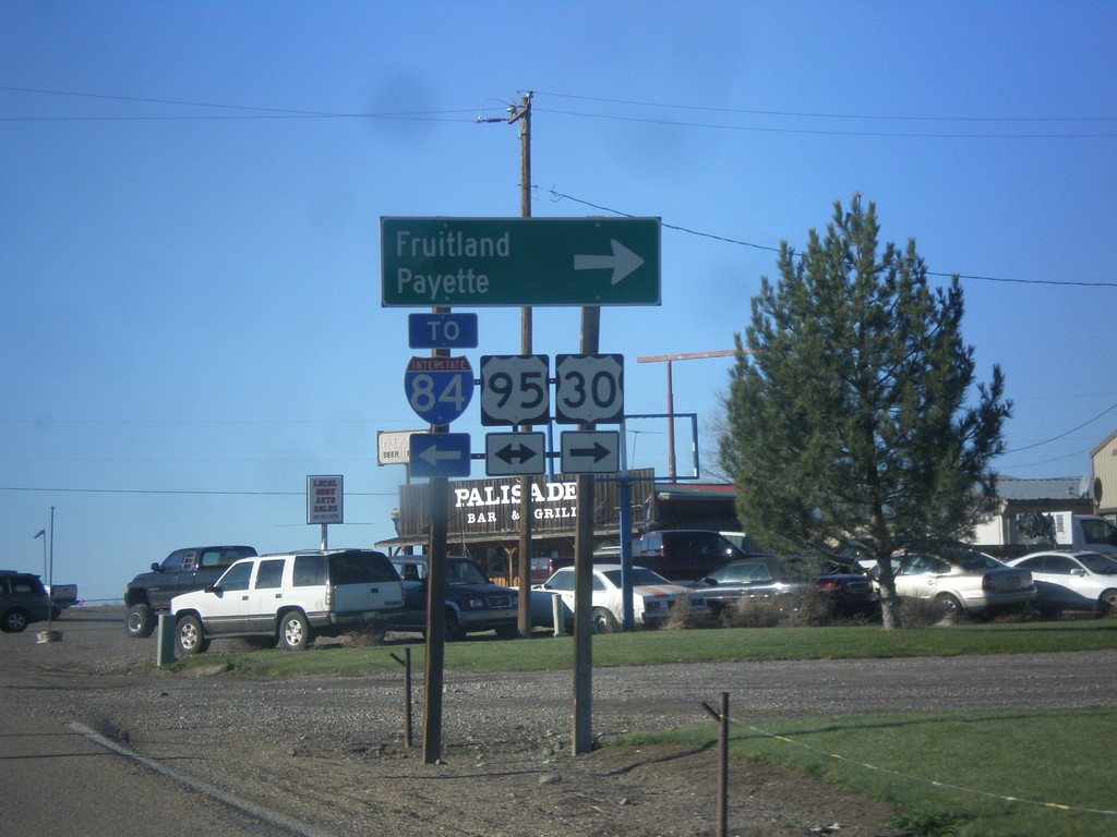
US-30 West at US-95
US-30 west at US-95. Turn right on US-95 north for Fruitland and Payette. Turn left on US-95 south for I-84. US-30 follows US-95 north to Fruitland.
Taken 12-14-2014
 Fruitland
Payette County
Idaho
United States
Fruitland
Payette County
Idaho
United States