Signs From Idaho
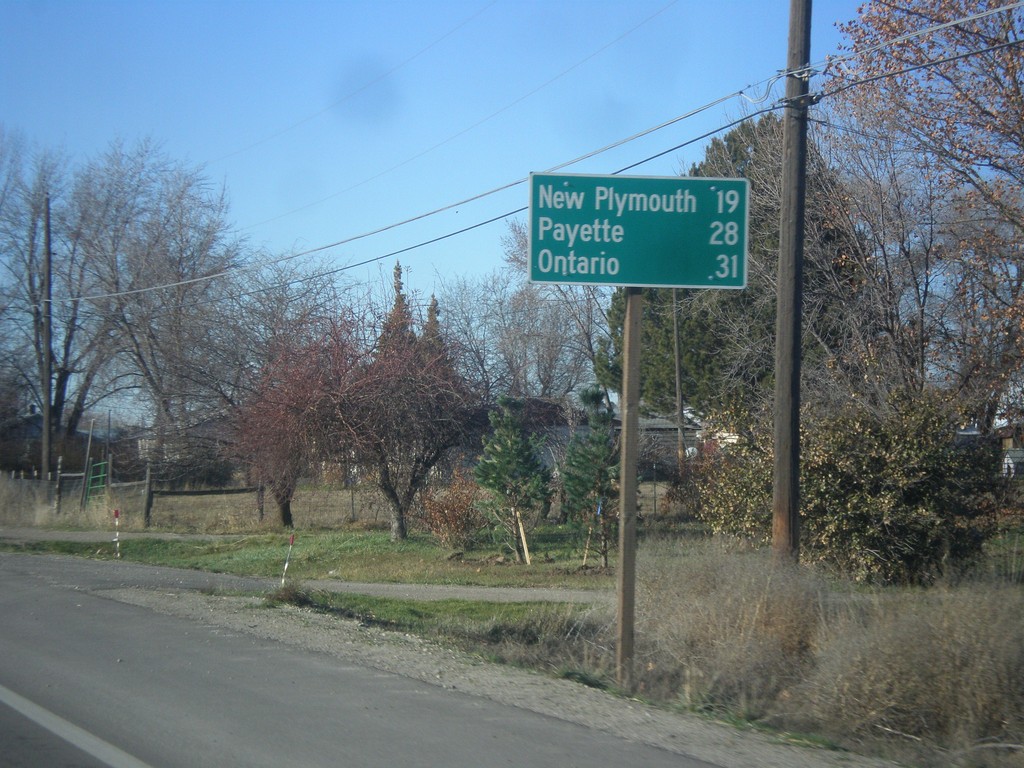
ID-52 West - Distance Marker
Distance marker on ID-52 west for New Plymouth, Payette, and Ontario (Oregon).
Taken 12-14-2014
 Emmett
Gem County
Idaho
United States
Emmett
Gem County
Idaho
United States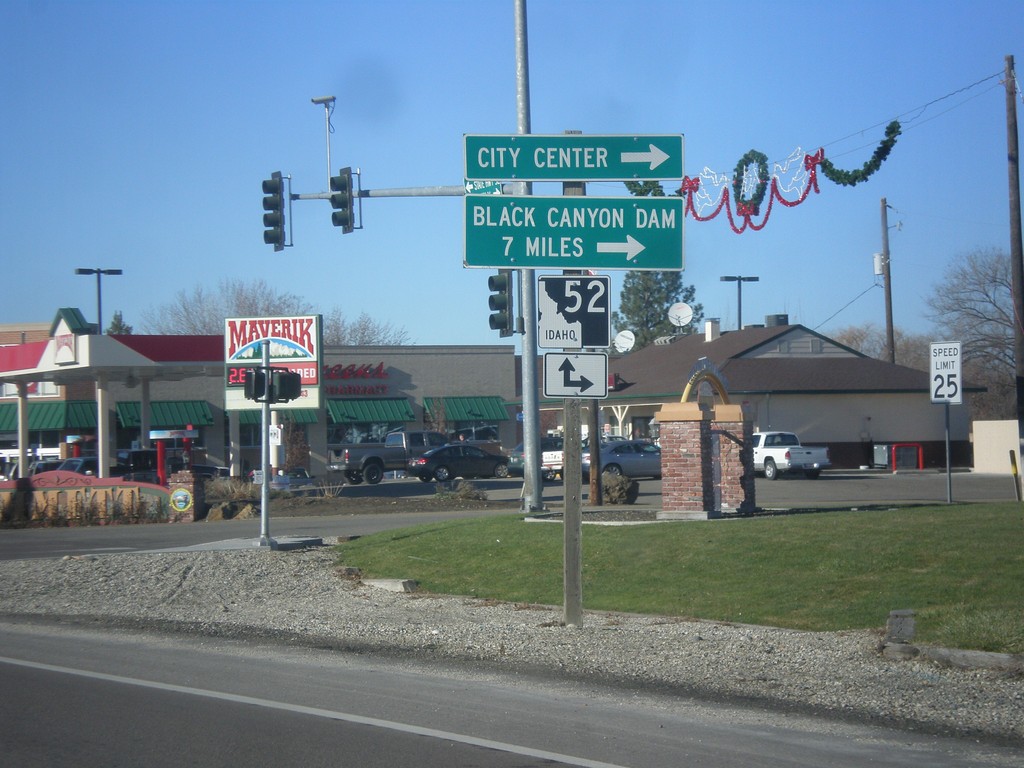
End ID-16 North at ID-52
End ID-16 north at ID-52. Turn right on ID-52 west for (Emmett) City Center and Black Canyon Dam.
Taken 12-14-2014
 Emmett
Gem County
Idaho
United States
Emmett
Gem County
Idaho
United States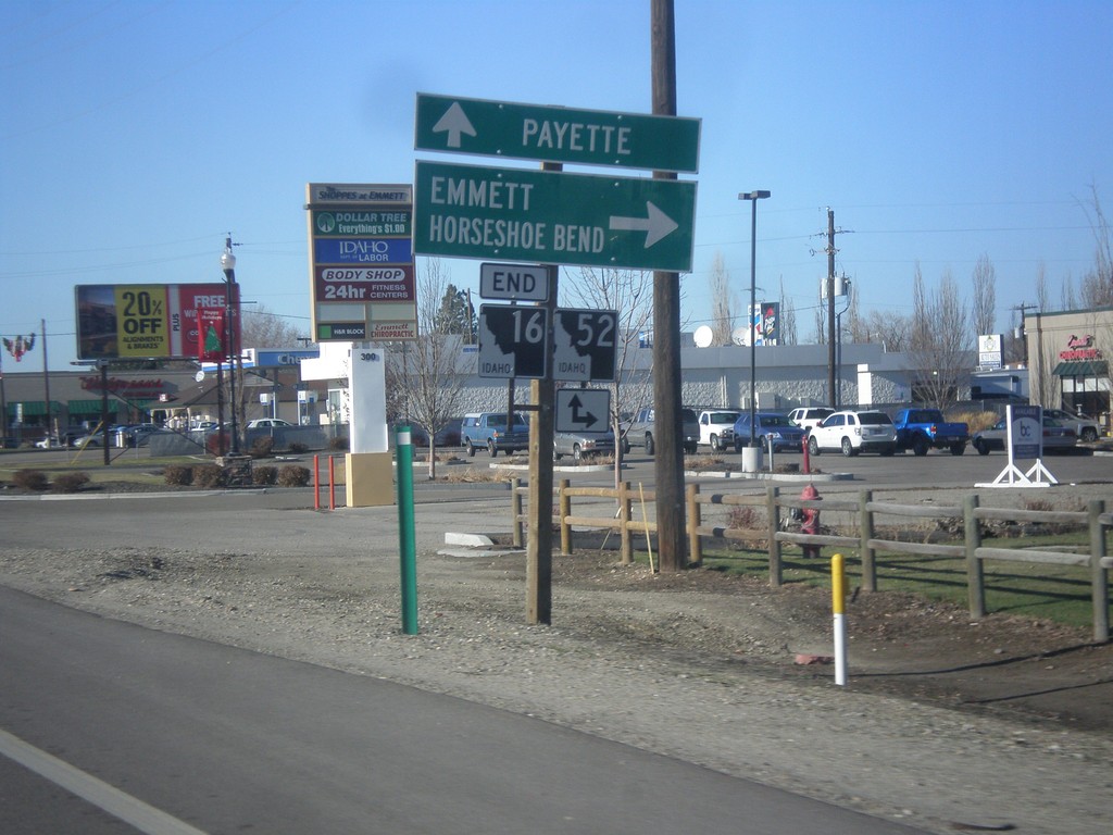
End ID-16 North at ID-52
End ID-16 north at ID-52. Turn right on ID-52 east for Emmett and Horseshoe Bend. Continue straight for ID-52 west to Payette.
Taken 12-14-2014
Emmett
Gem County
Idaho
United States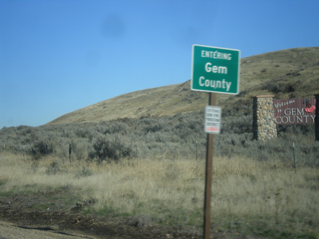
ID-16 North - Gem County
Entering Gem County on ID-16 north.
Taken 12-14-2014
Emmett
Gem County
Idaho
United States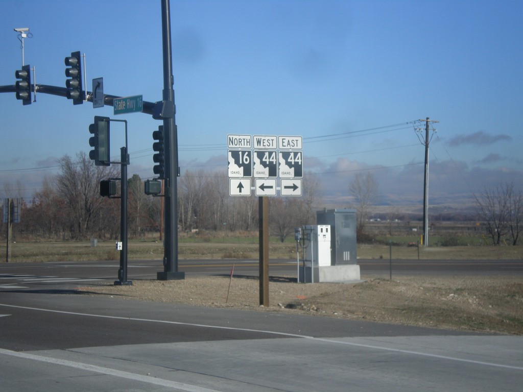
ID-16 North at ID-44
ID-16 north at ID-44 (State St.) in Ada County.
Taken 12-14-2014
 Eagle
Ada County
Idaho
United States
Eagle
Ada County
Idaho
United States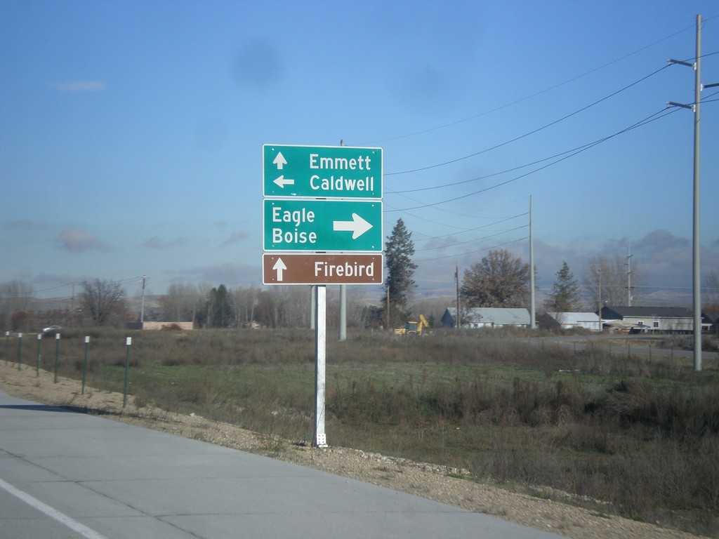
ID-16 North at ID-44
ID-16 north at ID-44. Turn right on ID-44 East for Eagle and Boise. Left on ID-44 West for Caldwell. Continue north on ID-16 for Emmett. Also use ID-16 north for Firebird (Raceway).
Taken 12-14-2014
Eagle
Ada County
Idaho
United States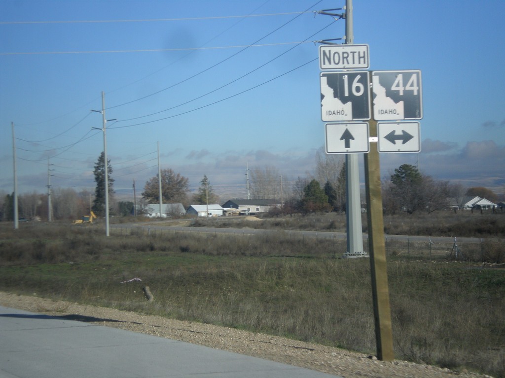
ID-16 North Approaching ID-44
ID-16 north approaching ID-44 in Ada County.
Taken 12-14-2014
Meridian
Ada County
Idaho
United States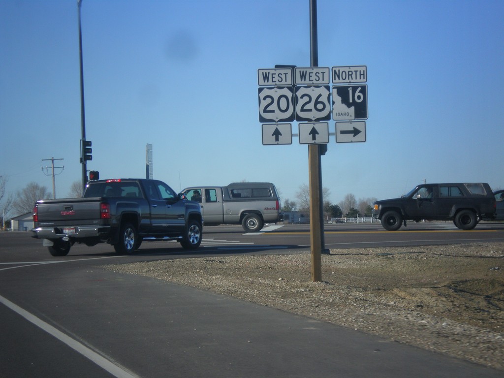
US-20/US-26 West at ID-16
US-20/US-26 West at ID-16. ID-16 between ID-44 and US-20/US-26 is the newly constructed Central Valley Expressway. Eventually ID-16 will connect to I-84 as a freeway.
Taken 12-14-2014

 Meridian
Ada County
Idaho
United States
Meridian
Ada County
Idaho
United States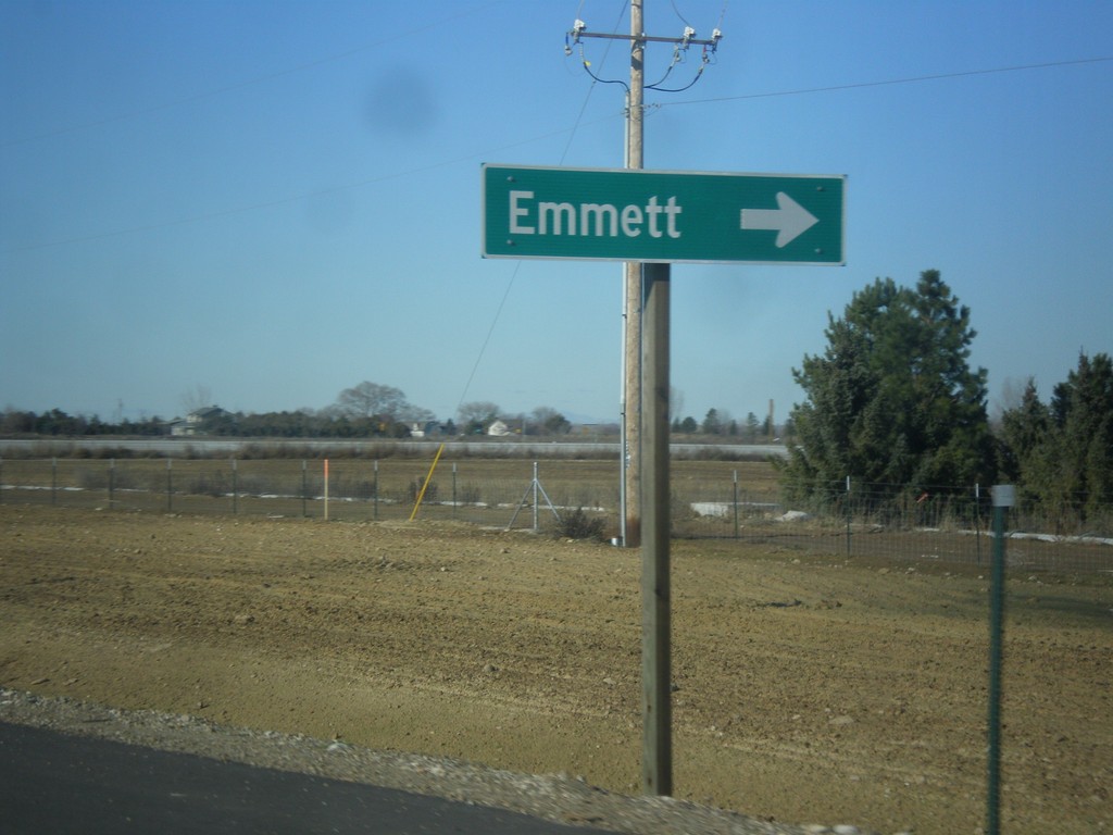
US-20/US-26 West at ID-16 North
US-20/US-26 West at ID-16 North to Emmett.
Taken 12-14-2014
Meridian
Ada County
Idaho
United States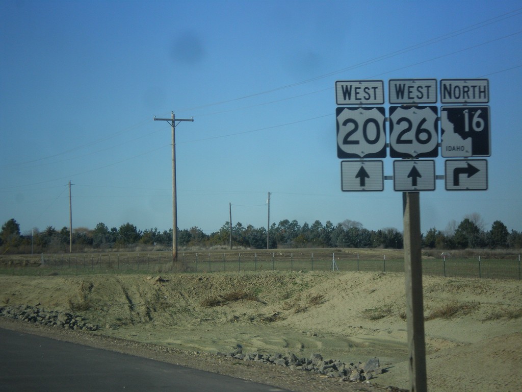
US-20/US-26 West Approaching ID-16
US-20/US-26 West approaching ID-16 in Ada County.
Taken 12-14-2014
Meridian
Ada County
Idaho
United States