Signs From Nevada
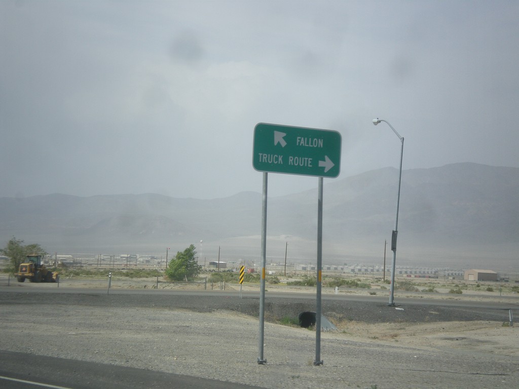
US-95 North at Hawthorne Truck Route
US-95 north at Hawthorne Truck Route. Merge right for the Truck Route, merge left for US-95 north towards Fallon.
Taken 05-05-2014

 Hawthorne
Mineral County
Nevada
United States
Hawthorne
Mineral County
Nevada
United States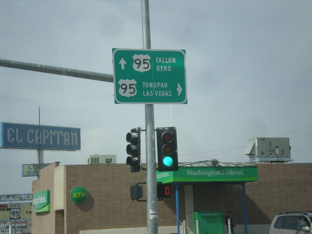
End NV-359 at US-95
End NV-359 at US-95. Turn right for US-95 south to Tonopah and Las Vegas. Continue straight for US-95 north to Fallon and Reno.
Taken 05-05-2014
 Hawthorne
Mineral County
Nevada
United States
Hawthorne
Mineral County
Nevada
United States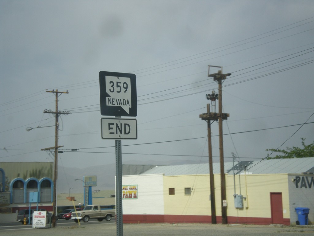
End NV-359 North at US-95
End NV-359 north at US-95 in Hawthorne.
Taken 05-05-2014
Hawthorne
Mineral County
Nevada
United States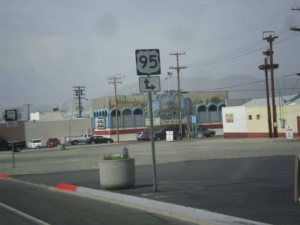
NV-359 North Approaching US-95
NV-359 North approaching US-95 in Hawthorne.
Taken 05-05-2014
Hawthorne
Mineral County
Nevada
United States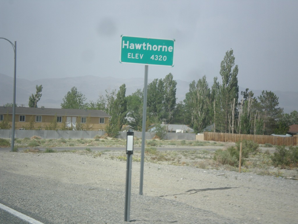
NV-359 North - Hawthorne
Hawthorne - Elevation 4,320 Feet on NV-359 North.
Taken 05-05-2014
Hawthorne
Mineral County
Nevada
United States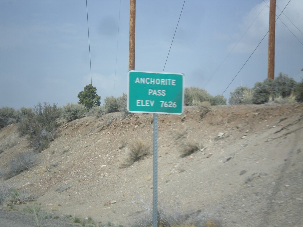
NV-359 North - Anchorite Pass
Anchorite Pass - Elevation 7,626 Feet on NV-359 North.
Taken 05-05-2014
Mina
Mineral County
Nevada
United States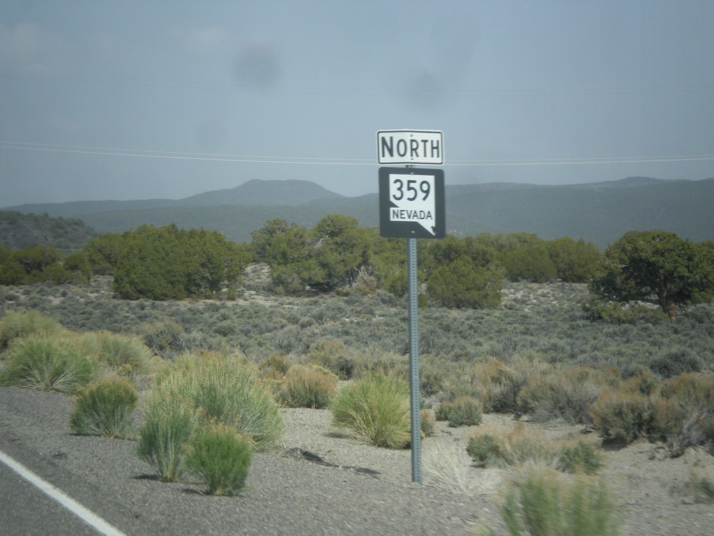
NV-359 North
NV-359 north in Mineral County. This is the first NV-359 shield after the state line.
Taken 05-05-2014
Mina
Mineral County
Nevada
United States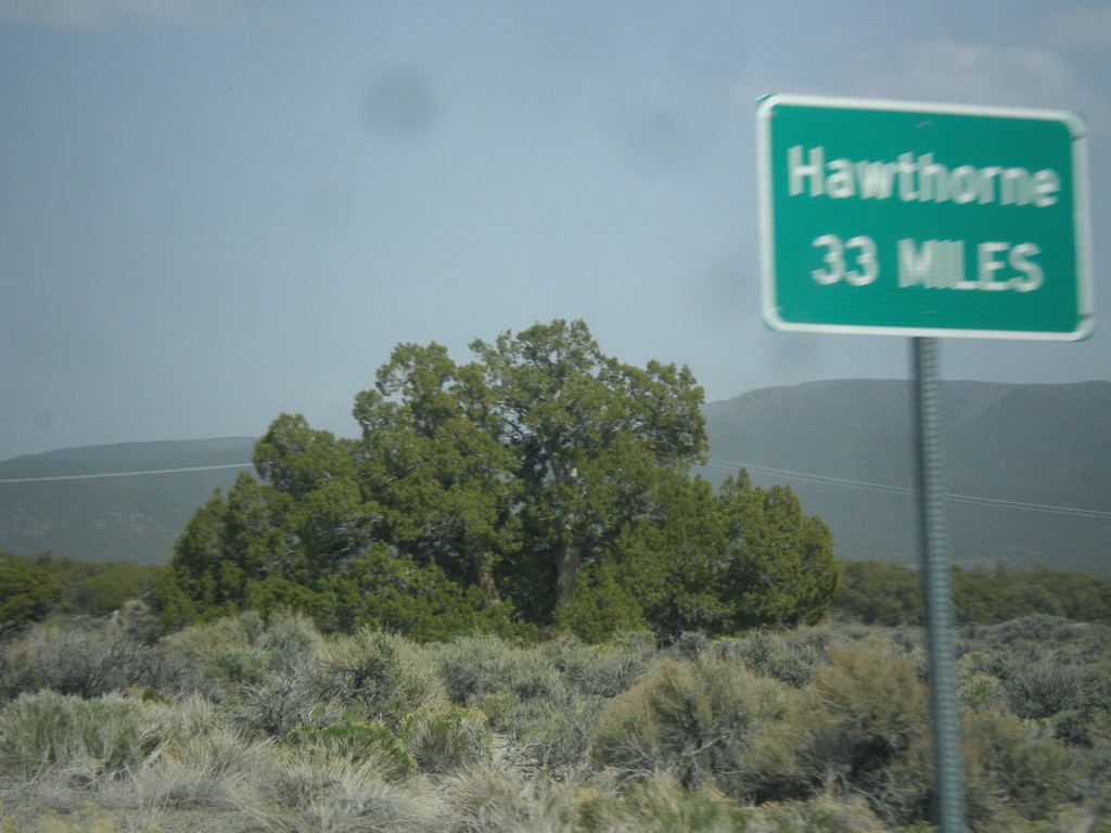
NV-359 North - Distance Marker
Distance marker on NV-359 north. Distance to Hawthorne. This sort of sign is common in Nevada where there is only one city listed as a destination.
Taken 05-05-2014
Mina
Mineral County
Nevada
United States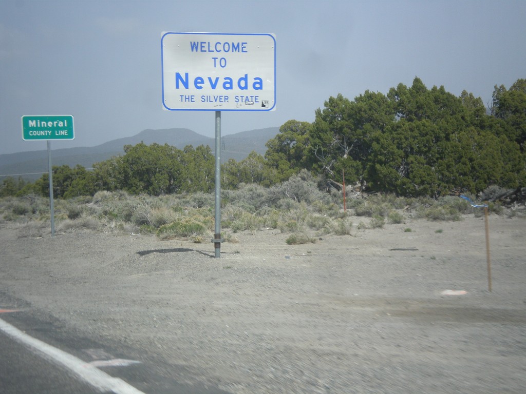
Welcome To Nevada - NV-359 North
Welcome to Nevada - The Silver State, Mineral County Line on NV-359 north. Taken at the Nevada - California state line.
Taken 05-05-2014
Mina
Mineral County
Nevada
United States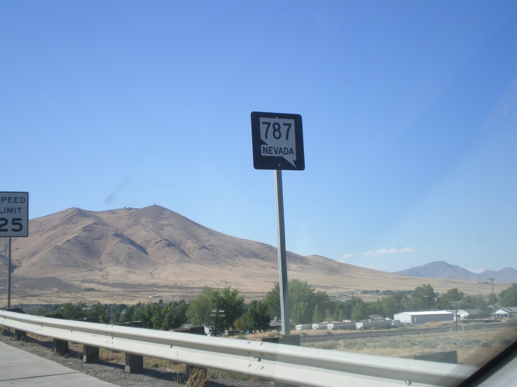
NV-787 North
NV-787 North (Hanson St.) in Winnemucca. NV-787 is a short state highway that connects NV-294 with Winnemucca Blvd. (BL-80 and US-95). There appears to only be one shield along the entire length of the road.
Taken 07-28-2012
 Winnemucca
Humboldt County
Nevada
United States
Winnemucca
Humboldt County
Nevada
United States