Signs From Nevada
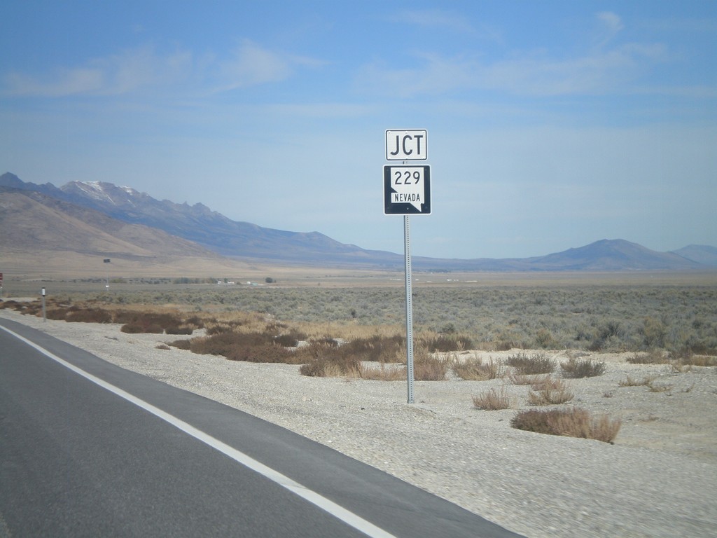
US-93 North Approaching NV-229
US-93 north approaching NV-229.
Taken 10-15-2011

 Wells
Elko County
Nevada
United States
Wells
Elko County
Nevada
United States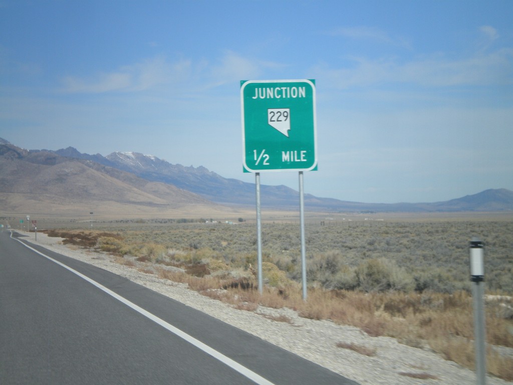
US-93 North Approaching NV-229
US-93 north approaching NV-229 junction.
Taken 10-15-2011
Wells
Elko County
Nevada
United States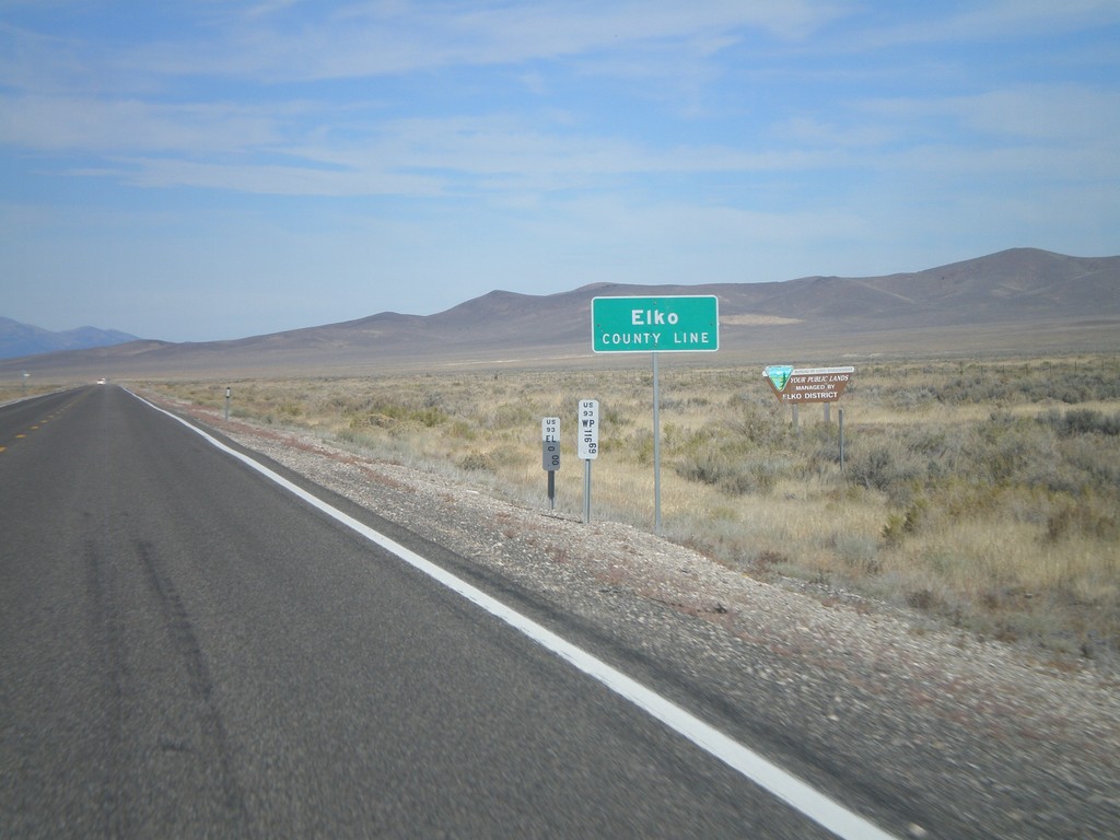
US-93 North - Elko County
Entering Elko County on US-93 north. Elko County is the fourth largest county by area in the lower 48 states.
Taken 10-15-2011
Ely
Elko County
Nevada
United States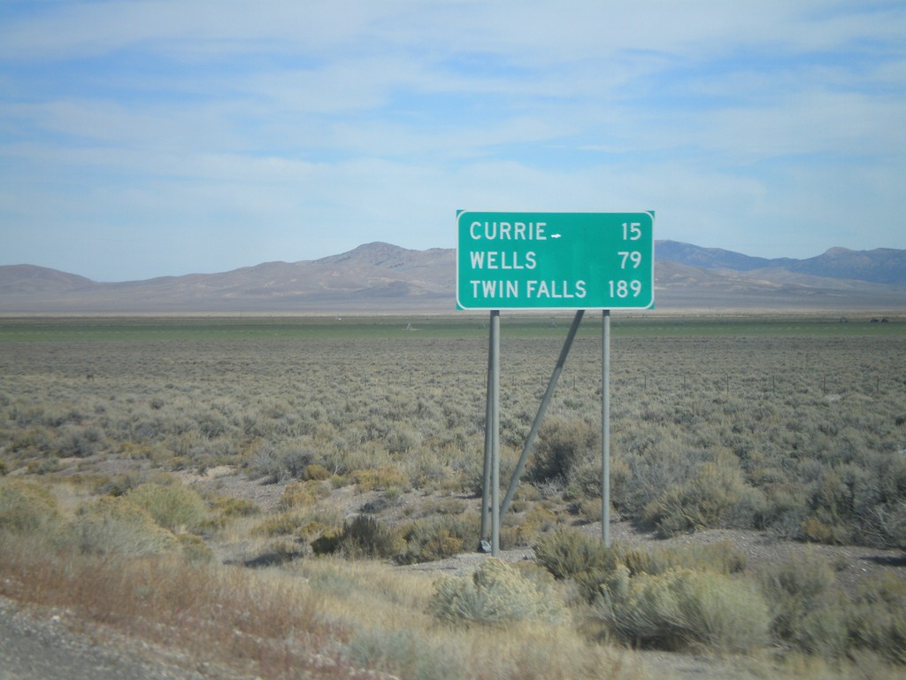
US-93 North - Distance Marker
Distance marker on US-93 north to Currie, Wells, and Twin Falls (Idaho). Taken just north of US-93/Alt. US-93 split.
Taken 10-15-2011
Ely
White Pine County
Nevada
United States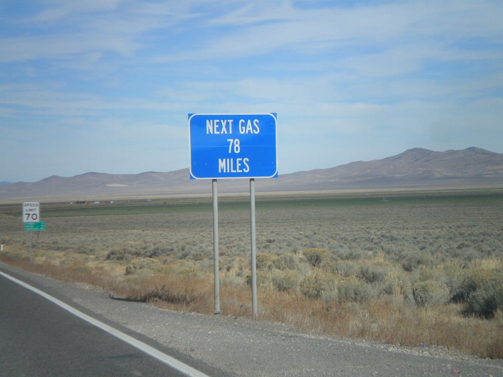
US-93 North - Next Gas 78 Miles
Next Gas 78 Miles on US-93 north. Taken just north of the Alt. US-93/US-93 intersection. Wells is the next city with gas.
Taken 10-15-2011
Ely
White Pine County
Nevada
United States
US-93 North at Alt. US-93
US-93 North at Alt. US-93 in White Pine County.
Taken 10-15-2011
 Ely
White Pine County
Nevada
United States
Ely
White Pine County
Nevada
United States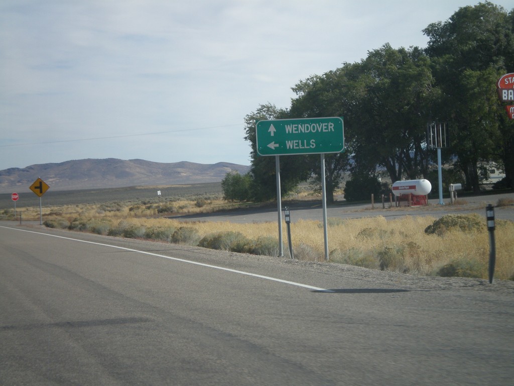
US-93 North at US-93 Alt. North
US-93 North at US-93 Alt. North. Continue straight for US-93 Alt. north to Wendover; turn left for US-93 north to Wells.
Taken 10-15-2011
Ely
White Pine County
Nevada
United States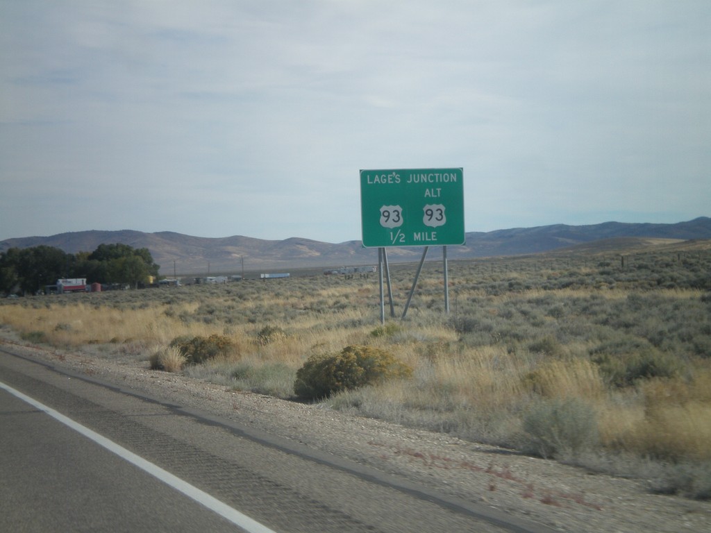
US-93 North Approaching Lages Junction
US-93 North approaching Lages Junction - US-93/Alt. US-93 Jct.
Taken 10-15-2011
Ely
White Pine County
Nevada
United States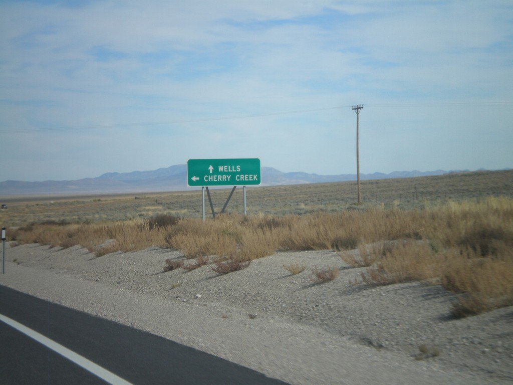
US-93 North at Clover Creek Jct.
US-93 north at Clover Creek Jct. Continue north on US-93 for Wells.
Taken 10-15-2011
Schellbourne
White Pine County
Nevada
United States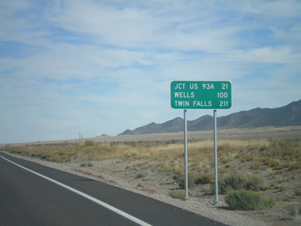
US-93 North - Distance Marker
Distance marker on US-93 north. Distance to Jct US-93A, Wells, and Twin Falls (Idaho).
Taken 10-15-2011
Schellbourne
White Pine County
Nevada
United States