Signs From Nevada
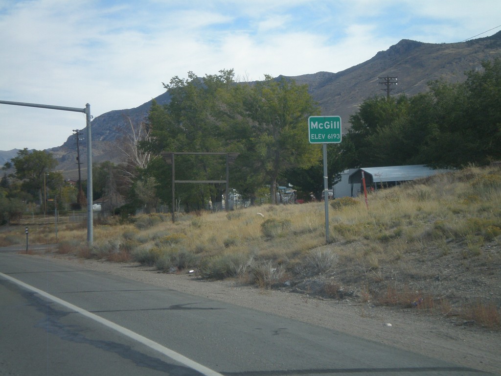
US-93 North - Mc Gill
Entering Mc Gill - Elevation 6193 Feet, on US-93 north.
Taken 10-15-2011
 Ely
White Pine County
Nevada
United States
Ely
White Pine County
Nevada
United States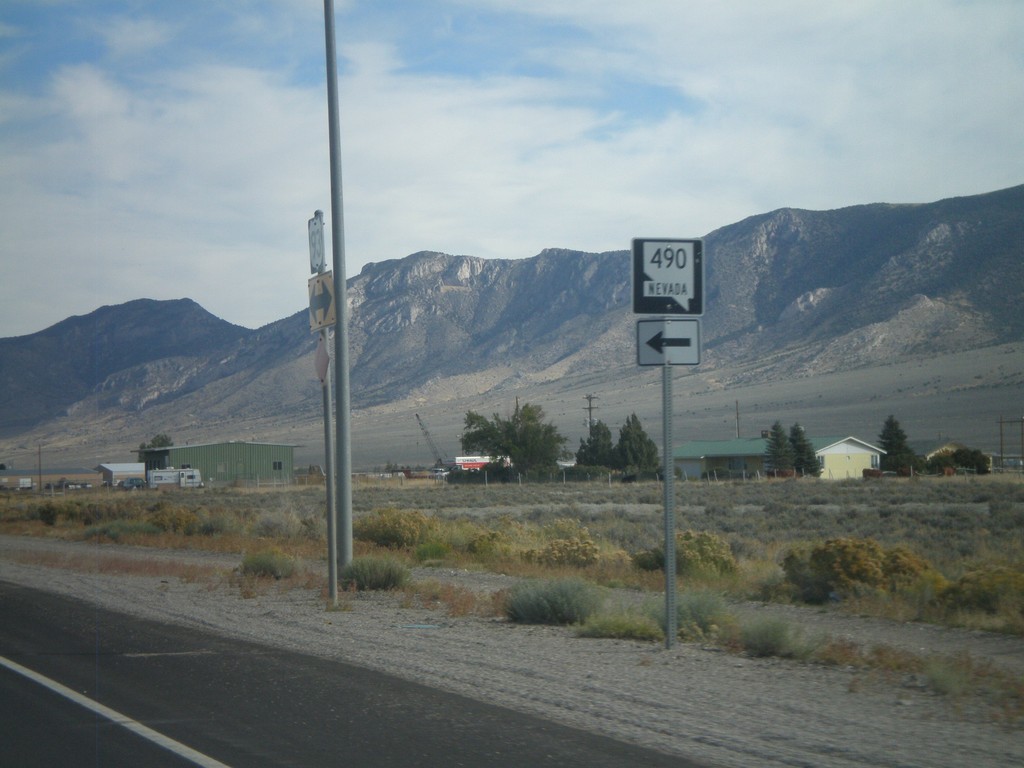
US-93 North at NV-490
US-93 north at NV-490 to Ely State Prison.
Taken 10-15-2011
 Ely
White Pine County
Nevada
United States
Ely
White Pine County
Nevada
United States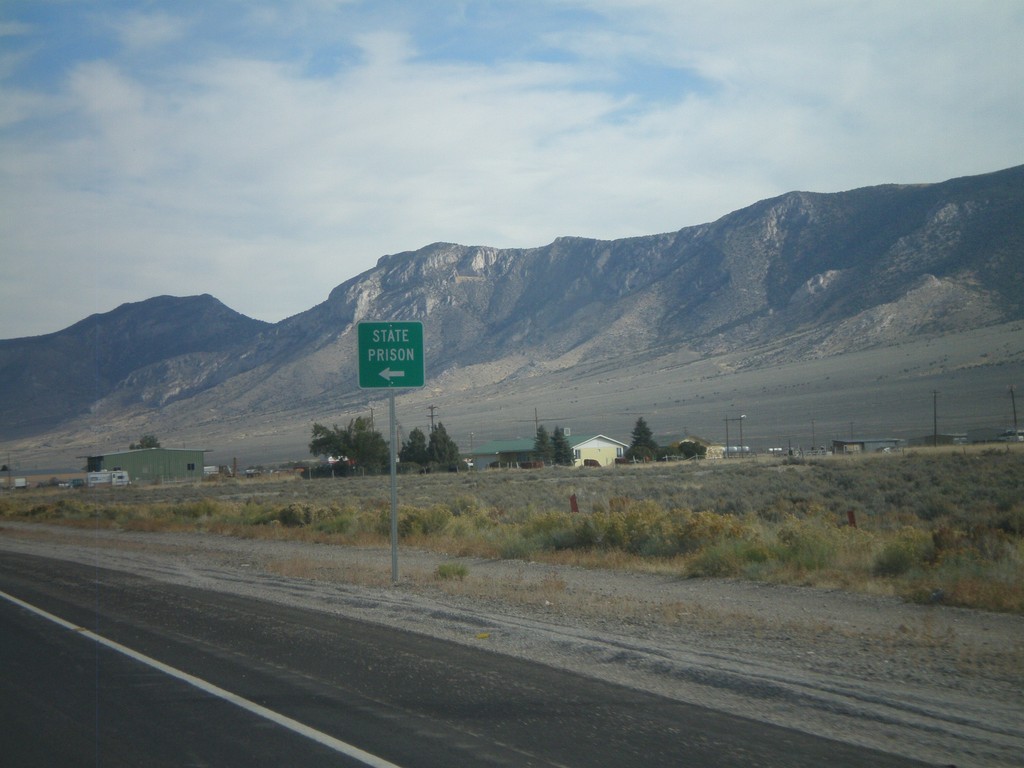
US-93 North Approaching NV-490
US-93 North Approaching NV-490 to State Prison (Ely State Prison).
Taken 10-15-2011
Ely
White Pine County
Nevada
United States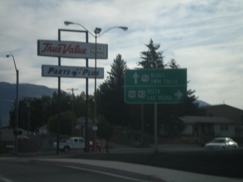
US-50 East at US-93
US-50 east at US-93. Continue ahead for US-93 north to McGill and Twin Falls (Idaho). Turn right for US-93 and US-50 for Delta (Utah) and Las Vegas. US-50 joins US-93 south over Sacramento Pass.
Taken 10-15-2011
 Ely
White Pine County
Nevada
United States
Ely
White Pine County
Nevada
United States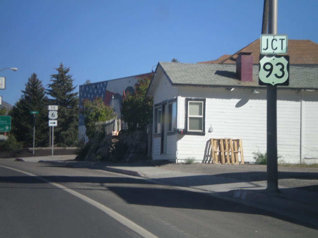
US-50 East at US-93
US-50 east at US-93. US-50 joins US-93 through Ely to Majors Junction. Use US-93 South/US-50 East for US-6.
Taken 10-14-2011
 Ely
White Pine County
Nevada
United States
Ely
White Pine County
Nevada
United States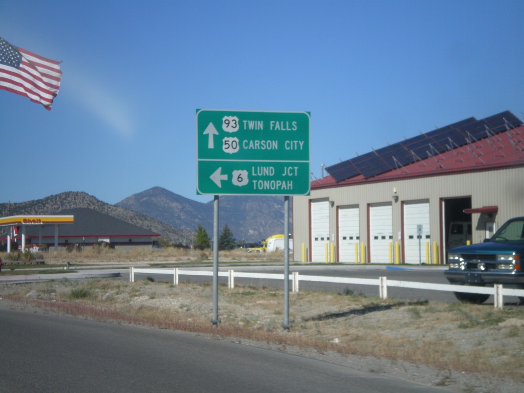
US-93 North/US-6 West/US-50 West at US-6
US-93 North/US-6 West/US-50 West at US-6 West junction. Use US-6 west for Lund Jct. and Tonopah. Use US-93 North/US-50 West for Twin Falls (Idaho via US-93) and Carson City (via US-50).
Taken 10-14-2011
Ely
White Pine County
Nevada
United States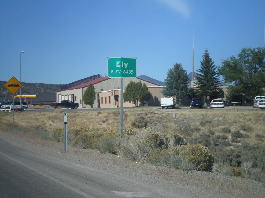
US-93 North - Entering Ely
Entering Ely - Elevation 6435 on US-93 North. Ely is the county seat of White Pine County.
Taken 10-14-2011
Ely
White Pine County
Nevada
United States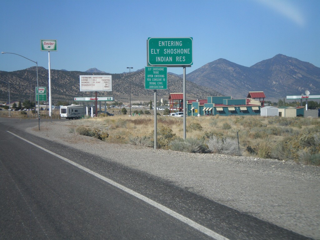
US-93 North - Entering Ely Shoshone Indian Reservation
US-93 North - Entering Ely Shoshone Indian Reservation. The Ely Shoshone Indian Reservation is a small reservation on the outskirts of Ely.
Taken 10-14-2011
Ely
White Pine County
Nevada
United States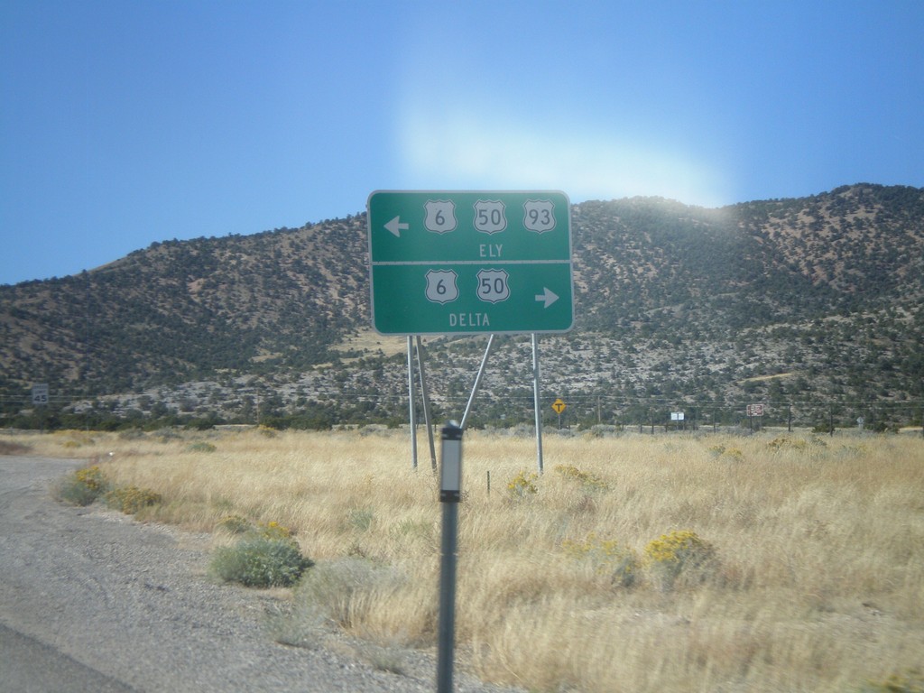
US-93 North at US-6/US-50
US-93 north at US-6/US-50 Jct. US-93 joins US-6/US-50 west into Ely. Turn left for US-93 North/US-6 West/US-50 West for Ely; left for US-6/US-50 East for Delta (Utah).
Taken 10-14-2011
Majors Place
White Pine County
Nevada
United States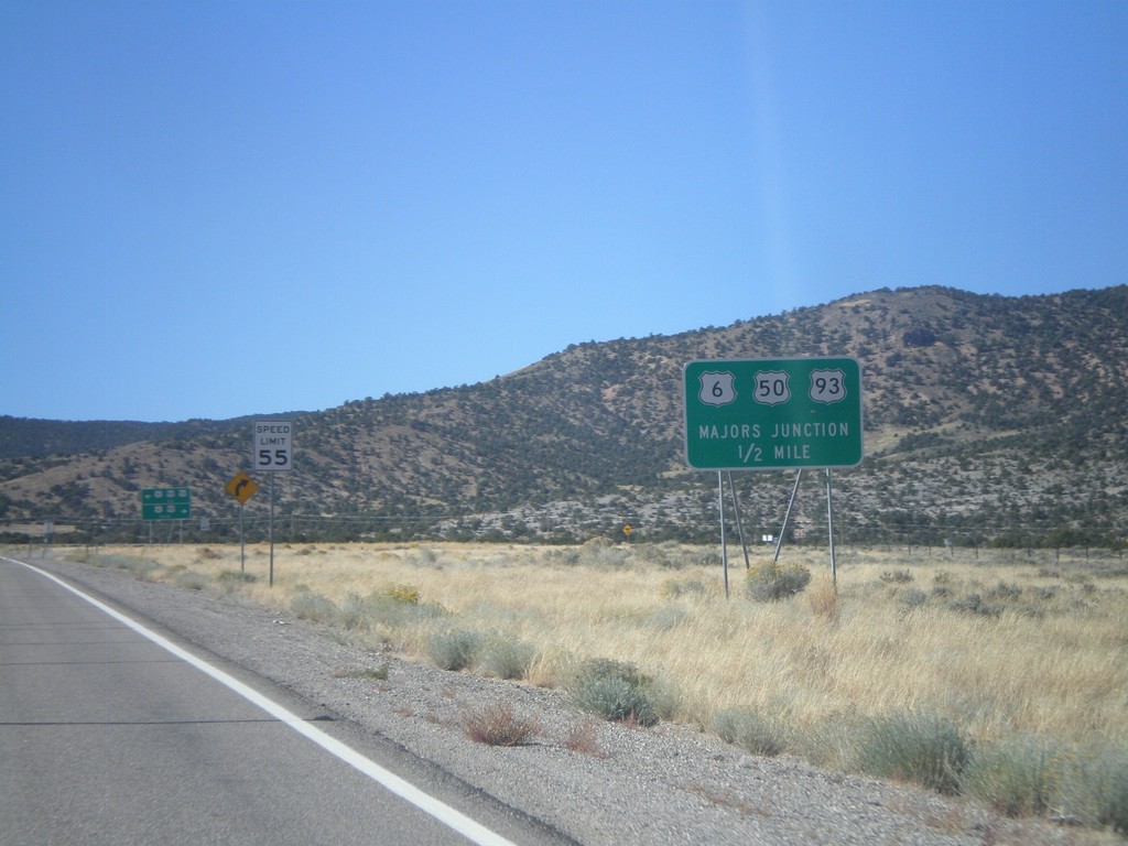
US-93 North Approaching Majors Jct.
US-93 North Approaching Majors Jct with US-50 and US-6.
Taken 10-14-2011
Ely
White Pine County
Nevada
United States