Signs From Nevada
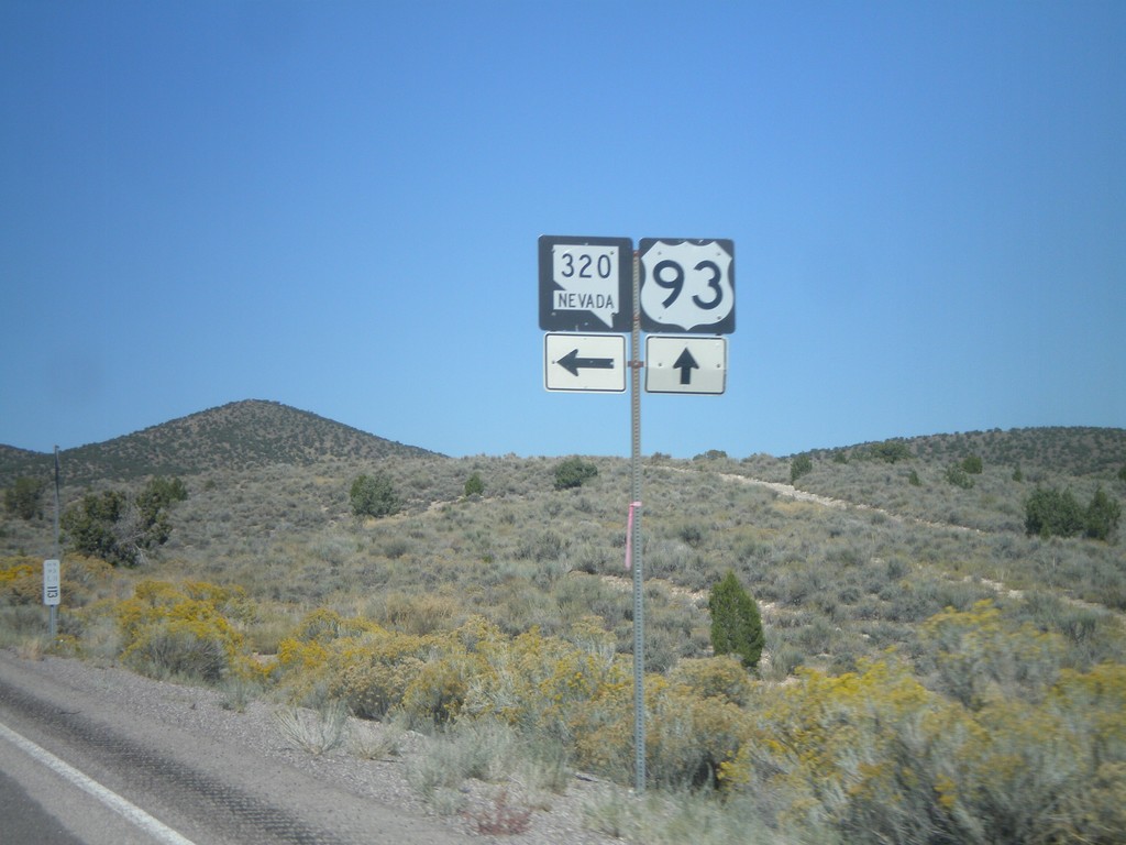
US-93 North at NV-320
US-93 north at NV-320 north.
Taken 10-14-2011

 Pioche
Lincoln County
Nevada
United States
Pioche
Lincoln County
Nevada
United States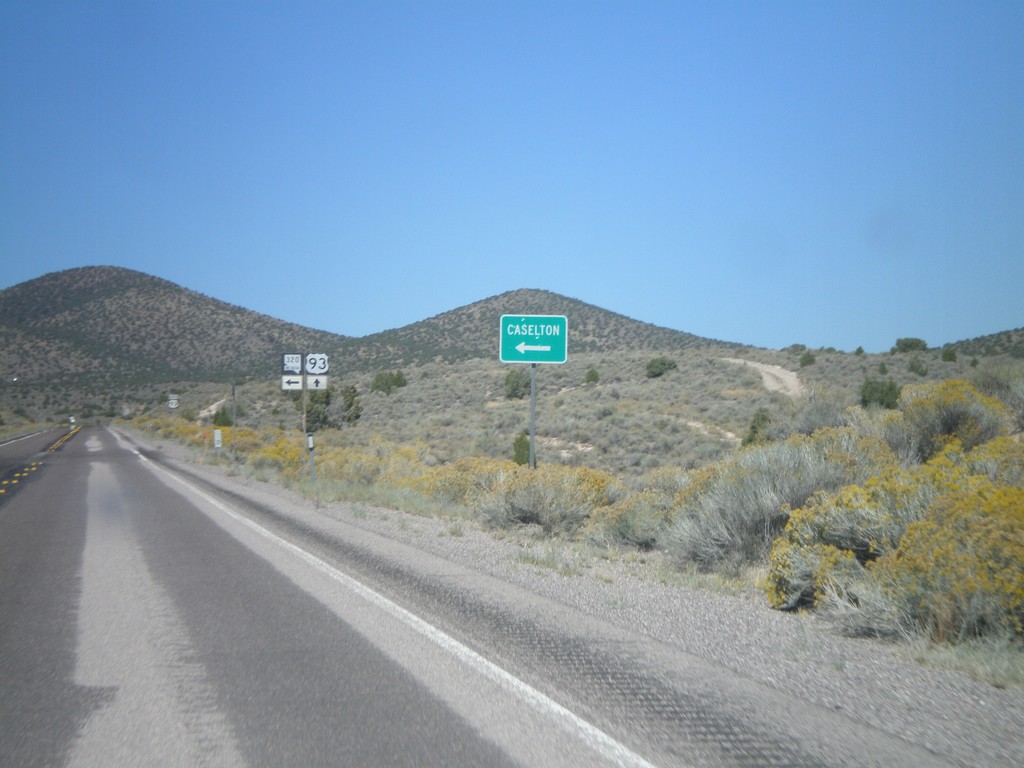
US-93 North approaching NV-320 North
US-93 north approaching NV-320 north to Caselton.
Taken 10-14-2011
Pioche
Lincoln County
Nevada
United States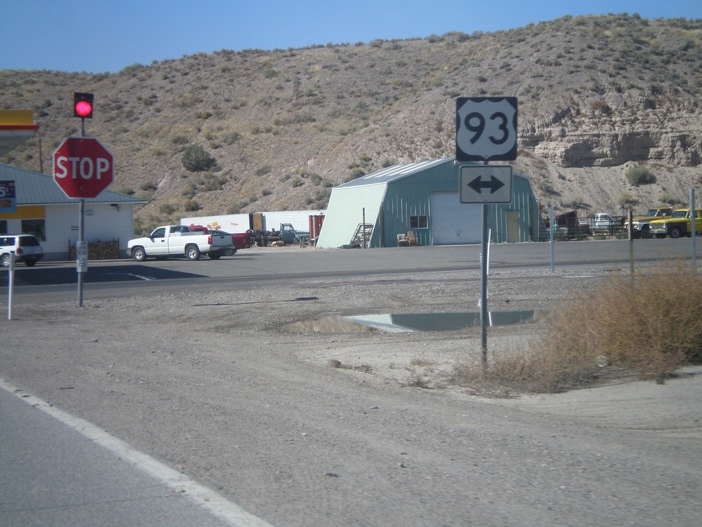
End NV-319 West at US-93
End NV-319 west at US-93.
Taken 10-14-2011
 Panaca
Lincoln County
Nevada
United States
Panaca
Lincoln County
Nevada
United States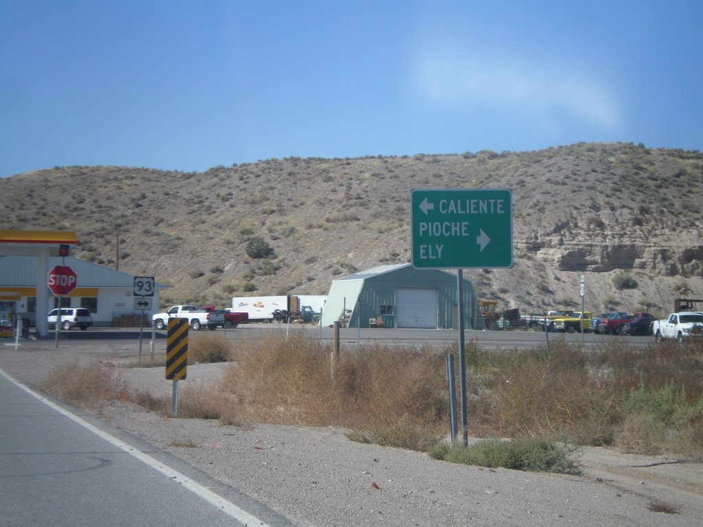
End NV-319 West at US-93
End NV-319 west at US-93. Use US-93 north for Pioche and Ely. Use US-93 south for Caliente.
Taken 10-14-2011
Panaca
Lincoln County
Nevada
United States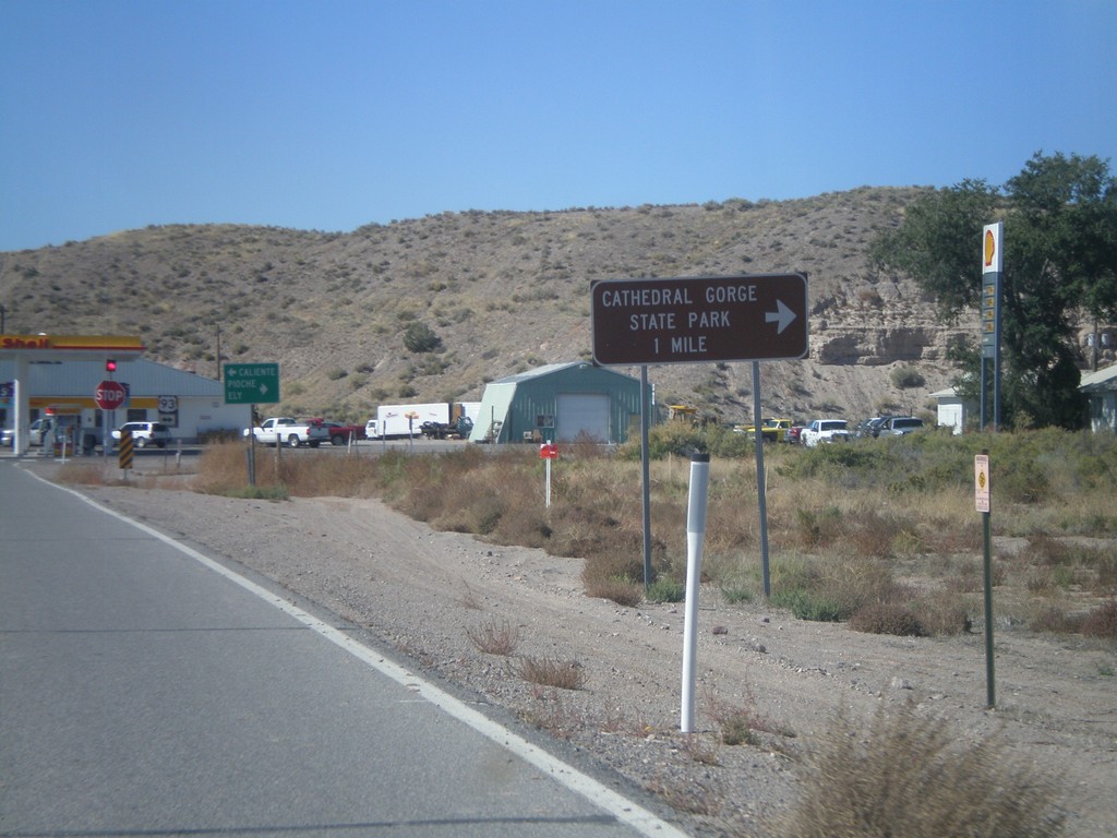
End NV-319 West at US-93
End NV-319 west at US-93. Use US-93 north for Cathedral Gorge State Park.
Taken 10-14-2011
Panaca
Lincoln County
Nevada
United States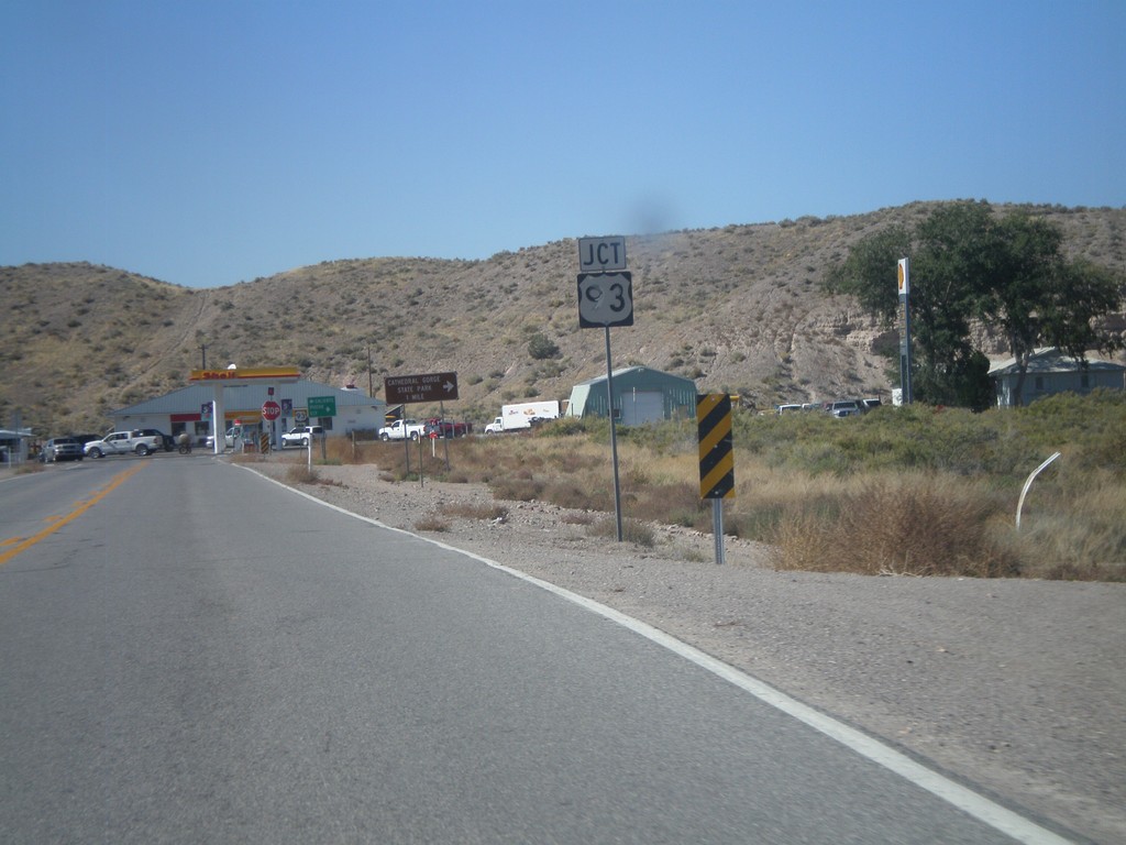
End NV-319 West at US-93
End NV-319 West at US-93
Taken 10-14-2011
Panaca
Lincoln County
Nevada
United States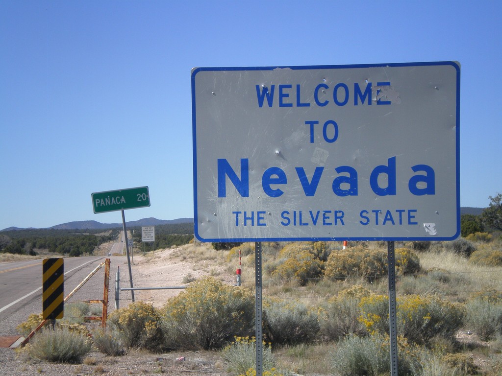
Welcome To Nevada
Welcome to Nevada - The Silver State on NV-319 west. Taken at the Utah-Nevada State Line.
Taken 10-14-2011
Modena
Lincoln County
Nevada
United States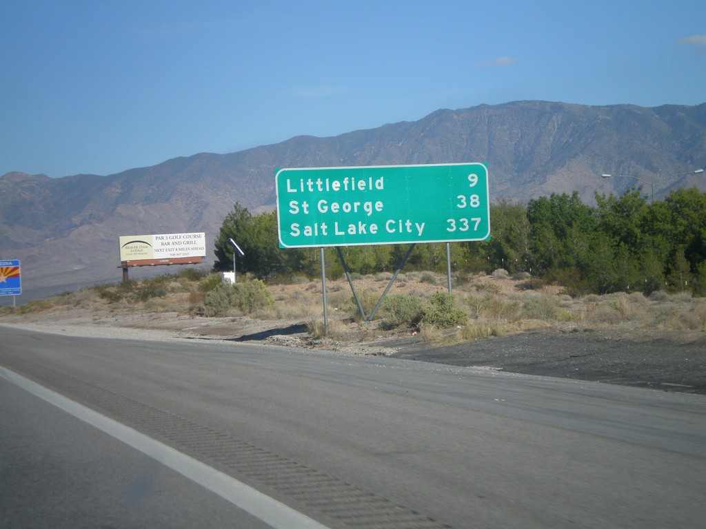
I-15 North - Distance Marker
Last distance marker in Nevada on I-15 north. Distance to Littlefield (Arizona), St. George (Utah), and Salt Lake City (Utah). The Arizona Welcome Sign can be seen in the background.
Taken 10-09-2011
 Mesquite
Clark County
Nevada
United States
Mesquite
Clark County
Nevada
United States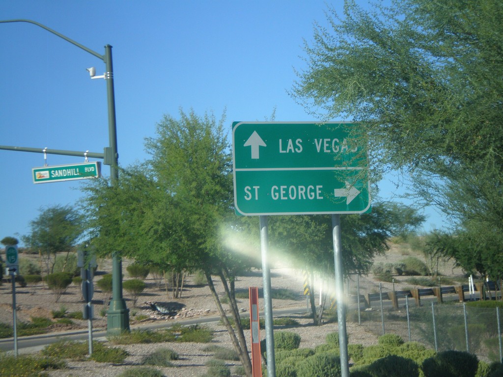
BL-15 North (Sandhill Blvd) at I-15
Northern end of Mesquite business loop at I-15. Use I-15 north for St. George (Utah); use I-15 south for Las Vegas.
Taken 10-09-2011
 Mesquite
Clark County
Nevada
United States
Mesquite
Clark County
Nevada
United States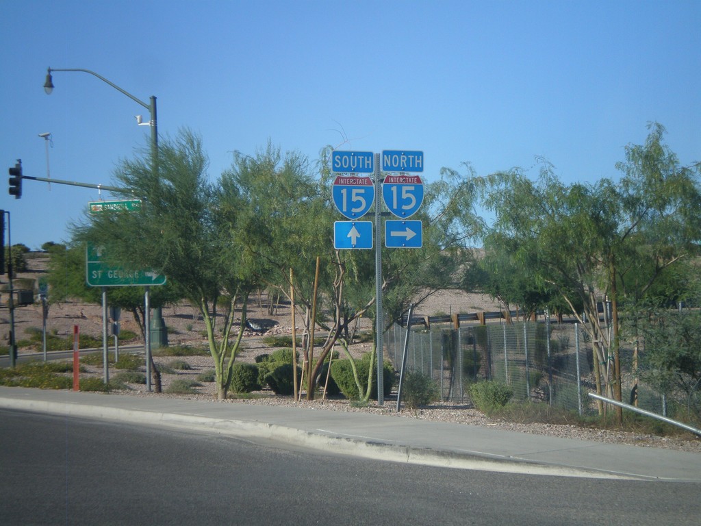
BL-15 North (Sandhill Blvd.) at I-15
BL-15 north (Sandhill Blvd.) at I-15 in Mesquite.
Taken 10-09-2011
Mesquite
Clark County
Nevada
United States