Signs From Nevada
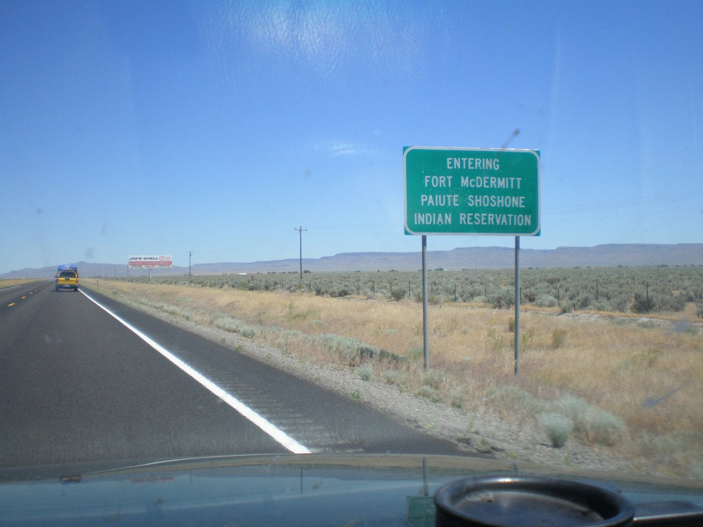
US-95 North - Entering Fort McDermitt Indian Reservation
Entering Fort McDermitt Paiute-Shoshone Indian Reservation on US-95 north.
Taken 07-13-2010
 McDermitt
Humboldt County
Nevada
United States
McDermitt
Humboldt County
Nevada
United States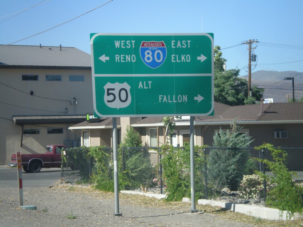
Alt. US-95 North at Alt. US-50/BL-80/NV-427
Alt. US-95 north at Alt. US-50/BL-80 east to Fallon and Elko and BL-80/NV-427 west to Reno.
Taken 07-12-2010


 Fernley
Lyon County
Nevada
United States
Fernley
Lyon County
Nevada
United States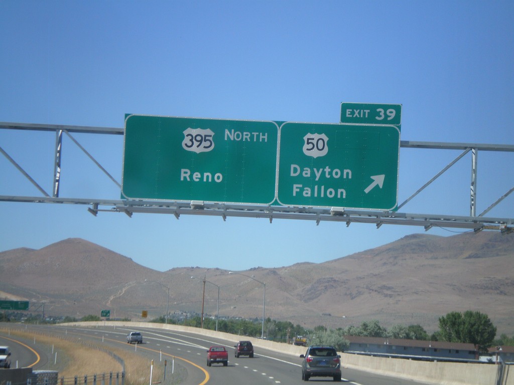
US-395 North - Exit 39
US-395 north at Exit 39 - US-50/Dayton/Fallon. Continue north on US-395 for Reno. The US-50/US-395 split ends here.
Taken 07-12-2010

 Carson City
Nevada
United States
Carson City
Nevada
United States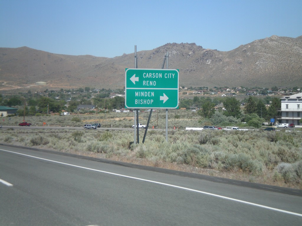
US-50 East Approaching US-395
US-50 east approaching US-395. Use US-395 south for Minden and Bishop (California). US-50 east joins US-395 north for Carson City and Reno.
Taken 07-12-2010
Carson City
Nevada
United States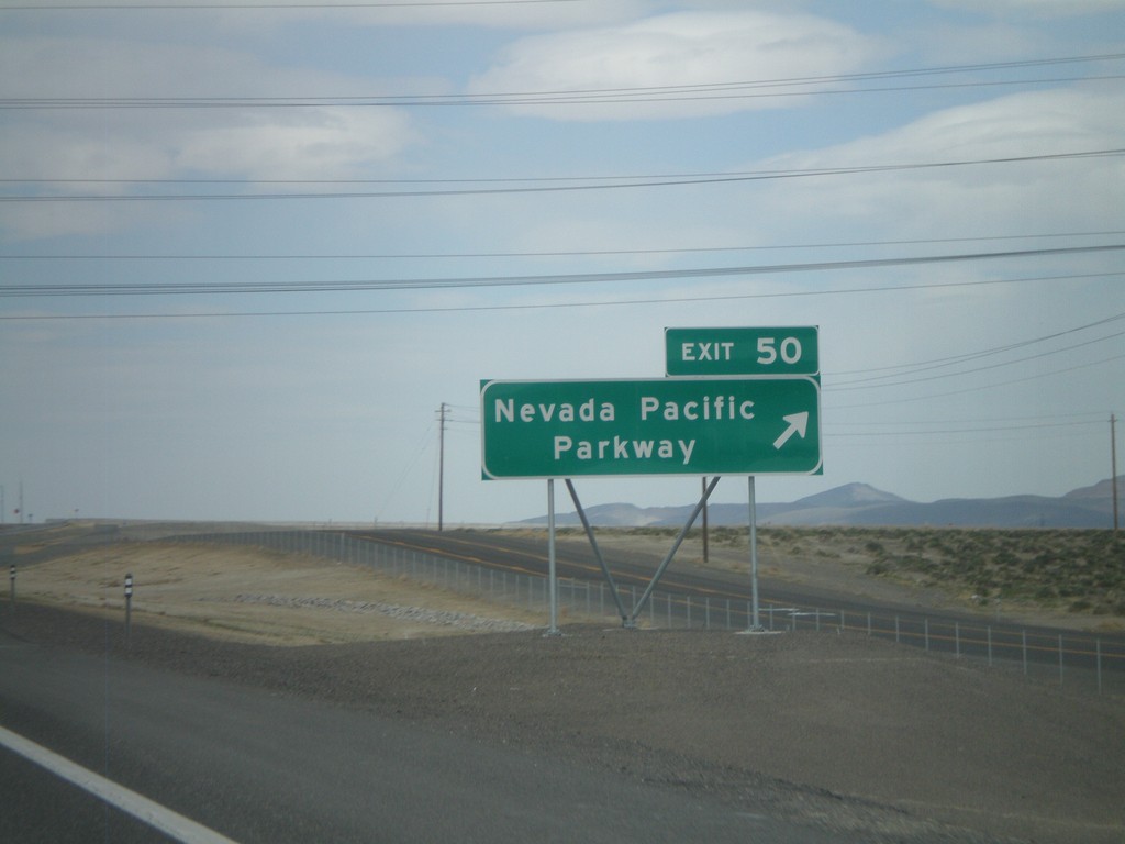
I-80 East - Exit 50
I-80 east at Exit 50 - Nevada Pacific Parkway. This exit was completed in 2010.
Taken 04-19-2010
 Fernley
Lyon County
Nevada
United States
Fernley
Lyon County
Nevada
United States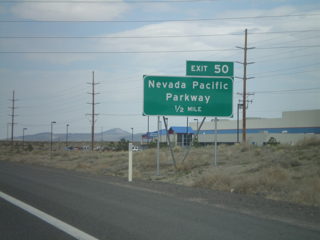
I-80 East Approaching Exit 50
I-80 east approaching Exit 50 - Nevada Pacific Parkway.
Taken 04-19-2010
Fernley
Lyon County
Nevada
United States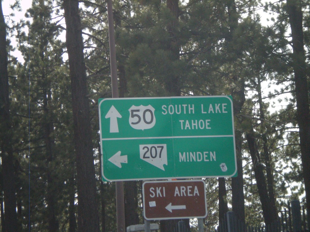
US-50 West at NV-207
US-50 west at NV-207/Kingsbury Grade junction in Stateline.
Taken 04-15-2010
 Stateline
Douglas County
Nevada
United States
Stateline
Douglas County
Nevada
United States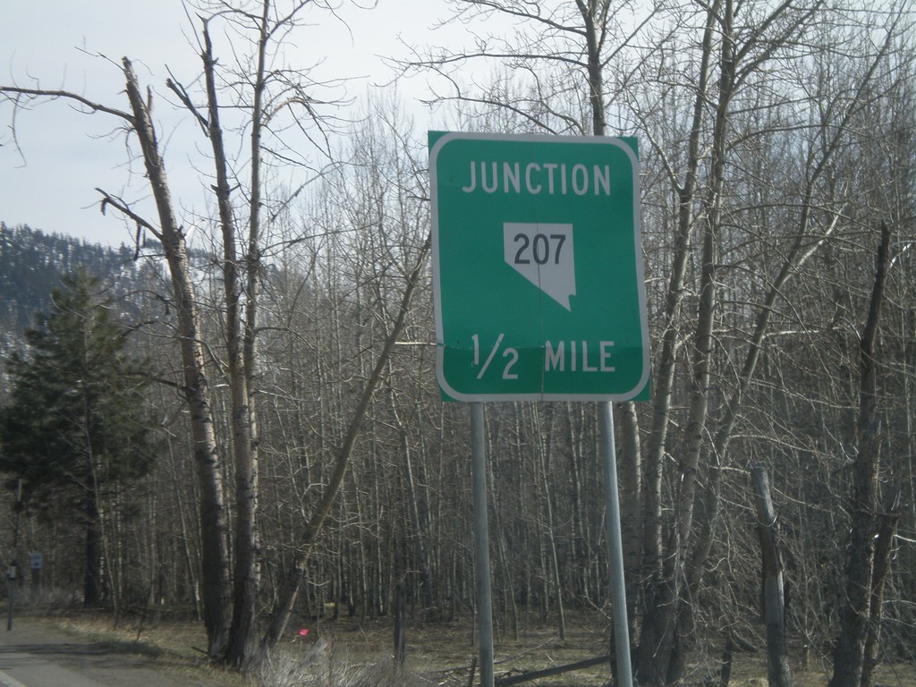
US-50 South Approaching NV-207
US-50 south approaching NV-207 east to Kingsbury Grade and Minden.
Taken 04-15-2010
Stateline
Douglas County
Nevada
United States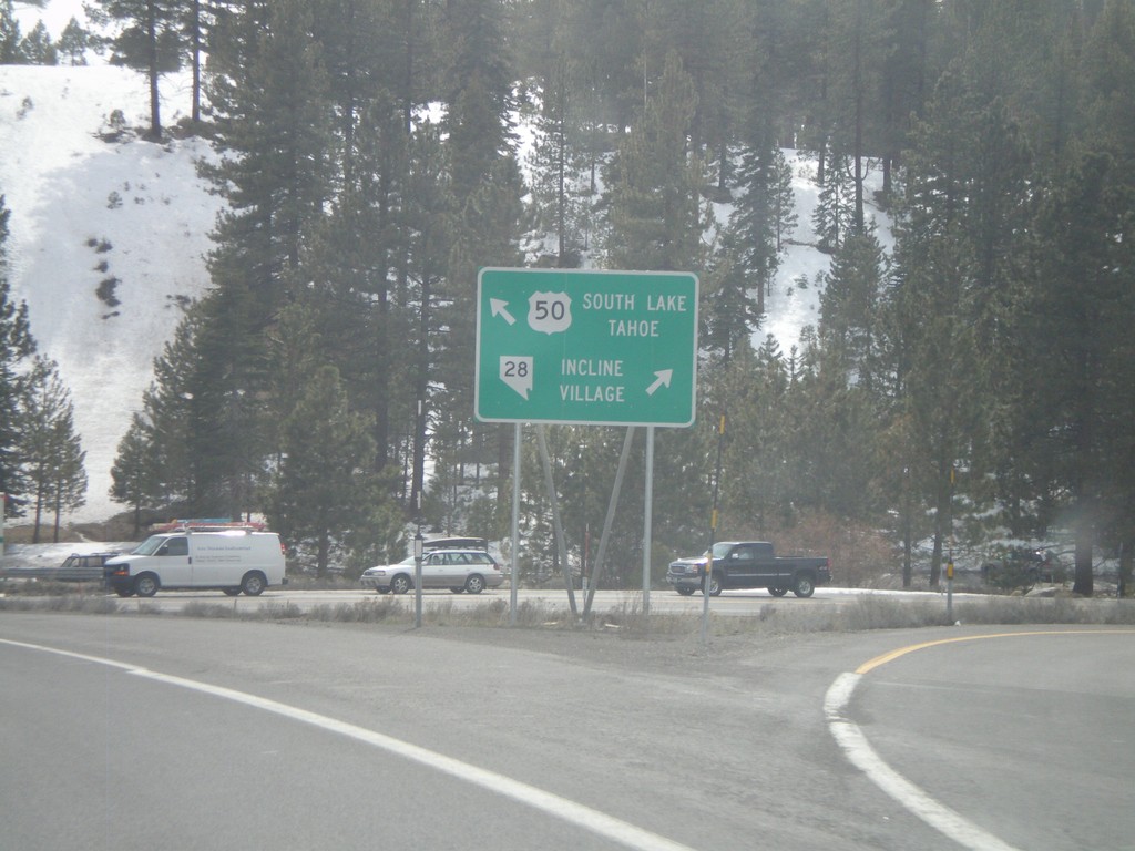
US-50 West at NV-28
US-50 west to South Lake Tahoe, at NV-28 north to Incline Village.
Taken 04-15-2010
 Carson City
Douglas County
Nevada
United States
Carson City
Douglas County
Nevada
United States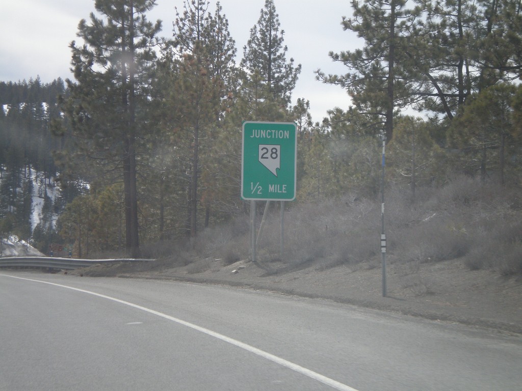
US-50 West Approaching NV-28
US-50 west approaching NV-28
Taken 04-15-2010
Carson City
Douglas County
Nevada
United States