Signs From Nevada
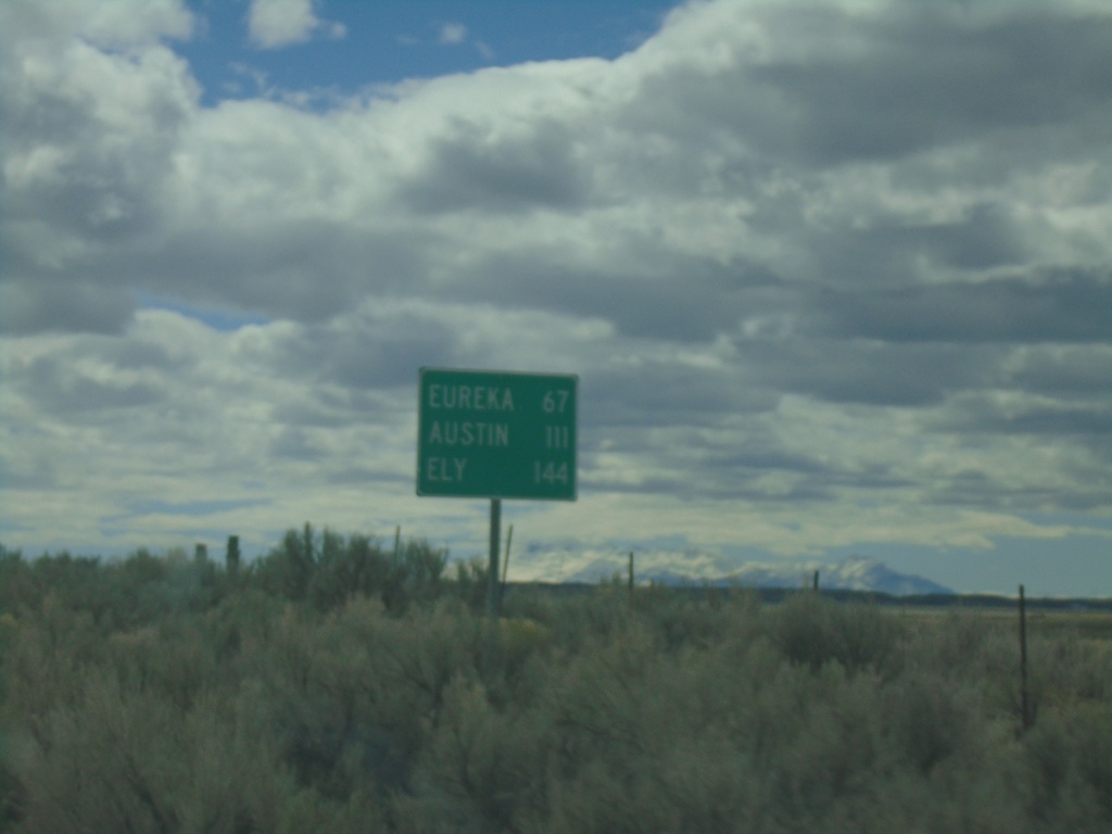
NV-278 South - Distance Marker
Distance marker on NV-278 south. Distance to Eureka, Austin (via US-50 West) and Ely (via US-50 East).
Taken 03-31-2023
 Carlin
Eureka County
Nevada
United States
Carlin
Eureka County
Nevada
United States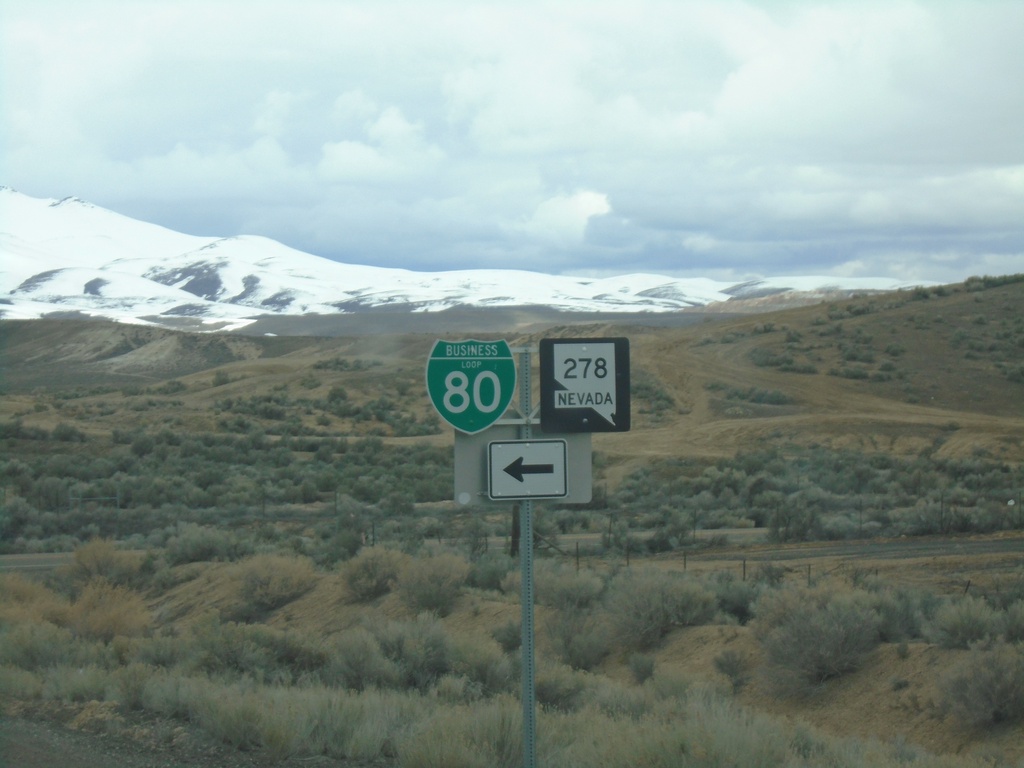
I-80 West - Exit 279 Offramp
I-80 West - Exit 279 Offramp. Turn left for NV-278 South/BL-80 East.
Taken 03-31-2023

 Carlin
Elko County
Nevada
United States
Carlin
Elko County
Nevada
United States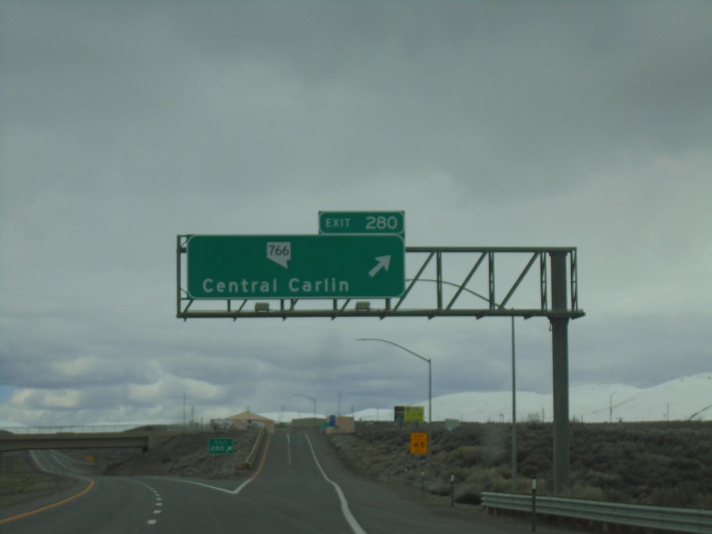
I-80 West - Exit 280
I-80 east at Exit 280 - NV-766/Central Carlin
Taken 03-31-2023
 Carlin
Elko County
Nevada
United States
Carlin
Elko County
Nevada
United States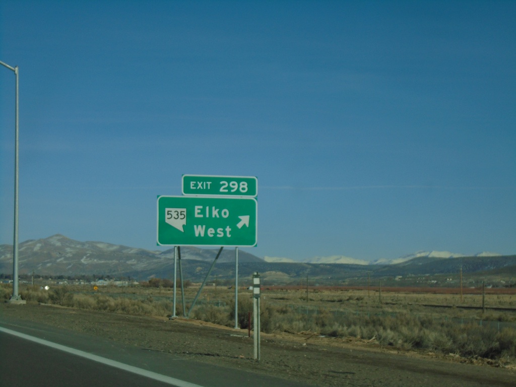
I-80 East - Exit 298
I-80 east at Exit 298 - NV-535/Elko West. The NV-535 shield was added to the Exit 298 freeway junction in 2021. Prior to that the text read Elko West without any route markers.
Taken 01-15-2022
 Elko
Elko County
Nevada
United States
Elko
Elko County
Nevada
United States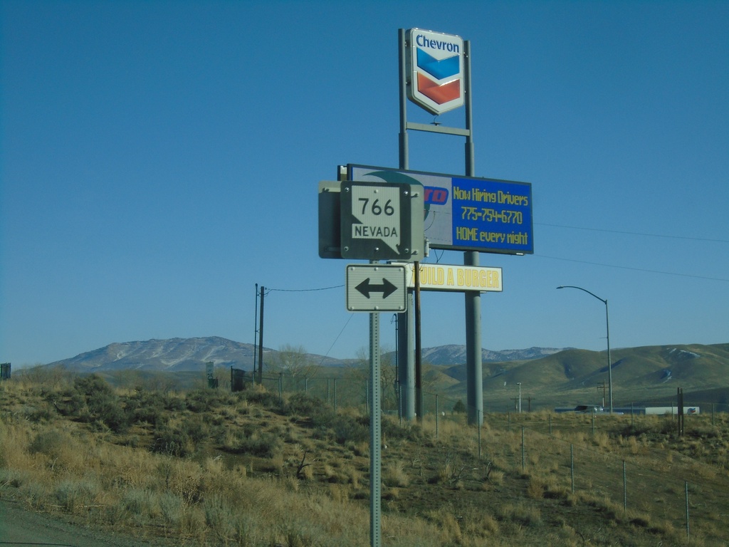
I-80 East Exit 280 Offramp at NV-766
I-80 east Exit 280 offramp at NV-766. NV-766 heads north to Newmont Gold Mine, south into Carlin.
Taken 01-15-2022
Carlin
Elko County
Nevada
United States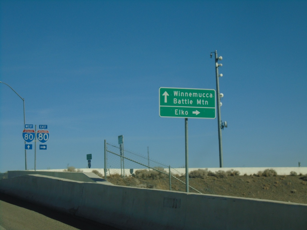
NV-305 North at I-80 - Battle Mountain
NV-305 North at I-80 in Battle Mountain. Turn right for I-80 East to Elko; continue over freeway for I-80 West to Winnemucca and for NV-305 North to Battle Mountain.
Taken 01-15-2022
 Battle Mountain
Lander County
Nevada
United States
Battle Mountain
Lander County
Nevada
United States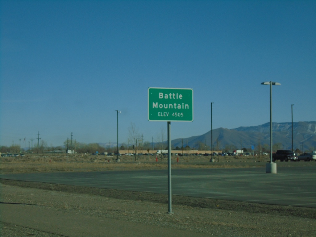
NV-305 North - Battle Mountain
Entering Battle Mountain on NV-305 North. Elevation 4505 Feet. Battle Mountain is the unincorporated county seat of Lander County.
Taken 01-15-2022
Battle Mountain
Lander County
Nevada
United States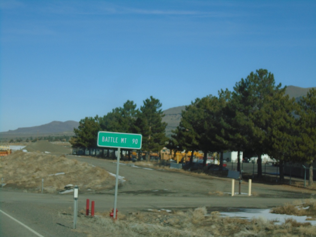
NV-305 North - Distance Marker
Distance marker on NV-305 north. Distance to Battle Mountain.
Taken 01-15-2022
Austin
Lander County
Nevada
United States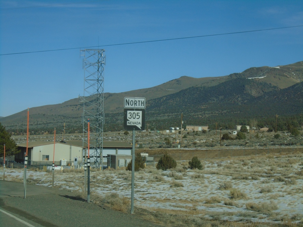
NV-305 North - Austin
NV-305 North in Austin
Taken 01-15-2022
Austin
Lander County
Nevada
United States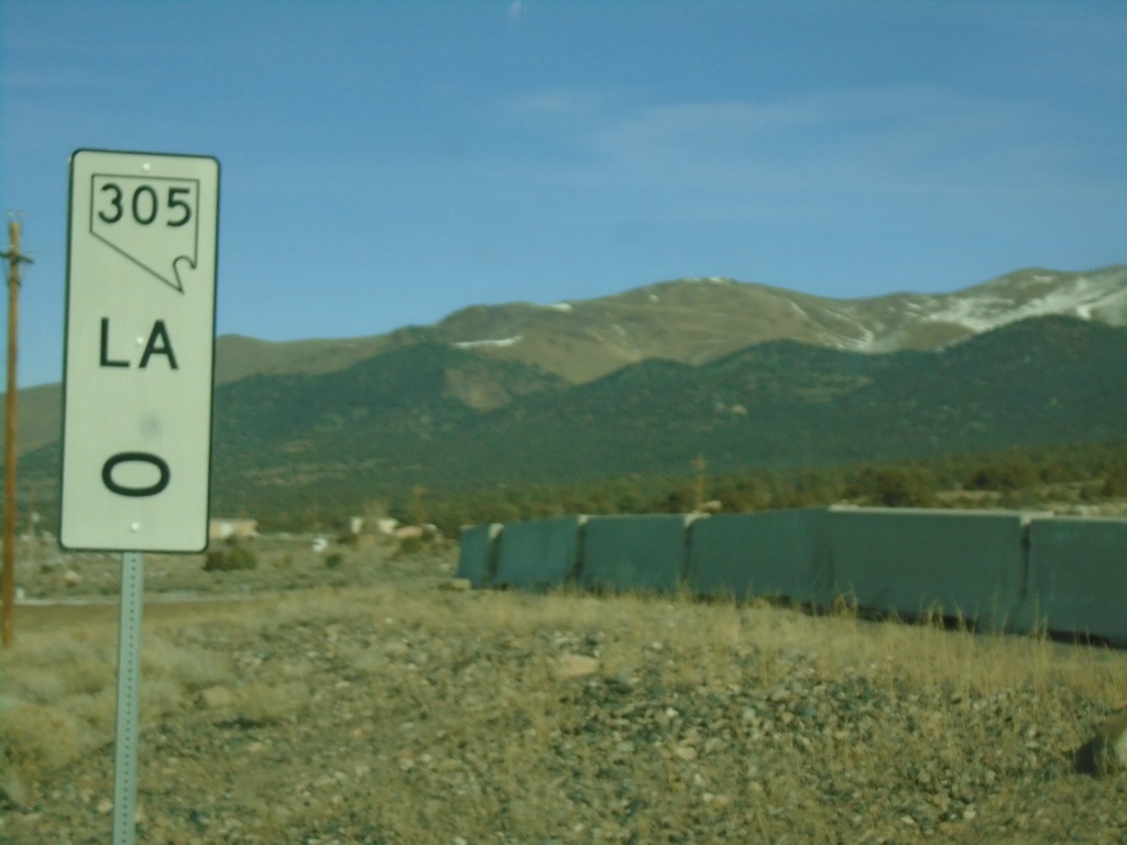
NV-305 - Mile 0
NV-305 - Mile 0 Lander (LA) County
Taken 01-15-2022
Austin
Lander County
Nevada
United States