Signs From Nevada
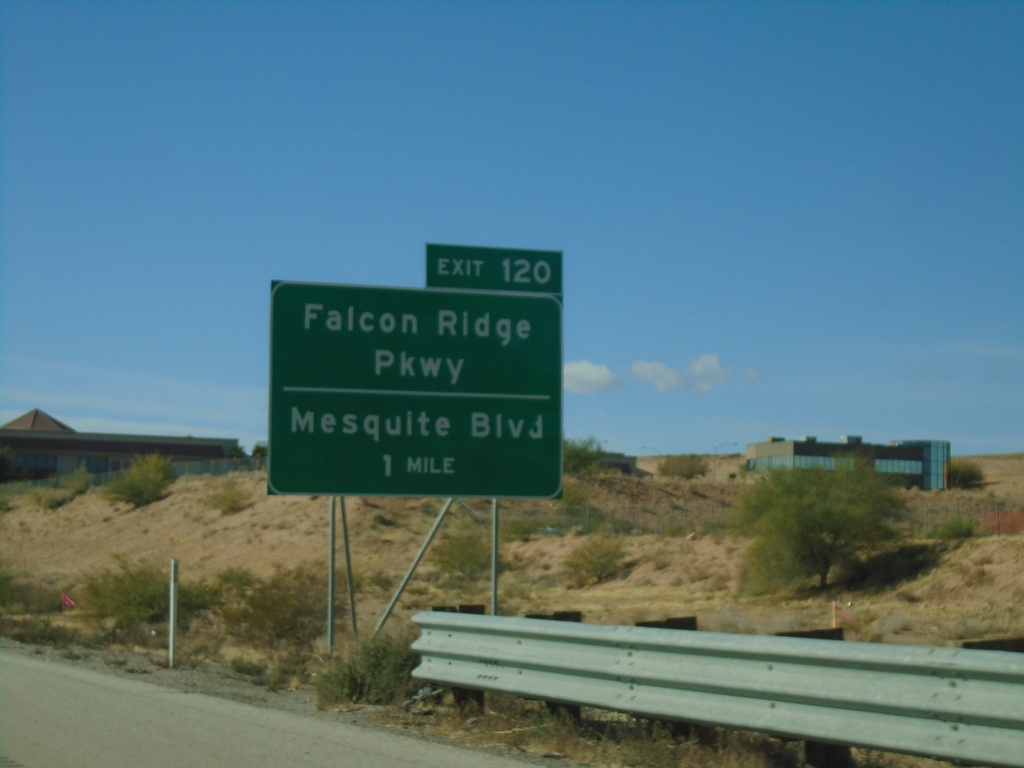
I-15 South - Exit 120
I-15 south approaching Exit 120 - Falcon Ridge Parkway/Mesquite Blvd. This is the south end of the Mesquite business loop.
Taken 11-26-2019

 Mesquite
Clark County
Nevada
United States
Mesquite
Clark County
Nevada
United States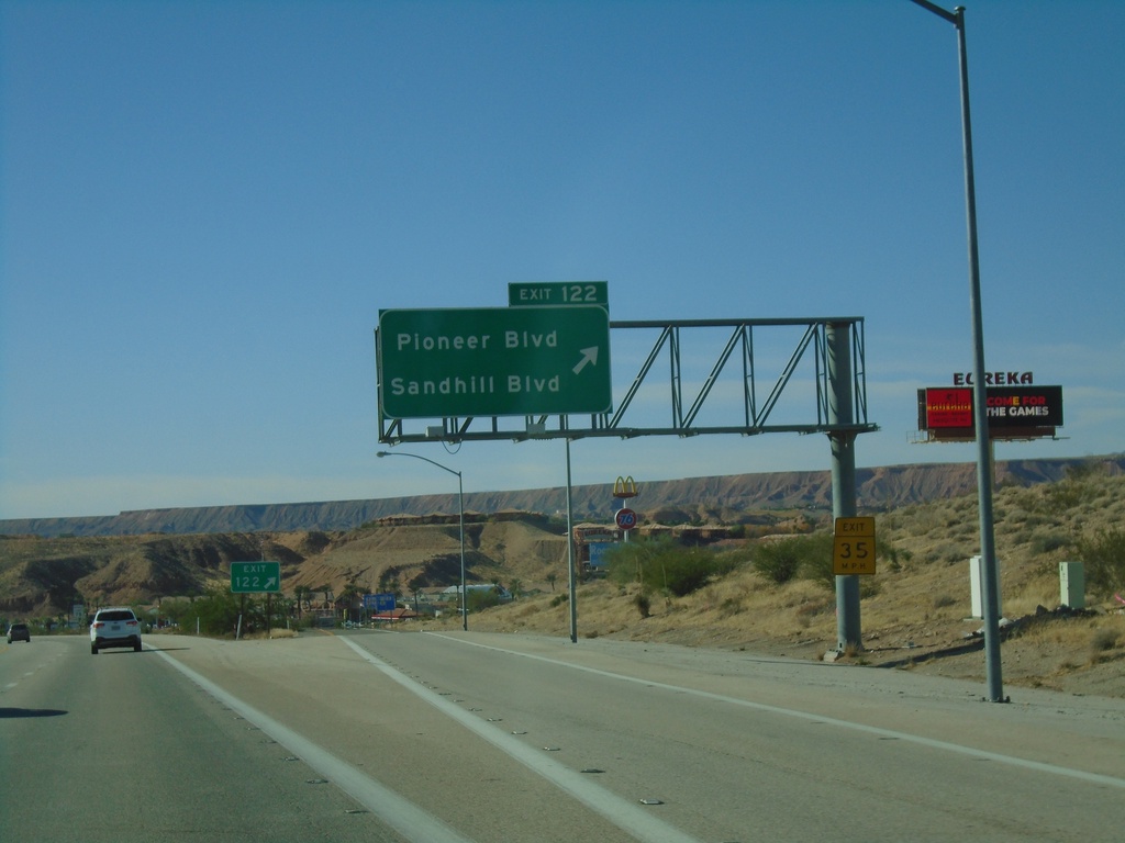
I-15 South - Exit 122
I-15 south at Exit 122 - Pioneer Blvd./Sandhill Blvd. This is the first exit in Nevada on I-15 southbound. This is also the northern end of the Mesquite Business Loop.
Taken 11-26-2019
Mesquite
Clark County
Nevada
United States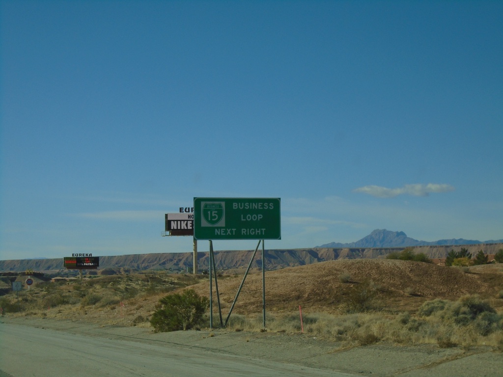
I-15 South - BL-15 Next Right
I-15 south approaching Exit 122. Use Exit 122 for BL-15 and Nevada Welcome Center. This is the north end of the Mesquite Business Loop.
Taken 11-26-2019
Mesquite
Clark County
Nevada
United States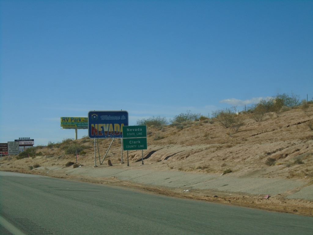
I-15 South - Welcome To Nevada
Welcome To Nevada on I-15 south. Taken at the Nevada-Arizona State Line. The green Nevada State Line sign in the foreground was placed by the Arizona DOT.
Taken 11-26-2019
Mesquite
Clark County
Nevada
United States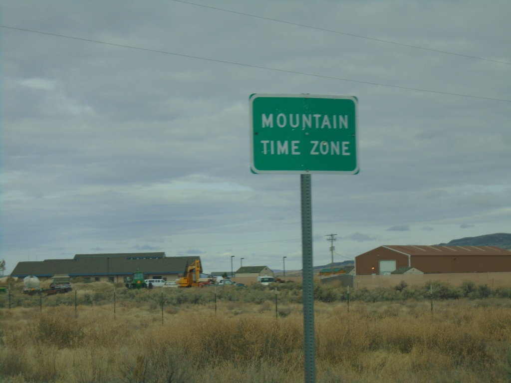
NV-225 North - Mountain Time
Entering Mountain Time Zone on NV-225 north, approaching the Idaho state line. The official time zone boundary is the Nevada-Idaho state line, but the towns of Owyhee and Mountain City, NV both observe Mountain Time.
Taken 10-20-2019
 Owyhee
Elko County
Nevada
United States
Owyhee
Elko County
Nevada
United States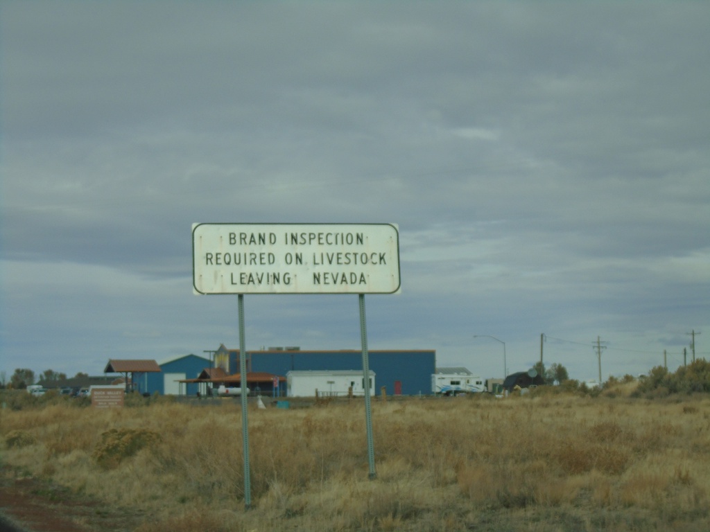
NV-225 North - Brand Inspection Required
Brand Inspection Required on Livestock Leaving Nevada on NV-225 north.
Taken 10-20-2019
Owyhee
Elko County
Nevada
United States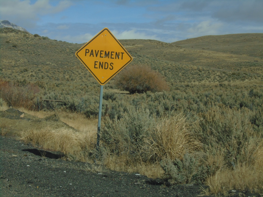
End NV-766 North
End NV-766 North. Pavement ends here and Maggie Creek Road begins.
Taken 10-20-2019
 Carlin
Eureka County
Nevada
United States
Carlin
Eureka County
Nevada
United States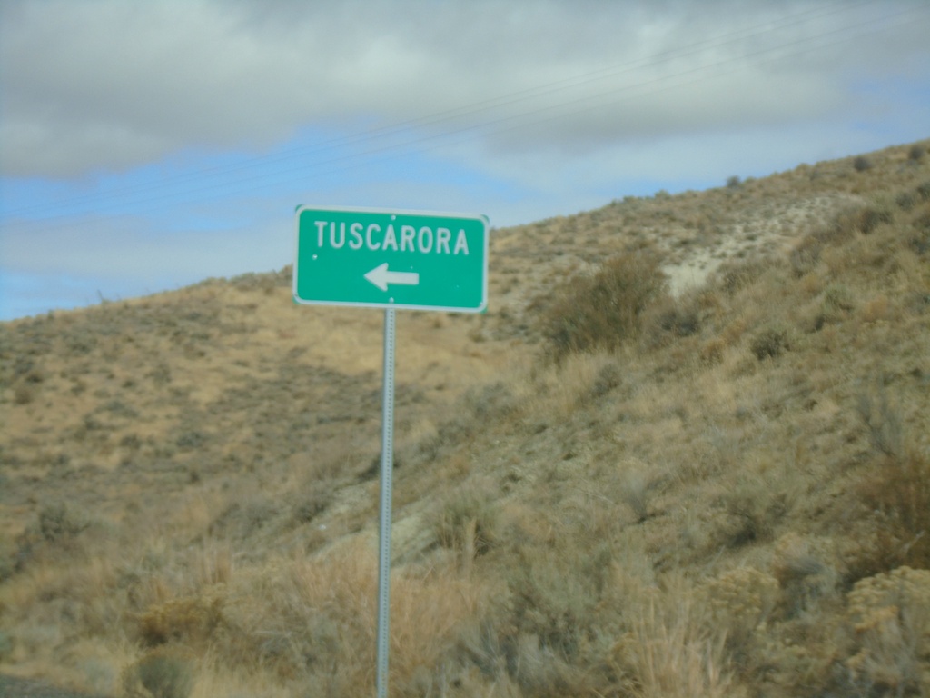
NV-226 North - Tuscarora Junction
NV-226 North at Tuscarora junction
Taken 10-20-2019
 Tuscarora
Elko County
Nevada
United States
Tuscarora
Elko County
Nevada
United States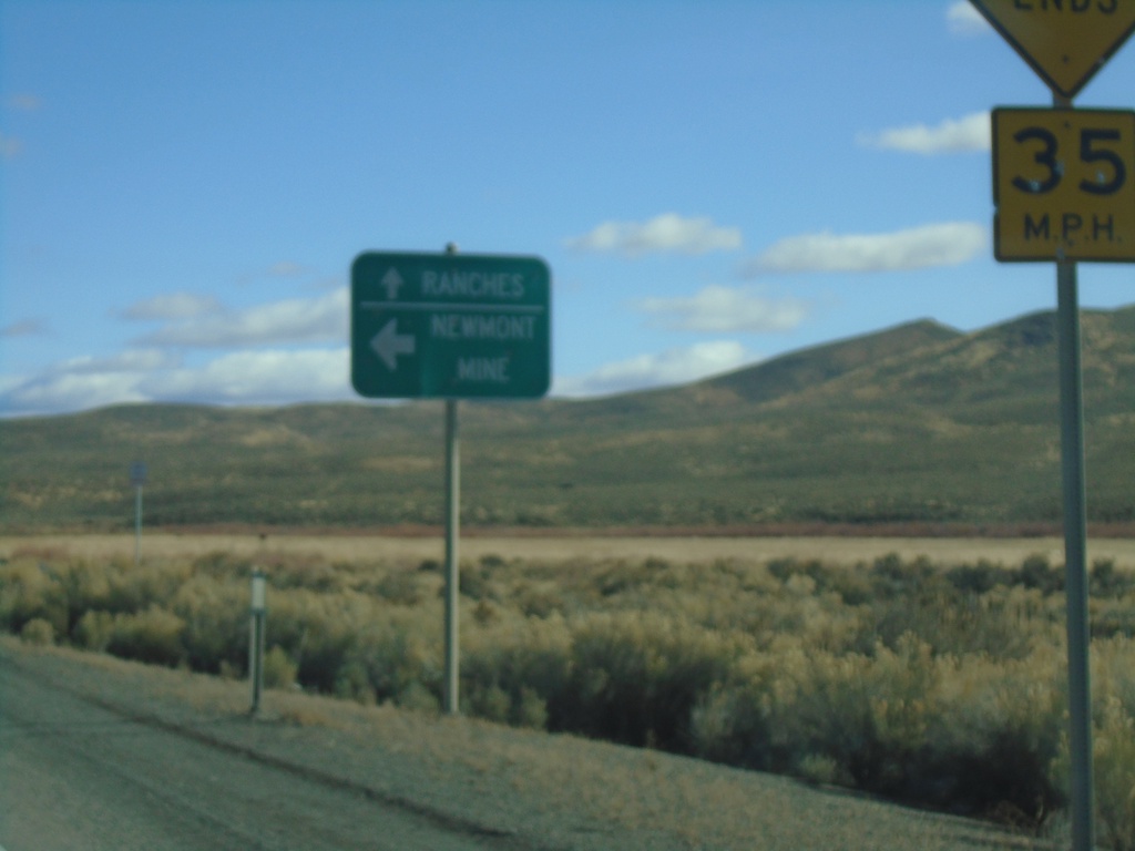
End NV-766 North
End NV-766 North in Eureka County. Turn left for Newmont Mine; continue straight for Ranches (Maggie Creek Road).
Taken 10-20-2019
Carlin
Eureka County
Nevada
United States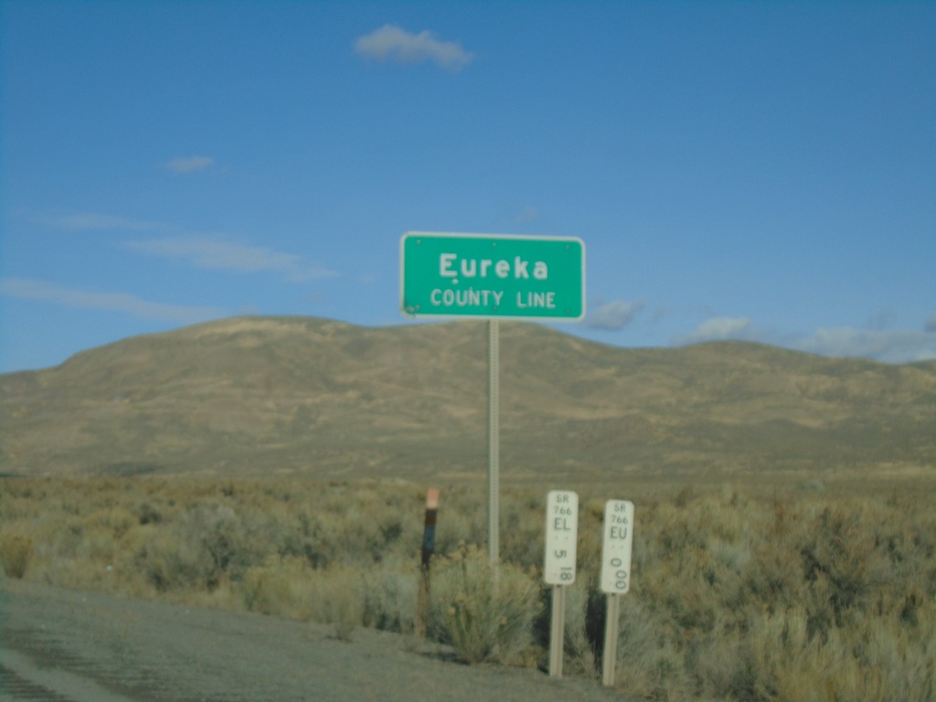
I-80 East - Eureka County Line
I-80 east at Eureka County Line.
Taken 10-20-2019
 Battle Mountain
Eureka County
Nevada
United States
Battle Mountain
Eureka County
Nevada
United States