Signs From Nevada
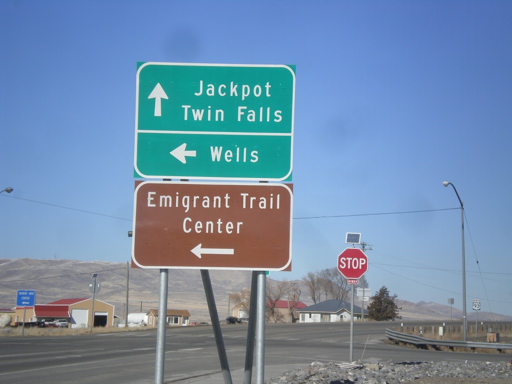
US-93 North at BL-80 and NV-233
US-93 North at BL-80 and NV-233. Turn left on BL-80/NV-233 for Wells and the Emigrant Trail Center. Continue north on US-93 for Jackpot and Twin Falls (Idaho).
Taken 02-13-2018


 Wells
Elko County
Nevada
United States
Wells
Elko County
Nevada
United States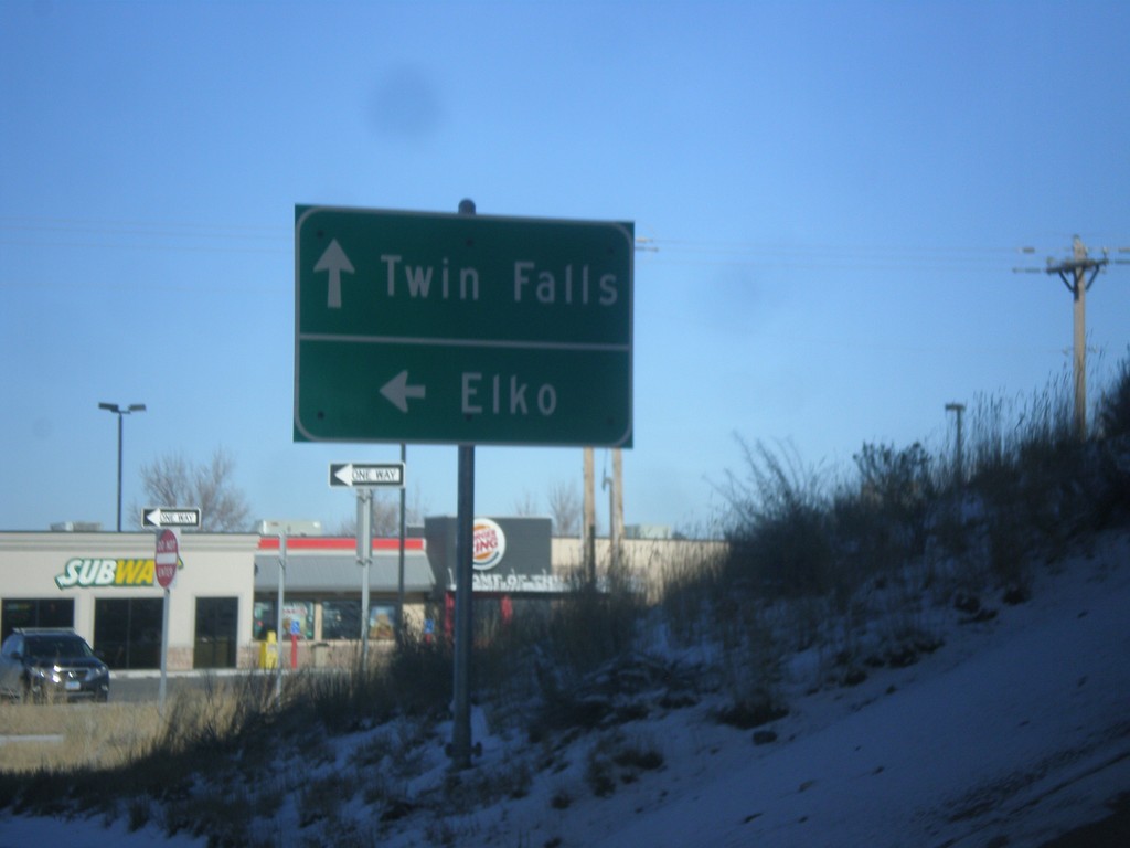
US-93 North at I-80 West
US-93 north at I-80 west (Exit 352). Turn right for I-80 west to Elko. Continue straight for US-93 north to Twin Falls (Idaho).
Taken 02-13-2018

 Wells
Elko County
Nevada
United States
Wells
Elko County
Nevada
United States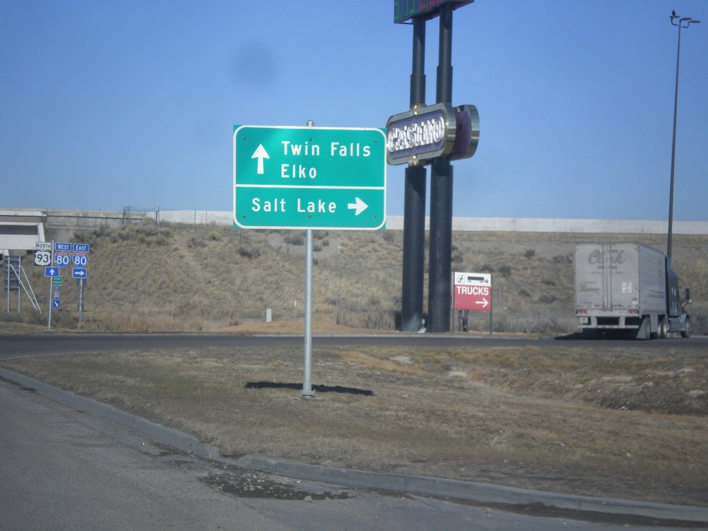
US-93 North at I-80
US-93 north at I-80 (Exit 352). Use I-80 east for Salt Lake. Use I-80 west for Elko. Continue north on US-93 for Twin Falls.
Taken 02-13-2018
Wells
Elko County
Nevada
United States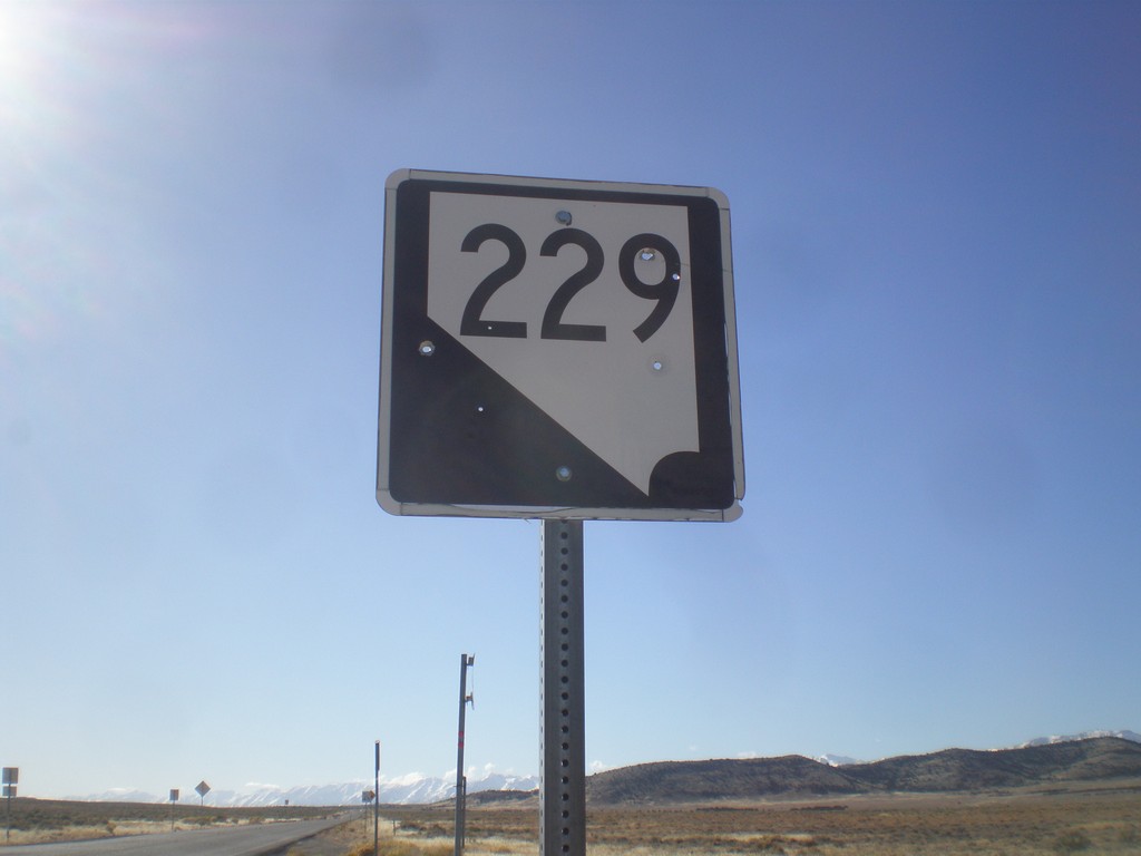
NV-229 North - Elko County
NV-229 north in Elko County.
Taken 02-13-2018
 Wells
Elko County
Nevada
United States
Wells
Elko County
Nevada
United States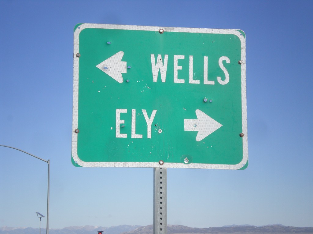
End NV-229 South at US-93
End NV-229 South at US-93. Use US-93 south for Ely; US-93 north for Wells.
Taken 02-13-2018
Wells
Elko County
Nevada
United States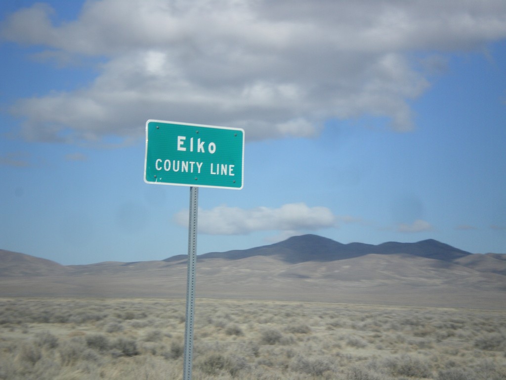
US-93 North - Elko County
Entering Elko County on US-93 north. Elko County is the fourth largest county by area in the lower 48 states.
Taken 02-13-2018
Ely
Elko County
Nevada
United States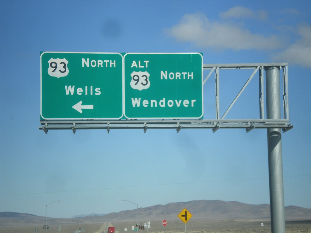
US-93 North at US-93 Alt. North
US-93 North at US-93 Alt. North. Continue straight for US-93 Alt. north to Wendover; turn left for US-93 north to Wells.
Taken 02-13-2018
Ely
White Pine County
Nevada
United States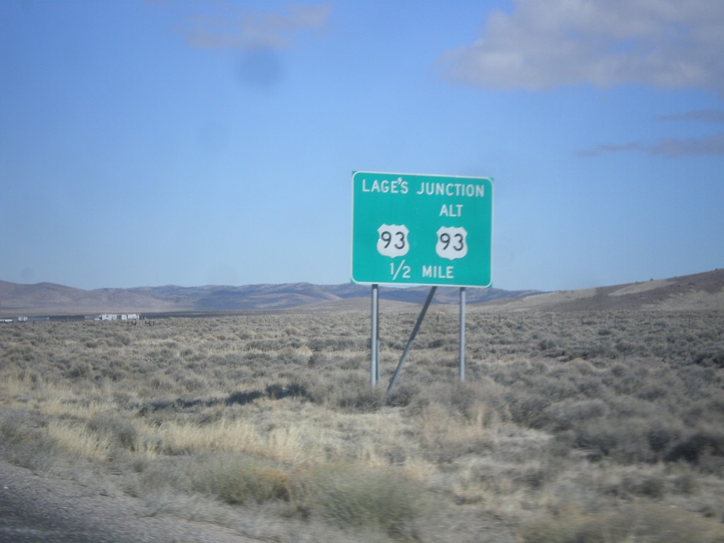
US-93 North Approaching Lages Junction
US-93 North approaching Lages Junction - US-93/Alt. US-93 Jct.
Taken 02-13-2018
Ely
White Pine County
Nevada
United States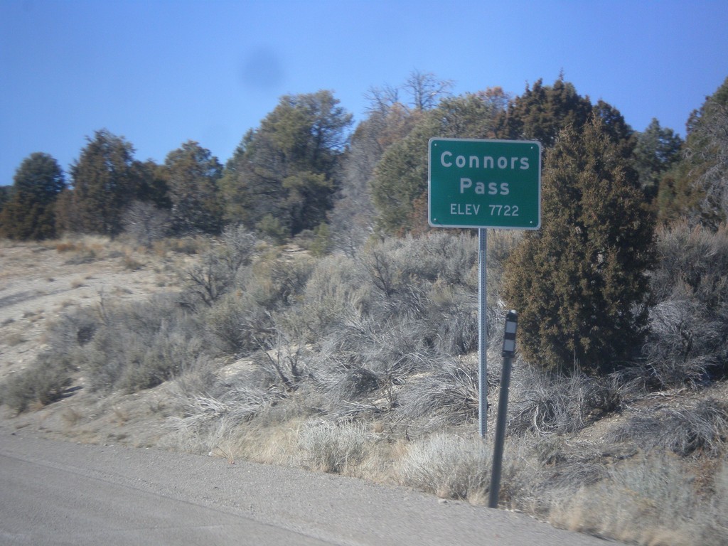
US-6/US-50 West/US-93 North - Connors Pass
US-6/US-50 West/US-93 North at Connors Pass - Elevation 7722 Feet. Connors Pass is a summit in the Schell Creek Range.
Taken 02-13-2018

 Ely
White Pine County
Nevada
United States
Ely
White Pine County
Nevada
United States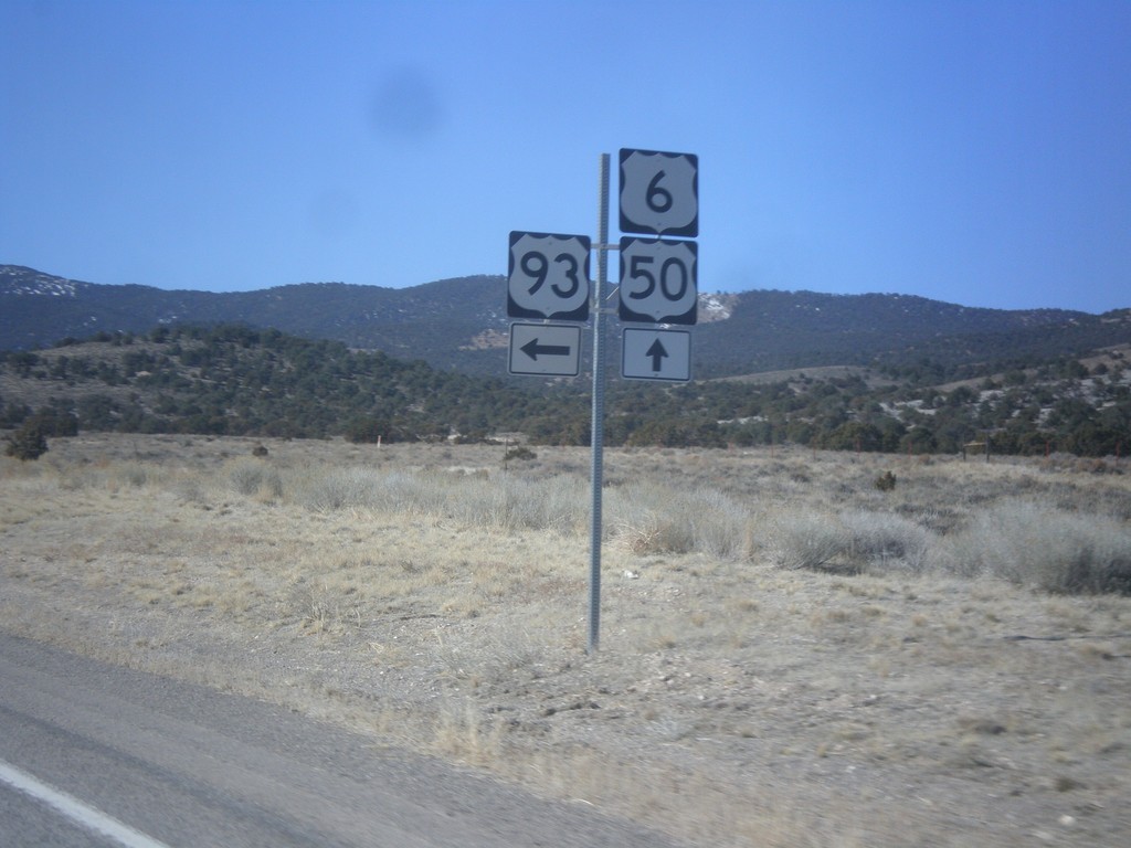
US-50/US-6 West at US-93 - Majors Junction
US-50/US-6 West at US-93 - Majors Junction. Turn left for US-93 south; continue straight for US-6/US-50 West/US-93 north.
Taken 02-13-2018
Majors Place
White Pine County
Nevada
United States