Signs From Oregon
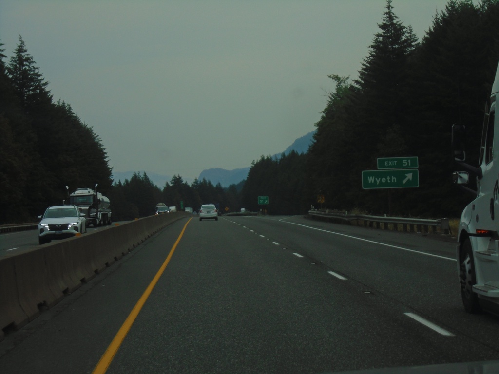
I-84 East - Exit 51
I-84 east at Exit 51 - Wyeth.
Taken 08-09-2024

 Wyeth
Hood River County
Oregon
United States
Wyeth
Hood River County
Oregon
United States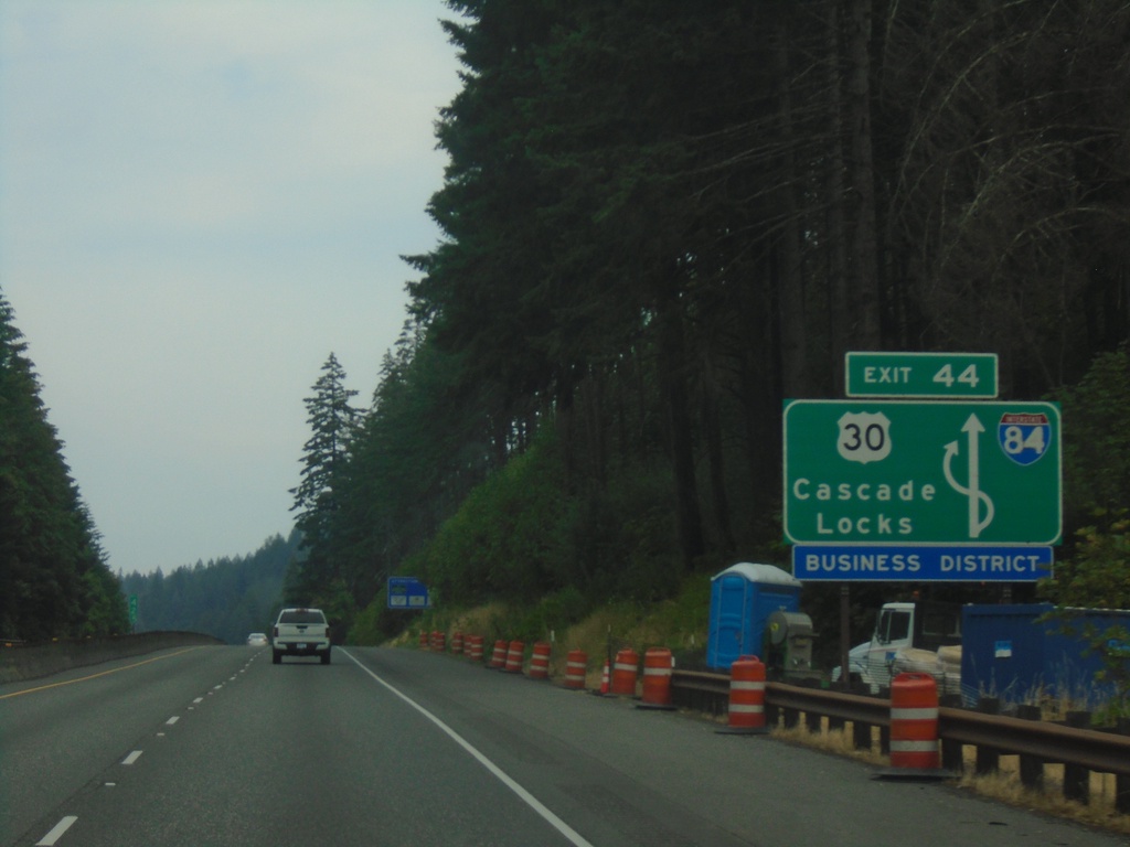
I-84 East - Exit 44 Route Diagram
Diagram of the Exit 44 interchange in Cascade Locks.
Taken 08-09-2024
Cascade Locks
Hood River County
Oregon
United States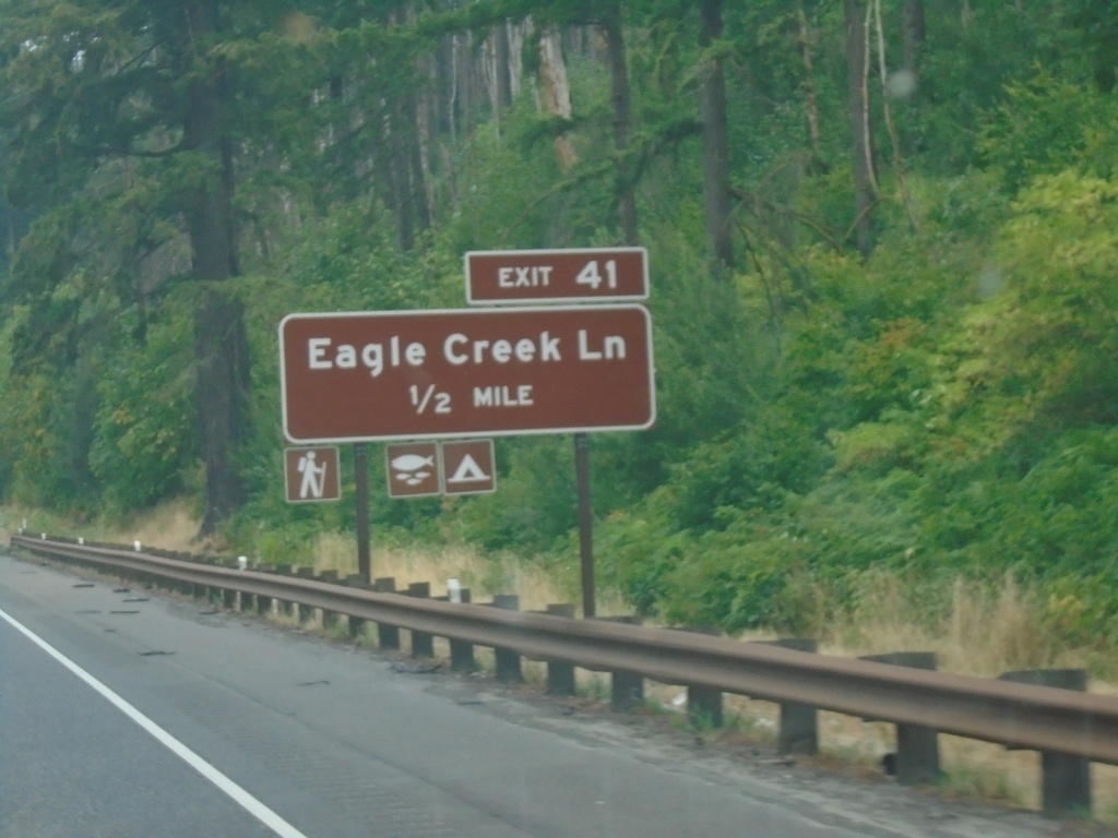
I-84 East - Exit 41
I-84 east approaching Exit 41 - Eagle Creek Lane.
Taken 08-09-2024
Cascade Locks
Multnomah County
Oregon
United States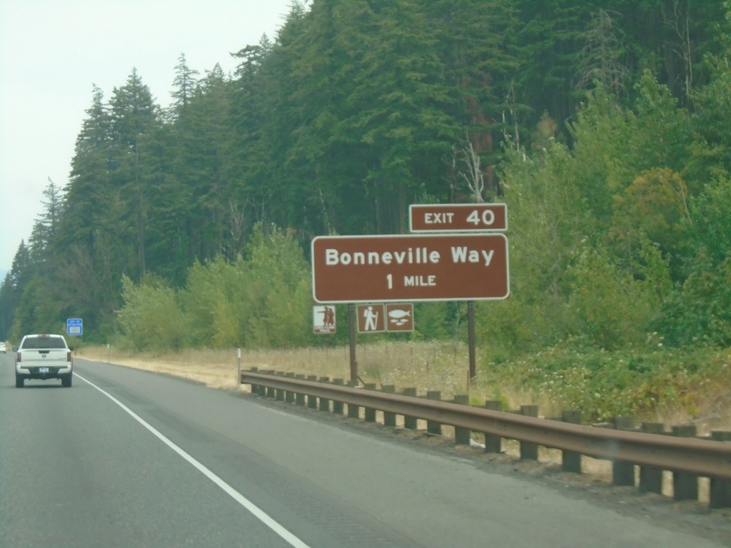
I-84 East - Exit 40
I-84 east approaching Exit 40 - Bonneville Way.
Taken 08-09-2024
Cascade Locks
Multnomah County
Oregon
United States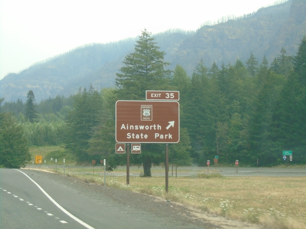
I-84 East - Exit 35
I-84 east at Exit 35 - Historic Route 30/Ainsworth State Park.
Taken 08-09-2024
Dodson
Multnomah County
Oregon
United States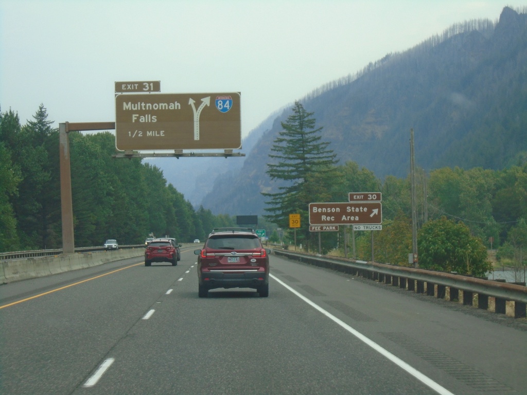
I-84 East - Exits 30 and 31
I-84 east at Exit 30 - Benson State Recreation Area. Approaching Exit 31 - Multnomah Falls. Exit 31 is a left exit.
Taken 08-09-2024
Bridal Veil
Multnomah County
Oregon
United States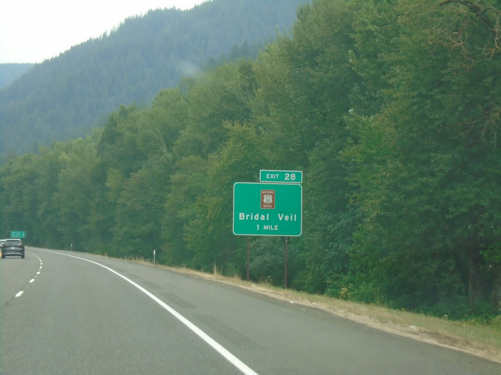
I-84 East - Exit 28
I-84 east approaching Exit 28 - Historic Route 30/Bridal Veil.
Taken 08-09-2024
Corbett
Multnomah County
Oregon
United States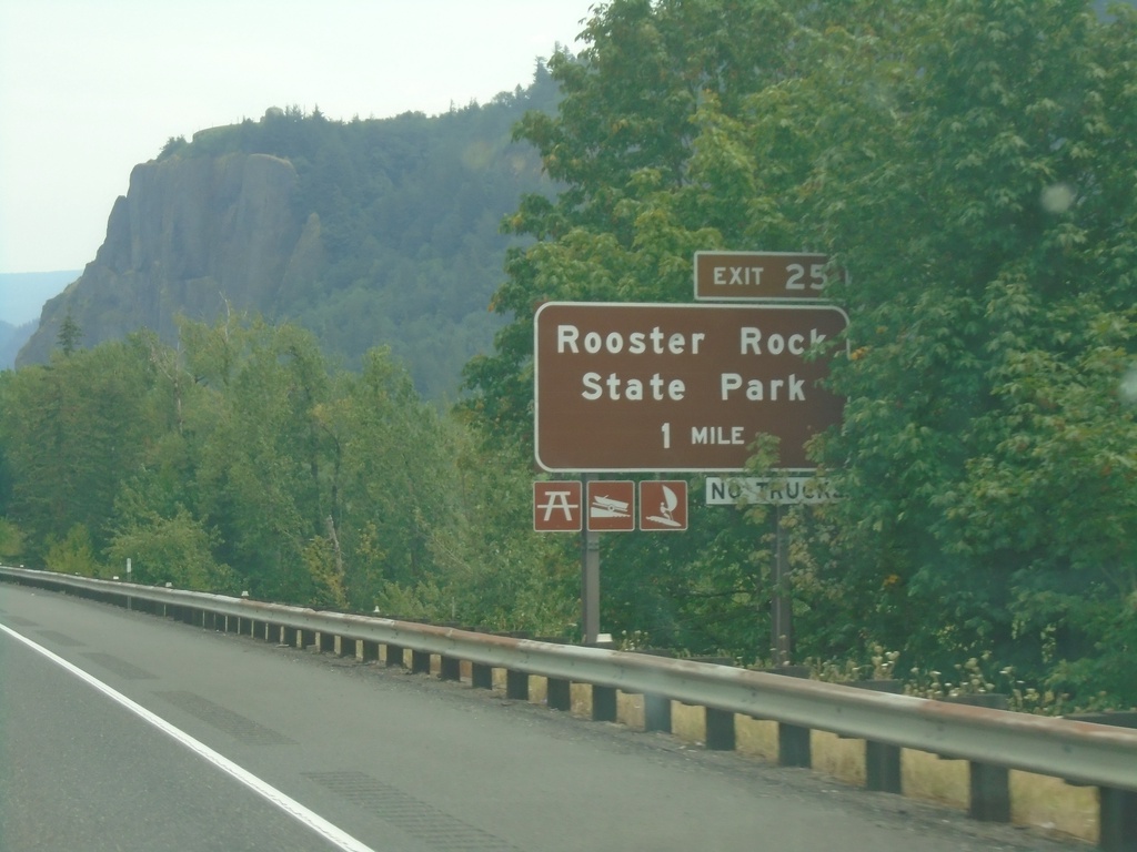
I-84 East - Exit 25
I-84 east approaching Exit 25 - Rooster Rock State Park.
Taken 08-09-2024
Corbett
Multnomah County
Oregon
United States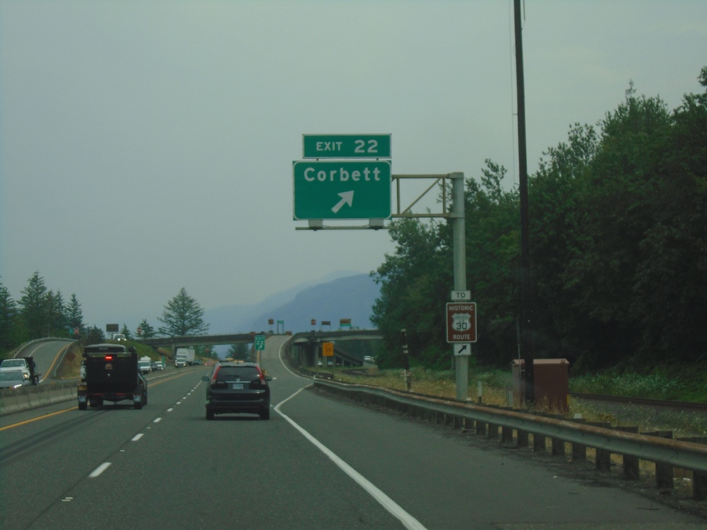
I-84 East - Exit 22
I-84 east at Exit 22 - Corbett. Use Exit 22 for access to Historic Route 30.
Taken 08-09-2024
Corbett
Multnomah County
Oregon
United States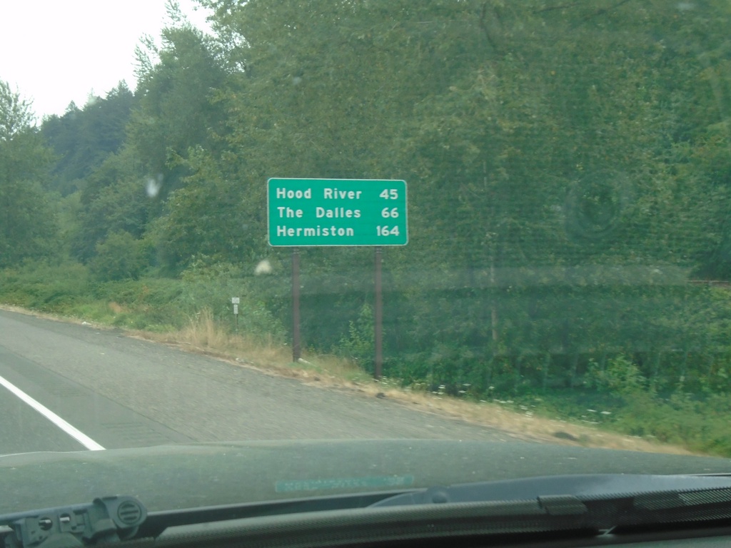
I-84 East - Distance Marker
First distance marker eastbound on I-84 after the Portland metro area. Distance to Hood River, The Dalles, and Hermiston.
Taken 08-09-2024
Troutdale
Multnomah County
Oregon
United States