Signs From Oregon
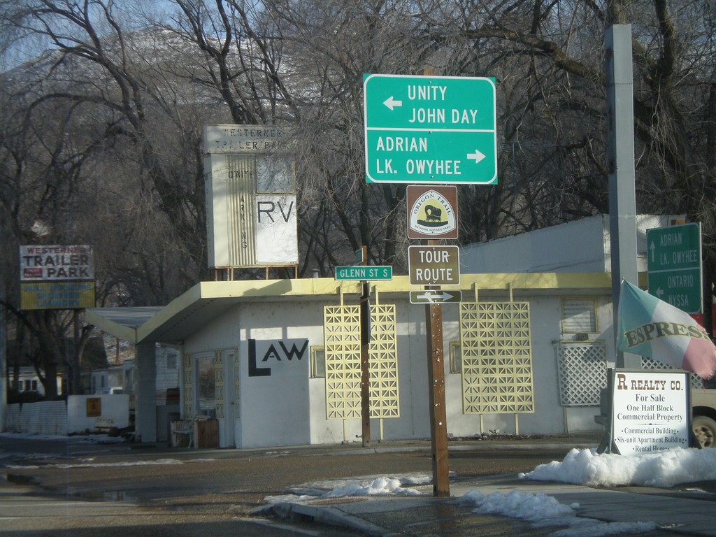
US-20 East at US-26 West
US-20 east at US-26 in downtown Vale. Use US-26 west for Unity and John Day. Use Glenn St. south for Adrian and Lake Owyhee. US-20 and US-26 join eastwards into Idaho.
Taken 01-18-2010

 Vale
Malheur County
Oregon
United States
Vale
Malheur County
Oregon
United States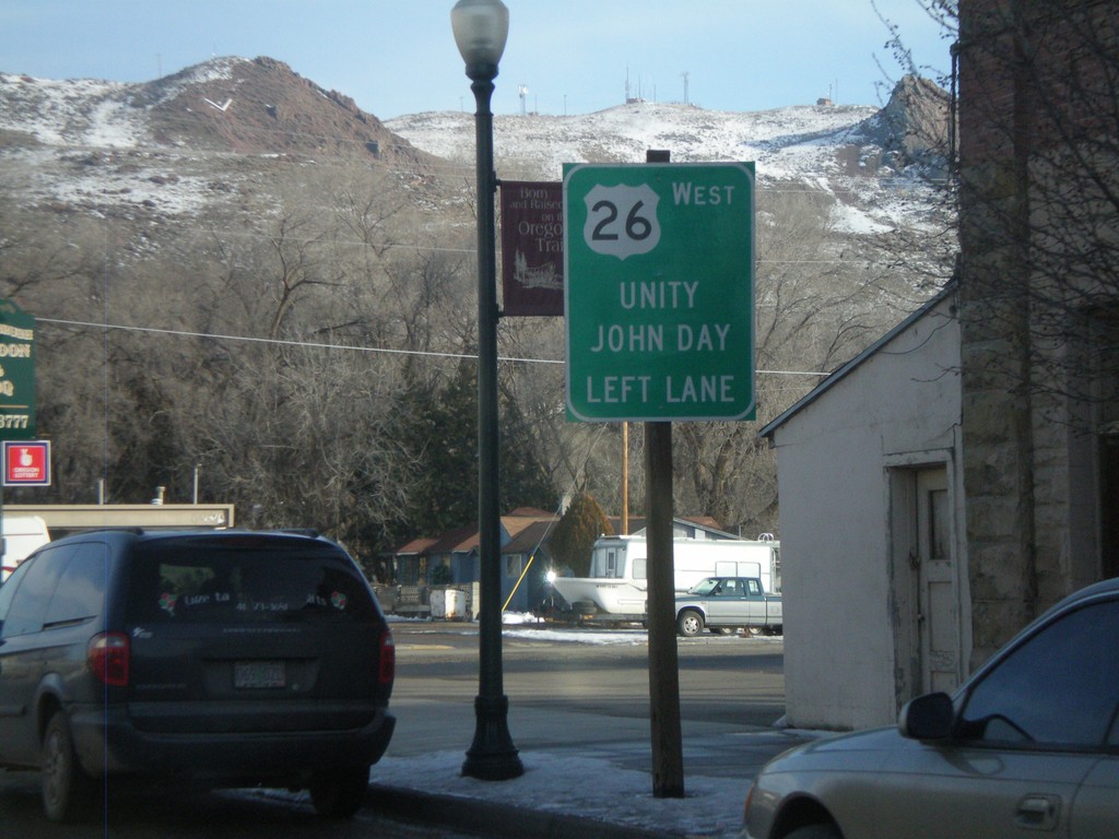
US-20 East Approacing US-26 West
US-20 east approaching US-26 in downtown Vale. Use US-26 west for Unity and John Day. US-20 and US-26 join eastwards into Idaho.
Taken 01-18-2010
Vale
Malheur County
Oregon
United States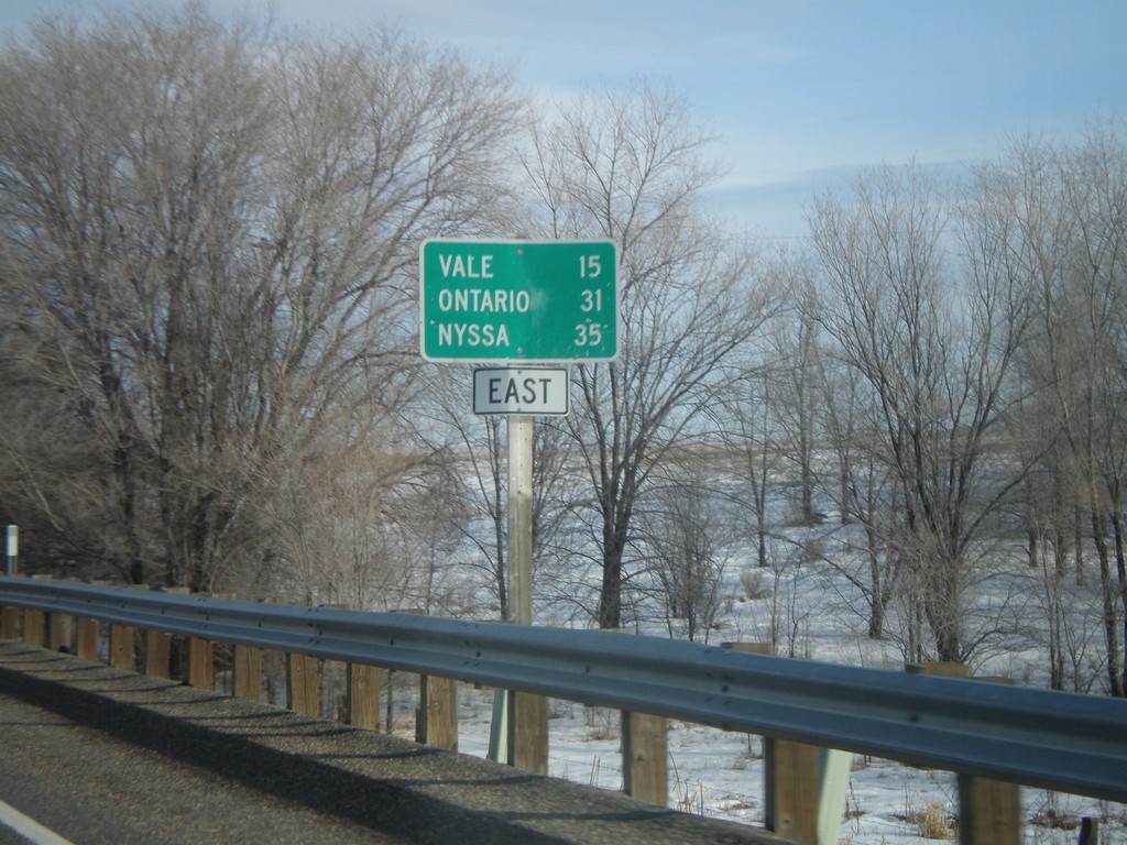
US-20 East - Distance Marker
Distance marker on US-20 east to Vale, Ontario, and Nyssa. Missing US-20 shield on sign.
Taken 01-18-2010
Harper
Malheur County
Oregon
United States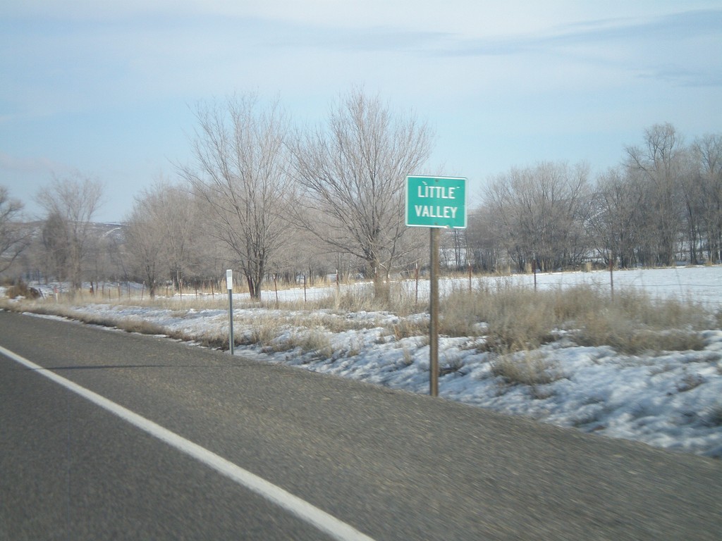
US-20 East - Little Valley
Entering the community of Little Valley on US-20 east.
Taken 01-18-2010
Harper
Malheur County
Oregon
United States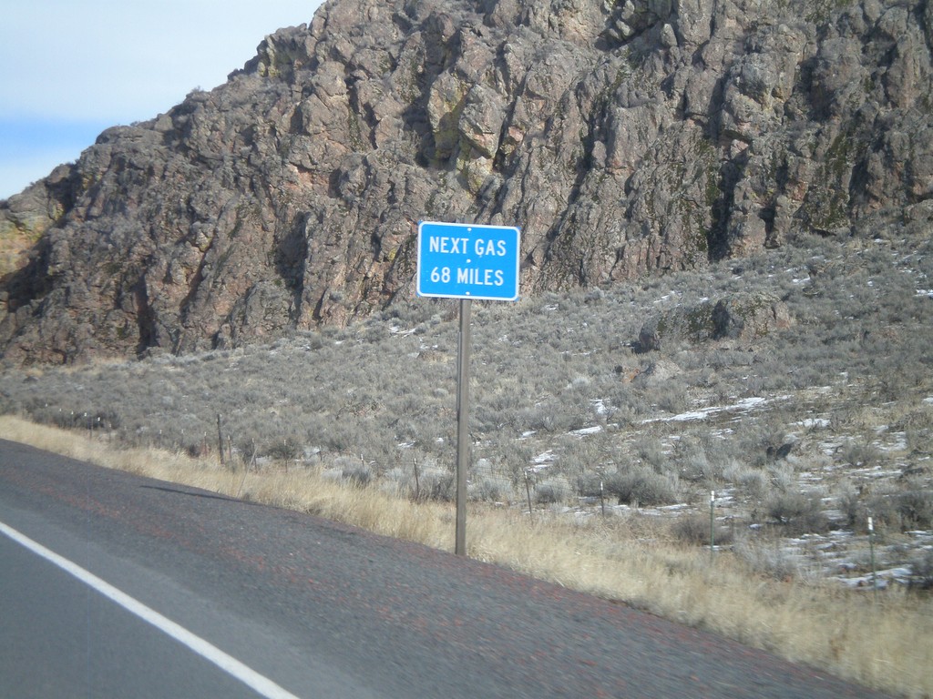
US-20 East - Next Gas 68 Miles
Next Gas 68 Miles on US-20 east. Taken just outside of the settlement of Buchanan. The next gas is in the town of Vale.
Taken 01-18-2010
Burns
Harney County
Oregon
United States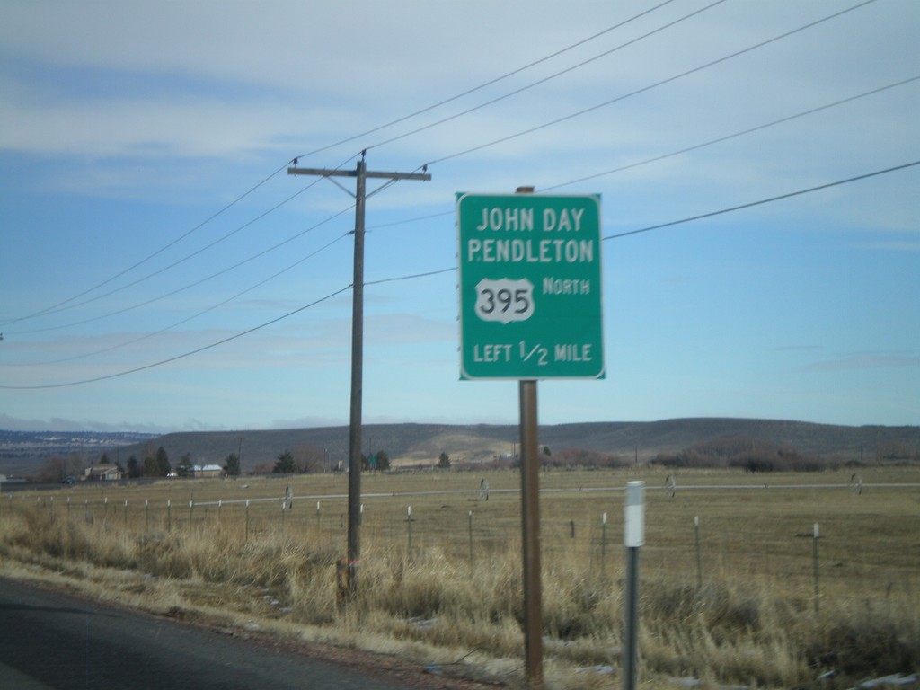
US-20 East/US-395 North Approaching US-395
US-20 East/US-395 North approaching US-395 north to John Day and Pendleton.
Taken 01-18-2010
 Burns
Harney County
Oregon
United States
Burns
Harney County
Oregon
United States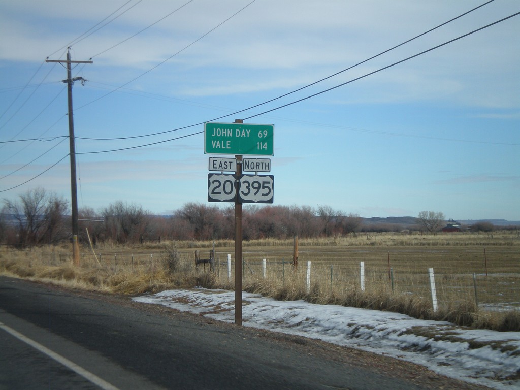
US-20 East/US-395 North - Distance Marker
Distance marker on US-20 East/US-395 north to John Day and Vale.
Taken 01-18-2010
Burns
Harney County
Oregon
United States
US-20 East/US-395 North Approaching OR-78
US-20 East/US-395 North approaching OR-78. Stay in the left lane for US-20 East/US-395 North for John Day and Vale.
Taken 01-18-2010
 Burns
Harney County
Oregon
United States
Burns
Harney County
Oregon
United States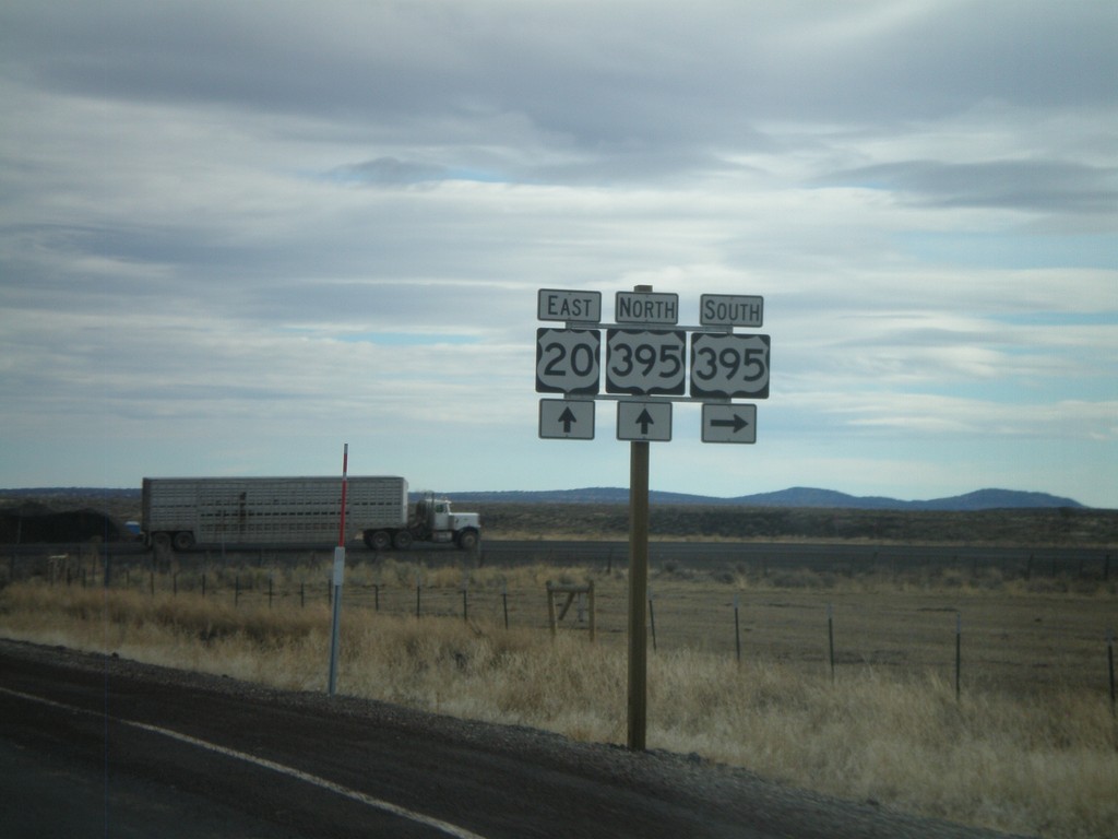
US-20 West at US-395 South
US-20 east at US-395. US-395 joins US-20 east through Burns.
Taken 01-18-2010
Riley
Harney County
Oregon
United States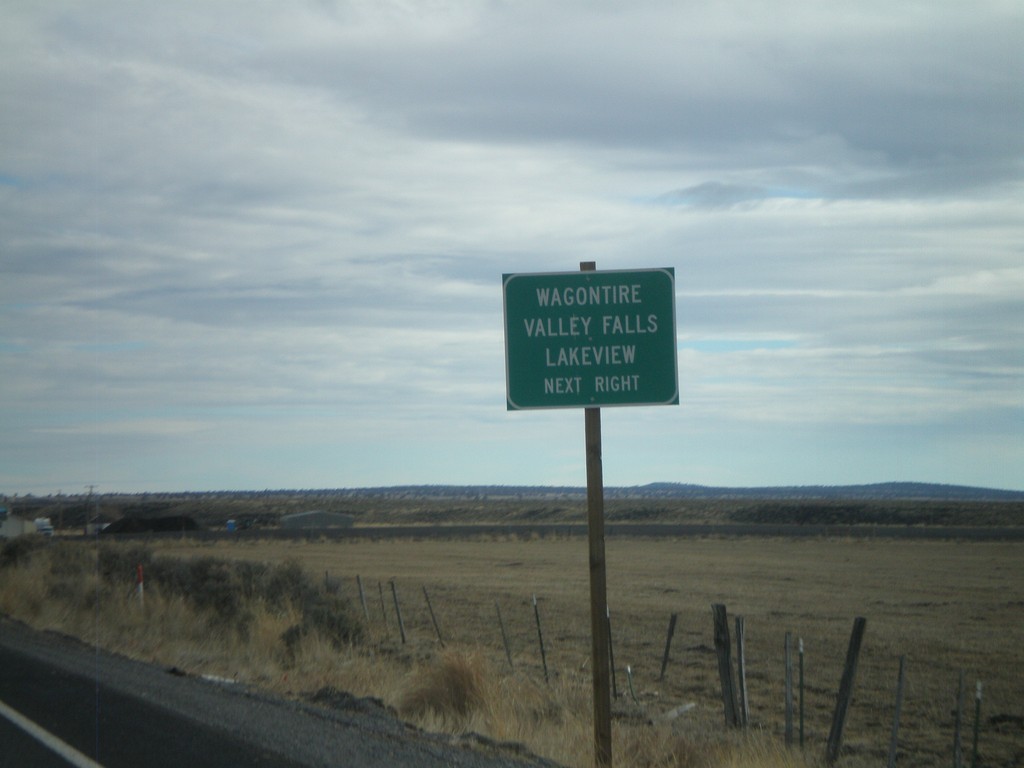
US-20 East Approaching US-395
US-20 east approaching US-395. Use US-395 south for Wagontire, Valley Falls, and Lakeview.
Taken 01-18-2010
Riley
Harney County
Oregon
United States