Signs From Oregon
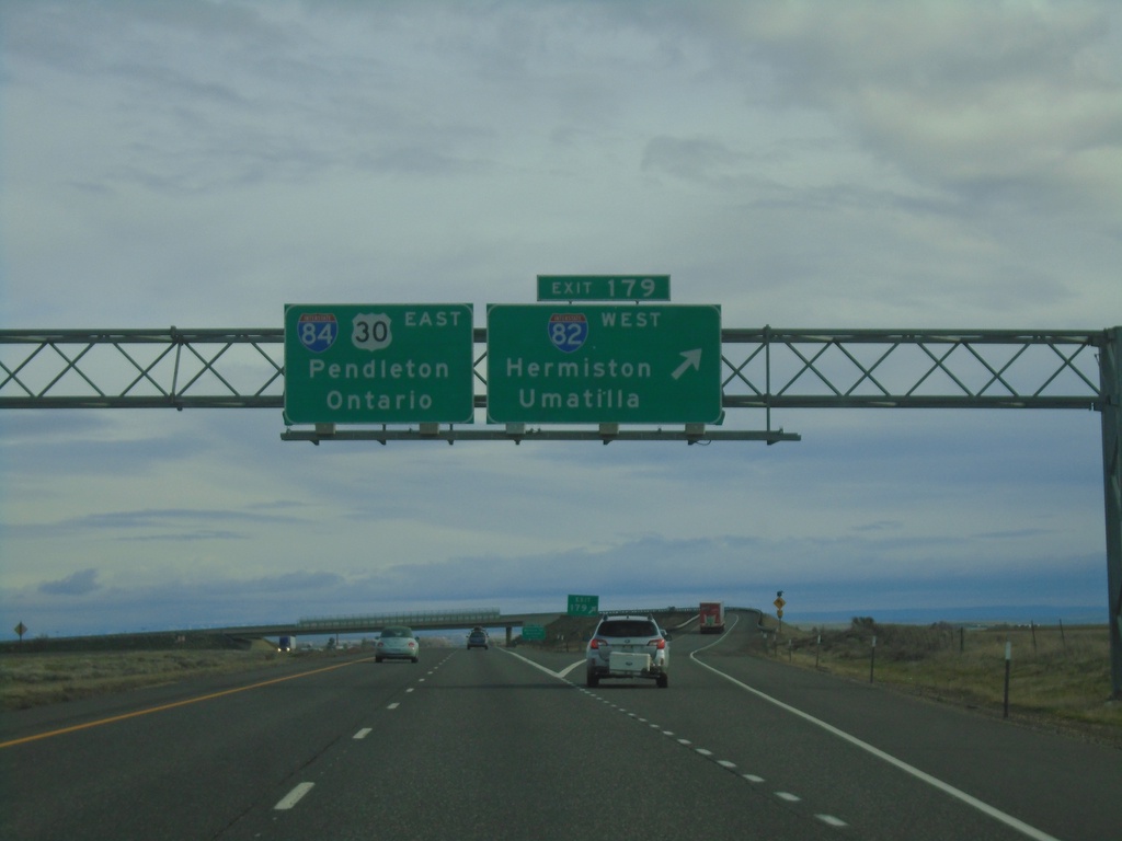
I-84 East - Exit 179
I-84 east at Exit 179 - I-82 West/Hermiston/Umatilla. I-84/US-30 continues east towards Pendleton and Ontario. This is the eastern end of I-82.
Taken 01-06-2024


 Hermiston
Umatilla County
Oregon
United States
Hermiston
Umatilla County
Oregon
United States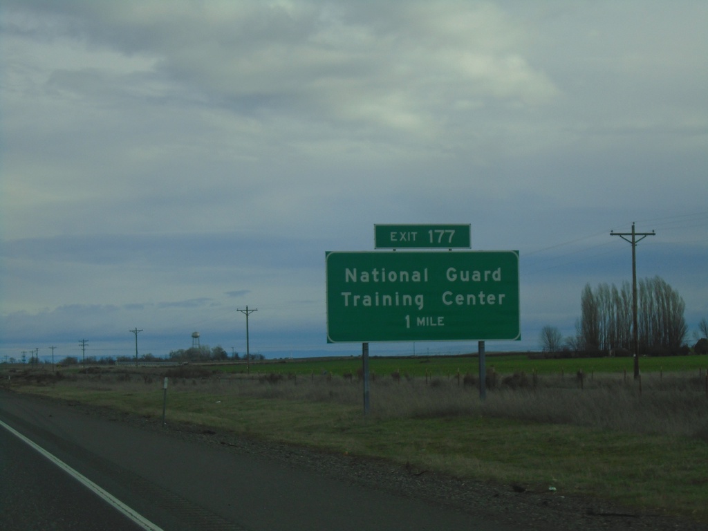
I-84 East - Exit 177
I-84 east approaching Exit 177 - National Guard Training Center. This interchange was formerly known as Umatilla Army Depot.
Taken 01-06-2024
Irrigon
Morrow County
Oregon
United States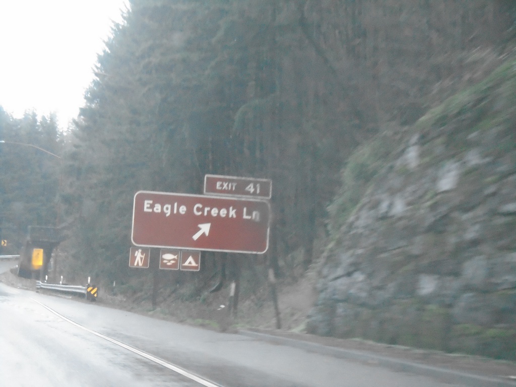
I-84 East - Exit 41
I-84 east at Exit 41 - Eagle Creek Lane
Taken 01-06-2024
Bonneville
Multnomah County
Oregon
United States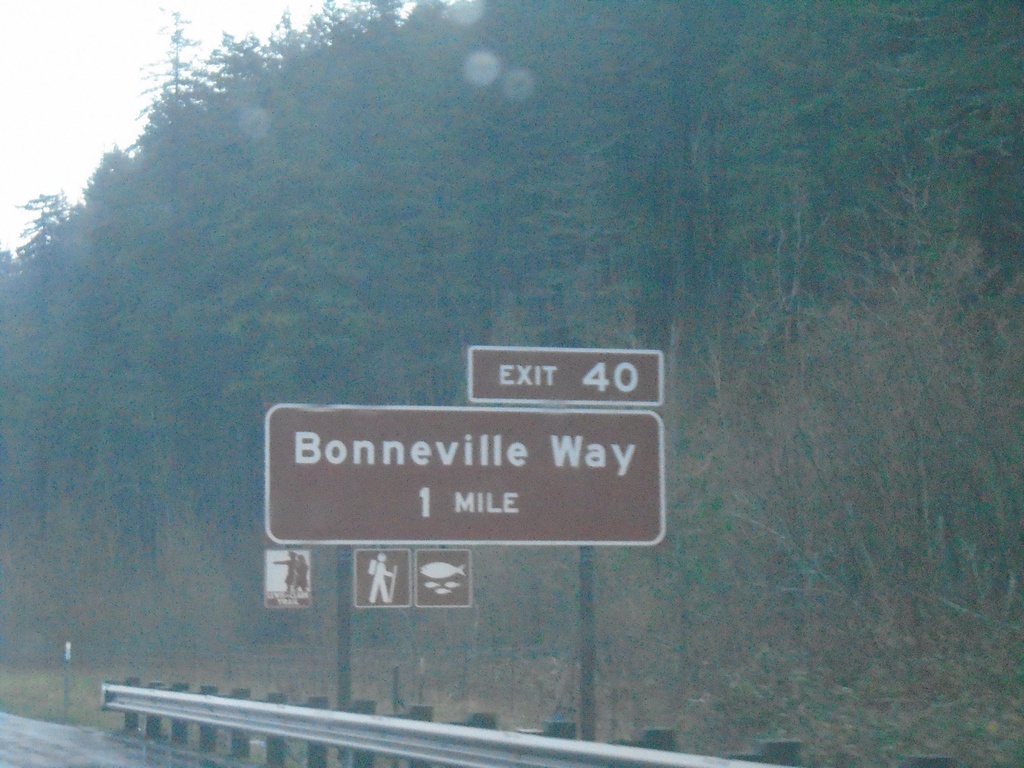
I-84 East - Exit 40
I-84 east approaching Exit 40 - Bonneville Way.
Taken 01-06-2024
Cascade Locks
Multnomah County
Oregon
United States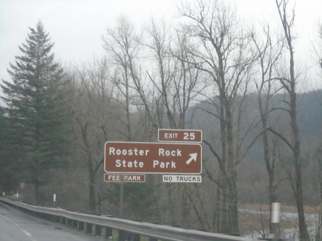
I-84 East - Exit 25
I-84 east at Exit 25 - Rooster Rock State Park. Use Exit 25 for Rooster Rock State Recreation Area.
Taken 01-06-2024
Corbett
Multnomah County
Oregon
United States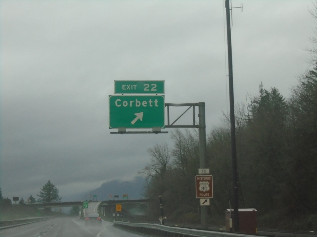
I-84 East - Exit 22
I-84 east at Exit 22 - Corbett.
Taken 01-06-2024
Corbett
Multnomah County
Oregon
United States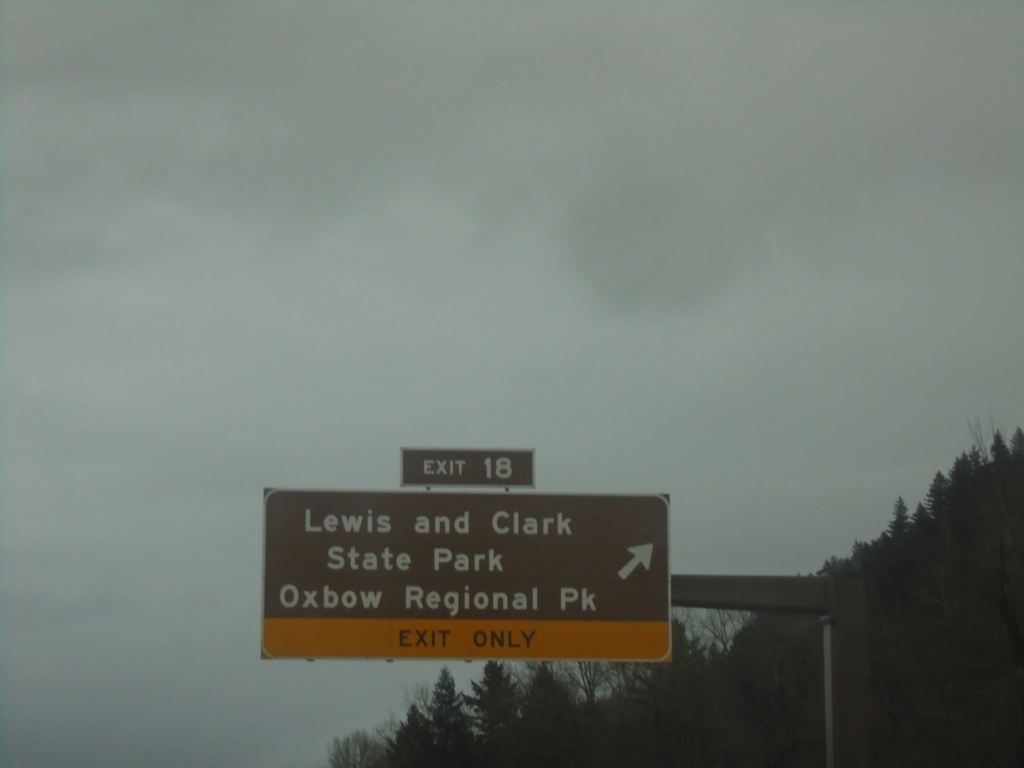
I-84 East - Exit 18
I-84 east at Exit 18 - Lewis and Clark State Park/Oxbow Regional Park. Highway enters the Columbia River Gorge Scenic Area here.
Taken 01-06-2024
Troutdale
Multnomah County
Oregon
United States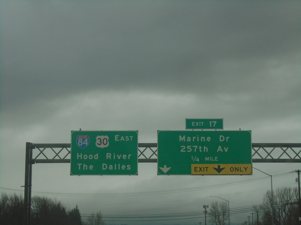
I-84 East Approaching Exit 17
I-84 east approaching Exit 17 - Marine Drive/257th Ave. Continue east on I-84/US-30 for The Dalles and Hood River.
Taken 01-06-2024
Troutdale
Multnomah County
Oregon
United States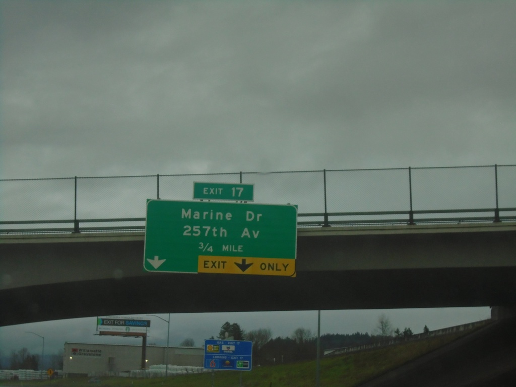
I-84 East Approaching Exit 17
I-84 east approaching Exit 17 - Marine Drive/257th Ave.
Taken 01-06-2024
Troutdale
Multnomah County
Oregon
United States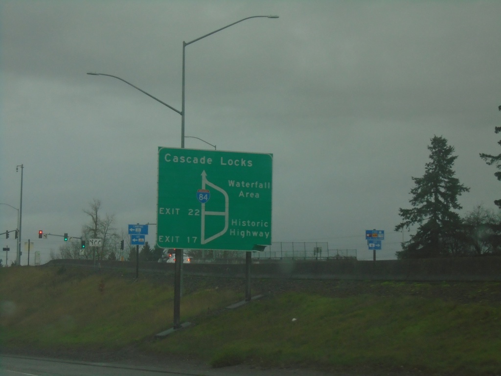
I-84/US-30 East - Historic Columbia River Highway Diagram
Route diagram for the Historic Columbia River Highway on I-84/US-30 East. Use Exit 17 (last Portland Metro. Area exit) on I-84/US-30 East for the Historic Highway. The Historic Columbia River Highway and I-84/US-30 rejoin before Cascade Locks.
Taken 01-06-2024
Fairview
Multnomah County
Oregon
United States