Signs From Oregon
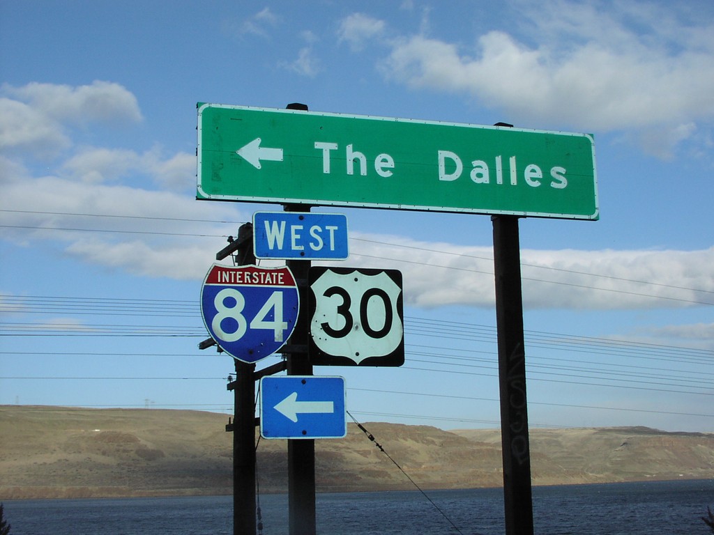
I-84/US-30 West Onramp Exit 123
I-84/US-30 West freeway entrance to The Dalles, at Exit 123.
Taken 01-01-2007

 Arlington
Gilliam County
Oregon
United States
Arlington
Gilliam County
Oregon
United States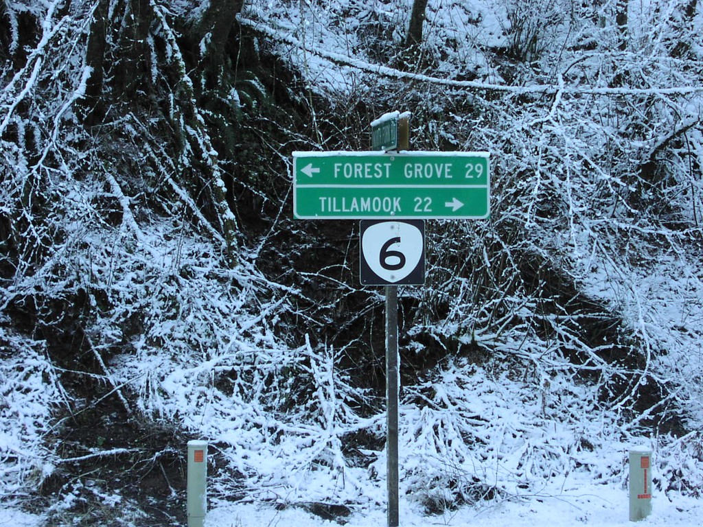
OR-6 - Tillamook State Forest
OR-6 to Tillamook and Forest Grove in the Tillamook State Forest.
Taken 01-01-2007
 Tillamook
 County
Oregon
United States
Tillamook
Tillamook County
Oregon
United States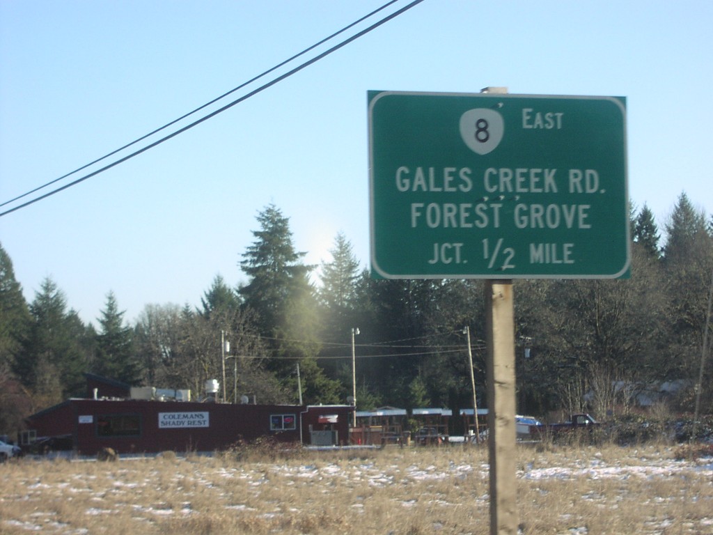
OR-6 East Approaching OR-8
OR-6 east approaching OR-8/Gales Creek Road/Forest Grove, 1/2 mile.
Taken 01-01-2007
 Gales Creek
Washington County
Oregon
United States
Gales Creek
Washington County
Oregon
United States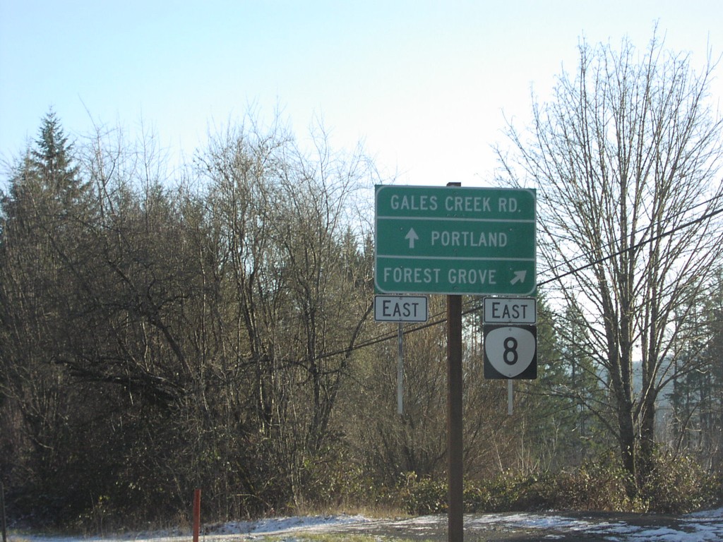
OR-6 East at OR-8
OR-6 east at OR-8 east to Forest Grove.
Taken 01-01-2007
Gales Creek
Washington County
Oregon
United States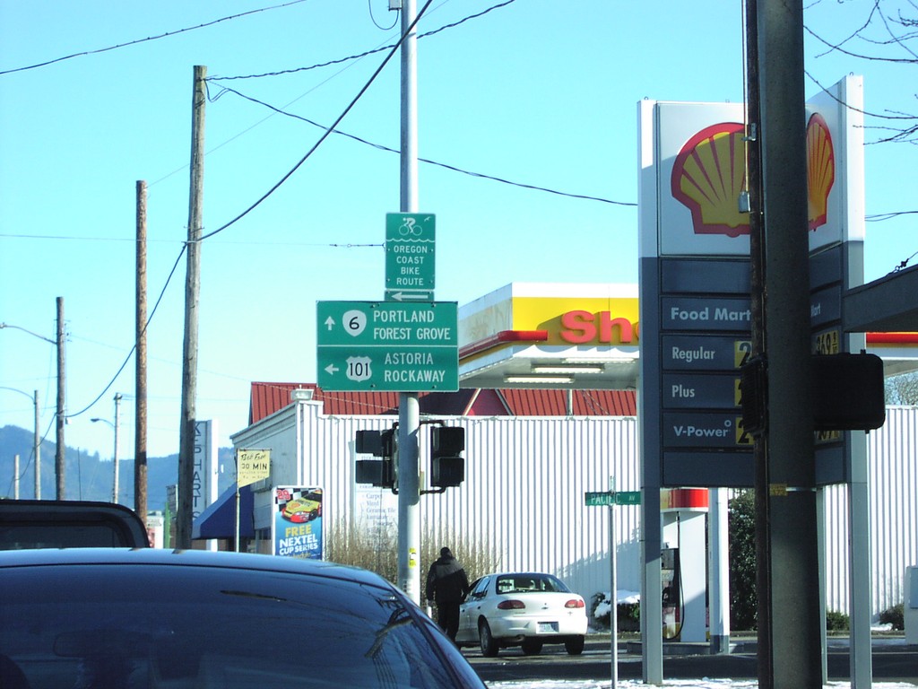
OR-6 East at US-101 North
OR-6 east at US-101 north to Rockaway and Astoria.
Taken 01-01-2007
 Tillamook
 County
Oregon
United States
Tillamook
Tillamook County
Oregon
United States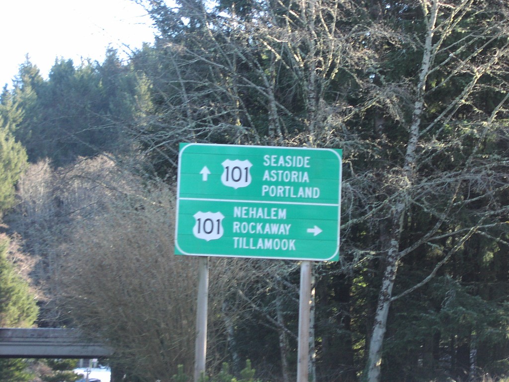
Sunset Blvd. at US-101 in Cannon Beach
Sunset Blvd. at US-101 on ramp.
Taken 01-01-2007
Cannon Beach
Clatsop County
Oregon
United States
US-101 North Approaching US-30
US-101 north approaching Columbia River Bridge at US-30 east junction.
Taken 01-01-2007
Astoria
Clatsop County
Oregon
United States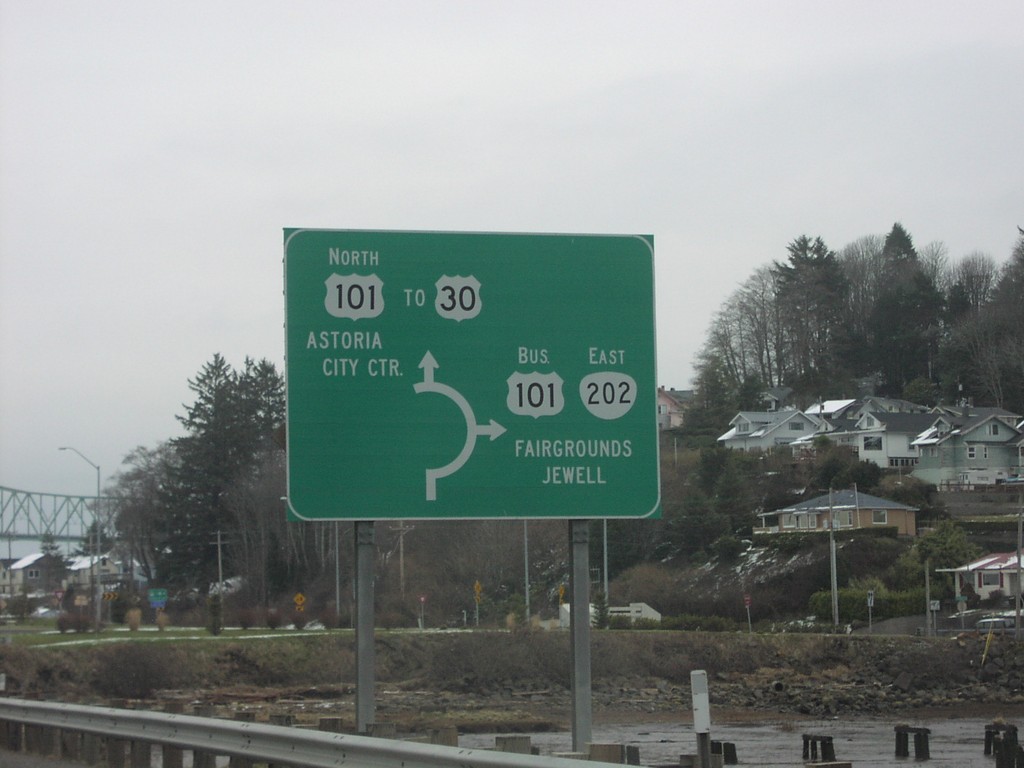
US-101 North at OR-202 South - Roundabout
US-101 north at OR-202 East/Bus. US-101 South to Jewell and Fairgrounds. US-101/OR-202 junction is a roundabout.
Taken 01-01-2007
 Astoria
Clatsop County
Oregon
United States
Astoria
Clatsop County
Oregon
United States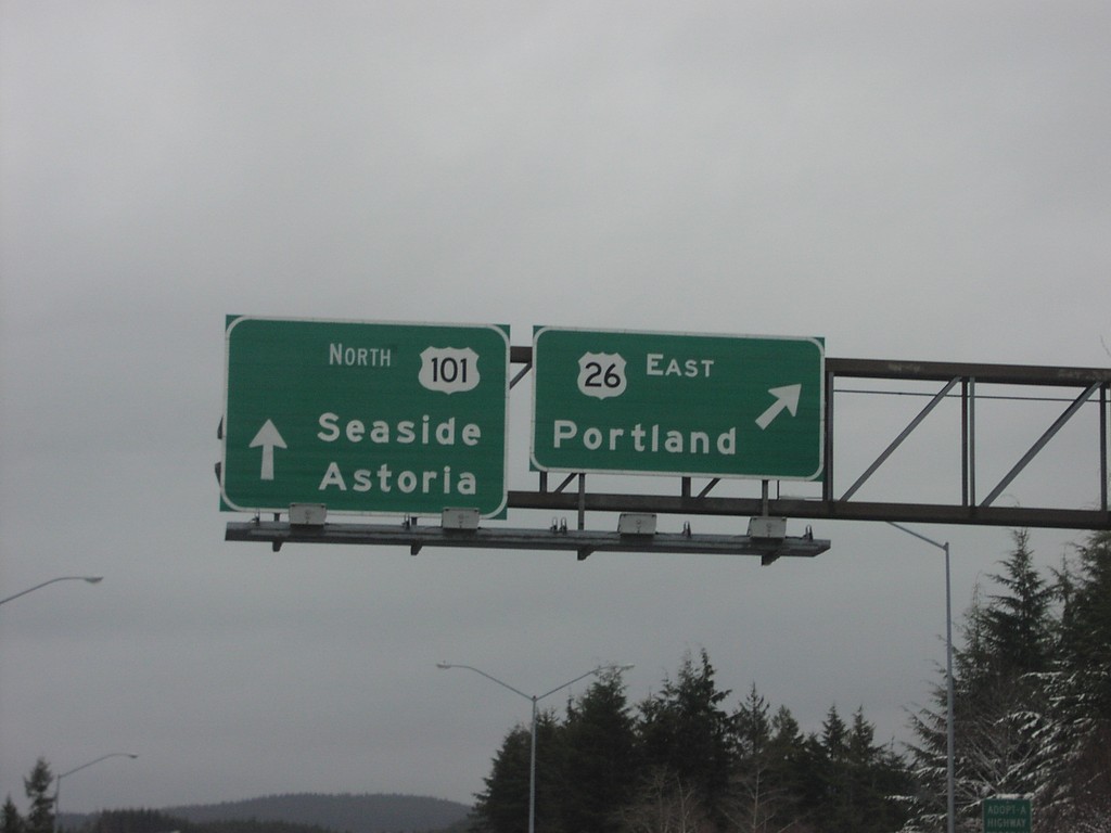
US-101 North at US-26 East
US-101 north to Seaside and Astoria at US-26 west to Portland.
Taken 01-01-2007
 Seaside
Clatsop County
Oregon
United States
Seaside
Clatsop County
Oregon
United States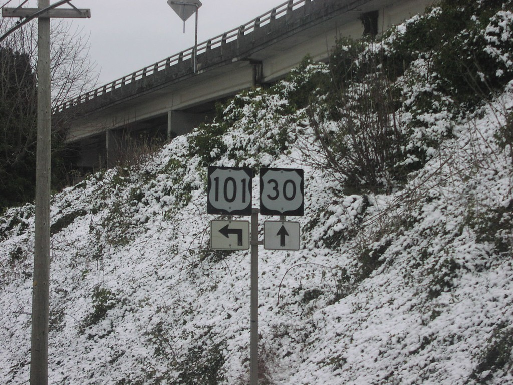
US-101 North at US-30
US-101 north approaching beginning of US-30.
Taken 01-01-2007
Astoria
Clatsop County
Oregon
United States