Signs From Oregon
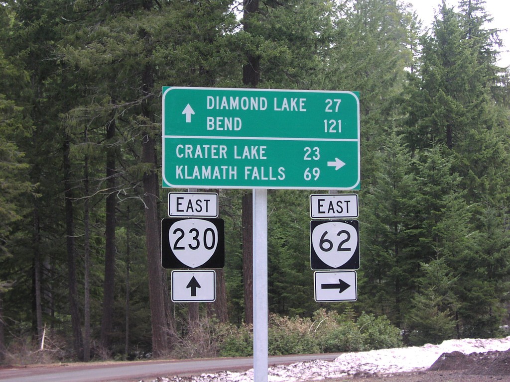
OR-62 North at OR-230
OR-62 north at OR-230 to Diamond Lake and Bend.
Taken 04-01-2006

 Prospect
Jackson County
Oregon
United States
Prospect
Jackson County
Oregon
United States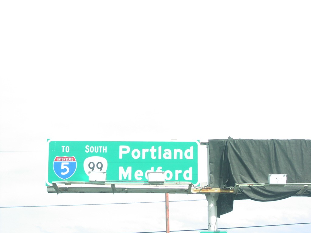
US-199 at OR-99/To I-5
US-199 north at OR-99/To I-5 to Portland and Medford.
Taken 04-01-2006

 Grants Pass
Josephine County
Oregon
United States
Grants Pass
Josephine County
Oregon
United States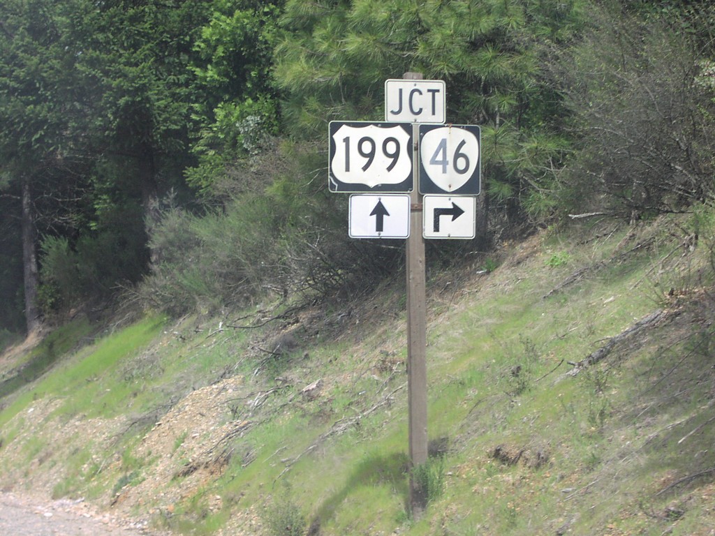
US-199 North at OR-46
US-199 north approaching OR-46.
Taken 04-01-2006
Cave Junction
Josephine County
Oregon
United States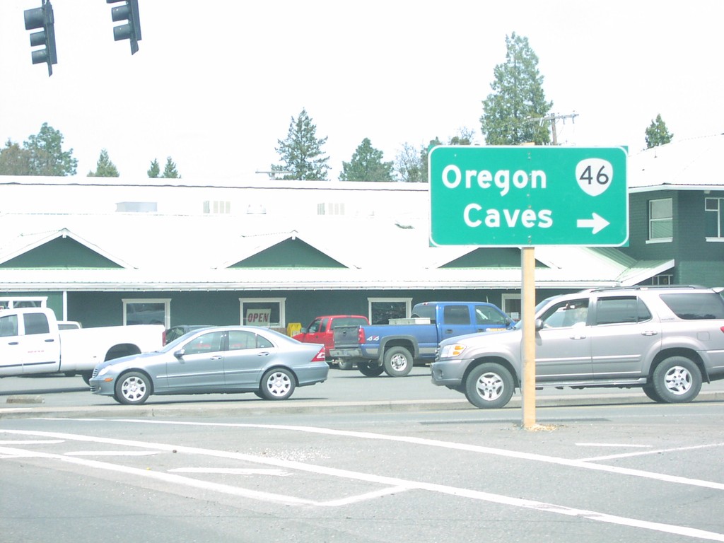
US-199 North at OR-46/Oregon Caves
US-199 north at OR-46 to Oregon Caves.
Taken 04-01-2006
Cave Junction
Josephine County
Oregon
United States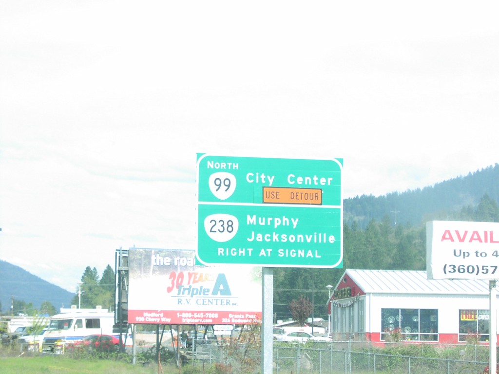
US-199 North at OR-99/OR-238
US-199 north at OR-238 to Murphy/Jacksonville and OR-99 north to City Center.
Taken 04-01-2006
 Grants Pass
Josephine County
Oregon
United States
Grants Pass
Josephine County
Oregon
United States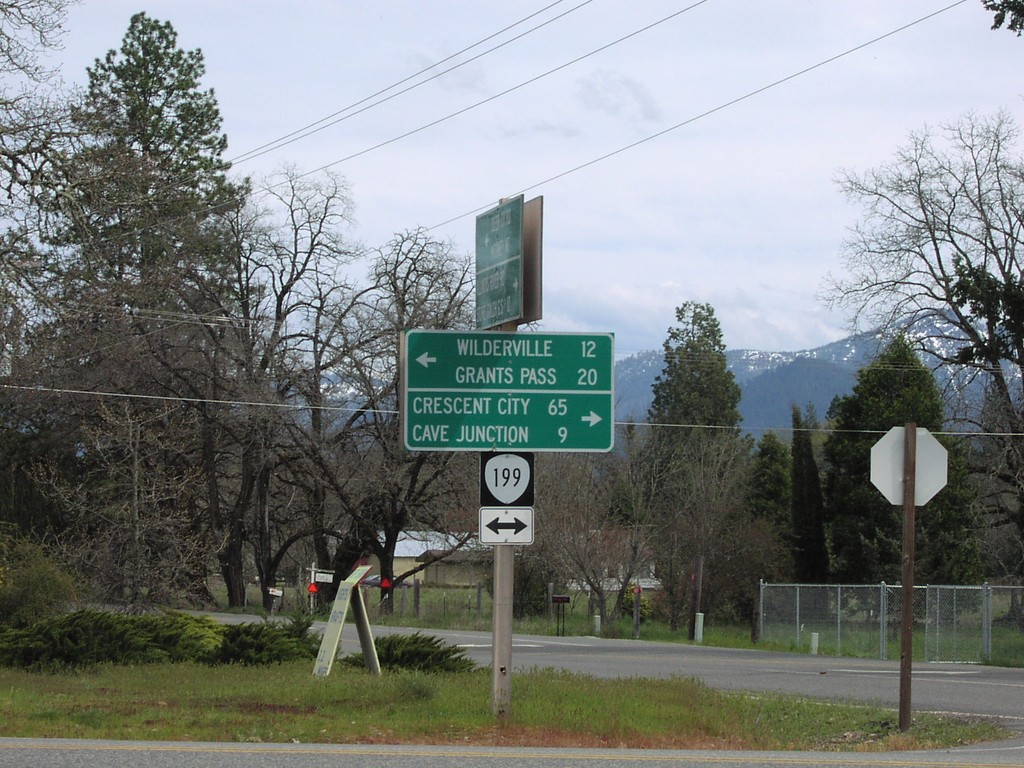
US-199 Shield Signed as OR-199
Junction of US-199 across from Selma Post Office. US-199 shield incorrectly displayed with OR-199 shield.
Taken 04-01-2006
Selma
Josephine County
Oregon
United States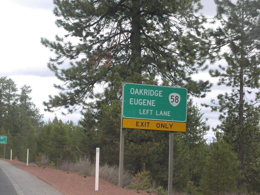
US-97 North approaching OR-58
US-97 north approaching OR-58 to Oakridge and Eugene.
Taken 04-01-2006
 Crescent
Klamath County
Oregon
United States
Crescent
Klamath County
Oregon
United States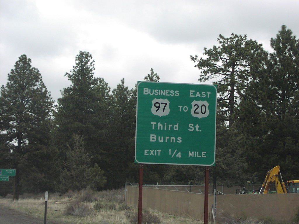
US-97 North at BL-97/To US-20 East
US-97 north approaching Bus. US-97/To US-20/Third St./Burns, 1/4 mile.
Taken 04-01-2006

 Bend
Deschutes County
Oregon
United States
Bend
Deschutes County
Oregon
United States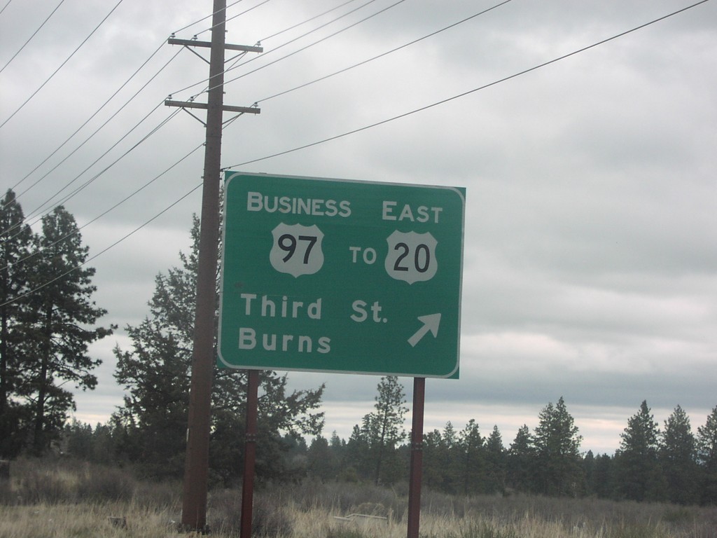
US-97 North at BL-97/To US-20 East
US-97 north at Bus. US-97/To US-20 East/Third St./Burns.
Taken 04-01-2006
Bend
Deschutes County
Oregon
United States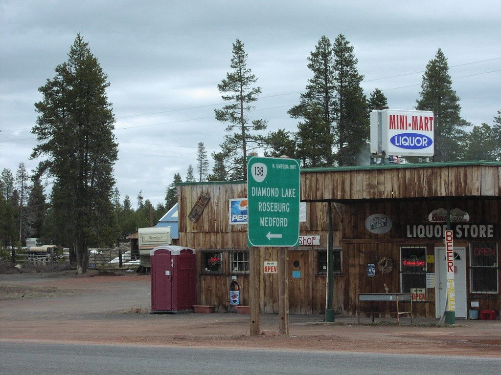
US-97 North at OR-138 West
US-97 north at OR-138/N. Umpqua Highway to Roseburg and Medford.
Taken 04-01-2006
Chemult
Klamath County
Oregon
United States