Signs From Oregon
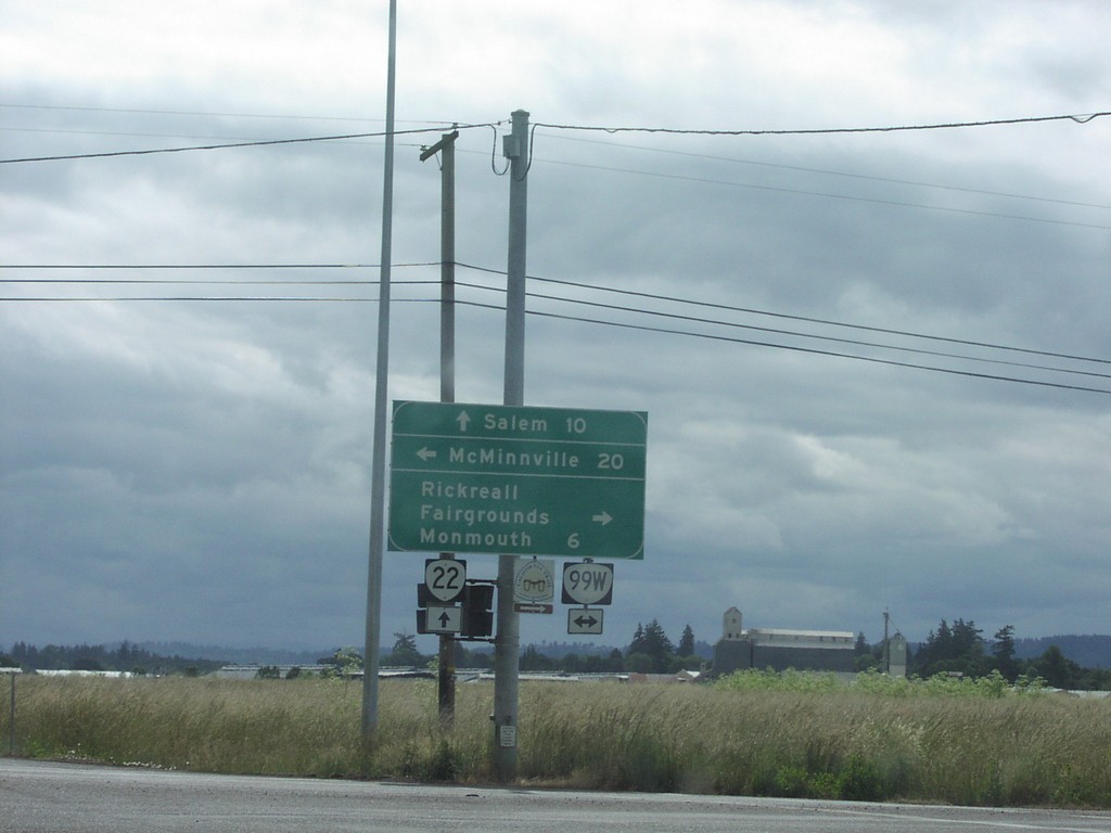
OR-22 East at OR-99W
OR-22 east at OR-99W. Use OR-99W south to Rickreall Fairgrounds, and Monmouth. Use OR-99W north to McMinnville. Continue east on OR-22 to Salem. This intersection has been replaced with a full interchange.
Taken 06-01-2001

 Rickreall
Polk County
Oregon
United States
Rickreall
Polk County
Oregon
United States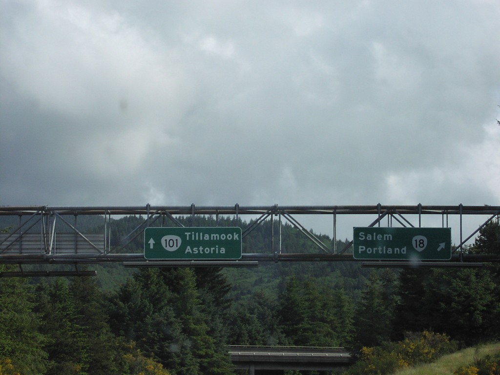
US-101 North at OR-18
US-101 North at OR-18 East to Salem and Portland. Continue north on US-101 to Tillamook and Astoria. The US-101 shield is incorrectly using the state highway shield style.
Taken 06-01-2001

 Otis
Lincoln County
Oregon
United States
Otis
Lincoln County
Oregon
United States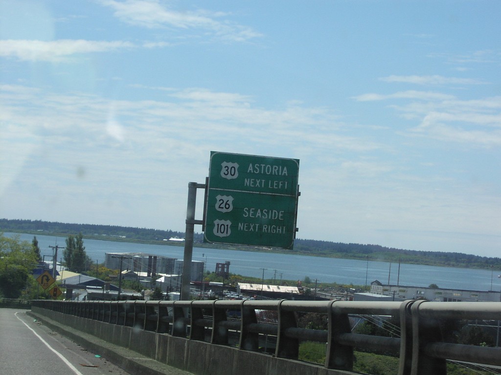
US-101 South Approaching US-30 (and Former US-26)
US-101 south approaching US-30 and (Former)US-26. Use US-30 east to Astoria; use US-101/(Former) US-26 to Seaside. US-26 currently ends in Seaside, but used to follow US-101 north to the US-101/US-30 junction in Astoria.
Taken 06-01-2001

 Astoria
Clatsop County
Oregon
United States
Astoria
Clatsop County
Oregon
United States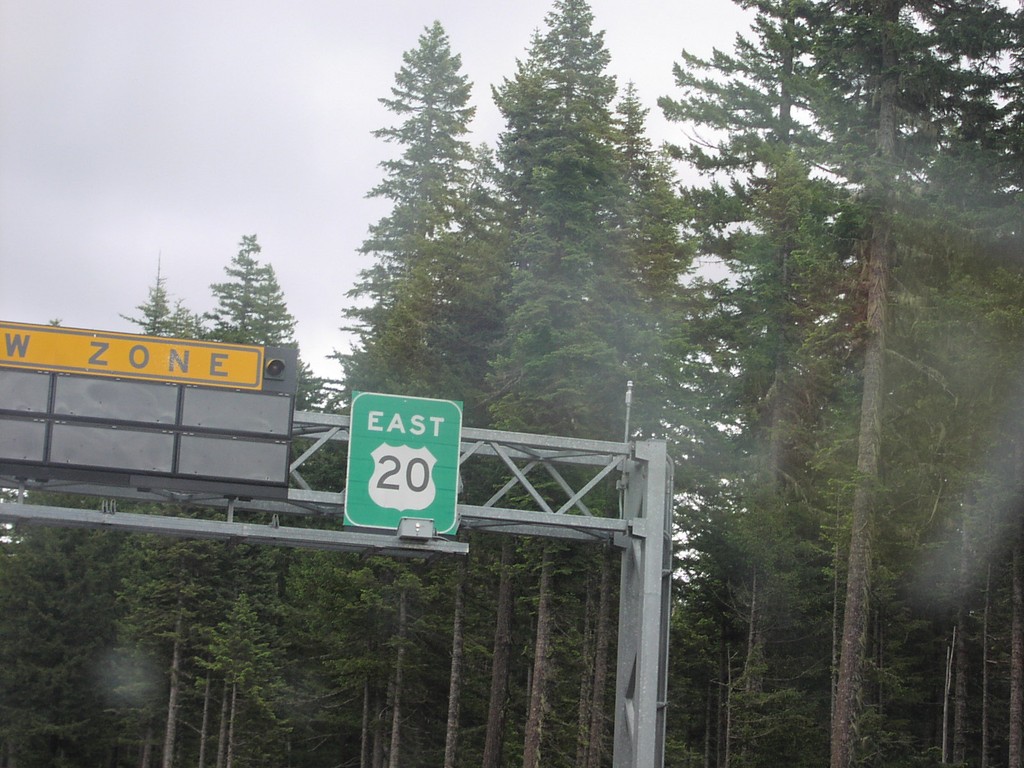
US-20 East - On West Approach To Santiam Pass
Snow Zone overhead and electronic message board on US-20 East at Santiam Pass.
Taken 06-01-2001

 Santiam Junction
Linn County
Oregon
United States
Santiam Junction
Linn County
Oregon
United States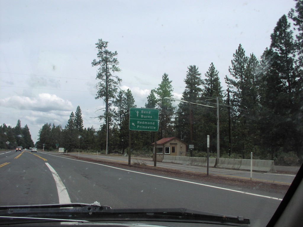
US-20/OR-126 East at Split
US-20/OR-126 East at route split. Continue straight for US-20 east to Bend and Burns. Merge left for OR-126 east to Redmond and Prineville.
Taken 06-01-2001
Sisters
Deschutes County
Oregon
United States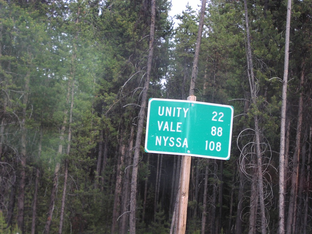
US-26 East - Distance Marker
Distance marker on US-26 east. Distance to Unity, Vale, and Nyssa.
Taken 06-01-2001
Grant County
Oregon
United States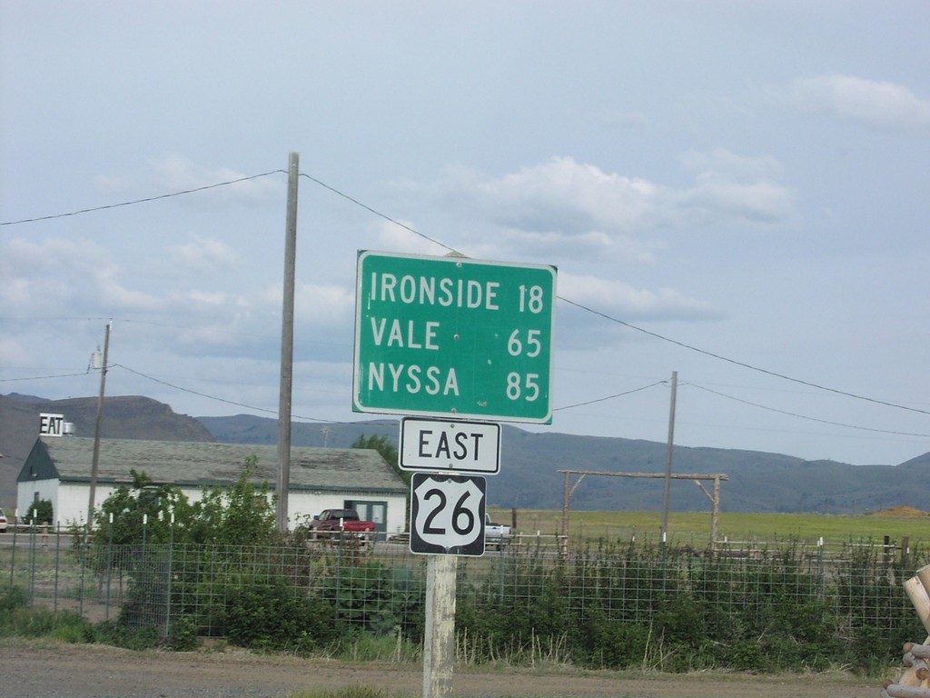
US-26 East - Distance Marker
Distance marker on US-26 east. Distance to Ironside, Vale, and Nyssa.
Taken 06-01-2001
Unity
Baker County
Oregon
United States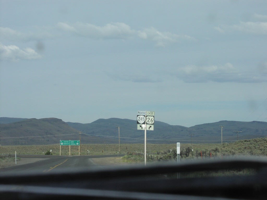
US-26 East Approaching OR-245
US-26 east approaching OR-245 north in Baker County.
Taken 06-01-2001
 Unity
Baker County
Oregon
United States
Unity
Baker County
Oregon
United States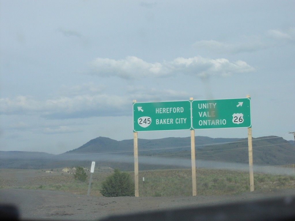
US-26 East at OR-245
US-26 East at OR-245 east to Hereford and Baker City. Continue east on US-26 for Unity, Vale, and Ontario.
Taken 06-01-2001
Unity
Baker County
Oregon
United States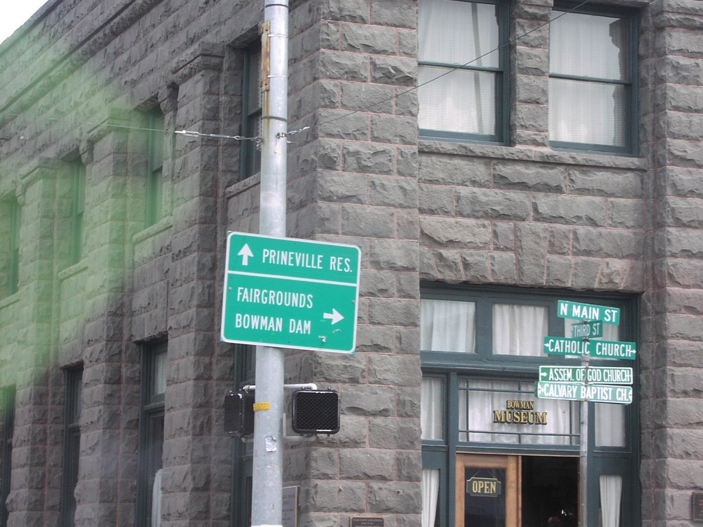
US-26 East at OR-27
US-26 east OR-27 south to Fairgrounds and Bowman Dam. Continue east on US-26 for Prineville Reservoir.
Taken 06-01-2001
 Prineville
Crook County
Oregon
United States
Prineville
Crook County
Oregon
United States