Signs From Oregon
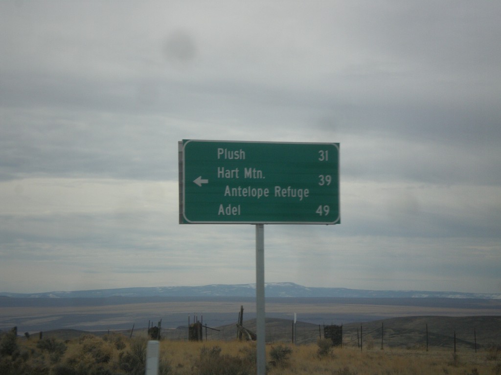
US-395 South - Hogback Road Jct.
US-395 South at Hogback Road Jct. Use Hogback Road for Plush, Hart Mountain Antelope Refuge, and Adel.
Taken 11-19-2017
 Lake County
Oregon
United States
Lake County
Oregon
United States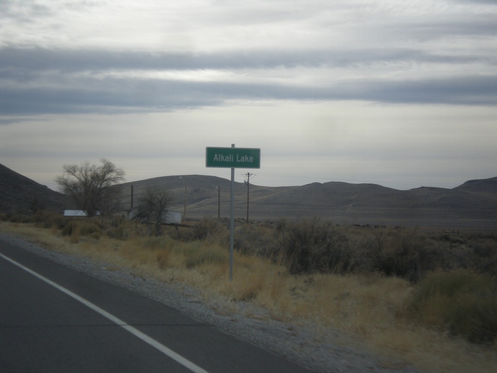
US-395 South - Alkali Lake
Entering Alkali Lake on US-395 south. Alkali Lake is home to a state rest area and a state highway maintenance station.
Taken 11-19-2017
Lakeview
Lake County
Oregon
United States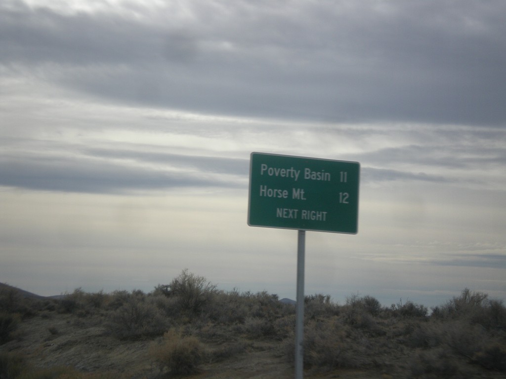
US-395 South - Horse Mountain Road
US-395 South approaching Horse Mountain Road to Horse Mountain and Poverty Basin.
Taken 11-19-2017
Lakeview
Lake County
Oregon
United States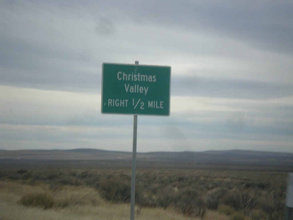
US-395 South Approaching Christmas Valley Junction
US-395 South approaching Christmas Valley junction in Lake County.
Taken 11-19-2017
Wagontire
Harney County
Oregon
United States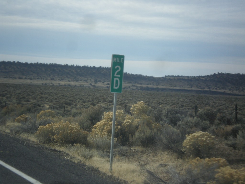
US-395 South - Milepost 2D
Milepost 2D on US-395 south. These types of mileposts have been appearing in Oregon in recent years. The letters represent the segment of the internal highway that this particular stretch is part of. In this case the D is the 4th named highway along US-395 south from the Washington line. (A=Umatilla-Stanfield, B=Pendleton-John Day, C=John Day Burns, D=Lakeview-Burns, E=Fremont).
Taken 11-19-2017
Riley
Harney County
Oregon
United States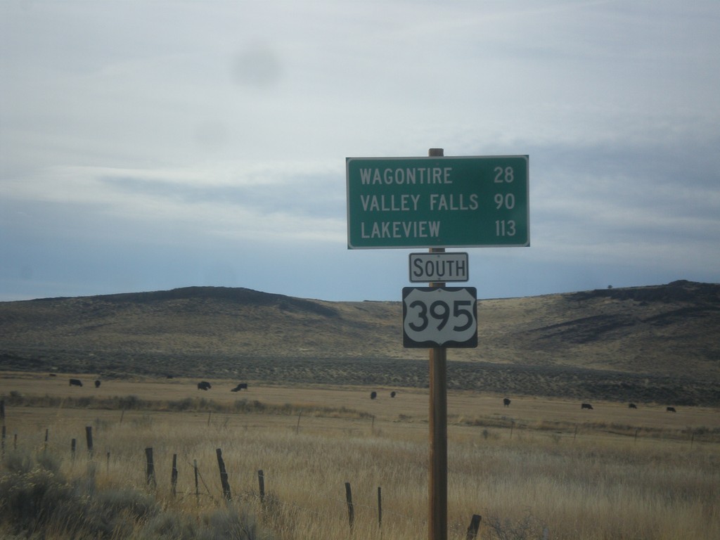
US-395 South - Distance Marker
Distance marker on US-395 south. Distance to Wagontire, Valley Falls, and Lakeview.
Taken 11-19-2017
Riley
Harney County
Oregon
United States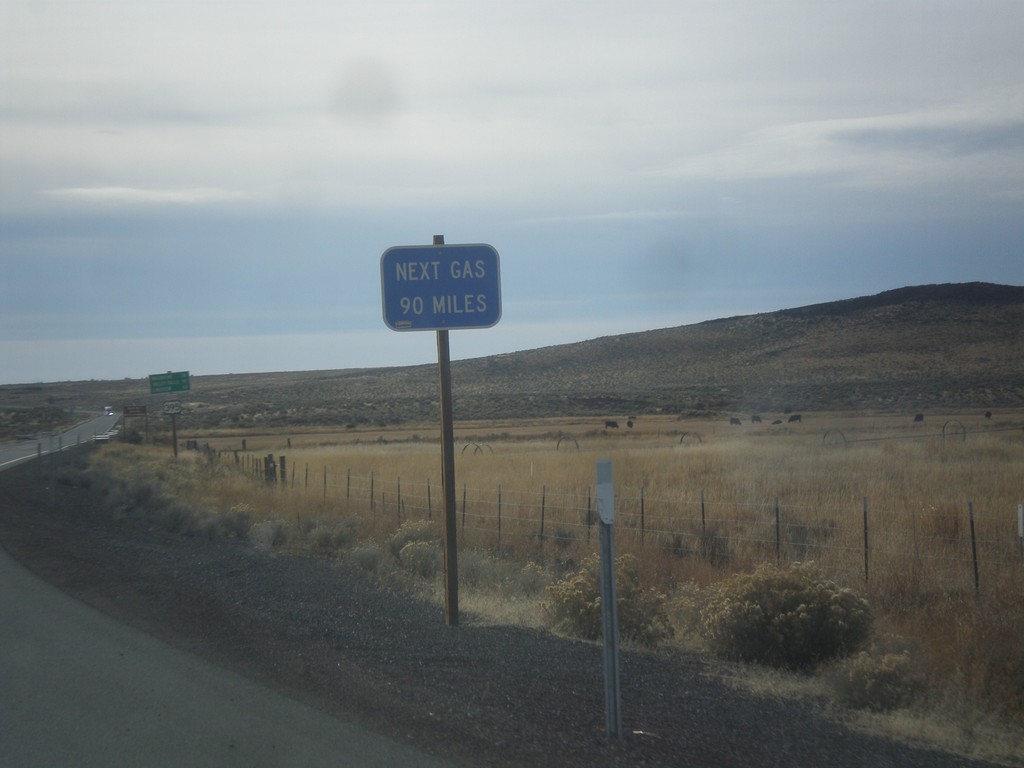
US-395 South - Next Gas 90 Miles
Next Gas 90 Miles on US-395 south. The next gas in this case is in Valley Falls. These types of signs are common in eastern Oregon after leaving a settlement with a gas pump.
Taken 11-19-2017
Riley
Harney County
Oregon
United States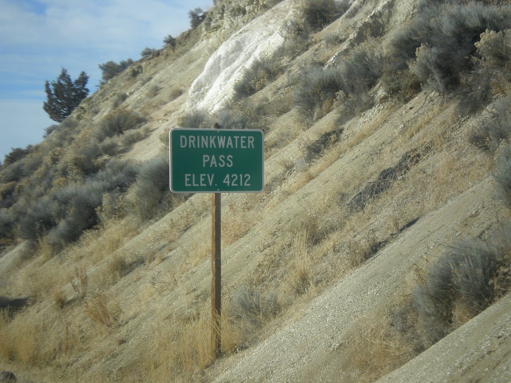
US-20 West - Drinkwater Pass
Drinkwater Pass - Elevation 4212 Feet on US-20 West.
Taken 11-19-2017
 Drewsey
Harney County
Oregon
United States
Drewsey
Harney County
Oregon
United States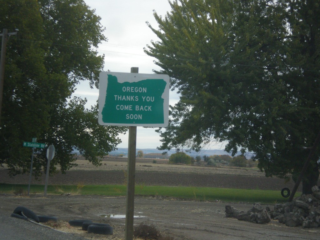
Oregon Thanks You - Come Back Soon on OR-201 South
Oregon Thanks You - Come Back Soon on OR-201 South approaching the Idaho border.
Taken 10-22-2017
 Adrian
Malheur County
Oregon
United States
Adrian
Malheur County
Oregon
United States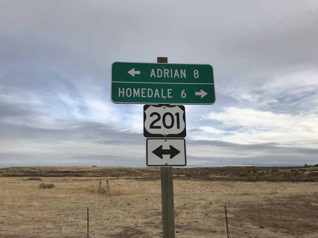
End Succor Creek Road at OR-201
End Succor Creek Road at OR-201. Use OR-201 south to Homedale (Idaho); use OR-201 north to Adrian. The OR-201 shield is incorrectly marked with a US shield.
Taken 10-22-2017
Adrian
Malheur County
Oregon
United States