Signs From Oregon
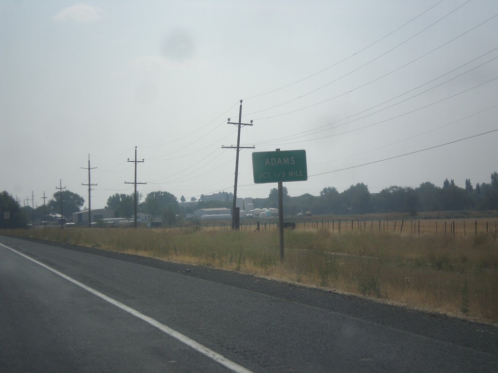
OR-11 South Approaching Adams Jct.
OR-11 South approaching Adams Jct.
Taken 09-09-2017
 Adams
Umatilla County
Oregon
United States
Adams
Umatilla County
Oregon
United States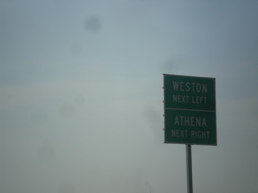
OR-11 South Approaching OR-334 and Banister Road
OR-11 South approaching (OR-334) west to Athena, and Banister Road east to Weston.
Taken 09-09-2017
 Athena
Umatilla County
Oregon
United States
Athena
Umatilla County
Oregon
United States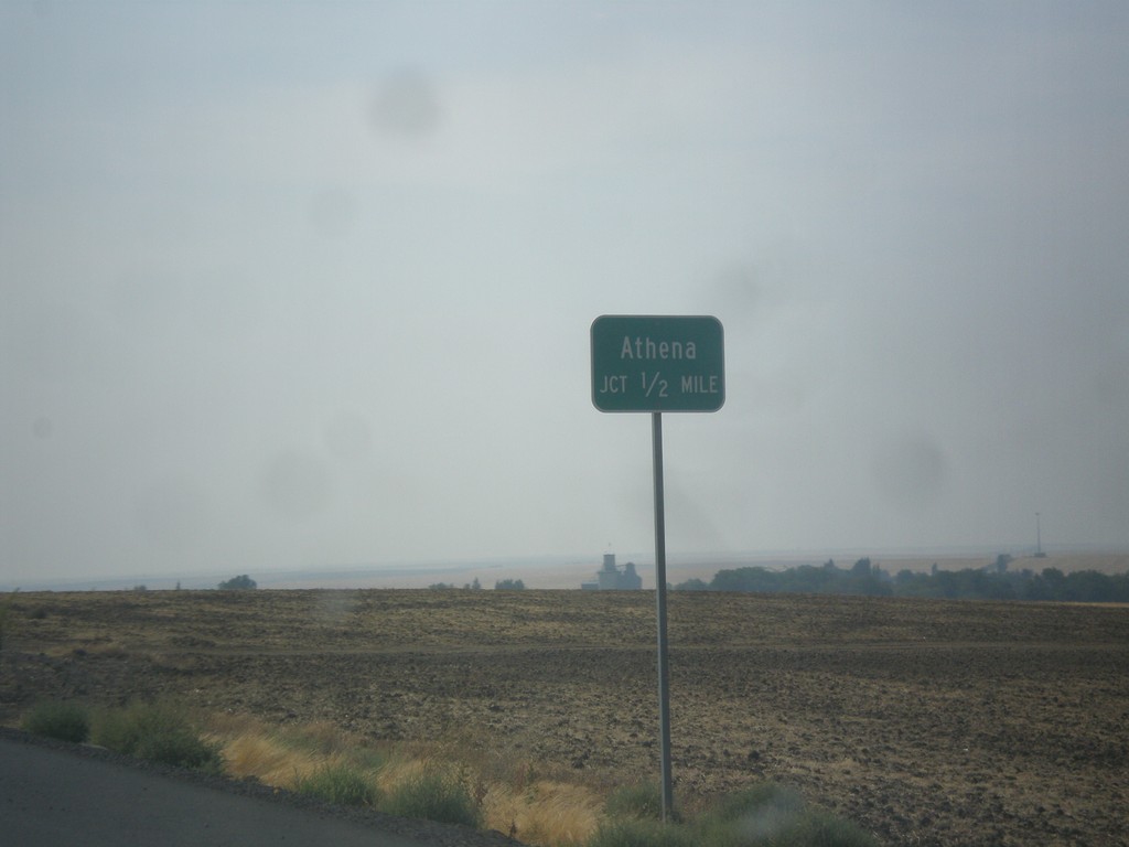
OR-11 South Approaching Athena Jct.
OR-11 South Approaching Athena Jct (unsigned OR-334).
Taken 09-09-2017
Athena
Umatilla County
Oregon
United States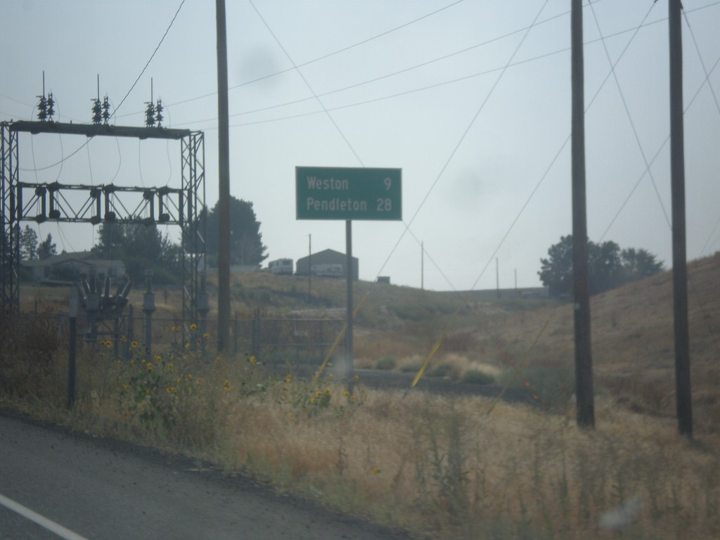
OR-11 South - Distance Marker
Distance marker on OR-11 south. Distance to Weston and Pendleton.
Taken 09-09-2017
Milton-Freewater
Umatilla County
Oregon
United States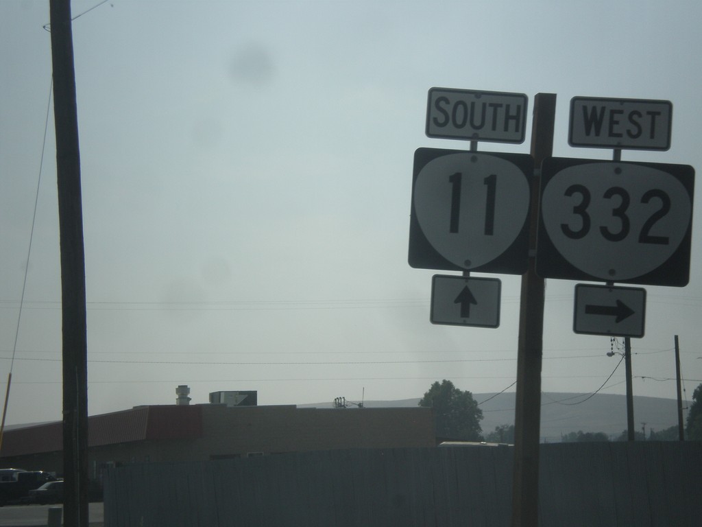
OR-11 South at OR-332
OR-11 south at OR-332 west in Umatilla County.
Taken 09-09-2017
 Milton-Freewater
Umatilla County
Oregon
United States
Milton-Freewater
Umatilla County
Oregon
United States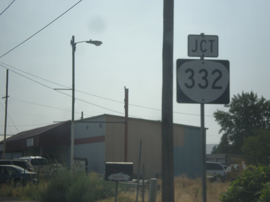
OR-11 South Approaching OR-332
OR-11 South approaching OR-332 in Umatilla County. OR-332 was recently signed as a state highway. In prior years this was just known as the Sunnyside-Umapine Highway #332, but without any route markers.
Taken 09-09-2017
Milton-Freewater
Umatilla County
Oregon
United States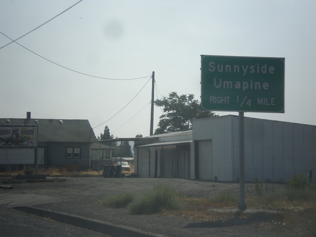
OR-11 South Approaching OR-332
OR-11 South approaching OR-332 to Sunnyside and Umapine.
Taken 09-09-2017
Milton-Freewater
Umatilla County
Oregon
United States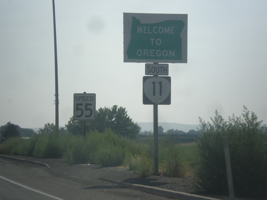
OR-11 South - Welcome To Oregon
Welcome to Oregon on OR-11 south at the Washington-Oregon state line. Also the first speed limit sign in Oregon is in the background - 55 MPH. Most Oregon speed limit signs omit the word Limit.
Taken 09-09-2017
Milton-Freewater
Umatilla County
Oregon
United States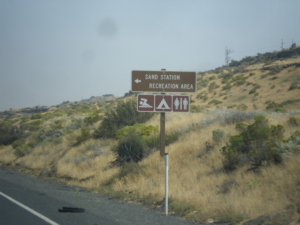
US-730 East - Sand Station Rec. Area
US-730 East at Sand Station Rec. Area on the Columbia River.
Taken 09-09-2017
 Helix
Umatilla County
Oregon
United States
Helix
Umatilla County
Oregon
United States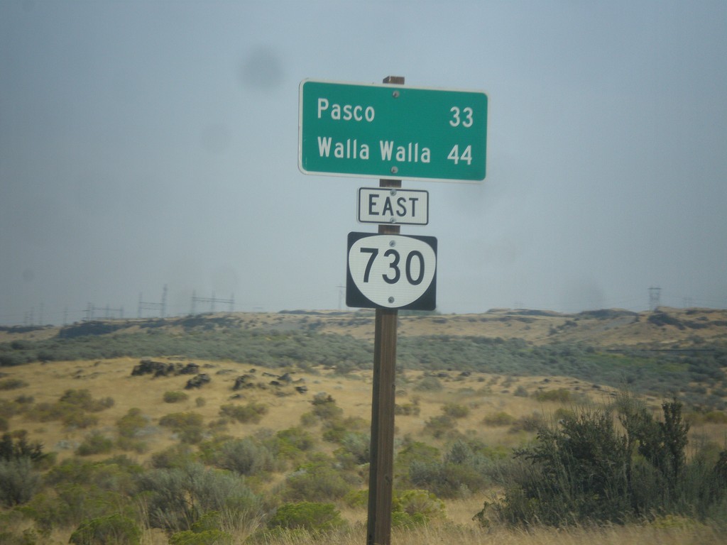
US-730 East - Distance Marker (Signed as OR-730)
Distance marker on US-730 east which is incorrectly signed as OR-730. Distance to Pasco (Washington) and Walla Walla (Washington).
Taken 09-09-2017
Hermiston
Umatilla County
Oregon
United States