Signs From Oregon
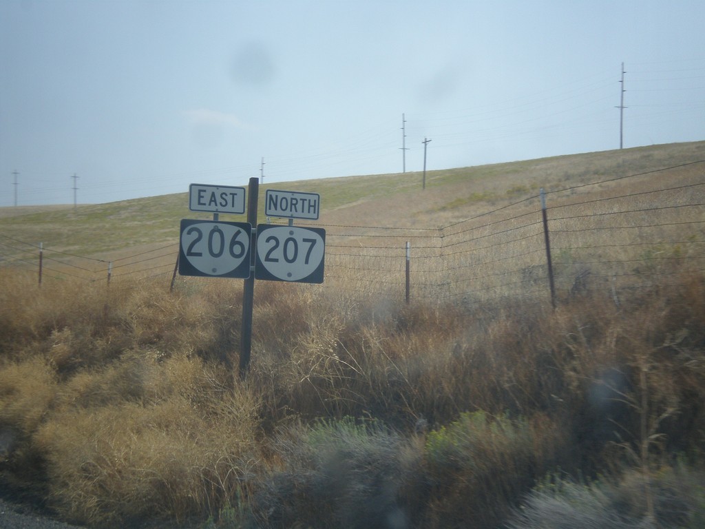
OR-206 East/OR-207 North - Morrow County
OR-206 East/OR-207 North in Morrow County.
Taken 09-09-2017

 Ruggs
Morrow County
Oregon
United States
Ruggs
Morrow County
Oregon
United States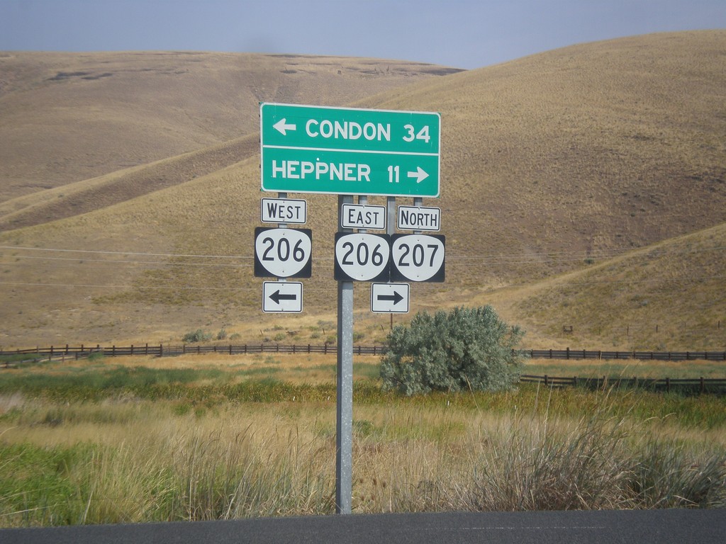
OR-207 North at OR-206
OR-207 North at OR-206 in Ruggs. Turn left for OR-206 West to Condon; turn right for OR-206 East/OR-207 North to Heppner. OR-207 joins OR-206 east to Heppner.
Taken 09-09-2017
Heppner
Morrow County
Oregon
United States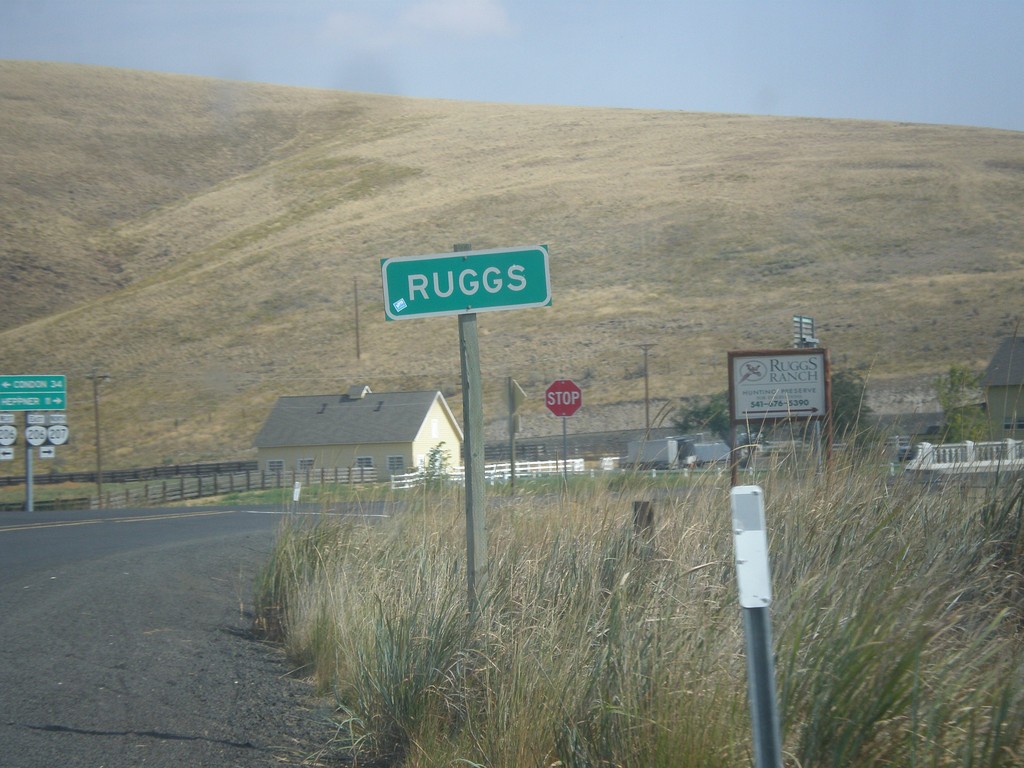
OR-207 North - Ruggs
Entering Ruggs on OR-207 north. Ruggs is a community along the junction of OR-207 and OR-206.
Taken 09-09-2017
Heppner
Morrow County
Oregon
United States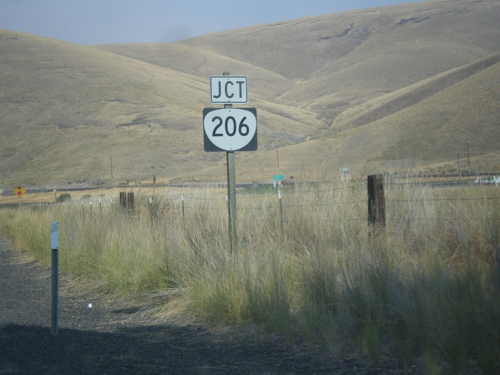
OR-207 North Approaching OR-206
OR-207 North approaching OR-206 in Morrow County.
Taken 09-09-2017
Heppner
Morrow County
Oregon
United States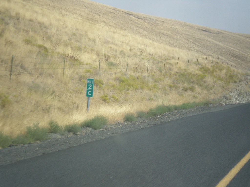
OR-207 North - Milepost
Milepost on OR-207 north - Mile 2C. Milepost 90 (B) on US-395 south. The C is because the state of Oregon maintains different internal highways along the state highway system. Some of the signed highways (like OR-207) span multiple internal highways. In this case this is the third internal highway south from the beginning of OR-207 at US-730 that belongs only to OR-207. The first (Hermiston Highway #333) is marked as an A on mileposts. The second (B) stretch is Lexington-Echo Highway #320. This stretch is the third (C) stretch (Heppner-Spray Highway #321). This type of milepost has been showing up in Oregon in the last 10 years, but not on all highways. I have seen it on US-395 and OR-207.
Taken 09-09-2017
Heppner
Morrow County
Oregon
United States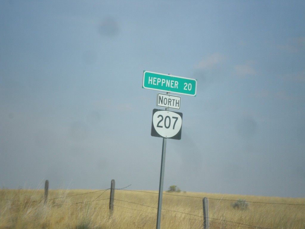
OR-207 North - Distance Marker
Distance marker on OR-207 north. Distance to Heppner.
Taken 09-09-2017
Heppner
Morrow County
Oregon
United States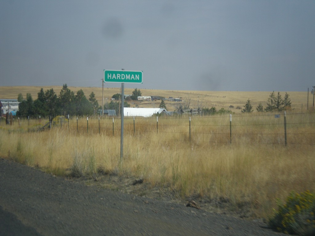
OR-207 North - Hardman
Entering the community of Hardman on OR-207 north. Hardman is a ghost town in Morrow County.
Taken 09-09-2017
Heppner
Morrow County
Oregon
United States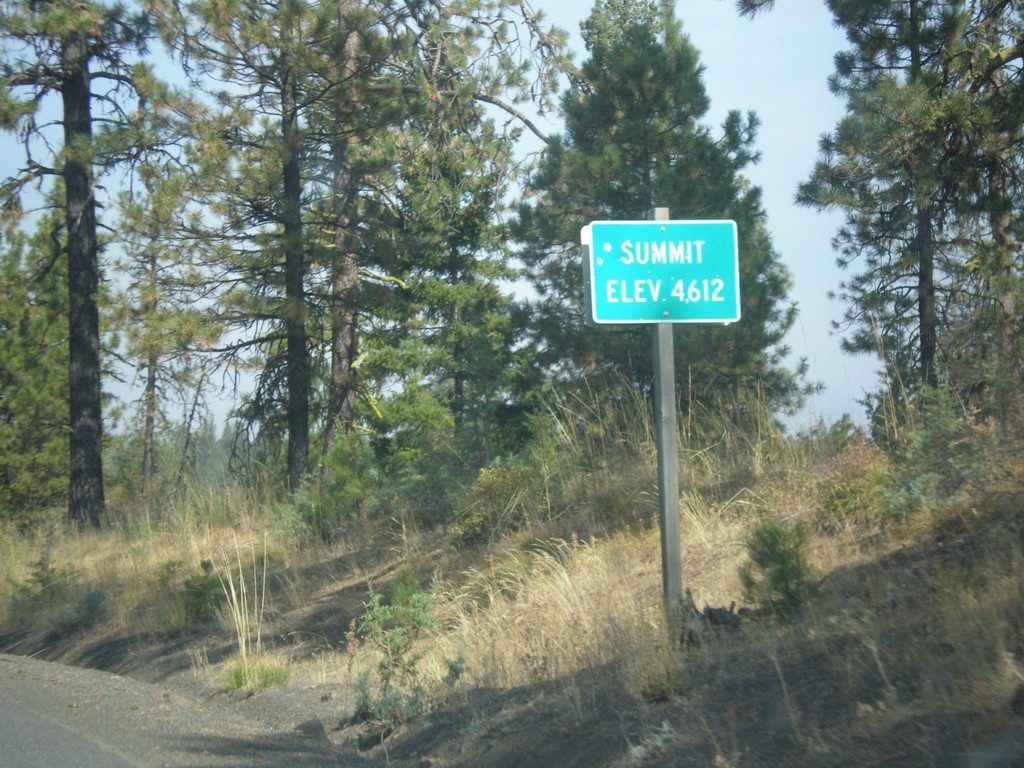
OR-207 North - Summit
Summit on OR-207 north - Elevation 4612 Feet.
Taken 09-09-2017
Spray
Wheeler County
Oregon
United States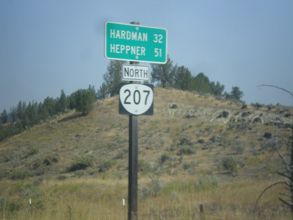
OR-207 North - Distance Marker
Distance marker on OR-207 north. Distance to Hardman and Heppner.
Taken 09-09-2017
Spray
Wheeler County
Oregon
United States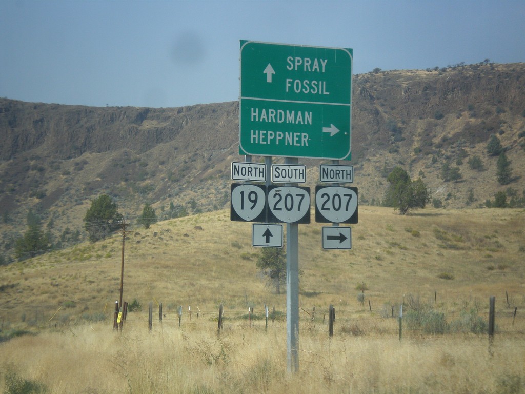
OR-19 North at OR-207 North
OR-19 North at OR-207 north near Spray. Use OR-207 north to Hardman and Heppner. Continue north on OR-19 and south on OR-207 to Spray and Fossil. OR-207 south joins OR-19 north to Service Creek.
Taken 09-09-2017
 Spray
Wheeler County
Oregon
United States
Spray
Wheeler County
Oregon
United States