Signs From Oregon
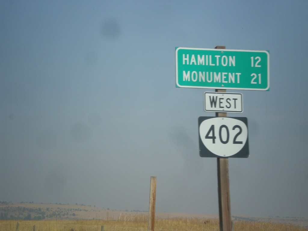
OR-402 West - Distance Marker
Distance marker on OR-402 west. Distance to Hamilton and Monument.
Taken 09-09-2017
 Long Creek
Grant County
Oregon
United States
Long Creek
Grant County
Oregon
United States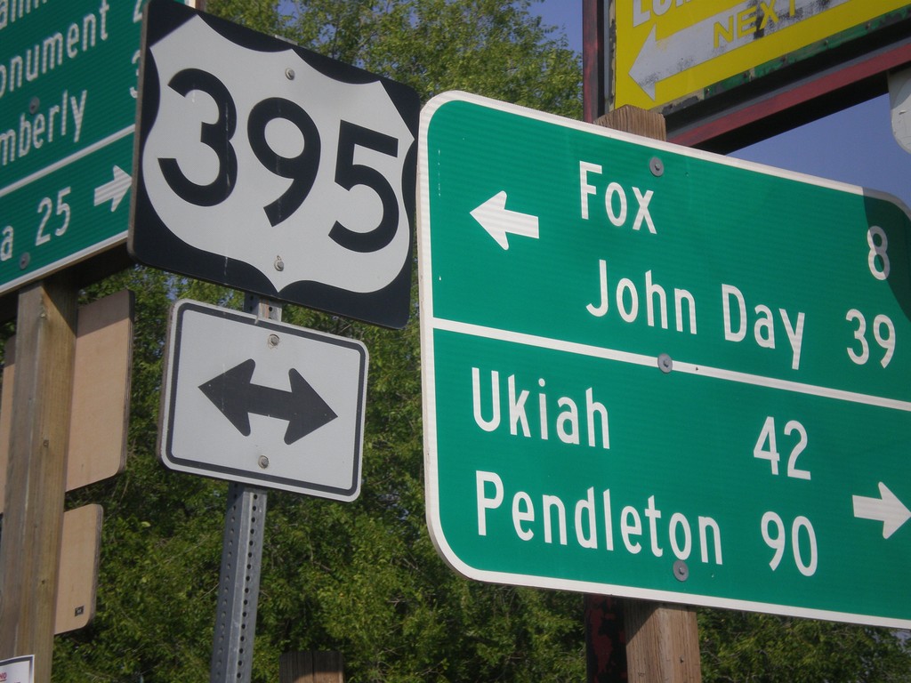
East Main St. at US-395/OR-402 in Long Creek
East Main St. at US-395/OR-402 in Long Creek. Turn left for US-395 north to Ukiah and Pendleton. Turn left for US-395 south to Fox and John Day.
Taken 09-09-2017
 Long Creek
Grant County
Oregon
United States
Long Creek
Grant County
Oregon
United States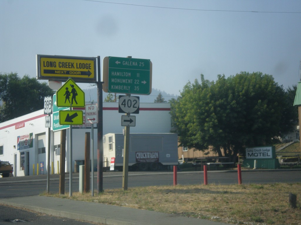
US-395 South at OR-402 West
US-395 south at OR-402 west to Hamilton, Monument, and Kimberly. Turn left for forest road east to Galena on the Middle Fork John Day River.
Taken 09-09-2017
Long Creek
Grant County
Oregon
United States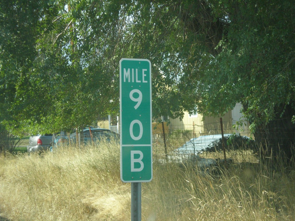
US-395 South - Mile 90 B
Milepost 90 (B) on US-395 south. The B is because the state of Oregon maintains different internal highways along the state highway system. Some of the signed highways (like US-395) span multiple internal highways. In this case this is the second internal highway south from the Washington border that belongs only to US-395. The first (Umatilla-Stanfield #54) is marked as an A on mileposts. This is the second (B) stretch - Pendleton - John Day #28). This type of milepost has been showing up in Oregon in the last 10 years, but not on all highways. I have seen it on US-395 and OR-207.
Taken 09-09-2017
Long Creek
Grant County
Oregon
United States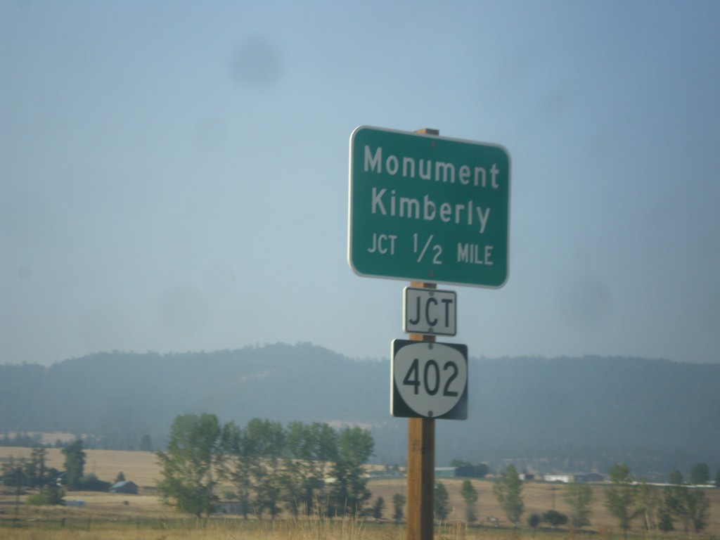
US-395 South Approaching OR-402
US-395 South approaching OR-402 in Long Creek. Use OR-402 west for Monument and Kimberly.
Taken 09-09-2017
Long Creek
Grant County
Oregon
United States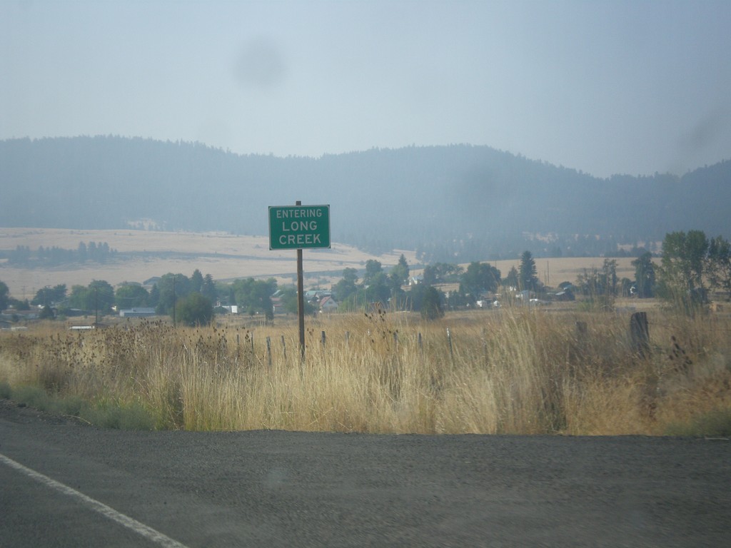
US-395 South - Entering Long Creek
Entering Long Creek on US-395 south.
Taken 09-09-2017
Long Creek
Grant County
Oregon
United States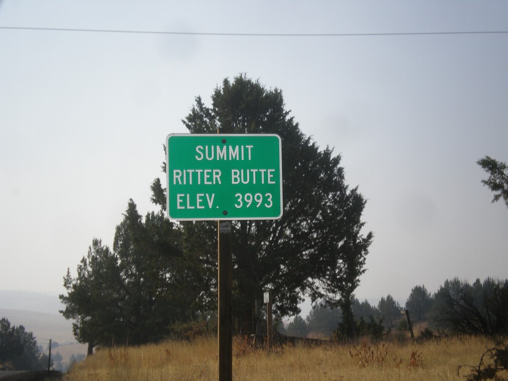
US-395 South - Ritter Butte Summit
US-395 South - Summit Ritter Butte - Elevation 3993 Feet.
Taken 09-09-2017
Ritter
Grant County
Oregon
United States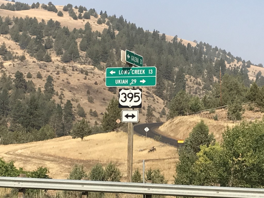
Middle Fork John Day River Road at US-395
Middle Fork John Day River Road at US-395 in Grant County. Turn left for US-395 south to Long Creek; left for US-395 north to Ukiah.
Taken 09-09-2017
Long Creek
Grant County
Oregon
United States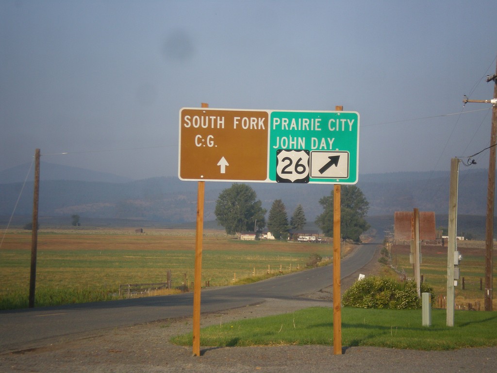
US-26 West - Burnt River Lane
US-26 West at Burnt River Lane in Unity. Merge left for South Fork (Burnt River) Campground. Merge right for US-26 west to Prairie City and John Day.
Taken 09-09-2017
 Unity
Baker County
Oregon
United States
Unity
Baker County
Oregon
United States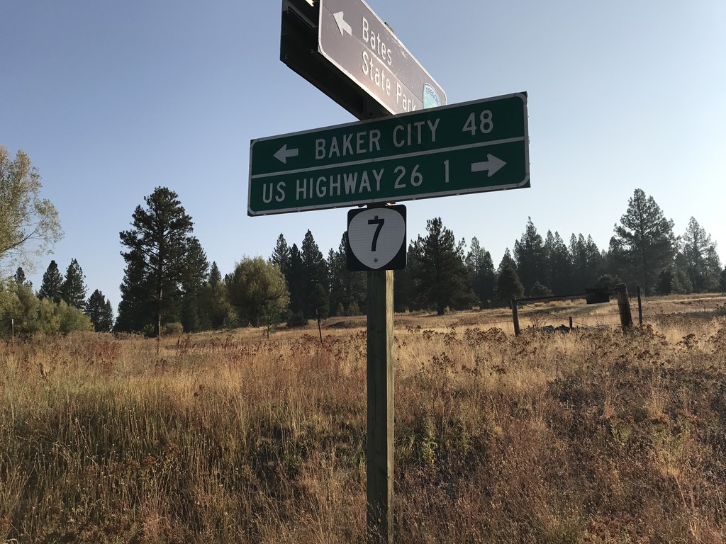
End Middle Fork John Day River Road at OR-7
End Middle Fork John Day River Road at OR-7 in Grant County. Use OR-7 west for US-26 Jct; OR-7 east for Baker City.
Taken 09-09-2017
 Austin
Grant County
Oregon
United States
Austin
Grant County
Oregon
United States