Signs From Oregon
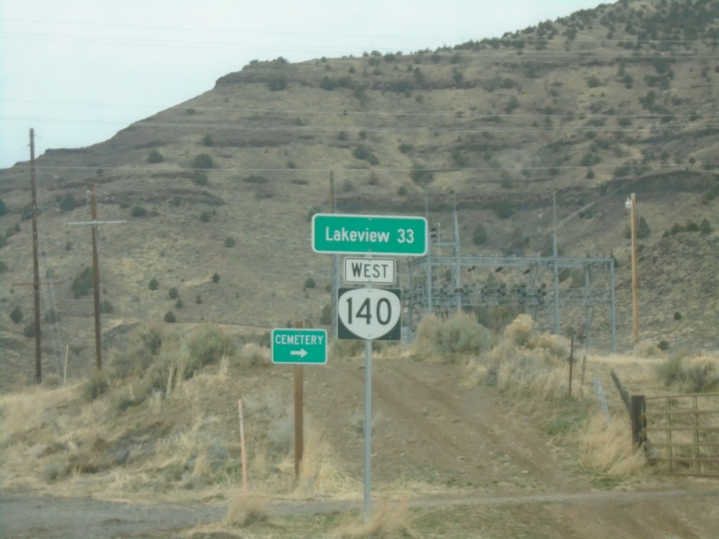
OR-140 West - Distance Marker
Distance marker on OR-140 west. Distance to Lakeview.
Taken 02-14-2026
 Adel
Lake County
Oregon
United States
Adel
Lake County
Oregon
United States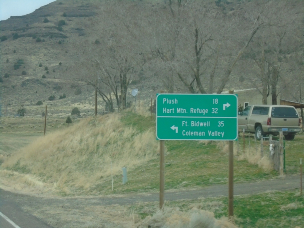
OR-140 West at Twentymile Road
OR-140 West at Twentymile Road in Adel. Turn right for Plush and Hart Mountain Refuge; turn left for Fort Bidwell (California) and Coleman Valley.
Taken 02-14-2026
Adel
Lake County
Oregon
United States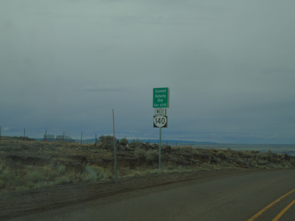
OR-140 West - Summit - Doherty Rim
Doherty Rim Summit, Elevation 6,240 Feet on OR-140 west in rural Lake County.
Taken 02-14-2026
Adel
Lake County
Oregon
United States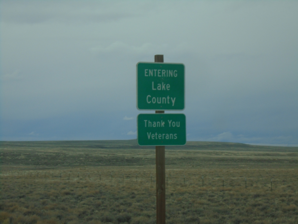
OR-140 West - Lake County
Entering Lake County on OR-140 west. A sign beneath reads Thank You Veterans. Many of the county boundaries in southern and eastern Oregon, as well as northern California have a message thanking veterans.
Taken 02-14-2026
Lake County
Oregon
United States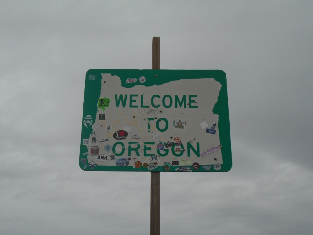
OR-140 West - Welcome To Oregon
Welcome to Oregon on OR-140 west. Taken at the Oregon-Nevada State Line.
Taken 02-14-2026
Harney County
Oregon
United States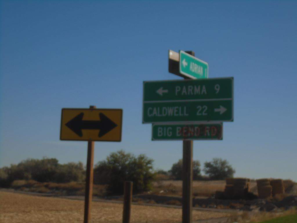
OR-452 East at OR-454
OR-452 East at OR-454 (Big Bend Road) in Malheur County. Turn right for OR-454 East to Caldwell (Idaho); turn left for OR-452 East to Parma (Idaho). OR-452 and OR-454 are both unsigned for their entire length.
Taken 10-19-2024

 Adrian
Malheur County
Oregon
United States
Adrian
Malheur County
Oregon
United States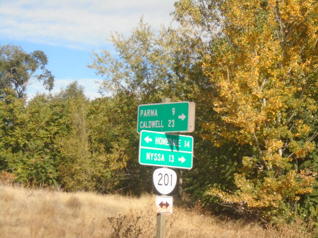
OR-201 North at OR-452
OR-201 North at OR-452 (unsigned) in Adrian. Turn right for OR-452 east to Parma (Idaho) and Caldwell (Idaho). Use OR-201 North to Nyssa; OR-201 South to Homedale (Idaho).
Taken 10-19-2024
 Adrian
Malheur County
Oregon
United States
Adrian
Malheur County
Oregon
United States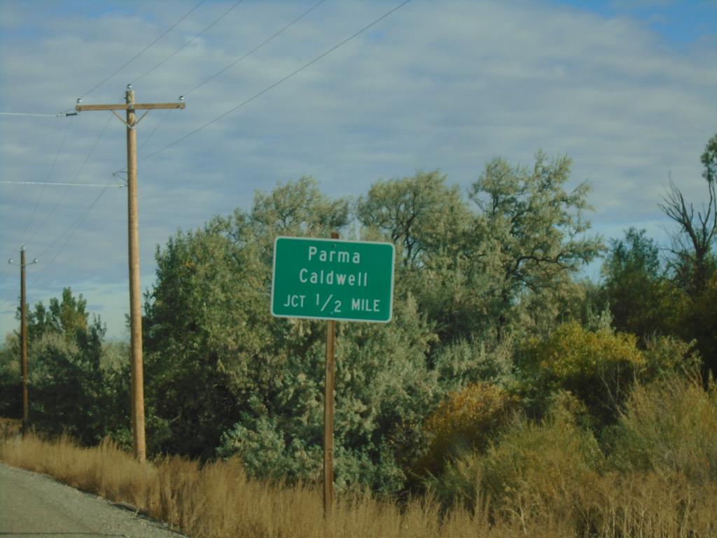
OR-201 North Approaching OR-452
OR-201 North approaching OR-452 (unsigned) to Parma (Idaho) and Caldwell (Idaho).
Taken 10-19-2024
Adrian
Malheur County
Oregon
United States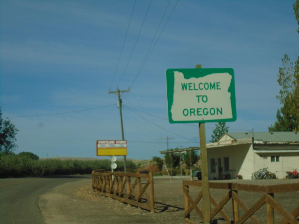
OR-201 North - Welcome To Oregon
Welcome to Oregon on OR-201 North. Taken at the Idaho/Oregon state line.
Taken 10-19-2024
Adrian
Malheur County
Oregon
United States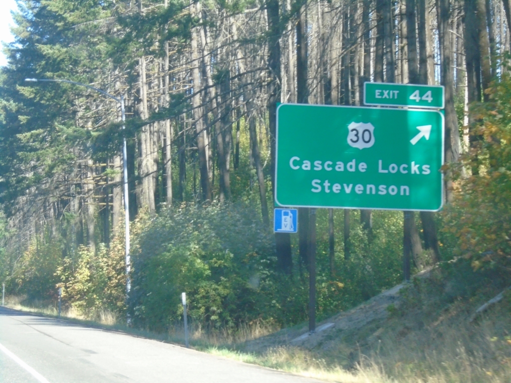
I-84 East - Exit 44
I-84 east at Exit 44 - US-30/Cascade Locks/Stevenson (WA). US-30 leaves I-84 eastbound here, and rejoins the freeway on the the east side of Cascade Locks.
Taken 09-28-2024

 Cascade Locks
Hood River County
Oregon
United States
Cascade Locks
Hood River County
Oregon
United States