Signs From Utah
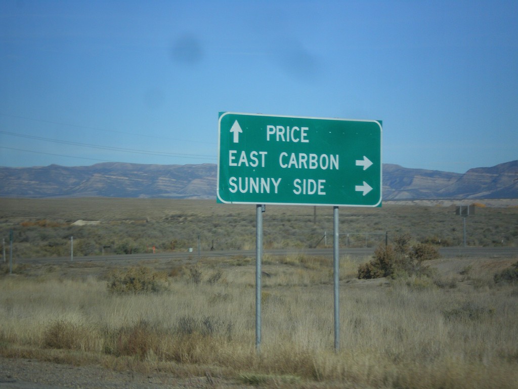
US-6 West/US-191 North Approaching UT-123
US-6 West/US-191 North approaching UT-123. Use UT-123 for East Carbon and Sunnyside. Continue on US-6 West/US-191 North for Price.
Taken 10-20-2012


 Price
Carbon County
Utah
United States
Price
Carbon County
Utah
United States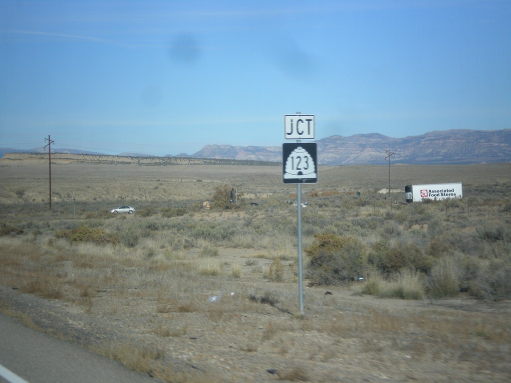
US-6 West/US-191 North Approaching UT-123
US-6 West/US-191 North approaching UT-123.
Taken 10-20-2012
Price
Carbon County
Utah
United States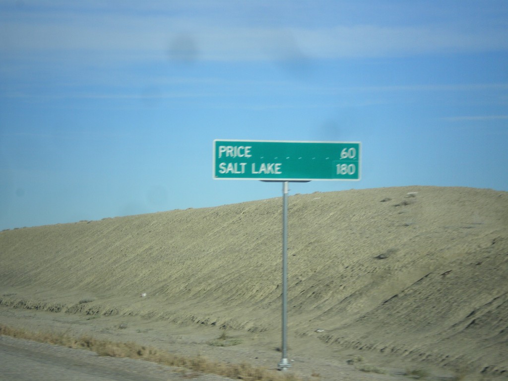
US-6 West/US-191 North - Distance Marker
Distance marker on US-6 West/US-191 North. Distance to Price and Salt Lake. Taken just north of I-70.
Taken 10-20-2012
Green River
Emery County
Utah
United States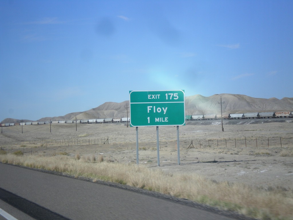
I-70 East Approaching Exit 175
I-70 east approaching Exit 175 - Floy. This exit previously was called Ranch Exit.
Taken 10-19-2012

 Green River
Grand County
Utah
United States
Green River
Grand County
Utah
United States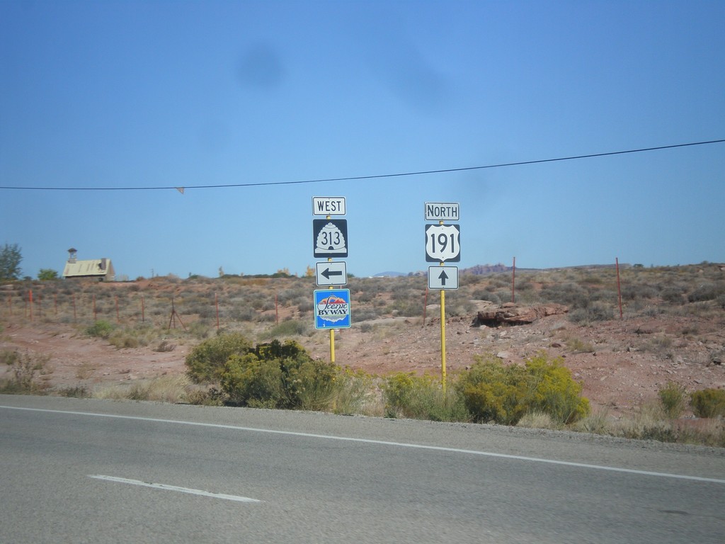
US-191 North at UT-313
US-191 North at UT-313. UT-313 is signed as a Utah Scenic Byway. UT-313 connects US-191 with Dead Horse Point State Park, and the Island in the Sky unit of Canyonlands.
Taken 10-17-2012
 Moab
Grand County
Utah
United States
Moab
Grand County
Utah
United States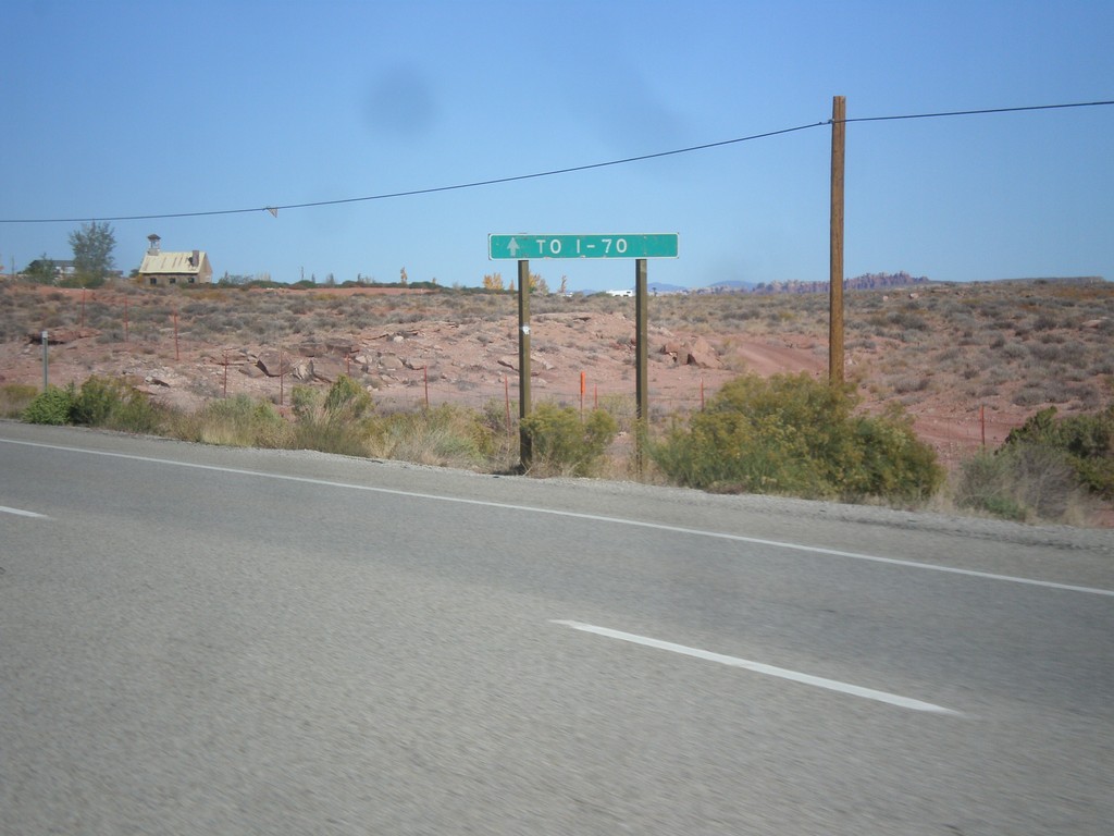
US-191 North Approaching UT-313
US-191 north approaching UT-313. Continue north on US-191 north for I-70.
Taken 10-17-2012
Moab
Grand County
Utah
United States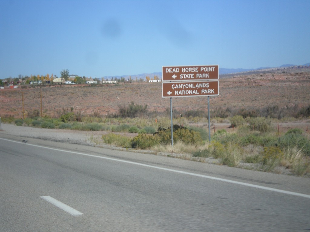
US-191 North Approaching UT-313
US-191 north approaching UT-313. Use UT-313 west for Dead Horse Point State Park, and Canyonlands National Park (Island In The Sky Unit).
Taken 10-17-2012
Moab
Grand County
Utah
United States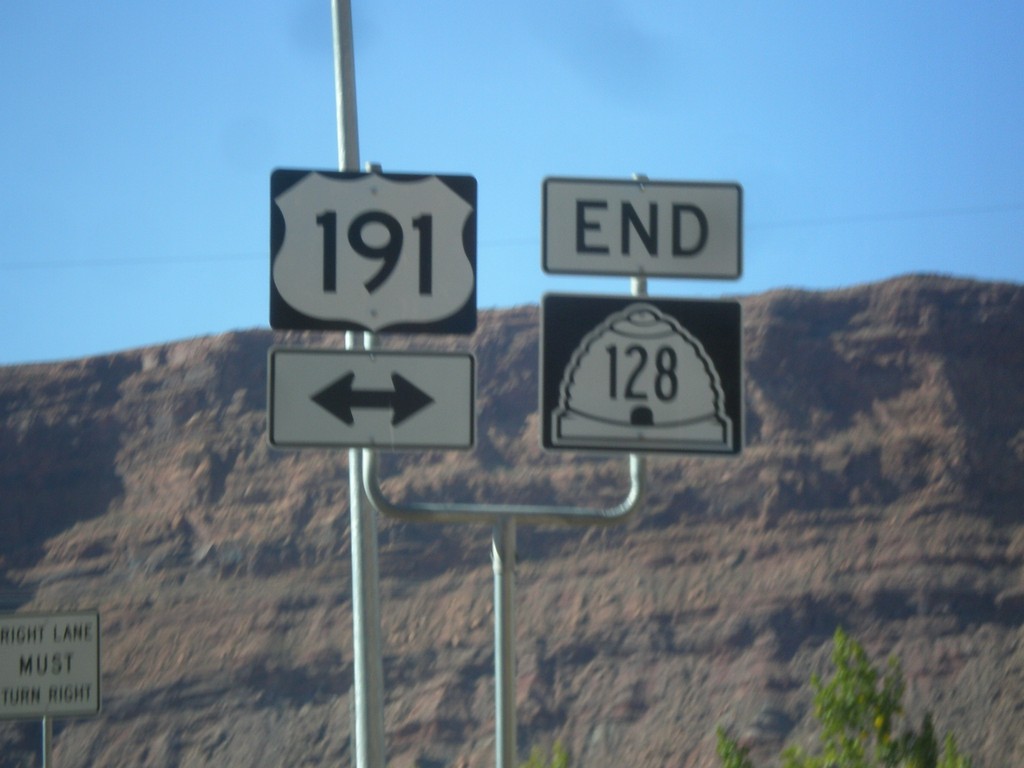
End UT-128 East at US-191
End UT-128 east at US-191 in Moab. This intersection has been replaced with a stoplight in recent years. UT-128 follows the south side of the Colorado River east from Moab towards Colorado.
Taken 10-17-2012
 Moab
Grand County
Utah
United States
Moab
Grand County
Utah
United States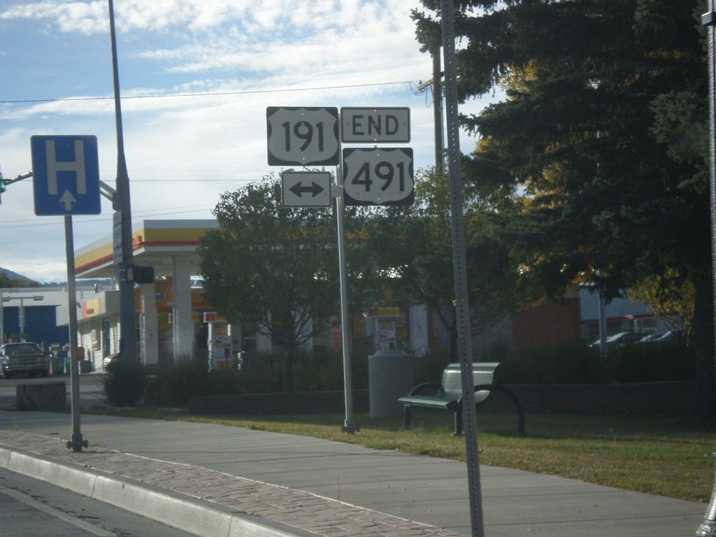
End US-491 North at US-191
End US-491 north at US-191 in Monticello. US-491 is former highway US-666, and runs from Gallup, New Mexico to Monticello, Utah. This is the northern terminus of US-491.
Taken 10-15-2012
 Monticello
San Juan County
Utah
United States
Monticello
San Juan County
Utah
United States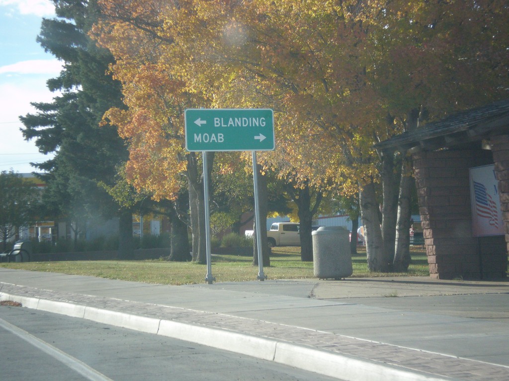
End US-491 at US-191
End US-491 at US-191. Use US-191 north for Moab; US-191 south for Blanding.
Taken 10-15-2012
Monticello
San Juan County
Utah
United States