Signs From Utah
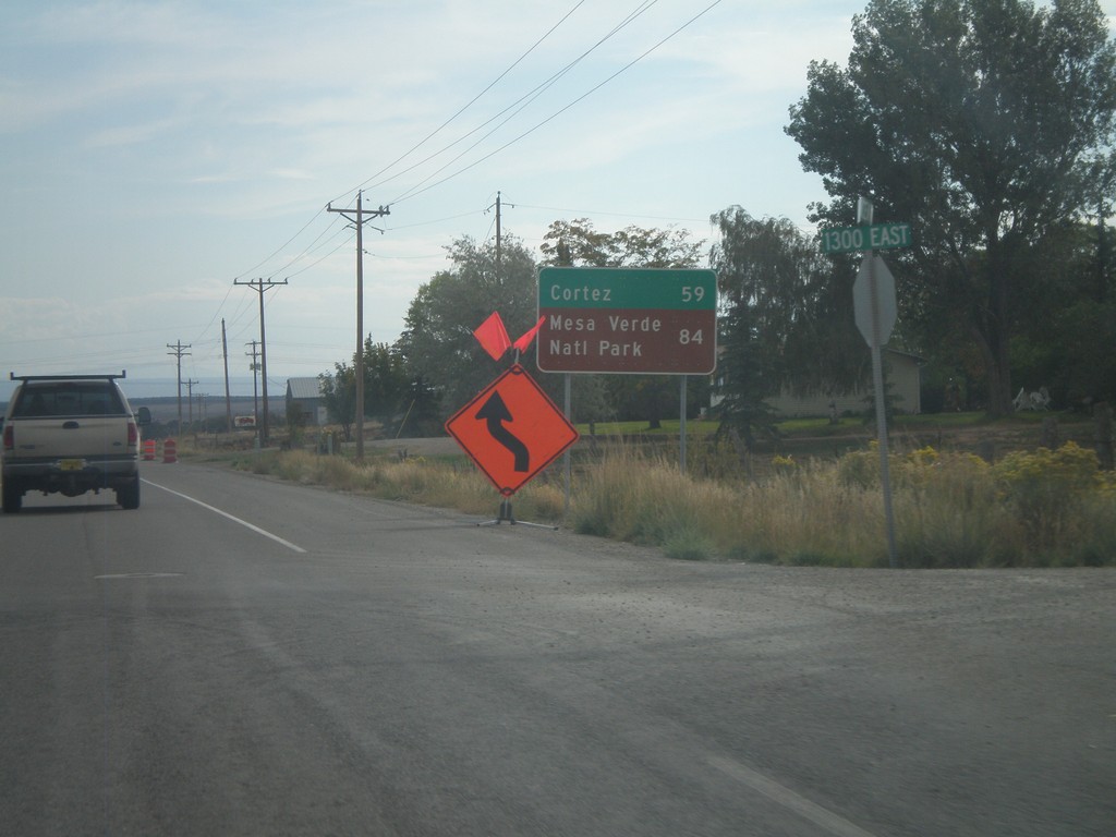
US-491 South - Distance Marker
Distance marker on US-491 south. Distance to Cortez and Mesa Verde National Park (both in Colorado). Taken on the east side of Monticello.
Taken 10-02-2011
 Monticello
San Juan County
Utah
United States
Monticello
San Juan County
Utah
United States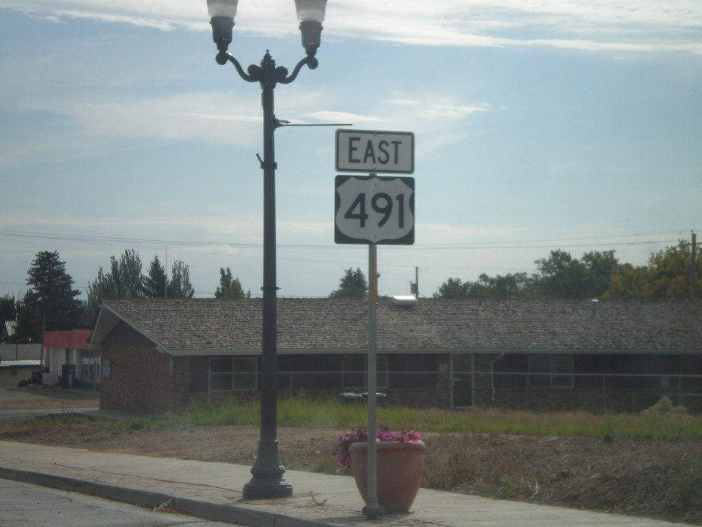
US-491 South - Monticello
US-491 south in Monticello. This is the first US-491 shield on US-491 southbound. US-491 was formerly US-666 until it was renamed in 2003.
Taken 10-02-2011
Monticello
San Juan County
Utah
United States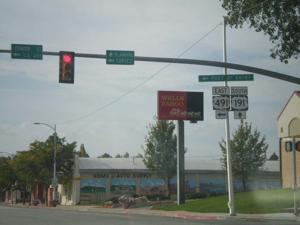
US-191 South at US-491
US-191 South at US-491. Use US-491 east for Cortez (Colorado); continue south on US-191 for Blanding. This is the northern end of US-491. Also US-491 east for the (Utah) Port of Entry.
Taken 10-02-2011
 Monticello
San Juan County
Utah
United States
Monticello
San Juan County
Utah
United States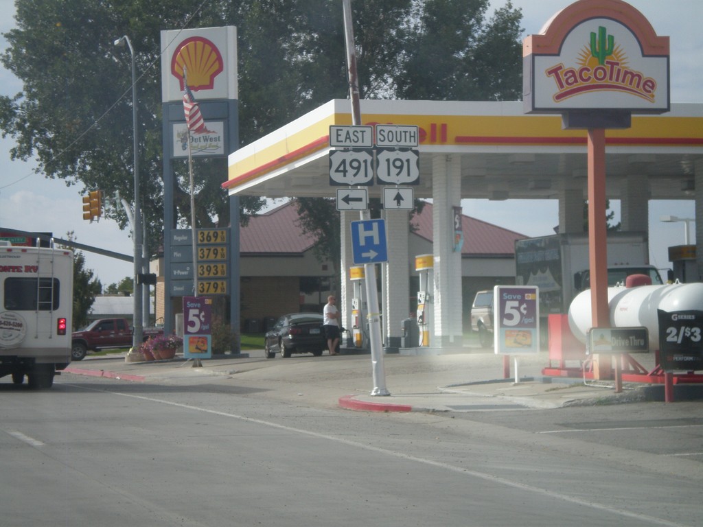
US-191 South Approaching US-491
US-191 south approaching US-491 east. US-491 is a north-south highway, but is signed as an east-west highway in Utah.
Taken 10-02-2011
Monticello
San Juan County
Utah
United States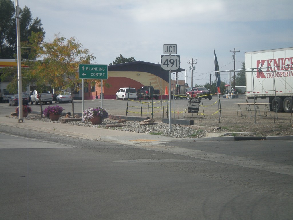
US-191 South Approaching US-491
US-191 south approaching US-491 east. Use US-491 south for Cortez (Colorado); continue south on US-491 for Blanding.
Taken 10-02-2011
Monticello
San Juan County
Utah
United States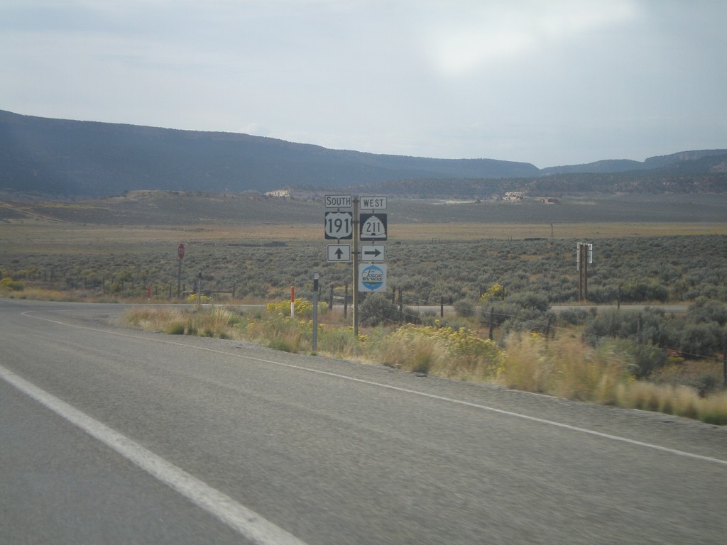
US-191 South at UT-211 West
US-191 South at UT-211 in San Juan County. UT-211 is a Utah Scenic Byway.
Taken 10-02-2011
 Monticello
San Juan County
Utah
United States
Monticello
San Juan County
Utah
United States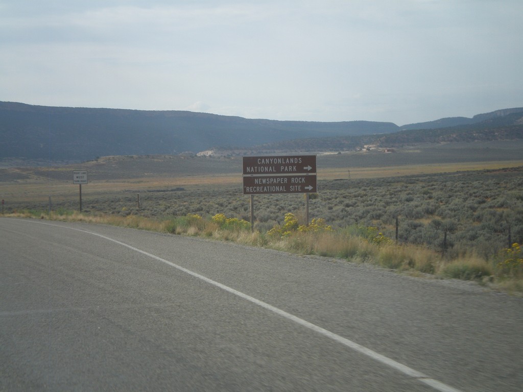
US-191 South Approaching UT-211
US-191 South approaching UT-211 west. Use UT-211 west for Canyonlands National Park (Needles District), and Newspaper Rock Recreational Site.
Taken 10-02-2011
Monticello
San Juan County
Utah
United States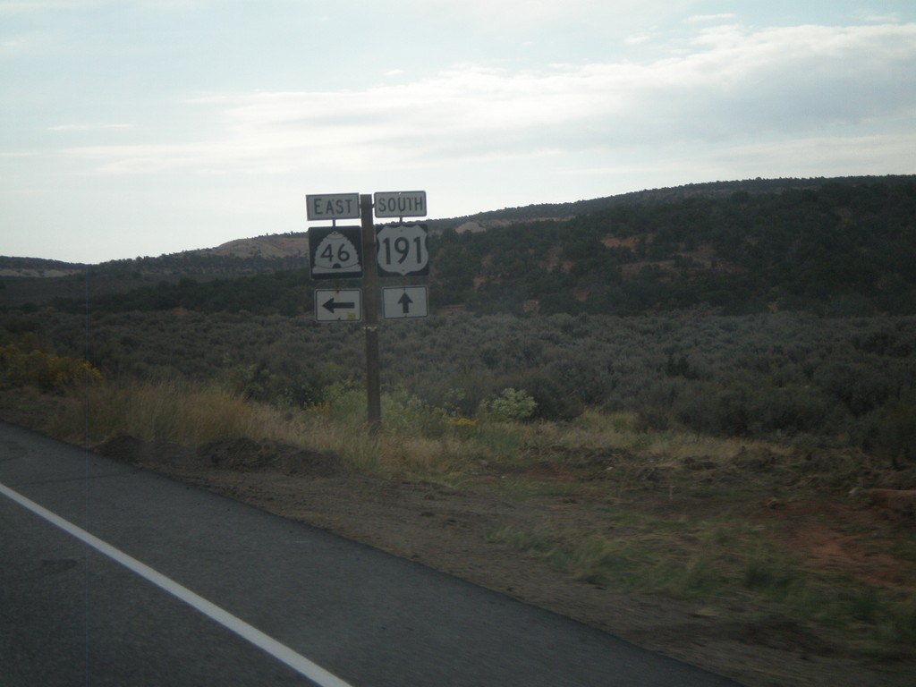
US-191 South at UT-46 East
US-191 South at UT-46 East at La Sal Junction.
Taken 10-02-2011
 La Sal
San Juan County
Utah
United States
La Sal
San Juan County
Utah
United States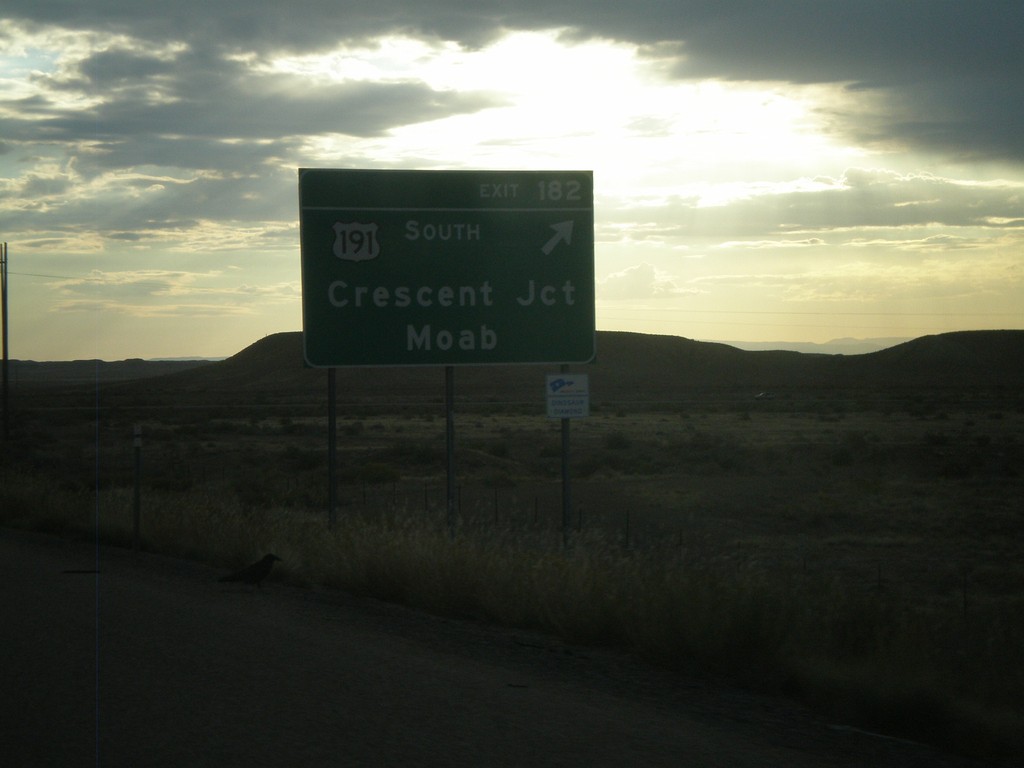
I-70 East - Exit 182
I-70 east at Exit 182 - US-191 South/Crescent Junction/Moab. US-191 south leaves I-70 here.
Taken 10-02-2011


 Crescent Junction
Grand County
Utah
United States
Crescent Junction
Grand County
Utah
United States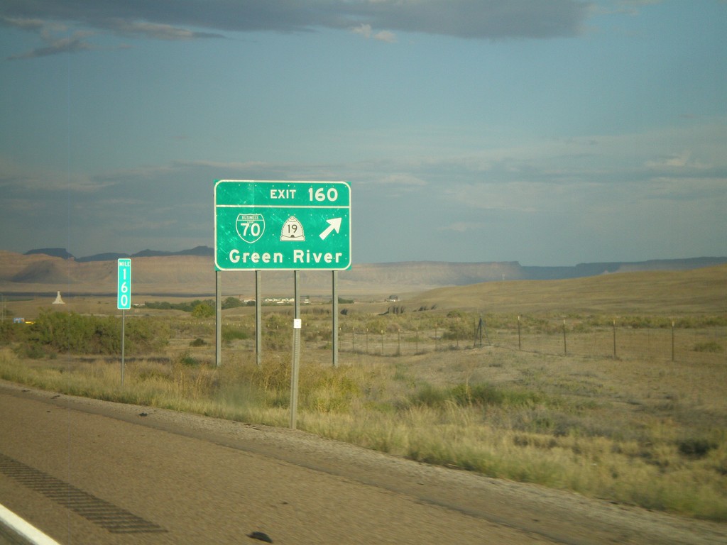
I-70 East - Exit 160
I-70 east at Exit 160 - BL-70/UT-19/Green River.
Taken 10-01-2011

 Green River
Emery County
Utah
United States
Green River
Emery County
Utah
United States