Signs From Utah
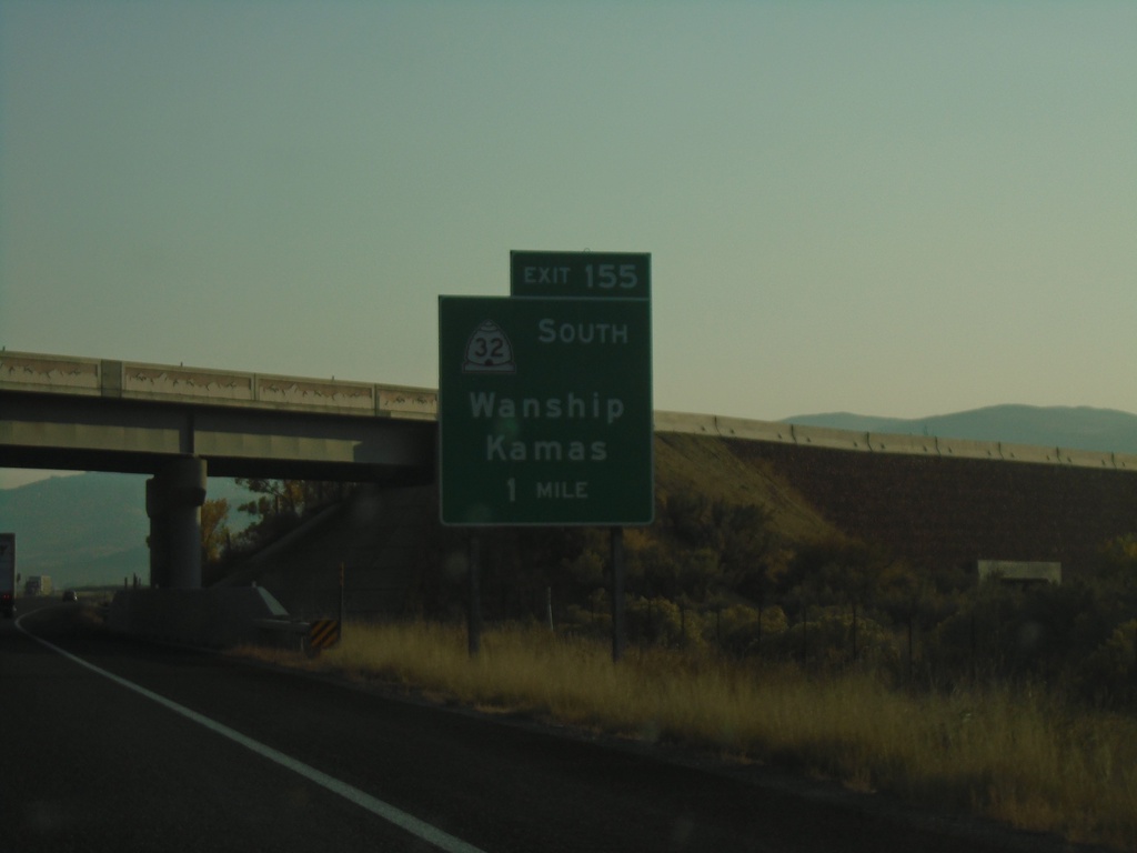
I-80 West - Exit 155
I-80 west approaching Exit 155 - UT-32 South/Wanship/Kamas.
Taken 10-03-2020

 Coalville
Summit County
Utah
United States
Coalville
Summit County
Utah
United States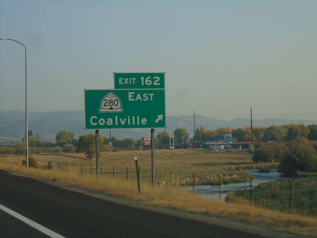
I-80 West - Exit 162
I-80 west at Exit 162 - UT-280 East/Coalville. The Weber River is in the background. Coalville is the county seat of Summit County.
Taken 10-03-2020
 Coalville
Summit County
Utah
United States
Coalville
Summit County
Utah
United States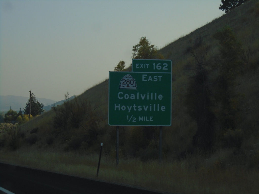
I-80 West - Exit 162
I-80 west approaching Exit 162 - UT-280 East/Hoytsville/Coalville.
Taken 10-03-2020
Coalville
Summit County
Utah
United States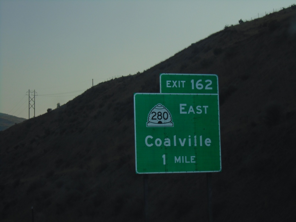
I-80 West - Exit 162
I-80 west approaching Exit 162 - UT-280 East/Coalville.
Taken 10-03-2020
Coalville
Summit County
Utah
United States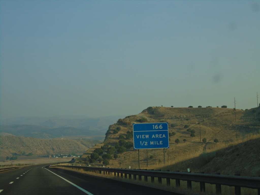
I-80 West Approaching View Area
I-80 West approaching View Area (166). Notice the exit tab area of the sign only has a number, not an EXIT text.
Taken 10-03-2020
Coalville
Summit County
Utah
United States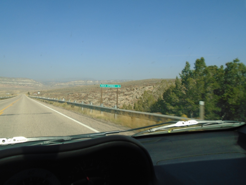
US-191 North - Distance Marker
Distance marker on US-191 north. Distance to Rock Springs (Wyoming). This is the last distance marker on US-191 north in Utah.
Taken 10-03-2020
 Dutch John
Daggett County
Utah
United States
Dutch John
Daggett County
Utah
United States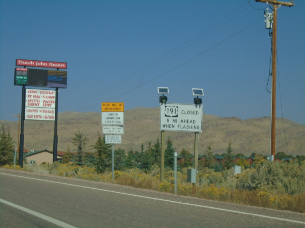
US-191 North - Winter Driving Information
Winter Driving information for US-191 north in Wyoming - 8 miles ahead.
Taken 10-03-2020
Dutch John
Daggett County
Utah
United States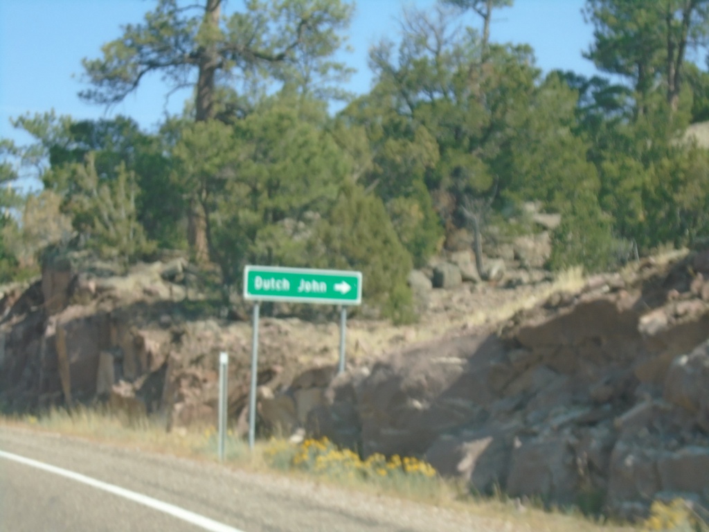
US-191 North - Dutch John
US-191 North at Dutch John junction.
Taken 10-03-2020
Dutch John
Daggett County
Utah
United States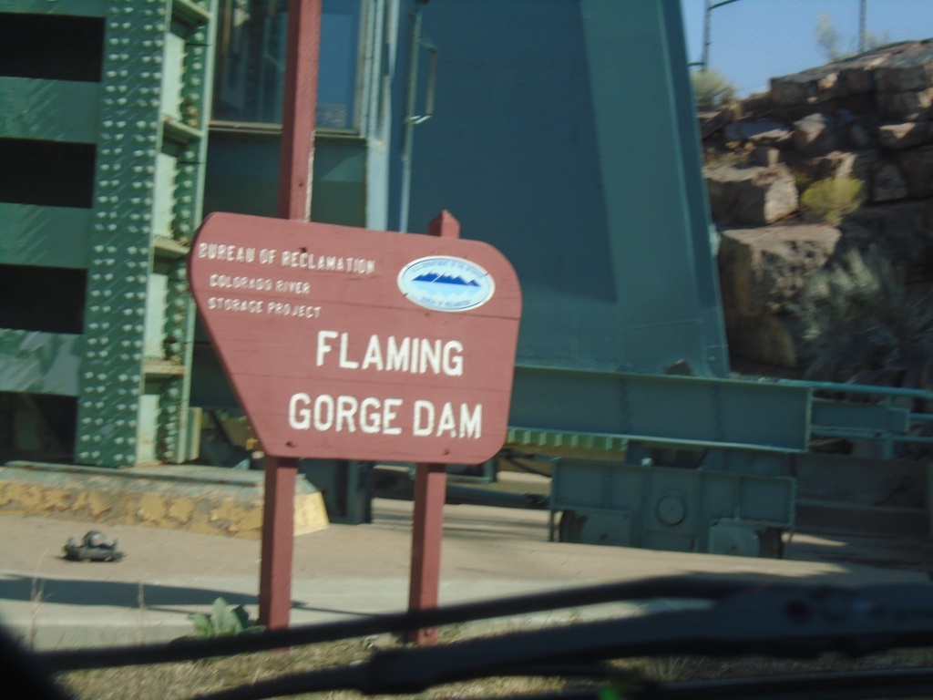
US-191 North - Flaming Gorge Dam
Flaming Gorge Dam on US-191 north. The Flaming Gorge Dam is on the Green River. Behind the dam is Flaming Gorge Reservoir which is part in Utah, and part in Wyoming.
Taken 10-03-2020
Dutch John
Daggett County
Utah
United States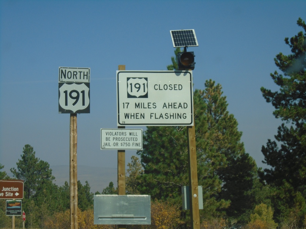
US-191 North - Daggett County
US-191 north in Daggett County. Winter closure sign for US-191 in Wyoming - 17 miles ahead. The winter closure sign appears to have been placed by the Wyoming DOT.
Taken 10-03-2020
Dutch John
Daggett County
Utah
United States