Signs From Utah
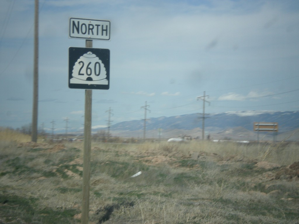
UT-260 North - Sevier County
UT-260 North in Sevier County,
Taken 03-29-2018
 Aurora
Sevier County
Utah
United States
Aurora
Sevier County
Utah
United States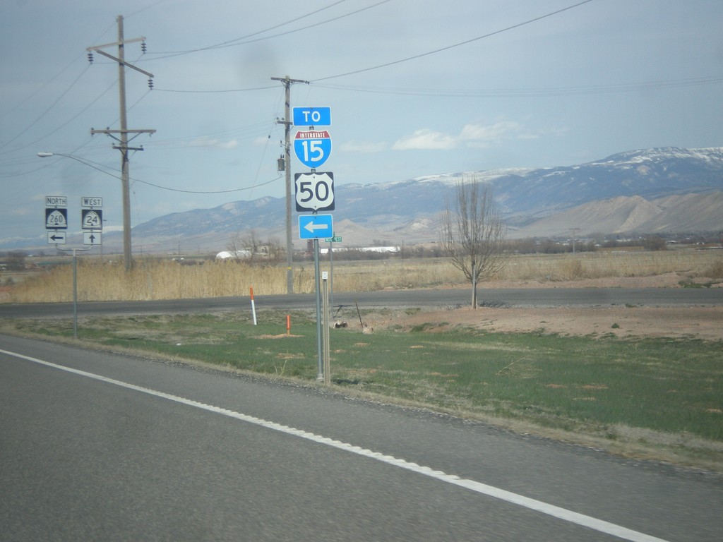
UT-24 East at UT-260 North
UT-24 East at UT-260 North. Use UT-260 for US-50 and I-15 (via US-50).
Taken 03-29-2018


 Aurora
Sevier County
Utah
United States
Aurora
Sevier County
Utah
United States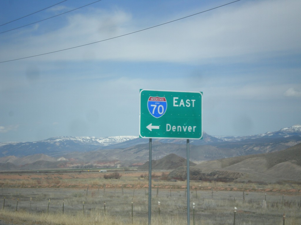
UT-24 West at I-70 (UT-259)
UT-24 west at I-70 east to Denver. There is a signed state highway, UT-259, that connects UT-24 to the I-70 ramps. This sign has been replaced in recent years to include the UTAH text in the I-70 shield.
Taken 03-29-2018

 Sigurd
Sevier County
Utah
United States
Sigurd
Sevier County
Utah
United States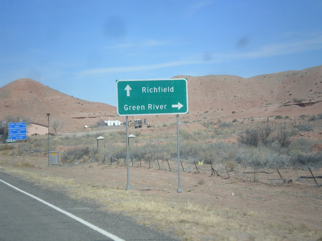
UT-95 West Approaching UT-24
UT-95 west approaching UT-24 in Hanksville. Use UT-24 east for Green River; use UT-24 west for Richfield.
Taken 03-29-2018
 Hanksville
Wayne County
Utah
United States
Hanksville
Wayne County
Utah
United States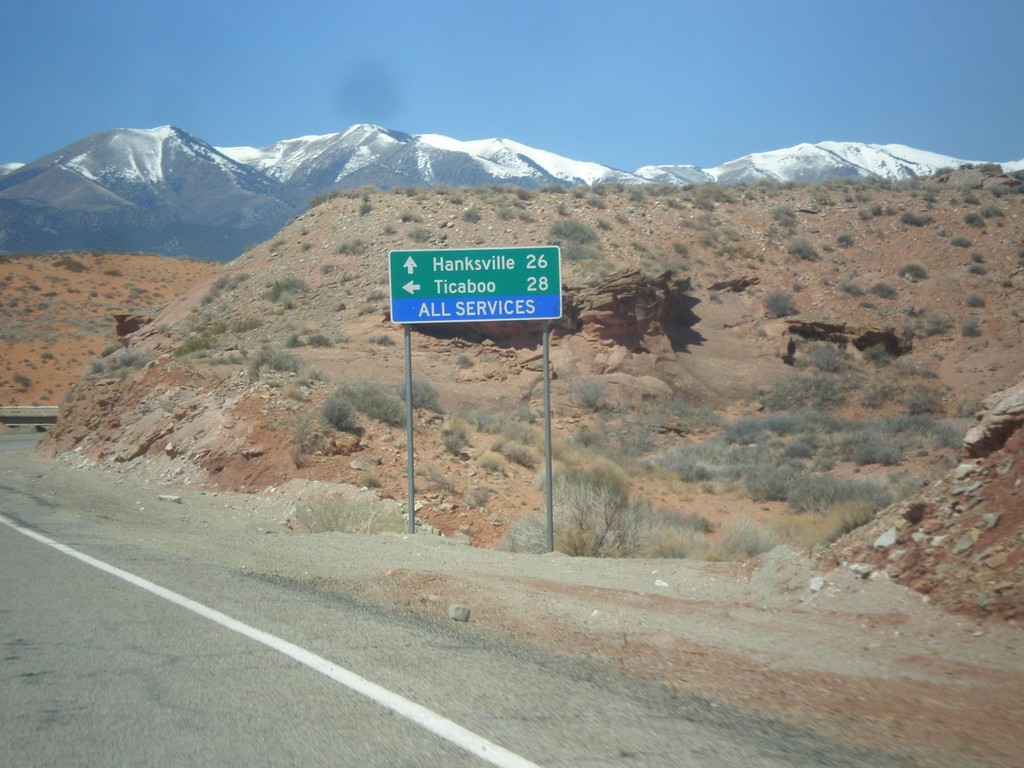
UT-95 West at UT-276
UT-95 west at UT-276 to Ticaboo. Continue west on UT-95 for Blanding.
Taken 03-29-2018
 Lake Powell
Garfield County
Utah
United States
Lake Powell
Garfield County
Utah
United States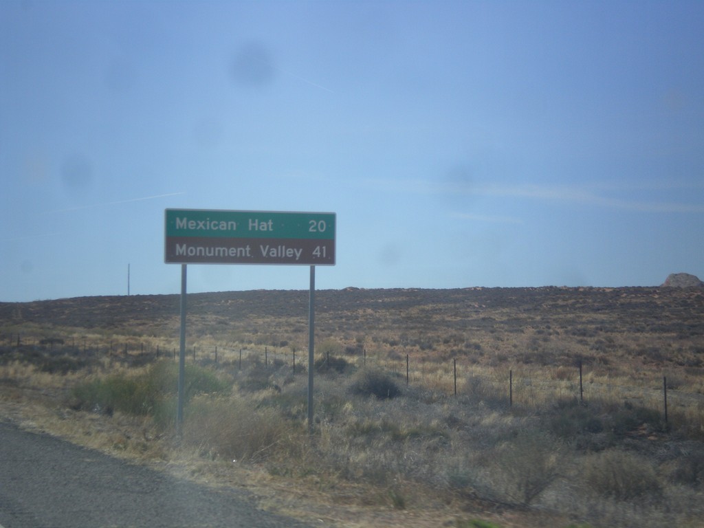
US-163 West - Distance Marker
First distance marker along US-163 west. Distance to Mexican Hat and Monument Valley (Navajo Tribal Park).
Taken 03-28-2018
 Bluff
San Juan County
Utah
United States
Bluff
San Juan County
Utah
United States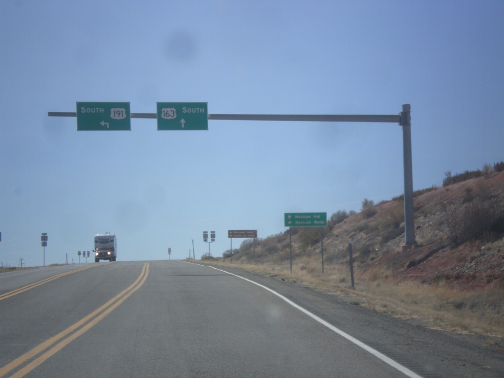
US-191 South at US-163
US-191 South at US-163 in San Juan County. Turn left to continue south on US-191 to Mexican Water (Arizona). Continue straight for US-163 west to Mexican Hat. This is the eastern end of US-163 west.
Taken 03-28-2018
 Bluff
San Juan County
Utah
United States
Bluff
San Juan County
Utah
United States
US-191 South - Bluff
US-191 south shield in Bluff.
Taken 03-28-2018
Bluff
San Juan County
Utah
United States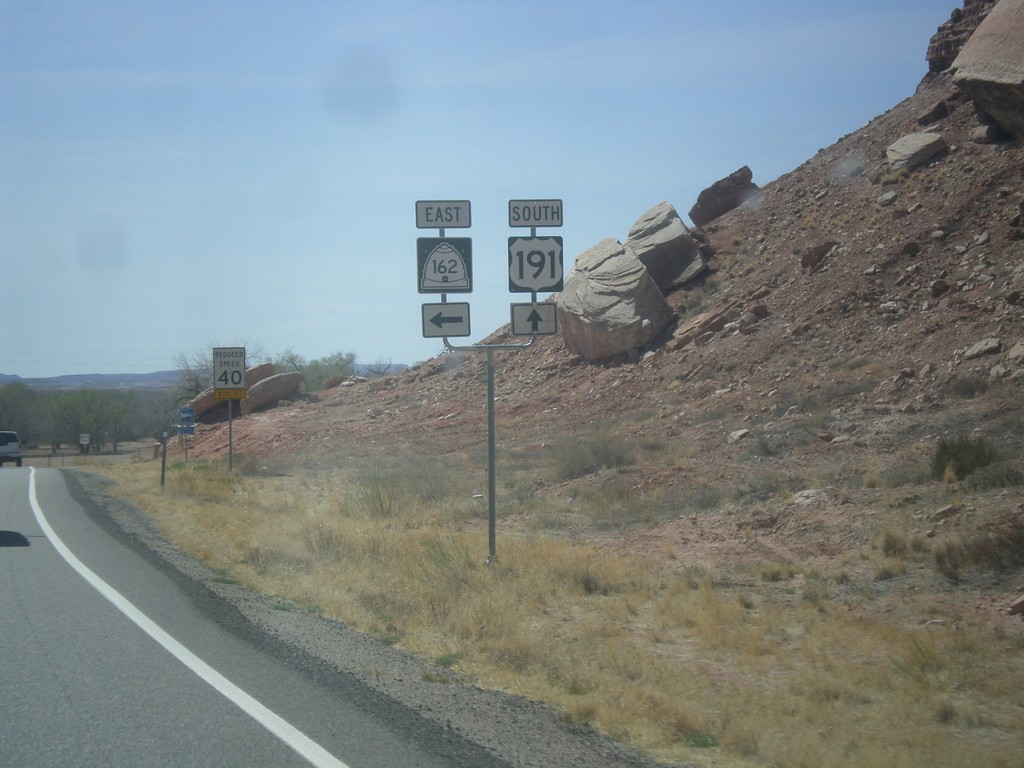
US-191 South at UT-162 East
US-191 South at UT-162 East in Bluff.
Taken 03-28-2018
 Bluff
San Juan County
Utah
United States
Bluff
San Juan County
Utah
United States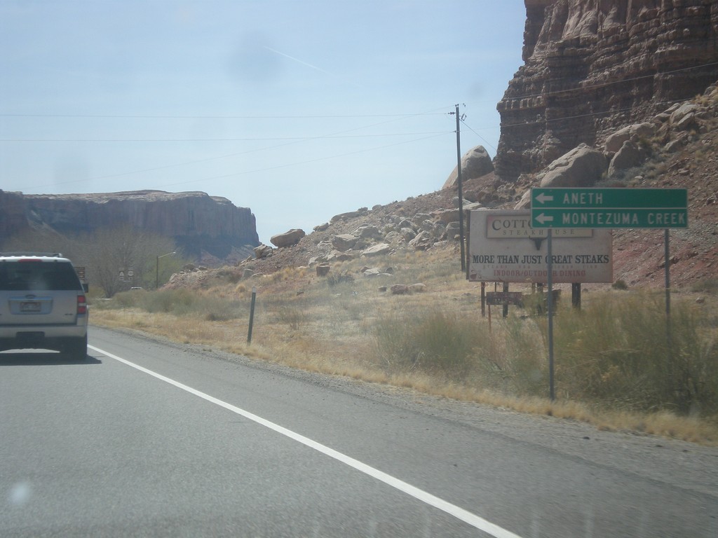
US-191 South Approaching UT-162
US-191 South approaching UT-162 in Bluff. Use UT-162 east for Montezuma Creek and Aneth.
Taken 03-28-2018
Bluff
San Juan County
Utah
United States