Signs From Utah
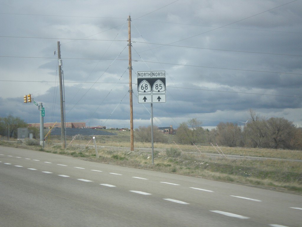
UT-68 North/UT-85 West - Lehi
UT-68 North/UT-85 West in Lehi
Taken 03-31-2017

 Lehi
Utah County
Utah
United States
Lehi
Utah County
Utah
United States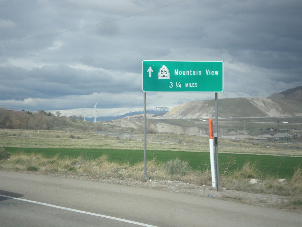
UT-68 North/UT-85 West - Mountain View
UT-68 North/UT-85 West - UT-85/Mountain View (Corridor) - 3.5 miles north.
Taken 03-31-2017
Saratoga Springs
Utah County
Utah
United States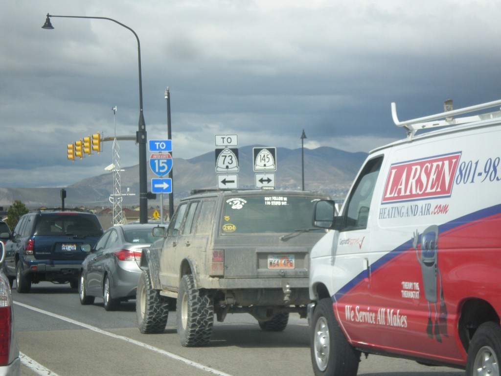
UT-68 North at UT-145 (Pioneer Crossing)
UT-68 North at UT-145 (Pioneer Crossing) in Saratoga Springs. Use UT-145 west to UT-73; UT-145 east to I-15.
Taken 03-31-2017


 Saratoga Springs
Utah County
Utah
United States
Saratoga Springs
Utah County
Utah
United States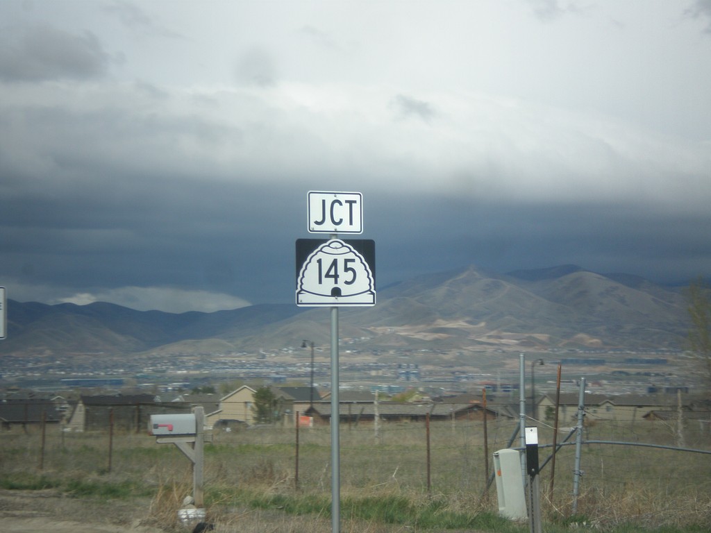
UT-68 North approaching UT-145
UT-68 North approaching UT-145 in Saratoga Springs.
Taken 03-31-2017
Saratoga Springs
Utah County
Utah
United States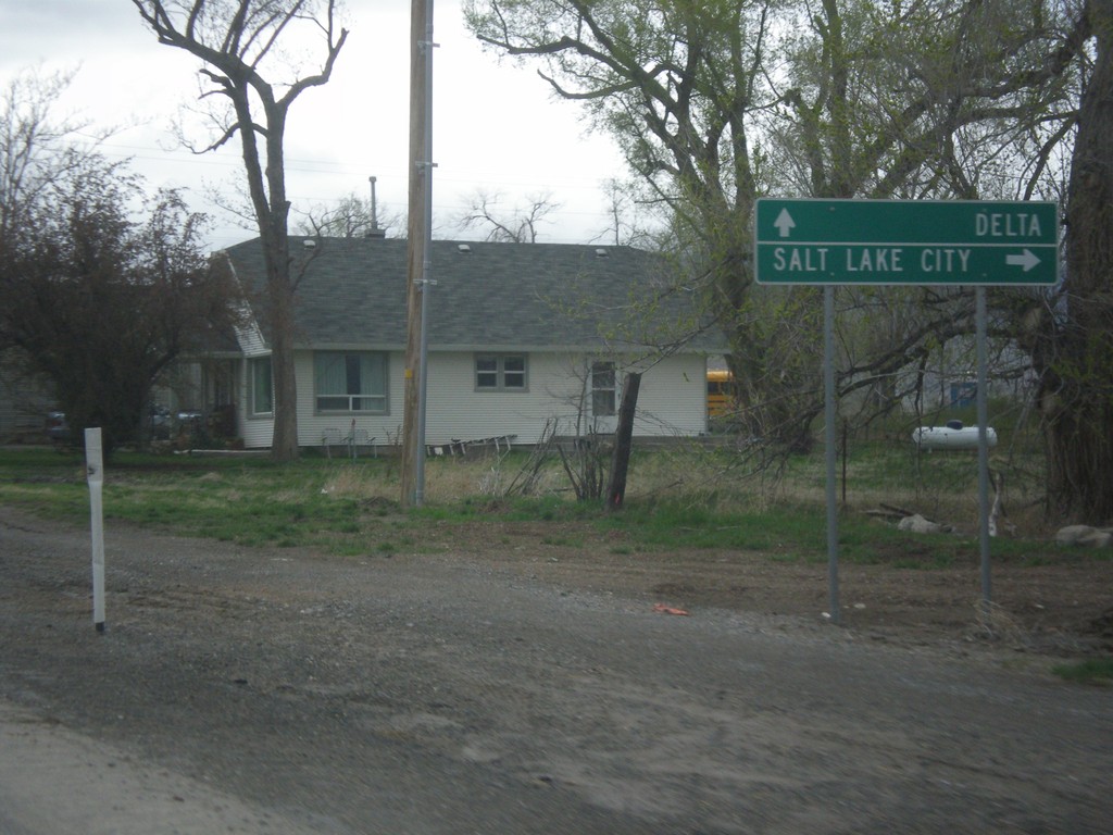
US-6 West at UT-68 North
US-6 West at UT-68 North to Salt Lake City. Continue west on US-6 for Delta.
Taken 03-31-2017
 Elberta
Utah County
Utah
United States
Elberta
Utah County
Utah
United States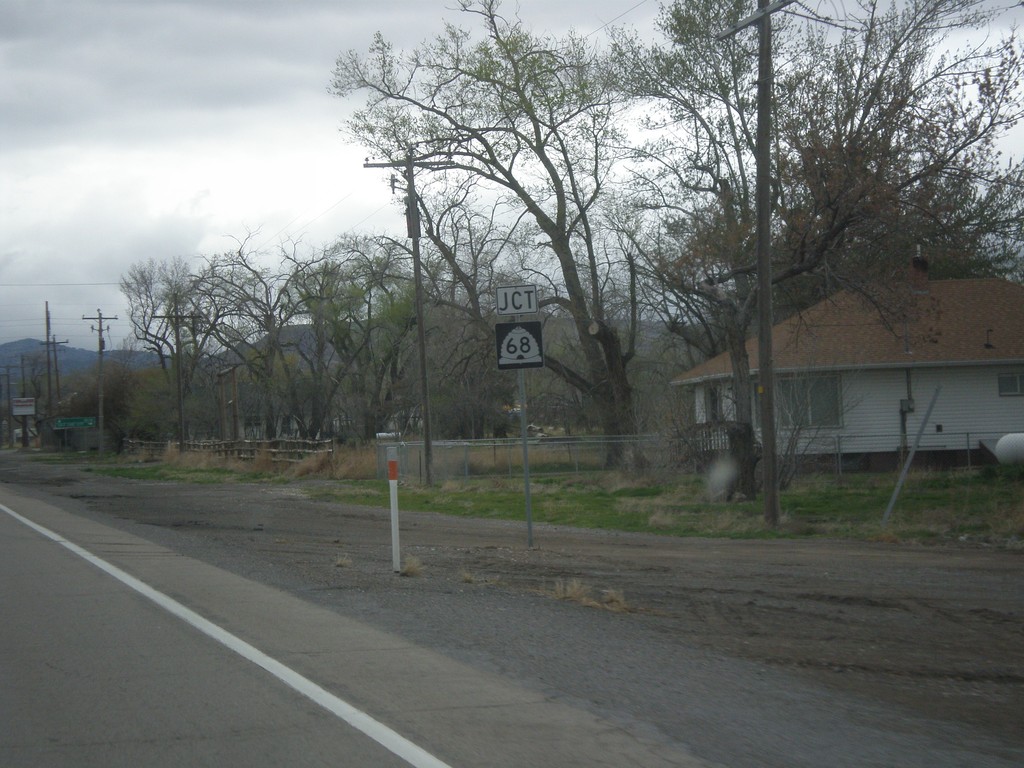
US-6 West Approaching UT-68
US-6 West approaching UT-68 north in Elberta.
Taken 03-31-2017
Goshen
Utah County
Utah
United States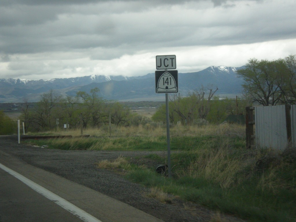
US-6 West - UT-141 Jct.
US-6 West approaching UT-141 Jct. in Genola.
Taken 03-31-2017
 Genola
Utah County
Utah
United States
Genola
Utah County
Utah
United States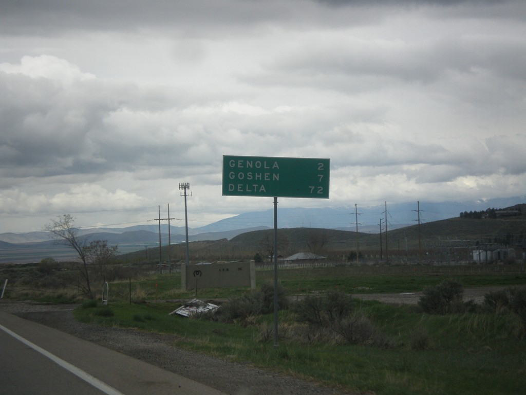
US-6 West - Distance Marker
Distance marker on US-6. Distance to Genola, Goshen, and Delta.
Taken 03-31-2017
Santaquin
Utah County
Utah
United States
US-6 West - Santaquin
US-6 West in Santaquin
Taken 03-31-2017
Santaquin
Utah County
Utah
United States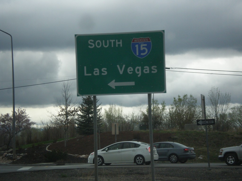
US-6 West at I-15 South (Exit 244)
US-6 West at I-15 South (Exit 244) in Santaquin. Use I-15 south for Las Vegas, NV.
Taken 03-31-2017
Santaquin
Utah County
Utah
United States