Signs From Washington
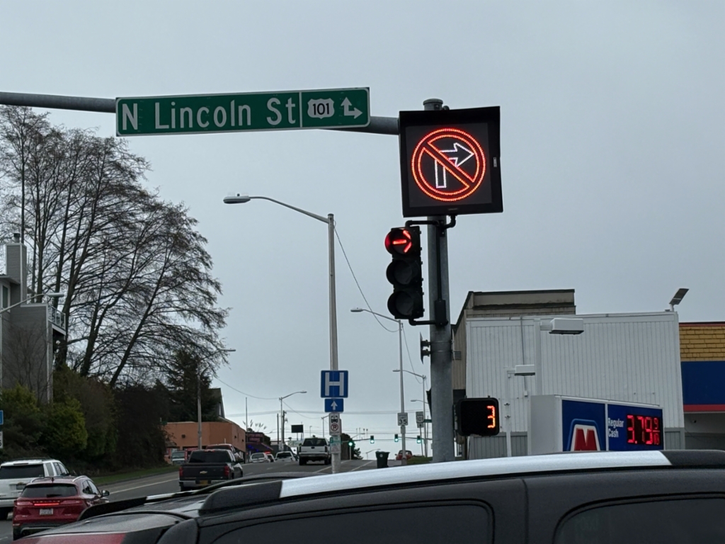
E 1st St. East at Lincoln St.
E 1st St. East at Lincoln St. Turn right for US-101 West; continue straight for US-101 East.
Taken 12-22-2025
 Port Angeles
Clallam County
Washington
United States
Port Angeles
Clallam County
Washington
United States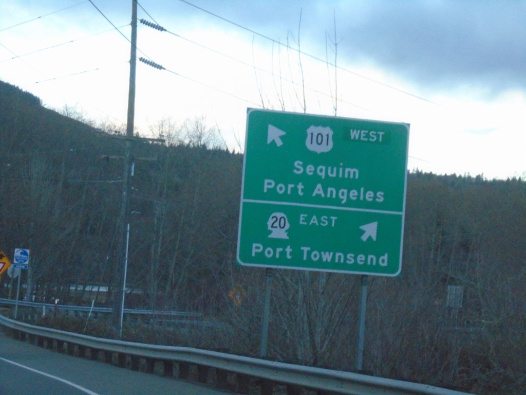
US-101 North at WA-20 East
US-101 north at WA-20 east to Port Townsend. Continue on US-101 west for Sequim and Port Angeles. US-101 is signed as an East-West highway between WA-20 and WA-113.
Taken 12-21-2025
 Port Townsend
Jefferson County
Washington
United States
Port Townsend
Jefferson County
Washington
United States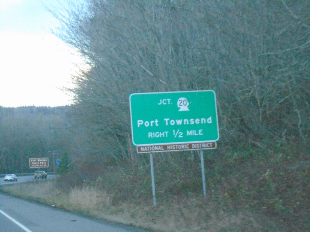
US-101 North Approaching WA-20
US-101 north approaching WA-20 to Port Townsend.
Taken 12-21-2025
Port Townsend
Jefferson County
Washington
United States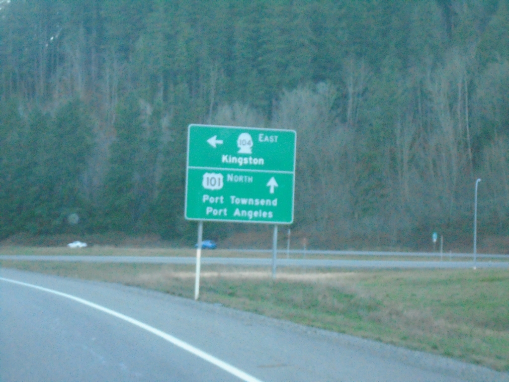
US-101 North at WA-104
US-101 North at WA-104 East to Kingston. Continue north on US-101 for Port Townsend and Port Angeles.
Taken 12-21-2025
 Quilcene
Jefferson County
Washington
United States
Quilcene
Jefferson County
Washington
United States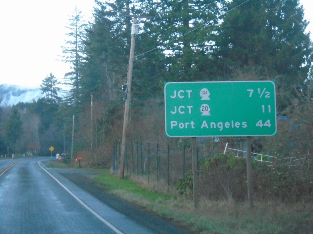
US-101 North - Distance Marker
Distance marker on US-101 north. Distance to WA-104, WA-20, and Port Angeles.
Taken 12-21-2025
Quilcene
Jefferson County
Washington
United States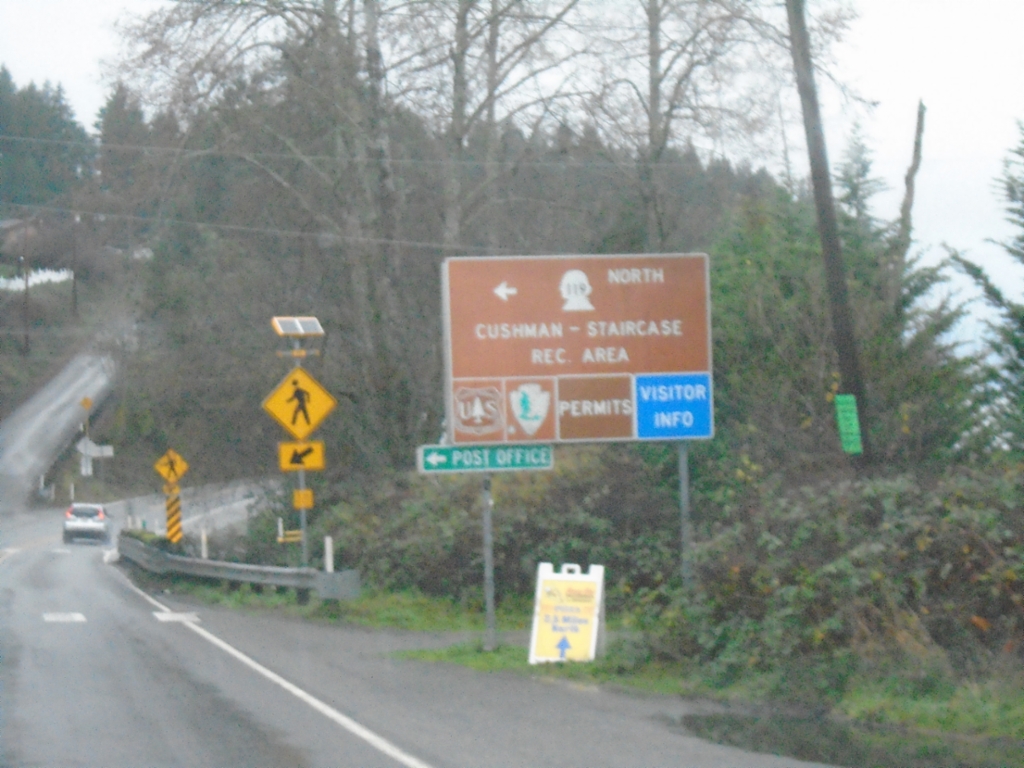
US-101 North at WA-119
US-101 North at WA-119 in Hoodsport. Use WA-119 North to Cushman-Staircase Recreation Area.
Taken 12-21-2025
 Hoodsport
Mason County
Washington
United States
Hoodsport
Mason County
Washington
United States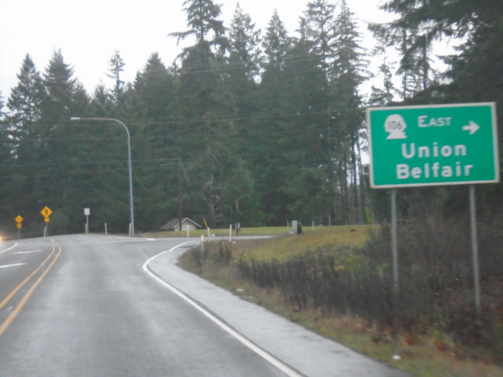
US-101 North at WA-106
US-101 North at WA-106 East to Union and Belfair.
Taken 12-21-2025
 Skokomish
Mason County
Washington
United States
Skokomish
Mason County
Washington
United States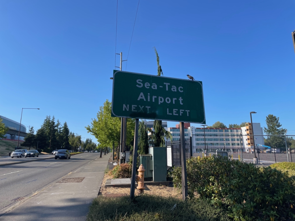
WA-99 North Approaching Sea-Tac Airport
WA-99 North approaching Sea-Tac Airport entrance.
Taken 07-17-2025
 SeaTac
King County
Washington
United States
SeaTac
King County
Washington
United States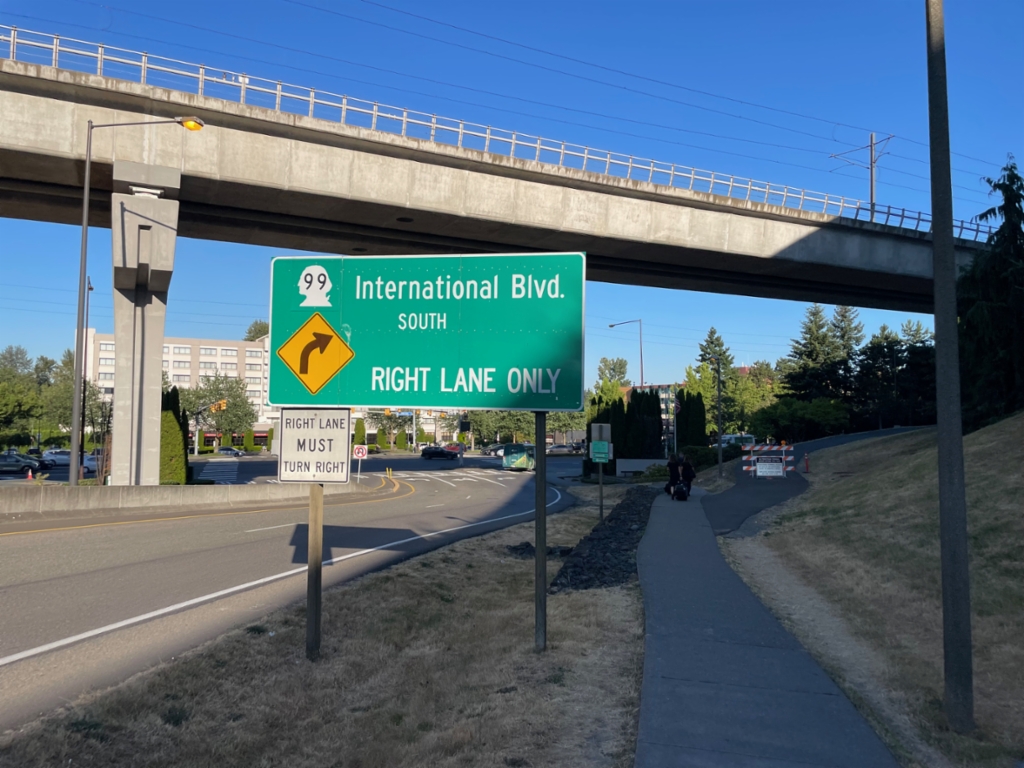
SeaTac Airport Arrivals Road Approaching WA-99
SeaTac Airport Arrivals Road approaching WA-99. Use right lane for WA-99 South/International Blvd.
Taken 07-16-2025
SeaTac
King County
Washington
United States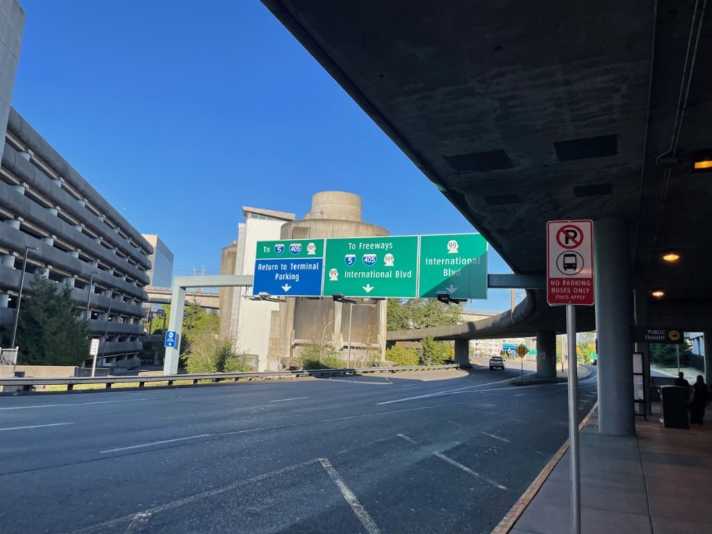
SeaTac Airport Arrivals Road At Airport Expressway
SeaTac Airport Arrivals Road at Airport Expressway to I-5/I-405/WA-509 Freeways and Return to Terminal/Parking. Use right lanes for WA-99/International Blvd.
Taken 07-16-2025


 SeaTac
King County
Washington
United States
SeaTac
King County
Washington
United States