Signs From Wyoming
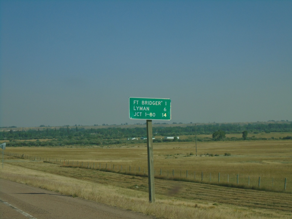
BL-80 East - Distance Marker
Distance marker on BL-80 east. Distance to Fort Bridger, Lyman, and Jct. I-80.
Taken 09-10-2022
 Fort Bridger
Uinta County
Wyoming
United States
Fort Bridger
Uinta County
Wyoming
United States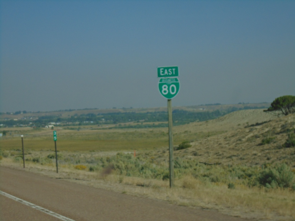
BL-80 East - Uinta County
BL-80 East in Uinta County
Taken 09-10-2022
Fort Bridger
Uinta County
Wyoming
United States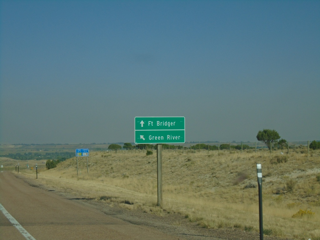
I-80 East - Exit 34 Offramp at BL-80
I-80 East - Exit 34 Offramp at BL-80. Merge right for BL-80 East/Fort Bridger. Merge left for the eastbound onramp to I-80 to Green River.
Taken 09-10-2022
 Fort Bridger
Uinta County
Wyoming
United States
Fort Bridger
Uinta County
Wyoming
United States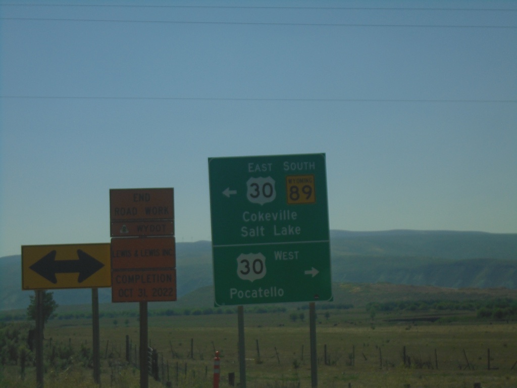
WY-89 South at US-30
WY-89 South at US-30 - Border Junction. Turn right on US-30 West to Pocatello (Idaho); turn left on US-30 East/WY-89 South to Cokeville and Salt Lake (Utah). WY-89 South joins US-30 East to Sage Junction.
Taken 09-10-2022

 Cokeville
Lincoln County
Wyoming
United States
Cokeville
Lincoln County
Wyoming
United States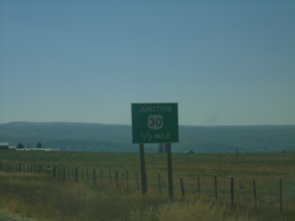
WY-89 South Approaching US-30
WY-89 south Approaching US-30 (Border Junction) in Lincoln County.
Taken 09-10-2022
Cokeville
Lincoln County
Wyoming
United States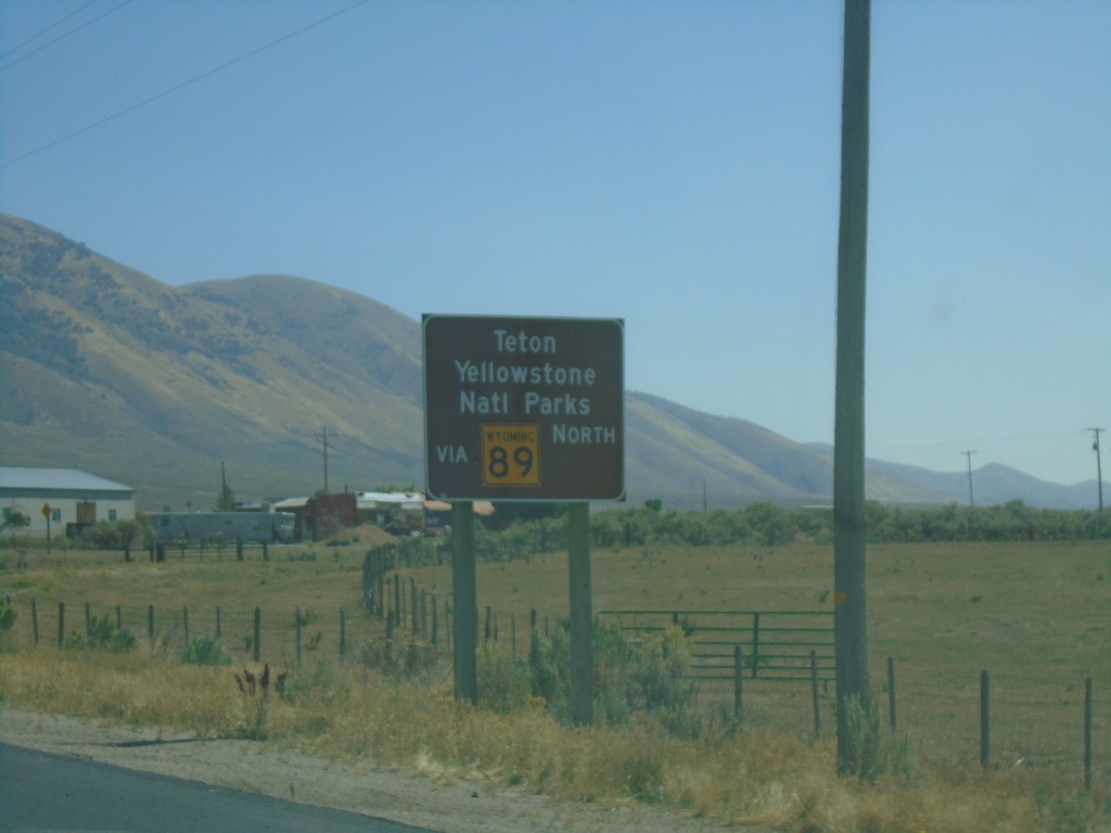
US-30 West - Use WY-89 For Teton and Yellowstone National Parks
US-30 West approaching WY-89. Use WY-89 For Teton and Yellowstone National Parks. These signs are located at most crossings into Wyoming, directing traffic to Yellowstone and Grand Teton National Parks.
Taken 09-10-2022
Cokeville
Lincoln County
Wyoming
United States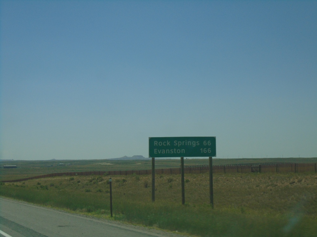
I-80 West - Distance Marker
Distance marker on I-80 west. Distance to Rock Springs and Evanston.
Taken 07-11-2022
Wamsutter
Sweetwater County
Wyoming
United States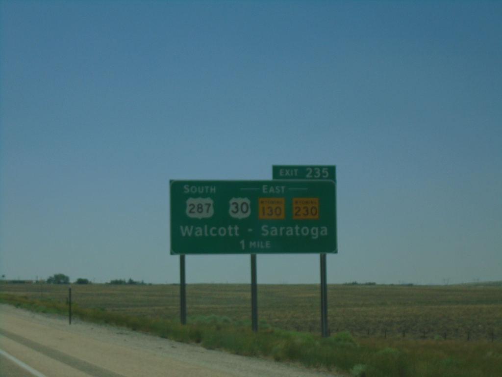
I-80 West - Exit 235
I-80 west approaching Exit 235 - US-287 South/US-30/WY-130/WY-230 East/Walcott/Saratoga.
Taken 07-11-2022


 Walcott
Carbon County
Wyoming
United States
Walcott
Carbon County
Wyoming
United States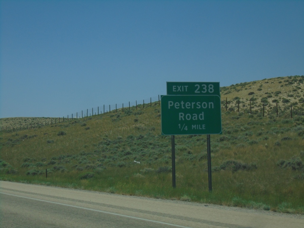
I-80 West - Exit 238
I-80 west approaching Exit 238 - Peterson Road
Taken 07-11-2022
Walcott
Carbon County
Wyoming
United States
I-80 West - Exit 267
I-80 west approaching Exit 267 - Wagonhound Road.
Taken 07-11-2022
Arlington
Carbon County
Wyoming
United States