Signs From Wyoming
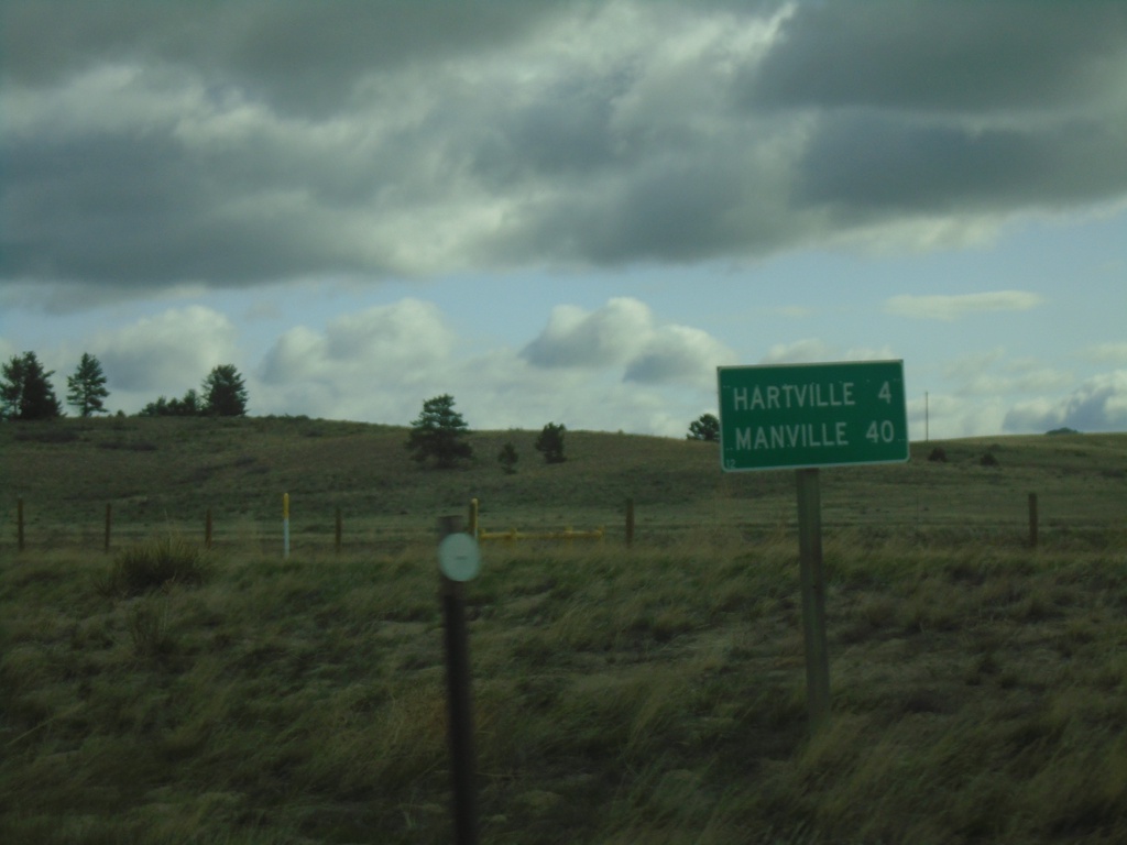
WY-270 North - Distance Marker
Distance marker on WY-270 north. Distance to Hartville, and Manville.
Taken 04-30-2022
 Guernsey
Platte County
Wyoming
United States
Guernsey
Platte County
Wyoming
United States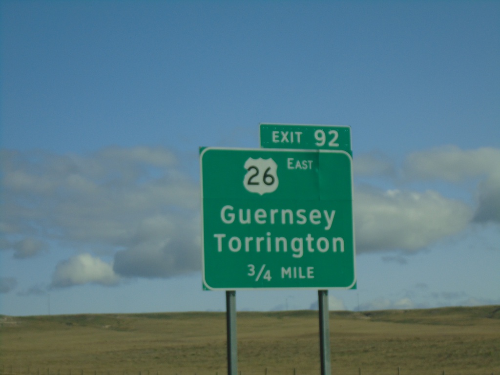
I-25 North - Exit 92
I-25 north approaching Exit 92 - US-26 East/Guernsey/Torrington. US-26 west joins I-25 north here.
Taken 04-30-2022


 Wheatland
Platte County
Wyoming
United States
Wheatland
Platte County
Wyoming
United States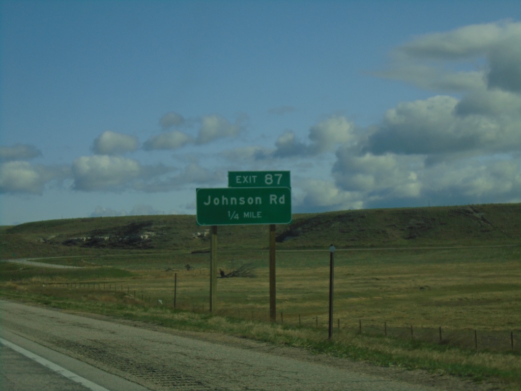
I-25 North - Exit 87
I-25 north approaching Exit 87 - Johnson Road.
Taken 04-30-2022
Wheatland
Platte County
Wyoming
United States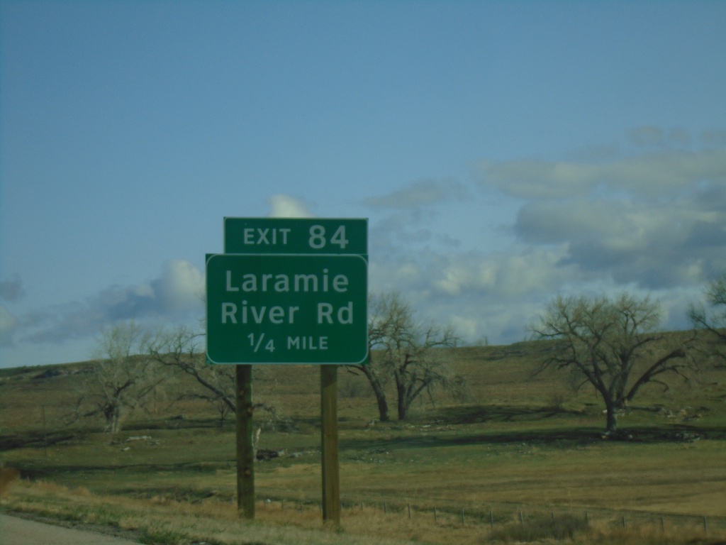
I-25 North - Exit 84
I-25 north approaching Exit 84 - Laramie River Road.
Taken 04-30-2022
Wheatland
Platte County
Wyoming
United States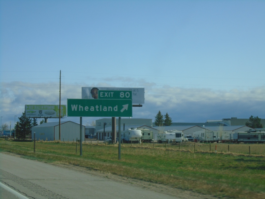
I-25 North - Exit 80
I-25 north at Exit 80 - Wheatland. This is the north end of the Wheatland business loop.
Taken 04-30-2022

 Wheatland
Platte County
Wyoming
United States
Wheatland
Platte County
Wyoming
United States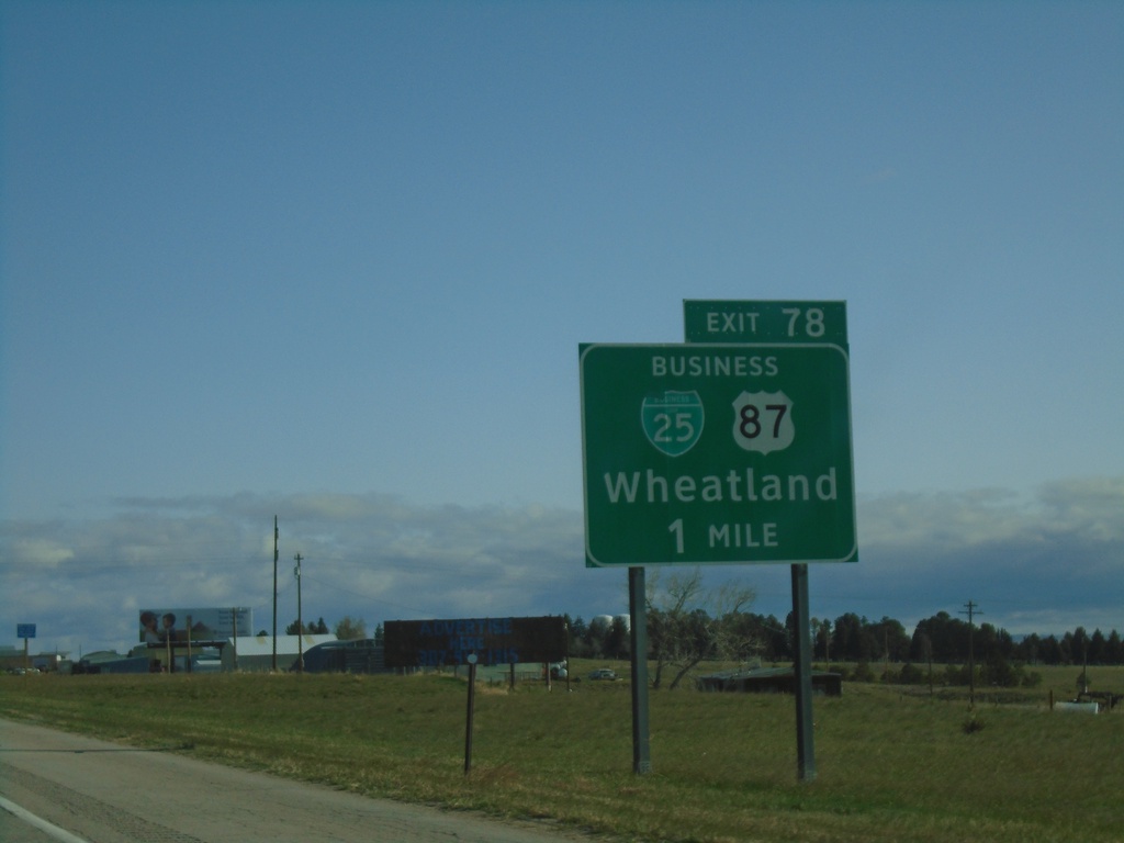
I-25 North - Exit 78
I-25 north approaching Exit 78 - BL-25/Bus. US-87/Wheatland. This is the southern end of the Wheatland business loop. Wheatland is the county seat of Platte County.
Taken 04-30-2022
Wheatland
Platte County
Wyoming
United States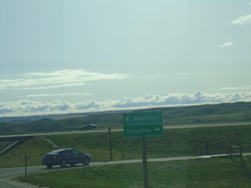
End WY-34 East at I-25
End WY-34 East at I-25 in Platte County. Use I-25 south to Cheyenne; I-25 north to Wheatland.
Taken 04-30-2022
Slater
Platte County
Wyoming
United States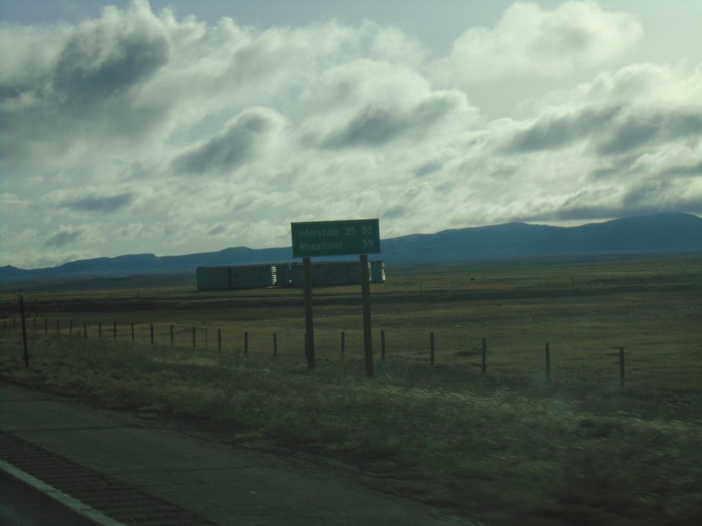
WY-34 East - Distance Marker
Distance marker on WY-34 east. Distance to I-25 and Wheatland (via I-25).
Taken 04-30-2022
 Laramie
Albany County
Wyoming
United States
Laramie
Albany County
Wyoming
United States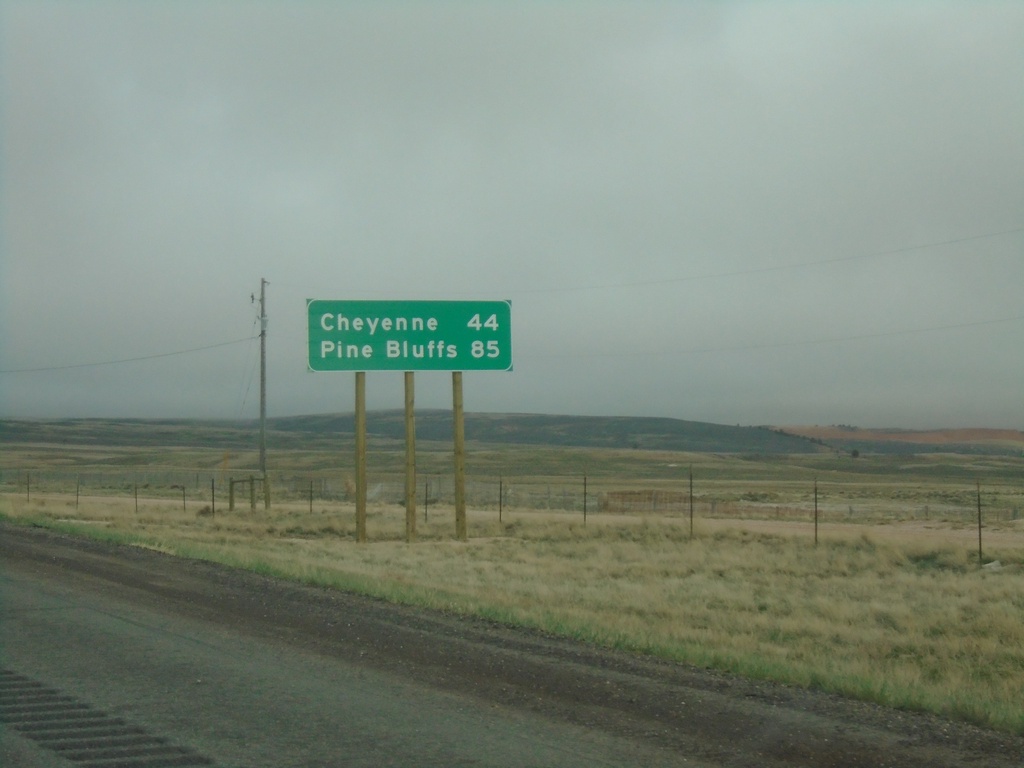
I-80 East - Distance Marker
Distance marker on I-80 east. Distance to Cheyenne and Pine Bluffs. Pine Bluffs is on the border with Nebraska.
Taken 04-29-2022
 Laramie
Albany County
Wyoming
United States
Laramie
Albany County
Wyoming
United States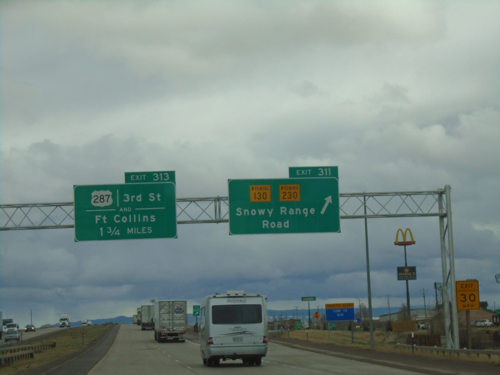
I-80 East - Exits 311 and 313
I-80 East at Exit 311 - WY-130/WY-230/Snowy Range Road. Approaching Exit 313 - US-287/3rd St./Fort Collins (Colorado).
Taken 04-29-2022


 Laramie
Albany County
Wyoming
United States
Laramie
Albany County
Wyoming
United States