Signs From Wyoming
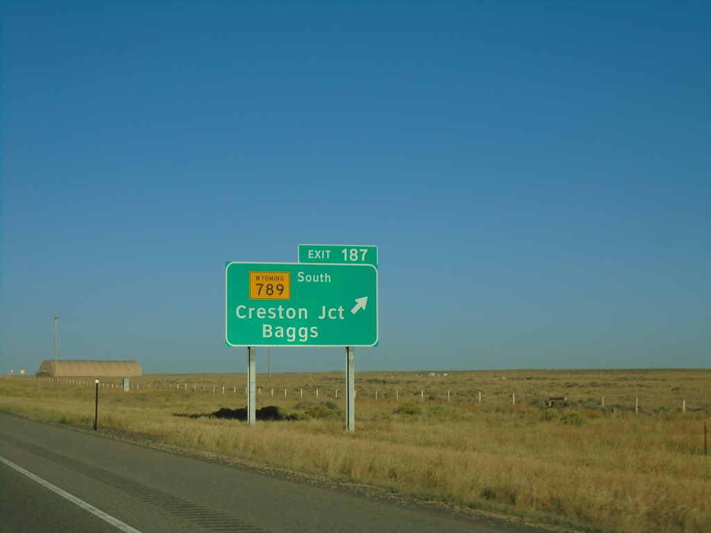
I-80 West Exit 187
I-80 west at Exit 187 - WY-789 South/Creston Jct./Baggs. WY-789 south leaves I-80 westbound.
Taken 08-15-2020


 Rawlins
Sweetwater County
Wyoming
United States
Rawlins
Sweetwater County
Wyoming
United States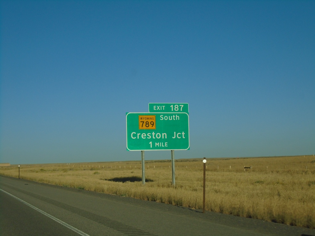
I-80 West Exit 187
I-80 west approaching Exit 187 - WY-789 South/Creston Jct.
Taken 08-15-2020
Creston
Sweetwater County
Wyoming
United States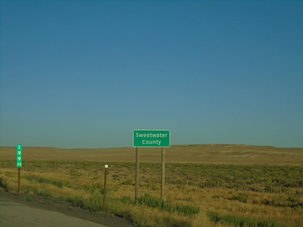
I-80 West - Sweetwater County
Entering Sweetwater County on I-80 west. Milemarker 199.05.
Taken 08-15-2020
Riner
Sweetwater County
Wyoming
United States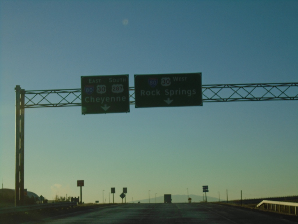
US-287 South at I-80
US-287 South/BL-80 East/Bus. US-30 East at I-80 in Rawlins. Use I-80/US-30 West for Rock Springs; I-80/US-30 East/US-287 South for Cheyenne.
Taken 08-15-2020


 Rawlins
Carbon County
Wyoming
United States
Rawlins
Carbon County
Wyoming
United States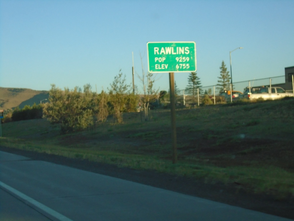
US-287 North - Rawlins
US-287 North/BL-80/US-30 West - Rawlins. Population 9259. Elevation 6755. Rawlins is the county seat of Carbon County, and is located just east of the Continental Divide.
Taken 08-15-2020
Rawlins
Carbon County
Wyoming
United States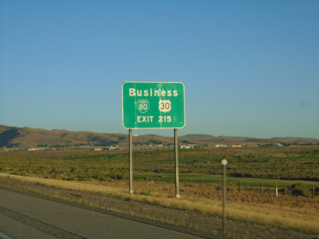
I-80 West - Exit 215
I-80 west approaching Exit 215. BL-80 and Bus. US-30, use Exit 215. This is the eastern end of the Rawlins business loop.
Taken 08-15-2020
Rawlins
Carbon County
Wyoming
United States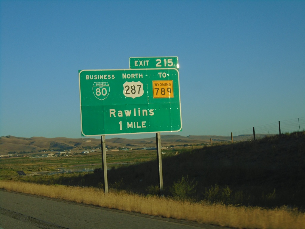
I-80 West - Exit 215
I-80 west approaching Exit 215, BL-80/US-287 North/To WY-789/Rawlins. US-287 North leaves I-80 westbound at Exit 215.
Taken 08-15-2020
Rawlins
Carbon County
Wyoming
United States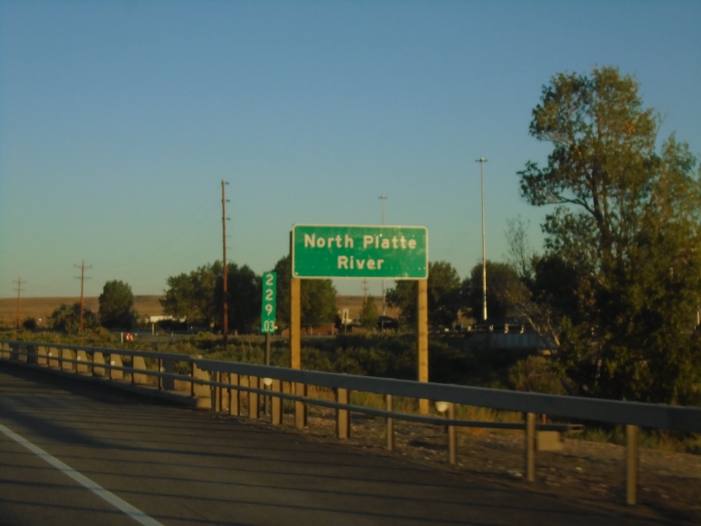
I-80 West - North Platte River
I-80 west crossing the North Platte River in Carbon County. Milemarker 229.03 in the background.
Taken 08-15-2020
Sinclair
Carbon County
Wyoming
United States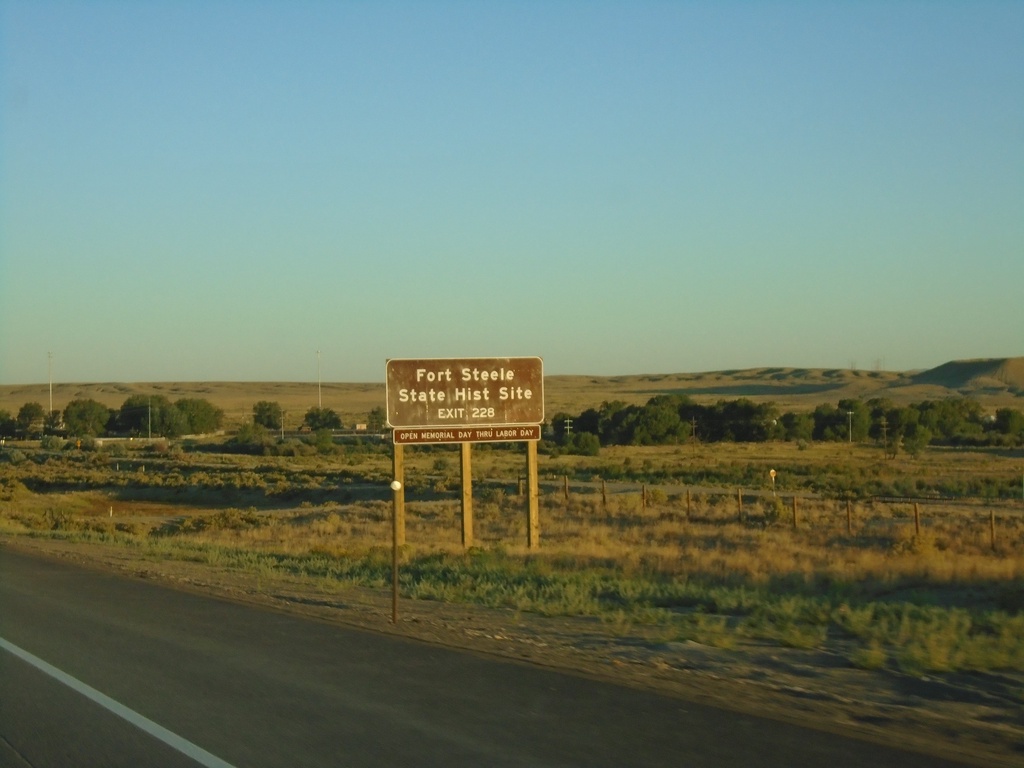
I-80 West - Exit 228
I-80 west approaching Exit 228 - Fort Steele. Use Exit 228 for Fort Steele State Historic Site.
Taken 08-15-2020
Walcott
Carbon County
Wyoming
United States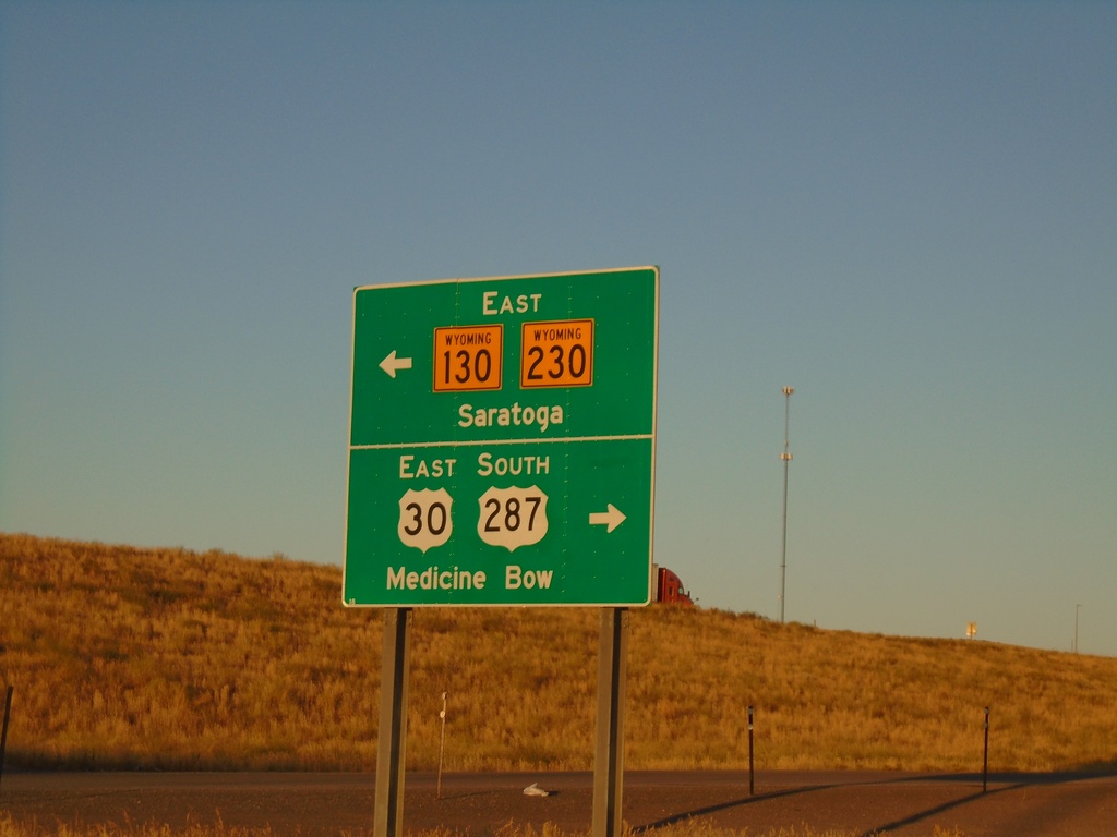
I-80 West Offramp at US-30/US-287/WY-130/WY-230
I-80 West offramp (Exit 235) at US-30/US-287/WY-130/WY-230. Use US-30 East/US-287 South to Medicine Bow. Use WY-130/WY-230 East to Saratoga. US-30 West joins I-80 westbound to Granger; US-287 North joins I-80 westbound to Rawlins.
Taken 08-15-2020

 Walcott
Carbon County
Wyoming
United States
Walcott
Carbon County
Wyoming
United States