Signs Tagged With Big Green Sign
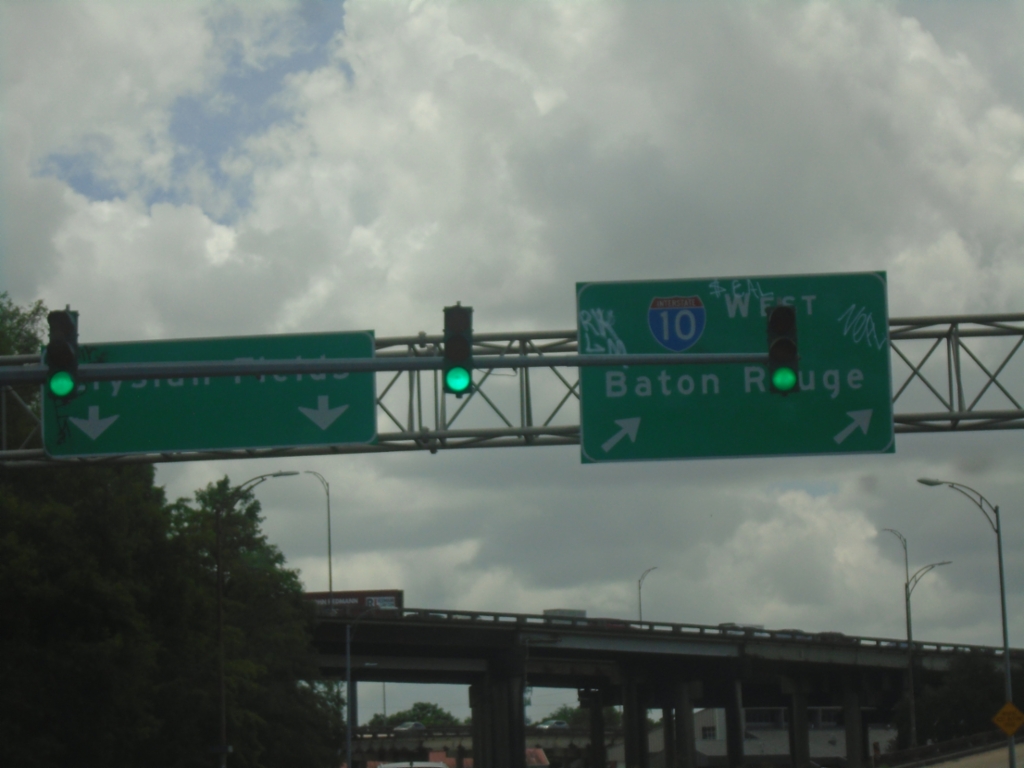
LA-3021 South at I-10 West
LA-3021 South (Elysian Fields Ave.) at I-10 West to Baton Rouge.
Taken 05-31-2026

 New Orleans
Orleans Parish
Louisiana
United States
New Orleans
Orleans Parish
Louisiana
United States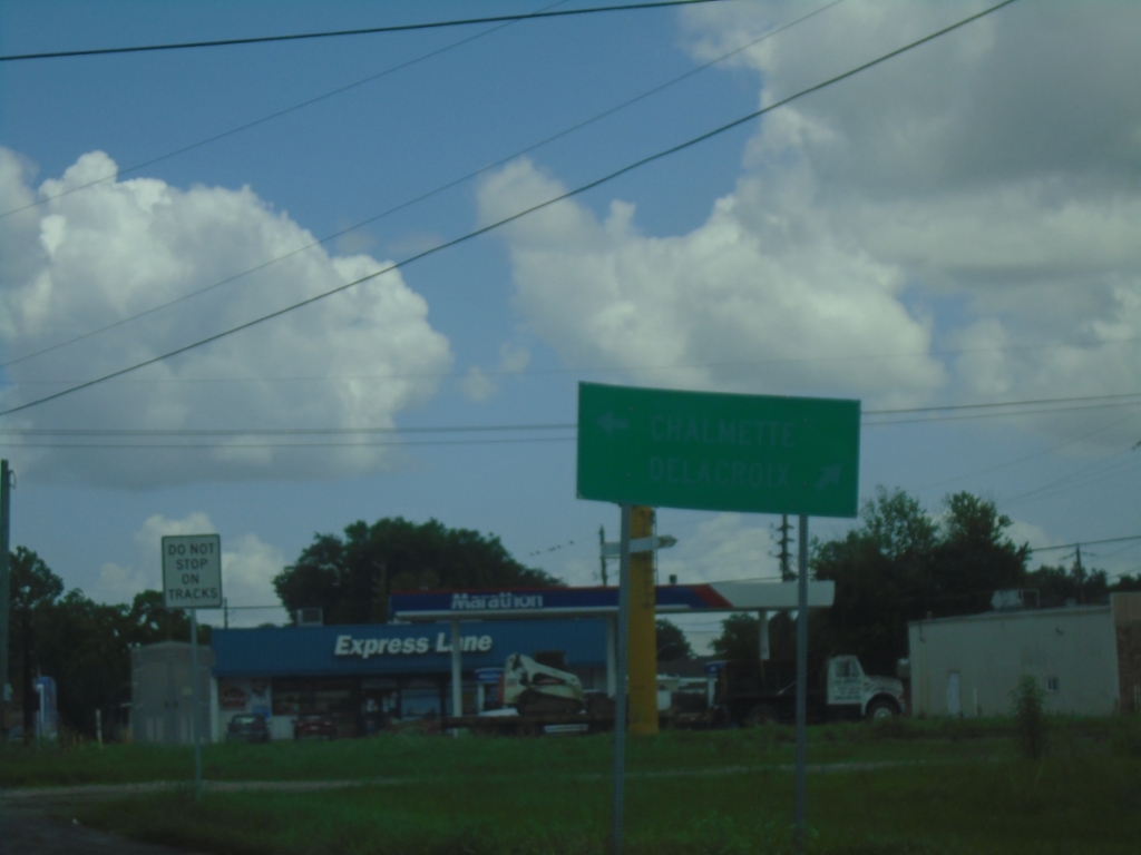
LA-39 North Approaching LA-46 - Poydras
LA-39 North Approaching LA-46 in Poydras. A very faded sign shows to turn left on LA-46 West for Chalmette; turn right on LA-46 East/LA-39 North to Delacroix.
Taken 05-31-2026

 Poydras
Saint Bernard Parish
Louisiana
United States
Poydras
Saint Bernard Parish
Louisiana
United States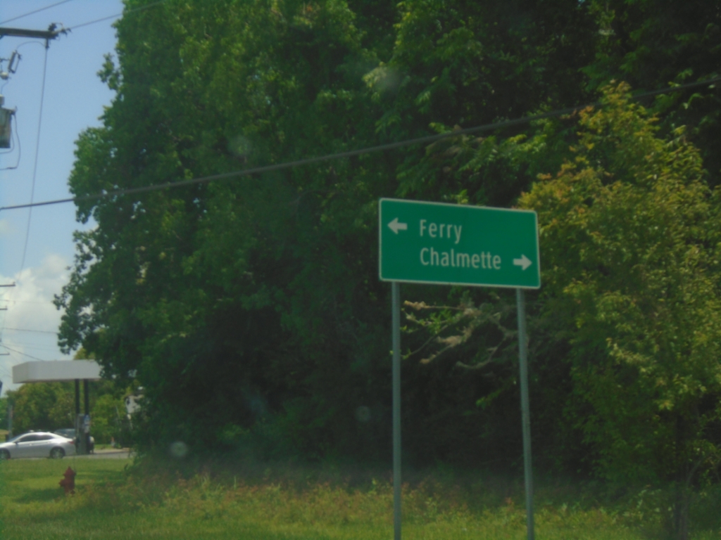
LA-39 North at Belle Chasse Ferry
LA-39 North at Belle Chasse Ferry. Turn right to continue north to Chalmette.
Taken 05-31-2026
Pointe à la Hache
Plaquemines Parish
Louisiana
United States
LA-23 South Approaching LA-3017
LA-23 South approaching LA-3017/Engineers Road in Belle Chasse.
Taken 05-31-2026

 Belle Chasse
Plaquemines Parish
Louisiana
United States
Belle Chasse
Plaquemines Parish
Louisiana
United States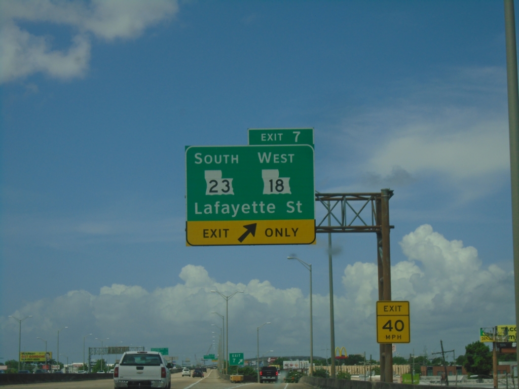
Bus. US-90 West - Exit 7
Bus. US-90 West at Exit 7 - LA-18 West/LA-23 South/Lafayette St.
Taken 05-31-2026

 Gretna
Jefferson Parish
Louisiana
United States
Gretna
Jefferson Parish
Louisiana
United States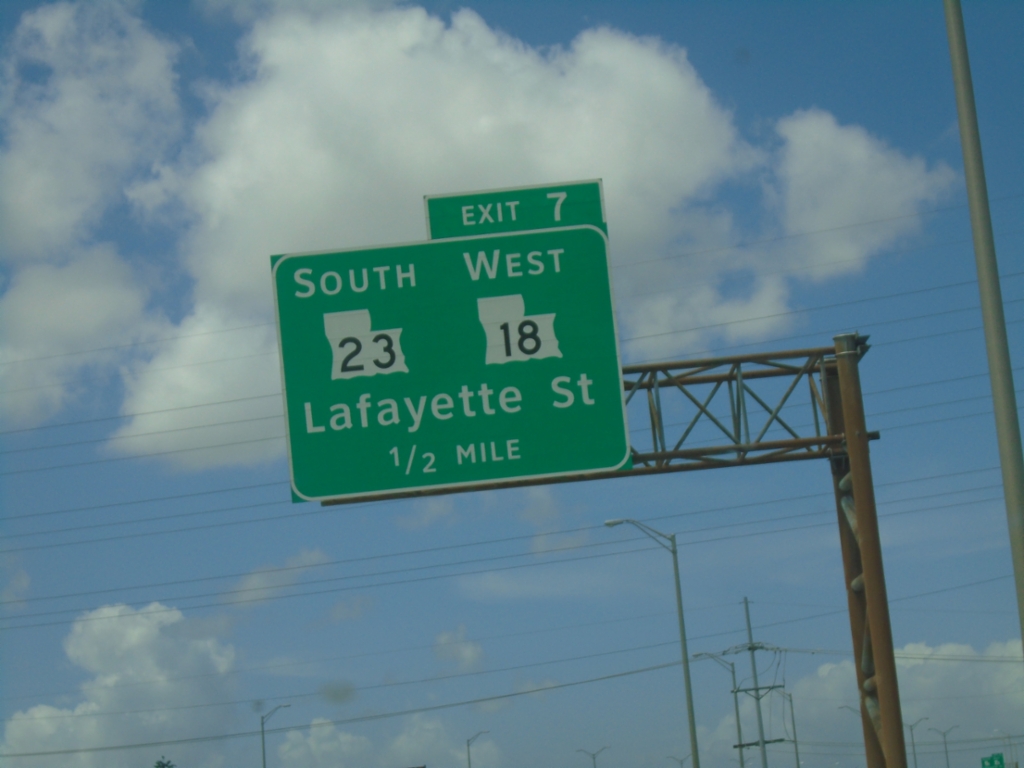
Bus. US-90 West - Exit 7
Bus. US-90 West approaching Exit 7 - LA-23 South/LA-18 West/Lafayette St.
Taken 05-31-2026
Gretna
Jefferson Parish
Louisiana
United States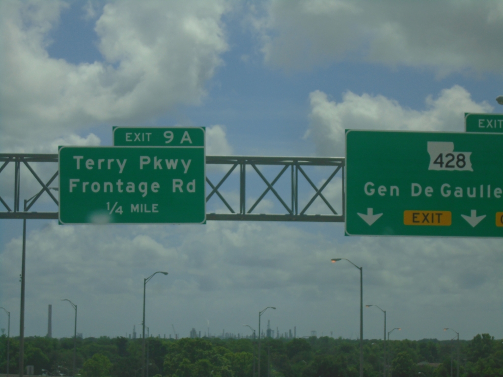
Bus. US-90 West - Exits 9B and 9A
Bus. US-90 West at Exit 9B - LA-428/General DeGaulle Drive. Approaching Exit 9A - Terry Parkway/Frontage Road.
Taken 05-31-2026
 New Orleans
Orleans Parish
Louisiana
United States
New Orleans
Orleans Parish
Louisiana
United States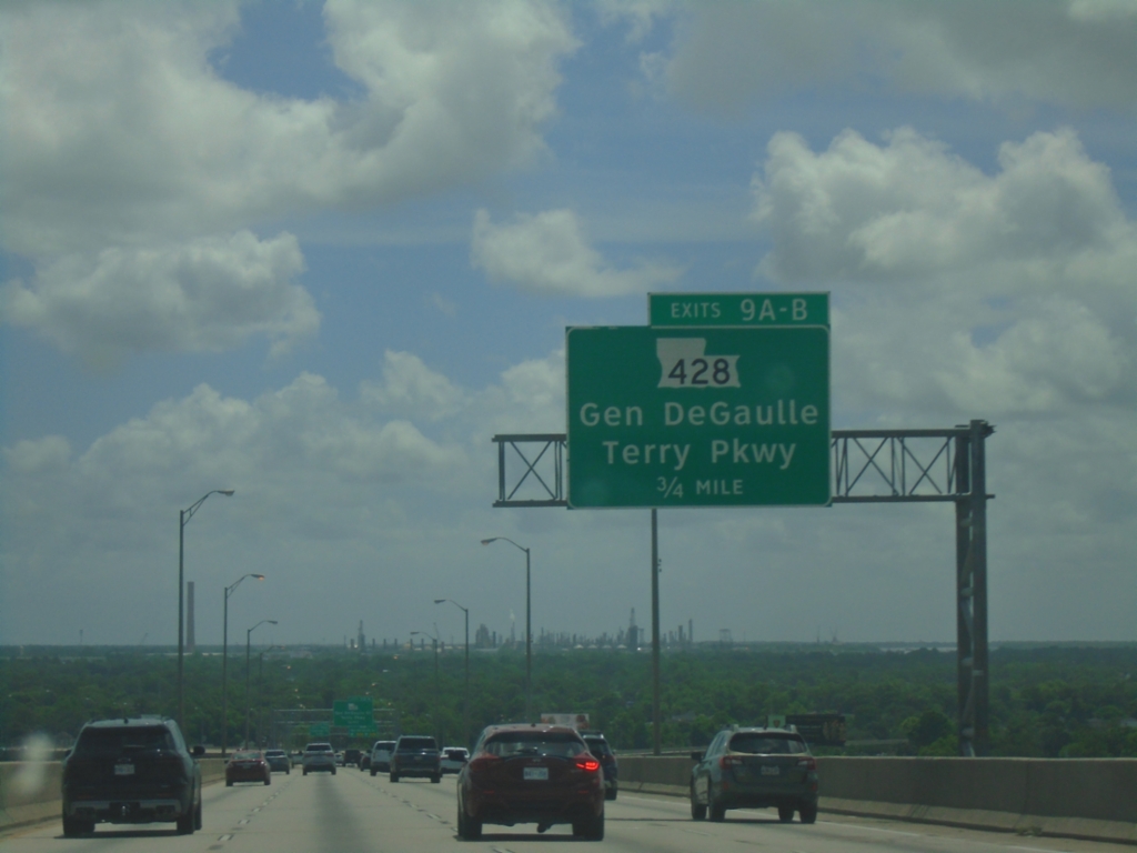
Bus. US-90 West - Exits 9A-B
Bus. US-90 West approaching Exits 9A-B - LA-428/Gen DeGaulle/Terry Parkway.
Taken 05-31-2026
New Orleans
Orleans Parish
Louisiana
United States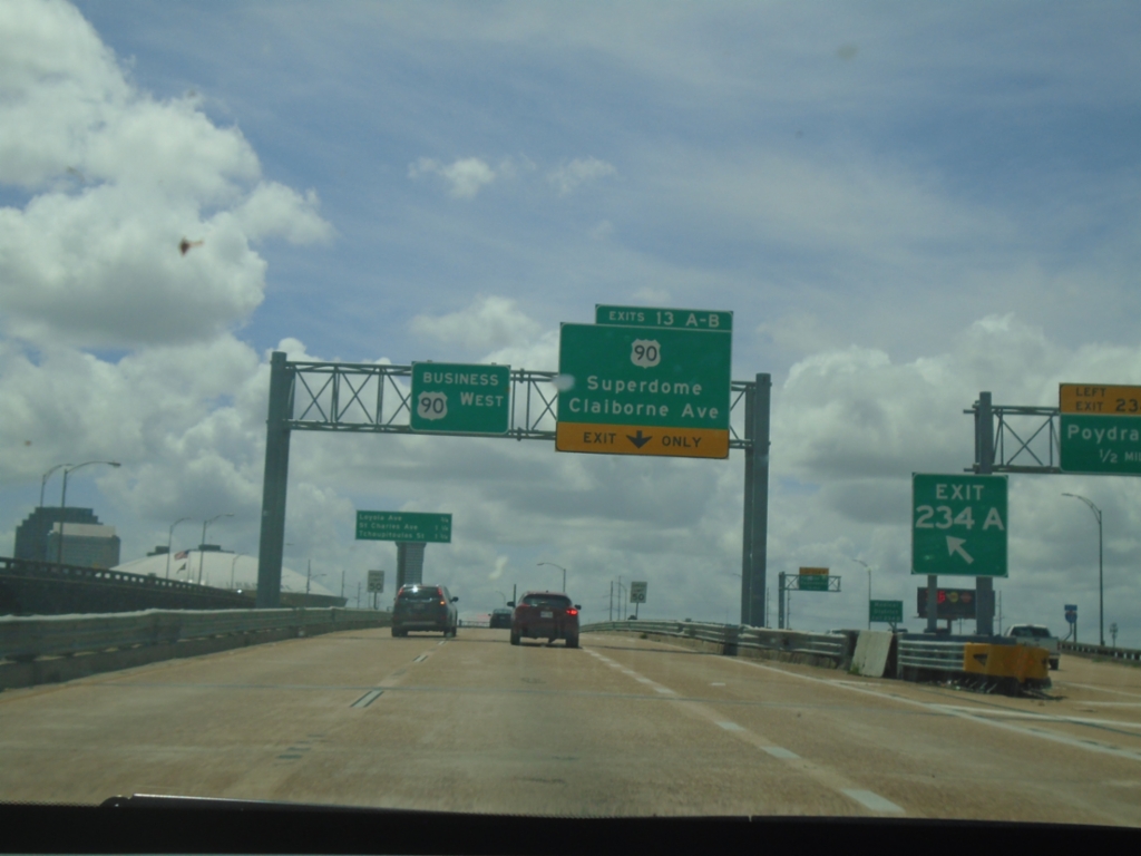
Bus. US-90 West - Exit 13A-B
Bus. US-90 West at Exit 13A-B - US-90/Superdome/Claiborne Ave. Bus. US-90 continues west towards the Mississippi River bridge.
Taken 05-31-2026
 New Orleans
Orleans Parish
Louisiana
United States
New Orleans
Orleans Parish
Louisiana
United States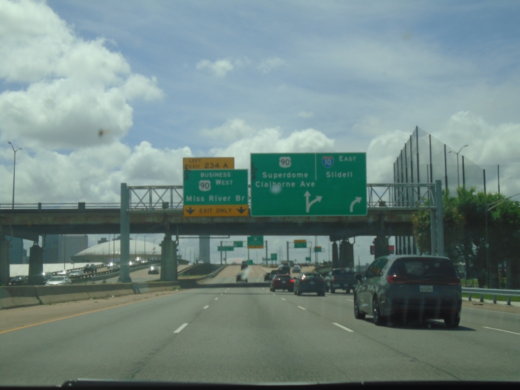
I-10 East - Exits 234A-B
I-10 east approaching Exit 234A - Bus. US-90 West/Mississippi River Bridge. Approaching (Exit 234B) - US-90/Superdome/Claiborne Ave. I-10 East continues towards Slidell.
Taken 05-31-2026
New Orleans
Orleans Parish
Louisiana
United States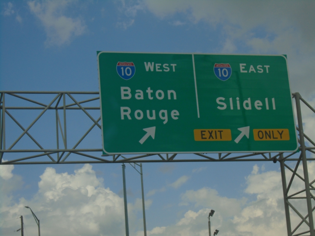
Carrollton Ave. North at I-10
Carrollton Ave. North at I-10 in New Orleans. Use I-10 East to Slidell; I-10 West to Baton Rouge.
Taken 05-29-2026
New Orleans
Orleans Parish
Louisiana
United States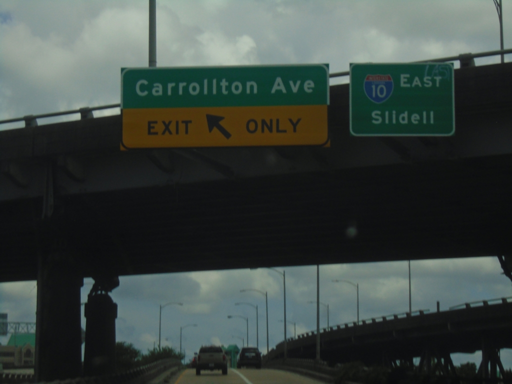
I-10 East - Exit 232 Offramp
I-10 East - Exit 232 Offramp at Carrollton Ave. Use left lane for Carrollton Ave; use right lane for I-10 East/Slidell.
Taken 05-29-2026
 New Orleans
Orleans Parish
Louisiana
United States
New Orleans
Orleans Parish
Louisiana
United States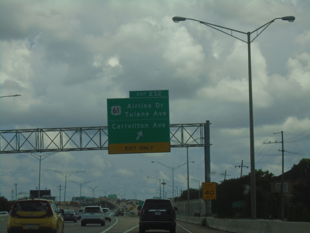
I-10 East - Exit 232
I-10 east at Exit 232 - US-61/Airline Drive/Tulane Ave. and Carrollton Ave.
Taken 05-29-2026
New Orleans
Orleans Parish
Louisiana
United States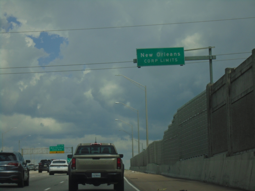
I-10 East - New Orleans
New Orleans Corporate Limit on I-10 east. Entering Orleans Parish.
Taken 05-29-2026
New Orleans
Orleans Parish
Louisiana
United States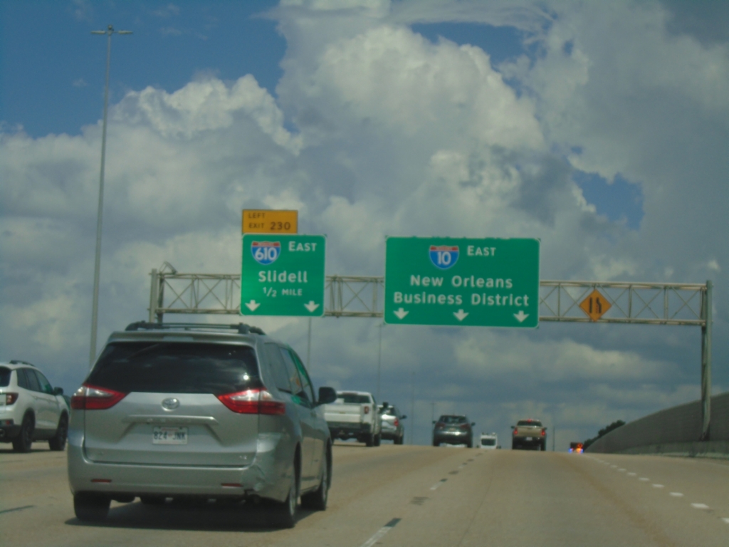
I-10 East - Exit 230
I-10 east approaching Exit 230 - I-610 East/Slidell (left exit). Continue east on I-10 for New Orleans Business District.
Taken 05-29-2026
 Metairie
Jefferson Parish
Louisiana
United States
Metairie
Jefferson Parish
Louisiana
United States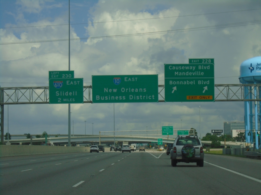
I-10 East - Exits 228 and 230
I-10 East at Exit 228 - Causeway Blvd./Mandeville and Bonnabel Blvd. Use Exit 228 for access to Lake Pontchartrain Causeway. Approaching Exit 230 - I-610 East/Slidell. Continue east on I-10 for the New Orleans Business District.
Taken 05-29-2026
Metairie
Jefferson Parish
Louisiana
United States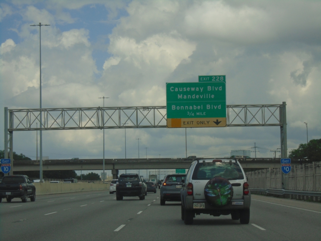
I-10 East - Exit 228
I-10 east approaching Exit 228 - Causeway Blvd./Mandeville and Bonnabel Blvd.
Taken 05-29-2026
Metairie
Jefferson Parish
Louisiana
United States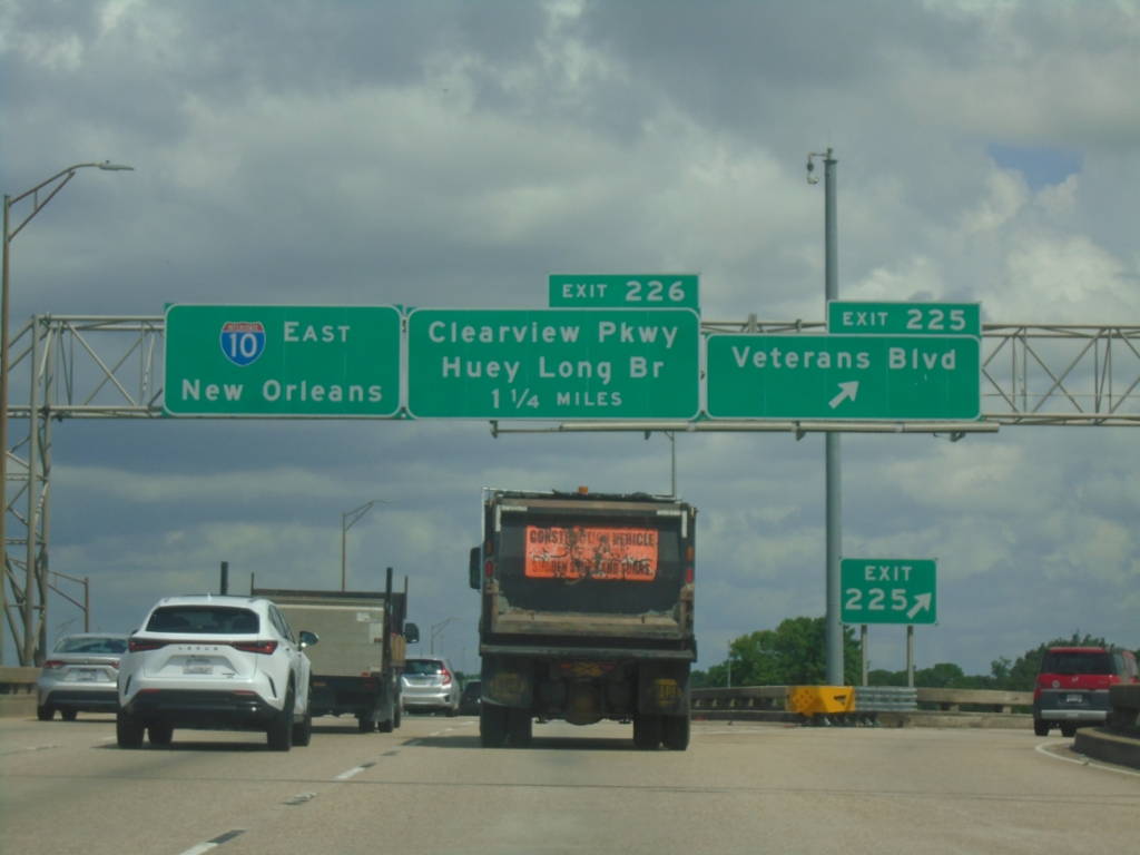
I-10 East - Exits 225 and 226
I-10 east at Exit 225 - Veterans Blvd. Approaching Exit 226 - Clearview Parkway/Huey Long Bridge. I-10 continues east to New Orleans.
Taken 05-29-2026
 Metairie
Jefferson Parish
Louisiana
United States
Metairie
Jefferson Parish
Louisiana
United States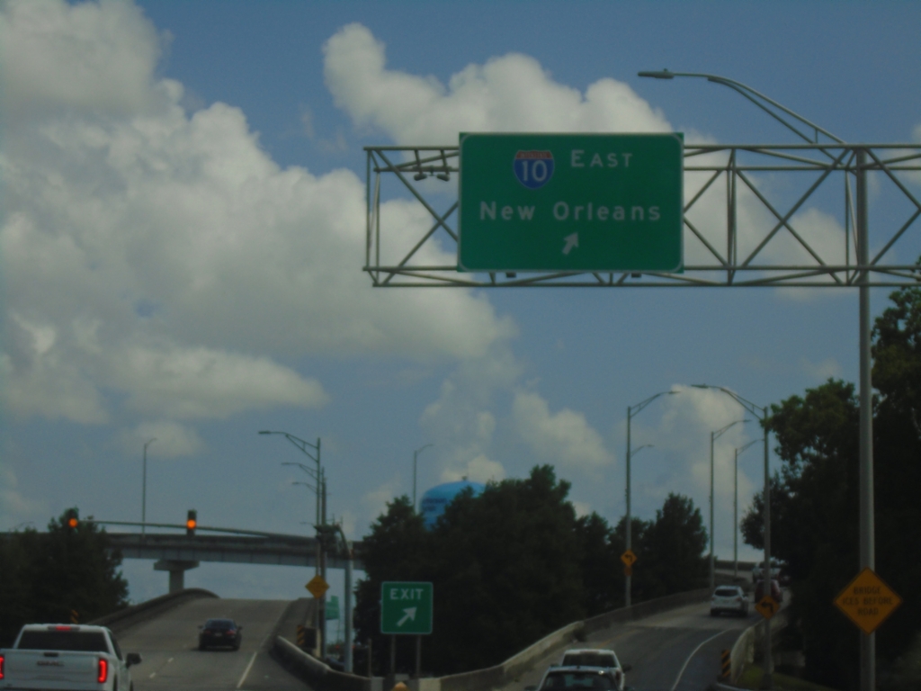
Power Blvd. South at I-10
Power Blvd. South at I-10 East to New Orleans.
Taken 05-29-2026
Metairie
Jefferson Parish
Louisiana
United States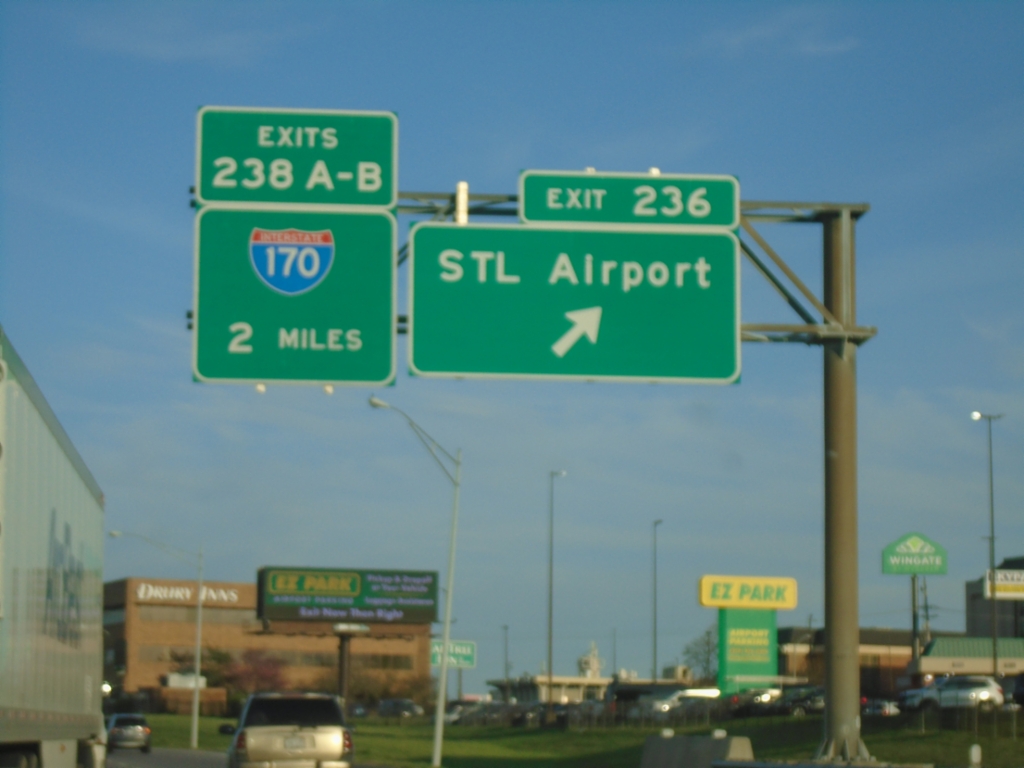
I-70 East - Exits 236 and 238A-B
I-70 East at Exit 236 - STL Airport. Approaching Exit 238A-B - I-170.
Taken 03-29-2026

 St. Ann
St. Louis County
Missouri
United States
St. Ann
St. Louis County
Missouri
United States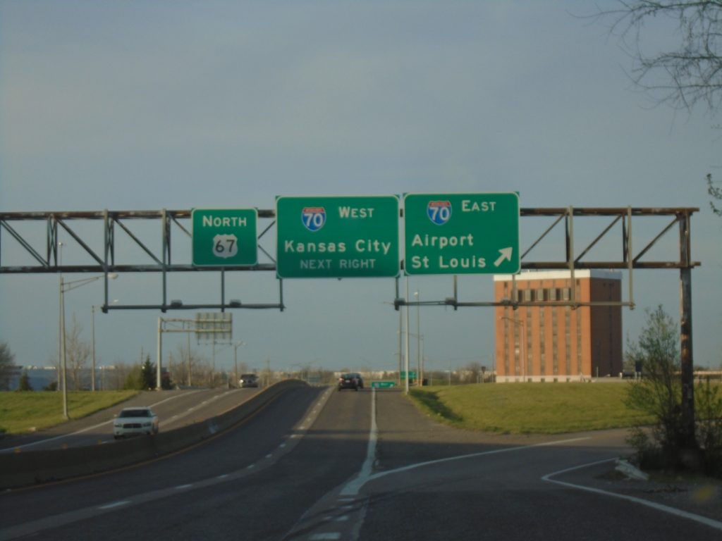
US-67 North at I-70
US-67 North at I-70 interchange. Use I-70 East to Airport/Saint Louis; I-70 West to Kansas City.
Taken 03-29-2026
 Bridgeton
Saint Louis County
Missouri
United States
Bridgeton
Saint Louis County
Missouri
United States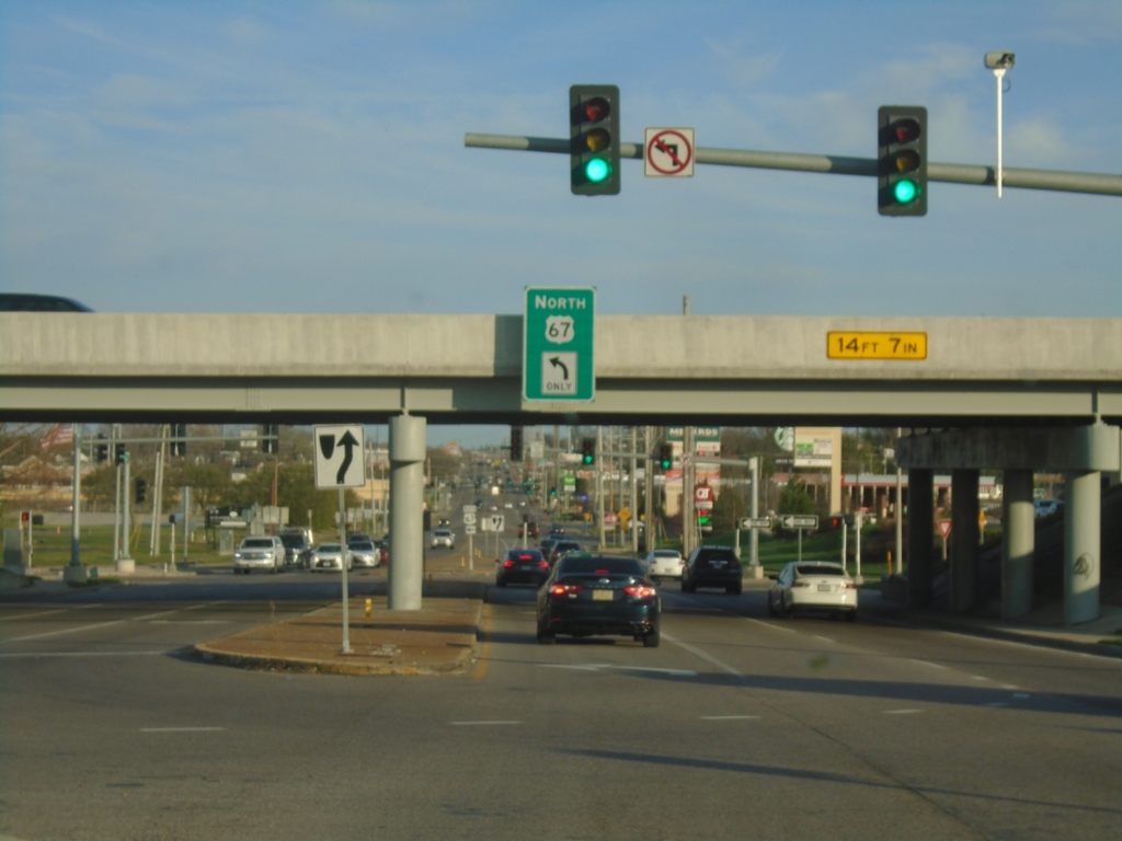
MO-180 East at US-67 North
MO-180 East (St. Charles Rock Road) at US-67 North interchange.
Taken 03-29-2026
 St. Ann
St. Louis County
Missouri
United States
St. Ann
St. Louis County
Missouri
United States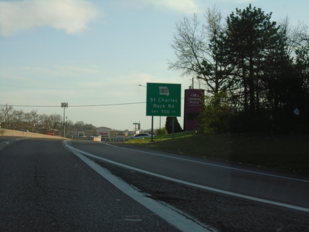
US-67 South Approaching MO-180
US-67 south approaching MO-180/Saint Charles Rock Road interchange.
Taken 03-29-2026
Bridgeton
Saint Louis County
Missouri
United States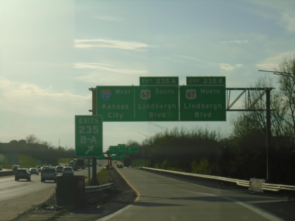
I-70 West - Exits 235B-A
I-70 West at Exits 235B-A - US-67/Lindbergh Blvd. Continue west on I-70 to Kansas City.
Taken 03-29-2026
Bridgeton
St. Louis County
Missouri
United States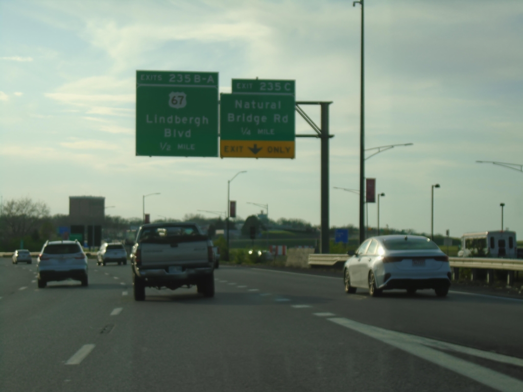
I-70 West - Exits 235C-B-A
I-70 West approaching Exit 235C - Natural Bridge Road. Approaching Exits 235B-A - US-67/Lindbergh Blvd.
Taken 03-29-2026
St. Ann
St. Louis County
Missouri
United States