Signs Tagged With Big Green Sign
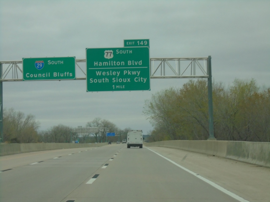
I-29 South - Exit 149
I-29 south approaching Exit 149 - US-77 South/Hamilton Blvd/Wesley Parkway/South Sioux City (NE). I-29 continues south to Council Bluffs.
Taken 05-02-2022

 Sioux City
Woodbury County
Iowa
United States
Sioux City
Woodbury County
Iowa
United States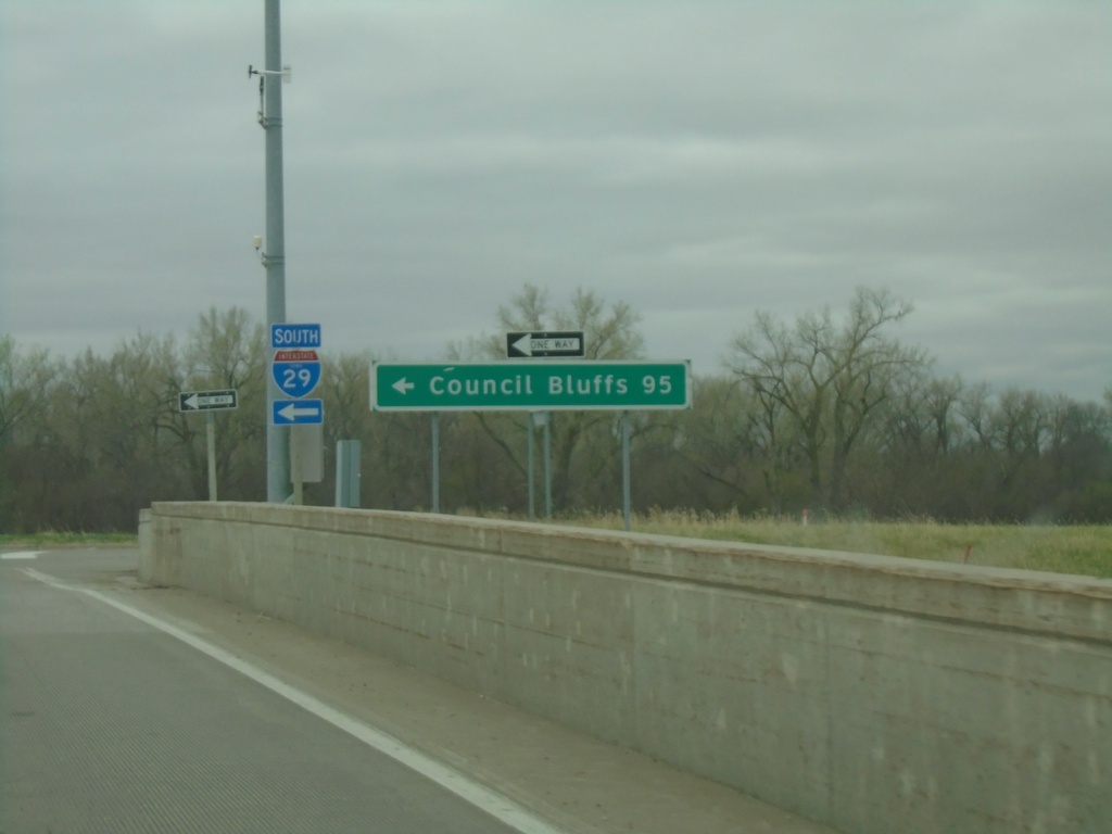
End IA-12 South at I-29 South
End IA-12 South at I-29 South to Council Bluffs.
Taken 05-02-2022
 Sioux City
Woodbury County
Iowa
United States
Sioux City
Woodbury County
Iowa
United States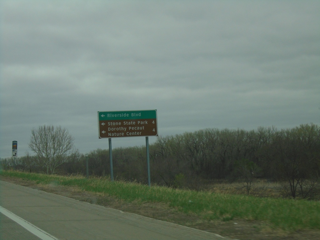
I-29 South Exit 151 Offramp at IA-12
I-29 South Exit 151 offramp at IA-12. Turn left on IA-12 north for Riverside Blvd., Stone State Park, Dorothy Peanut Nature Center.
Taken 05-02-2022
Sioux City
Woodbury County
Iowa
United States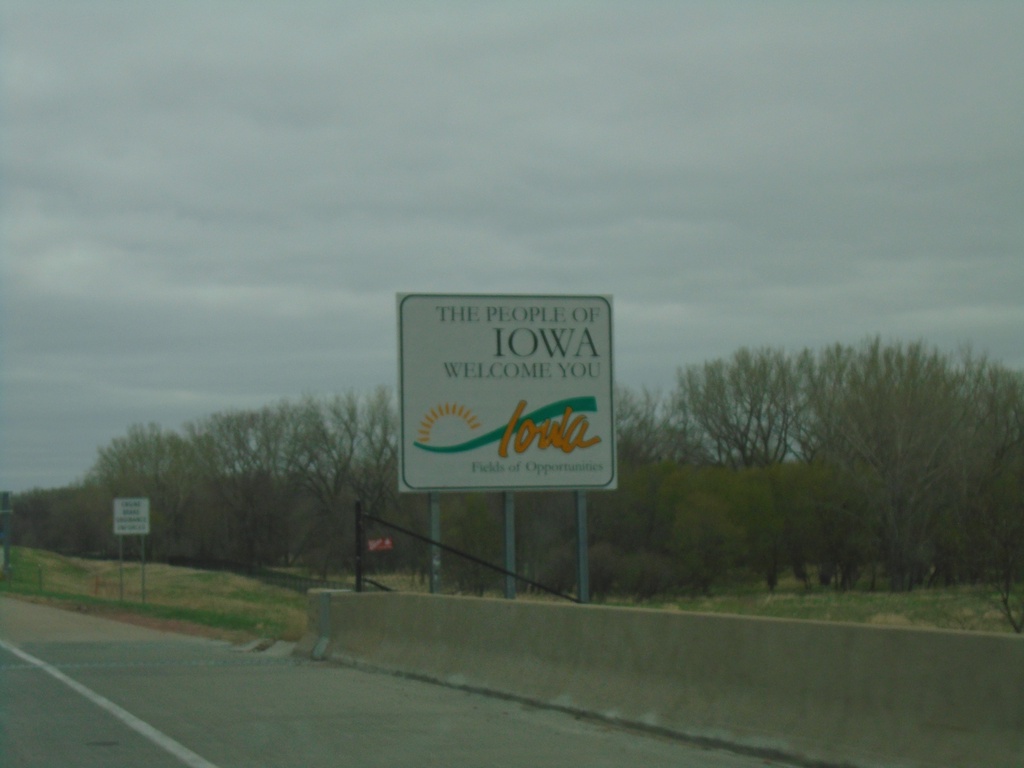
I-29 South - Welcome To Iowa
Welcome to Iowa on I-29 south in Sioux City.
Taken 05-02-2022
Sioux City
Woodbury County
Iowa
United States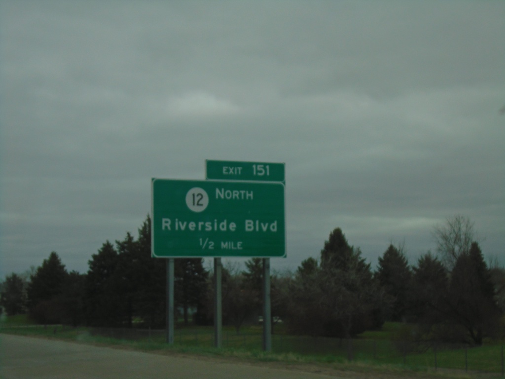
I-29 South - Iowa Exit 151
I-29 south approaching Exit 151 (Iowa) - IA-12/Riverside Blvd.
Taken 05-02-2022
Dakota Dunes
Union County
South Dakota
United States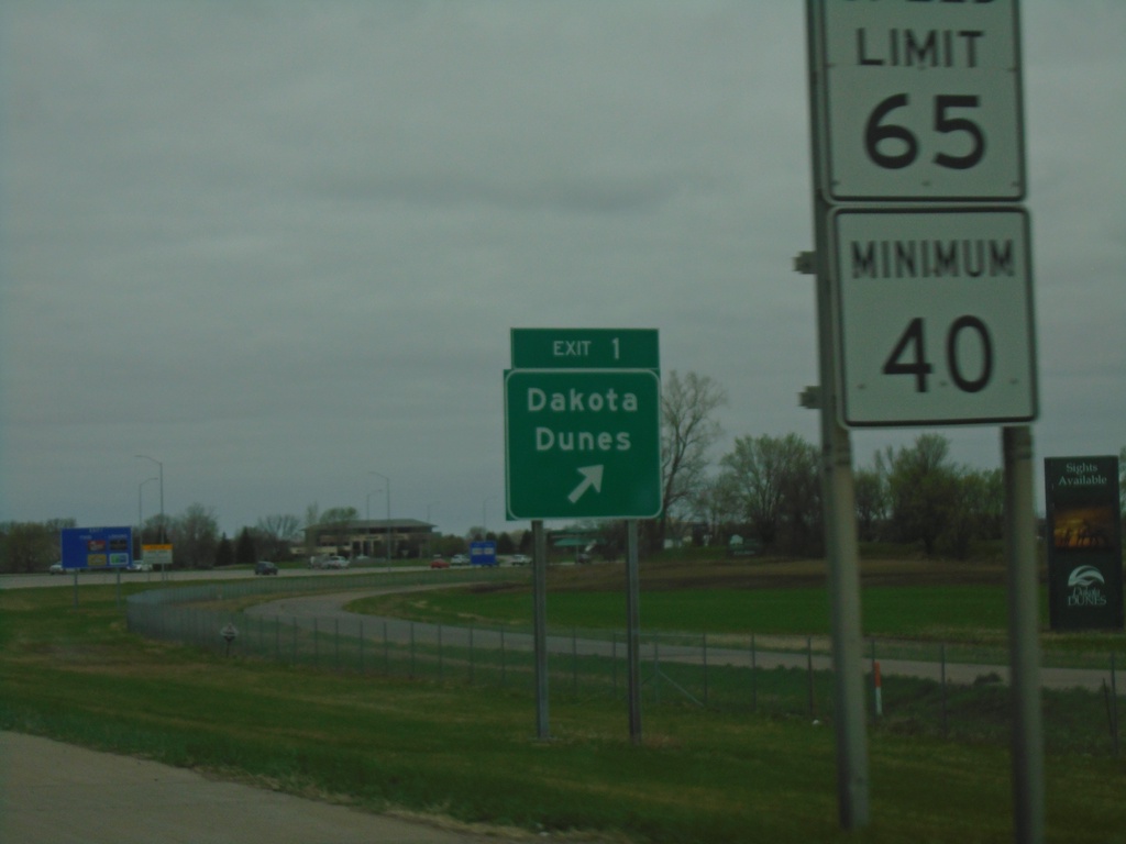
I-29 North - Exit 1
I-29 north at Exit 1 - Dakota Dunes. This is the first exit in South Dakota on I-29 northbound.
Taken 05-02-2022
North Sioux City
Union County
South Dakota
United States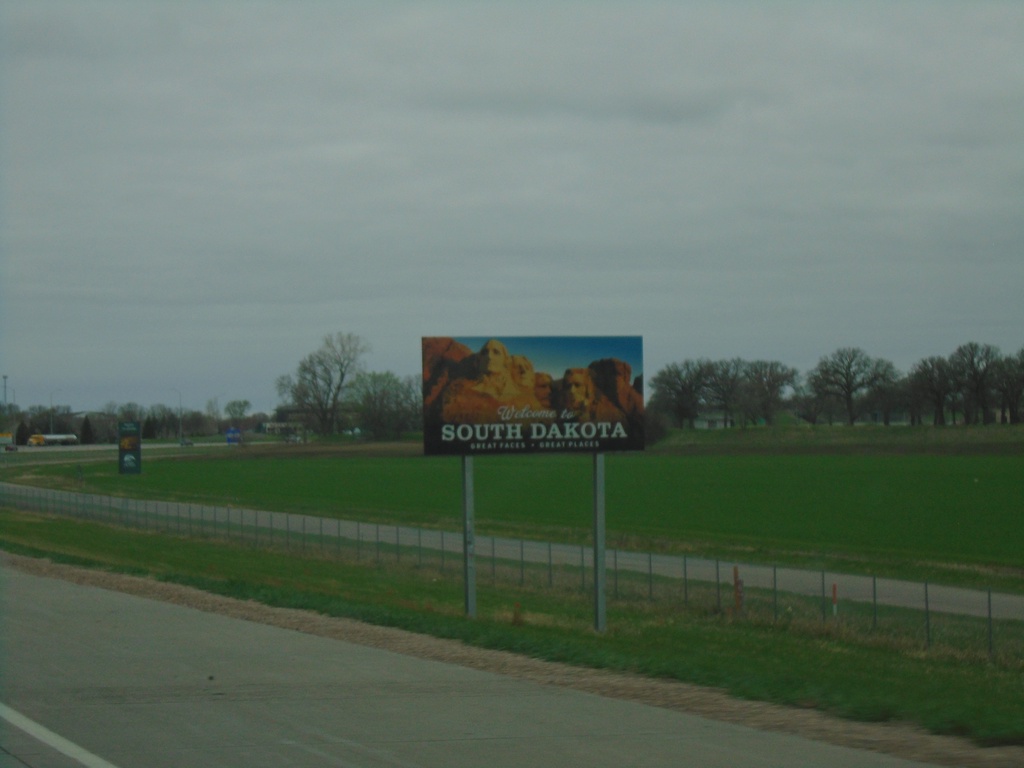
I-29 North - Welcome To South Dakota
Welcome to South Dakota on I-29 north.
Taken 05-02-2022
North Sioux City
Union County
South Dakota
United States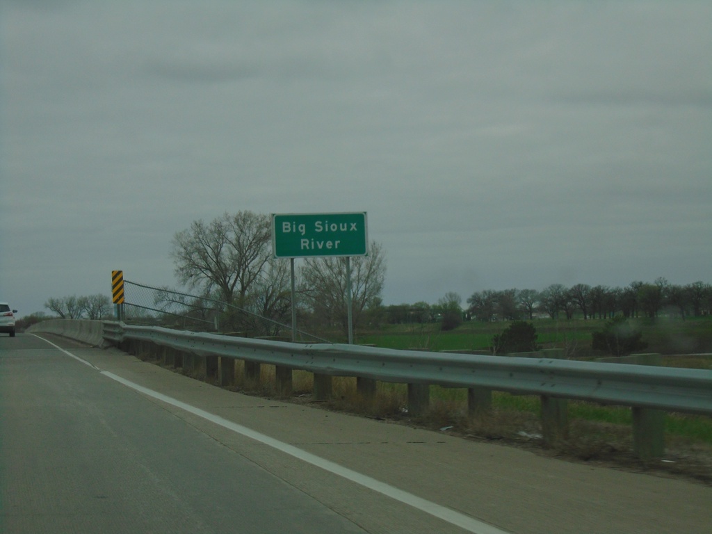
I-29 North - Big Sioux River
I-29 north at the Big Sioux River. The Big Sioux River marks the state line between Iowa and South Dakota.
Taken 05-02-2022
Sioux City
Woodbury County
Iowa
United States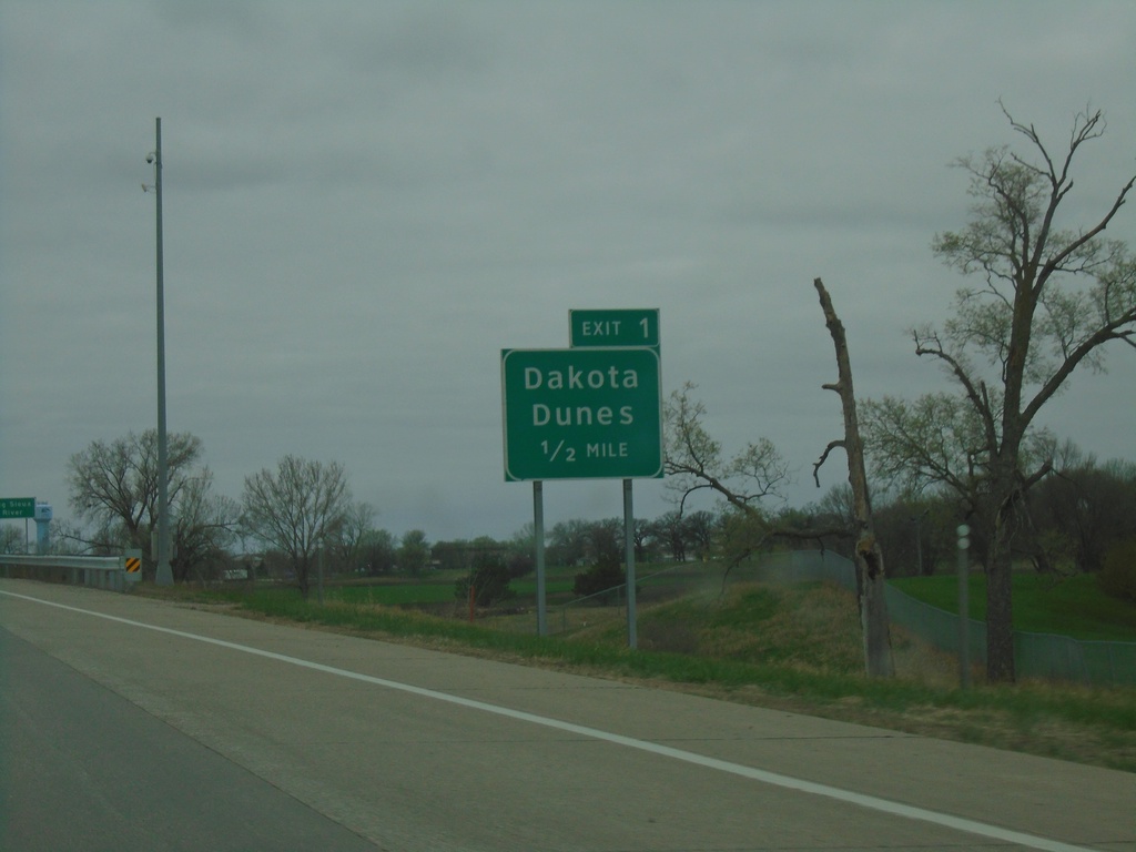
I-29 North - South Dakota Exit 1
I-29 North - Exit 1 (South Dakota) - Dakota Dunes. Approaching the South Dakota state line.
Taken 05-02-2022
Sioux City
Woodbury County
Iowa
United States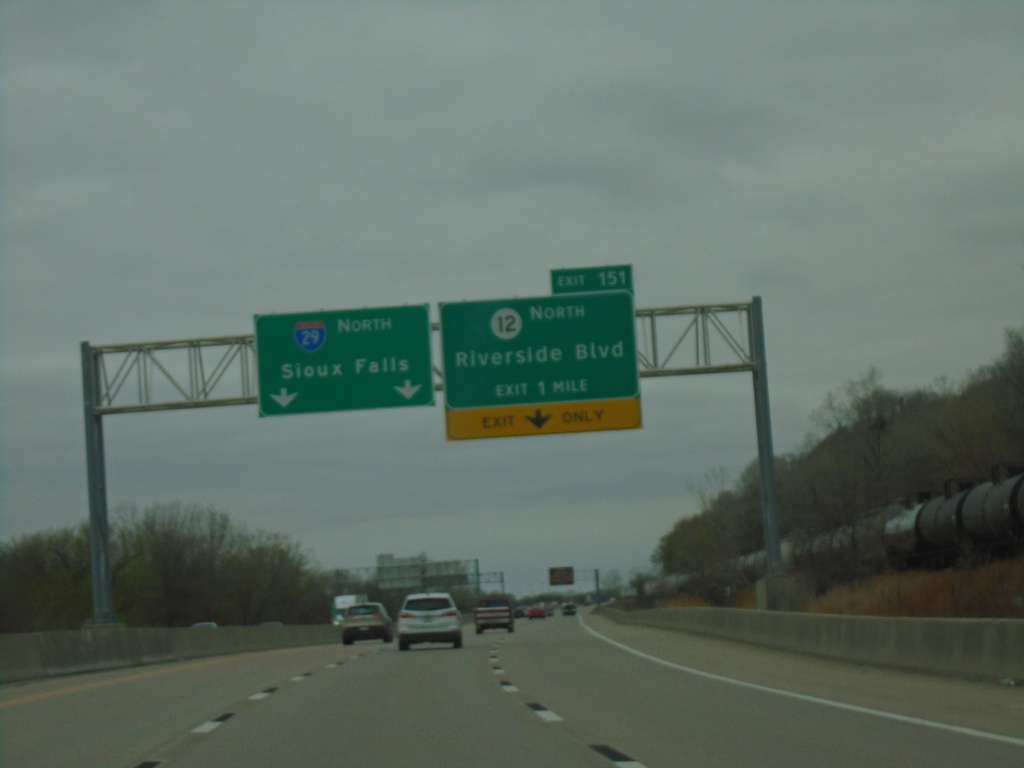
I-29 North - Exit 151
I-29 North approaching Exit 151 - IA-12 North/Riverside Blvd. Continue north on I-29 to Sioux Falls (SD). This is the last exit in Iowa northbound.
Taken 05-02-2022
Sioux City
Woodbury County
Iowa
United States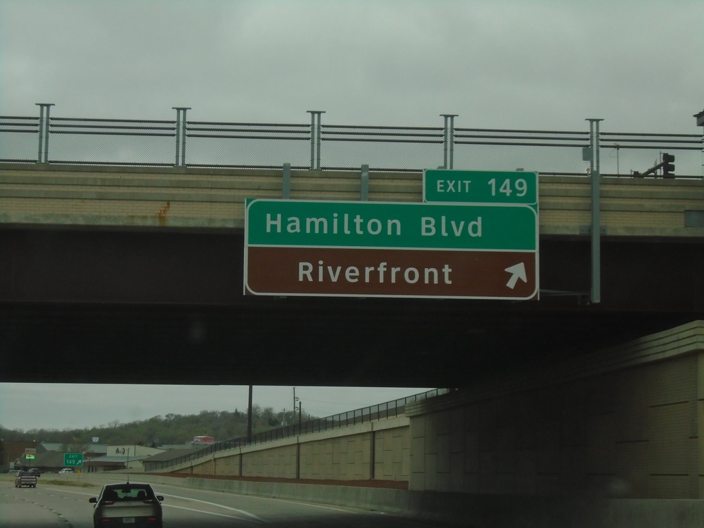
I-29 North - Exit 149
I-29 north at Exit 149 - Hamilton Blvd/Riverfront
Taken 05-02-2022
Sioux City
Woodbury County
Iowa
United States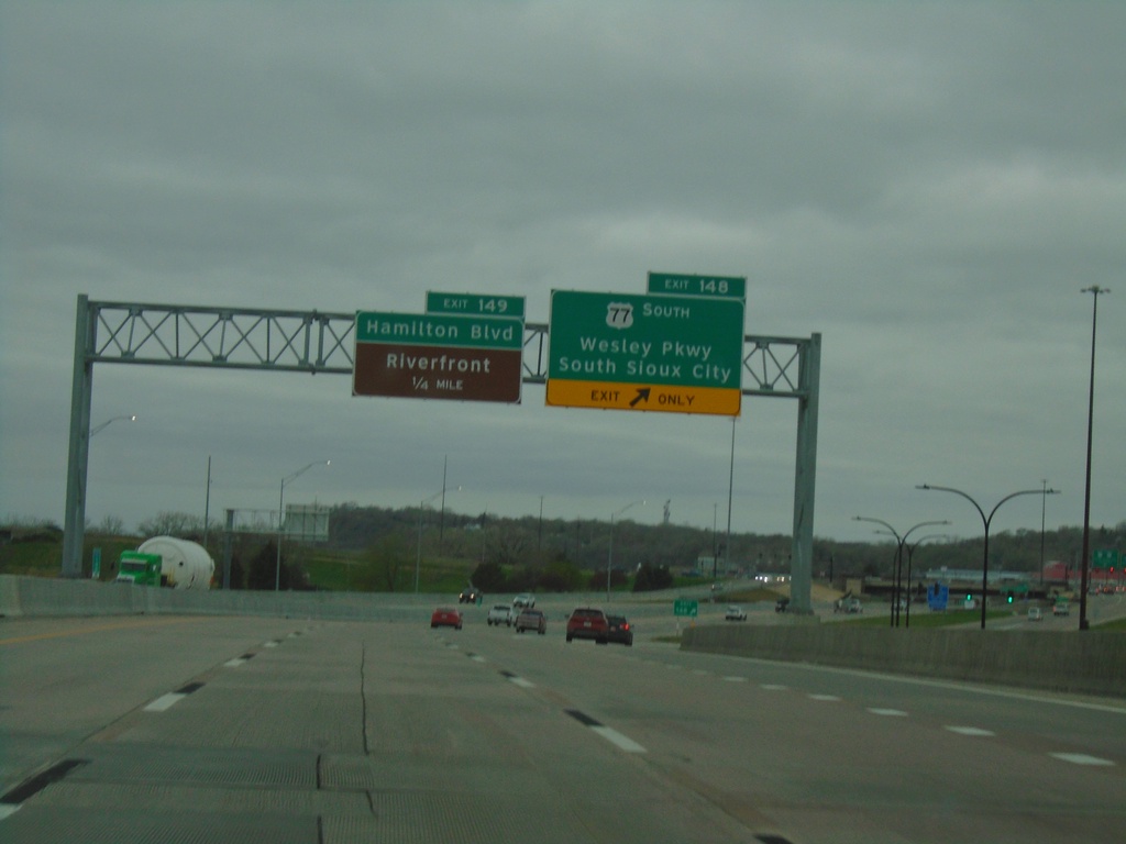
I-29 North - Exits 148 and 149
I-29 north at Exit 148 - US-77 South/Wesley Parkway/South Sioux City (NE). Approaching Exit 149 - Hamilton Blvd./Riverfront.
Taken 05-02-2022
Sioux City
Woodbury County
Iowa
United States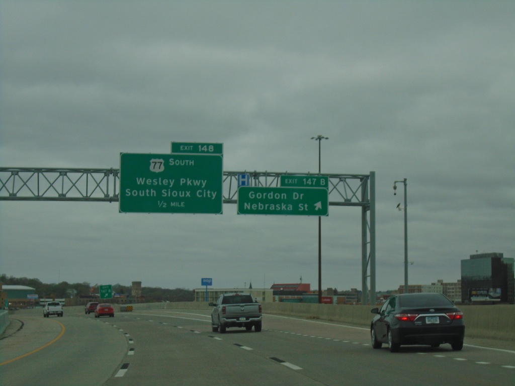
I-29 North - Exits 147B and 148
I-29 North at Exits 147B - Gordon Drive/Nebraska St and approaching Exit 148 - US-77 South/Wesley Parkway/South Sioux City (NE).
Taken 05-02-2022
Sioux City
Woodbury County
Iowa
United States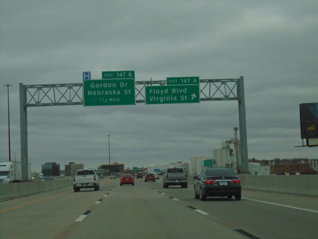
I-29 North - Exits 147A and 147B
I-29 north at Exit 147A - Floyd Blvd/Virginia St. Approaching Exit 147B - Gordon Drive/Nebraska St.
Taken 05-02-2022
Sioux City
Woodbury County
Iowa
United States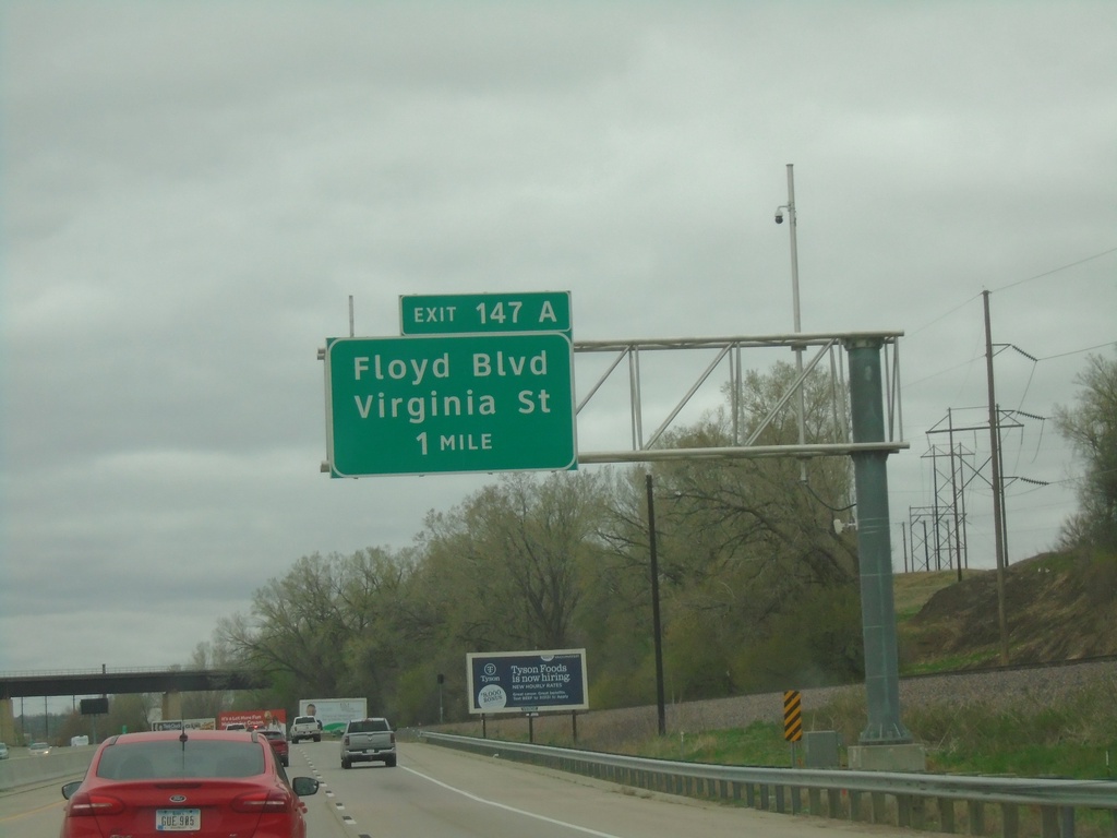
I-29 North - Exit 147A
I-29 north approaching Exit 147A - Floyd Blvd/Virginia St.
Taken 05-02-2022
Sioux City
Woodbury County
Iowa
United States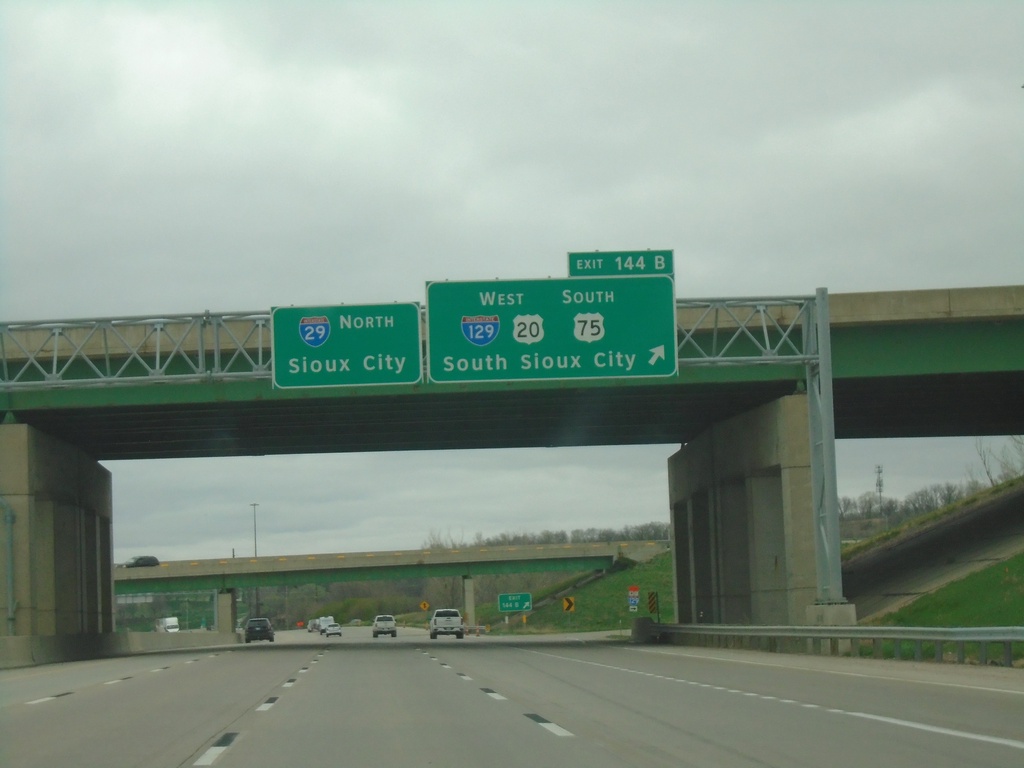
I-29 North - Exit 144B
I-29 north at Exit 144B - I-129 West/US-20 West/US-75 South/South Sioux City (NE). Continue north on I-29 for Sioux City.
Taken 05-02-2022


 Sioux City
Woodbury County
Iowa
United States
Sioux City
Woodbury County
Iowa
United States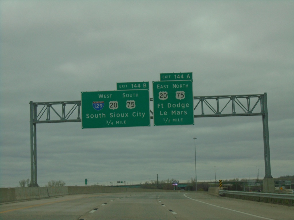
I-29 North - Exits 144A and 144B
I-29 north approaching Exit 144A - US-20 East/US-75 North/Fort Dodge/Le Mars. Approaching Exit 144B - I-129 West/US-20 West/US-75 South/South Sioux City (NE).
Taken 05-02-2022
Sioux City
Woodbury County
Iowa
United States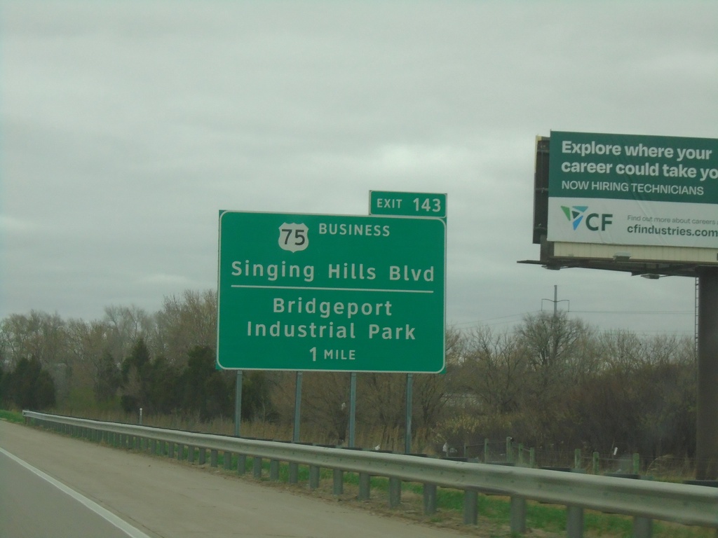
I-29 North - Exit 143
I-29 north approaching Exit 143 - Bus. US-75/Singing Hills Blvd/Bridgeport Industrial Park.
Taken 05-02-2022
 Sioux City
Woodbury County
Iowa
United States
Sioux City
Woodbury County
Iowa
United States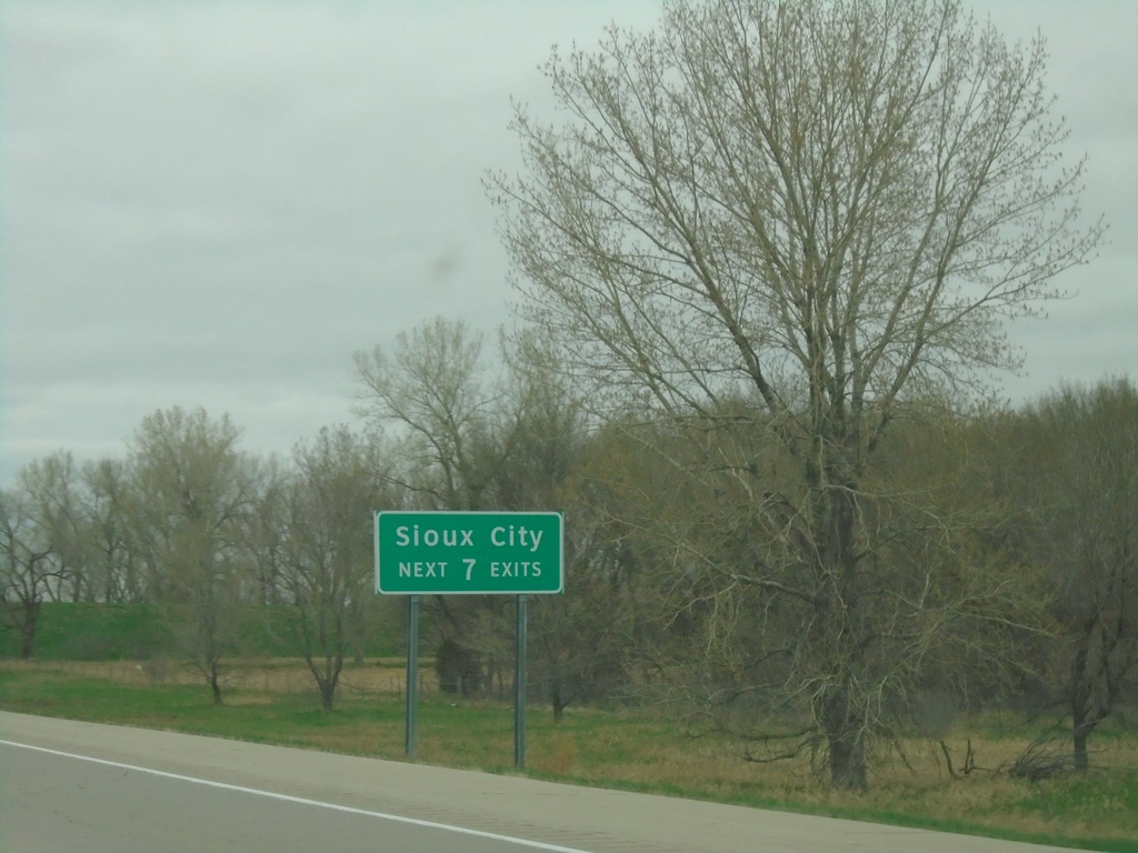
I-29 North - Sioux City Exits
I-29 North - Sioux City Next 7 Exits
Taken 05-02-2022
Sergeant Bluff
Woodbury County
Iowa
United States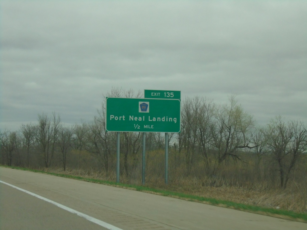
I-29 North - Exit 135
I-29 north approaching Exit 135 - CH-D51/Port Neal Landing.
Taken 05-02-2022
 Salix
Woodbury County
Iowa
United States
Salix
Woodbury County
Iowa
United States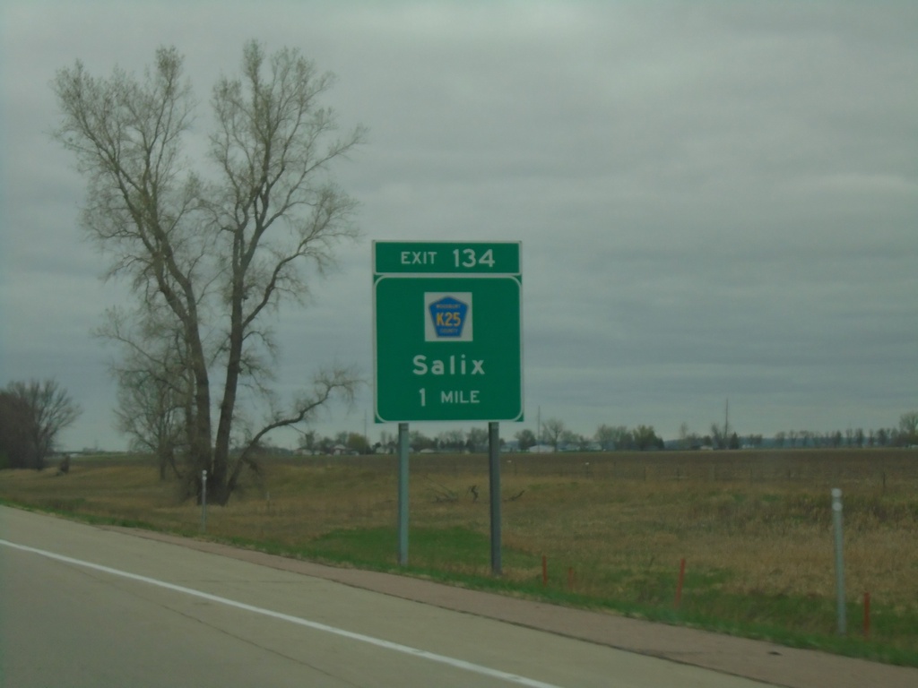
I-29 North - Exit 134
I-29 north approaching Exit 134 - CH-K25/Salix.
Taken 05-02-2022
 Salix
Woodbury County
Iowa
United States
Salix
Woodbury County
Iowa
United States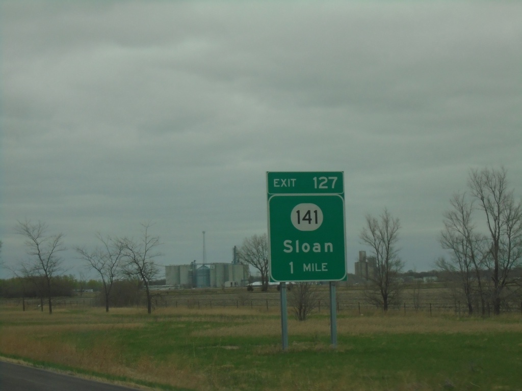
I-29 North - Exit 127
I-29 north approaching Exit 127 - IA-141/Sloan.
Taken 05-02-2022
 Sloan
Woodbury County
Iowa
United States
Sloan
Woodbury County
Iowa
United States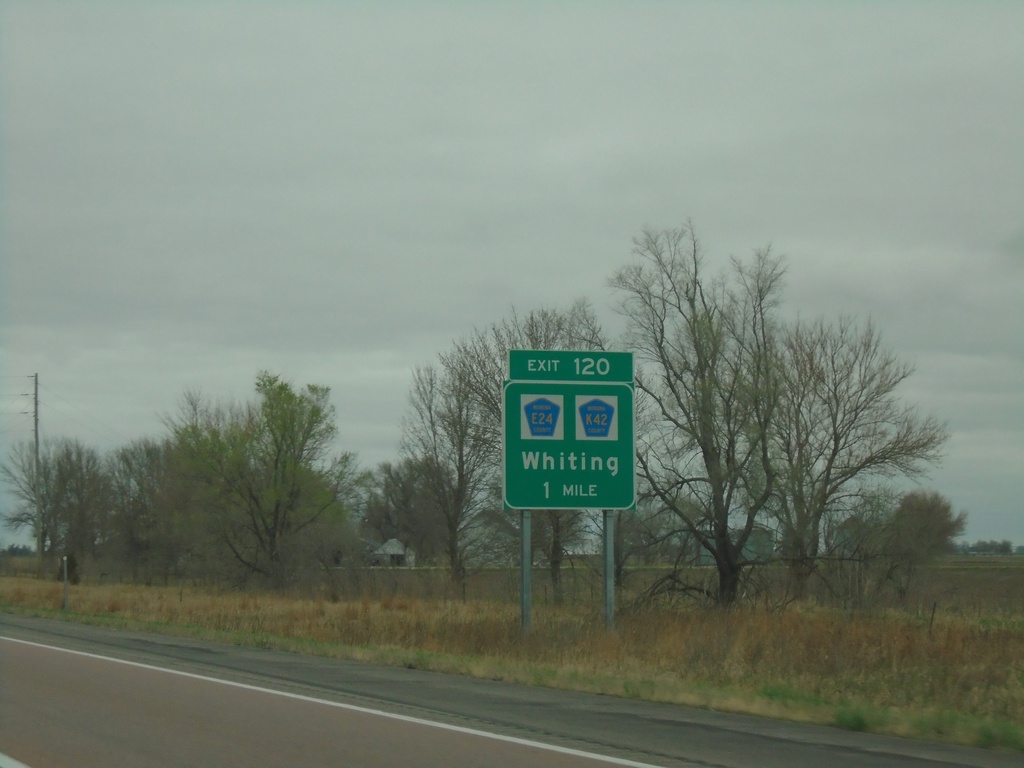
I-29 North - Exit 120
I-29 north approaching Exit 120 - CH-E24/CH-K42/Whiting.
Taken 05-02-2022

 Whiting
Monona County
Iowa
United States
Whiting
Monona County
Iowa
United States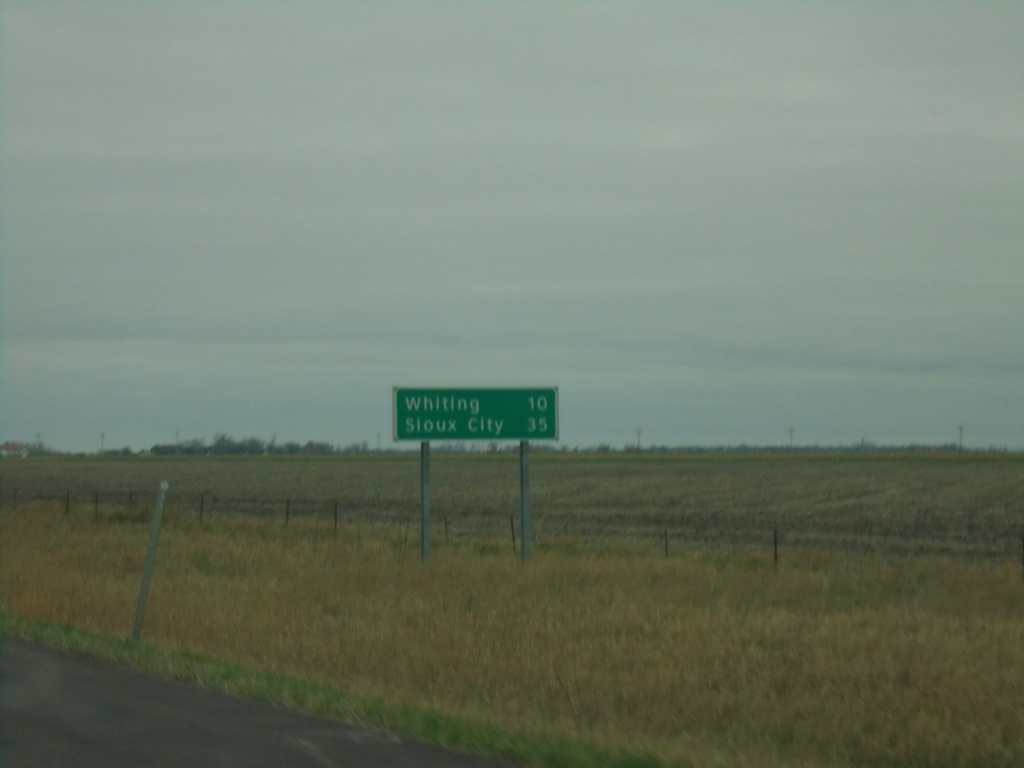
I-29 North - Distance Marker
Distance marker on I-29 north. Distance to Whiting and Sioux City.
Taken 05-02-2022
Onawa
Monona County
Iowa
United States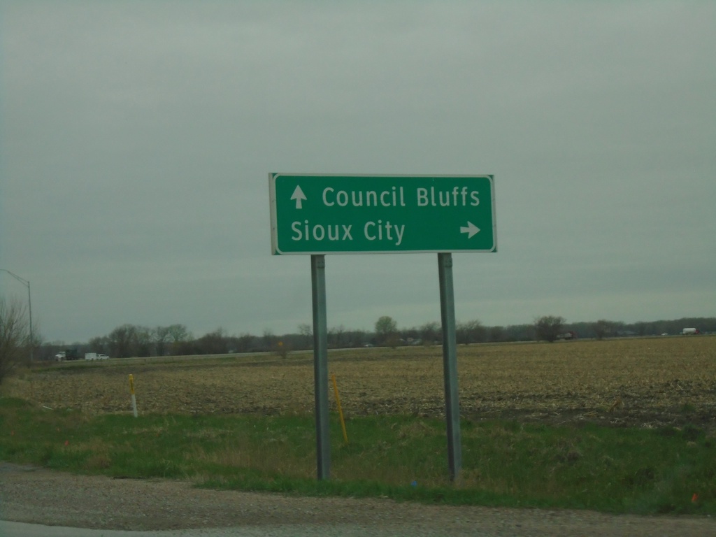
IA-175 West at I-29 (Exit 112)
IA-175 West at I-29 (Exit 112). Use I-29 north to Sioux City; I-29 south to Council Bluffs.
Taken 05-02-2022
 Onawa
Monona County
Iowa
United States
Onawa
Monona County
Iowa
United States