Signs Tagged With Big Green Sign
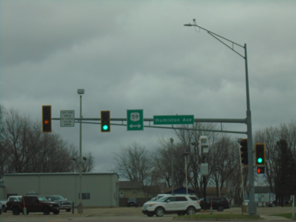
Ryan Road at US-59
Ryan Road at US-59 (Humiston Ave.) in Worthington.
Taken 05-01-2022
 Worthington
Nobles County
Minnesota
United States
Worthington
Nobles County
Minnesota
United States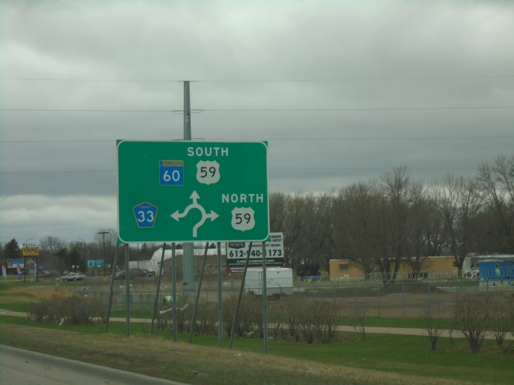
MN-60 West at US-59 and CH-33
MN-60 West at US-59 and CH-33 roundabout in Worthington. US-59 South joins MN-60 westbound.
Taken 05-01-2022


 Worthington
Nobles County
Minnesota
United States
Worthington
Nobles County
Minnesota
United States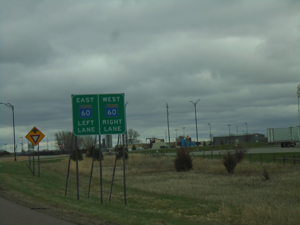
I-90 East - Exit 45 Offramp at BL-90/MN-60 Roundabout
I-90 East - Exit 45 offramp at BL-90/MN-60 roundabout in Worthington. Use right lane for MN-60 West/(BL-90 West); left lane for MN-60 East.
Taken 05-01-2022
 Worthington
Nobles County
Minnesota
United States
Worthington
Nobles County
Minnesota
United States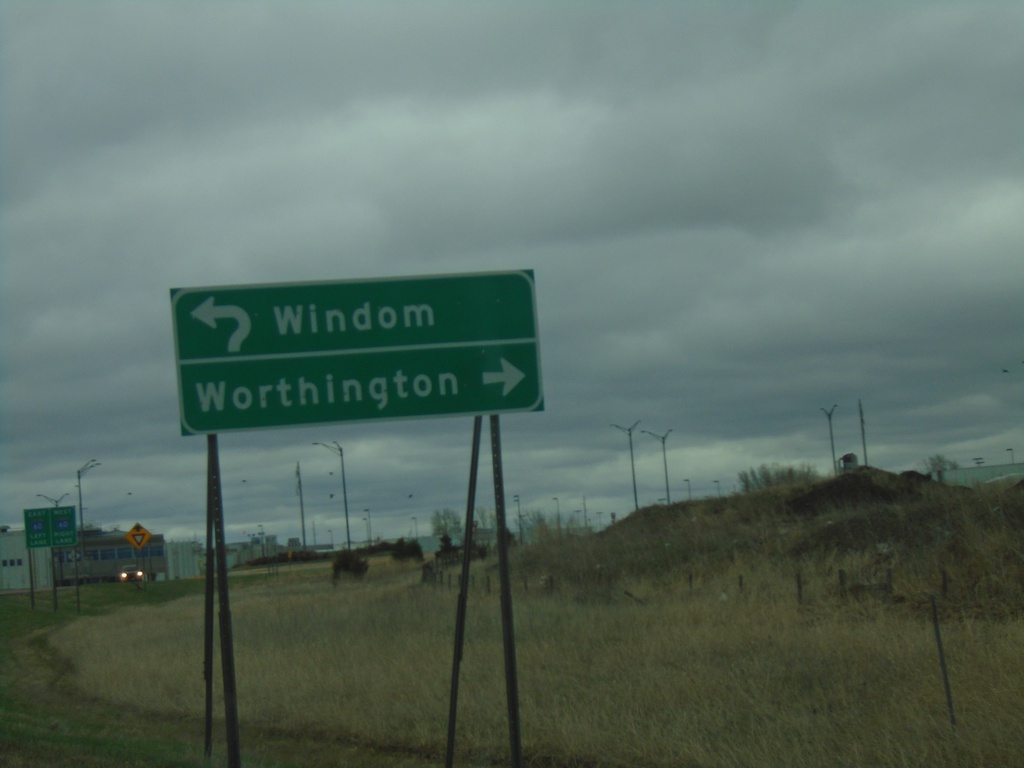
I-90 East - Exit 45 Offramp at MN-60/BL-90 Roundabout
I-90 East - Exit 45 Offramp at MN-60/BL-90 roundabout. Use BL-90 West/MN-60 South to Worthington; MN-60 north to Windom.
Taken 05-01-2022
Worthington
Nobles County
Minnesota
United States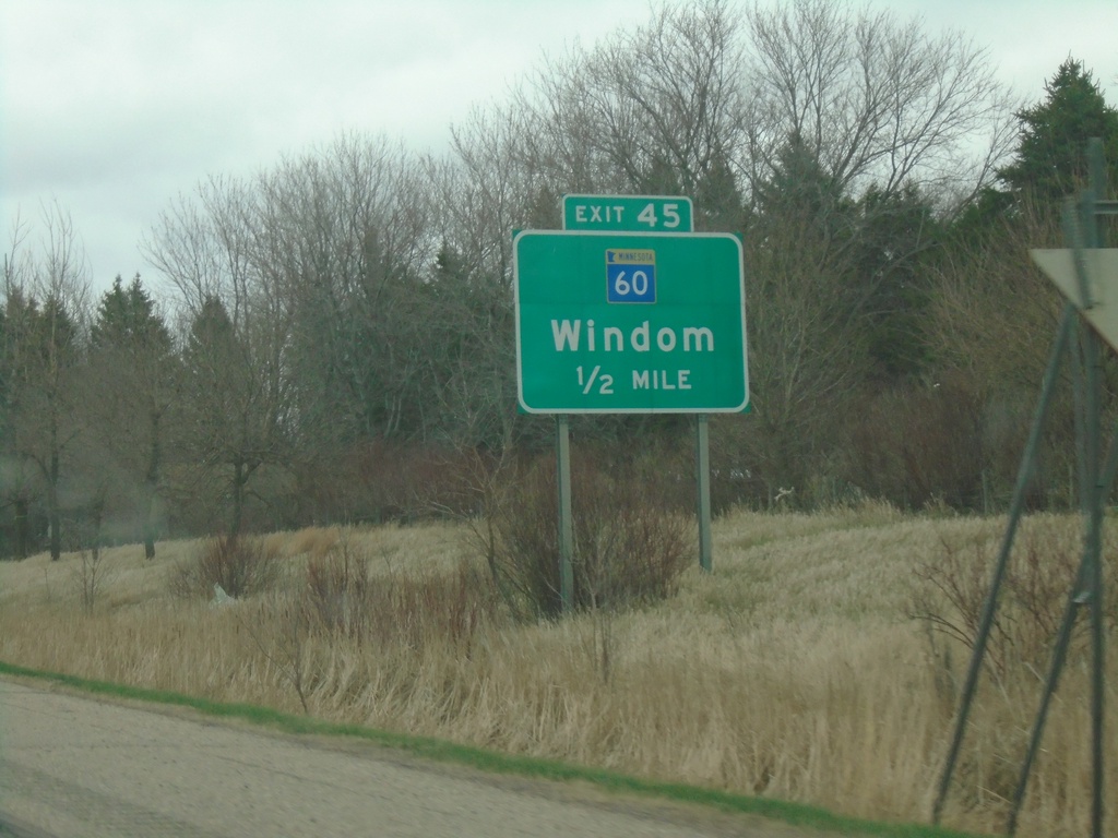
I-90 East - Exit 45
I-90 east approaching Exit 45 - MN-60/Windom. This is the eastern end of the Worthington business loop.
Taken 05-01-2022
Worthington
Nobles County
Minnesota
United States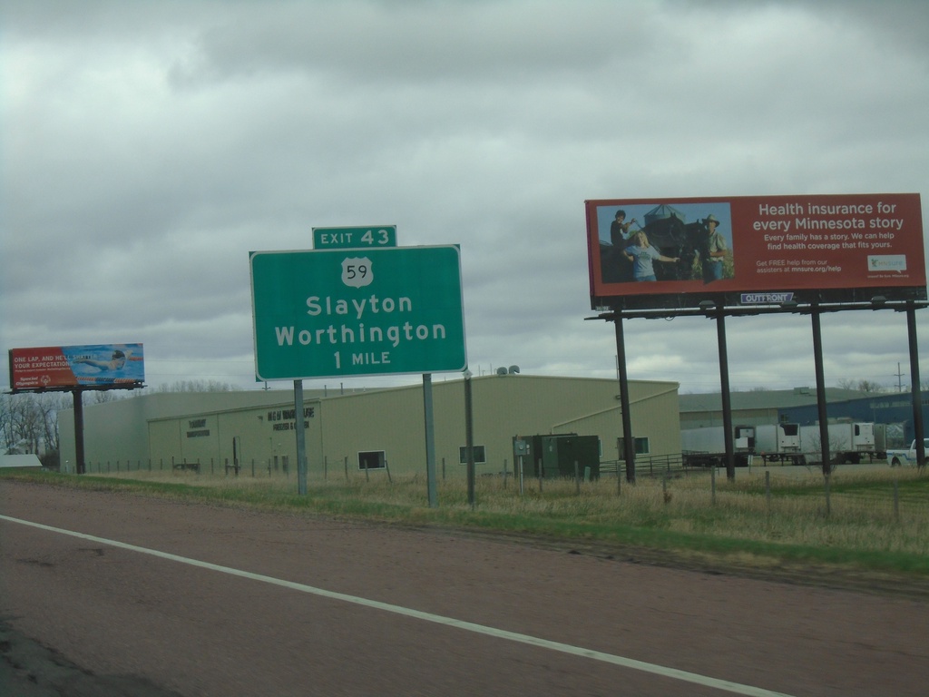
I-90 East - Exit 43
I-90 east approaching Exit 43 - US-59/Slayton/Worthington
Taken 05-01-2022
Worthington
Nobles County
Minnesota
United States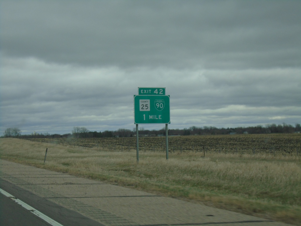
I-90 East - Exit 42
I-90 East approaching Exit 42 - BL-90/CH-25. This is the west end of the Worthington business loop.
Taken 05-01-2022
 Worthington
Nobles County
Minnesota
United States
Worthington
Nobles County
Minnesota
United States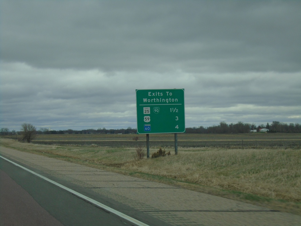
I-90 East - Worthington Exits
Exits to Worthington on I-90 East. BL-90/CH-25, US-59, and MN-60.
Taken 05-01-2022
Worthington
Nobles County
Minnesota
United States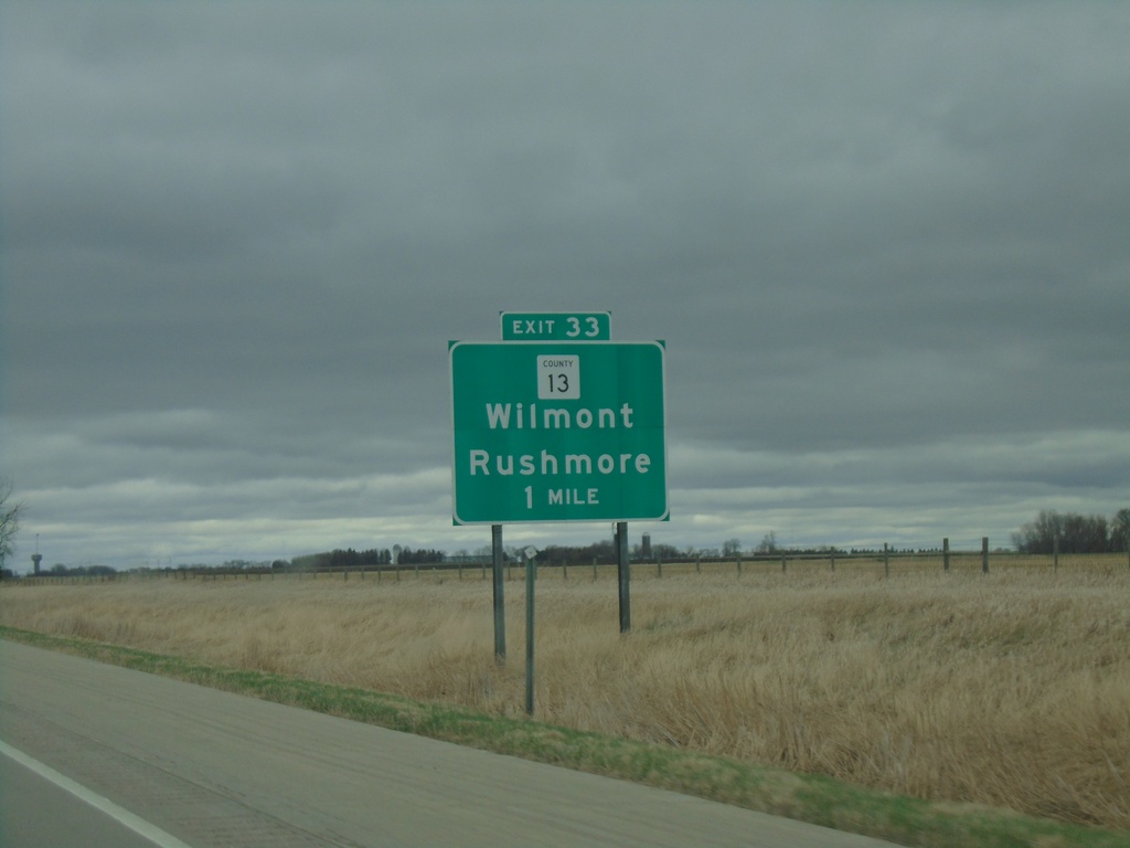
I-90 East - Exit 33
I-90 east approaching Exit 33 - CH-13/Wilmont/Rushmore.
Taken 05-01-2022
 Adrian
Nobles County
Minnesota
United States
Adrian
Nobles County
Minnesota
United States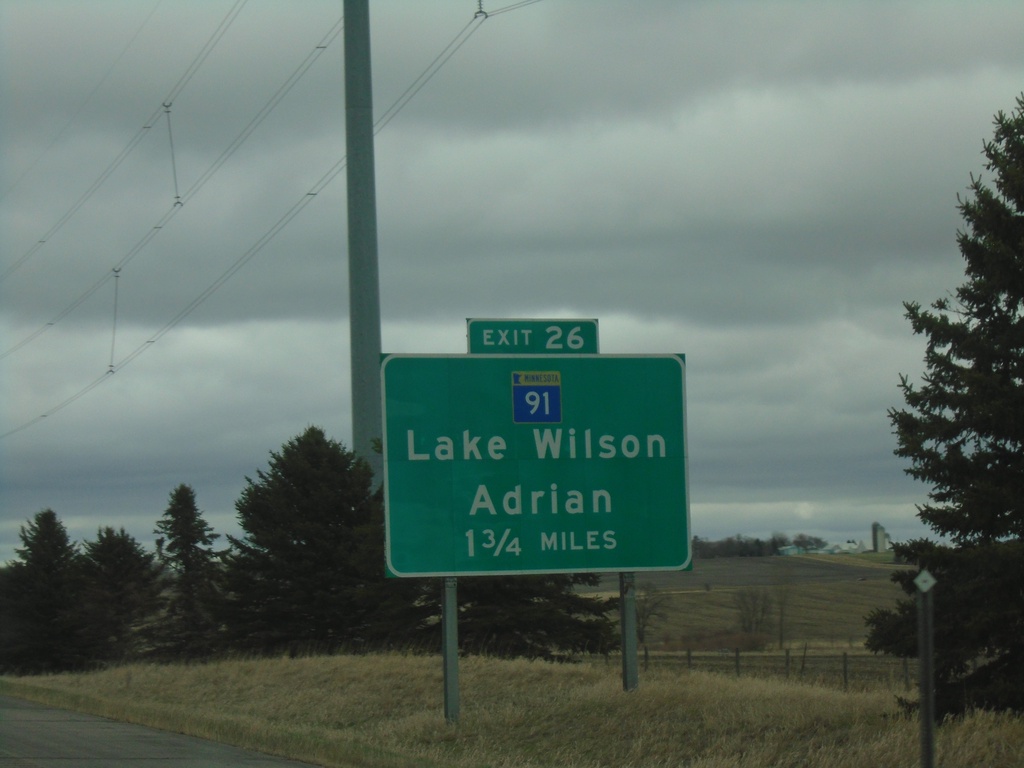
I-90 East - Exit 26
I-90 East approaching Exit 26 - MN-91/Lake Wilson/Adrian.
Taken 05-01-2022
 Adrian
Nobles County
Minnesota
United States
Adrian
Nobles County
Minnesota
United States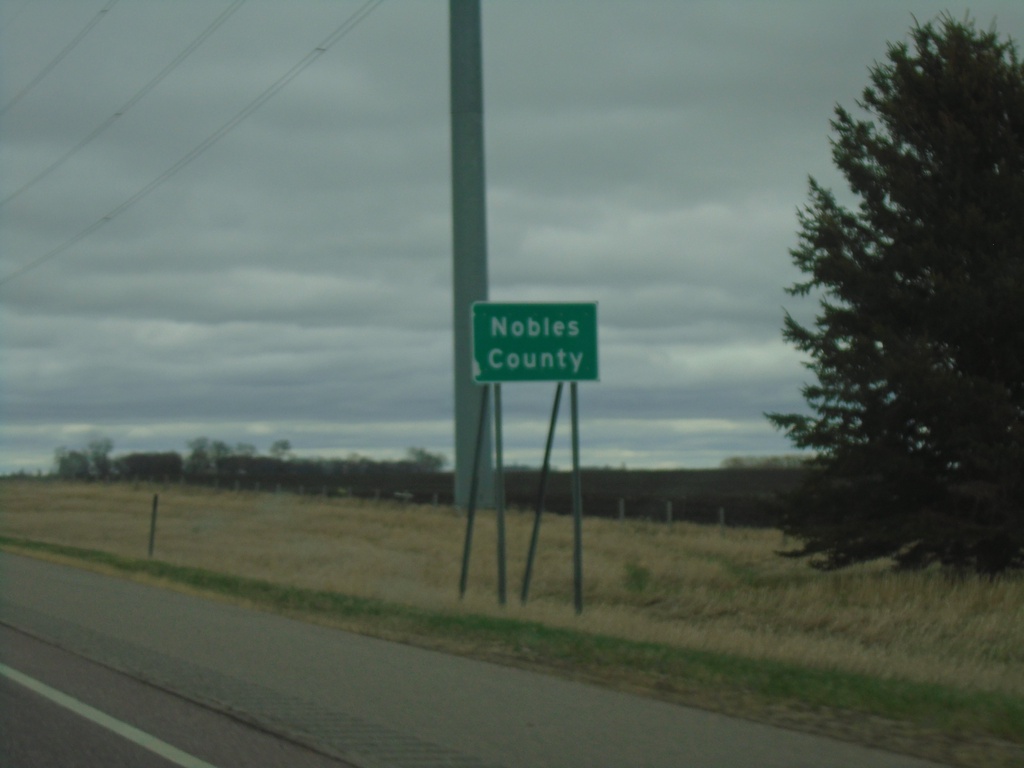
I-90 East - Nobles County
Nobels County on I-90 East.
Taken 05-01-2022
Adrian
Rock County
Minnesota
United States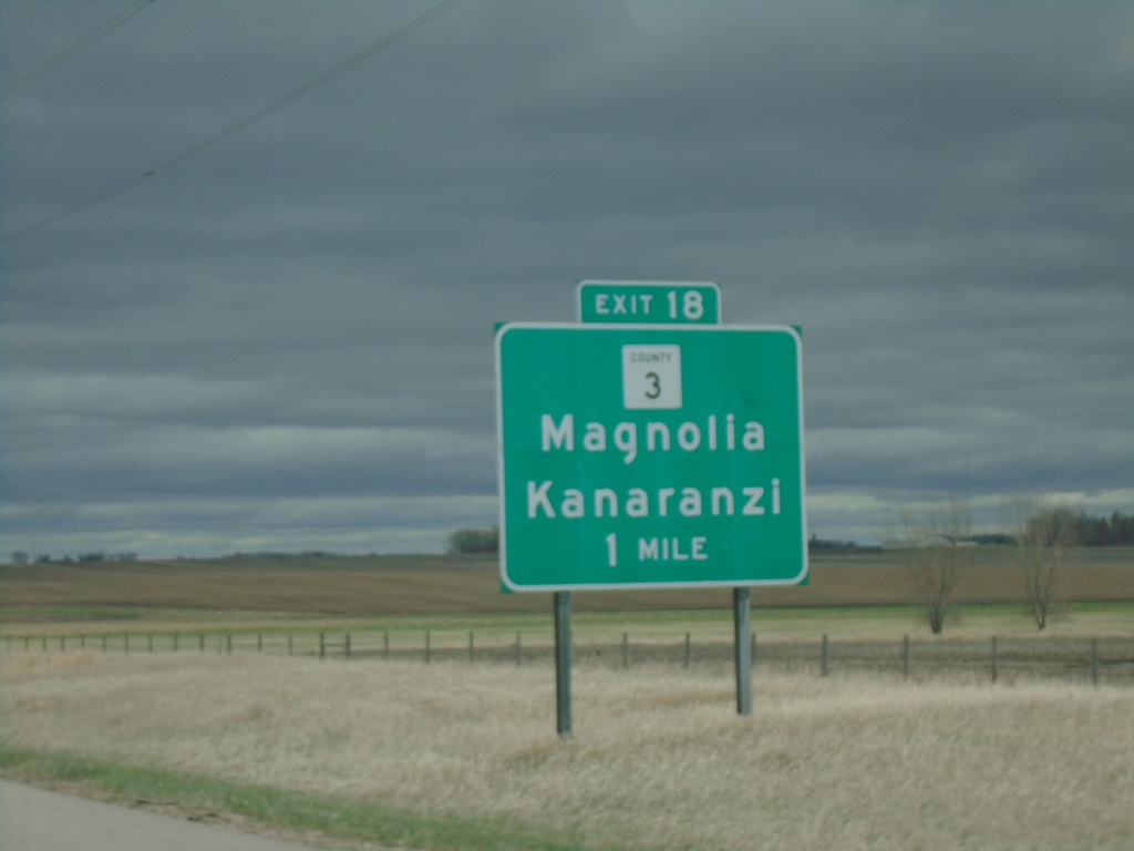
I-90 East - Exit 18
I-90 east approaching Exit 18 - CH-3/Magnolia/Kanaranzi.
Taken 05-01-2022
 Luverne
Rock County
Minnesota
United States
Luverne
Rock County
Minnesota
United States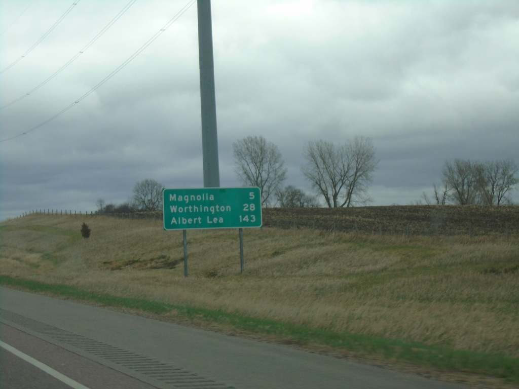
I-90 East - Distance Marker
Distance marker on I-90 east. Distance to Magnolia, Worthington, and Albert Lea.
Taken 05-01-2022
Luverne
Rock County
Minnesota
United States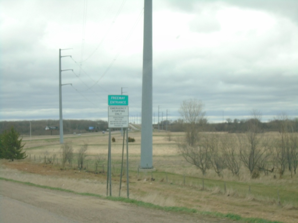
US-75 South at I-90 East - Freeway Entrance
US-75 South at I-90 East (Exit 12) - Freeway Entrance
Taken 05-01-2022
 Luverne
Rock County
Minnesota
United States
Luverne
Rock County
Minnesota
United States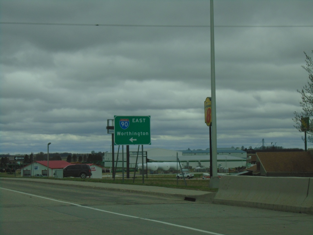
US-75 South at I-90 East
US-75 South at I-90 East to Worthington.
Taken 05-01-2022
Luverne
Rock County
Minnesota
United States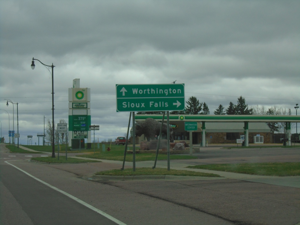
US-75 South Approaching I-90
US-75 South approaching I-90 in Luverne. Use I-90 west to Sioux Falls (South Dakota); I-90 east to Worthington.
Taken 05-01-2022
Luverne
Rock County
Minnesota
United States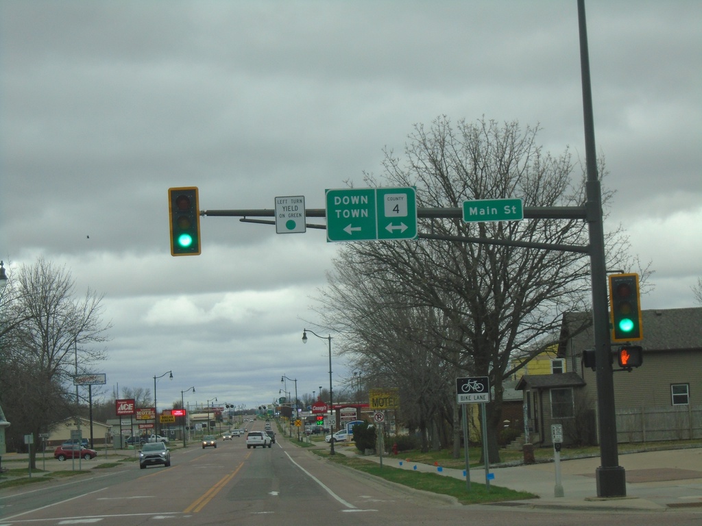
US-75 South at Rock County 4 / Main St
US-75 South at Rock County 4 / Main St in Luverne. Turn left on Main St./CH-4 for Downtown (Luverne).
Taken 05-01-2022
 Luverne
Rock County
Minnesota
United States
Luverne
Rock County
Minnesota
United States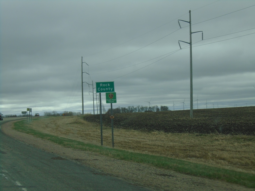
US-75 South - Rock County
Rock County on US-75 South. Rock County is in the southwestern corner of Minnesota.
Taken 05-01-2022
Trosky
Pipestone County
Minnesota
United States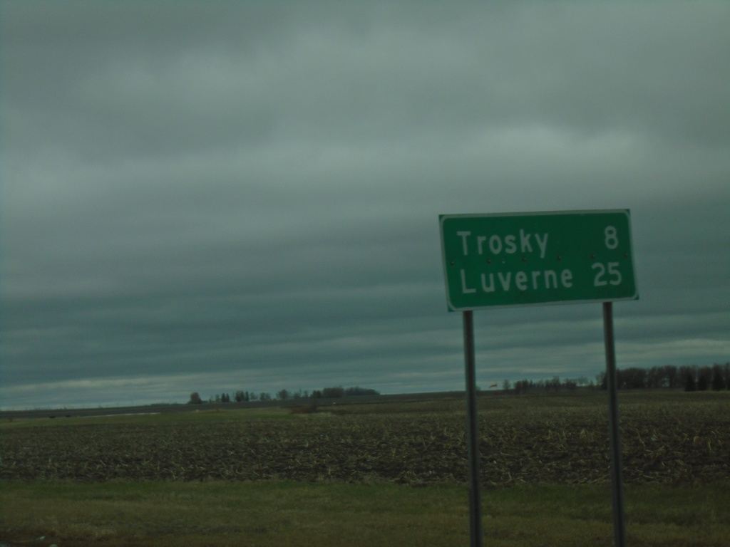
US-75 South - Distance Marker
Distance marker on US-75 south. Distance to Trosky and Luverne.
Taken 05-01-2022
Pipestone
Pipestone County
Minnesota
United States
US-75 South/MN-30 East Approaching US-75/MN-30 Split
US-75 South/MN-30 East approaching US-75/MN-30 split in Pipestone. Use US-75 South for Luverne; MN-30 East for Slayton.
Taken 05-01-2022
 Pipestone
 County
Minnesota
United States
Pipestone
Pipestone County
Minnesota
United States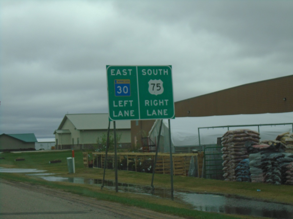
MN-30 East/US-75 South Approaching MN-30/US-75 Split
MN-30 East/US-75 South approaching MN-30/US-75 Split in Pipestone. Use left lane for MN-30 East; right lane for US-75 South.
Taken 05-01-2022
Pipestone
Pipestone County
Minnesota
United States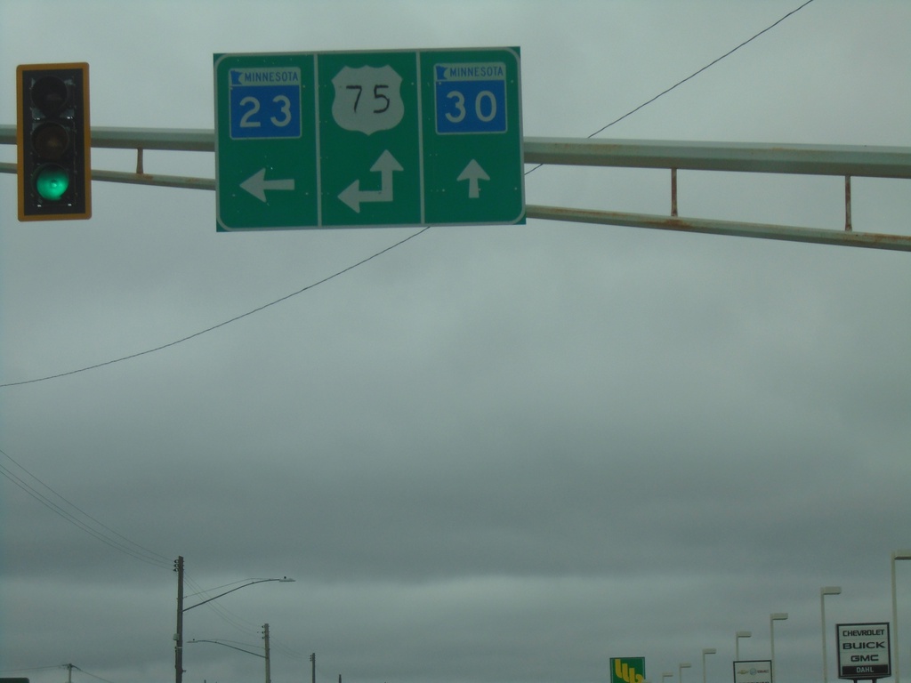
MN-30 East/MN-23 North at US-75
MN-30 East/MN-23 North at US-75 in Pipestone. Turn left for US-75 North/MN-23 North. Continue straight for MN-30 East/US-75 South. US-75 South joins MN-30 East through Pipestone.
Taken 05-01-2022
 Pipestone
 County
Minnesota
United States
Pipestone
Pipestone County
Minnesota
United States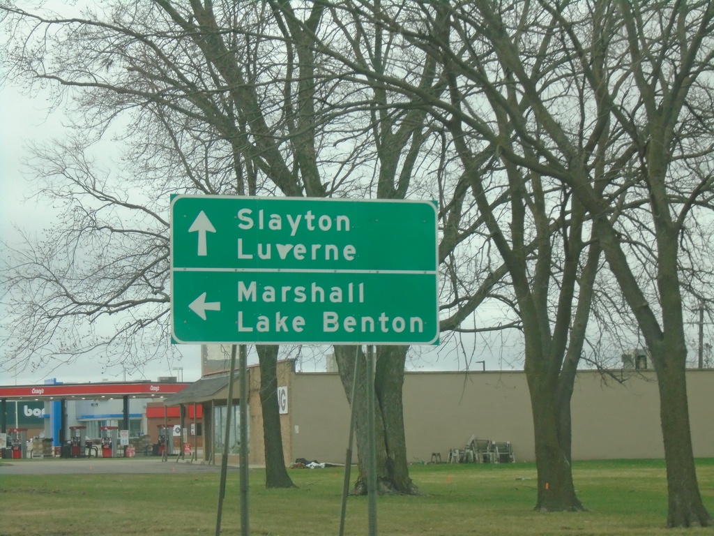
MN-30 East/MN-23 North Approaching US-75/MN-23 North
MN-30 East/MN-23 North approaching US-75/MN-23 North in Pipestone. Use US-75/MN-23 North for Marshall and Lake Benton. Use US-75 South/MN-30 East for Slayton and Luverne. US-75 South joins MN-30 East through Pipestone.
Taken 05-01-2022
Pipestone
Pipestone County
Minnesota
United States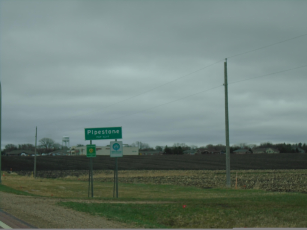
MN-30 East - Pipestone
Entering Pipestone on MN-30 east. Pipestone is the count seat of Pipestone County.
Taken 05-01-2022
Pipestone
Pipestone County
Minnesota
United States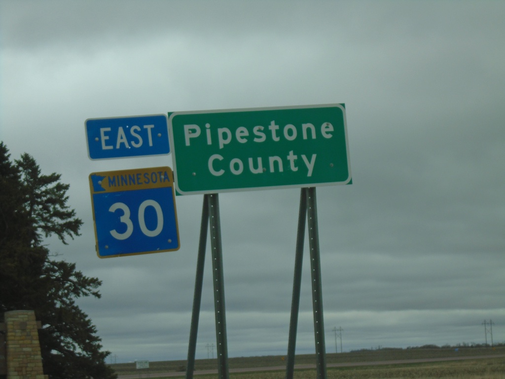
MN-30 East - Pipestone County
MN-30 East - Pipestone County. At the South Dakota-Minnesota State Line.
Taken 05-01-2022
Pipestone
Pipestone County
Minnesota
United States