Signs Tagged With Big Green Sign
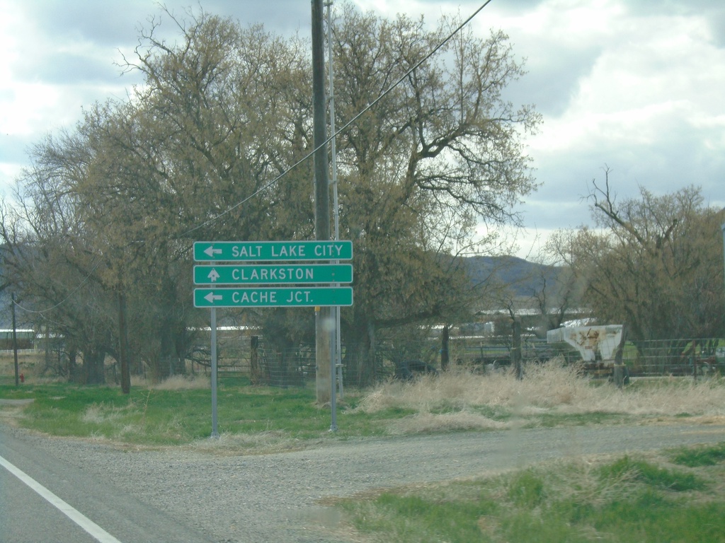
UT-23 South Approaching UT-142
UT-23 South approaching UT-142 west to Clarkston. Turn left to continue south on UT-23 for Cache Junction and Salt Lake City.
Taken 04-23-2021

 Newton
Cache County
Utah
United States
Newton
Cache County
Utah
United States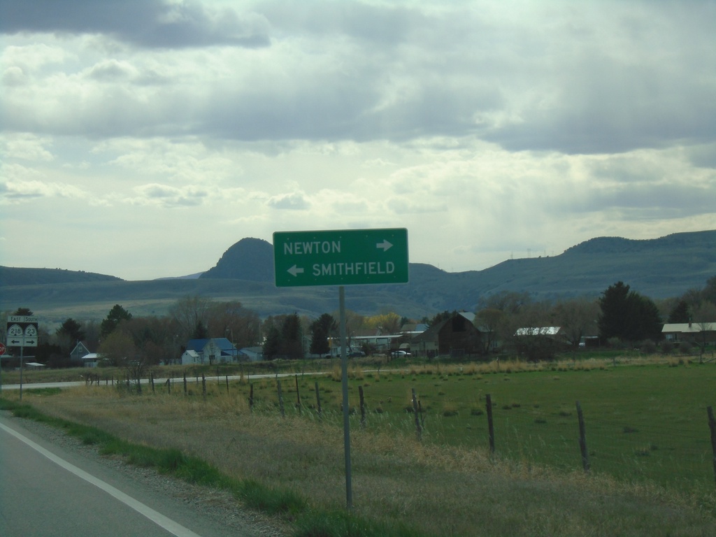
UT-23 South Approaching UT-218
UT-23 South approaching UT-218. Turn left for UT-218 East to Smithfield; right to continue on UT-23 south to Newton.
Taken 04-23-2021
 Newton
Cache County
Utah
United States
Newton
Cache County
Utah
United States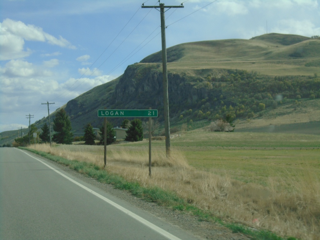
UT-23 South - Distance Marker
Distance marker on UT-23 south. Distance to Logan.
Taken 04-23-2021
Trenton
Cache County
Utah
United States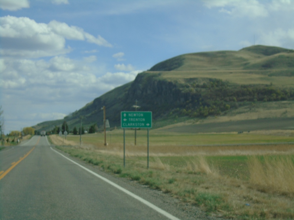
UT-23 South Approaching UT-142
UT-23 South approaching UT-142. Turn right for UT-142 west to Clarkson; left for UT-142 east to Trenton. Continue south on UT-23 for Newton.
Taken 04-23-2021
Trenton
Cache County
Utah
United States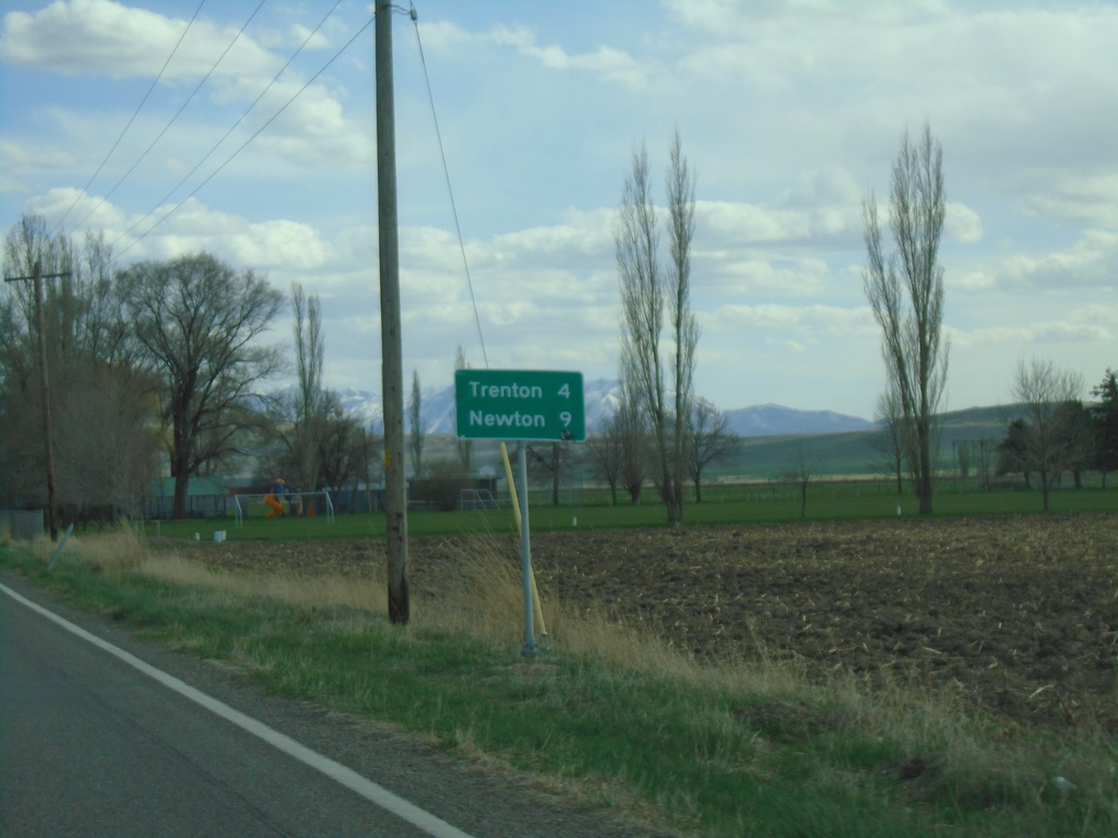
UT-23 South - Distance Marker
Distance marker on UT-23 south. Distance to Trenton and Newton.
Taken 04-23-2021
Cornish
Cache County
Utah
United States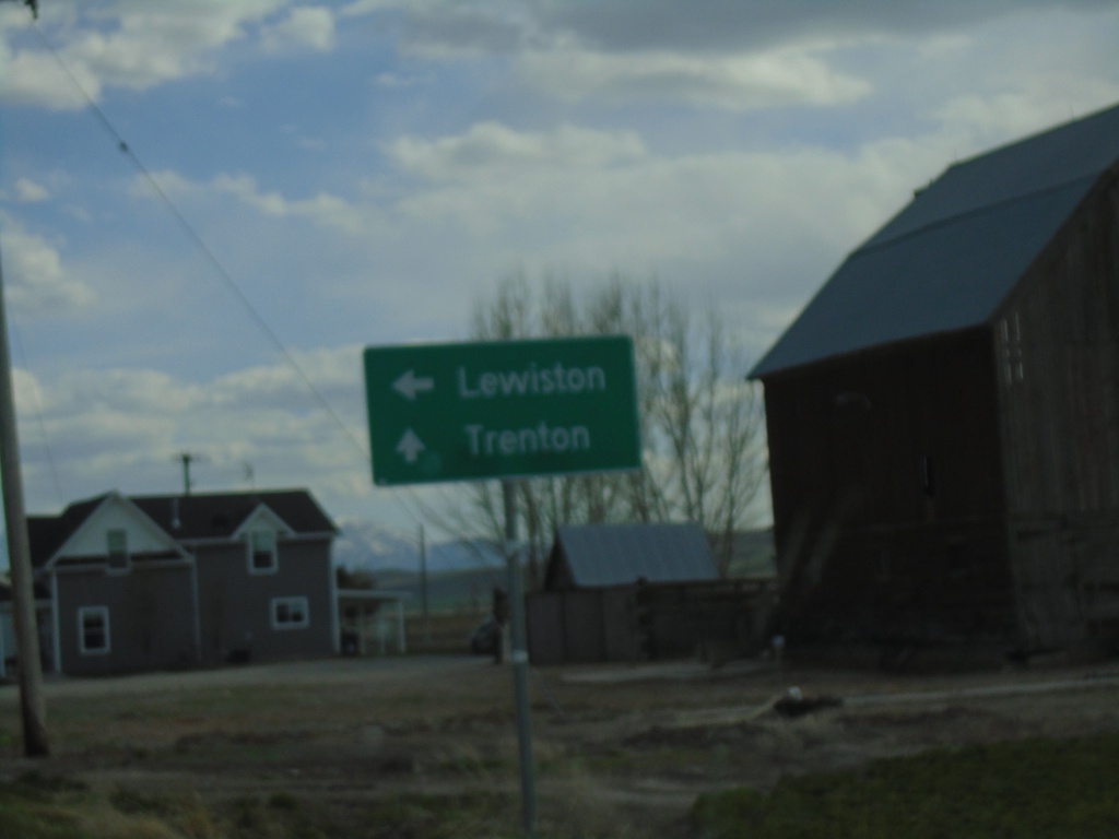
UT-23 South Approaching UT-61
UT-23 South approaching UT-61 west to Lewiston. Continue south on UT-23 for Trenton.
Taken 04-23-2021
 Cornish
Cache County
Utah
United States
Cornish
Cache County
Utah
United States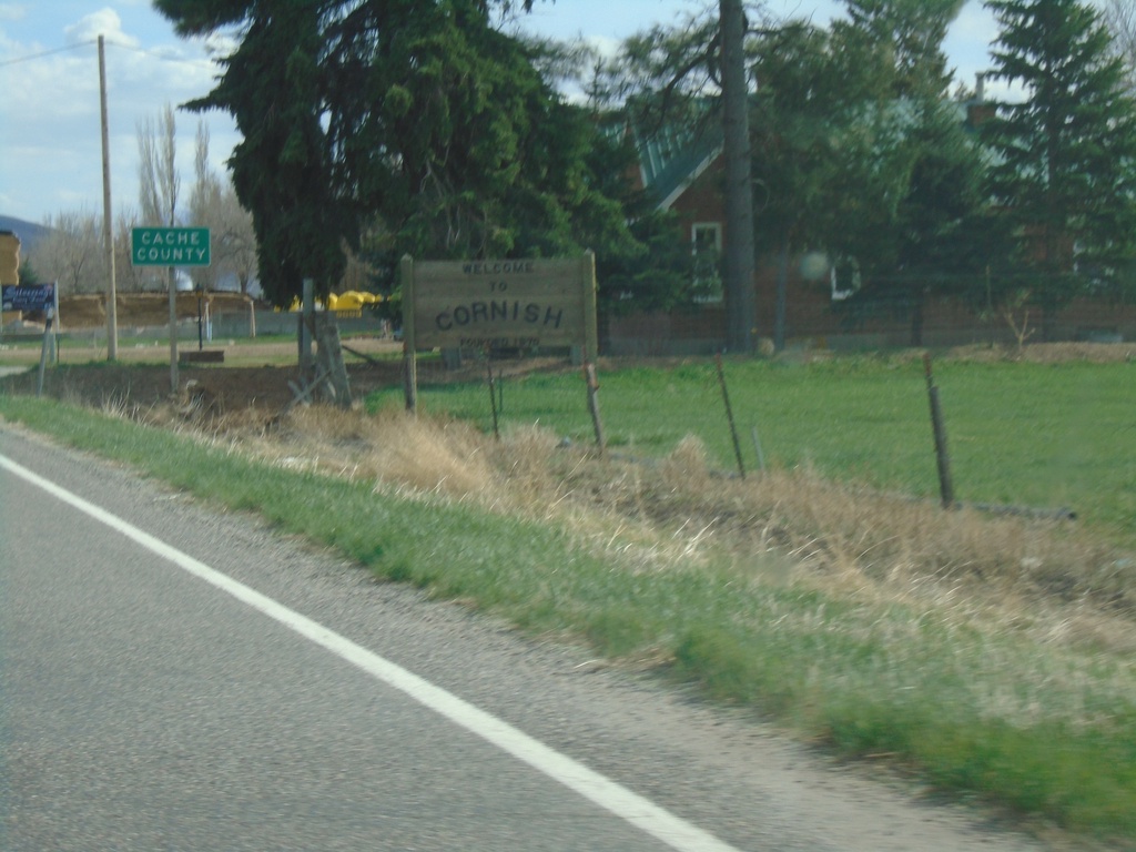
Entering Cornish and Cache County
Entering city of Cornish and Cache County, Utah at the Utah-Idaho State Line
Taken 04-23-2021
Cornish
Cache County
Utah
United States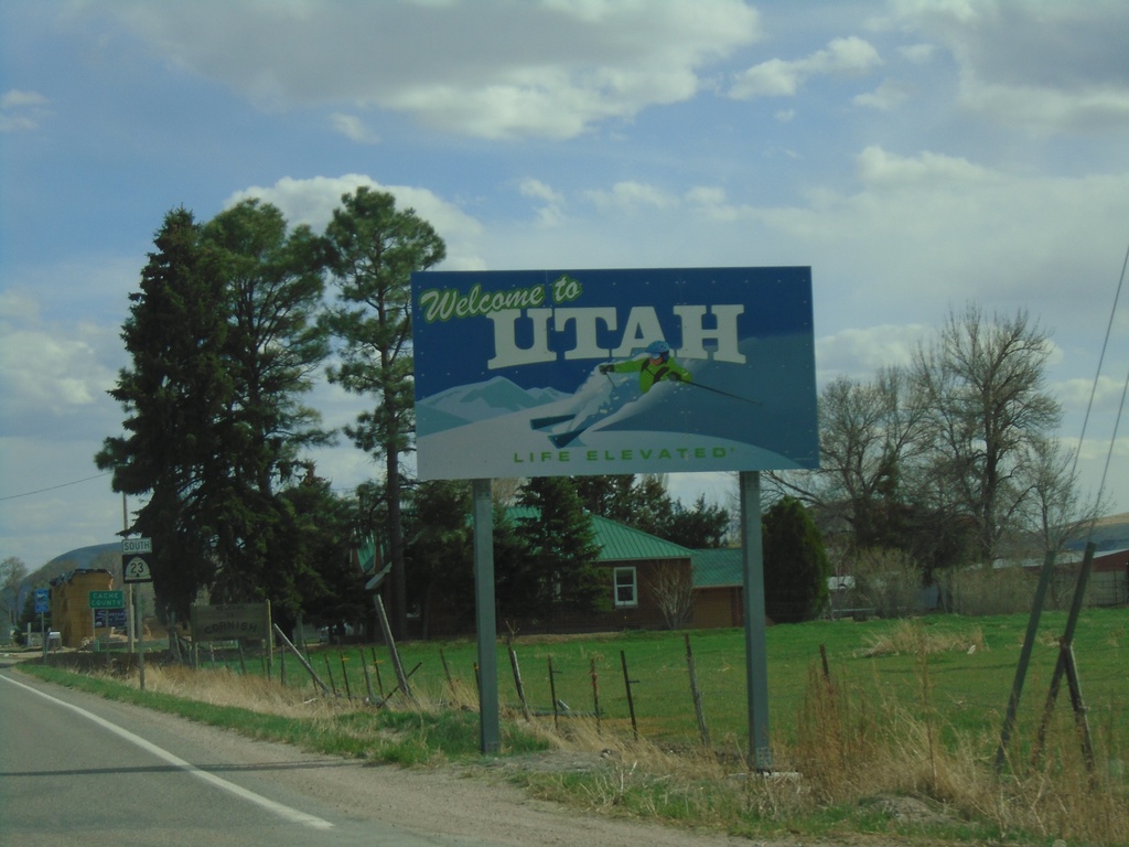
Welcome To Utah - UT-23 South
Welcome to Utah on UT-23 south. Taken at the Idaho-Utah state line.
Taken 04-23-2021
Cornish
Cache County
Utah
United States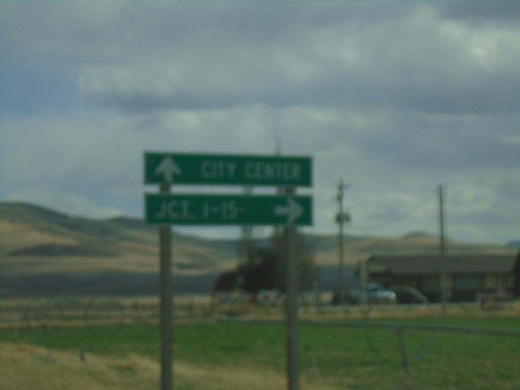
ID-36 West (Westside Highway) at Weston Canyon Road
ID-36 West (Westside Highway) at Weston Canyon Road. Turn right to continue west on ID-36 to I-15 Jct. Continue south on Westside Highway to (Weston) City Center.
Taken 04-23-2021
 Weston
Franklin County
Idaho
United States
Weston
Franklin County
Idaho
United States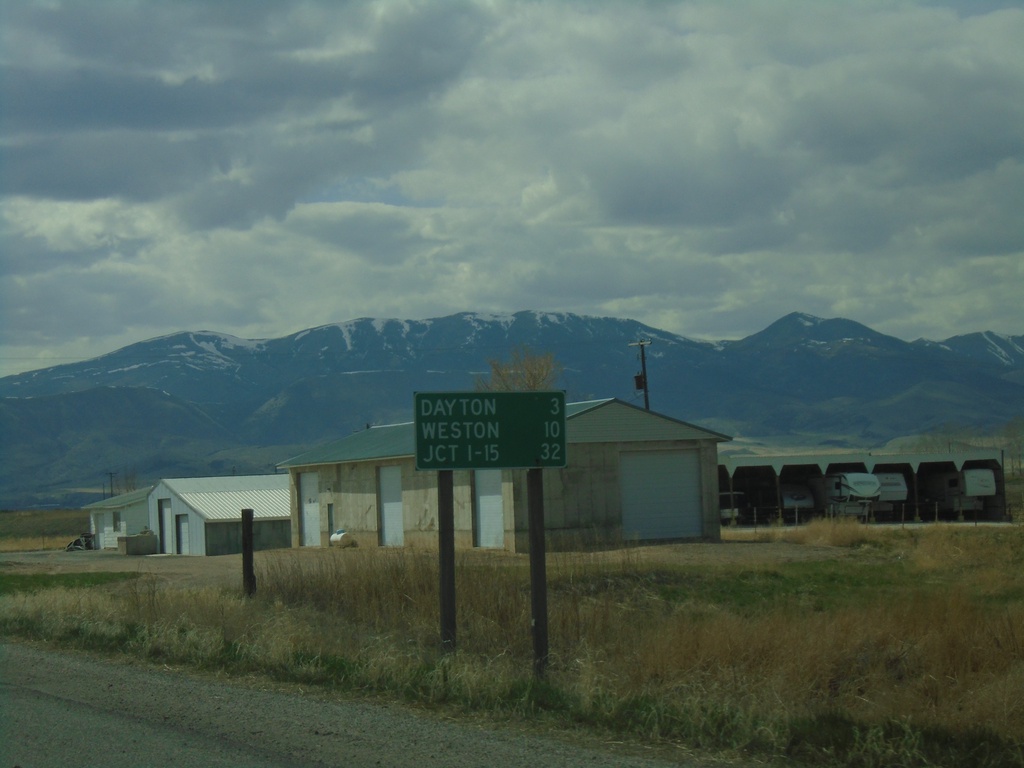
ID-36 West - Distance Marker
Distance marker on ID-36 west. Distance to Dayton, Weston, and Jct. I-15.
Taken 04-23-2021
Preston
Franklin County
Idaho
United States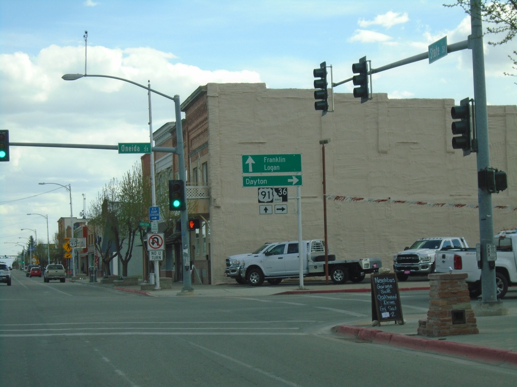
US-91 South/ID-36 West at US-91/ID-36 Split
US-91 South/ID-36 West (State St.) at US-91/ID-36 (Oneida St.) Split in Preston. Turn right on ID-36 West to Dayton; continue south on US-91 for Franklin and Logan (Utah).
Taken 04-23-2021
 Preston
Franklin County
Idaho
United States
Preston
Franklin County
Idaho
United States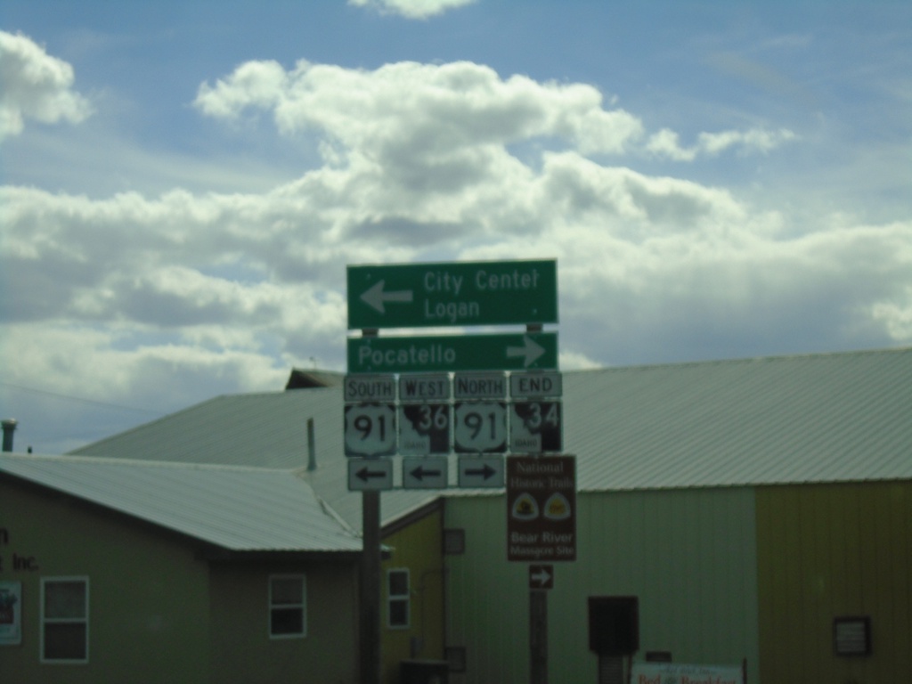
End ID-34 South at ID-36/US-91 - Preston
End ID-34 South at ID-36/US-91 in Preston. Turn right for US-91 north to Pocatello; left for US-91 South/ID-34 West to (Preston) City Center/Logan (Utah).
Taken 04-23-2021
 Preston
Franklin County
Idaho
United States
Preston
Franklin County
Idaho
United States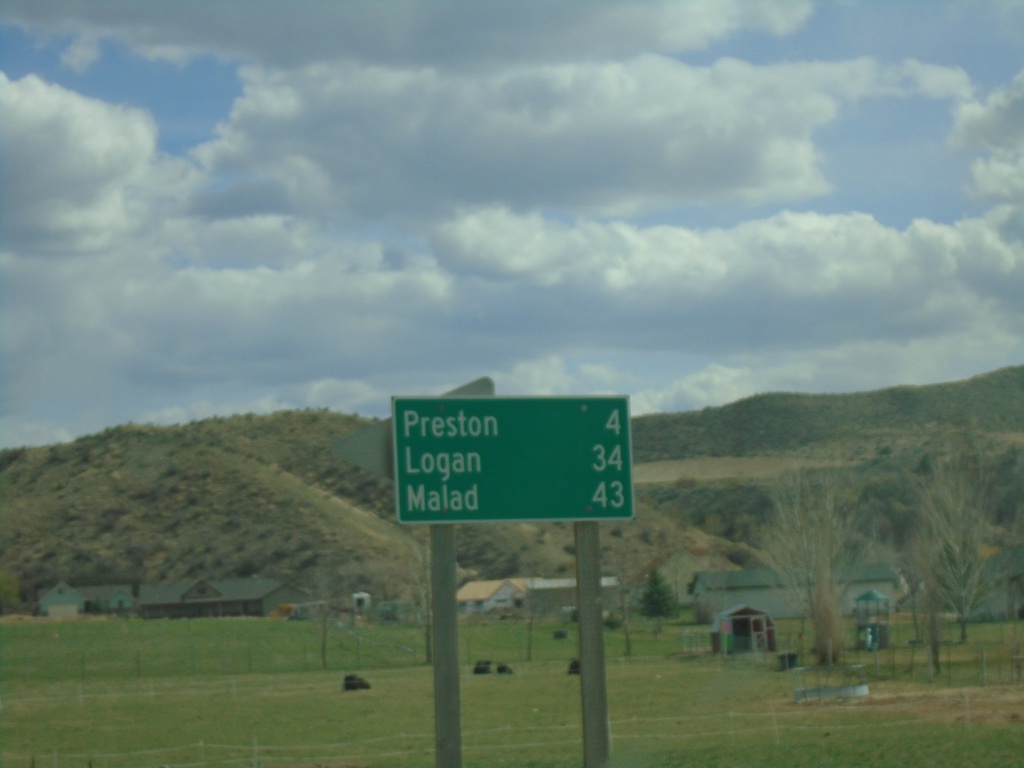
ID-34 South/ID-36 East - Distance Marker
Distance marker on ID-34 South/ID-36 East. Distance to Preston, Logan (Utah - via US-91), and Malad (via ID-36).
Taken 04-23-2021
Preston
Franklin County
Idaho
United States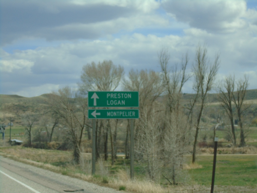
ID-34 South at ID-36
ID-34 South at ID-36 East to Montpelier. Continue south on ID-34 South/ID-36 West to Preston and Logan (Utah).
Taken 04-23-2021
Preston
Franklin County
Idaho
United States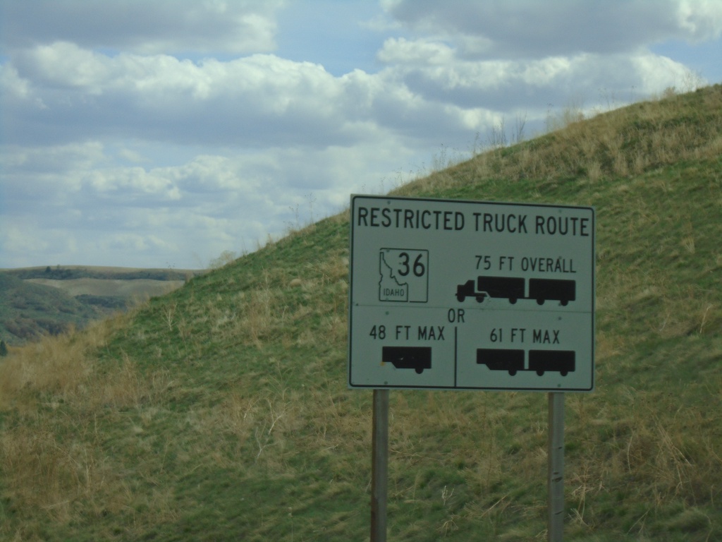
ID-34 South - ID-36 East Truck Information
ID-34 south approaching ID-36. Truck information for ID-36 east traffic.
Taken 04-23-2021
Preston
Franklin County
Idaho
United States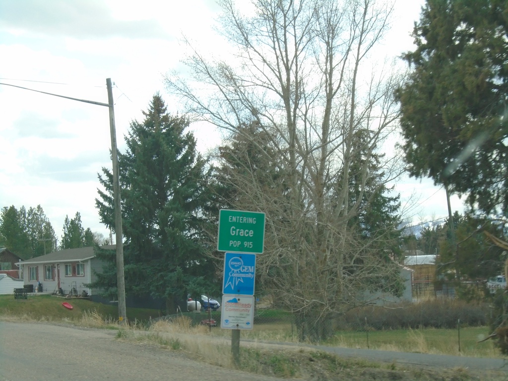
ID-34 South - Grace
Entering Grace on ID-34 south.
Taken 04-23-2021
Grace
Caribou County
Idaho
United States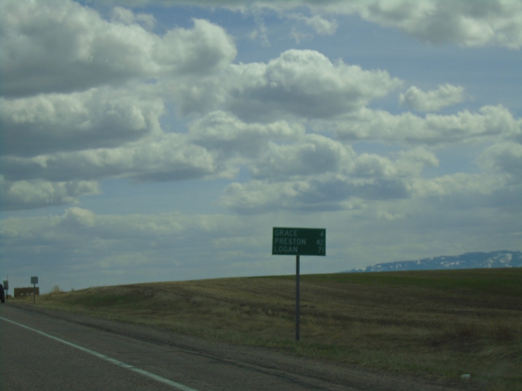
ID-34 South - Distance Marker
Distance marker on ID-34 south. Distance to Grace, Preston, and Logan (Utah).
Taken 04-23-2021
Bancroft
Caribou County
Idaho
United States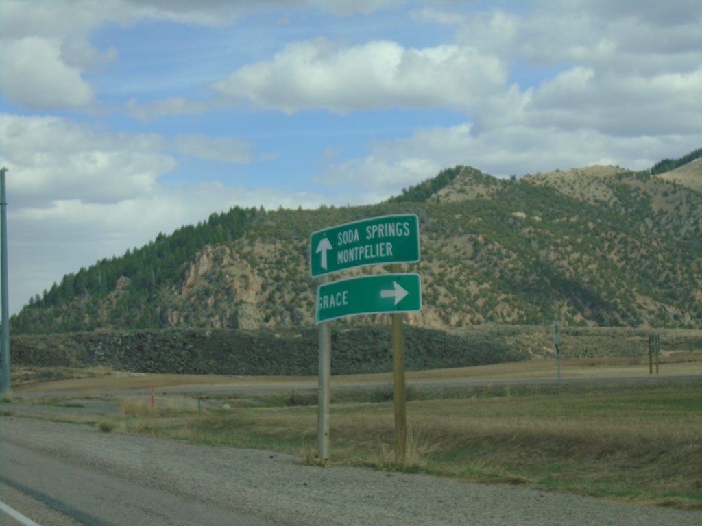
US-30 East Approaching ID-34
US-30 East approaching ID-34 south to Grace. Continue east on US-30 for Soda Springs and Montpelier. ID-34 north joins US-30 eastbound to Soda Springs.
Taken 04-23-2021
 Bancroft
Caribou County
Idaho
United States
Bancroft
Caribou County
Idaho
United States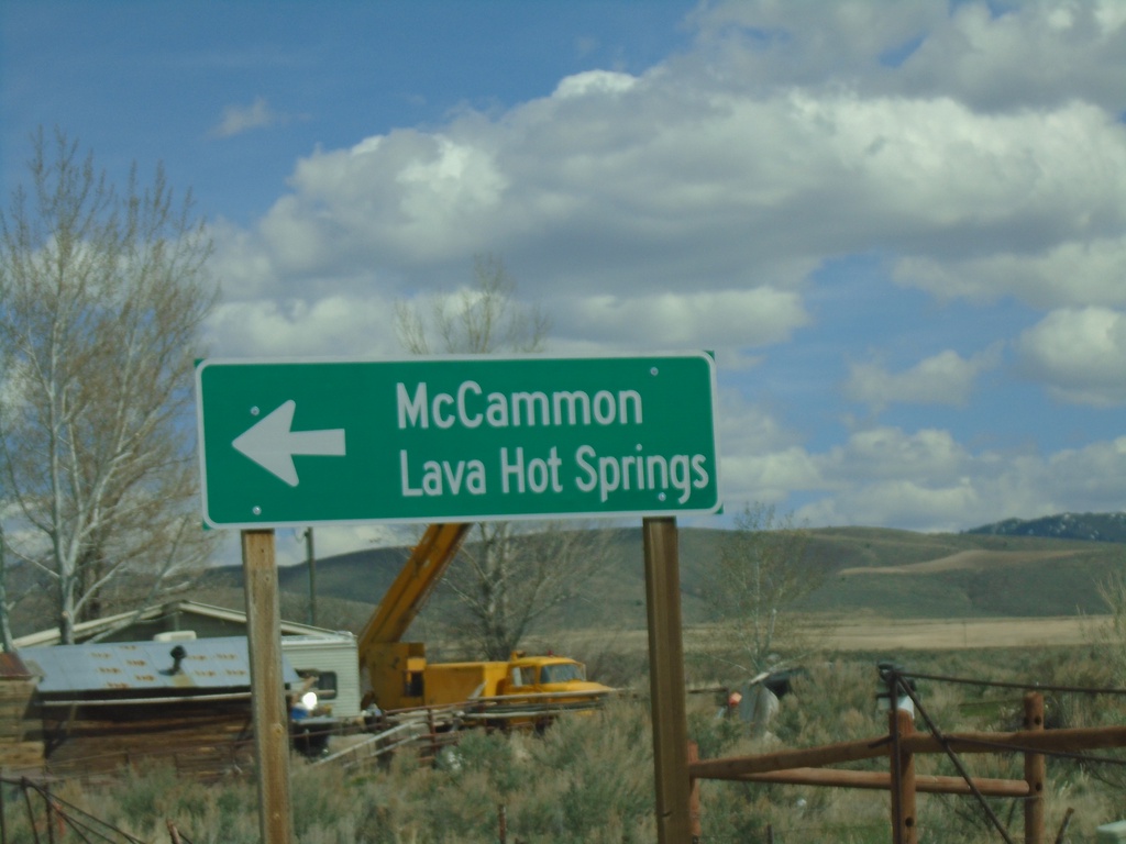
BL-15 North at Old US-91
BL-15 North at Old US-91 in Bannock County. Turn left on Old US-91 to continue north on BL-15 to McCammon and Lava Hot Springs.
Taken 04-23-2021
 McCammon
Bannock County
Idaho
United States
McCammon
Bannock County
Idaho
United States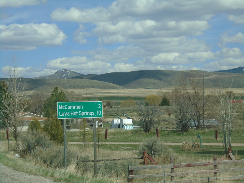
BL-15 North - Distance Marker
Distance marker on BL-15 north. Distance to McCammon and Lava Hot Springs (via US-30).
Taken 04-23-2021
McCammon
Bannock County
Idaho
United States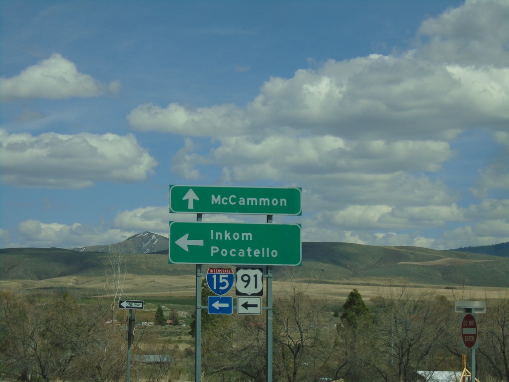
Jensen Road/BL-15 North at I-15/US-91 North (Exit 44)
Jensen Road/BL-15 North at I-15/US-91 North (Exit 44) in McCammon. Use I-15/US-91 North to Inkom and Salt Lake. Continue north on BL-15 for McCammon.
Taken 04-23-2021
 McCammon
Bannock County
Idaho
United States
McCammon
Bannock County
Idaho
United States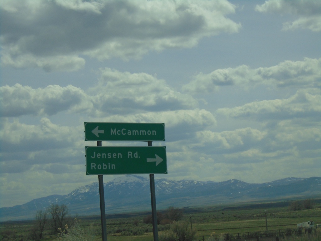
I-15/US-91 Exit 44 Onramp
I-15/US-91 Exit 44 offramp at BL-15/Jensen Road. Turn left for BL-15 North to McCammon; right for Jenson Road to Robin.
Taken 04-23-2021
McCammon
Bannock County
Idaho
United States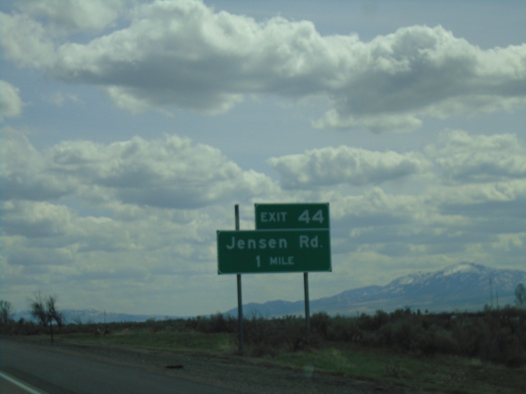
I-15 South - Exit 44
I-15 south approaching Exit 44 - Jensen Road.
Taken 04-23-2021
McCammon
Bannock County
Idaho
United States
E Center St. at I-15
E Center St. at I-15 in Pocatello. Use I-15 south for McCammon and Salt Lake (Utah). Use I-15 north for Blackfoot and Idaho Falls.
Taken 04-23-2021
Pocatello
Bannock County
Idaho
United States
E Center St. Approaching I-15
E Center St. approaching I-15 (Exit 69) in Pocatello. Use right lane for I-15 South.
Taken 04-23-2021
Pocatello
Bannock County
Idaho
United States