Signs Tagged With Big Green Sign
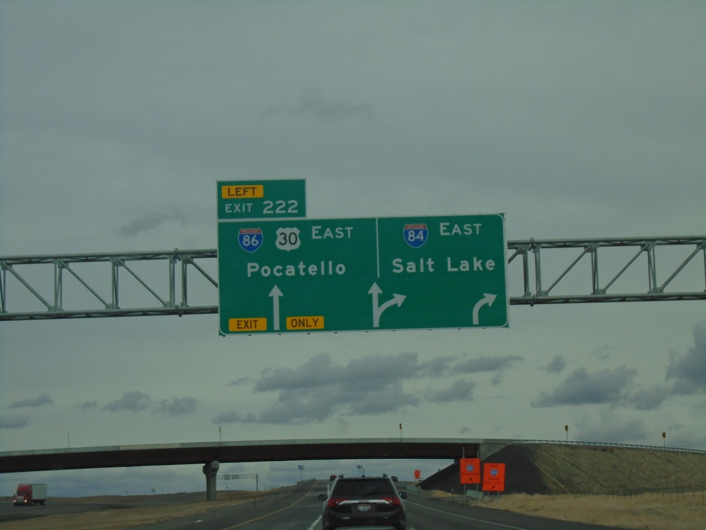
I-84 East - Exit 222
I-84 east at Exit 222 - I-86 East/US-30/Pocatello. Use I-84 east for Salt Lake. I-86 begins here.
Taken 03-20-2021


 Declo
Cassia County
Idaho
United States
Declo
Cassia County
Idaho
United States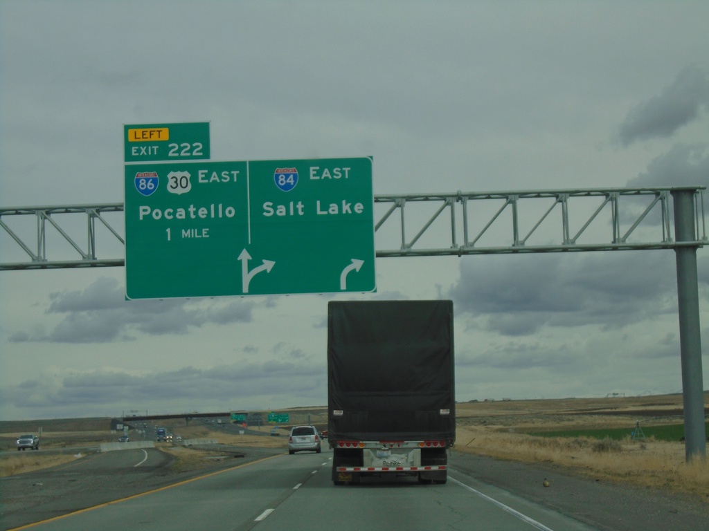
I-84 East Approaching I-86
I-84 east approaching Exit 222 - I-86/US-30 East/Pocatello. Use I-84 east for Salt Lake. This interchange has recently been rebuilt and re-designed.
Taken 03-20-2021
Declo
Cassia County
Idaho
United States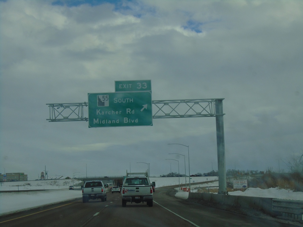
I-84 East - Exit 33
I-84 east at Exit 33 - ID-55 South/Karcher Road/Midland Blvd.
Taken 02-15-2021
 Nampa
Canyon County
Idaho
United States
Nampa
Canyon County
Idaho
United States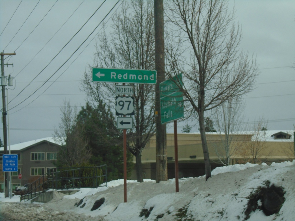
Powers Road West at US-97 North (Bend Parkway)
Powers Road West at US-97 North (Bend Parkway) to Redmond.
Taken 02-14-2021
 Bend
Deschutes County
Oregon
United States
Bend
Deschutes County
Oregon
United States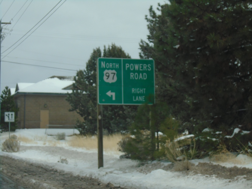
Powers Road East Approaching US-97 North
Powers Road East approaching US-97 North
Taken 02-14-2021
Bend
Deschutes County
Oregon
United States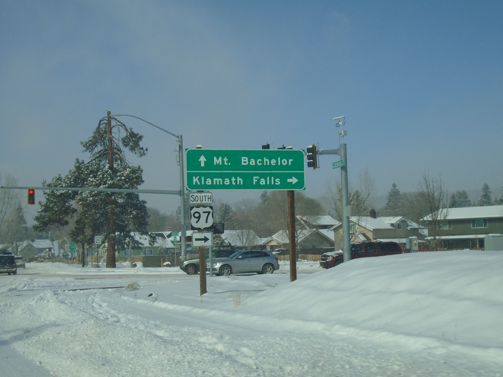
SE Scott Ave. West at US-97 South
SE Scott Ave. West at US-97 South (Bend Parkway) to Klamath Falls. SE Scott Ave. becomes NW Colorado Ave. westbound. Use NW Colorado Ave. to Mt. Bachelor (Ski Area).
Taken 02-13-2021
Bend
Deschutes County
Oregon
United States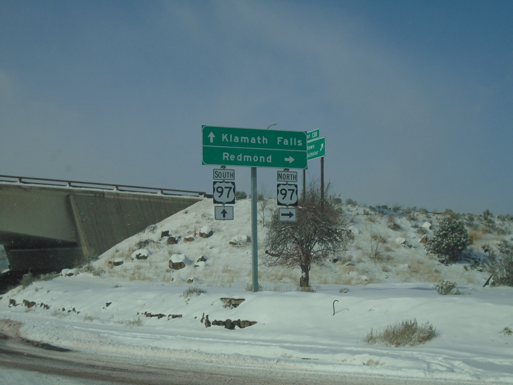
SE Scott St. West at US-97
SE Scott St. West at US-97 (Bend Parkway) onramp (Exit 138). Use US-97 north for Redmond; US-97 south for Klamath Falls.
Taken 02-13-2021
Bend
Deschutes County
Oregon
United States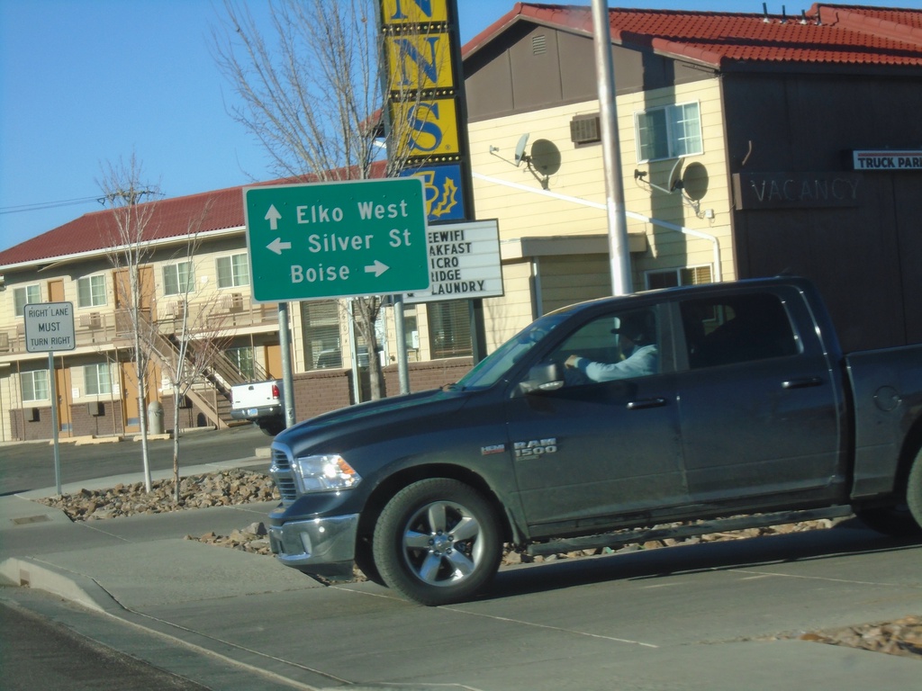
BL-80/NV-535 West Approaching NV-225
BL-80/NV-535 West (Idaho Street) approaching NV-225 North (Mountain City Highway and Silver St.). Use NV-225 north (Mountain City Highway) to Boise (Idaho). Continue west on BL-80/NV-535 to Elko West. Turn left for Silver St.
Taken 01-18-2021


 Elko
Elko County
Nevada
United States
Elko
Elko County
Nevada
United States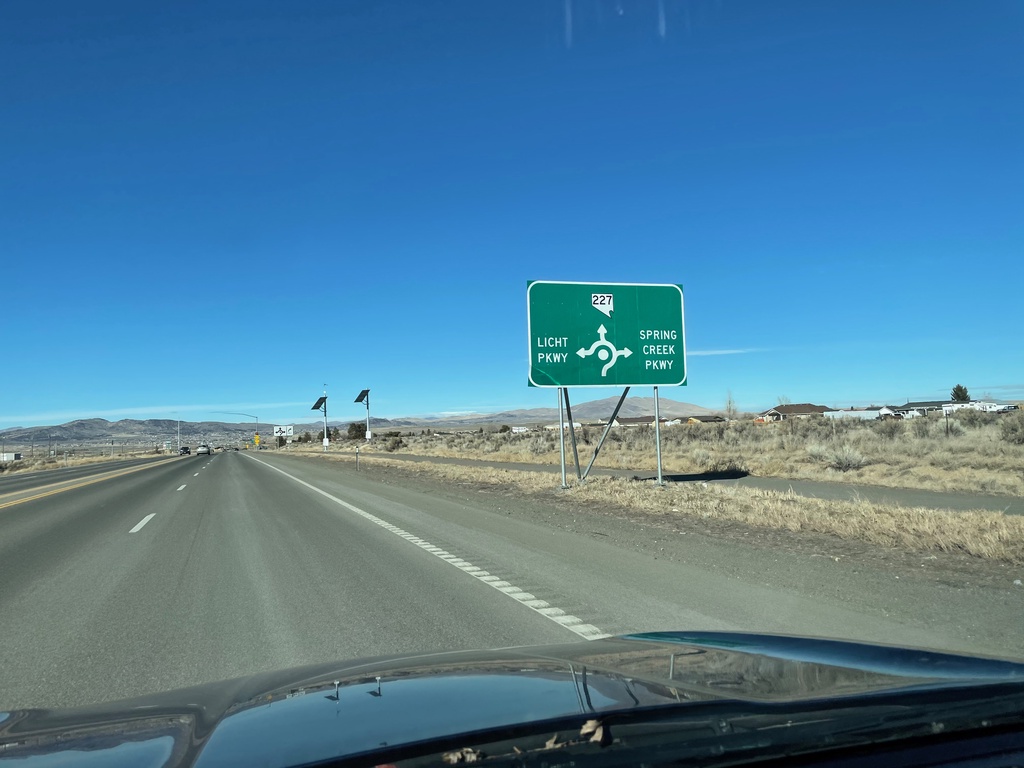
NV-227 West Approaching Roundabout in Spring Creek
NV-227 West approaching Licht Parkway and Spring Creek Parkway roundabout in Spring Creek.
Taken 01-17-2021
 Spring Creek
Elko County
Nevada
United States
Spring Creek
Elko County
Nevada
United States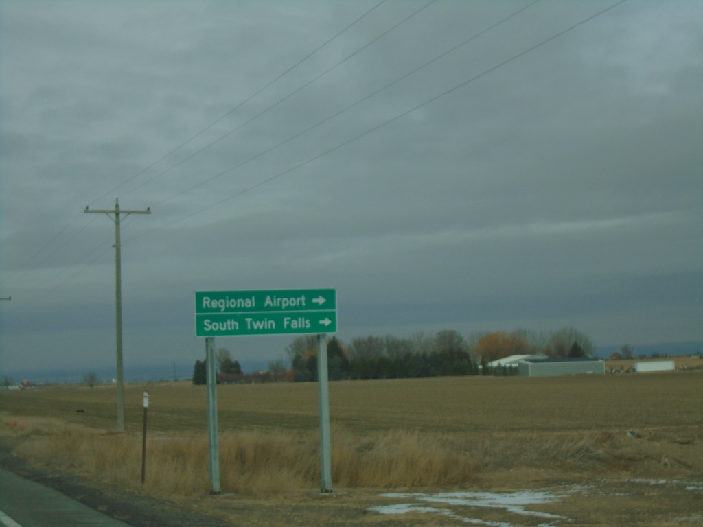
US-93 North Approaching ID-74
US-93 north approaching ID-74. Use ID-74 north for Regional Airport and South Twin Falls.
Taken 12-31-2020

 Twin Falls
 County
Idaho
United States
Twin Falls
Twin Falls County
Idaho
United States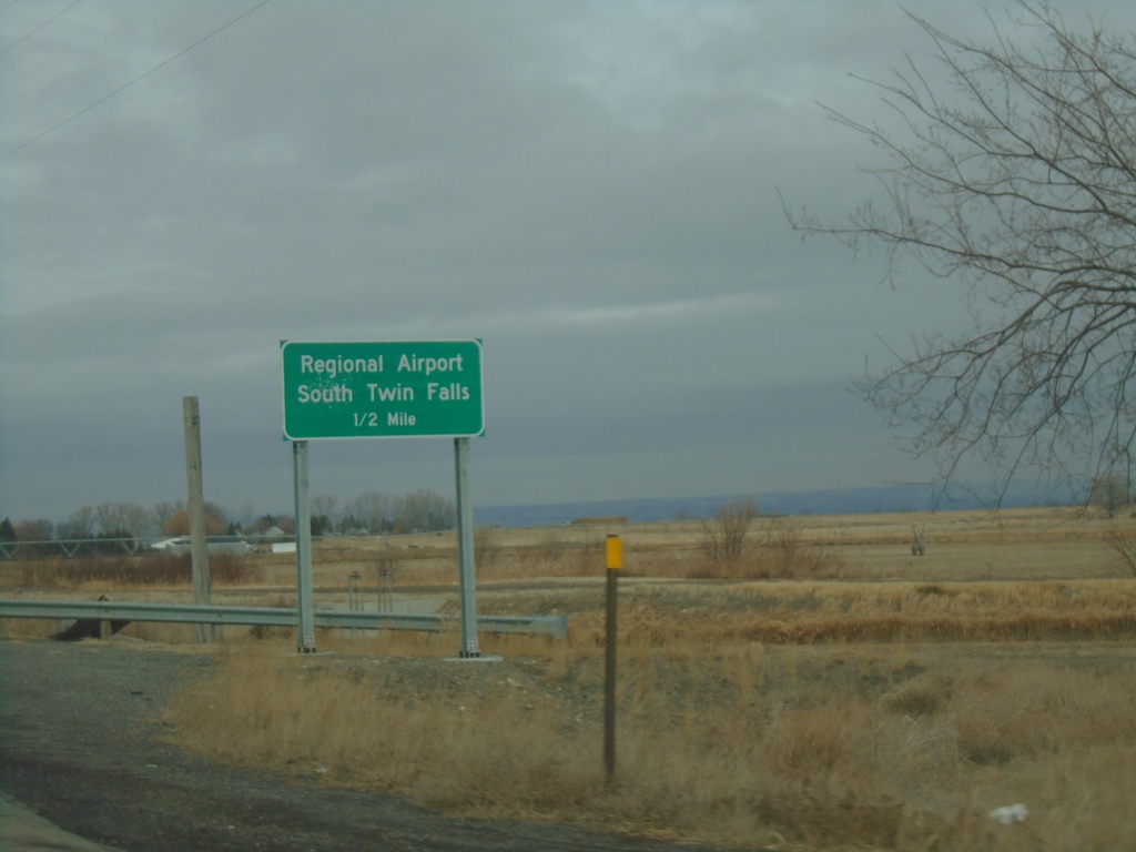
US-93 North Approaching ID-74
US-93 North approaching ID-74 in Twin Falls County. Use ID-74 north for Regional Airport and South Twin Falls.
Taken 12-31-2020
Filer
Twin Falls County
Idaho
United States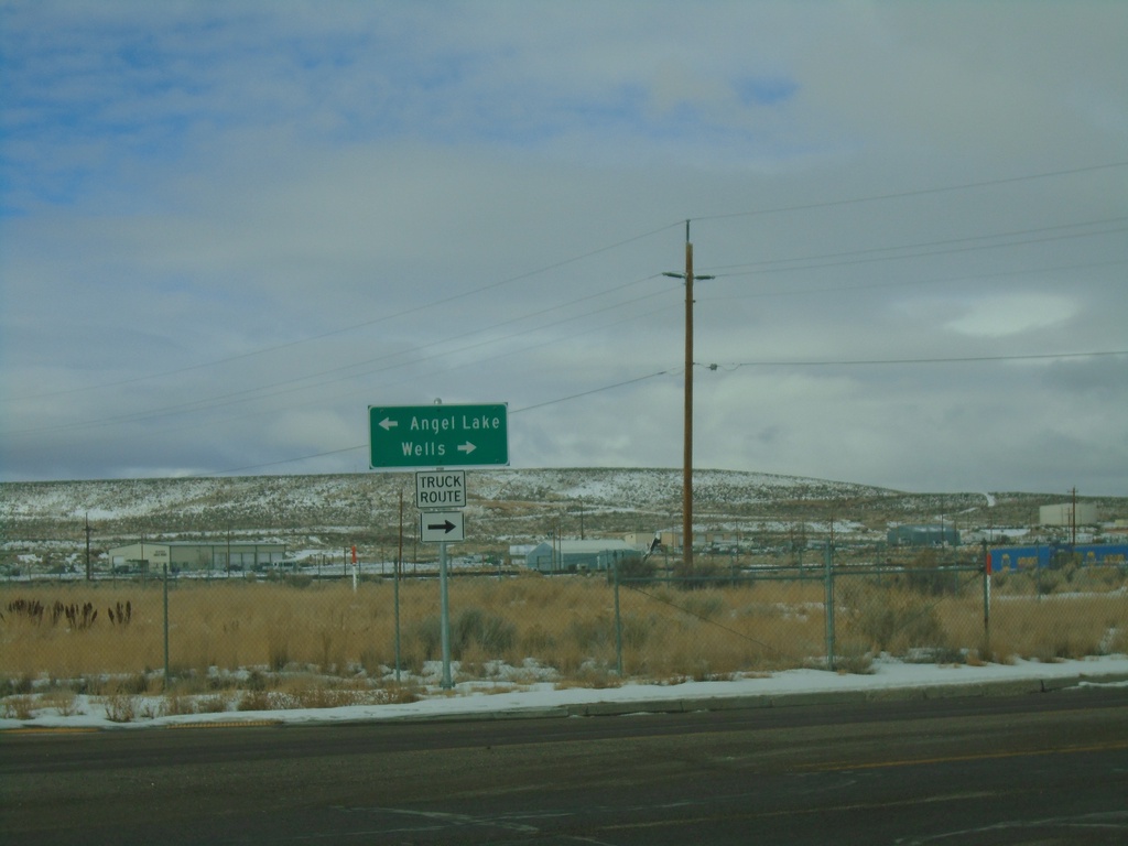
I-80 West - Exit 351 Offramp at BL-80/NV-223
I-80 West - Exit 351 Offramp at BL-80/NV-223 (Humboldt Ave.) in Wells. Turn right for BL-80 West/NV-223 to Wells; left for Angel Lake. This is the western end of the Wells business loop.
Taken 12-31-2020

 Wells
Elko County
Nevada
United States
Wells
Elko County
Nevada
United States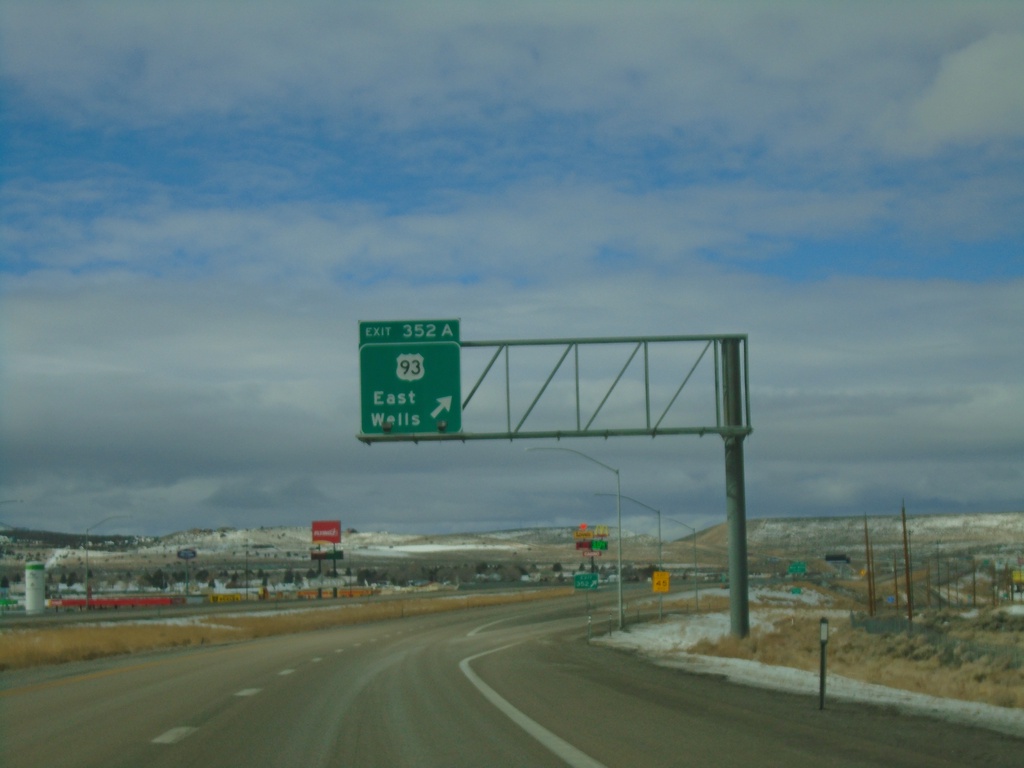
I-80 West - Exit 352A
I-80 west at Exit 352A - US-93/East Wells.
Taken 12-31-2020
 Wells
Elko County
Nevada
United States
Wells
Elko County
Nevada
United States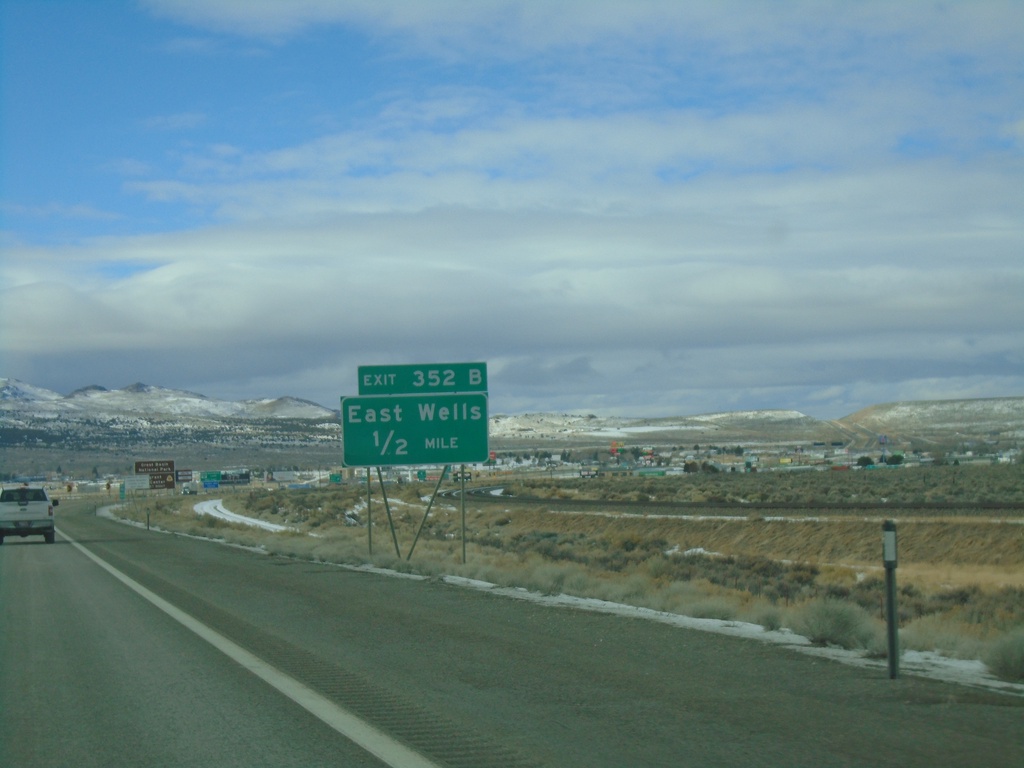
I-80 West - Exit 352B
I-80 west approaching Exit 352B - East Wells.
Taken 12-31-2020
Wells
Elko County
Nevada
United States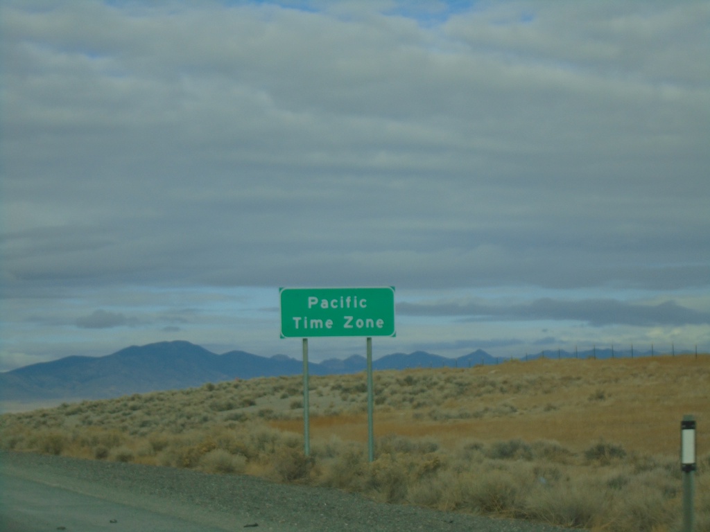
I-80 West - Pacific Time Zone
Entering Pacific Time Zone on I-80 West/Alt. US-93 North. The city of West Wendover, Nevada observes Mountain Time as it is located on the Utah border. The time zone boundary on I-80 is just west of West Wendover.
Taken 12-31-2020
West Wendover
Elko County
Nevada
United States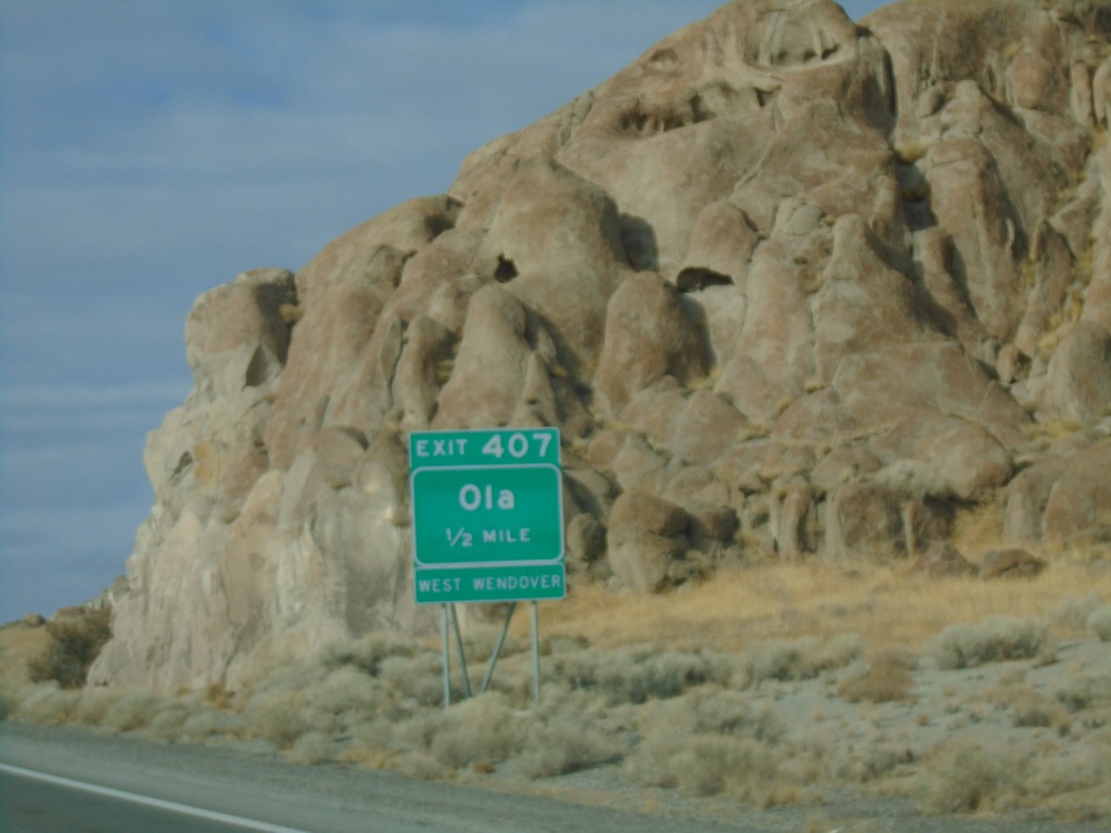
I-80 West - Exit 407
I-80 west approaching Exit 407 - Ola. Use Exit 407 for access to West Wendover.
Taken 12-31-2020
West Wendover
Elko County
Nevada
United States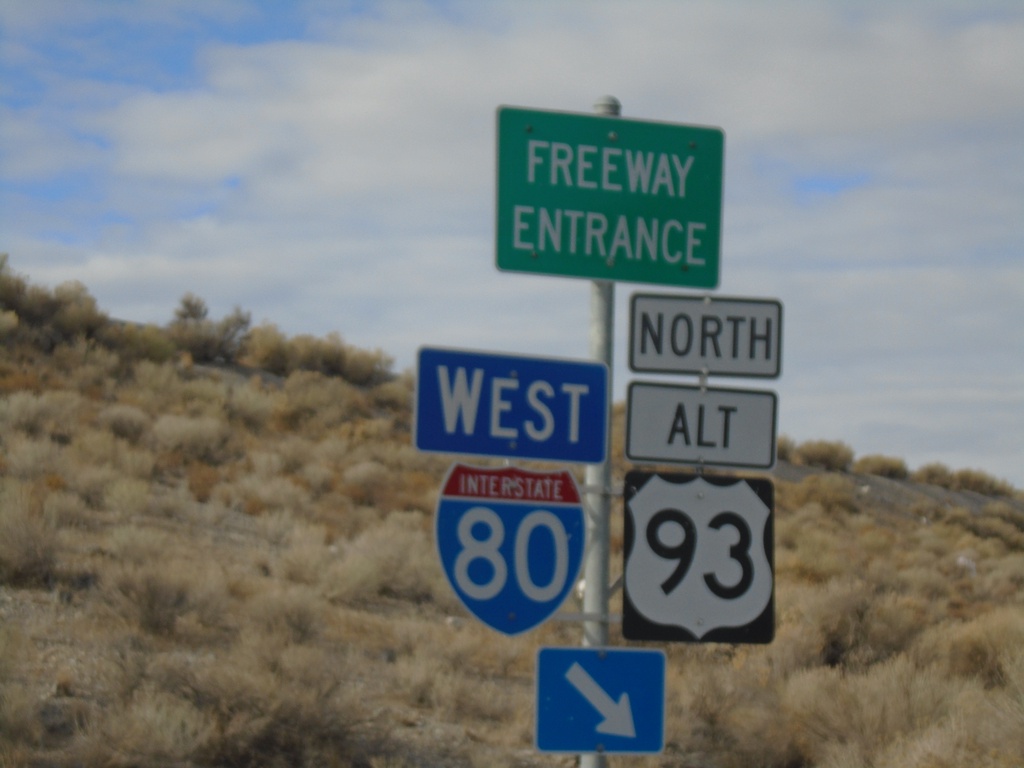
US-93 Alt/BL-80 West at I-80/US-93 Alt Onramp
US-93 Alt/BL-80 West at I-80 West/US-93 Alt. North onramp (Exit 410) - in West Wendover.
Taken 12-31-2020
West Wendover
Elko County
Nevada
United States
BL-80 West at I-80 West (Exit 410)
BL-80 West at I-80 West (Exit 410) to Elko.
Taken 12-31-2020
West Wendover
Elko County
Nevada
United States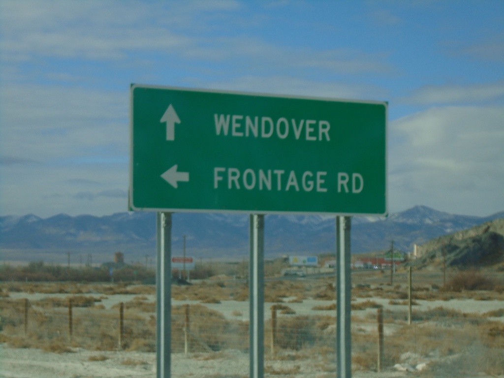
UT-58 West/BL-80 West at Frontage Road
UT-58 West/BL-80 West at Frontage Road. Continue west on UT-58/BL-80 for Wendover.
Taken 12-31-2020
 Wendover
Tooele County
Utah
United States
Wendover
Tooele County
Utah
United States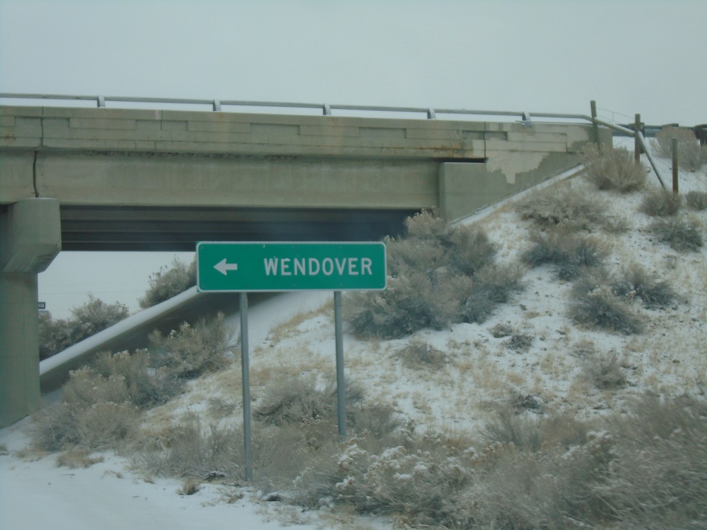
End UT-196 North at I-80
End UT-196 North at I-80 west to Wendover.
Taken 12-31-2020
 Skull Valley
Tooele County
Utah
United States
Skull Valley
Tooele County
Utah
United States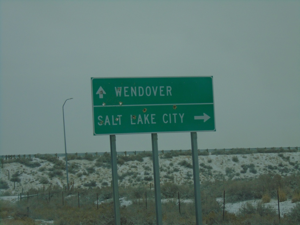
End UT-196 North at I-80
End UT-196 North at I-80 in Tooele County. Use I-80 east for Salt Lake City; I-80 west for Wendover.
Taken 12-31-2020
Skull Valley
Tooele County
Utah
United States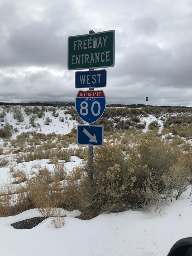
I-80 West (Exit 360) Onramp
I-80 West Onramp at Exit 360 in Elko County.
Taken 12-31-2020
Moor
Elko County
Nevada
United States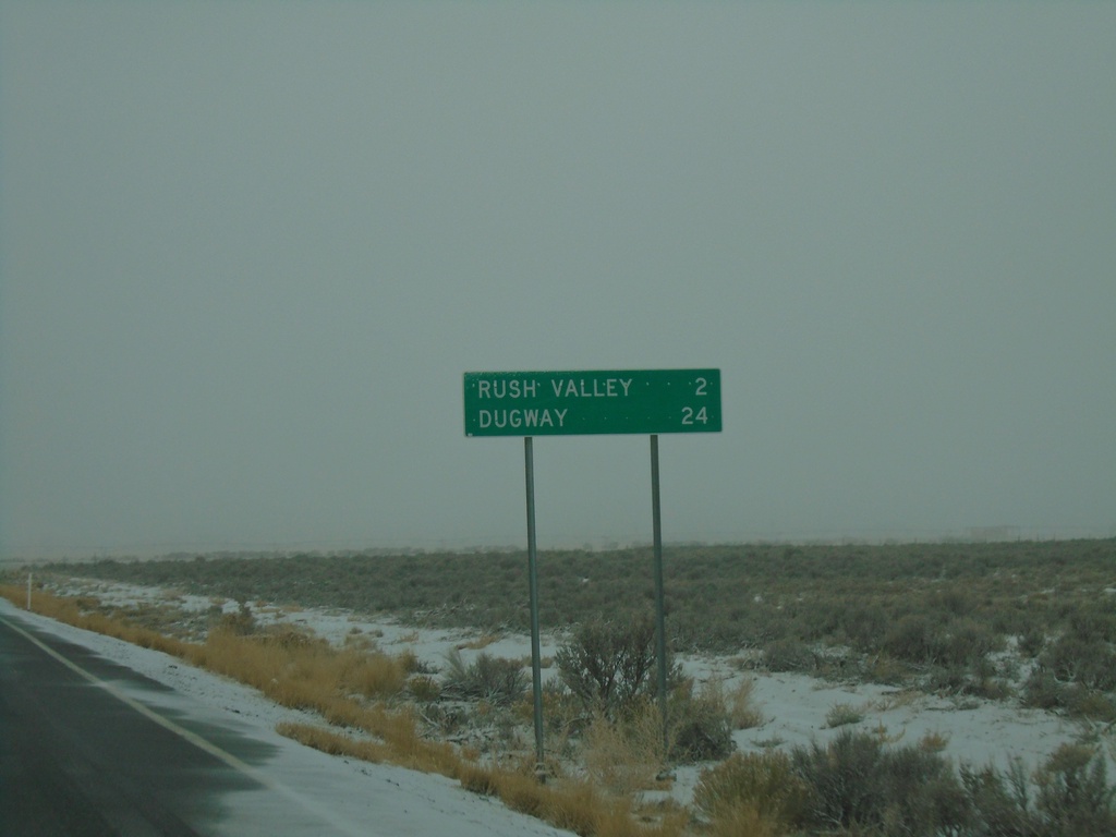
UT-199 West - Distance Marker
Distance marker on UT-199 west. Distance to Rush Valley and Dugway.
Taken 12-31-2020
 Rush Valley
Tooele County
Utah
United States
Rush Valley
Tooele County
Utah
United States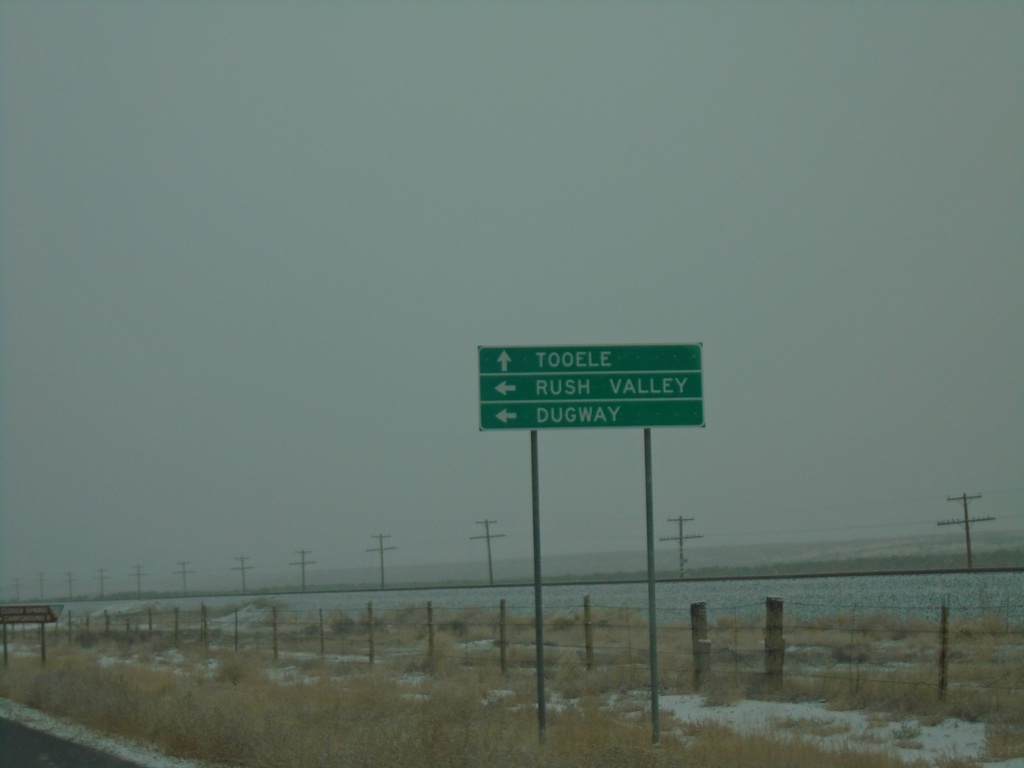
UT-36 North Approaching UT-199
UT-36 North approaching UT-199 west to Rush Valley and Dugway. Continue north on UT-36 to Tooele.
Taken 12-31-2020
 Rush Valley
Tooele County
Utah
United States
Rush Valley
Tooele County
Utah
United States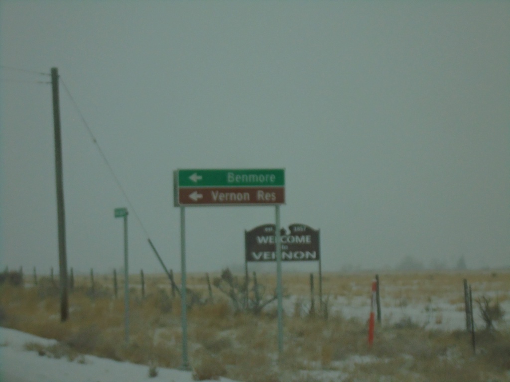
UT-36 North at Benmore Road
UT-36 North at Benmore Road south to Benmore and Vernon Reservoir
Taken 12-31-2020
Vernon
Tooele County
Utah
United States