Signs Tagged With Big Green Sign
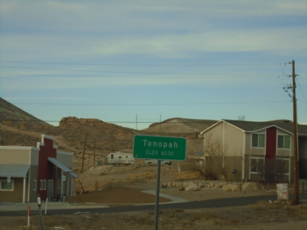
US-95 North - Tonopah
Entering Tonopah on US-95 North - Elevation 6030 Feet. Tonopah is the unincorporated county seat of Nye County.
Taken 01-14-2022
 Tonopah
Nye County
Nevada
United States
Tonopah
Nye County
Nevada
United States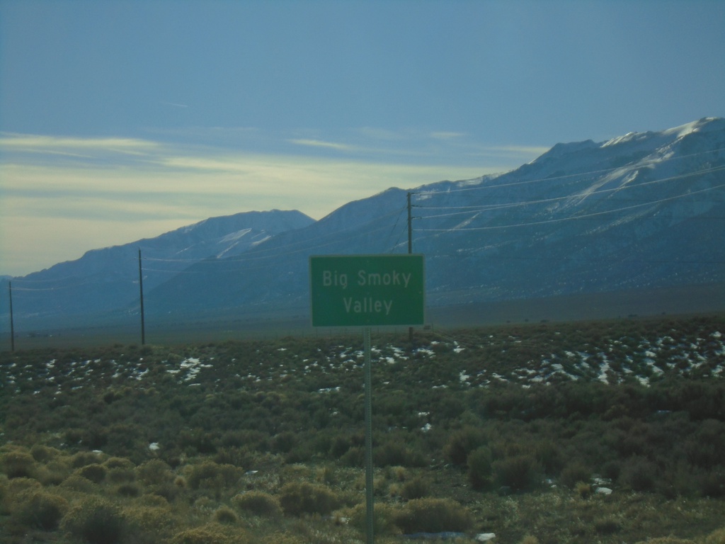
NV-376 South - Big Smoky Valley
Big Smoky Valley on NV-376 South
Taken 01-14-2022
 Austin
Lander County
Nevada
United States
Austin
Lander County
Nevada
United States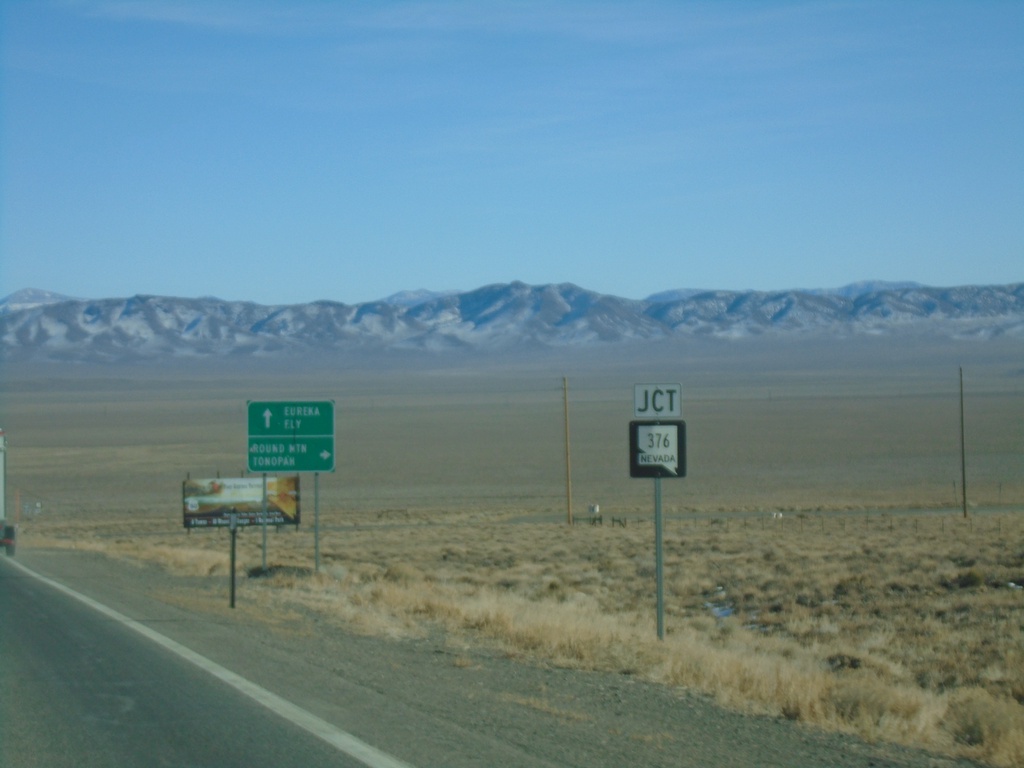
US-50 East Approaching NV-376
US-50 East approaching NV-376 south to Round Mountain and Tonopah. Continue east on US-50 for Eureka and Ely.
Taken 01-14-2022
 Austin
Lander County
Nevada
United States
Austin
Lander County
Nevada
United States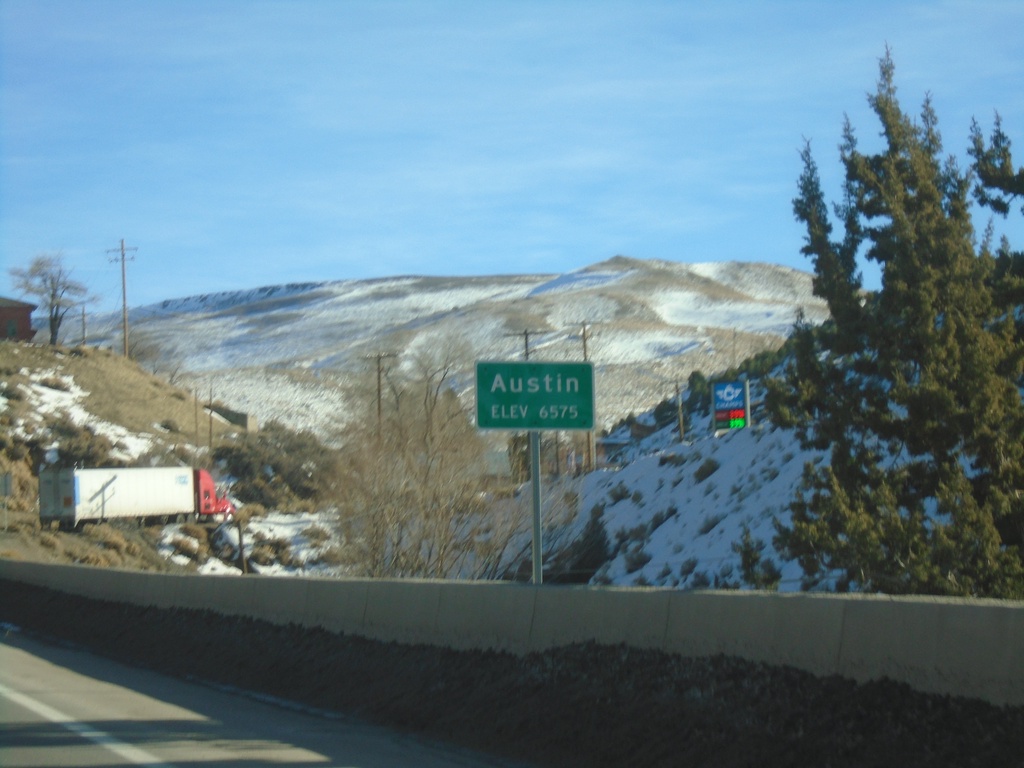
US-50 East - Austin
Entering Austin on US-50 east. Elevation 6575 Feet.
Taken 01-14-2022
Austin
Lander County
Nevada
United States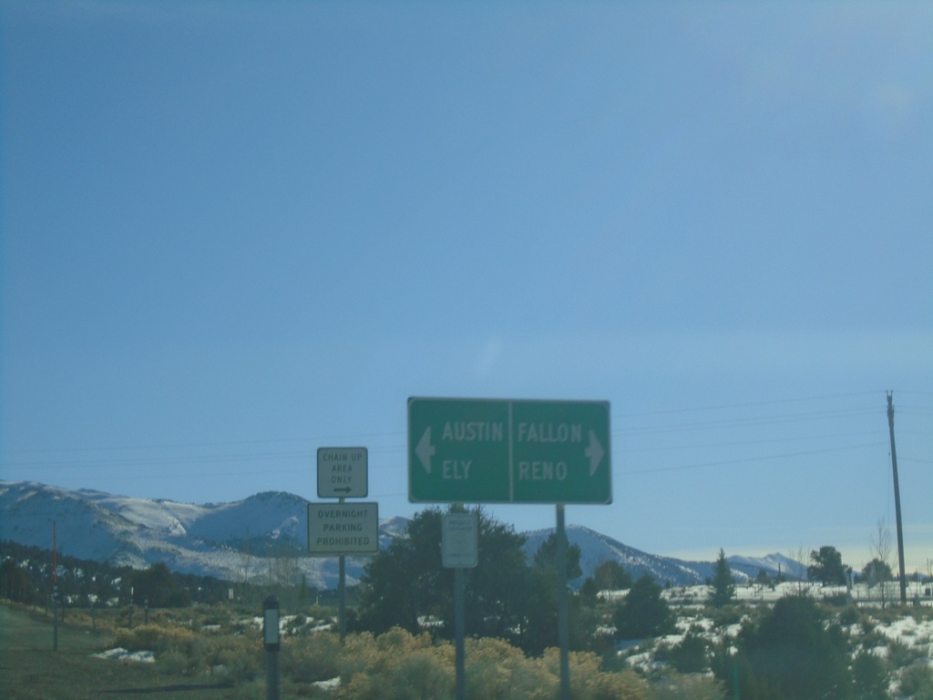
End NV-305 South at US-50
End NV-305 south at US-50. Use US-50 West to Reno and Fallon; US-50 east to Austin and Ely.
Taken 01-14-2022
 Austin
Lander County
Nevada
United States
Austin
Lander County
Nevada
United States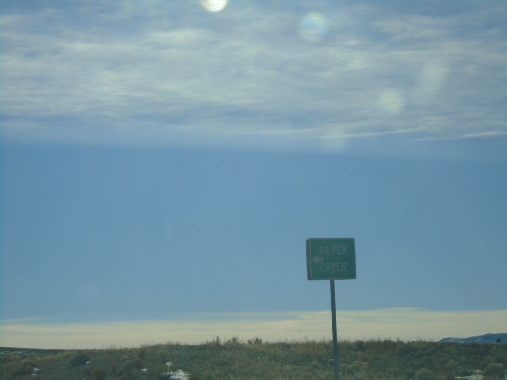
NV-305 South - Silver Creek
NV-305 South at Silver Creek Junction
Taken 01-14-2022
Austin
Lander County
Nevada
United States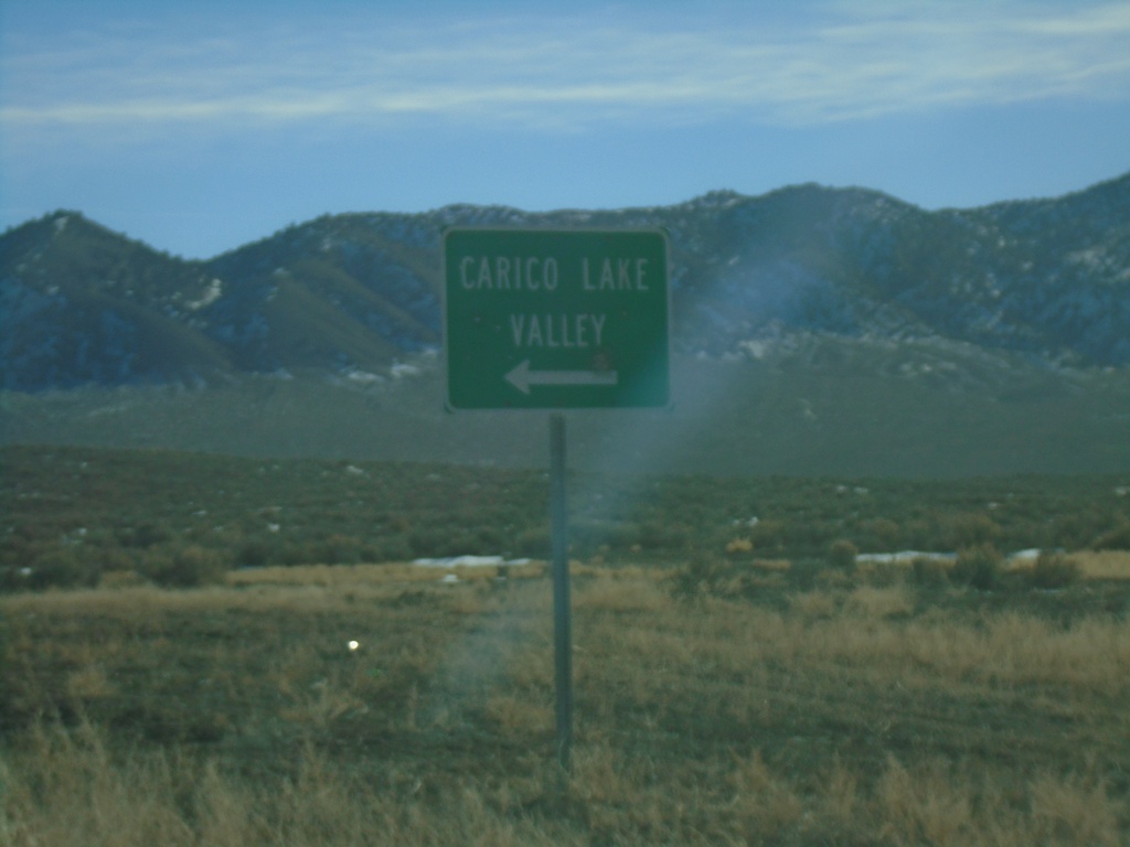
NV-305 South - Carico Lake Valley
NV-305 South at Carico Lake Valley junction
Taken 01-14-2022
Battle Mountain
Lander County
Nevada
United States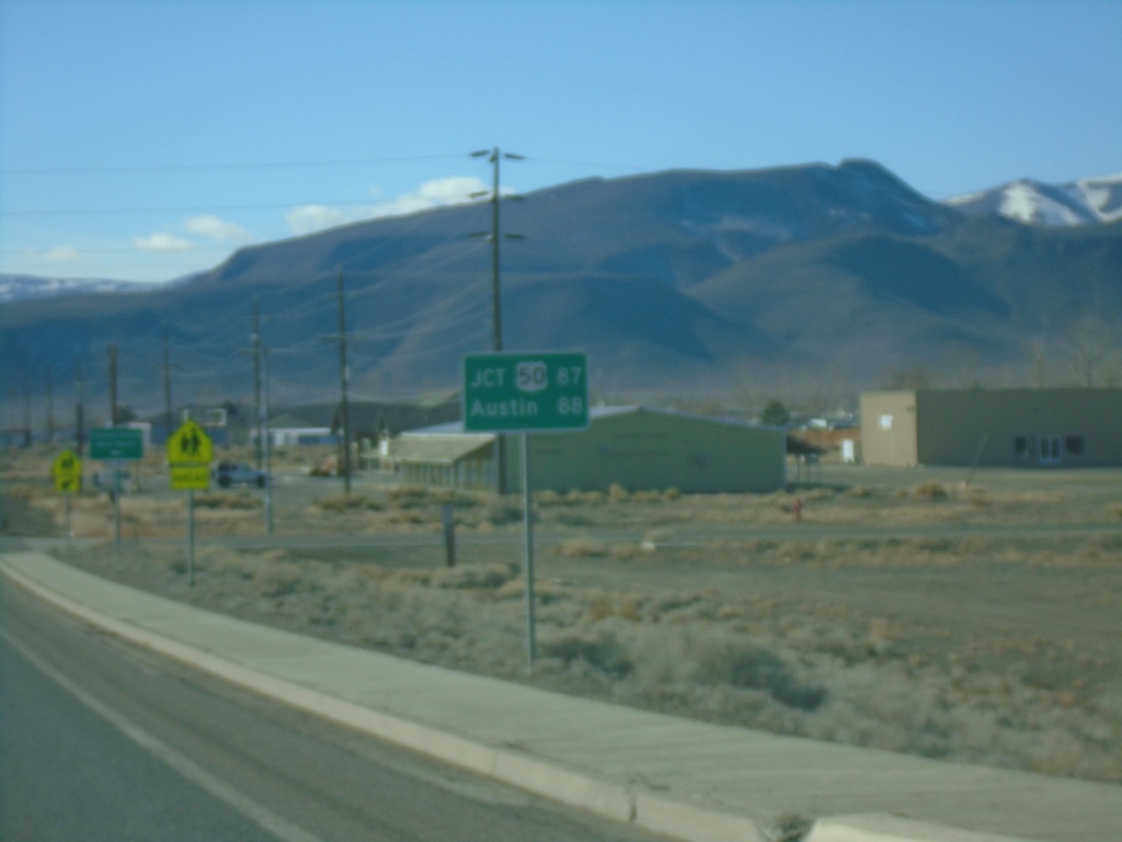
NV-305 South - Distance Marker
Distance marker on NV-305 south. Distance to Jct. US-50 and Austin.
Taken 01-14-2022
Battle Mountain
Lander County
Nevada
United States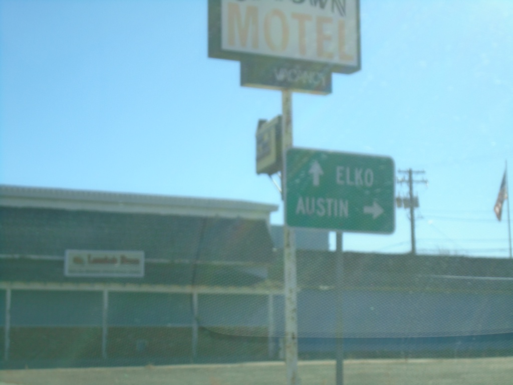
BL-80 East/NV-304 East at NV-305 South
BL-80 East/NV-304 East (Front St.) at NV-305 South (Broad St.) to Austin. Continue on BL-80/NV-304 for Elko.
Taken 01-14-2022

 Battle Mountain
Lander County
Nevada
United States
Battle Mountain
Lander County
Nevada
United States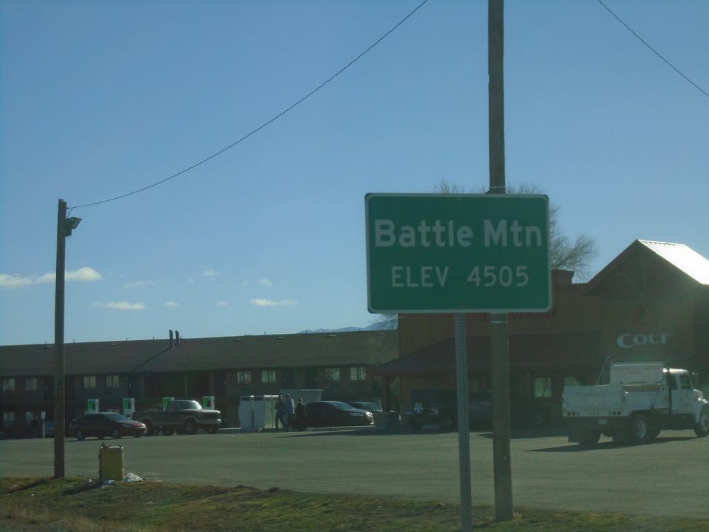
BL-80 East/NV-304 East - Entering Battle Mountain
Entering Battle Mountain (Elevation 4505 Feet) on BL-80 East/NV-304 East. Battle Mountain is the unincorporated county seat of Lander County Nevada.
Taken 01-14-2022
Battle Mountain
Lander County
Nevada
United States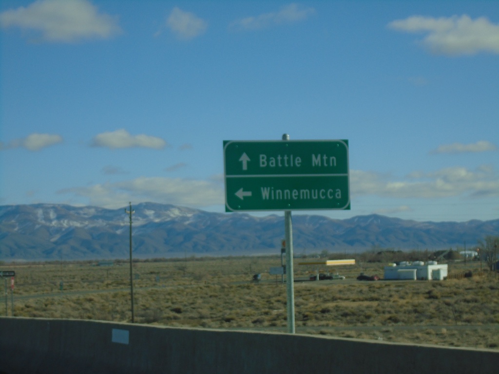
BL-80 East/NV-304 East at I-80 West
BL-80 East/NV-304 East at I-80 West (Exit 229) in Battle Mountain. Use I-80 west for Winnemucca; BL-80/NV-304 East for Battle Mountain. This is the western end of the Battle Mountain business loop.
Taken 01-14-2022
 Battle Mountain
Lander County
Nevada
United States
Battle Mountain
Lander County
Nevada
United States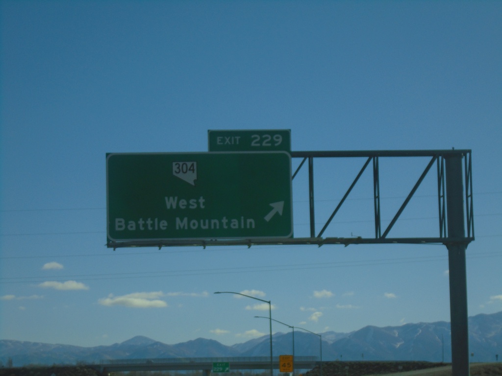
I-80 East - Exit 229
I-80 east at Exit 229 - NV-304/West Battle Mountain
Taken 01-14-2022
Battle Mountain
Lander County
Nevada
United States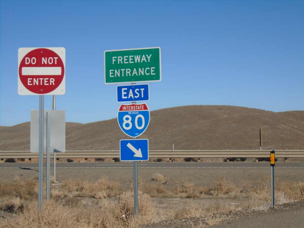
I-80 East Onramp - Exit 203
I-80 East onramp - Exit 203 (Iron Point).
Taken 01-14-2022
Red House
Humboldt County
Nevada
United States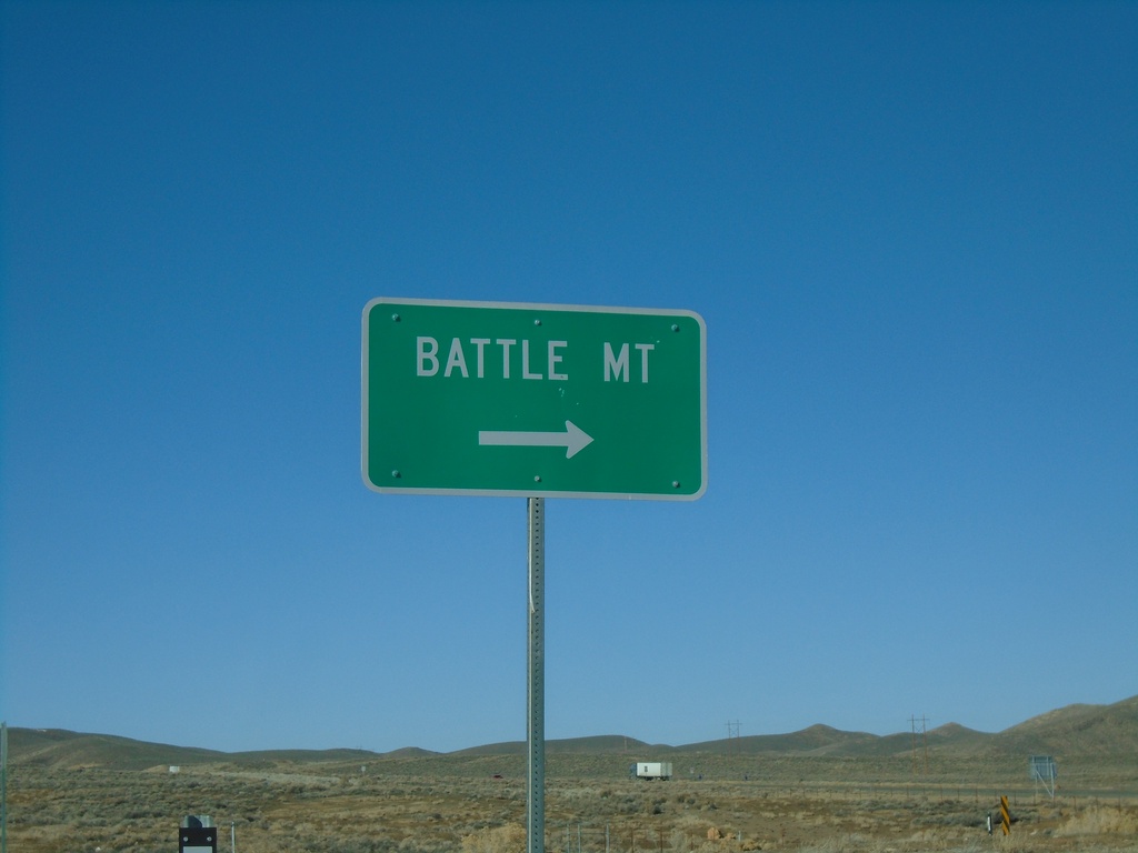
I-80 Exit 203 East Onramp
I-80 east onramp at Exit 203 to Battle Mountain
Taken 01-14-2022
Red House
Humboldt County
Nevada
United States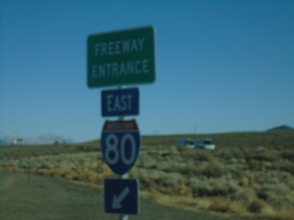
NV-794 East at I-80 East
NV-794 East at I-80 East (Exit 180)
Taken 01-14-2022
 Winnemucca
Humboldt County
Nevada
United States
Winnemucca
Humboldt County
Nevada
United States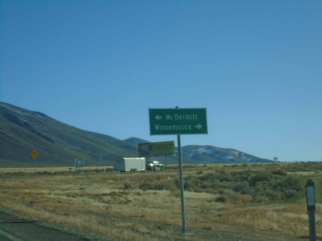
End NV-140 East at US-95
End NV-140 East at US-95. Use US-95 north for McDermitt; US-95 south for Winnemucca.
Taken 01-14-2022
 Winnemucca
Humboldt County
Nevada
United States
Winnemucca
Humboldt County
Nevada
United States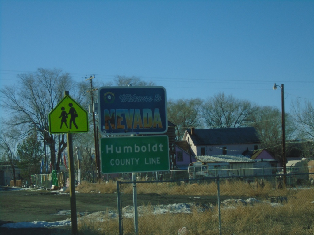
US-95 South - Welcome To Nevada
US-95 South - Welcome To Nevada / Humboldt County Line. Taken at the state line of Nevada and Oregon in McDermitt.
Taken 01-14-2022
McDermitt
Humboldt County
Nevada
United States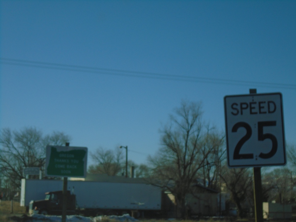
US-95 South - Oregon Thanks You
US-95 South - Oregon Thanks You - Come Back Soon. Speed 25 MPH, approaching the Oregon-Nevada state line.
Taken 01-14-2022
McDermitt
Malheur County
Oregon
United States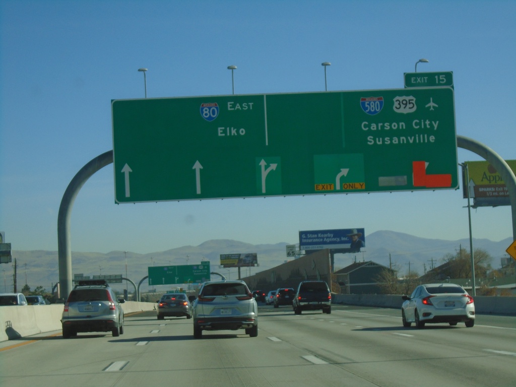
I-80 East - Exit 15
I-80 east at Exit 15 - I-580/US-395/Carson City/Susanville (California). Continue east on I-80 for Elko.
Taken 11-27-2021

 Reno
Washoe County
Nevada
United States
Reno
Washoe County
Nevada
United States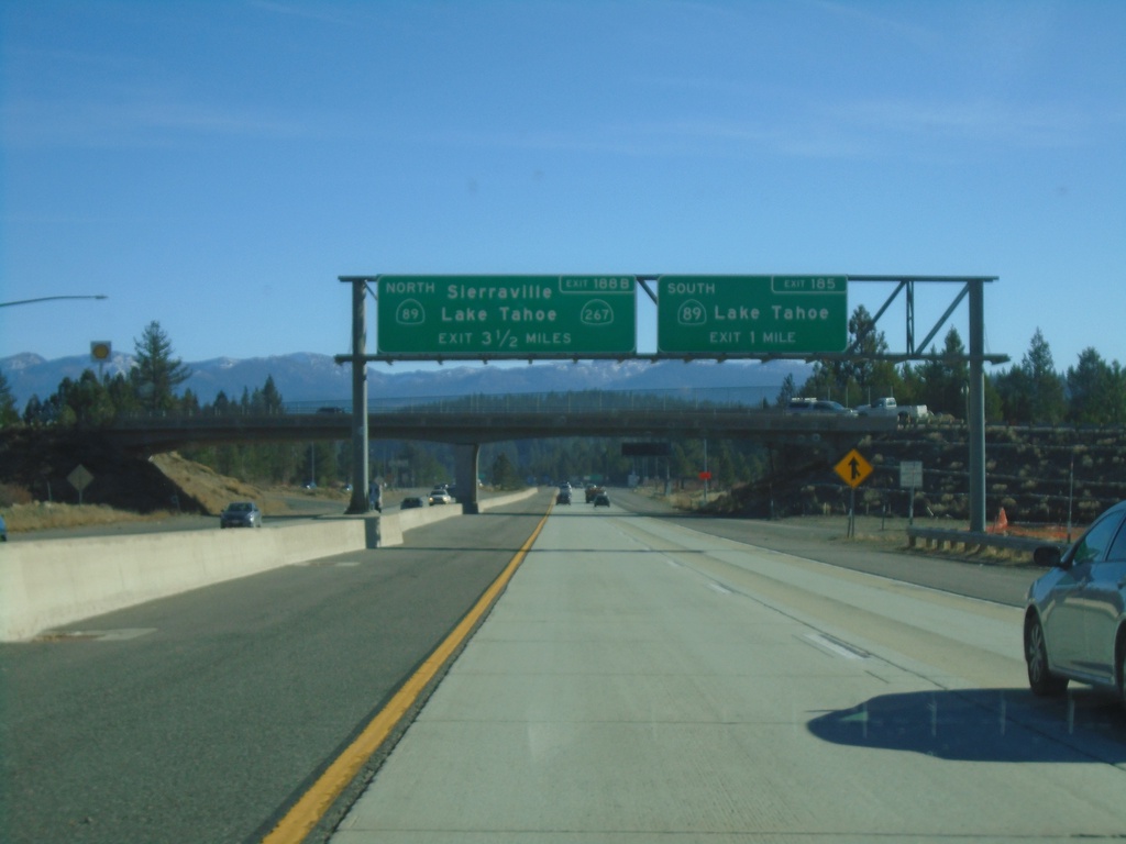
I-80 East - Exits 185 and 188B
I-80 east approaching Exit 185 - CA-89 South/Lake Tahoe. Advanced signage for Exit 188B - CA-89 North/CA-267/Sierraville/Lake Tahoe.
Taken 11-27-2021

 Truckee
Nevada County
California
United States
Truckee
Nevada County
California
United States
Maple St at I-80 West
Maple St. at Maple St. overpass to I-80 West.
Taken 11-27-2021
Auburn
Placer County
California
United States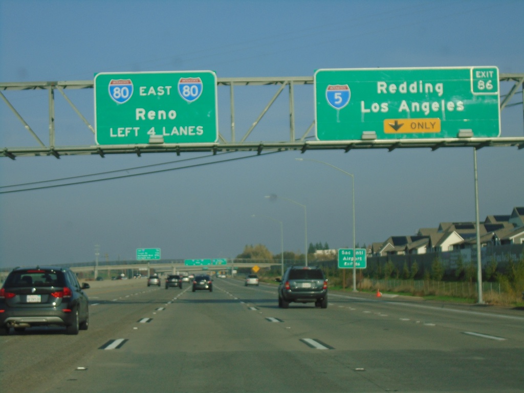
I-80 East - Exit 86
I-80 east approaching Exit 86 - I-5/Redding/Los Angeles. Continue east on I-80 for Reno (Nevada).
Taken 11-25-2021
 Sacramento
 County
California
United States
Sacramento
Sacramento County
California
United States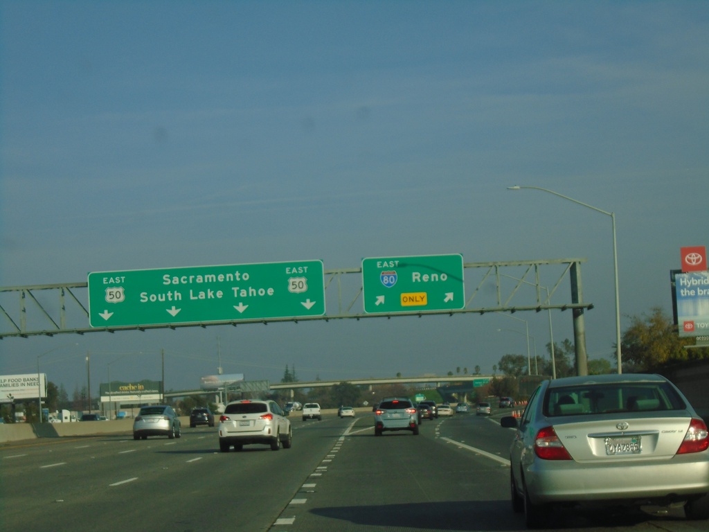
I-80 East - Exit 82
I-80 east at Exit 82 -US-50/South Lake Tahoe/Sacramento. Use right lanes for I-80 East to Reno.
Taken 11-25-2021
West Sacramento
Yolo County
California
United States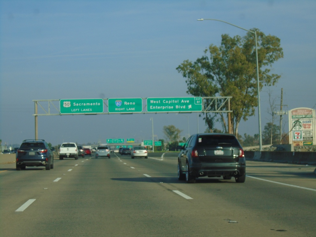
I-80 East - Exit 81 and Exit 82
I-80 east at Exit 81 - West Capitol Ave./Enterprise Blvd. Approaching Exit 82 - US-50/Sacramento. I-80 traffic use right lanes for Reno (Nevada).
Taken 11-25-2021
West Sacramento
Yolo County
California
United States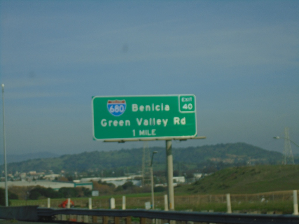
I-80 East - Exit 40
I-80 East approaching Exit 40 - I-680/Benicia/Green Valley Road.
Taken 11-25-2021
 Fairfield
Solano County
California
United States
Fairfield
Solano County
California
United States