Signs Tagged With Big Green Sign
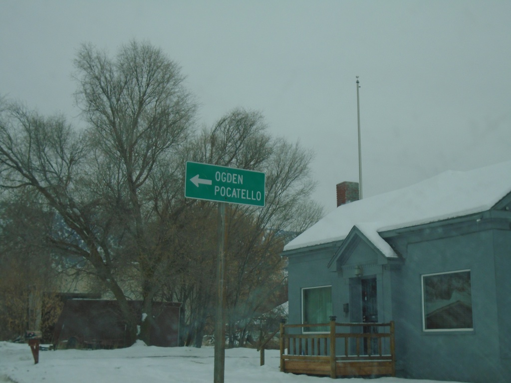
ID-38 East at South Main St.
ID-38 East (90 S) at South Main St. in Malad City. Turn left on S Main St to continue east on ID-38 and for I-15 to Ogden (UT) and Pocatello.
Taken 12-30-2020
 Malad City
Oneida County
Idaho
United States
Malad City
Oneida County
Idaho
United States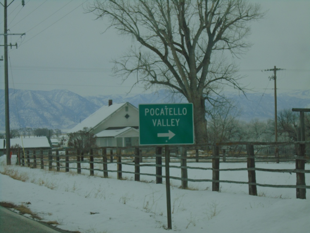
ID-38 East at 5400 West to Pocatello Valley
ID-38 East at 5400 West to Pocatello Valley
Taken 12-30-2020
Malad City
Oneida County
Idaho
United States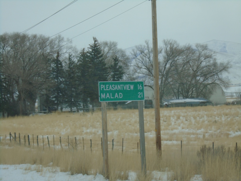
ID-38 East - Distance Marker
Distance marker on ID-38 east. Distance to Pleasantview and Malad.
Taken 12-30-2020
Malad City
Oneida County
Idaho
United States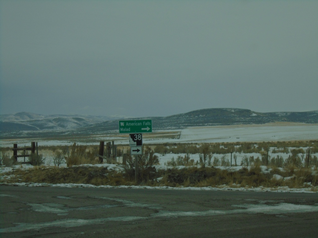
End 21000 West at ID-38 and Old Highway 37
End 21000 West at ID-38 and Old Highway 37 in Holbrook. Turn left for Old Highway 37 (to ID-37) and American Falls. Turn right for ID-38 to Malad.
Taken 12-30-2020
Holbrook
Oneida County
Idaho
United States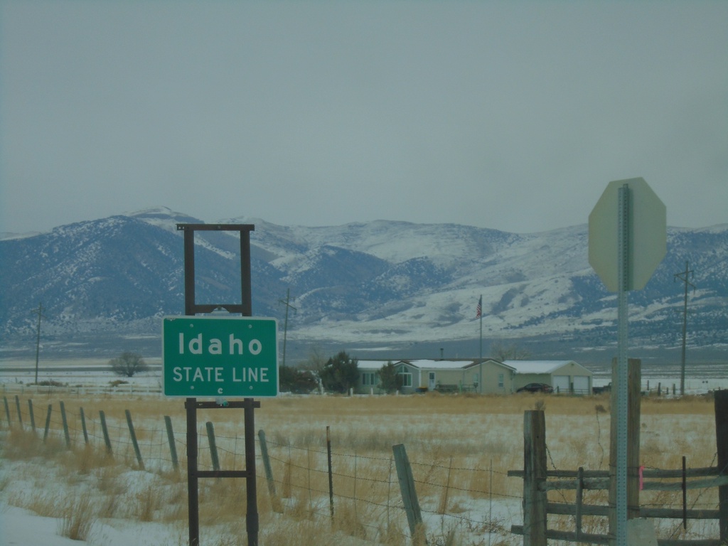
Entering Idaho on 23000 W
Idaho State Line on 23000 W (road connecting Snowville, Utah and Holbrook, Idaho).
Taken 12-30-2020
Stone Oneida County Idaho United States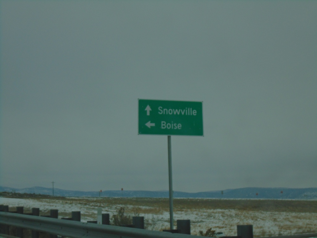
End UT-30 at I-84 West
End UT-30 at I-84 West. Use I-84 west for Boise (Idaho). Continue east on county road to Snowville.
Taken 12-30-2020

 Snowville
Box Elder County
Utah
United States
Snowville
Box Elder County
Utah
United States
End UT-30 East at I-84
End UT-30 East at I-84 (Exit 5) in Box Elder County.
Taken 12-30-2020
Snowville
Box Elder County
Utah
United States
UT-30 East at I-84
UT-30 east at I-84 (Exit 5). Use I-84 west for Boise (Idaho); I-84 east for Salt Lake. Continue east on county road for Snowville. UT-30 ends here at I-84.
Taken 12-30-2020
Snowville
Box Elder County
Utah
United States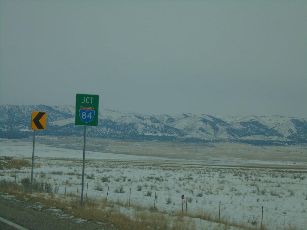
UT-30 East Approaching I-84
UT-30 East approaching I-84 (Exit 5).
Taken 12-30-2020
Snowville
Box Elder County
Utah
United States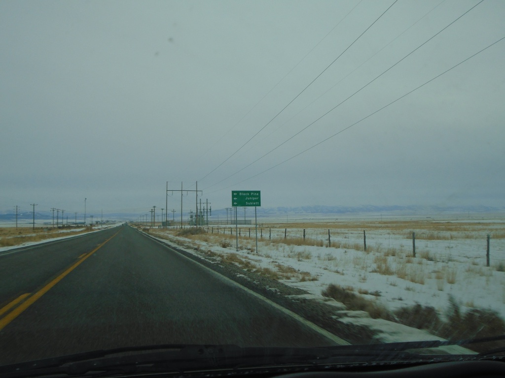
UT-30 East - Black Pine Road
UT-30 east at Black Pine Road jct. Turn north for Juniper, Sublette, and Black Pine.
Taken 12-30-2020
Snowville
Box Elder County
Utah
United States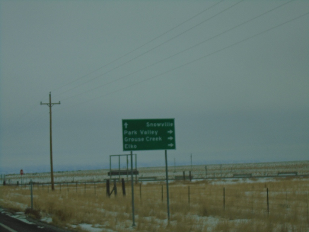
UT-42 South at UT-30
UT-42 South at UT-30 in Box Elder County. Use UT-30 west for Park Valley, Grouse Creek, and Elko (Nevada). Continue east on UT-30 for Snowville. UT-42 ends here.
Taken 12-30-2020
 Snowville
Box Elder County
Utah
United States
Snowville
Box Elder County
Utah
United States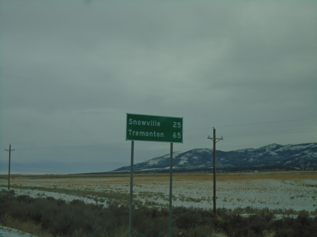
UT-42 South - Distance Marker
Distance marker on UT-42 south. Distance to Snowville and Tremonton.
Taken 12-30-2020
Malta
Box Elder County
Utah
United States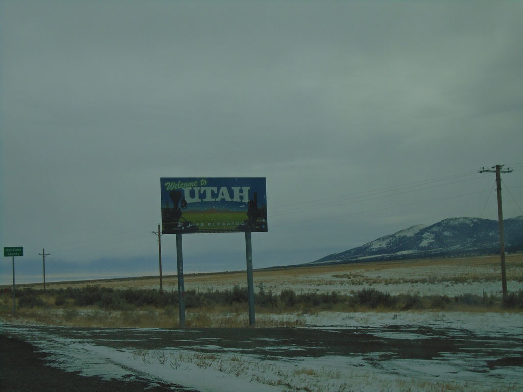
UT-42 South - Welcome To Utah
Welcome to Utah / Box Elder County at the Utah - Idaho state line on UT-42 south.
Taken 12-30-2020
Malta
Box Elder County
Utah
United States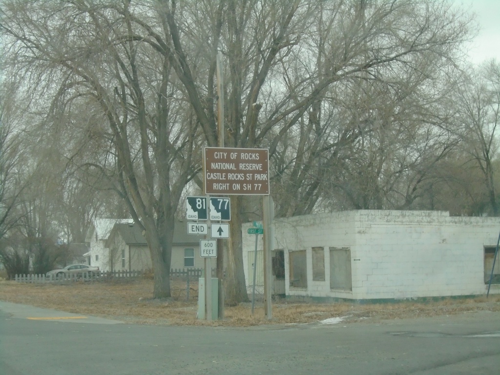
End ID-81 South at ID-77
End ID-81 South at ID-77 in Malta. Use ID-77 north for City of Rocks National Preserve and Castle Rocks State Park.
Taken 12-30-2020

 Malta
Cassia County
Idaho
United States
Malta
Cassia County
Idaho
United States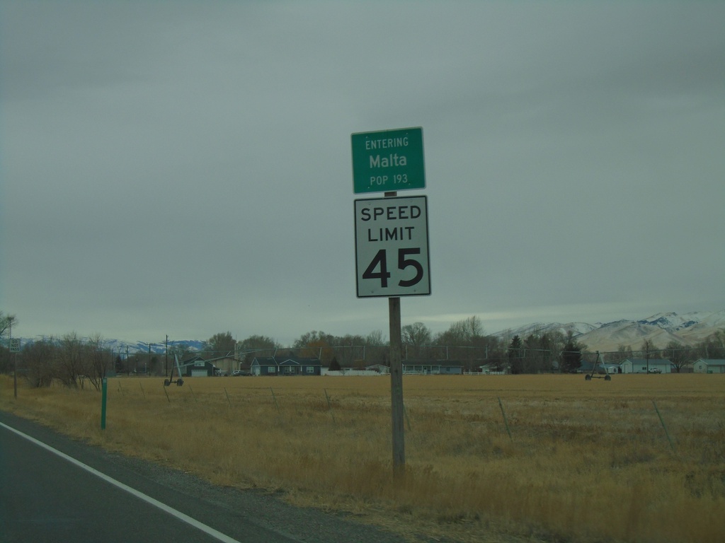
ID-81 South - Malta
Entering Malta on ID-81 south. Speed Limit 45 MPH.
Taken 12-30-2020
Albion
Cassia County
Idaho
United States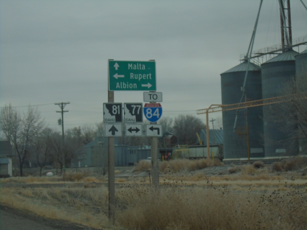
ID-81 South at ID-77
ID-81 South at ID-77 in Declo. Turn right for ID-77 south to Albion; left for ID-77 north to Rupert and I-84. Continue south on ID-81 for Malta.
Taken 12-30-2020
Declo
Cassia County
Idaho
United States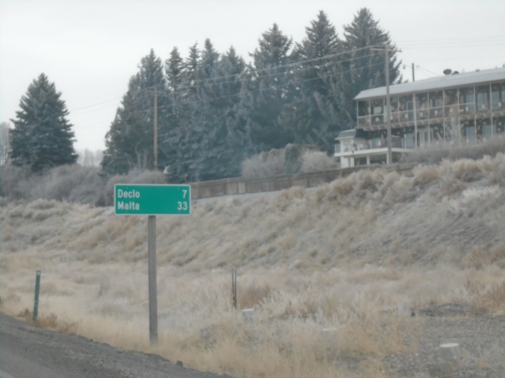
ID-81 South - Distance Marker
Distance marker on ID-81 south. Distance to Declo and Malta.
Taken 12-30-2020
Burley
Cassia County
Idaho
United States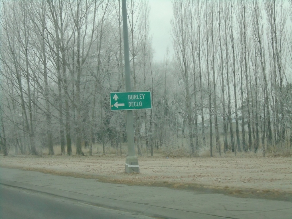
US-30/BL-84 West at ID-81
US-30/BL-84 West at ID-81 south to Declo. Continue on US-30/BL-84 for Burley.
Taken 12-30-2020

 Burley
Cassia County
Idaho
United States
Burley
Cassia County
Idaho
United States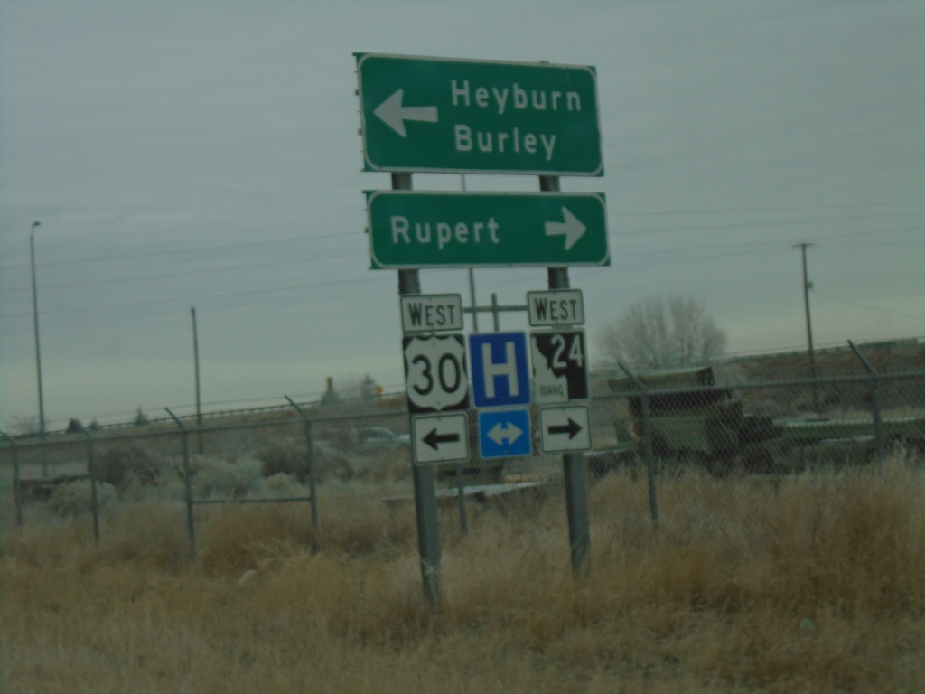
I-84 East - Exit 211 Offramp at BL-84/ID-24/US-30
I-84 East - Exit 211 Offramp at BL-84/ID-24/US-30 in Heyburn. Turn right for ID-24 west to Rupert; left for US-30/BL-84 West to Burley and Heyburn.
Taken 12-30-2020
 Heyburn
Minidoka County
Idaho
United States
Heyburn
Minidoka County
Idaho
United States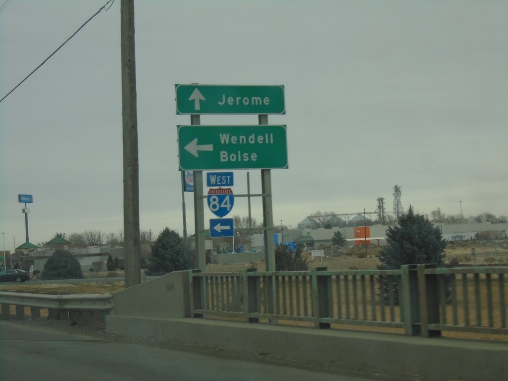
Lincoln Ave. North at I-84 West
Lincoln Ave. north at I-84 west to Wendell and Boise. Continue north on Lincoln Ave. to Jerome City Center.
Taken 12-30-2020
Jerome
Jerome County
Idaho
United States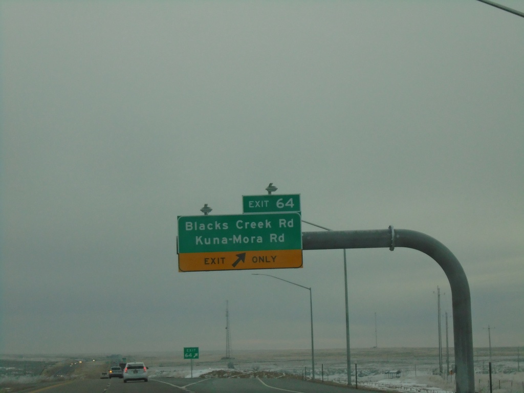
I-84 East - Exit 64
I-84 east at Exit 64 - Blacks Creek Road/Kuna-Mora Road.
Taken 12-30-2020

 Boise
Ada County
Idaho
United States
Boise
Ada County
Idaho
United States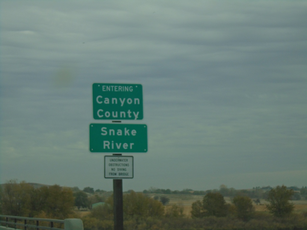
ID-55 North - Canyon County/Snake River
ID-55 north crossing the Snake River and entering Canyon County.
Taken 11-06-2020
 Marsing
Owyhee County
Idaho
United States
Marsing
Owyhee County
Idaho
United States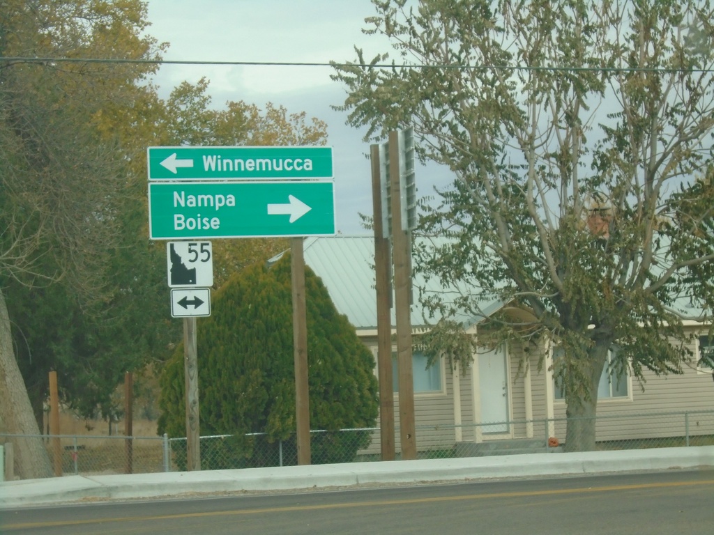
End ID-78 at ID-55
End ID-78 at ID-55 in Marsing. Turn right for ID-55 north to Nampa and Boise. Turn left for ID-55 south to Winnemucca (Nevada).
Taken 11-06-2020
 Marsing
Owyhee County
Idaho
United States
Marsing
Owyhee County
Idaho
United States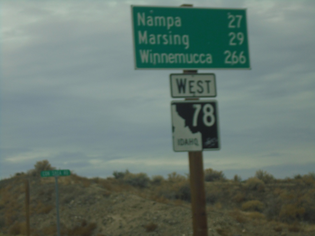
ID-78 West - Distance Marker
Distance marker on ID-78 west. Distance to Nampa, Marsing, and Winnemucca (Nevada).
Taken 11-06-2020
Murphy
Owyhee County
Idaho
United States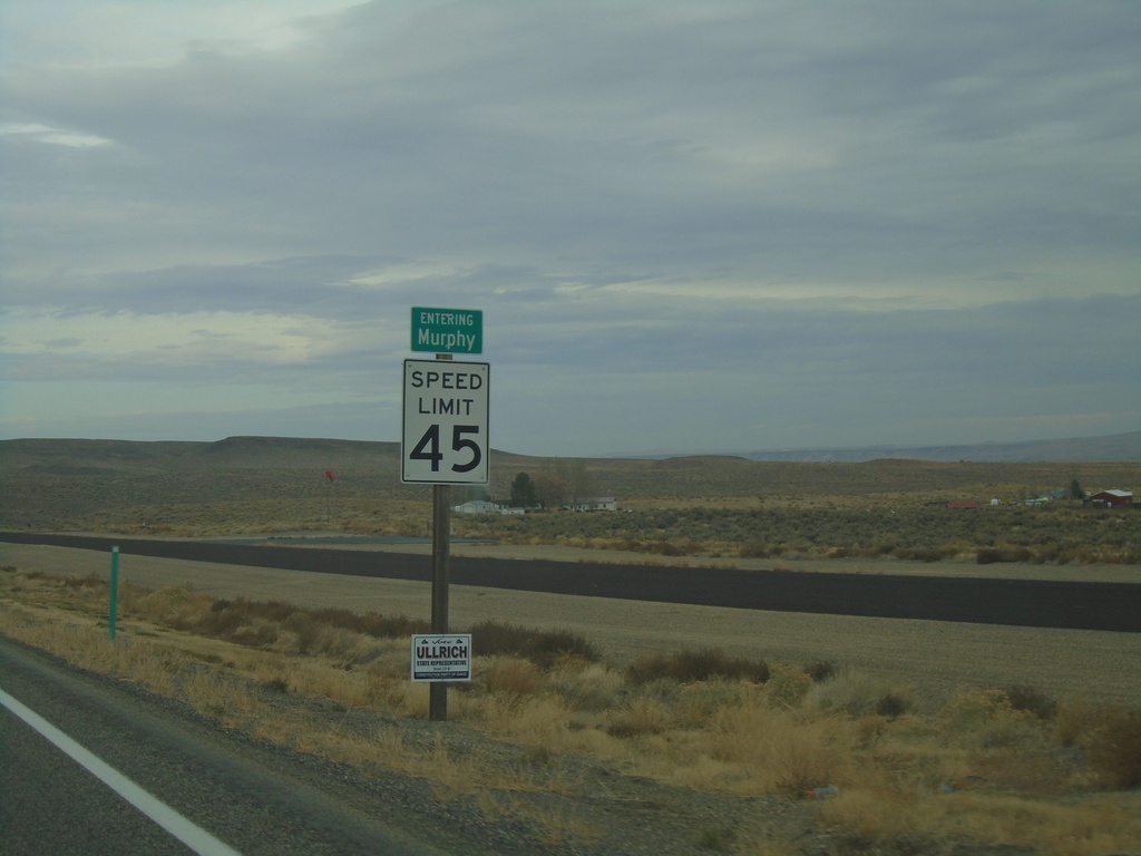
ID-78 West - Murphy
Entering Murphy (unincorporated) on ID-78 west. Murphy is the county seat of Owyhee County.
Taken 11-06-2020
Murphy
Owyhee County
Idaho
United States