Signs Tagged With Big Green Sign
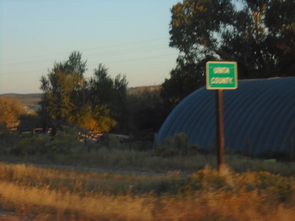
WY-414 North - Uinta County
Uinta County on WY-414 North.
Taken 09-25-2021
 Lonetree
Uinta County
Wyoming
United States
Lonetree
Uinta County
Wyoming
United States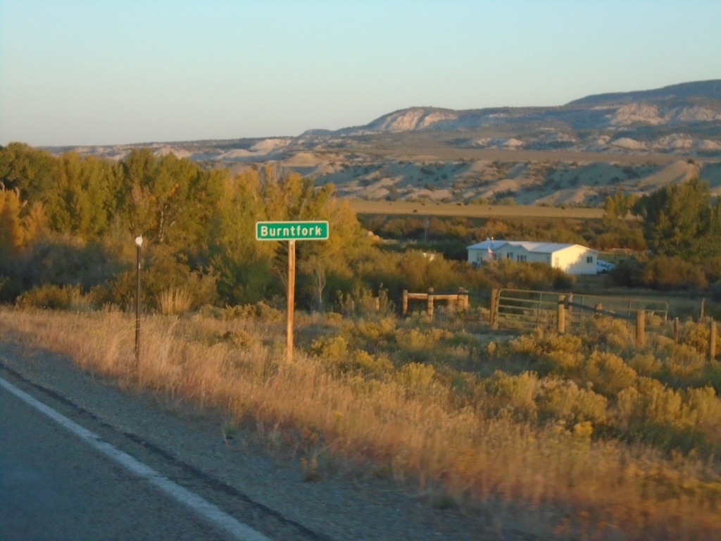
WY-414 North - Burntfork
Entering Burntfork on WY-414 north.
Taken 09-25-2021
McKinnon
Sweetwater County
Wyoming
United States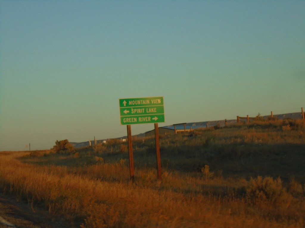
WY-414 North - McKinnon Road
WY-414 North at McKinnon Road. Turn right for Green River; left for Spirit Lake. Continue north on WY-414 for Mountain View.
Taken 09-25-2021
McKinnon
Sweetwater County
Wyoming
United States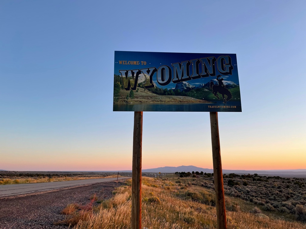
Welcome To Wyoming - WY-414 North
Welcome To Wyoming on WY-414 North. Taken at the Utah-Wyoming Line.
Taken 09-25-2021
McKinnon
Sweetwater County
Wyoming
United States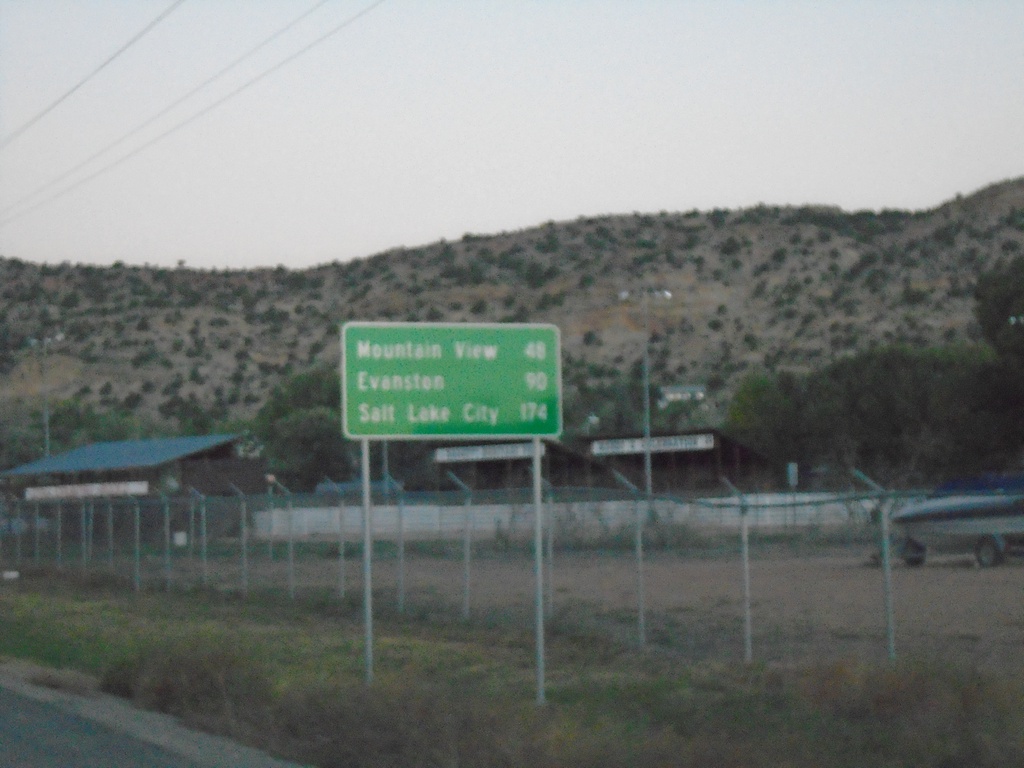
UT-43 West - Distance Marker
Distance marker on UT-43 west. Distance to Mountain View (WY), Evanston (WY), and Salt Lake City. Access to Salt Lake City via UT-43 west involves cutting through the southwest corner of Wyoming.
Taken 09-25-2021
 Manila
Daggett County
Utah
United States
Manila
Daggett County
Utah
United States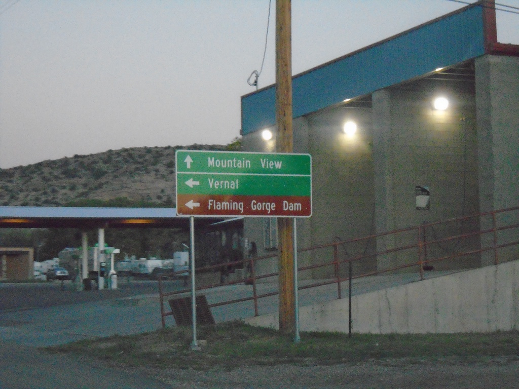
UT-43 West at UT-44
UT-43 west at UT-44 in Manila. Use UT-43 west for Mountain View (Wyoming). Use UT-44 South for Vernal and Flaming Gorge Dam.
Taken 09-25-2021
 Manila
Daggett County
Utah
United States
Manila
Daggett County
Utah
United States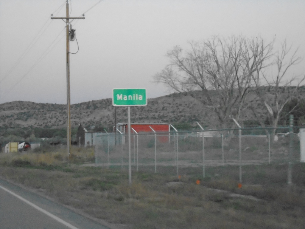
UT-43 West - Manila
Entering Manila on UT-43 west. Manila is the county seat of Daggett County Utah.
Taken 09-25-2021
Manila
Daggett County
Utah
United States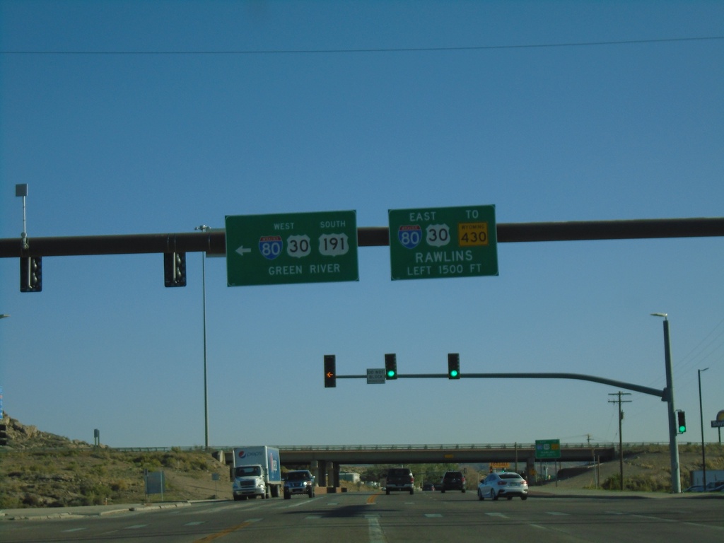
I-80 West - Exit 104 Offramp
US-191 South at I-80/US-30 (Exit 104). Use I-80/US-30 West to Green River. Use I-80/US-30 East to Rawlins.
Taken 09-24-2021


 Rock Springs
Sweetwater County
Wyoming
United States
Rock Springs
Sweetwater County
Wyoming
United States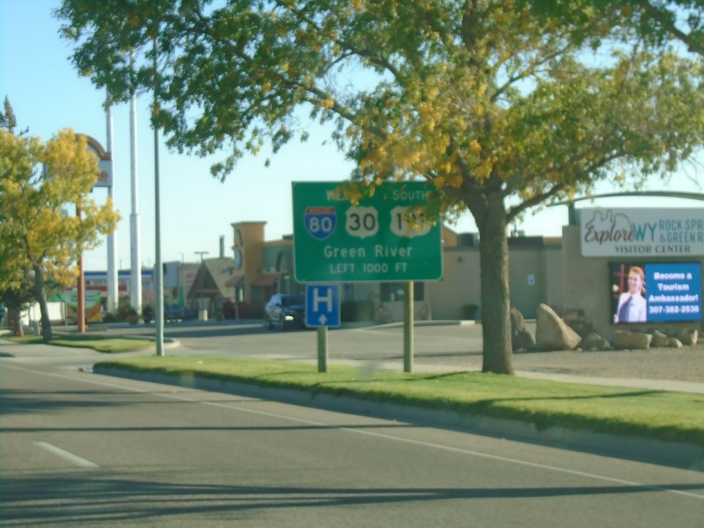
US-191 South Approaching I-80/US-191
US-191 South approaching I-80/US-191 in Rock Springs. Use I-80 West/US-30 West/US-191 South to Green River.
Taken 09-24-2021
Rock Springs
Sweetwater County
Wyoming
United States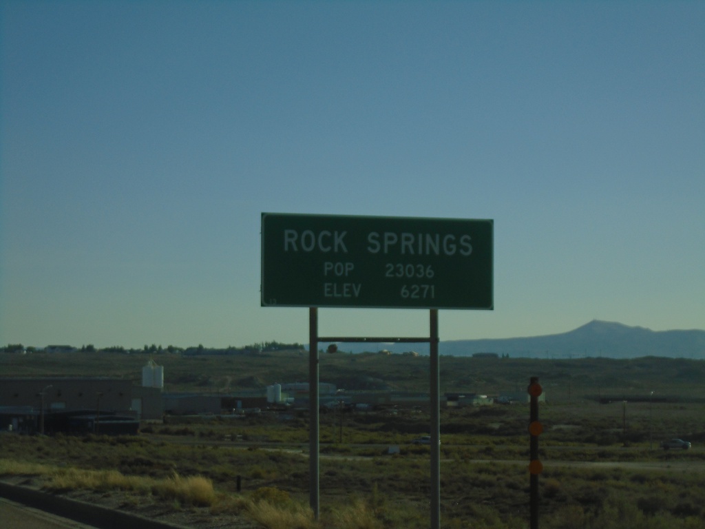
US-191 South - Rock Springs
Entering Rock Springs on US-191 south. Population 23036 / Elevation 6271 Feet. Rock Springs is the 5th largest city in Wyoming based on the 2010 census.
Taken 09-24-2021
Rock Springs
Sweetwater County
Wyoming
United States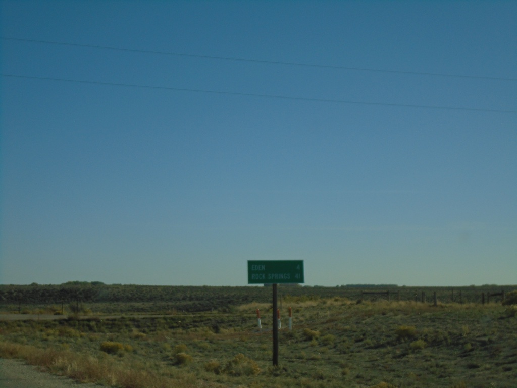
US-191 South - Distance Marker
Distance marker on US-191 south. Distance to Eden and Rock Springs.
Taken 09-24-2021
Eden
Sweetwater County
Wyoming
United States
US-191 South at WY-28
US-191 South at WY-28 in Farson. Use WY-28 West for Kemmerer; WY-28 East for Lander.
Taken 09-24-2021
 Farson
Sweetwater County
Wyoming
United States
Farson
Sweetwater County
Wyoming
United States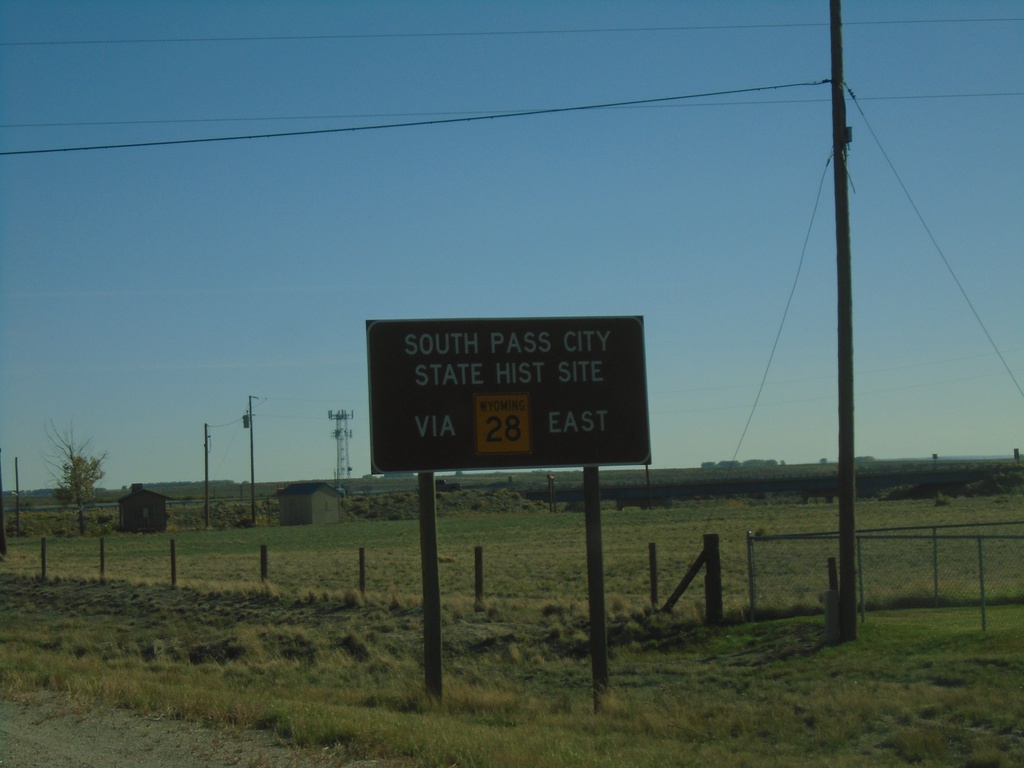
US-191 South Approaching WY-28
US-191 South approaching WY-28. Use WY-28 east for South Pass City State Historical Site.
Taken 09-24-2021
Farson
Sweetwater County
Wyoming
United States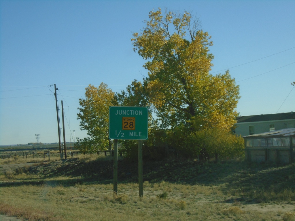
US-191 South Approaching WY-28
US-191 South approaching WY-28 in Farson.
Taken 09-24-2021
Farson
Sweetwater County
Wyoming
United States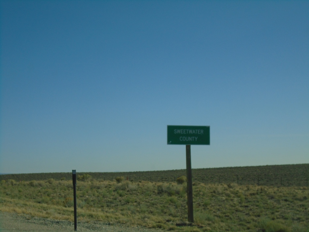
US-191 South - Sweetwater County
Entering Sweetwater County on US-191 south.
Taken 09-24-2021
Farson
Sweetwater County
Wyoming
United States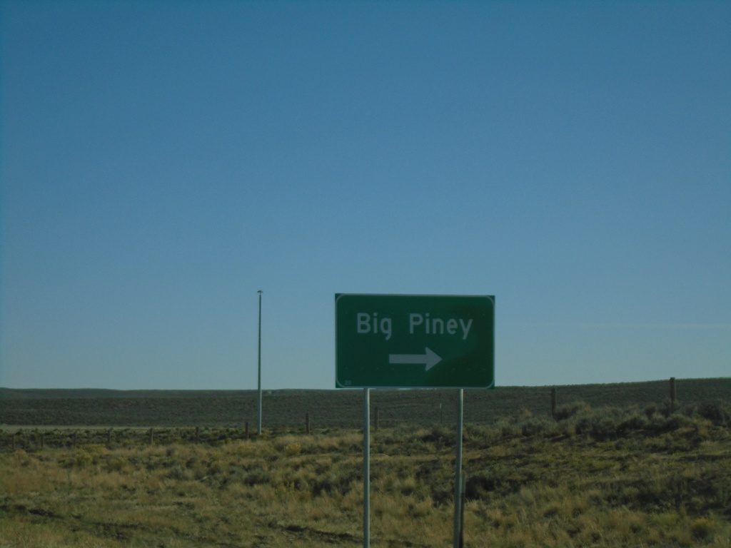
US-191 South at WY-351
US-191 south at WY-351 West to Big Piney.
Taken 09-24-2021
 Boulder
Sublette County
Wyoming
United States
Boulder
Sublette County
Wyoming
United States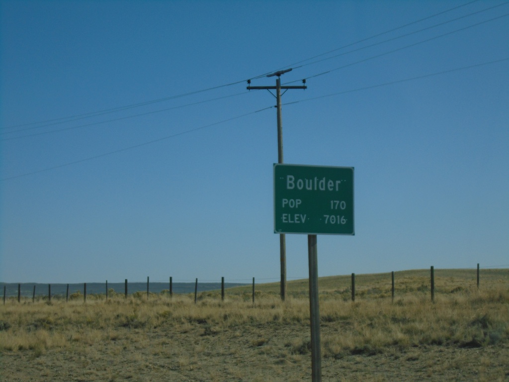
US-191 South - Boulder
Entering Boulder on US-191 South. Population 170 / Elevation 7016 Feet.
Taken 09-24-2021
Pinedale
Sublette County
Wyoming
United States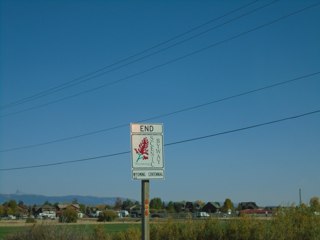
US-191 South - End Wyoming Centennial Scenic Byway
End Wyoming Centennial Scenic Byway on US-191 South. The Wyoming Centennial Scenic Byway runs between Dubois and Pinedale Wyoming. Following routes US-26, and US-191.
Taken 09-24-2021
Pinedale
Sublette County
Wyoming
United States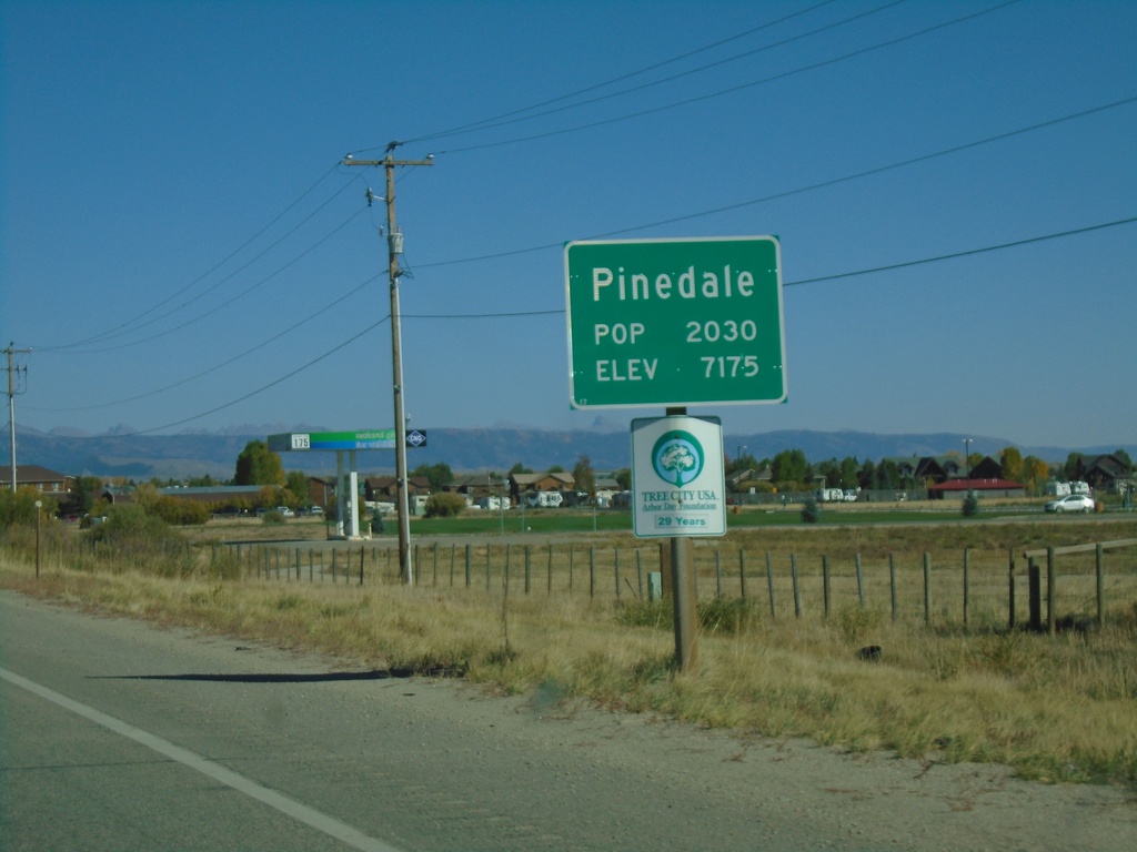
US-191 South - Pinedale
Entering Pinedale on US-191 south - Population 2030 / Elevation 7175. Pinedale is the county seat of Sublette County.
Taken 09-24-2021
Pinedale
Sublette County
Wyoming
United States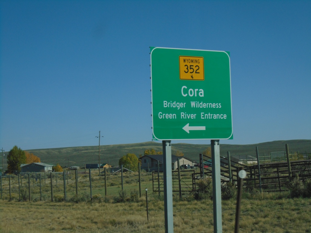
US-191 South at WY-352
US-191 South at WY-352 North to Cora and Bridger Wilderness (Green River Entrance).
Taken 09-24-2021
 Pinedale
Sublette County
Wyoming
United States
Pinedale
Sublette County
Wyoming
United States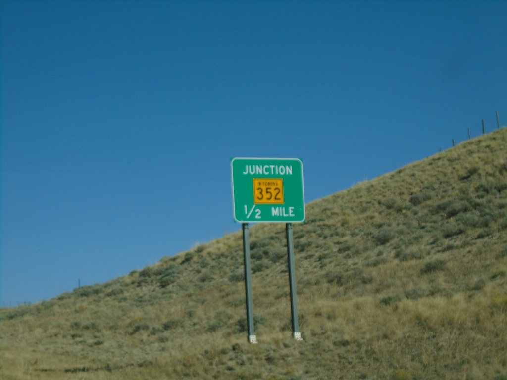
US-191 South Approaching WY-352
US-191 South approaching WY-352 in Sublette County.
Taken 09-24-2021
Pinedale
Sublette County
Wyoming
United States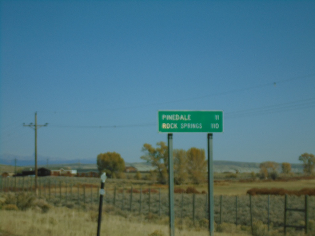
US-191 South - Distance Marker
Distance marker on US-191 south. Distance to Pinedale and Rock Springs.
Taken 09-24-2021
Pinedale
Sublette County
Wyoming
United States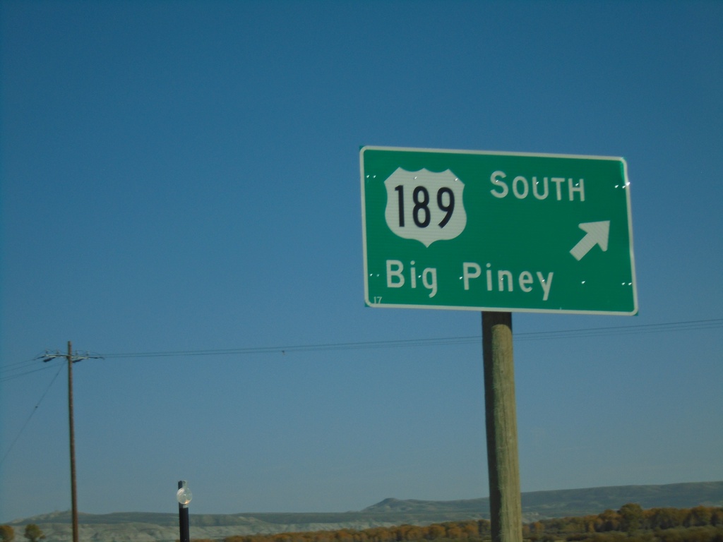
US-189/US-191 South - Daniel Junction
US-189/US-191 South at Daniel Junction. Turn right to continue south on US-189 to Big Piney.
Taken 09-24-2021
 Daniel
Sublette County
Wyoming
United States
Daniel
Sublette County
Wyoming
United States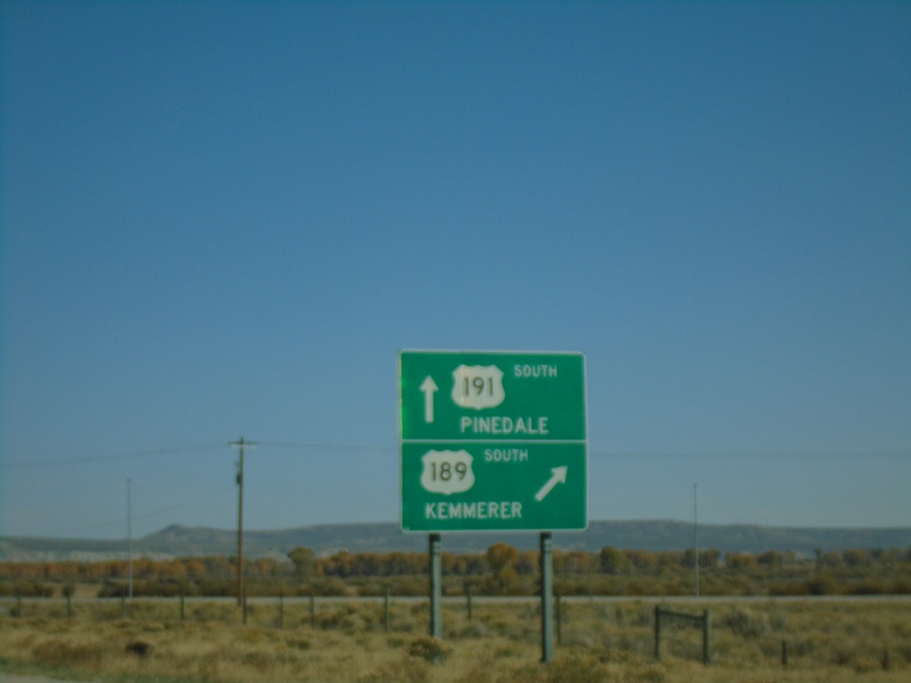
US-189/US-191 South - Daniel Junction
US-189/US-191 South at US-189/US-191 Split. Turn right for US-189 south to Kemmerer. Continue straight for US-191 south to Pinedale.
Taken 09-24-2021
Pinedale
Sublette County
Wyoming
United States
US-189/US-191 South - Daniel Junction
US-189/US-191 South approaching US-189/US-191 split.
Taken 09-24-2021
Pinedale
Sublette County
Wyoming
United States