Signs Tagged With Big Green Sign
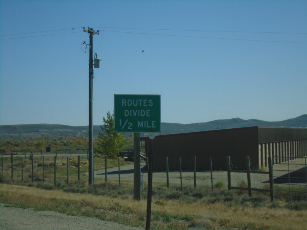
US-189/US-191 South - Routes Divide
US-189/US-191 South approaching US-189/US-191 split. Wyoming typically posts a Routes Divide sign at intersections similar to this where two co-signed highways split onto different roads.
Taken 09-24-2021

 Daniel
Sublette County
Wyoming
United States
Daniel
Sublette County
Wyoming
United States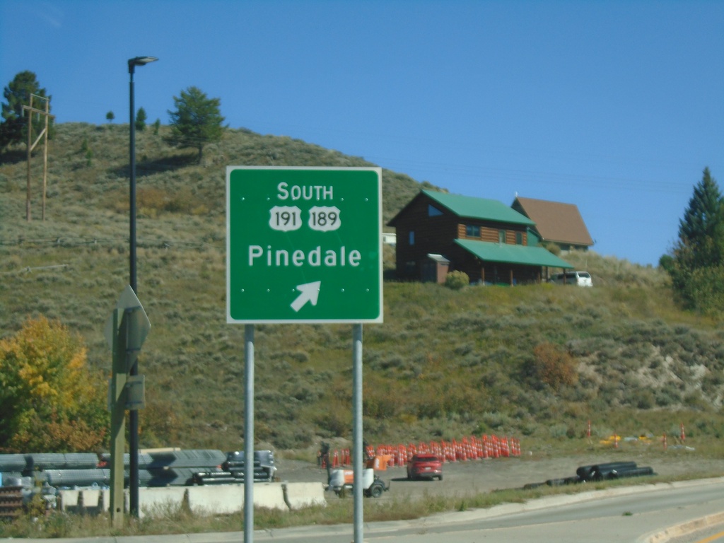
US-26/US-89/US-189/US-191 - Hoback Junction Roundabout
US-26/US-89/US-189/US-191 roundabout at Hoback Junction. Merge right for US-189/US-191 South to Pinedale.
Taken 09-24-2021

 Jackson
Teton County
Wyoming
United States
Jackson
Teton County
Wyoming
United States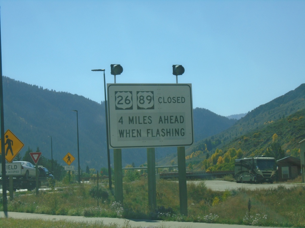
US-26 West - US-89/US-189/US-191 South at Hoback Junction - Road Closure Information
Road Closure Information at US-26 West - US-89/US-189/US-191 South in Hoback Junction. Road Closed on US-26 West/US-89 South when lights flashing.
Taken 09-24-2021
Hoback
Teton County
Wyoming
United States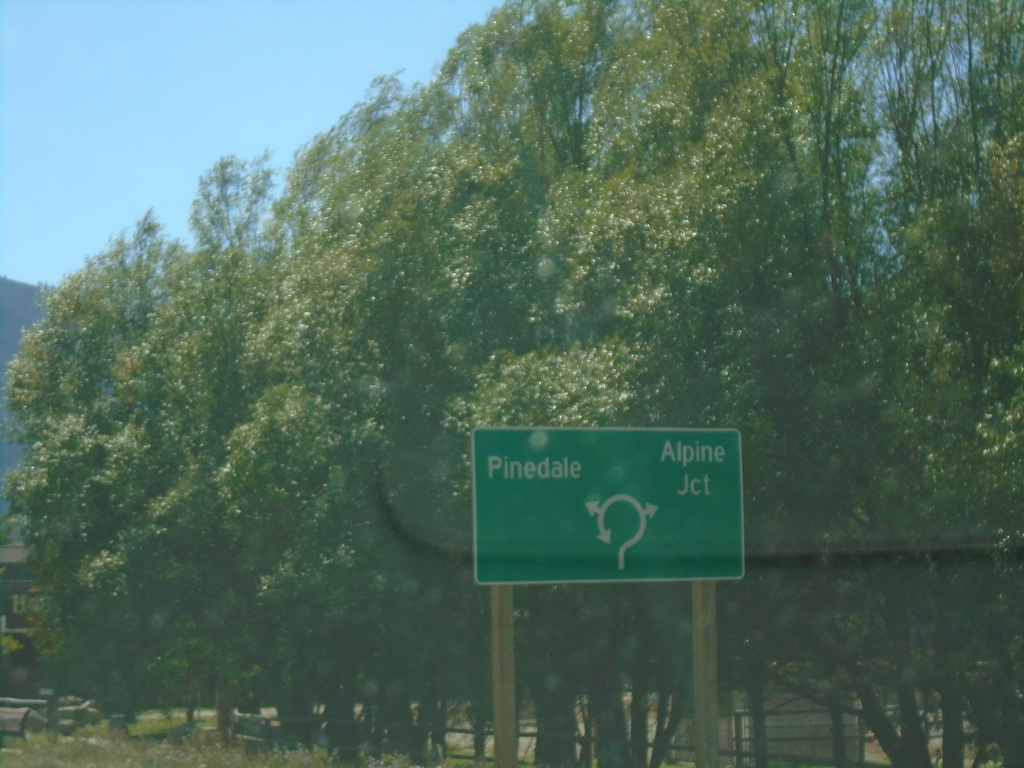
US-26 West - US-89/US-189/US-191 South - Roundabout
US-26 West - US-89/US-189/US-191 South entering roundabout at Hoback Junction. Use US-26 West/US-89 South for Alpine Jct.; use US-189/US-191 South for Pinedale.
Taken 09-24-2021
Jackson
Teton County
Wyoming
United States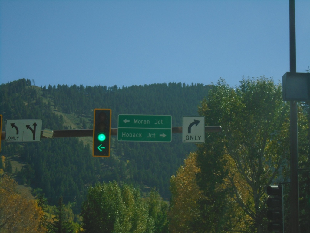
End WY-22 East at US-26/US-89/US-189/US-191
End WY-22 East at US-26/US-89/US-189/US-191 in Jackson. Turn left on US-26 East/US-89/US-189/US-191 North to Moran Jct. Turn right on US-26 West/US-89/US-189/US-191 South to Hoback Jct.
Taken 09-24-2021
 Jackson
Teton County
Wyoming
United States
Jackson
Teton County
Wyoming
United States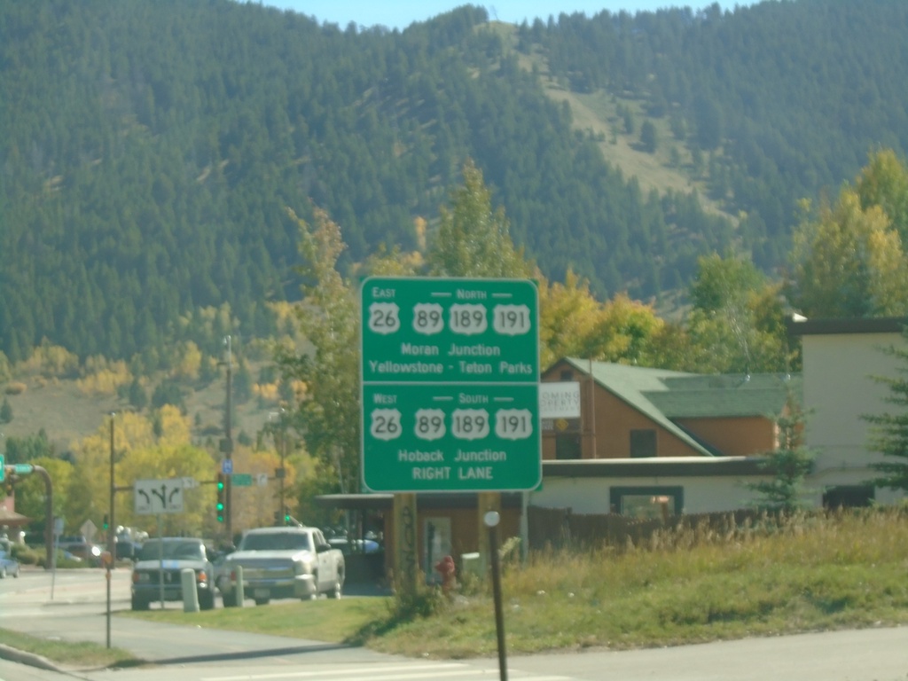
WY-22 East at US-26/US-89/US-189/US-191
End WY-22 East at US-26/US-89/US-189/US-191. Use US-26 West/US-89/US-189/US-191 South to Hoback Junction. Use US-26 East/US-89/US-189/US-191 North to Moran Junction and Yellowstone - Teton National Parks.
Taken 09-24-2021
Jackson
Teton County
Wyoming
United States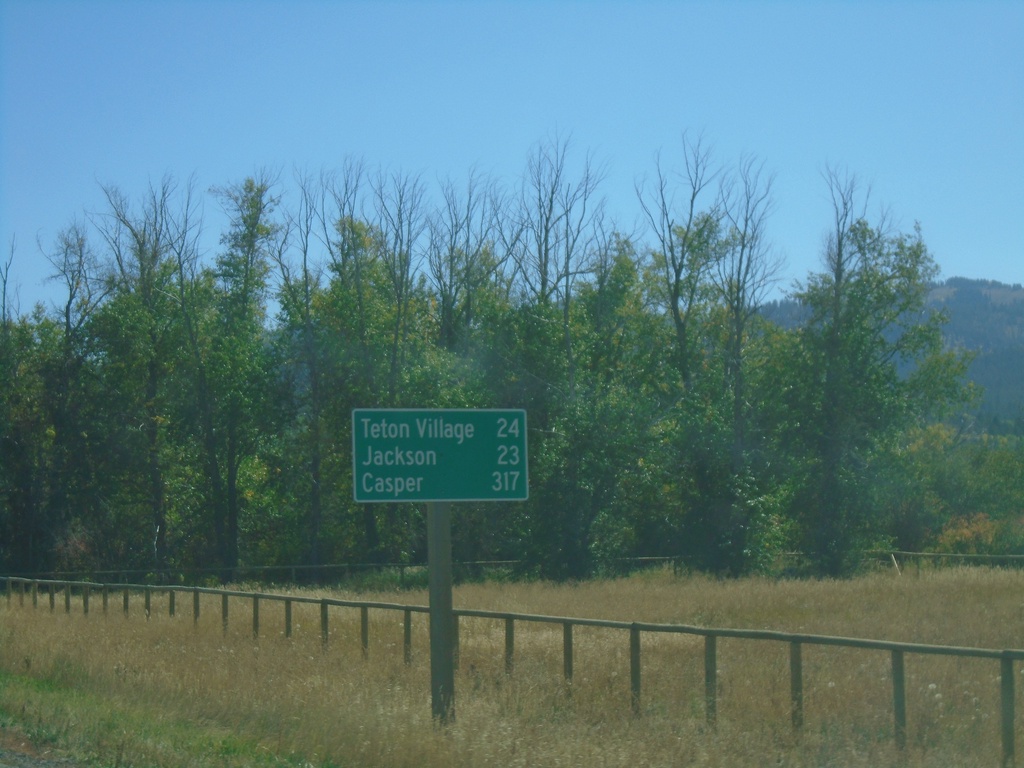
ID-33 East - Distance Marker
Last distance marker on ID-33 east in Idaho. Distance to Teton Village, Jackson, and Casper. All destinations are in Wyoming.
Taken 09-24-2021
 Victor
Teton County
Idaho
United States
Victor
Teton County
Idaho
United States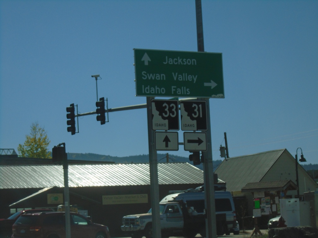
ID-33 East at ID-31
ID-33 East at ID-31 in Victor. Turn right on ID-31 south for Swan Valley and Idaho Falls. Continue straight on ID-33 for Jackson (Wyoming). Teton Scenic Byway leaves ID-33 here and follows ID-31 south.
Taken 09-24-2021
 Victor
Teton County
Idaho
United States
Victor
Teton County
Idaho
United States
ID-33 East at ID-32
ID-33 east at ID-32 north to Ashton. Continue east on ID-33 for Driggs and Jackson (Wyoming). The Teton Mountain Range are in the background. The Teton Scenic Byway follows ID-32 south and turns east onto ID-33 east here.
Taken 09-24-2021
 Tetonia
Teton County
Idaho
United States
Tetonia
Teton County
Idaho
United States
ID-33 East - Distance Marker
Distance marker on ID-33 east. Distance to Tetonia, Driggs, and Jackson (Wyoming).
Taken 09-24-2021
Newdale
Madison County
Idaho
United States
ID-33 East at US-20 Access Road
ID-33 east at access road that connects ID-33 and US-20. Turn right to continue on ID-33 east towards Driggs.
Taken 09-24-2021
 Sugar City
Madison County
Idaho
United States
Sugar City
Madison County
Idaho
United States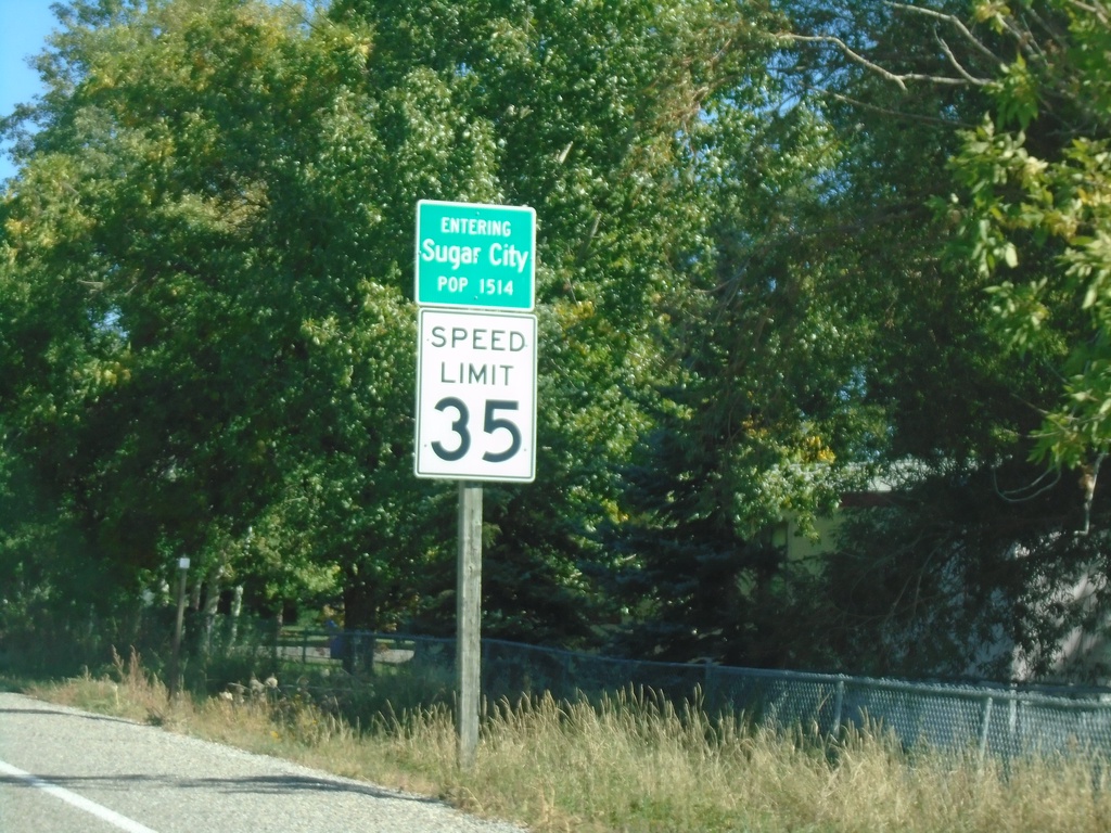
ID-33 East - Sugar City
Entering Sugar City on ID-33 East. Speed Limit 35.
Taken 09-24-2021
Sugar City
Madison County
Idaho
United States
ID-33 East - Rexburg
ID-33 east (W Main St.) in downtown Rexburg. Turn left on N 2nd St. to continue on ID-33.
Taken 09-24-2021
Rexburg
Madison County
Idaho
United States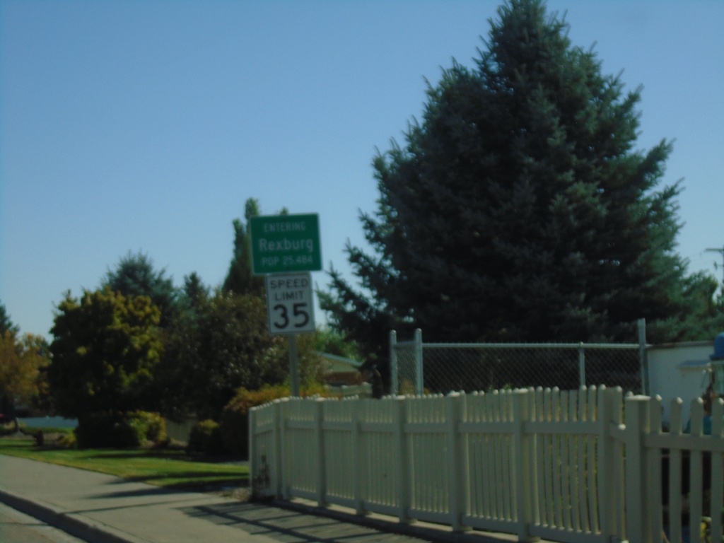
ID-33 East - Entering Rexburg
Entering Rexburg on ID-33 East (W Main St.). Rexburg is the county seat of Madison County.
Taken 09-24-2021
Rexburg
Madison County
Idaho
United States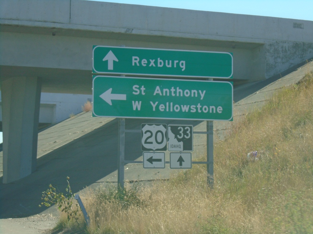
ID-33 East at US-20 East
ID-33 east at US-20 east. Use US-20 east for St. Anthony and West Yellowstone (Montana). Continue east on ID-33 for downtown Rexburg.
Taken 09-24-2021
Rexburg
Madison County
Idaho
United States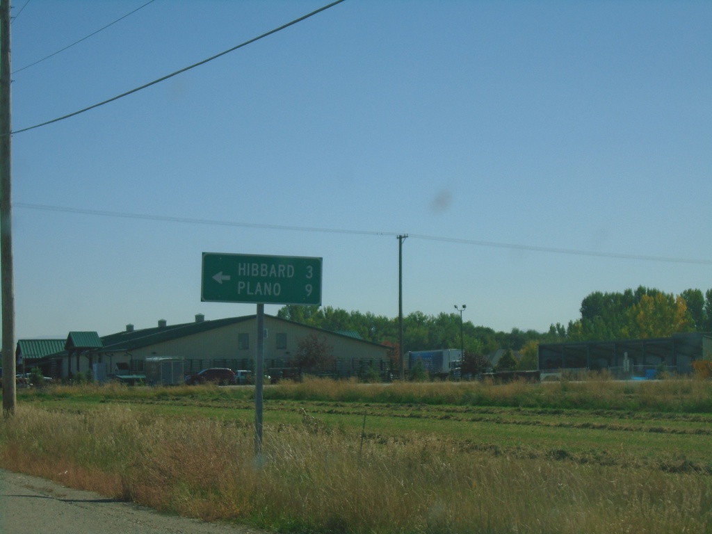
ID-33 East at N 3000 West
ID-33 east at N 3000 West to Hibbard and Plano.
Taken 09-24-2021
Rexburg
Madison County
Idaho
United States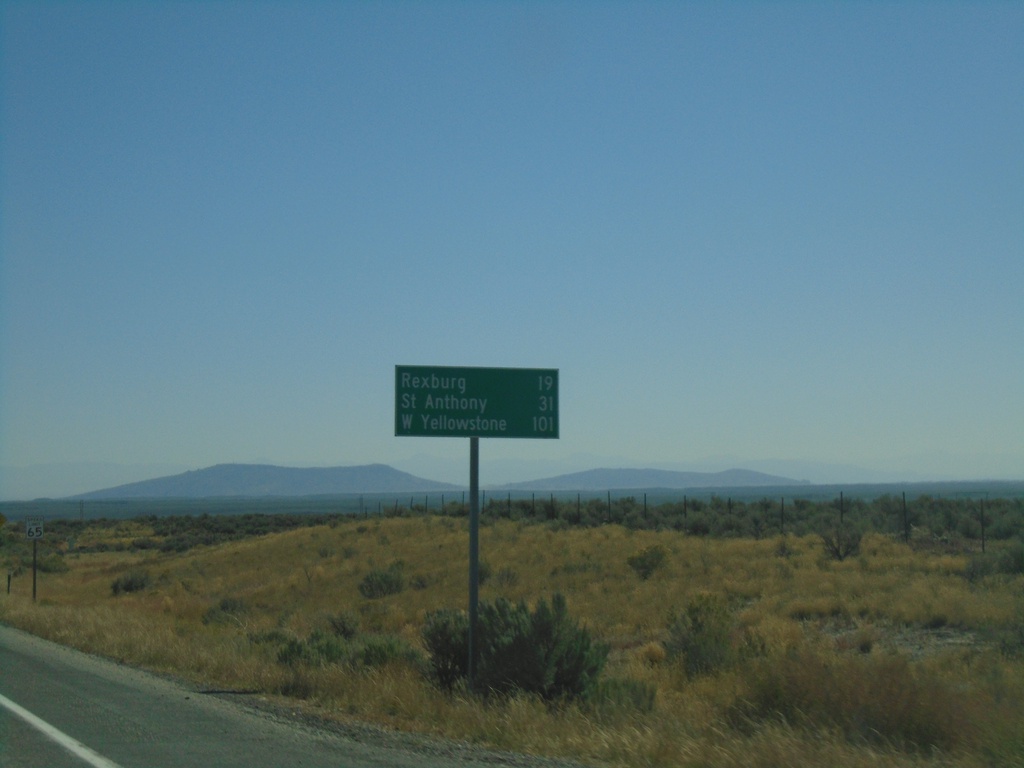
ID-33 East - Distance Marker
Distance marker on ID-33 East. Distance to Rexburg, St. Anthony (via US-20 East), and West Yellowstone (Montana via US-20 East).
Taken 09-24-2021
Hamer
Jefferson County
Idaho
United States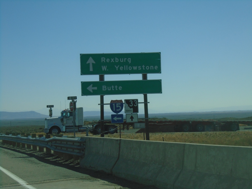
ID-33 East at I-15 North
ID-33 East at I-15 North (Exit 143). Use I-15 North for Butte (Montana). Continue east on ID-33 for Rexburg and West Yellowstone (Montana).
Taken 09-24-2021
 Roberts
Jefferson County
Idaho
United States
Roberts
Jefferson County
Idaho
United States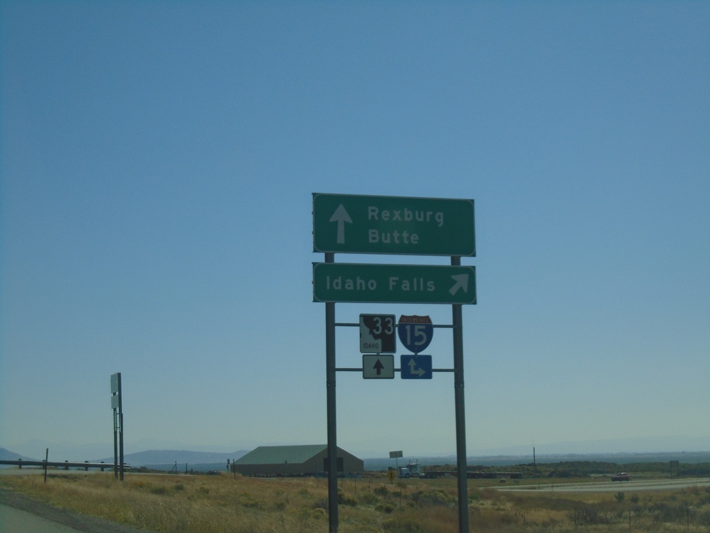
ID-33 East at I-15 South
ID-33 east at I-15 south to Idaho Falls. Continue over overpass for I-15 north onramp to Butte (Montana). Continue east on ID-33 for Rexburg.
Taken 09-24-2021
Sage Junction
Jefferson County
Idaho
United States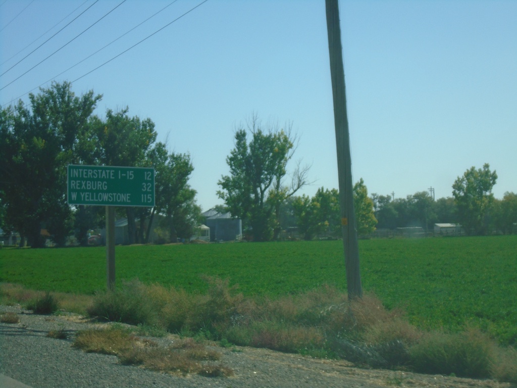
ID-33 East - Distance Marker
Distance marker on ID-33 east. Distance to I-15, Rexburg, and West Yellowstone (Montana - via US-20 East)
Taken 09-24-2021
Terreton
Jefferson County
Idaho
United States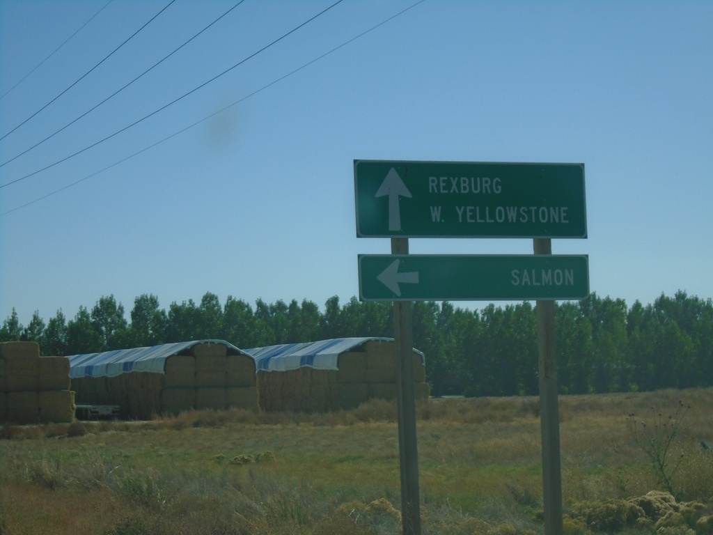
ID-33 East at ID-28
ID-33 east at ID-28 north to Salmon. Continue east on ID-33 for Rexburg and West Yellowstone (Montana). This is the southern end of ID-33. The Sacajawea Historic Byway turns from ID-28 to ID-33 east here.
Taken 09-24-2021
 Mud Lake
Jefferson County
Idaho
United States
Mud Lake
Jefferson County
Idaho
United States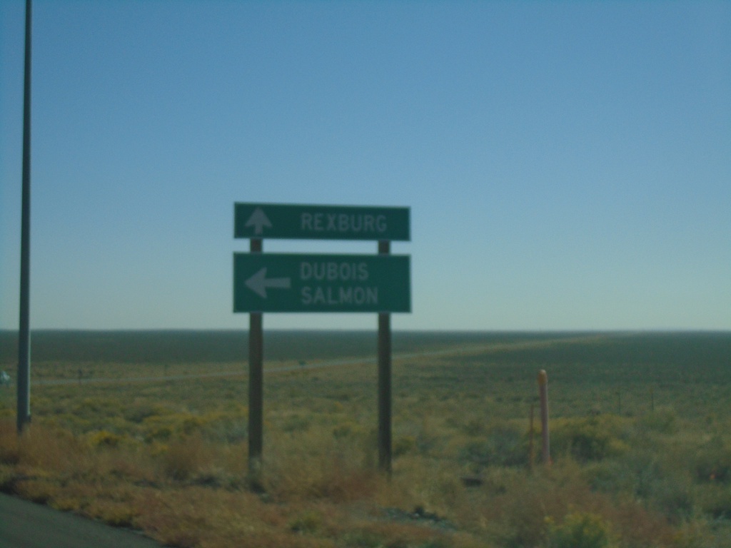
ID-33 East at ID-22 East
ID-33 east at ID-22 east to Dubois and Salmon (via ID-28). Continue east on ID-33 for Rexburg.
Taken 09-24-2021
 Howe
Butte County
Idaho
United States
Howe
Butte County
Idaho
United States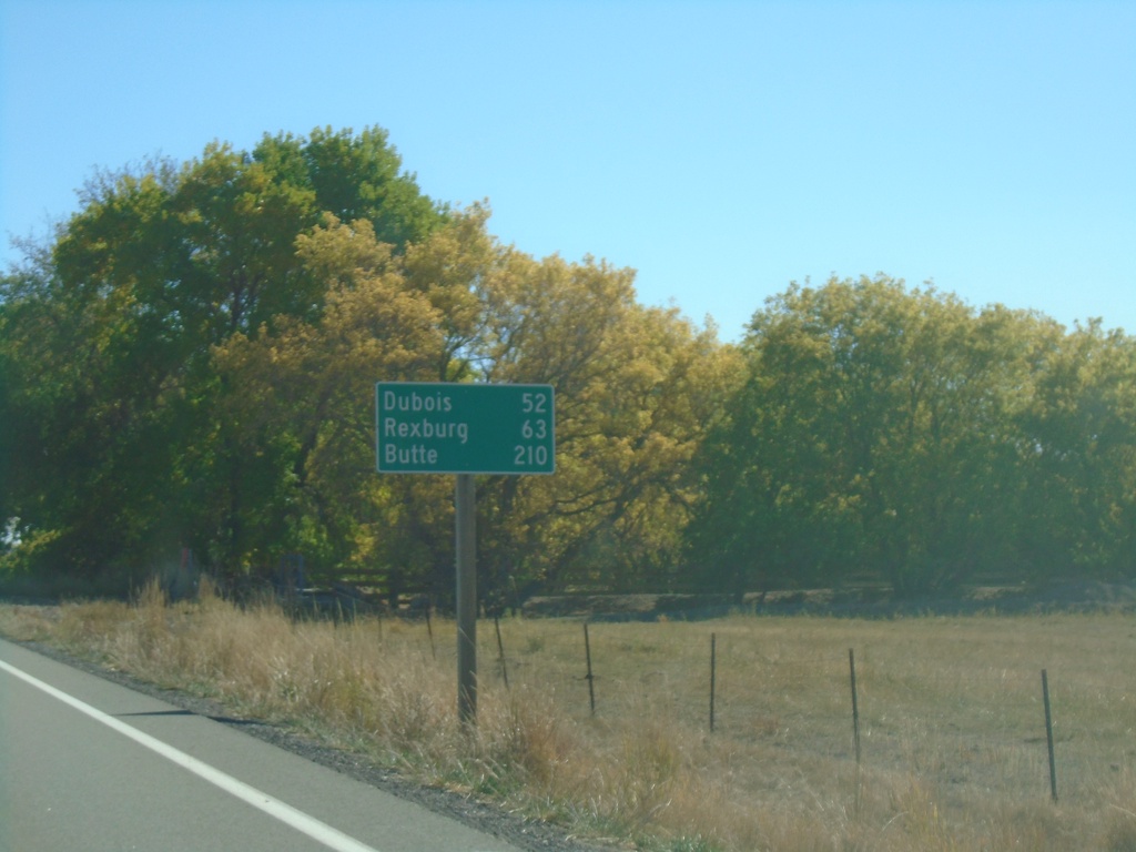
ID-33 East - Distance Marker
Distance marker on ID-33 east. Distance to Dubois (via ID-22), Rexburg, and Butte (Montana - via ID-22 and I-15).
Taken 09-24-2021
Howe
Butte County
Idaho
United States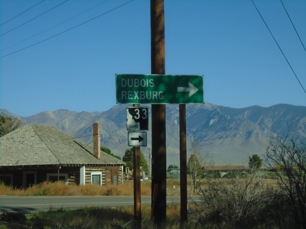
ID-33 East at Little Lost River Highway
ID-33 East at Little Lost River Highway in Howe. Turn right to continue east on ID-33 towards Dubois and Rexburg.
Taken 09-24-2021
Howe
Butte County
Idaho
United States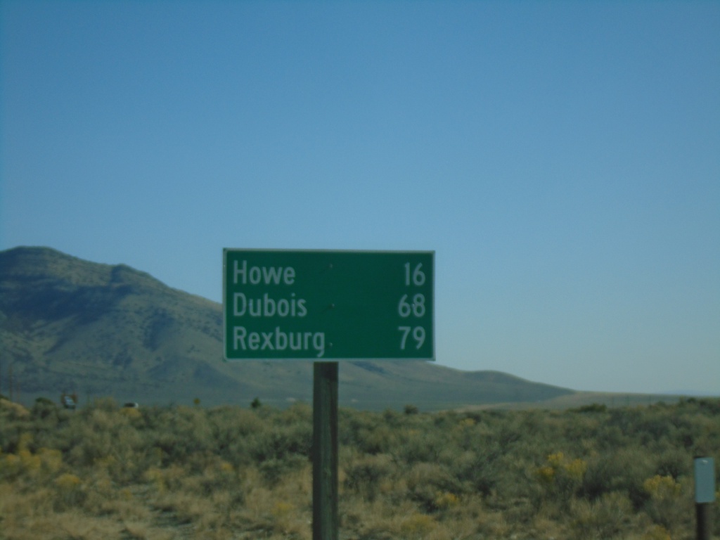
ID-33 East - Distance Marker
Distance marker on ID-33 east. Distance to Howe, Dubois (via ID-22), and Rexburg.
Taken 09-24-2021
Butte City
Butte County
Idaho
United States