Signs Tagged With Big Green Sign
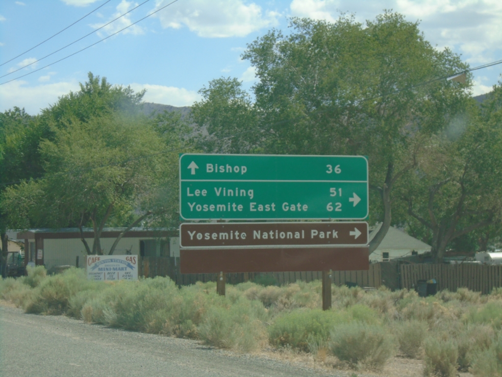
US-6 West at CA-120 West
US-6 West at CA-120 West. Use CA-120 west for Lee Vining, Yosemite East Gate, and Yosemite National Park. Continue west on US-6 for Bishop.
Taken 07-20-2025

 Benton
Mono County
California
United States
Benton
Mono County
California
United States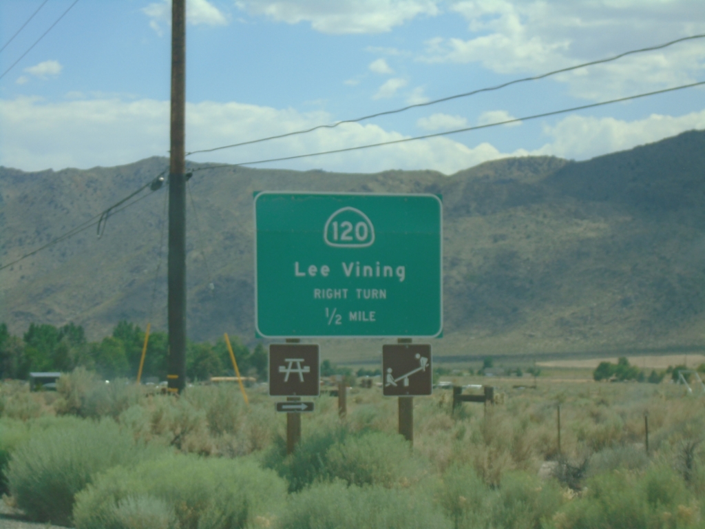
US-6 West Approaching CA-120
US-6 west approaching CA-120 west to Lee Vining.
Taken 07-20-2025
Benton
Mono County
California
United States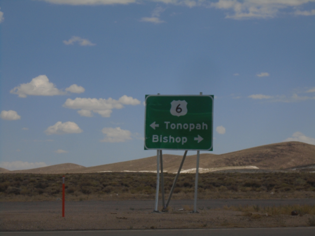
End NV-360 at US-6
End NV-360 at US-6. Use US-6 west to Bishop (California); US-6 east to Tonopah.
Taken 07-20-2025
 Dyer
Mineral County
Nevada
United States
Dyer
Mineral County
Nevada
United States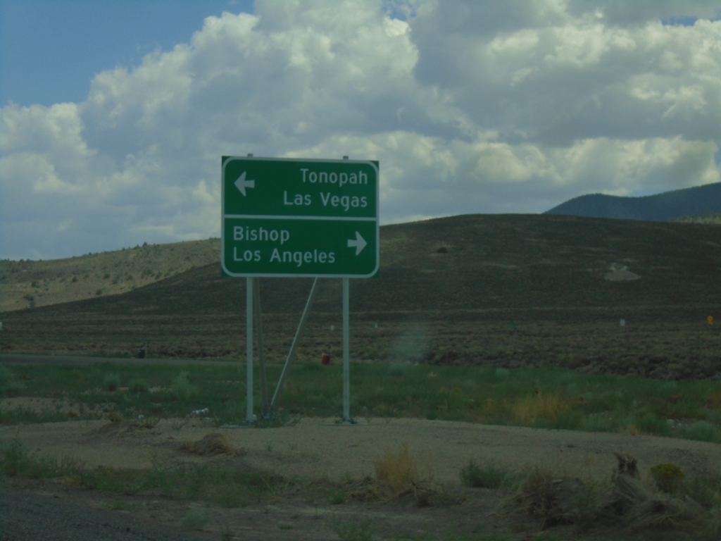
NV-360 South at US-6
NV-360 South at US-6. Use US-6 west for Bishop (California) and Los Angeles (California). Use US-6 east for Tonopah and Las Vegas (via US-95).
Taken 07-20-2025
Dyer
Mineral County
Nevada
United States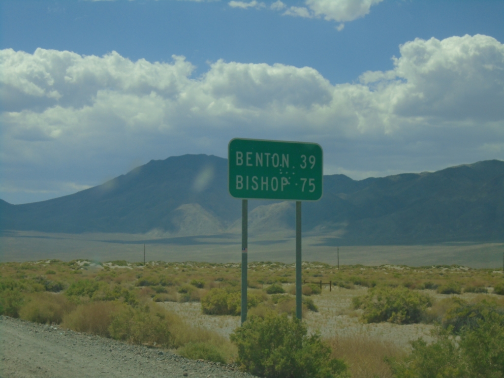
NV-360 South - Distance Marker
Distance marker on NV-360 south. Distance to Benton (CA) and Bishop (CA).
Taken 07-20-2025
Mina
Mineral County
Nevada
United States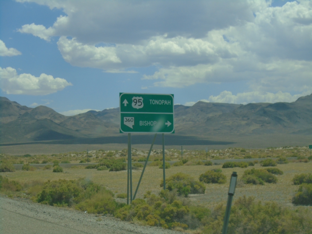
US-95 South at NV-360
US-95 south at NV-360. Use NV-360 south to Bishop (CA); continue south on US-95 to Tonopah.
Taken 07-20-2025
 Mina
Mineral County
Nevada
United States
Mina
Mineral County
Nevada
United States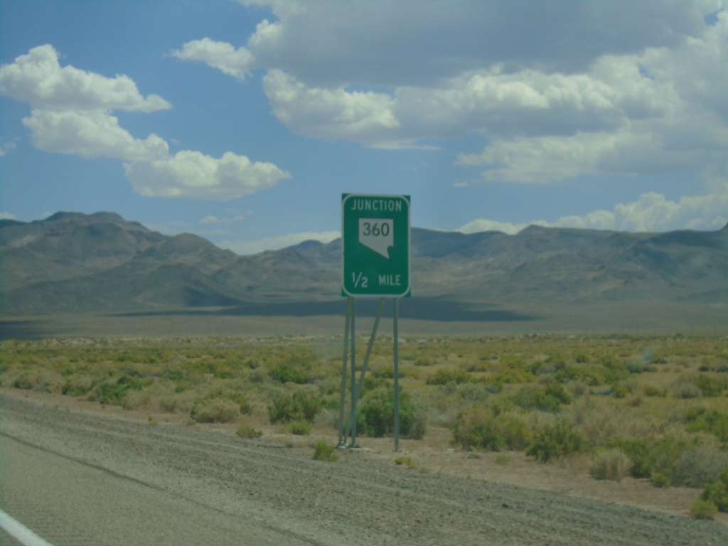
US-95 South Approaching NV-360
US-95 South approaching NV-360 in Mineral County.
Taken 07-20-2025
Mina
Mineral County
Nevada
United States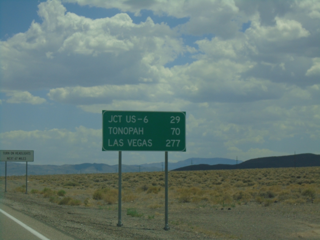
US-95 South - Distance Marker
Distance marker on US-95 south. Distance to Jct. US-6, Tonopah, and Las Vegas.
Taken 07-20-2025
Mina
Mineral County
Nevada
United States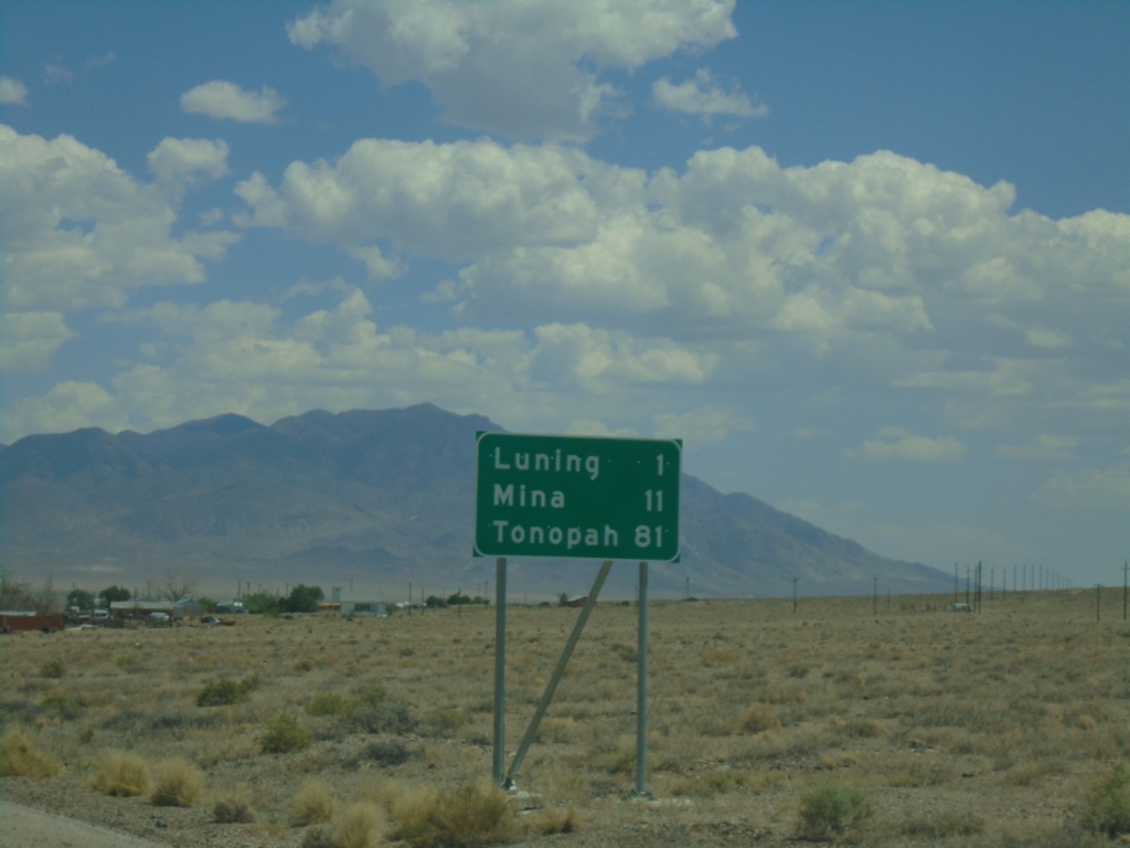
US-95 South - Distance Marker
Distance marker on US-95 south. Distance to Luning, Mina, and Tonopah.
Taken 07-20-2025
Luning
Mineral County
Nevada
United States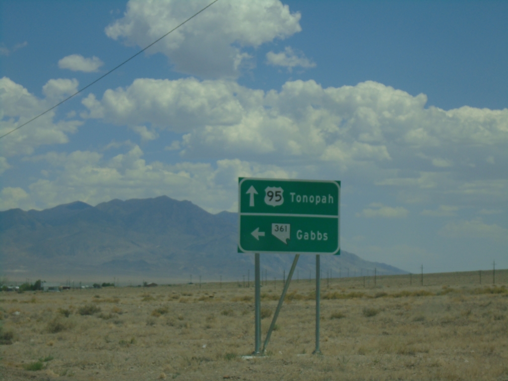
US-95 South at NV-361
US-95 South at NV-361 North to Gabbs. Continue south on US-95 to Tonopah.
Taken 07-20-2025
 Luning
Mineral County
Nevada
United States
Luning
Mineral County
Nevada
United States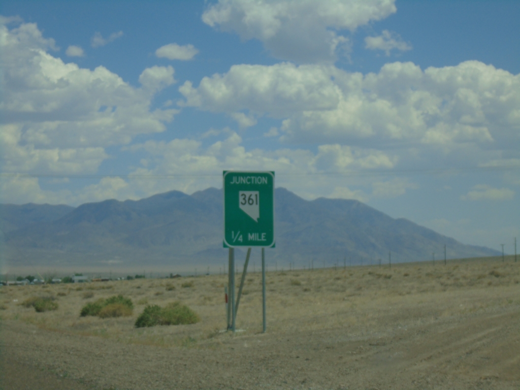
US-95 South Approaching NV-361
US-95 South approaching NV-361 in Luning.
Taken 07-20-2025
Luning
Mineral County
Nevada
United States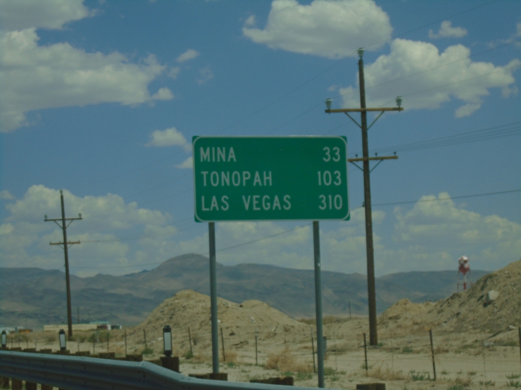
US-95 South - Distance Marker
Distance marker on US-95 south. Distance to Mina, Tonopah, and Las Vegas.
Taken 07-20-2025
Hawthorne
Mineral County
Nevada
United States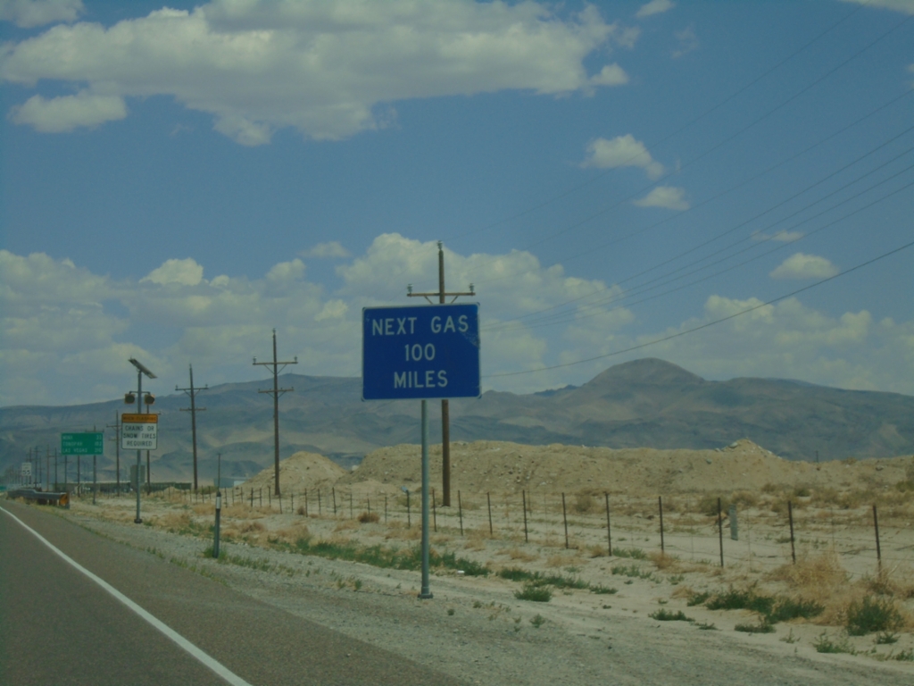
US-95 South - Next Gas 100 Miles
Next Gas 100 Miles (in Tonopah) on US-95 south.
Taken 07-20-2025
Hawthorne
Mineral County
Nevada
United States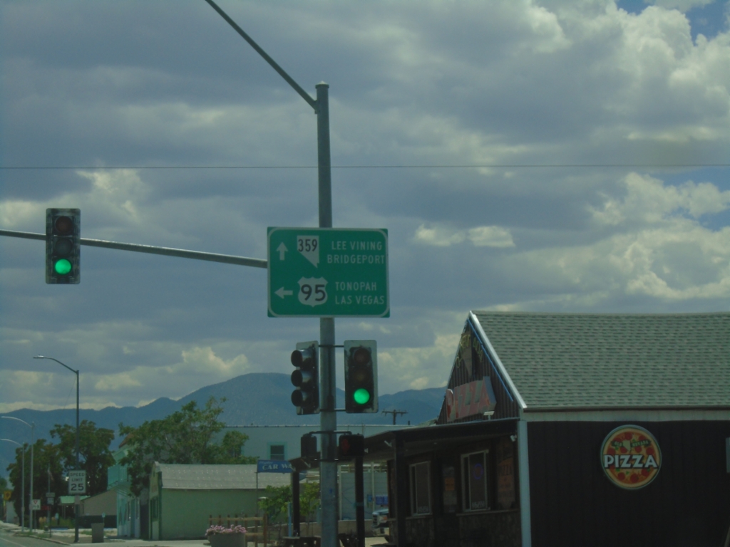
US-95 South at NV-359 South
US-95 south at NV-359 west to Lee Vining (CA) and Bridgeport (CA). Turn left to continue south on US-95 to Tonopah and Las Vegas.
Taken 07-20-2025
 Hawthorne
Mineral County
Nevada
United States
Hawthorne
Mineral County
Nevada
United States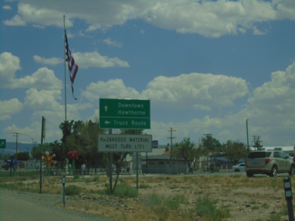
US-95 South Approaching US-95 Truck Route
US-95 south approaching Truck US-95 South. Turn left for Truck Route; continue straight for US-95 to Downtown Hawthorne. Hazardous Material Must Turn Left.
Taken 07-20-2025
Hawthorne
Mineral County
Nevada
United States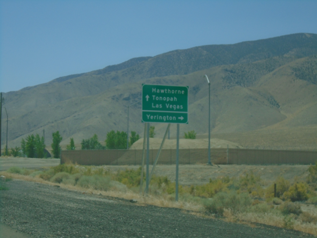
US-95 South Approaching Alt. US-95
US-95 South approaching Alt. US-95. Use Alt. US-95 North to Yerrington; US-95 south to Hawthorne, Tonopah, and Las Vegas.
Taken 07-20-2025
 Schurz
Mineral County
Nevada
United States
Schurz
Mineral County
Nevada
United States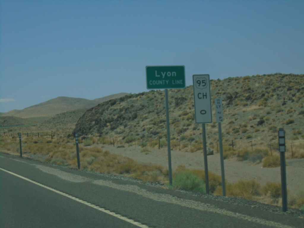
US-95 South - Lyon County
Lyon County Line on US-95 South. Mile 0 US-95 Churchill (CH) County. US-95 runs through a short 2 mile stretch of Lyon County.
Taken 07-20-2025
Fallon
Churchill County
Nevada
United States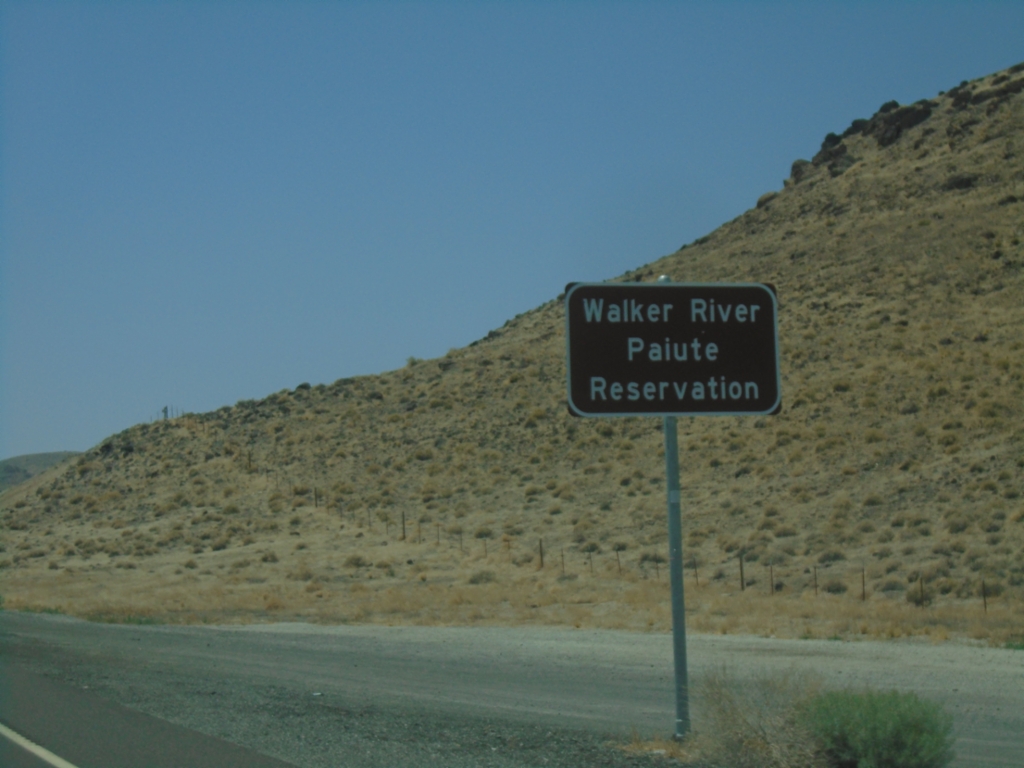
US-95 South - Walker Paiute Indian Reservation
Entering Walker Paiute Indian Reservation on US-95 South
Taken 07-20-2025
Fallon
Churchill County
Nevada
United States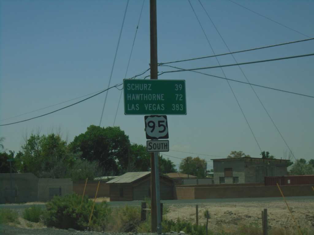
US-95 South - Distance Marker
Distance marker on US-95 south. Distance to Schurz, Hawthorne, and Las Vegas.
Taken 07-20-2025
Fallon
Churchill County
Nevada
United States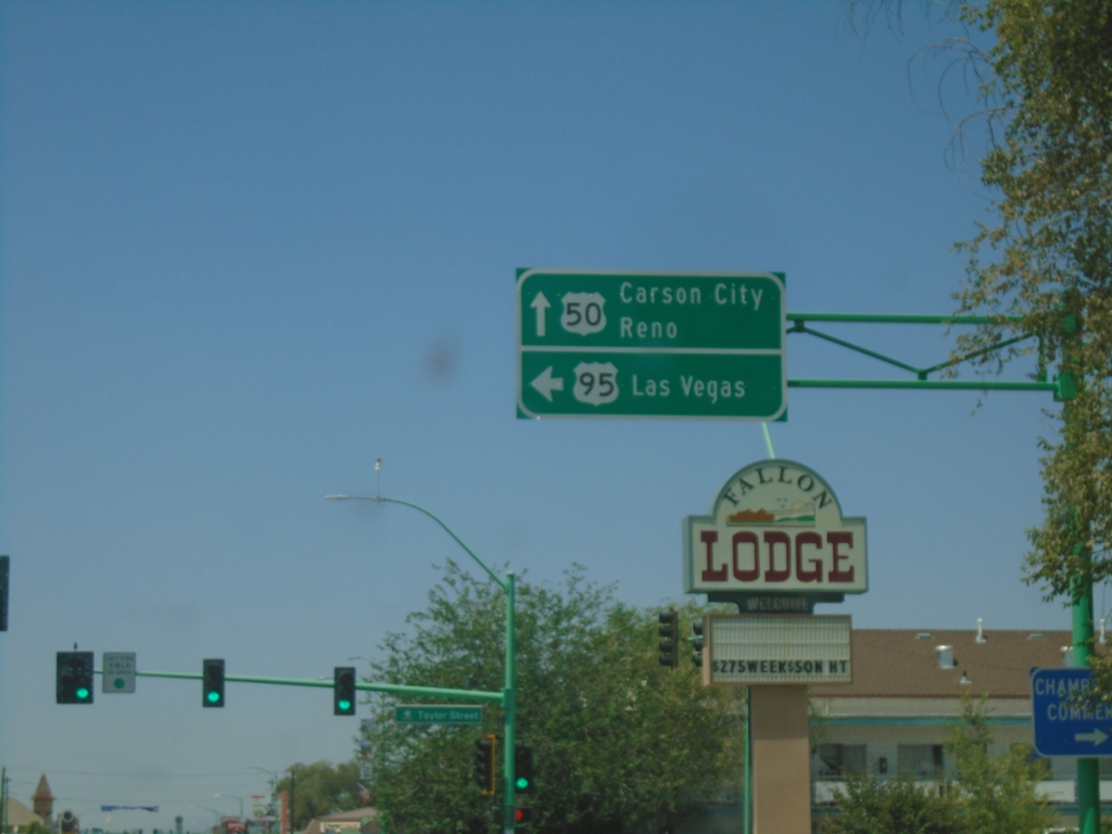
US-50 West/US-95 South at US-50/US-95 Split
US-50 West/US-95 South at US-50/US-95 Split in Fallon. Use US-50 West to Carson City and Reno; US-95 South to Las Vegas.
Taken 07-20-2025
 Fallon
Churchill County
Nevada
United States
Fallon
Churchill County
Nevada
United States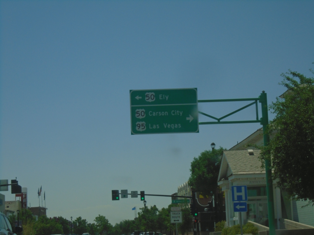
US-95 South at US-50
US-95 South at US-50 in Fallon. Use US-50 East to Ely. Turn right for US-50 West to Carson City and US-95 South to Las Vegas.
Taken 07-20-2025
Fallon
Churchill County
Nevada
United States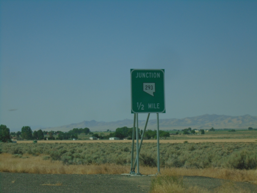
US-95 South Approaching NV-293
US-95 South approaching NV-293 in Orovada.
Taken 07-20-2025
 Orovada
Humboldt County
Nevada
United States
Orovada
Humboldt County
Nevada
United States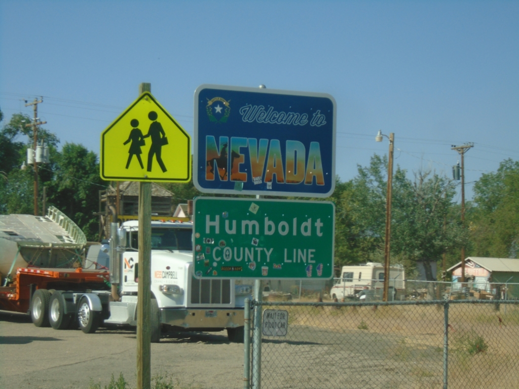
US-95 South - Welcome To Nevada
US-95 South - Welcome To Nevada / Humboldt County Line. Taken at the state line of Nevada and Oregon in McDermitt.
Taken 07-20-2025
McDermitt
Humboldt County
Nevada
United States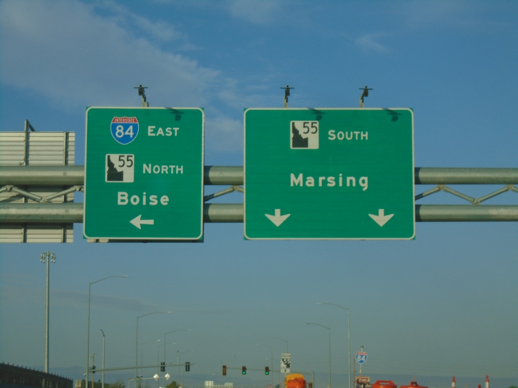
Karcher Road West Approaching I-84 East/ID-55 North
Karcher Road West approaching I-84 East/ID-55 North (Exit 33) to Boise. Continue west on ID-55 for Marsing.
Taken 07-20-2025


 Nampa
Canyon County
Idaho
United States
Nampa
Canyon County
Idaho
United States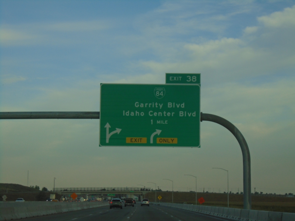
I-84 West - Exit 38
I-84/US-30 west at Exit 38 - BL-84/Garrity Blvd./Idaho Center Blvd.
Taken 07-20-2025
 Nampa
Canyon County
Idaho
United States
Nampa
Canyon County
Idaho
United States