Signs Tagged With Big Green Sign
I-15/US-91 Exit 44 Onramp
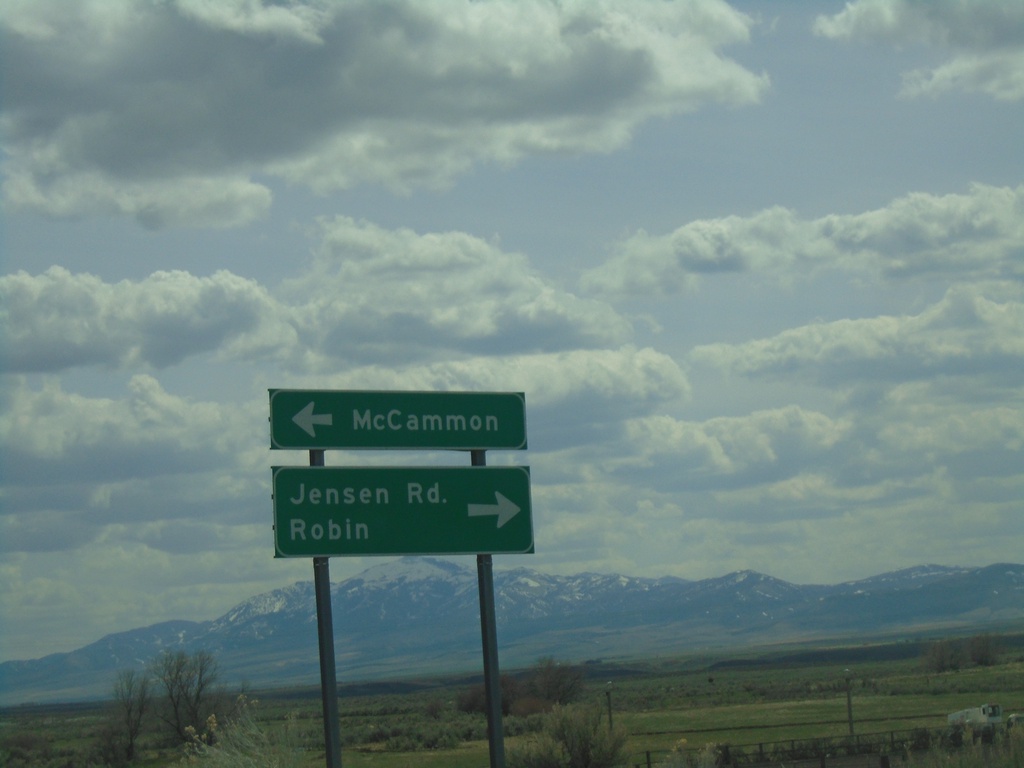
I-15/US-91 Exit 44 offramp at BL-15/Jensen Road. Turn left for BL-15 North to McCammon; right for Jenson Road to Robin.
Taken 04-23-2021


 McCammon
Bannock County
Idaho
United States
McCammon
Bannock County
Idaho
United States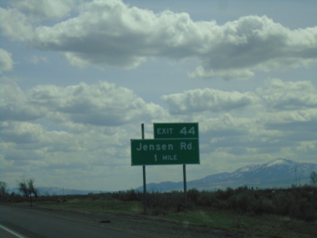
I-15 South - Exit 44
I-15 south approaching Exit 44 - Jensen Road.
Taken 04-23-2021
McCammon
Bannock County
Idaho
United States
E Center St. at I-15
E Center St. at I-15 in Pocatello. Use I-15 south for McCammon and Salt Lake (Utah). Use I-15 north for Blackfoot and Idaho Falls.
Taken 04-23-2021
Pocatello
Bannock County
Idaho
United States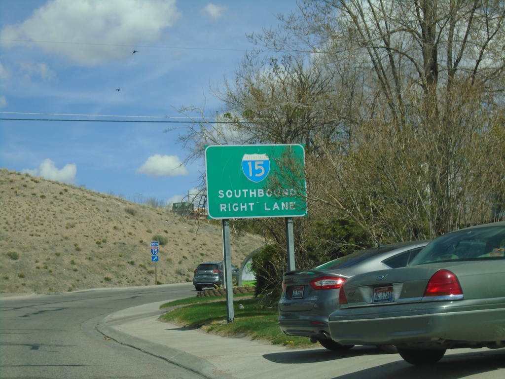
E Center St. Approaching I-15
E Center St. approaching I-15 (Exit 69) in Pocatello. Use right lane for I-15 South.
Taken 04-23-2021
Pocatello
Bannock County
Idaho
United States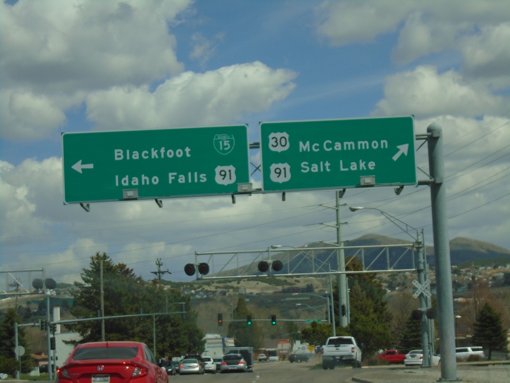
US-30 East (Oak St.) at BL-15/US-91
US-30 East (Oak St.) at BL-15/US-91 (Yellowstone Ave.) Turn right for BL-15/US-91 South/US-30 East/McCammon/Salt Lake (Utah). Turn left for BL-15/US-91 North/Blackfoot/Idaho Falls.
Taken 04-23-2021
 Pocatello
Bannock County
Idaho
United States
Pocatello
Bannock County
Idaho
United States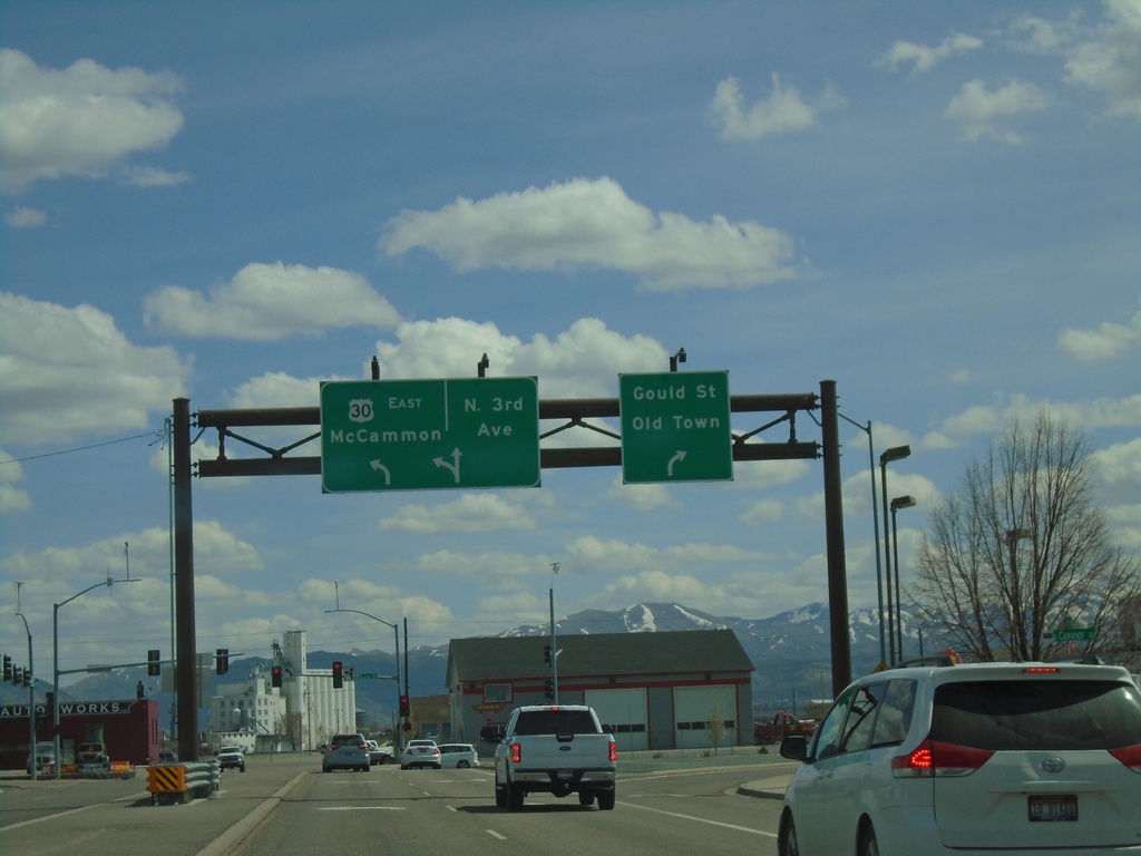
US-30 East (Garrett Way) at Gould St. and N 3rd
US-30 East (Garrett Way) at Gould St. and N 3rd Ave. in Pocatello. Turn right for Gould St./Old Town; straight for N 3rd Ave. Turn left to continue east on US-30 to McCammon.
Taken 04-23-2021
Pocatello
Bannock County
Idaho
United States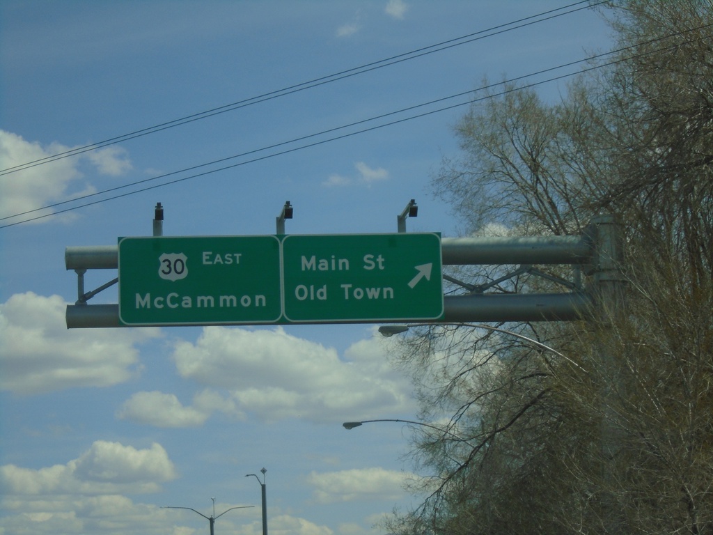
US-30 East at Main St.
US-30 East (Garrett Way) at Main St./Old Town (Pocatello). Continue on US-30 East to McCammon.
Taken 04-23-2021
Pocatello
Bannock County
Idaho
United States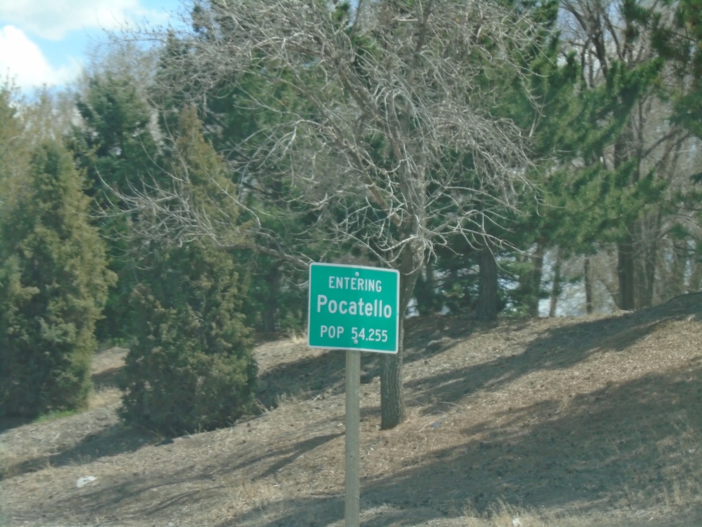
US-30 East - Pocatello
Entering Pocatello on US-30 East. Pocatello is the 5th largest city in Idaho according to the 2017 census estimate. Pocatello is also home to Idaho State University.
Taken 04-23-2021
Pocatello
Bannock County
Idaho
United States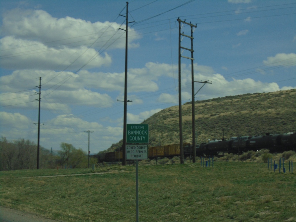
US-30 East - Bannock County
Entering Bannock County on US-30 east.
Taken 04-23-2021
Pocatello
Bannock County
Idaho
United States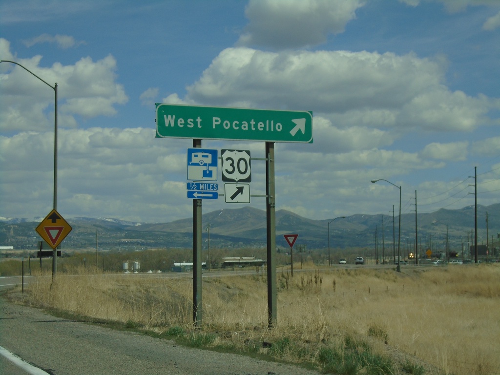
I-86 East - Exit 58 Offramp at US-30
I-86 East - Exit 58 offramp at US-30. US-30 leaves I-86 eastbound here. Turn right for US-30 East to West Pocatello.
Taken 04-23-2021
 Pocatello
Power County
Idaho
United States
Pocatello
Power County
Idaho
United States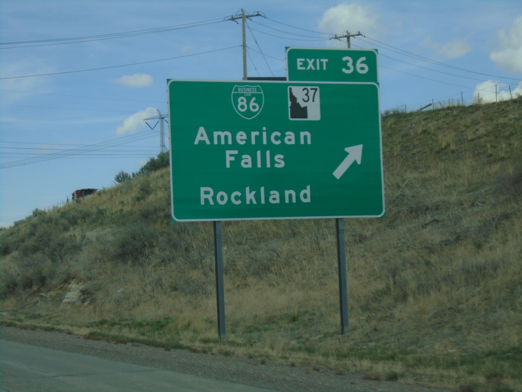
I-86 East - Exit 36
I-86 east at Exit 36 - BL-86/ID-37/American Falls/Rockland.
Taken 04-23-2021

 American Falls
Power County
Idaho
United States
American Falls
Power County
Idaho
United States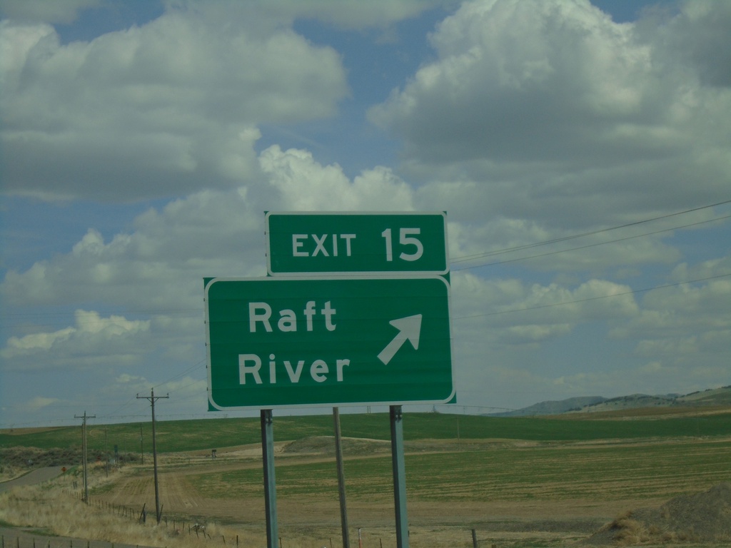
I-86 East - Exit 15
I-86 east at Exit 15 - Raft River
Taken 04-23-2021
American Falls
Cassia County
Idaho
United States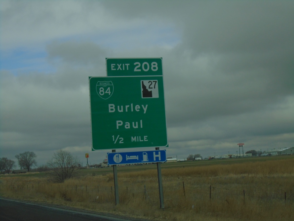
I-84 West - Exit 208
I-84 west approaching Exit 208 - BL-84/ID-27/Burley/Paul.
Taken 03-23-2021


 Heyburn
Minidoka County
Idaho
United States
Heyburn
Minidoka County
Idaho
United States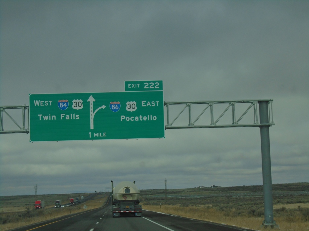
I-84 West Approaching Exit 222
I-84 west approaching Exit 222 - I-86/US-30 East/Pocatello. Continue west on I-84/US-30 West for Twin Falls.
Taken 03-23-2021
Declo
Cassia County
Idaho
United States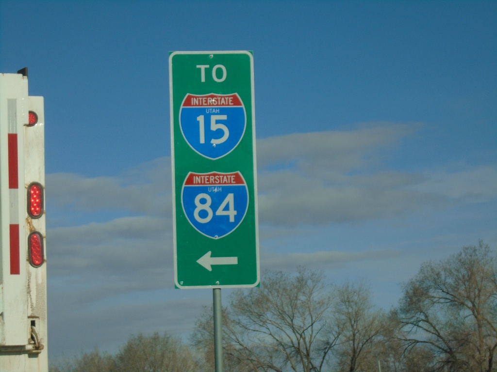
US-89 North at UT-126 South
US-89 North at UT-126 South to I-15 and I-84 Junction.
Taken 03-23-2021

 Willard
Box Elder County
Utah
United States
Willard
Box Elder County
Utah
United States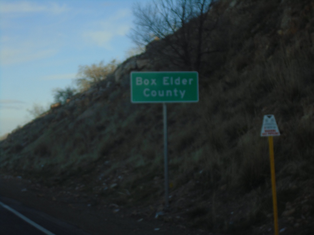
US-89 North - Box Elder County
Entering Box Elder County on US-89 North.
Taken 03-23-2021
Willard
Box Elder County
Utah
United States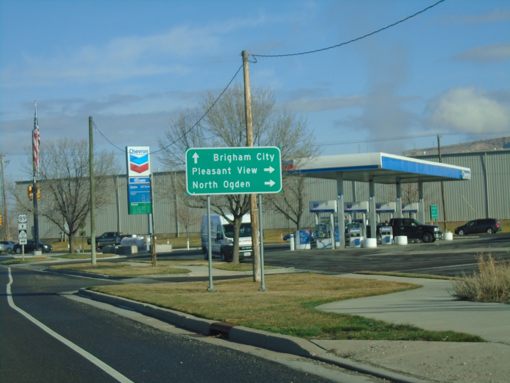
US-89 North at UT-134
US-89 North (Harrisville Road) at UT-134 (W 2700 N) in Pleasant View. Turn right on UT-134 for North Ogden and Pleasant View. Continue north on US-89 for Brigham City.
Taken 03-23-2021
 Ogden
Weber County
Utah
United States
Ogden
Weber County
Utah
United States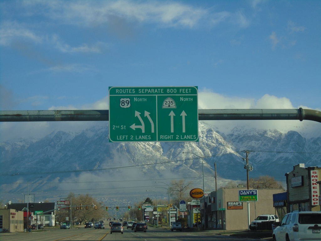
US-89 North Approaching UT-235
US-89 North (Washington Blvd.) approaching UT-235. Continue straight on Washington Blvd. for UT-235 North. Merge left to continue north on US-89 (Harrisville Road). Make a hard left for 2nd St.
Taken 03-23-2021
 Ogden
Weber County
Utah
United States
Ogden
Weber County
Utah
United States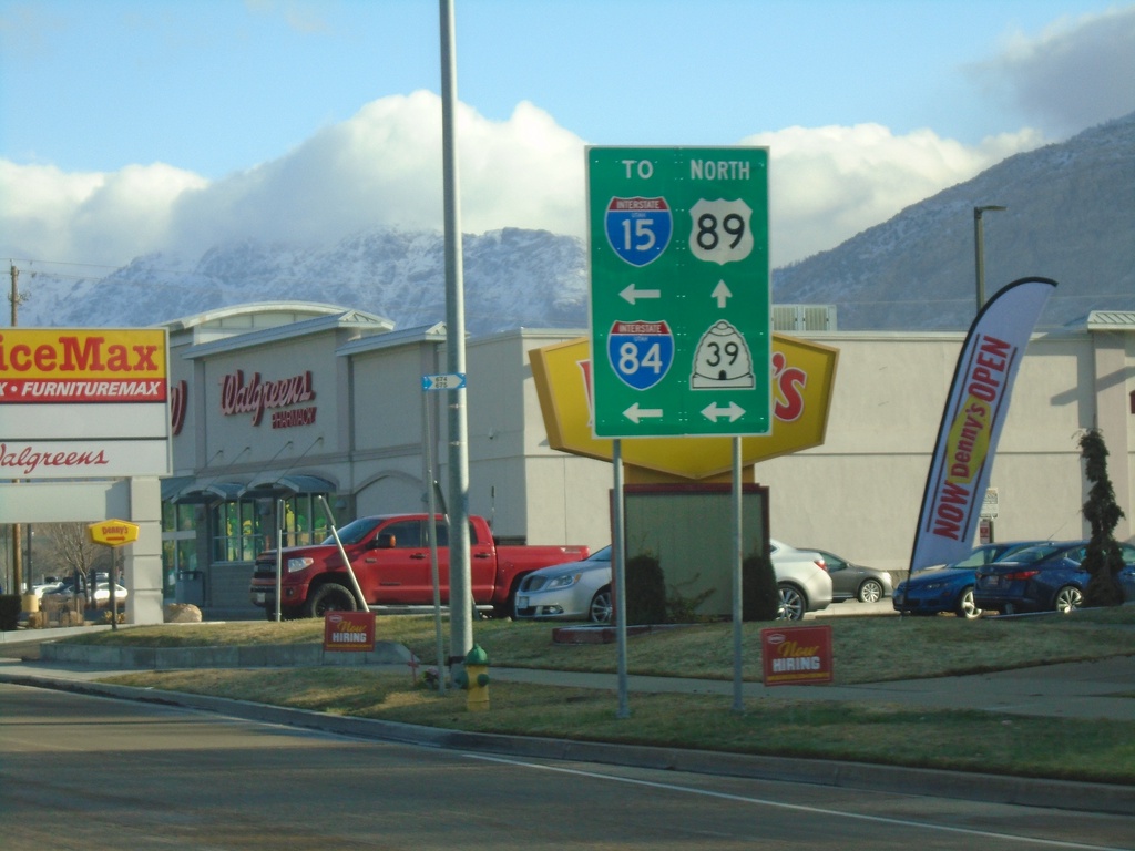
US-89 North at UT-39
US-89 North (Washington Blvd.) at UT-39 (12th St.). Use UT-39 west for I-15 and I-84.
Taken 03-23-2021
 Ogden
Weber County
Utah
United States
Ogden
Weber County
Utah
United States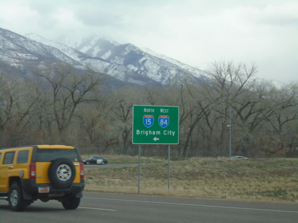
UT-79 East at I-84 West/I-15 North
UT-79 East (W 31st St.) at I-84 West/I-15 North to Brigham City.
Taken 03-22-2021
 Ogden
Weber County
Utah
United States
Ogden
Weber County
Utah
United States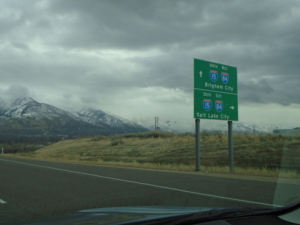
UT-79 East at I-84 East/I-15 South
UT-79 East at I-84 East/I-15 South (Exit 341). Use I-84 East/I-15 South to Salt Lake City. Continue over freeway for I-15 North/I-84 West to Brigham City.
Taken 03-22-2021
Ogden
Weber County
Utah
United States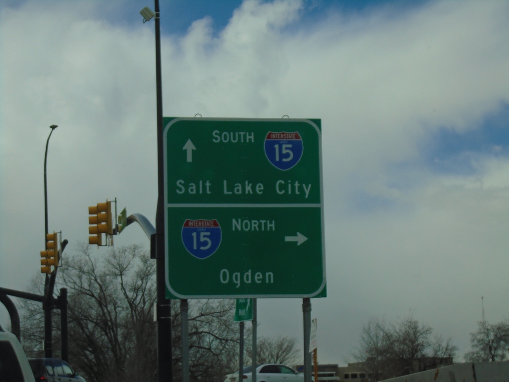
Antelope Drive West at I-15 and UT-108
Antelope Drive West at I-15 North to Ogden. Continue over freeway for I-15 south to Salt Lake City. Antelope Drive West becomes UT-108 South.
Taken 03-21-2021
 Layton
Davis County
Utah
United States
Layton
Davis County
Utah
United States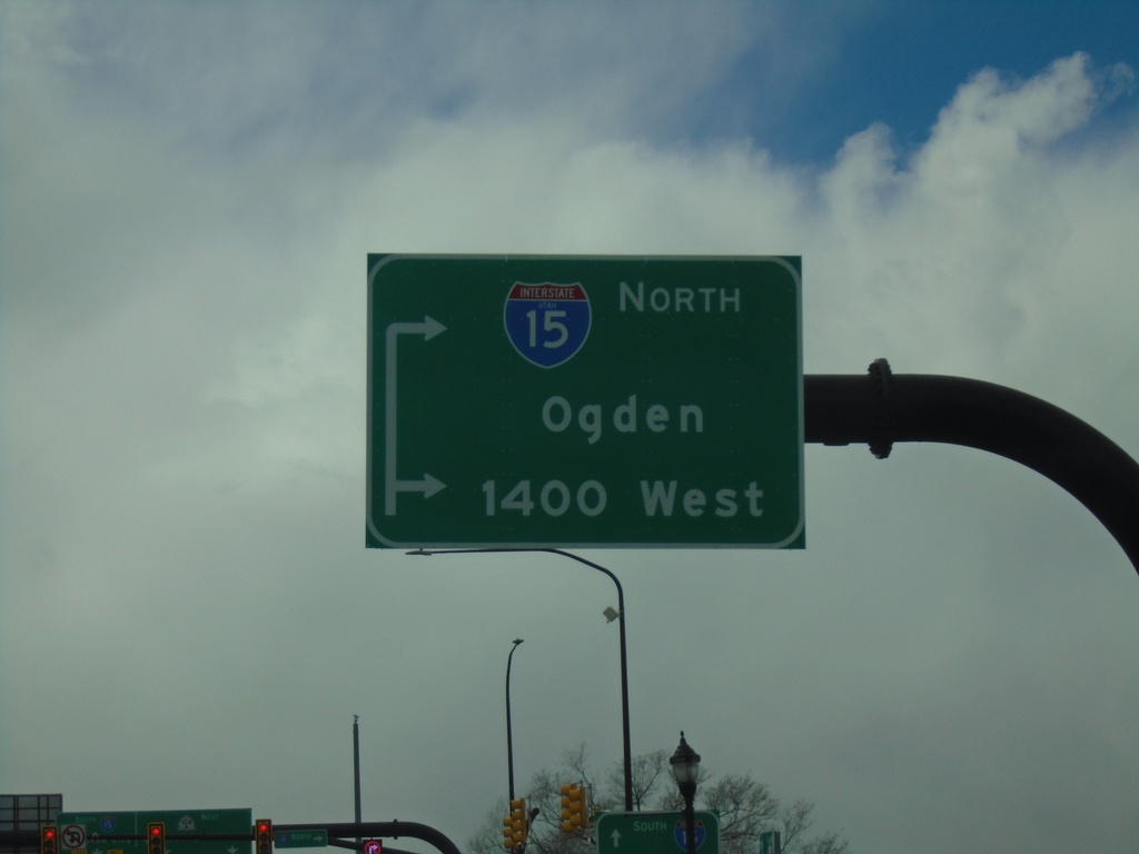
Antelope Drive West Approaching I-15 and UT-108
Antelope Drive West approaching I-15 North to Ogden. Use inner right hand turn lane for 1400 West. Antelope Drive West becomes UT-108 South.
Taken 03-21-2021
Layton
Davis County
Utah
United States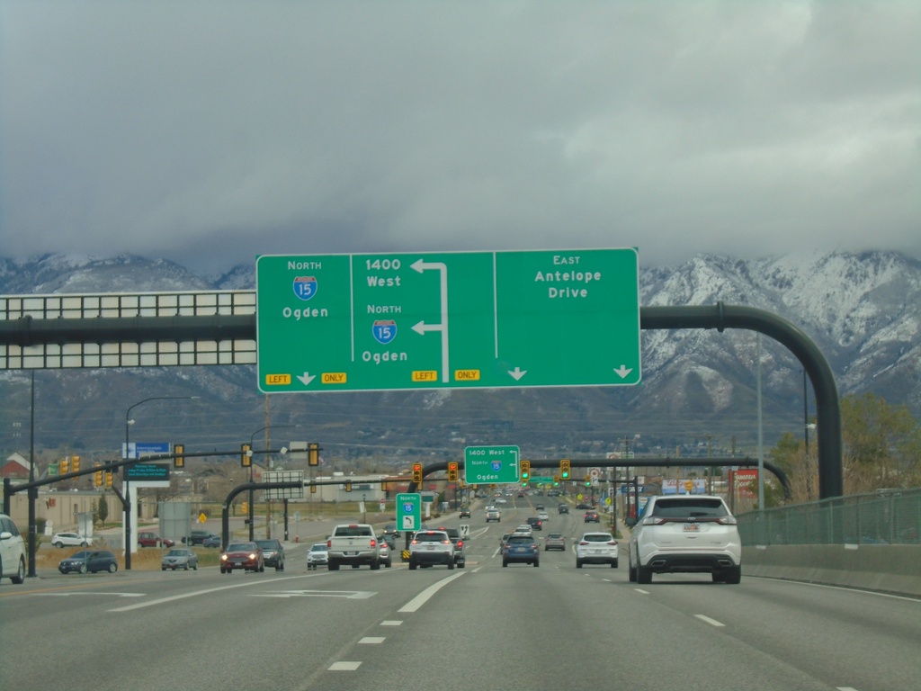
End UT-108 South at I-15
End UT-108 South at I-15 in Layton. Use I-15 north for Ogden. Use outer left turn lane for 1400 West. Continue east for East Antelope Drive .
Taken 03-21-2021
Layton
Davis County
Utah
United States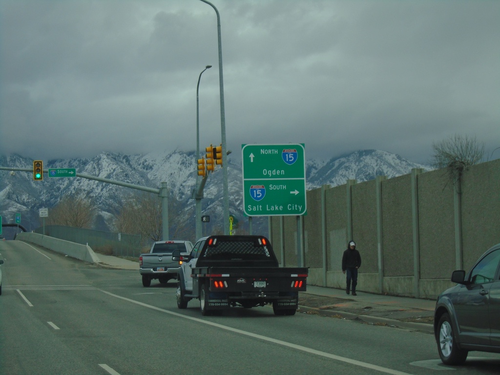
UT-108 East at I-15 South (Exit 332)
UT-108 East at I-15 South (Exit 332) in Layton. Use I-15 south for Salt Lake City. Continue over freeway for I-15 North to Ogden.
Taken 03-21-2021
Layton
Davis County
Utah
United States