Signs Tagged With Big Green Sign
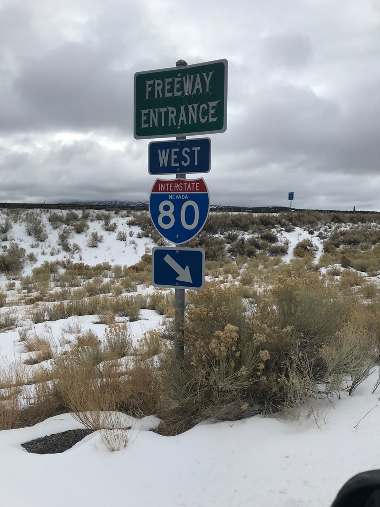
I-80 West (Exit 360) Onramp
I-80 West Onramp at Exit 360 in Elko County.
Taken 12-31-2020

 Moor
Elko County
Nevada
United States
Moor
Elko County
Nevada
United States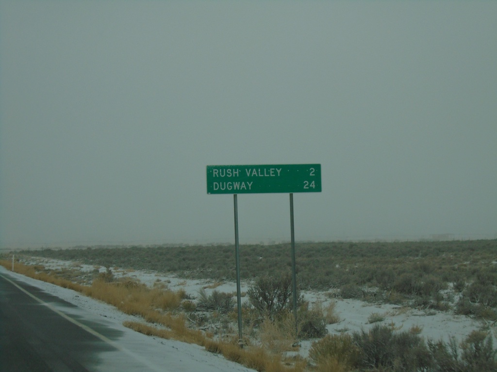
UT-199 West - Distance Marker
Distance marker on UT-199 west. Distance to Rush Valley and Dugway.
Taken 12-31-2020
 Rush Valley
Tooele County
Utah
United States
Rush Valley
Tooele County
Utah
United States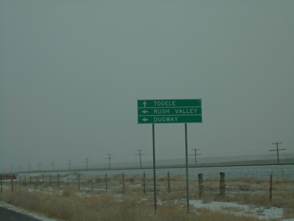
UT-36 North Approaching UT-199
UT-36 North approaching UT-199 west to Rush Valley and Dugway. Continue north on UT-36 to Tooele.
Taken 12-31-2020
 Rush Valley
Tooele County
Utah
United States
Rush Valley
Tooele County
Utah
United States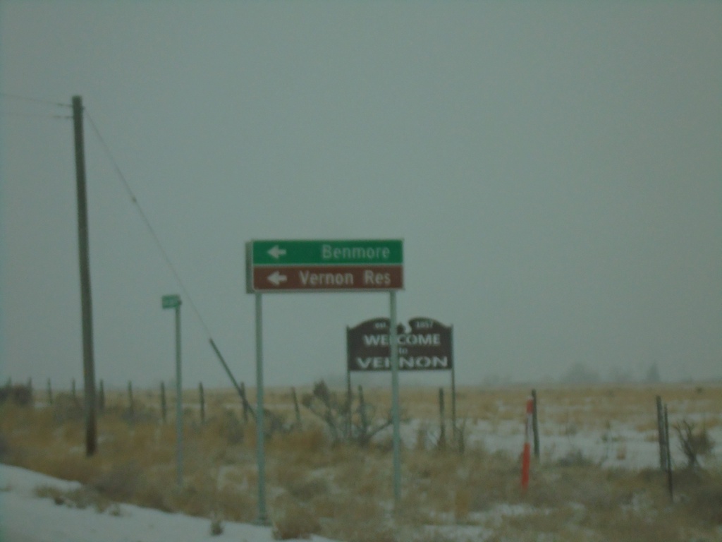
UT-36 North at Benmore Road
UT-36 North at Benmore Road south to Benmore and Vernon Reservoir
Taken 12-31-2020
Vernon
Tooele County
Utah
United States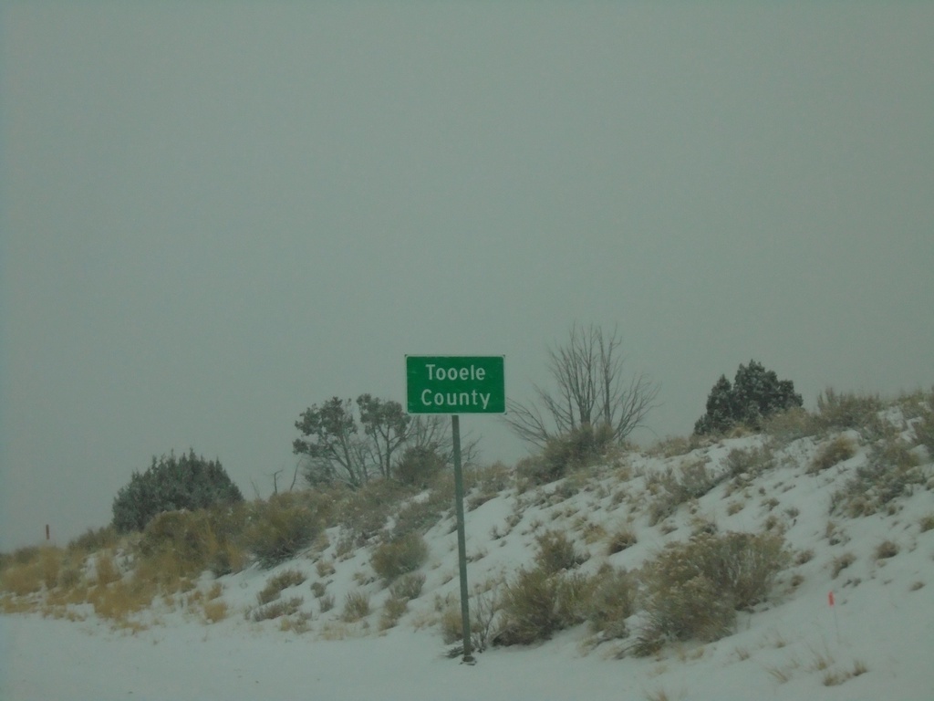
UT-36 North - Tooele County
Entering Tooele County on UT-36 north. Tooele County is the second largest county in Utah by area.
Taken 12-31-2020
Eureka
Tooele County
Utah
United States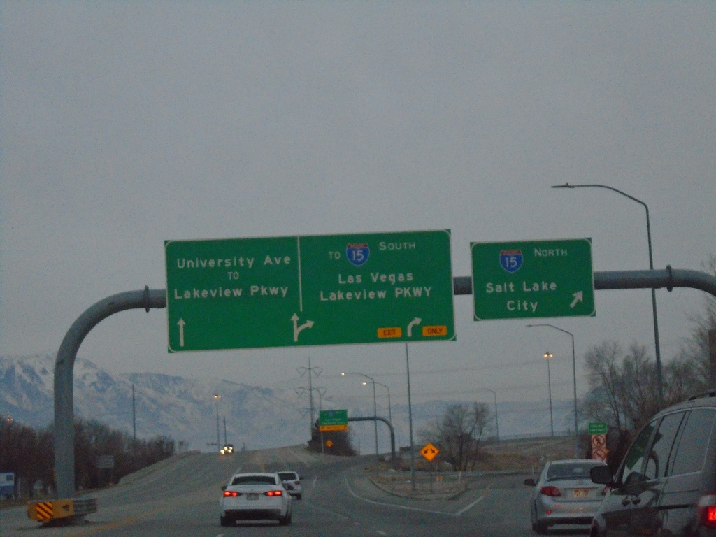
End US-189 South at I-15
US-189 South at I-15 North to Salt Lake City. Approaching ramp for I-15 South to Las Vegas (Nevada) and Lakeview Parkway. Use left lane to continue south on University Ave./To Lakeview Parkway. This is the southern end of US-189.
Taken 12-30-2020

 Provo
Utah County
Utah
United States
Provo
Utah County
Utah
United States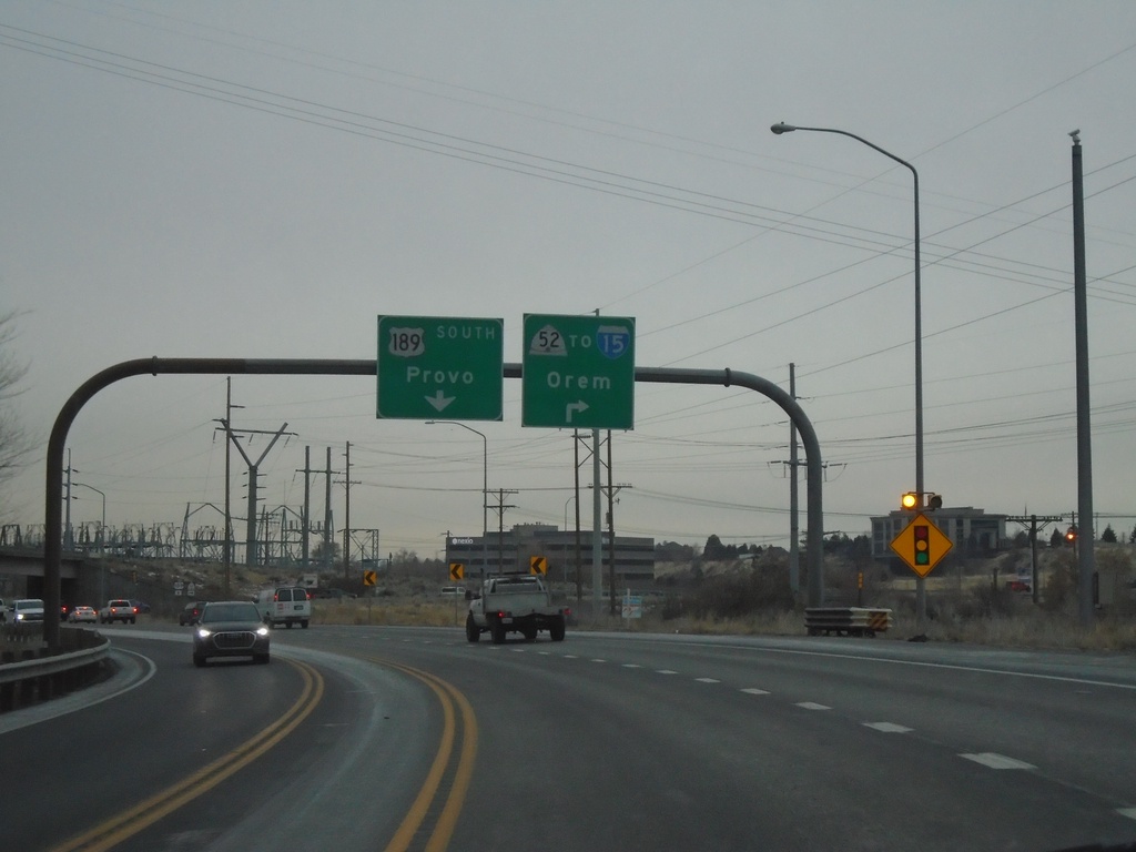
US-189 South Approaching UT-52/To I-15
US-189 South approaching UT-52/To I-15 to Orem. Continue south on US-189 for Provo.
Taken 12-30-2020
 Orem
Utah County
Utah
United States
Orem
Utah County
Utah
United States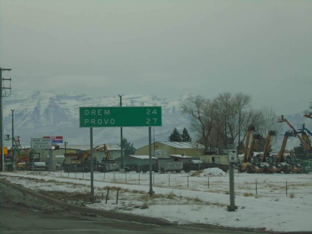
US-189 South - Distance Marker
Distance marker on US-189 south. Distance to Orem and Provo.
Taken 12-30-2020
Heber City
Wasatch County
Utah
United States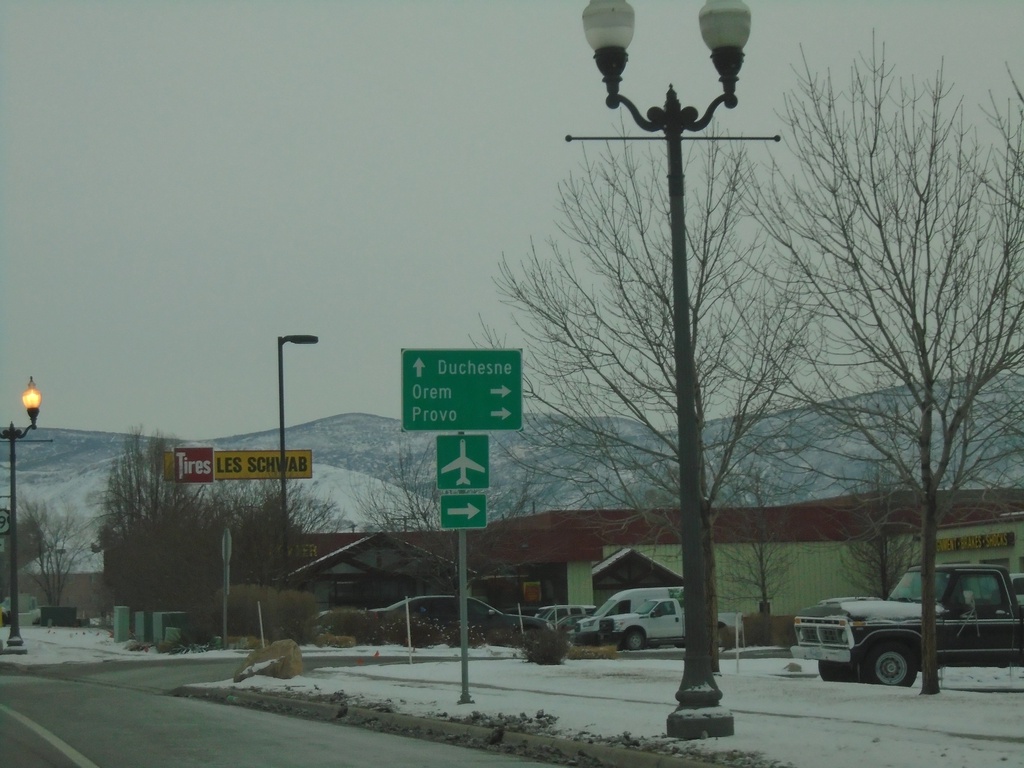
US-40 East/US-189 South at US-40/US-189 Split
US-40 East/US-189 South at US-40/US-189 split in Heber City. Turn right to continue south on US-189 to Provo and Orem; merge left to stay on US-40 East to Duchesne.
Taken 12-30-2020
 Heber City
Wasatch County
Utah
United States
Heber City
Wasatch County
Utah
United States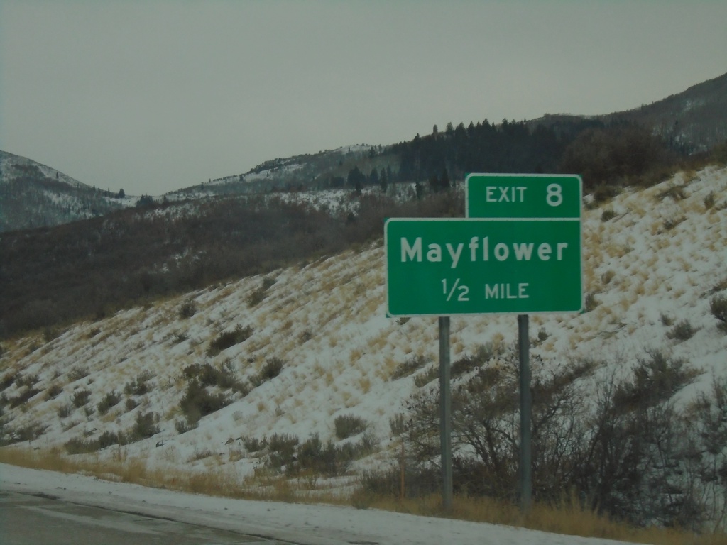
US-40 East/US-189 South - Exit 8
US-40 East/US-189 South approaching Exit 8 - Mayflower
Taken 12-30-2020
Park City
Wasatch County
Utah
United States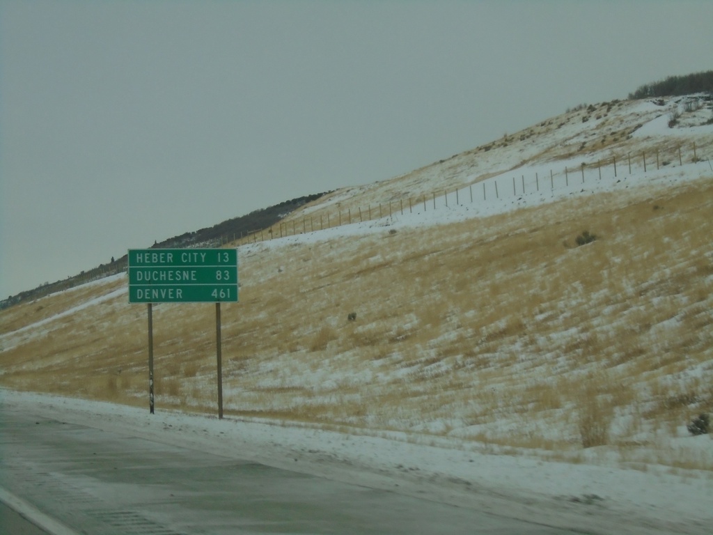
US-40 East/US-189 South - Distance Marker
Distance marker on US-40 East/US-189 South. Distance to Heber City, Duchesne, and Denver (Colorado).
Taken 12-30-2020
Snyderville
Summit County
Utah
United States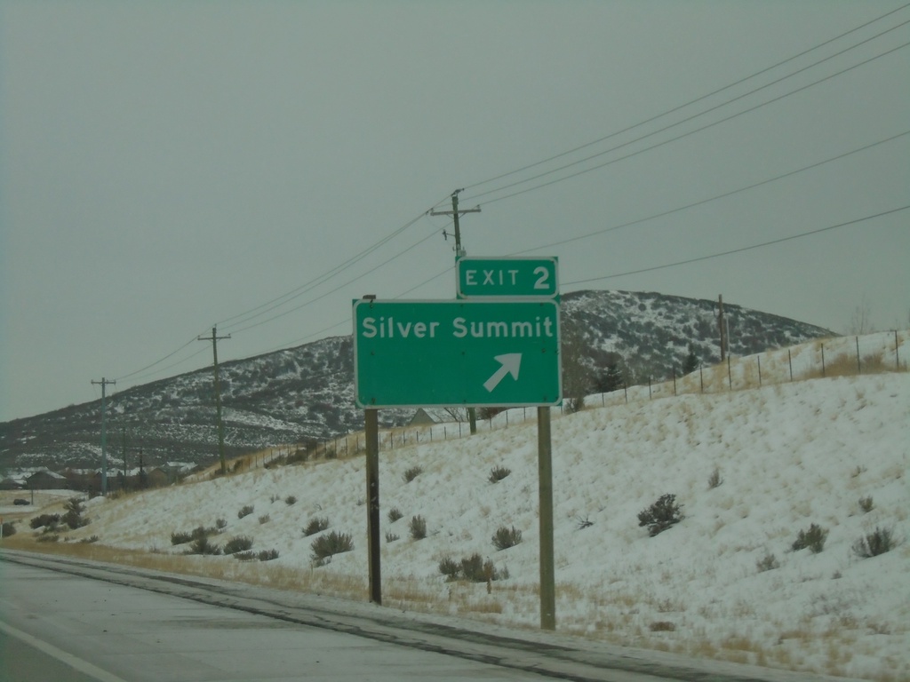
US-40 East/US-189 South - Exit 2
US-40 East/US-189 South at Exit 2 - Silver Summit.
Taken 12-30-2020
Park City
Summit County
Utah
United States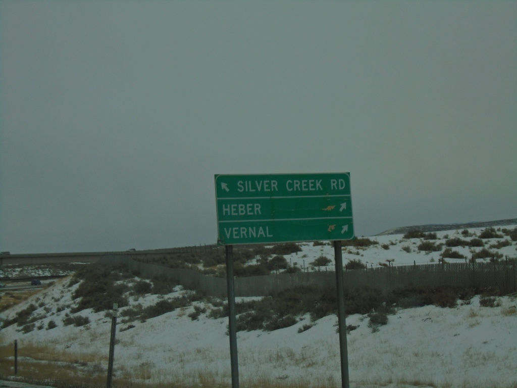
I-80 West - Exit 146 Offramp
I-80 West - Exit 146 offramp. Merge left for Silver Creek Road. Merge right for US-40 East/US-189 South/Heber/Vernal.
Taken 12-30-2020
Park City
Summit County
Utah
United States
I-80 East - Exit 146
I-80 East at Exit 146 - US-40 East/Heber City/Vernal. This is the western end of US-40.
Taken 12-30-2020
Park City
Summit County
Utah
United States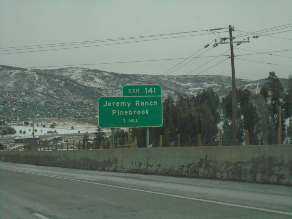
I-80 East - Exit 141
I-80 east approaching Exit 141 - Jeremy Ranch/Pinebrook.
Taken 12-30-2020
Park City
Summit County
Utah
United States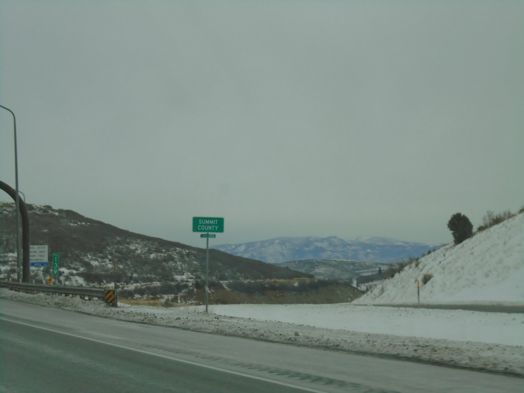
I-80 East - Summit County
Entering Summit County on I-80 East at Parleys Summit - 7120 Feet. This is the highest point along I-80 in the state of Utah.
Taken 12-30-2020
Park City
Summit County
Utah
United States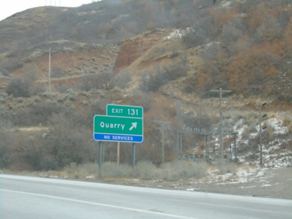
I-80 East - Exit 131
I-80 east at Exit 131 - Quarry.
Taken 12-30-2020
Salt Lake City
Salt Lake County
Utah
United States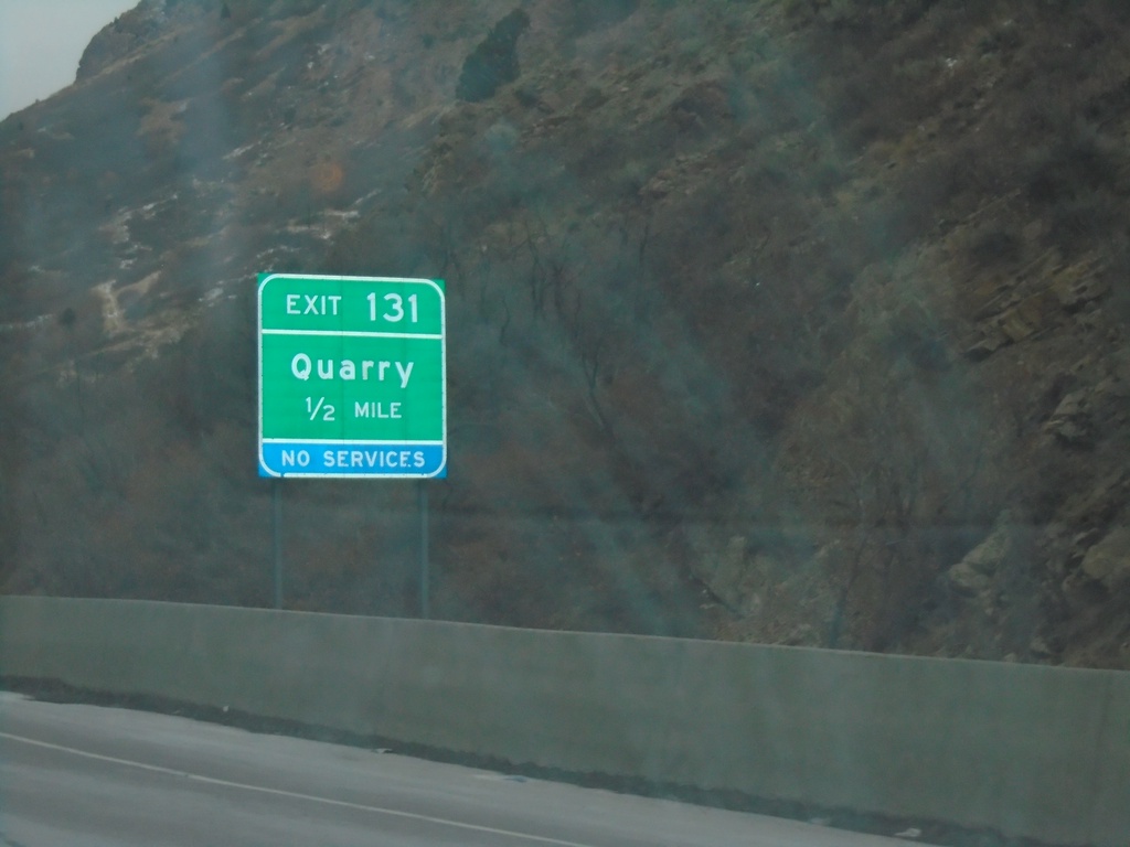
I-80 East - Exit 131
I-80 east approaching Exit 131 - Quarry.
Taken 12-30-2020
Salt Lake City
Salt Lake County
Utah
United States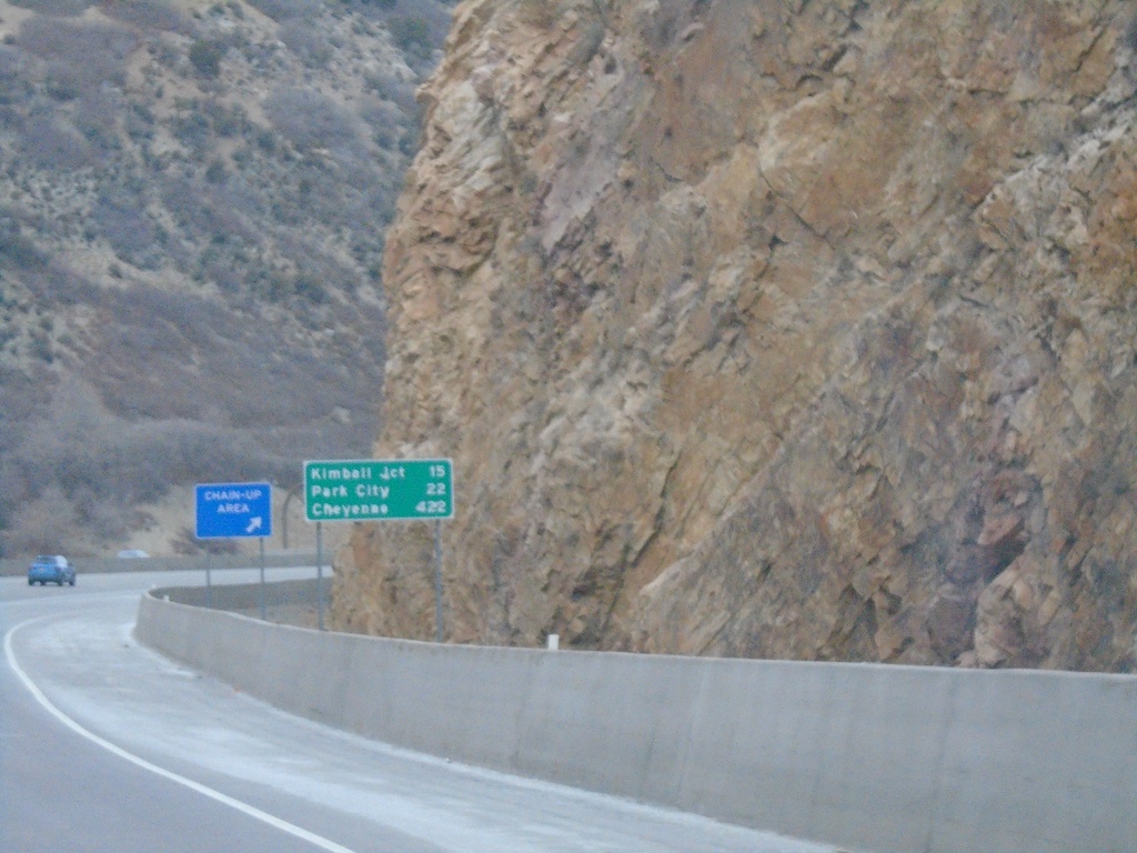
I-80 East - Distance Marker
Distance marker on I-80 east. Distance to Kimball Junction, Park City, and Cheyenne (Wyoming). This is the first distance marker eastbound out of Salt Lake City.
Taken 12-30-2020
Millcreek
Salt Lake County
Utah
United States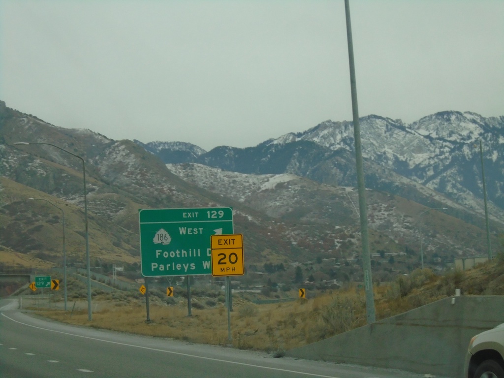
I-80 East - Exit 129
I-80 East at Exit 129 - UT-186 West/Foothill Drive/Parleys Way
Taken 12-30-2020
 Salt Lake City
Salt Lake County
Utah
United States
Salt Lake City
Salt Lake County
Utah
United States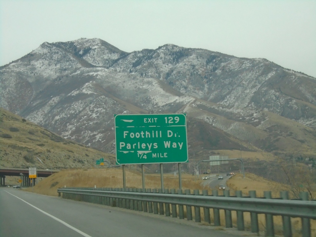
I-80 East - Exit 129
I-80 east approaching Exit 129 - Foothill Drive/Parleys Way.
Taken 12-30-2020
Salt Lake City
Salt Lake County
Utah
United States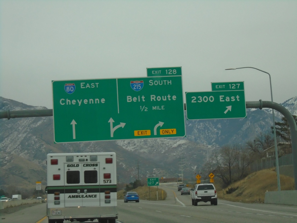
I-80 East - Exits 127 and 128
I-80 east at Exit 127 - 2300 East. Approaching Exit 128 - I-215 South/Belt Route. Continue east on I-80 for Cheyenne (Wyoming).
Taken 12-30-2020
 Salt Lake City
Salt Lake County
Utah
United States
Salt Lake City
Salt Lake County
Utah
United States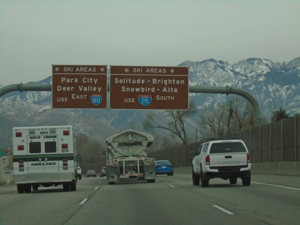
I-80 East - Ski Areas
Ski Area directions on I-80 east approaching I-215. Use I-215 South (Exit 128) for Solitude, Brighton, Snowbird, and Alta Ski Areas. Continue east on I-80 for Park City and Deer Valley Ski Areas.
Taken 12-30-2020
Salt Lake City
Salt Lake County
Utah
United States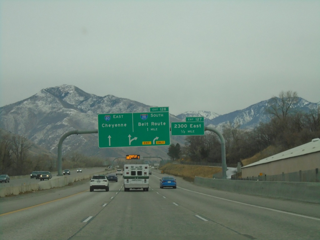
I-80 East - Exits 127 and 128
I-80 east approaching Exit 127 - 2300 East. Approaching Exit 128 - I-215 South/Belt Route. Continue east on I-80 for Cheyenne (Wyoming).
Taken 12-30-2020
Salt Lake City
Salt Lake County
Utah
United States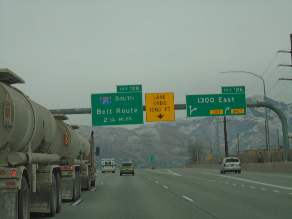
I-80 East - Exit 126 and Approaching Exit 128
I-80 east at Exit 126 - 1300 East. Approaching Exit 128 - I-215 South/Belt Route.
Taken 12-30-2020
Salt Lake City
Salt Lake County
Utah
United States